The first state park in New Jersey offers an easy hike through a beautiful forest to Spring Lake.
3.0 miles, total round trip. Forested trail with some rocks; minor rolling hills.
| 3.0 miles | This hike guide: Detailed instructions and photos follow below. |
| Same park | Swartswood Grist Mill Trail |
| Nearby | Catfish Fire Tower; Culvers Gap to Culver Fire Tower; Culvers Gap to Blue Mountain; Kittatinny Valley State Park; White Lake Natural Resource Area; Stokes – Blue Mountain Loop; Blue Mountain – Red Maple Trail; Paulinskill Valley Trail – Cedar Ridge to Aqueduct; Paulinskill Valley Trail – Warbasse Junction to Cedar Ridge; Great Valley Trail Loop. |
| Nearby Kayaking | Swartswood Lake (this park); White Lake Kayak; Lake Aeroflex Kayak. |
Our two cents:
While Swartswood Lake is the main draw of this park, this is a pleasant hike away from the crowds. Combine with a visit to the main park, add in the Emmons’ Path along the lake, and/or a short drive to also do the Grist Mill trail.
The Willow Crest Trail a little further from the main park (we’ve not done this). The park also offers camping, boating, and swimming.
Fun Fact: Swartswood was established as New Jersey’s first state park in 1915 to ensure public access to the third largest freshwater lake in the state.
Hike Info:
Map:
The park office had maps or print one ahead. Follow along on your smartphone with our Interactive Map link above.
Parking: N41.07274° W74.81939°
Swartswood State Park, 1091 E Shore Dr, Swartswood, NJ 07877. This address is for the park office where there is a large parking lot for the lake.
The trailhead and a small dirt parking area is across from the park driveway, at the intersection of E. Shore Dr. and Duck Pond Pond (it has no street number.)
Fees: From Memorial Day through Labor Day, see the NJ Park Pass. Note that this applies to the main parking area, but not this small lot at the trailhead.
Restrooms:
Restroom outside the park office. Also by the beach area.
Hike Directions:
Overview: YELLOW (Bear Claw) – WHITE (Limestone) – RED (Spring Lake)
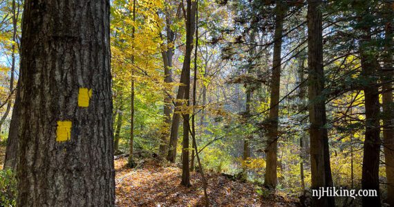
0.0 – Two trails start from the small trailhead parking lot. Start following YELLOW (Bear Claw) on the RIGHT. [The paved Duck Pond Trail on the left will meet up with this route later].
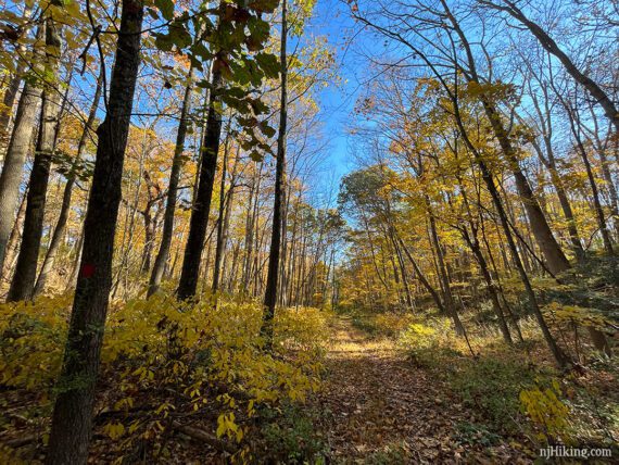
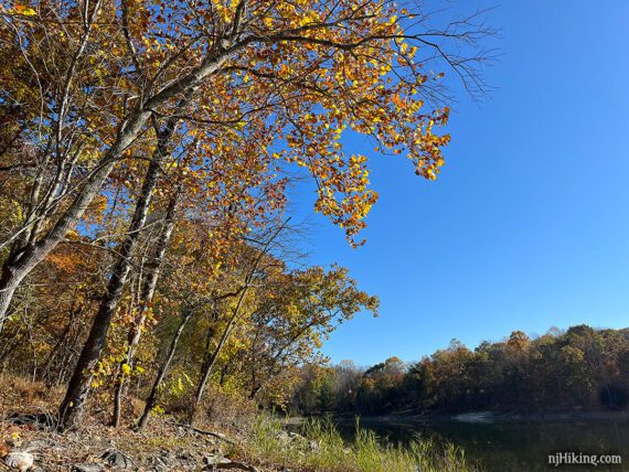
YELLOW (Bear Claw) meanders through the forest with the occasional remnant of a stone fence.
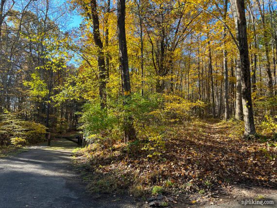
0.6 – YELLOW (Bear Claw) ends at the intersection of paved Duck Pond, nearby a map display. Cross the paved trail and start following WHITE (Limestone).
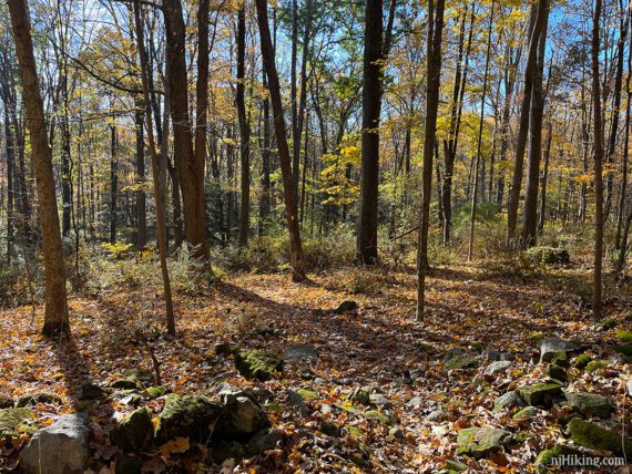
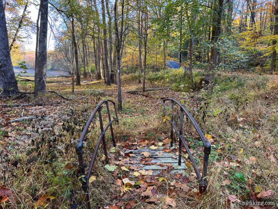
WHITE (Limestone) continues over a bridge to nowhere. We’re assuming this area sometimes (or used to, based on how overgrown the bridge is) becomes wet when Duck Pond is full.
WHITE (Limestone) approaches an open area – seasonal Duck Pond.
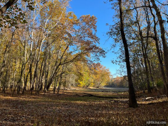
This was totally dry when we hiked in October. Couldn’t even tell that its a pond.
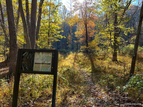
1.1 – WHITE (Limestone) ends at a T-intersection. Turn RIGHT to now follow RED (Spring Lake). The markers weren’t obvious at this intersection. [RED (Spring Lake) also goes left and will shorten the hike].
1.4 – Continue on RED (Spring Lake) pass an unmarked trail on the right that leads to a parking area on Doves Island Road.
1.7 – Spring Lake may be visible through the trees on the right. [Pass GREEN (Sinkhole) on the left – though we did not notice it].
2.0 – Turn RIGHT on to an unmarked side trail that leads to the shore of Spring Lake. This trail is not shown on the park map. [On the LEFT is BLUE (Passage)].
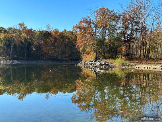
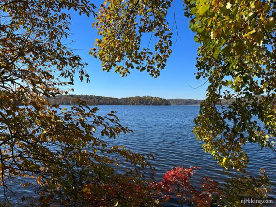
The shore is a wide open rocky area with plenty nice break spots.
Retrace the trail back and turn RIGHT to continue on RED (Spring Lake). [Pass BLUE (Passage).]
2.8 – Continue on RED (Spring Lake) until it ends at a path for the campground. Turn RIGHT to the road then turn LEFT and walk down the shoulder a bit back to the parking lot.
Optional: Head into the main area of the park for views of Swartswood Lake, either on foot or drive over. There are many places to see the lake and ORANGE (Emmons’ Path) runs along the shore for 1 mile, one way.
—
Hiked: 10/22/22.