Paddle a horseshoe shaped reservoir surrounded by Monks and Horse Pond mountains.
Miles: 5.0+. We do around 5; probably could get around 7, possibly more. Lake Size: 505 acres. Average Depth: 43’, max depth: 90’.
| Miles 5.0+ | Detailed instructions, photos, and video follow below. |
| Park info | The reservoir is part of Long Pond Ironworks State Park. |
| Nearby kayak | Wawayanda Lake Kayak |
| Nearby hike, same lot | Monks Trail Loop |
| Nearby hikes | Long Pond Ironworks – Sterling Ridge and Jennings Hollow; Governor Mountain; Horse Pond Mountain to Lake Sonoma Loop; Skylands Manor – Ilgenstein Rock; Bearfort Ridge Loop – Surprise Lake; Surprise Lake Loop via State Line. |
Our two cents:
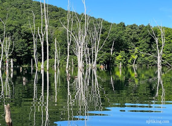
Large area of quiet paddling in a reservoir circled by mountains. Be sure to explore north of the Rt 511/Greenwood Lake Rd. bridge, where there is an interesting area of submerged trees to navigate through.
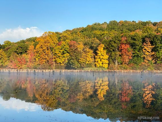
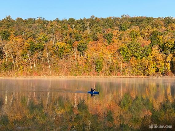
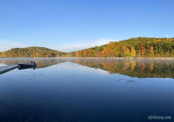
This area is a fantastic spot for fall foliage. Even if you aren’t kayaking or hiking, the view from the parking lots of colorful mountains reflected in water can be stunning.
There are large power lines crossing the water but you’ll be distracted by the pretty scenery enough to mentally Photoshop them right out.
Combo your kayak with a hike around the mountain on the Monks Trail Loop which starts from this same parking area.
Updated: 4/2026 – Minor edits, added photos. 9/2024 – Minor edits. 7/2022 – Re-kayaked; minor edits, added photos, refreshed page.
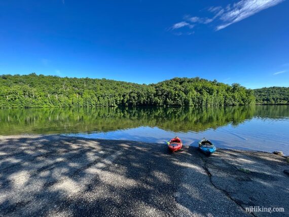
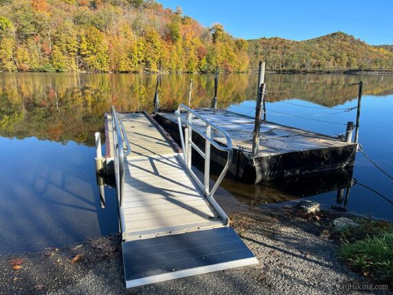
Parking: N41.13660° W74.30710° [North Launch]
Monksville Reservoir, North Boat Launch, Ringwood, NJ 07456. Paved ramp; dirt on either side.
From the south: 287N to exit 55 towards 511/Wanaque/Pompton Lakes. Right at bottom of ramp and follow 511/Ringwood Ave/Greenwood Lake Turnpike through town. The road will curve left. Pass the South Launch on the left, and then turn left at the sign for the North Launch. A right turn here leads to the Beech Road Launch.
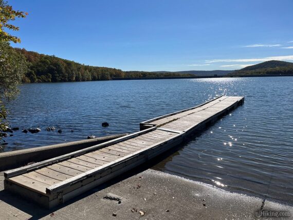
South Launch – paved ramp: N41.12711° W74.30108° – Monksville Reservoir South Boat Launch, 1081 County Rd 511, Ringwood, NJ 07456. Boat rental runs from this launch.
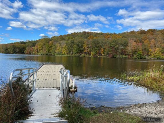
Beech Road Launch – dock: N41.14230° W74.30065° – 119 Beech Rd, Hewitt, NJ 07421.
Restrooms:
Portable toilet at all three launch locations (as of 10/2025). Gas station and a few stores on Rt 511 just the before the turn for the North Launch. Nearby Long Pond Ironworks Museum & Visitor Center has restrooms but is only open open weekends 1pm-4pm, Apr-Nov.
Kayak Rentals:
Flatwater Paddle Co. rents single and tandem kayaks and SUP (stand-up paddle boards) from the South Launch.
Book:
Appears in Quiet Water New Jersey (2010).
Note: Our go-to kayaking book is Quiet Water New Jersey (2010), available as an e-book or a used printed book.
The newer version is “Quiet Water Mid-Atlantic (2018)”. This contains 13 of the 52 locations in the New Jersey-only book and is available both in printed and online formats.
Related: Kayaking NJ overview page.
Launches:
The North launch has a wide paved ramp suitable for trailers, with a little grass on either side of the pavement. This is where this guide starts from.
On our October 2025 visit, we spotted these additions.
The South launch is a paved lot with a long floating bridge. This lot is the location of the kayak/paddle board rentals.
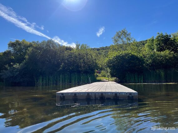
There is a long floating dock at the Beech Road Launch, with a bit of a carry (or roll if you’ve got a cart) from the parking area.
The Route:
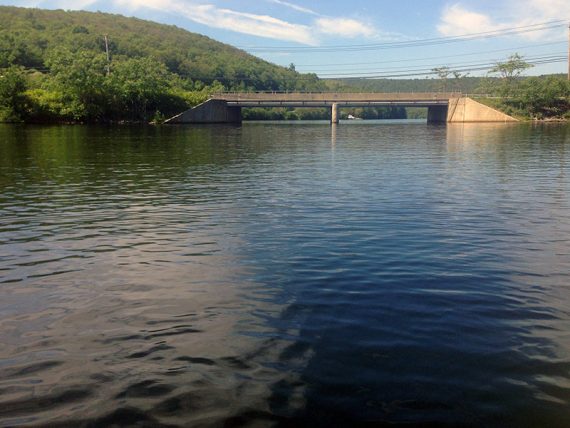
Monksville Reservoir is crossed by the Rt 511/Greenwood Lake Turnpike bridge. South of the bridge is the main part of the reservoir with north and south boat launches. This large area curves all the way down to the Monksville Dam. North of the bridge includes an area of submerged trees and the Beech Road launch.
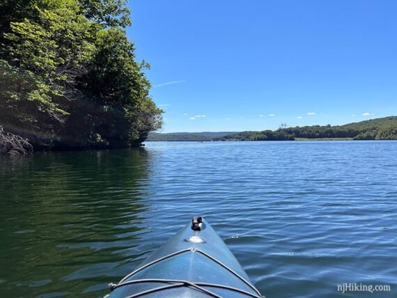
From the North launch, we normally turn right and paddle under the bridge. It’s tall and has plenty of room to pass under.
Keep right after the bridge and follow the perimeter of the reservoir around to pass the Beech Road dock.
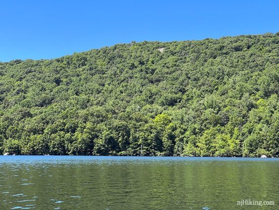
Continue along the edge towards the northeast corner of the reservoir. There’s an old telephone poll sticking up and a house tucked back in the trees. This is looking back from that corner:
Meander around to where the submerged trees are – this is our favorite part.
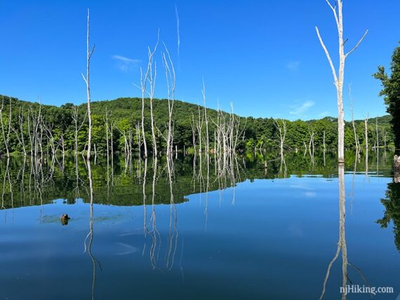
Paddle through the trees, watching for any that are juuust submerged and hard to spot.
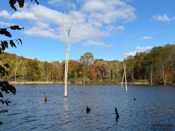
Update… the amount of trees visible above the water have been greatly reduced since we last kayaked here. The photo below was taken while walking around Long Pond Ironworks in 10/2025. We’re assuming a storm did a number on the trees.
The Monksville Reservoir was created by damming the Wanaque River in 1987 to address water shortages. The community of Monksville was moved before the area was flooded.
Along the back is a somewhat hidden entrance to paddle up the Wanaque River a short distance. Once around some vegetation it turns to the right and opens up.
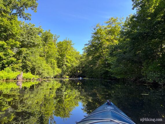
The river soon narrows and becomes shallow. The Sterling Ridge/Highlands Trail is on the left but you may not notice it unless there are hikers. This trail goes past the nearby remains of the Long Pond Iron Furnaces and is a nice hike.
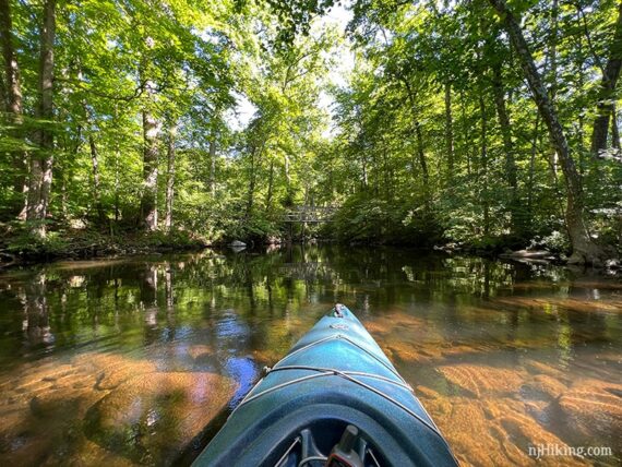
The river continues under a large trail bridge but becomes too shallow and rocky to continue much further.
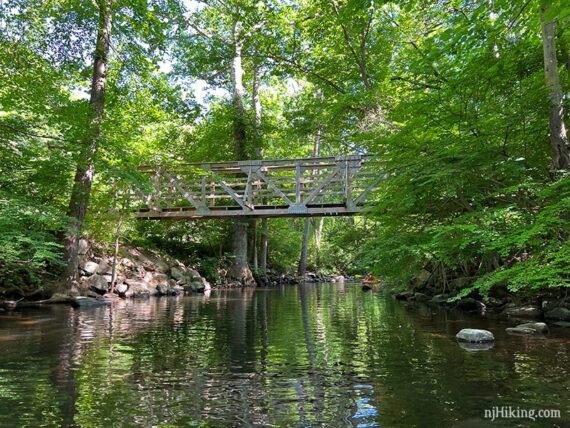
One time when we hiked over this bridge, waaay back in 2009, there were two kayakers on the river (photo below, and the Trail Blog for that hike: “Long Pond Ironworks in September“).
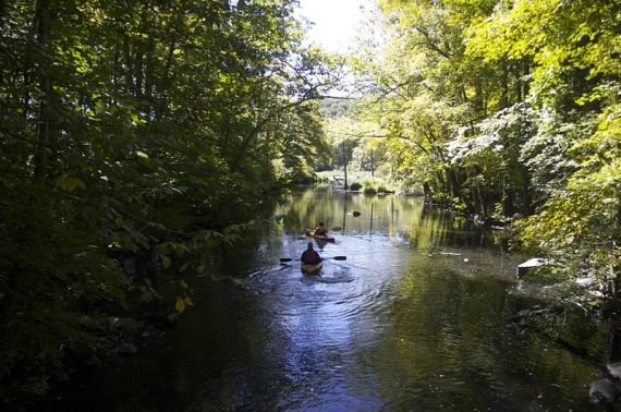
This image always stuck with me because we were surprised to see kayakers on this little stream but also that it sparked a discussion of how it looked like fun and that we should rent more often, or maybe consider buying kayaks. Now, years later, we’re the ones on the water.
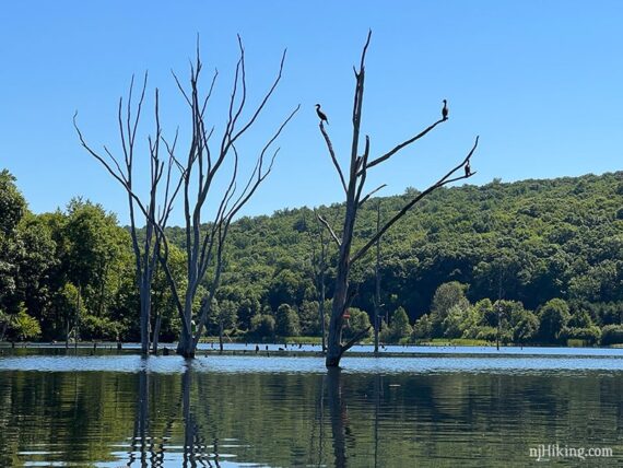
Turn around and head back, through the submerged trees again, and towards the Rt 511/Greenwood Lake Turnpike bridge. Perhaps spot a cormorant hanging out in one of the dead trees.
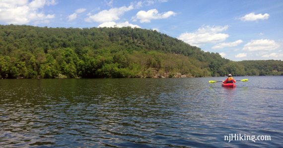
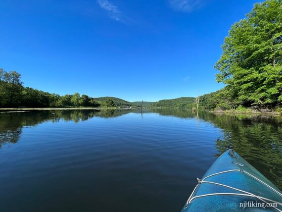
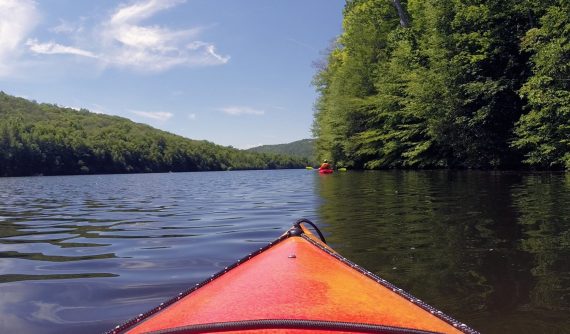
South of the bridge is wider and surrounded by hills.
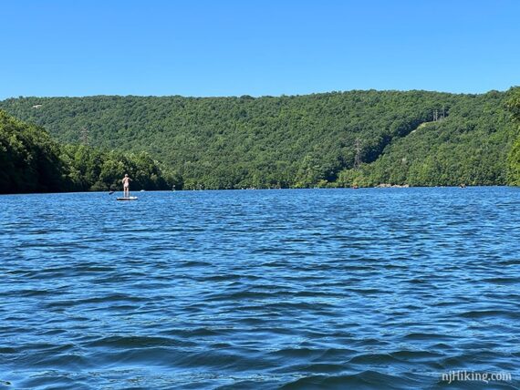
Continue following the curve of the reservoir along either shore. Monksville Reservoir is sort of shaped like a horseshoe with Monks Mountain in the middle.
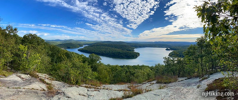
You may spot a bare rocky section up near the top of the hillside – this outcrop is a viewpoint on another hike in the area.
Hike to this viewpoint on Horse Pond Mountain and be rewarded with an awesome panorama over Monksville Reservoir. From here the curve of the reservoir is obvious, with Monks Mountain rising in the center.
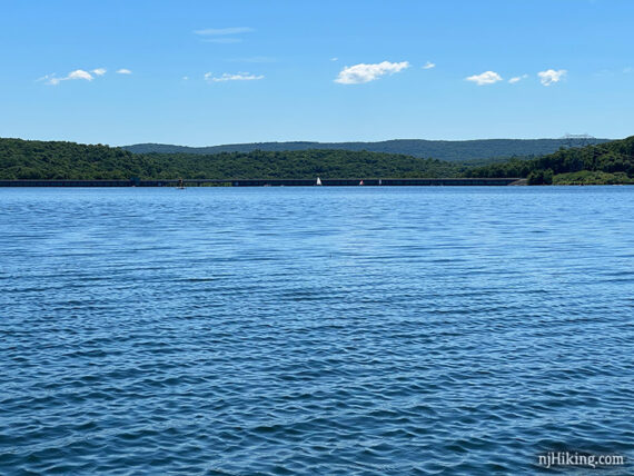
Towards the Monksville Dam, the reservoir widens and might become windier. The South launch and rentals are on this end too.
—
Kayaked 7/4/22. 4.7 miles.
Kayaked 6/14/15. 5.1 miles.