Fantastic views of Greenwood Lake and the surrounding area, Surprise Lake, multiple scrambles.
4.1 or 7.2 miles, total round trip. Surface is rugged and rocky, with multiple challenging scrambling areas. The initial part of the trail is steep. Dogs might have issues negotiating many of the scrambles.
| 4.1 miles | This hike guide: Detailed instructions, photos, and video follow below. |
| Shorter | 2.0 – Just to the ridge on Ernest Walker. Enjoy the view, then retrace. 2.5 – Go to Surprise Lake, bust our your lunch/snacks, and then retrace. |
| Longer | 7.2 – Surprise Lake Loop + Bellvale Mountain – add a jaunt north into NY for great views from the Appalachian Trail. Directions also included below. |
| Alternate, nearby: | To Surprise Lake via Bearfort Ridge Trail from a nearby parking area. |
| Nearby | Terrace Pond North; Terrace Pond Loop, Terrace Pond – North; South, Circular & Yellow; Wawayanda State Park – Old Coal Trail; Long Pond Ironworks. |
| Nearby kayaking | Monksville Reservoir; Wawayanda Lake. |
Our two cents:
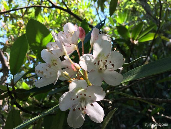
This is a solid pick for a hike with lots of views, a lake, a pond, scrambling, and probably our favorite rhododendron tunnel in the state.
Even though it’s not a long hike, the rock scrambles make it more challenging (or fun, depending on your tastes…) than an average hike and might be more than a casual hiker is looking for.
The detailed hike directions below include an optional extension into New York for more viewpoints along the Appalachian Trail.
Some low-flying small airplane noise. While you may see people swimming in Surprise Lake, it is prohibited.
Note: This is the Surprise Lake found in Abram S. Hewitt State Forest in Hewitt, New Jersey, not to be confused with Lake Surprise in Watchung Reservation.
Updated: 9/2025 – Added peaks photo. 7/2025 – Minor edits; partially re-hiked while doing a variation of Bearfort Ridge to Surprise Lake. Older change log at page bottom.
Hike Info:
Map:
Northern New Jersey Highlands Trails Map is best for the full longer route, the park map doesn’t contain the NY section of the Appalachian Trail. Follow along on your smartphone with our Interactive Map link above.
Books:
This loop can be found in Hiking New Jersey (2023), Hike of the Week, Take a Hike New York City, Best Day Hikes Near New York City, and Hiking the Jersey Highlands.
An excellent variation is in 50 Hikes in New Jersey and 60 Hikes Within 60 Miles: New York City. Not aware of a book that includes the out-and-back section of the AT for extra viewpoints like this route.
Detailed trail descriptions found in the The New Jersey Walk Book.
Parking: N41.18577° W74.33197°
Abram S. Hewitt State Forest Parking, Hewitt, NJ 07421. Small parking area shared with a lot for a marina.
Approaching from 287N take exit 55, then Rt 511 towards Wanaque. Follow 511 as it makes a right (Lakeside Rd) and hugs the west side of Greenwood Lake. Take it all the way to just before the NY border (if you hit the border, you went too far).
The parking area is tough to spot: just past a white guardrail on the left, turn LEFT into a small lot and go straight back, past the first parking areas. The lot is directly across from the Greenwood Lake Marina building on the right.
Hikers can park at the back by the kiosk and along the left side – do not park in the marina spots (the areas on the right, as you enter). There used to be signs denoting but don’t recall seeing them the last time here. Parking is very limited, like 10 – 15 cars or so, and is often filled.
Related: Challenging Hikes in NJ
Restrooms:
Portable toilet in the lot (as of 8/2023… but doesn’t appear in a Google street view image from April 2025 so this could be seasonal or who knows…). Gas station at the corner of Lakeside Rd., and before that on Rt. 511.
Hike Directions:
Overview: State Line (BLUE on WHITE) to Ernest Walker (YELLOW) to Appalachian Trail (WHITE) to State Line (BLUE on WHITE).
0.0 – Follow State Line Trail (BLUE on WHITE) starts out along a stream (may not have much, if any, water) and then heads steeply uphill. There are a few unmarked side trails to ignore.
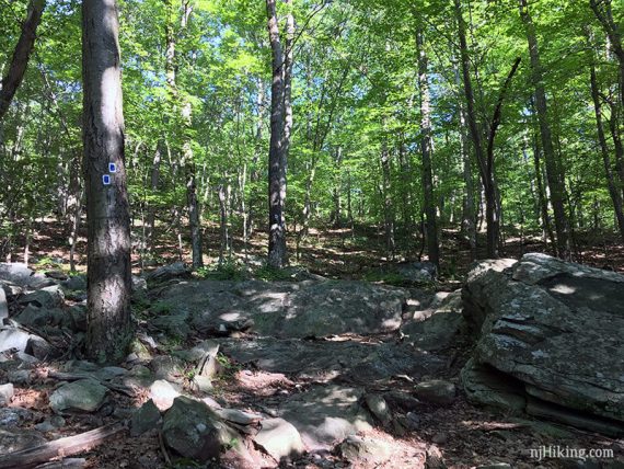
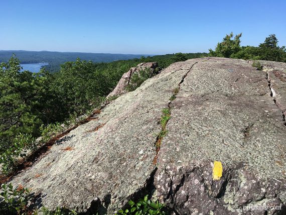
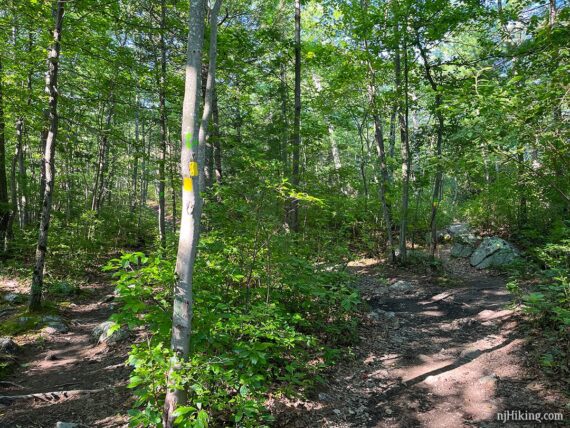
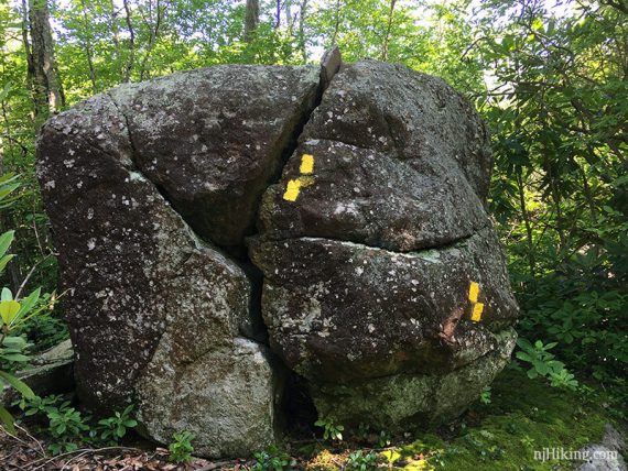
0.7 – Turn left onto Ernest Walker (YELLOW). Trail continues to climb over long sections of exposed rock.
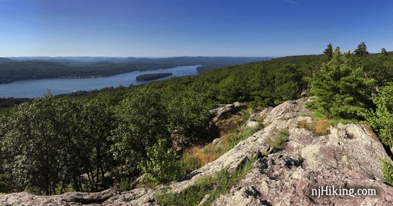
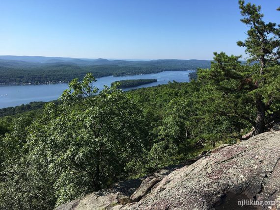
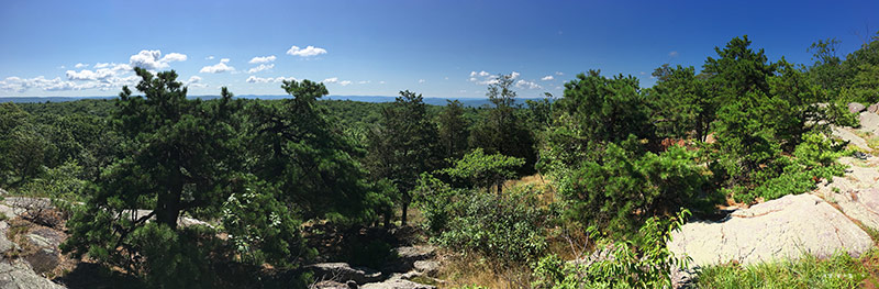
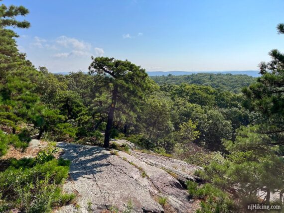
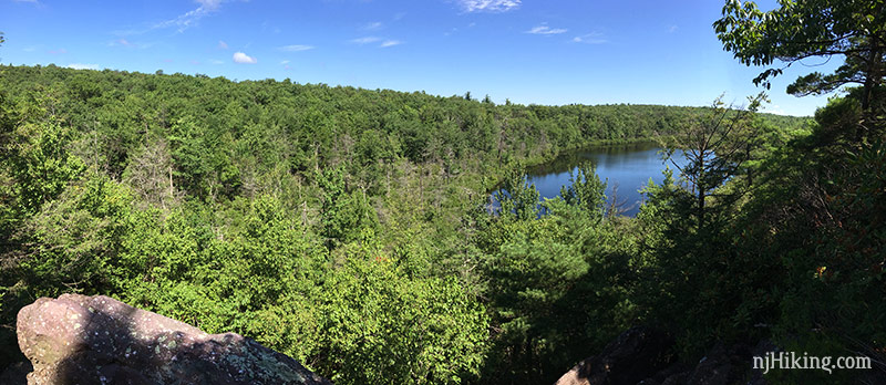
0.8 – Awesome views overlooking Greenwood Lake. When facing the lake, to the left is looking over New Jersey into New York.
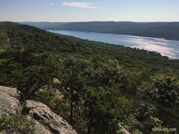
Towards the right looks over Abram S. Hewitt State Forest to Greenwood Lake.
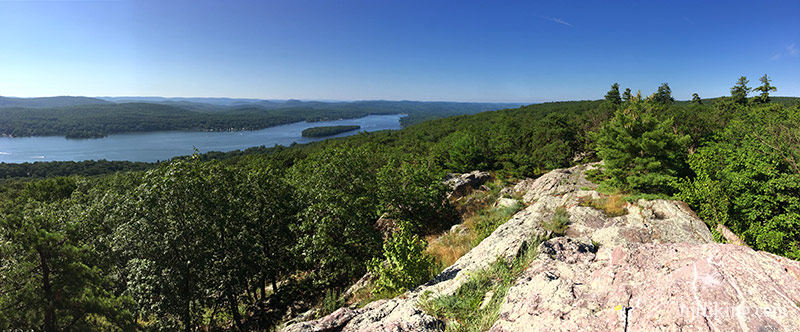
The mountains seen in the distance have lots of trails to explore.
Hike Governor Mountain for a stunning view over the Wanaque Reservoir. Board, Bear, and Windbeam Mountains are part of the challenging Stonetown Circular. And Norvin Green State Forest contains Carris Hill and Buck Mountain.
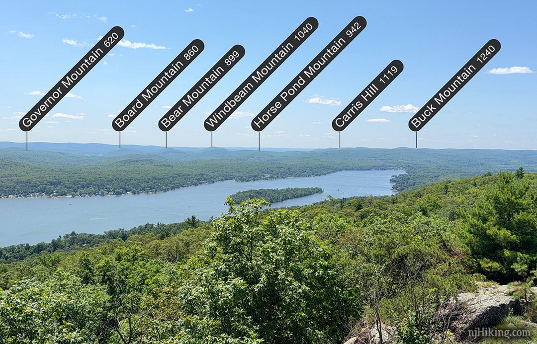
The island on Greenwood Lake is called Fox Island.
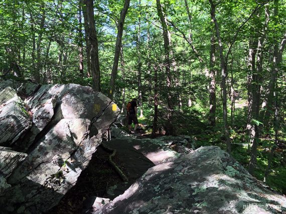
Enjoy the views as the trail follows the ridge for a bit more before ducking back into the woods.
// Shorter, 2 miles total round trip: Instead, retrace steps from here. //
1.0 – Ernest Walker (YELLOW) turns RIGHT, heading away from the ridge and into the woods.
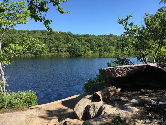
1.2 – Surprise Lake. The lake just kind of appears without warning. We’ve always assumed this is how it was named.
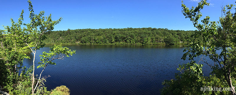
There are a few rocky areas to sit by the lake, connected by a casual path.
// Shorter, 2.5 miles total round trip: Instead, retrace steps from here. //
With your back to the lake, veer to the RIGHT to keep following Ernest Walker (YELLOW).
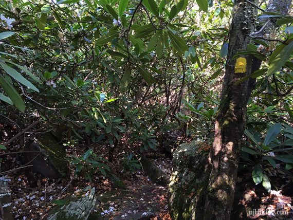
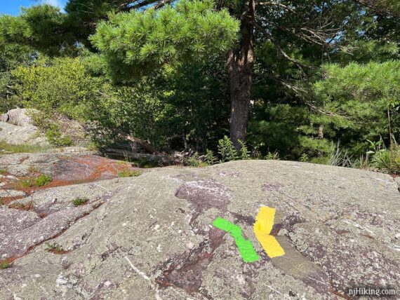
Almost immediately, Ernest Walker (YELLOW) veers RIGHT where Bearfort Ridge Loop (GREEN) goes straight (and is also co-joined with Ernest Walker).
[Note: If you are using an older map, Bearfort Ridge Loop (GREEN) used to be Quail (ORANGE) until late 2020]
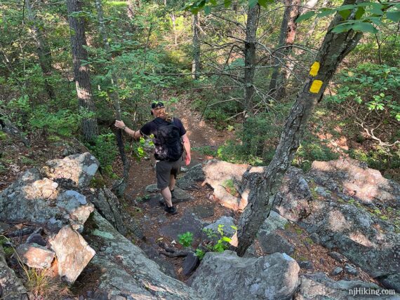
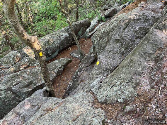
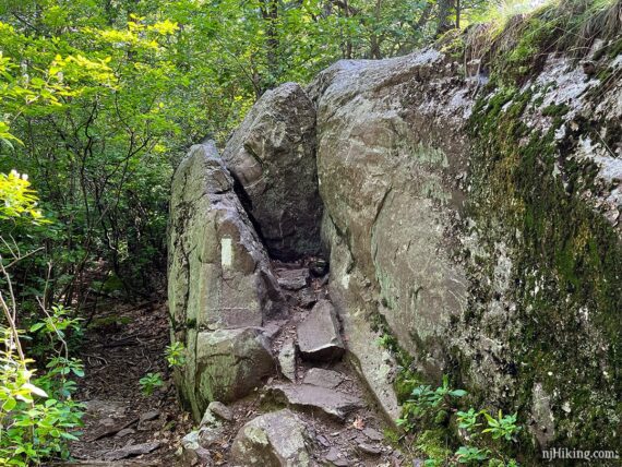
Pass through a long rhododendron tunnel with a bit of a scramble down.
Then it’s on to some big rocks and a wet area to rock hop across.
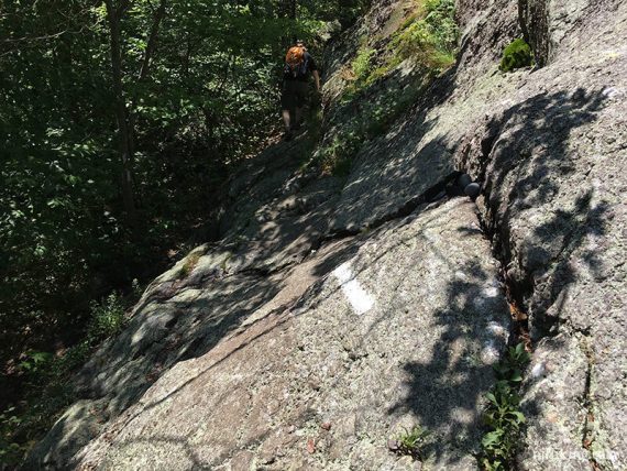
Head steeply up, with a scramble up a rock face.
This is one of those scrambles that is easier (and more fun!) in this direction because you are climbing up. But this is steeper than the photo shows.
1.6 – Viewpoint at the intersection where the two trails split. The NYC skyline might be spotted faintly in the distance.
Looking back behind where you just climbed up. Surprise Lake is down there in the trees, somewhere.
Veer to the RIGHT to continue on Ernest Walker (YELLOW). While marked well, this intersection can be easy to miss – at least we somehow manage to blow by this turn every time.
If you miss it you’ll continue ahead on Bearfort Ridge Loop (GREEN) for a minute, blissfully unaware until you notice the blazes are green and not yellow.
Maybe we get distracted by turning around to see the view after a steep climb up. Or maybe we’re discussing if should we have a snack break at the next viewpoint over West Lake (the correct answer to “should we stop for a snack?” is always yes).
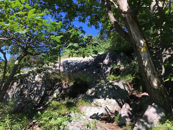
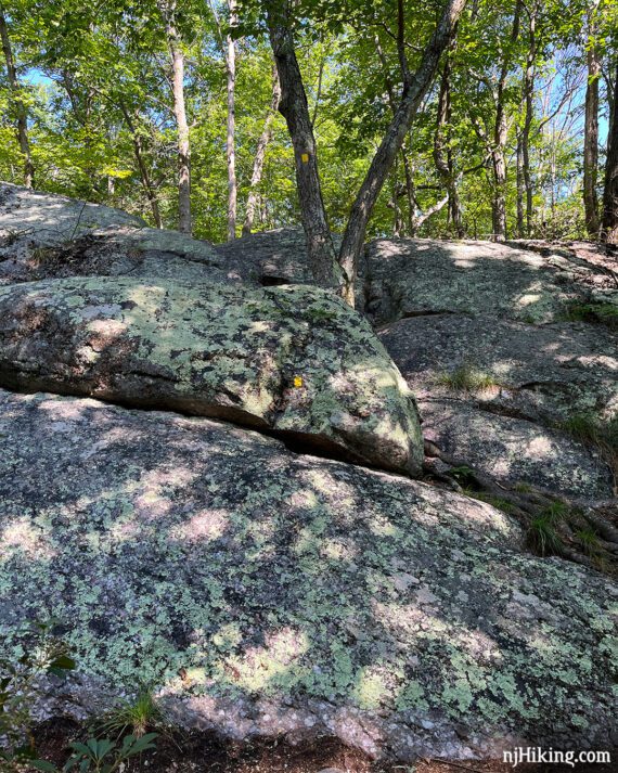
Continue on Ernest Walker (YELLOW) over a series of rock scrambles, both up and down, in varying degrees of difficulty along this whole section.
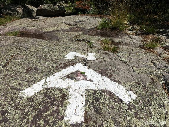
1.7 – Just after the second scramble down, turn RIGHT to out-and-back an unmarked side trail (may be an arrow on the tree) to a nice view over West Pond.
There is a rock outcrop that makes for a decent break spot.
Continue on Ernest Walker (YELLOW), with a few more scrambles to negotiate. Believe there are more heading down than up, or maybe it just seems like that.
Finally, a nice big fun vertical scramble up. These rocky sections are what turn this hike into something a bit more than your average romp through the woods.
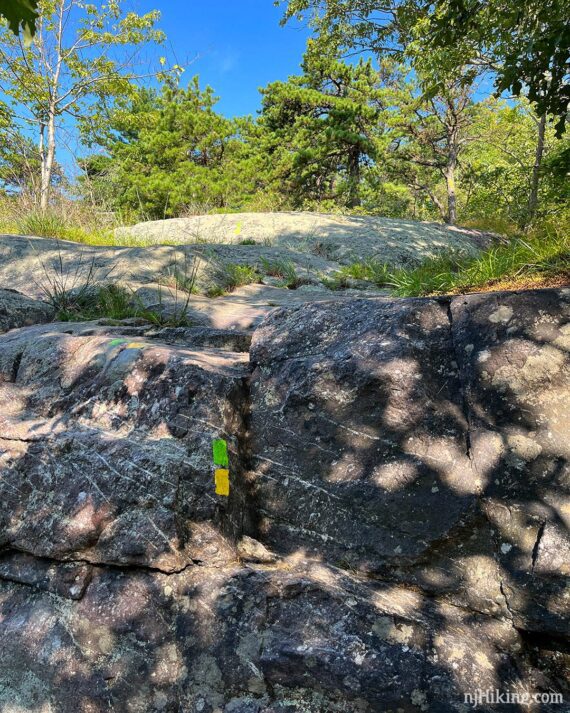
2.0 – Follow Ernest Walker (YELLOW) as it turns sharply RIGHT. [To the left is West Ridge (PINK), noted by a pink arrow].
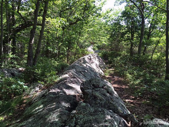
The trail follows long ridges of exposed rock in this section.
2.6 – Ernest Walker (YELLOW) ends at the junction with the Appalachian Trail (WHITE). The AT goes RIGHT (North) or LEFT (South).
Turn RIGHT, now heading north on the Appalachian Trail (WHITE). Follow the AT for a bit with some more scrambling.
2.9 – Arrive at the start of State Line (BLUE on WHITE). Appalachian Trail (WHITE) continues ahead.
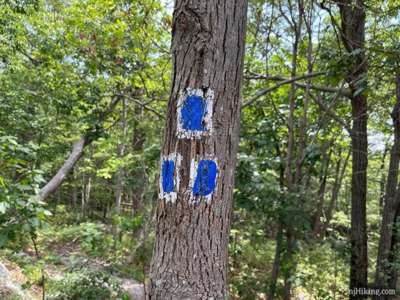
Turn RIGHT to now follow State Line (BLUE on WHITE), back to the parking lot. When you pass Ernest Walker (YELLOW) you have 0.7 mile to go.
For the main 4.1 mile Surprise Lake Loop, the directions end here.
Longer version: Surprise Lake Loop + Bellvale Mountain – 7.2 miles
Continue following the directions below, keeping on Appalachian Trail (WHITE).
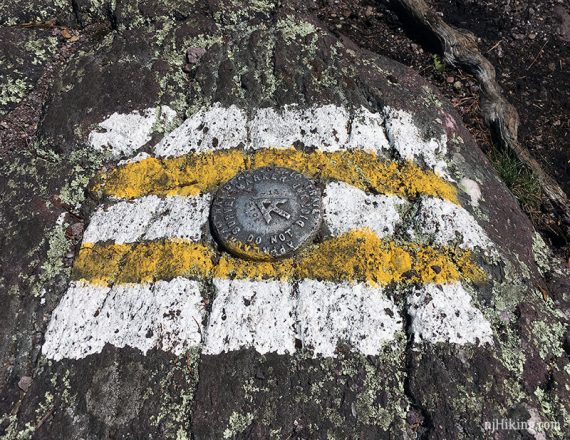
Not long after passing State Line (BLUE on WHITE) arrive at the New Jersey – New York border.
The NJ/NY state line is painted in white on the ground near an Appalachian Trail geologic marker. You can pause here to get your photo taken with one foot in each state. Go ahead, we know you need to.
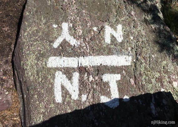
The stripes around the geologic marker are all white now (2023), believe this photo was taken 2017.
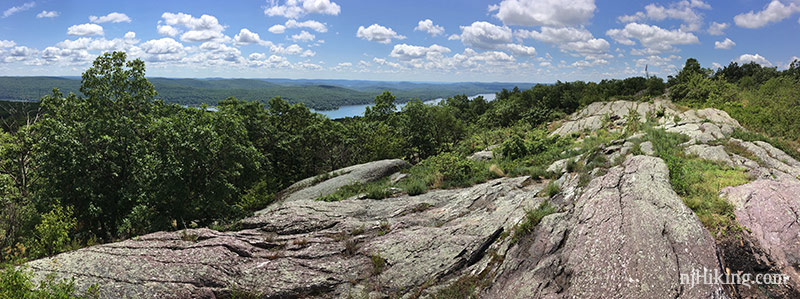
3.3 – Appalachian Trail (WHITE) follows along the ridge of Bellvale Mountain in New York, eventually opening up for panoramic views over Greenwood Lake at “Prospect Rock” marked on the Northern New Jersey Highlands Trails Map.
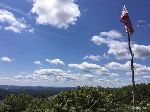
This pole is still up but the flag must have worn away and it appeared to be replaced with a tiny version (as of 8/2023).
After Prospect Rock, the Appalachian Trail (WHITE) jogs over to the left a bit. Shortly, pass BLUE (Zig Zag) on the LEFT – though we often do not notice this.
3.5 – Appalachian Trail (WHITE) turns sharply to the right BUT FIRST continue straight out to a rock outcrop for a wide view over New York. Nice break spot, though it is in full sun.
We usually blow right by the turn for the AT and end up at the viewpoint anyway, and not even notice the sharp right for the trail.
Backtrack, and continue following the Appalachian Trail (WHITE) as it heads down.
// Shorter Variation: This is a good turn around point if you want to skip some scrambles and a long section of forested trail. //
Scramble across a slanted rock face, using a ridge in the rock as a handhold.
The Appalachian Trail (WHITE) is now off the ridge and back in the forest. The trail is shady, but very rocky, and potentially pretty wet after heavy rain.
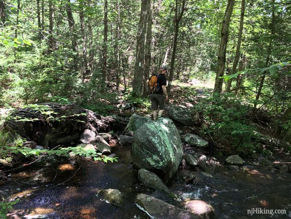
4.2 – Rock-hop a stream.
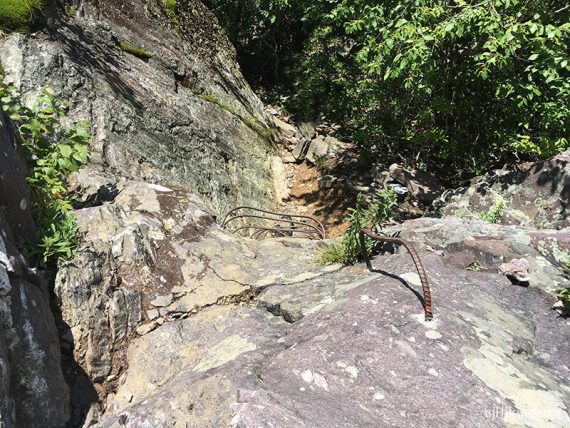
Approaching the viewpoint are some large rocks, then skinny metal rungs to assist going up a rock face (used to be a wooden ladder when we hiked in 2011).
The rungs go up about a 10′ section and the final one on the left is a handhold. After the rungs is another scramble up. [Dogs would likely have issue getting up the rungs and probably the scramble].
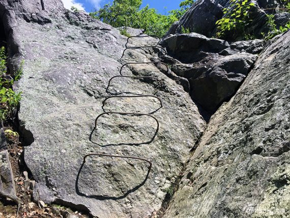
For anyone whose reaction to this photo wasn’t “oh this looks like FUN“… this is doable. It’s awkward because the rungs are thin but not as bad as it looks.
At the top is a vertical rung on the left as a handhold. In reality, this is probably less work than all the uphill negotiating rocks you just did. There is a little scrambling after the ladder.
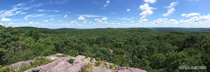
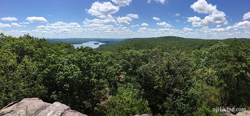
4.5 – In just a few seconds, arrive at a viewpoint on Bellvale Mountain looking back at Greenwood Lake, and over New York and into New Jersey.
Retrace the route on the Appalachian Trail (WHITE) back to into Jersey.
Like most scrambles, going up the metal ladder is easier than down. This is what it looks like from above:
6.1 – Turn LEFT to now follow State Line (BLUE on WHITE) back to the parking lot.
6.5 – Pass the intersection with Ernest Walker (YELLOW) from earlier. You’ve only got another 0.7 miles downhill back to the lot.
—
Hiked: 7/4/25. Partially; variation using West Ridge and starting at Bearfort Ridge Connector pkg.
Hiked: 8/5/23 (AT north).
Hiked: 7/16/17 (AT north). Trail Blog: “Bearfort Mountain – State Line to Surprise Lake in Summer“
Hiked: 10/23/11 (AT north). Trail Blog: “Bearfort Mountain – State Line to Surprise Lake in October“
Hiked: 4/3/2010 (AT south). Trail Blog: “Bearfort Mountain – State Line, Surprise Lake, Ernest Walter, AT South“
Updated: 8/2023 – Page refreshed; added photos of rock scrambles; slight edits to make the main loop be the short version, and the longer the optional extension; re-hiked. 4/2021 – Trail name/blaze of passed trail, doesn’t affect this route (near Surprise Lake, “Quail Trail” updated to “Bearfort Ridge Loop”); not re-hiked. 6/2020 – Page refreshed, not re-hiked. 7/2017 – re-hiked, tweaked description, added side trail to West Pond, added GPX.