Easy, sandy trails through pine barrens and around cranberry bogs with views of Cedar Creek and several reservoirs.
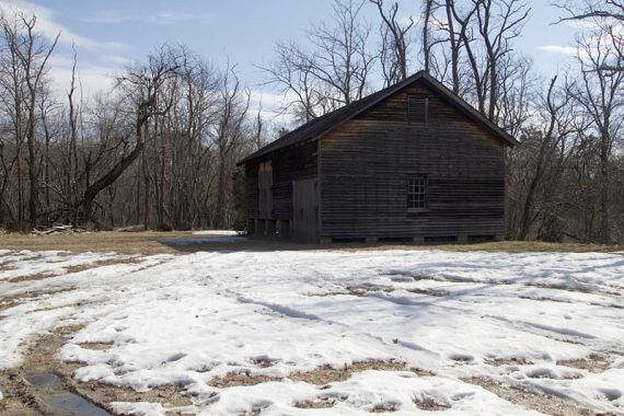
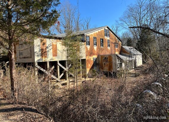
Also explore the Village buildings from the early 20th-century cranberry industry in New Jersey.
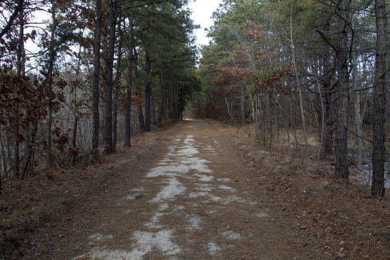
4.0 miles. Flat, easy, packed sand roads. Swordons Pond and Clear Brook optional add-ons are regular hiking trails.
| 4.0 miles | This hike guide: Detailed instructions, photos, and video follow below. |
| Shorter | 1.5 miles – Nature Trail only. |
| Longer | Add in Clear Brook (0.6) and/or Swordens Pond (1.5). |
| Nearby | Jakes Branch County Park; Cattus Island Park; Wells Mills County Park; Barnegat Branch Trail; Island Beach State Park. |
Our 2-cents:
The main portion is on wide sand roads around old cranberry bogs and is more “hey, let’s go for an easy walk” than what we’d consider hiking BUT the Swordens Pond and Clear Brook trails offer a traditional pine barrens hike.
Good option for winter hiking and snowshoeing but the areas around the bogs are open and can be windy/chilly. Some road noise due to the proximity to the Garden State Parkway.
No-hunting park. All of this hike except for the Swordens Pond lollipop is within a no-hunting zone.
Updated: 8/2024 – Page refreshed, minor edits; re-hiked 2022. Older change log at page bottom.
Hike Info:
Map/Books:
A trail map may be available outside the visitor center or print out the trail map ahead. Follow along on your smartphone with our Interactive Map link above.
The park site also contains a guide which provides a historical overview and describes in each trail.
Brief mention in the The New Jersey Walk Book (where it just lists the 1.5 m Nature Trail).
Parking: N39.89756° W74.22181°
Double Trouble State Park. The address is technically “581 Pinewald Keswick Rd, Bayville, NJ 08721” but that might not be accurate in a GPS if just that is entered (Google did better with just the park name).
Garden State Parkway Southbound: Take exit 77. Turn left off exit ramp and travel 1/2 mile south on Double Trouble Road/ County Route 619 South to the traffic signal. Park entrance is straight ahead across Pinewald Keswick Road/County Route 618.
Garden State Parkway Northbound: Take exit 77. Turn left onto County Route 618 West, go under Garden State Parkway and travel approximately 1/2 mile on Pinewald Keswick Road to the traffic signal at Double Trouble Road. Park entrance is on the left.
Restrooms:
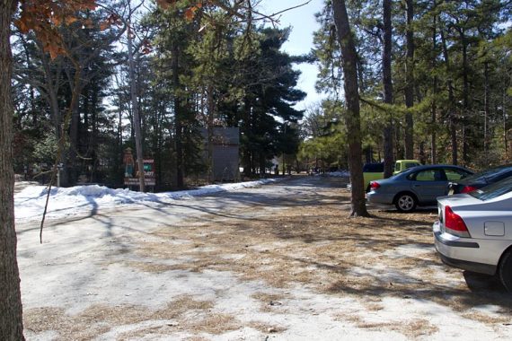
Regular bathrooms are inside the visitor center. Walk straight from the parking lot, past the trail sign, looking to the right for the small white Visitor Center building.
Hike Directions:
The route below combines two trails, ORANGE (Sweetwater) and RED (Mill Pond). Since both of these loops start from the parking lot they’re described individually for those who want a bail out option.
Alternately, combine them by starting with RED and then at the end of the loop, turn RIGHT onto ORANGE.
Options to extend the hike, with PURPLE (Clear Brook) and/or YELLOW (Swordens Pond) trails, are noted.
ORANGE (Sweetwater Trail) + optional add-ons
0.0 – From the parking lot, start walking straight into the park, past the trail sign. The small visitor center/restroom is off on the right in a white building, next to the start of the RED (Mill Pond) trail.
Keep following the main park path straight through the Village, passing various old buildings. This is also GREEN (Nature).
Pass the other end of RED (Mill Pond) on the right. Start following then ORANGE (Sweetwater) where there are ORANGE and GREEN markers on a fence next to the sawmill.
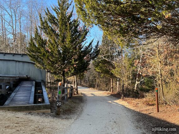
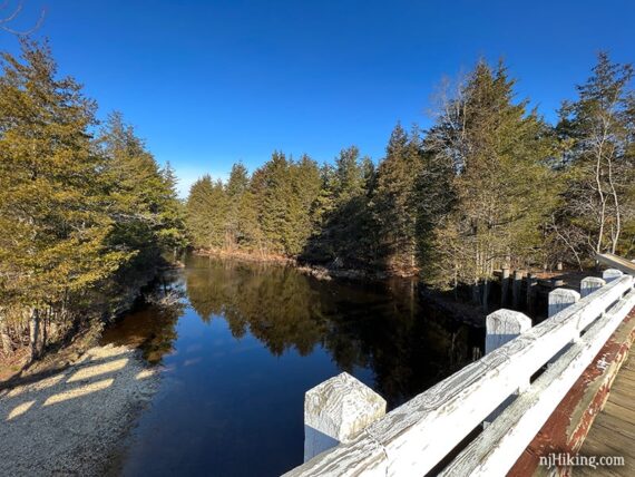
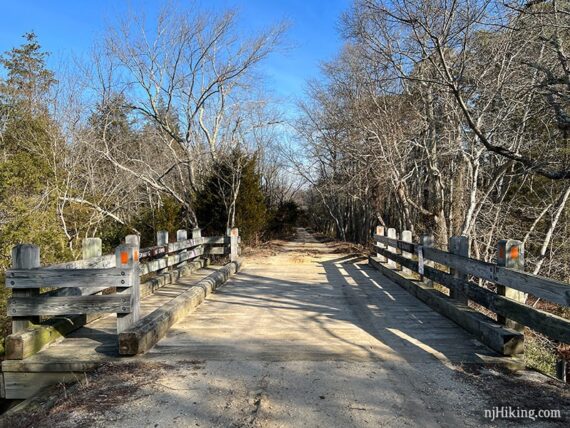
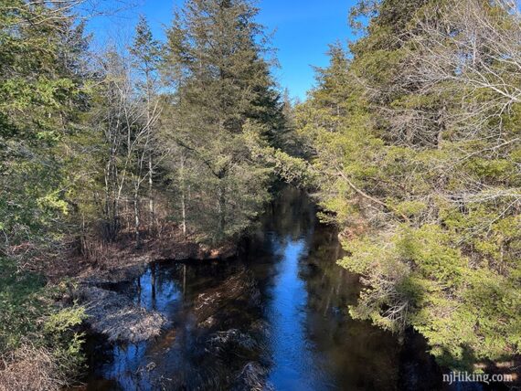
0.3 – Cross Cedar Creek on a bridge.
0.4 – Arrive at a junction with marker posts that read “Carriage Road” and “Mud Dam Road”.
Straight is an unmarked trail that leads to Lacey Road near a sign about hurricane damage. PURPLE (Clear Brook) is right.
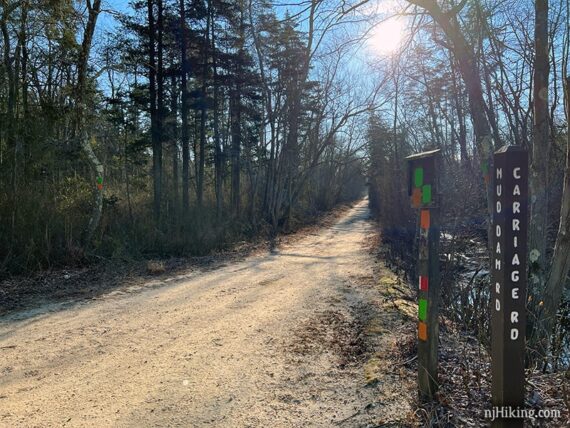
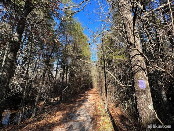
Continue following ORANGE (Sweetwater) as it turns LEFT to head down a long straight sand road.
// Longer add-on, +0.6 miles – via PURPLE (Clear Brook) //
Before continuing on ORANGE (Sweetwater), turn RIGHT on to PURPLE (Clear Brook).
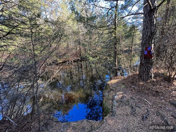
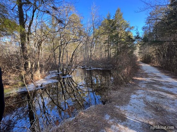
PURPLE (Clear Brook) leads to a view of Cedar Creek. Retrace back to the intersection.
// End of PURPLE (Clear Brook) add-on //
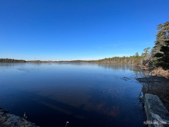
Continue on ORANGE (Sweetwater). Platt Reservoir is on the right. Pass GREEN (Nature) on the left [taking this back would cut the hike short].
0.8 – Soon, follow ORANGE (Sweetwater) as it turns RIGHT. [The sand road continues ahead and parallels ORANGE (Sweetwater)]
0.9 – Follow ORANGE (Sweetwater) as it turns LEFT. [YELLOW (Swordens Pond) starts straight.]
// Longer add-on, +1.5 miles – via YELLOW (Swordens Pond) //
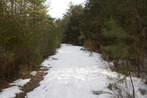
Before continuing on ORANGE (Sweetwater), continue straight to now follow YELLOW (Swordens Pond). This leaves the sand roads and meanders through a pine forest on a regular trail.
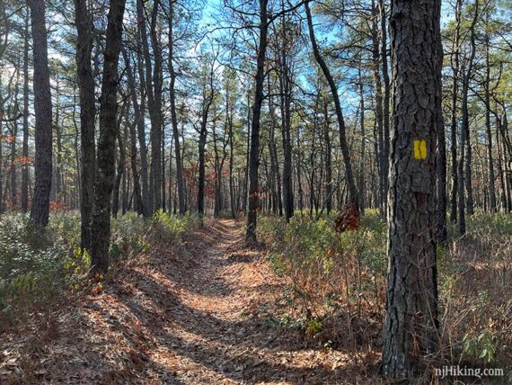
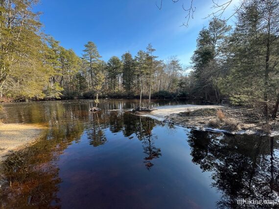
The trail is a “lollipop” so where it splits you can take either direction. At the far end of the loop is a small pond a few steps off the main trail.
Continue following YELLOW (Swordens Pond), making sure to turn when it meets back up – and not loop around again.
Back at where YELLOW (Swordens Pond) started, turn RIGHT to follow ORANGE (Sweetwater) again.
// End of YELLOW (Swordens Pond) add-on //
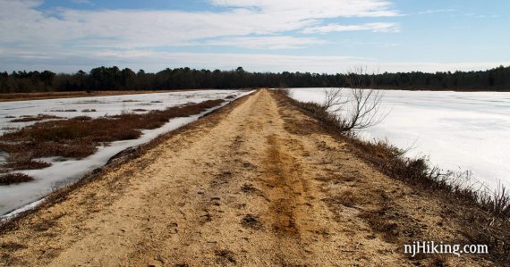
Continue following ORANGE (Sweetwater) on a narrow strip of land between old cranberry bogs and Sweetwater Reservoir.
1.3 – Continue following ORANGE (Sweetwater) as turns LEFT at the far end of Sweetwater Reservoir.
Pass another sand road with a marker post for Platt Lane and Parkway Access.
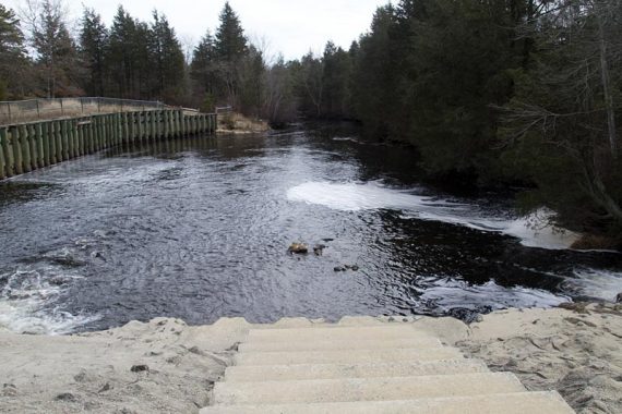
1.4 – On the right are steps that lead down to a small dock on Cedar Creek.
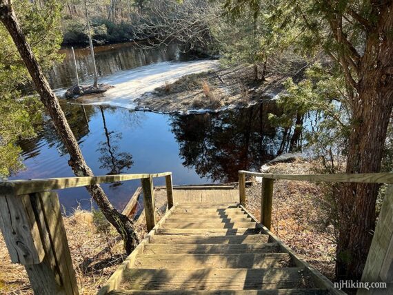
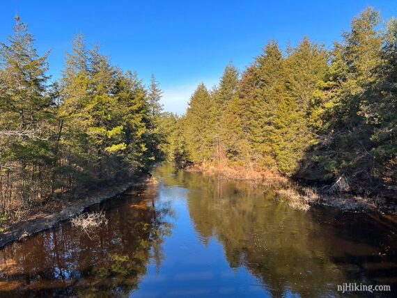
Like most streams in the pine barrens, the creek is tea-colored due to tannic acid produced by the cedar trees along its banks.
Continue following ORANGE (Sweetwater) as it crosses Cedar Creek on a wooden bridge again.
Continue following ORANGE (Sweetwater). Eventually pass an unmarked trail off on the left (this leads back toward the GREEN (Nature) trail around the bogs .
The trail continues back to the parking lot. Call it a day or continue on to…
RED (Mill Pond)
0.0 – From the parking lot, start walking straight into the park, past the trail sign. The start of the RED (Mill Pond) trail is off on the right next to the white visitor center/restroom building.
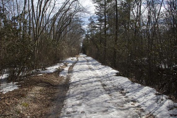
RED (Mill Pond) is a wide sand road on this part of the loop.
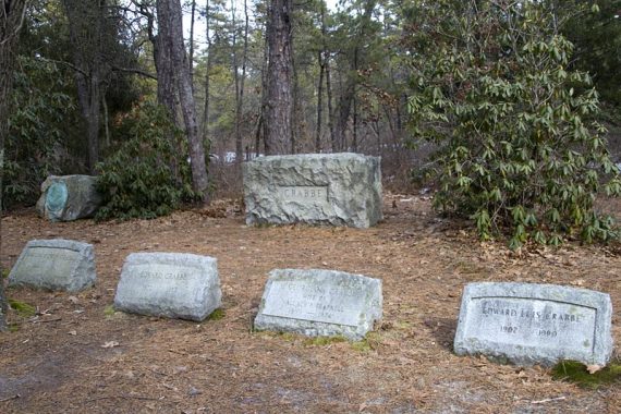
0.3 – Turn RIGHT on an unmarked short side trail to check out the small Crabbe Family Cemetery, with a few headstones.
Then retrace your steps back to continue on RED (Mill Pond).
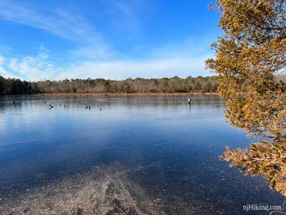
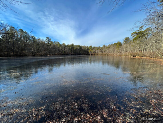
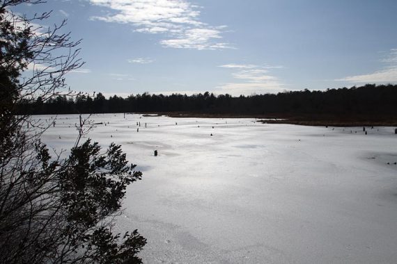
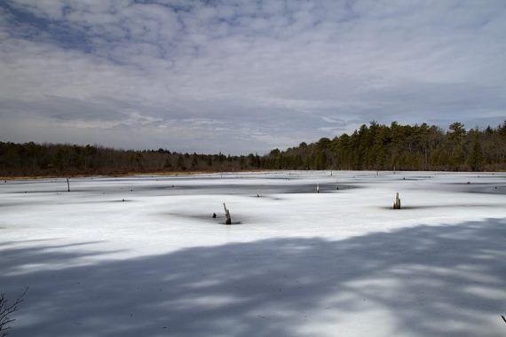
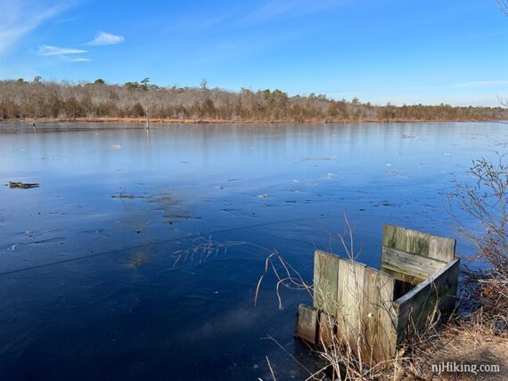
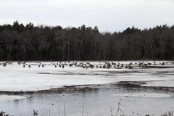
0.6 – Arrive at Mill Pond Reservoir with a wooden fence and a cement causeway that may be mostly covered with water.
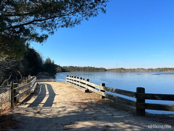
When we last hiked here the water was frozen so it was crossable. This photo is looking back at the area. The trail map shows an unmarked path that continues to Lacey Road (which we did not do).
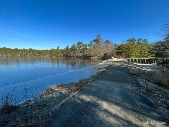
When ready, turn around and look for the continuation of RED (Mill Pond) that veers off to the RIGHT.
The return path through pine trees closely follows the sand road of the other half of the loop.
1.3 – Arrive back in the Village, and turn LEFT to now follow the main park path back to the parking lot.
—
Hiked: 1/23/22. All 4 trails: 6.0 miles.
Hiked: 2/13/11. Trail Blog: “Double Trouble State Park – Cranberry Bogs and Sand Roads“
Updated: 1/2022 – Re-hiked; description adjusted for trail names/colors, added options to extend the hike, more photos. Of note, the route is the same but trails have been marked/named since we’d last hiked here (2011). 6/2020 – Page refreshed, not re-hiked.