Enjoyable, shady, rhododendron filled hike around Wawayanda Lake from Lake Loop to Twin Bridges.
7.6 or 5.6 miles. Terrain is easy to moderate. Wawayanda terrain is less rocky and more level (many are old woods roads) than the majority of North Jersey.
- Shorter: Variation noted below is worthwhile and you won’t be missing out – just seeing different areas and hiking a little less.
- Nearby, boat lot: Furnace Loop; Lake Loop; Cedar Swamp and Lake Lookout.
- Nearby, visitor lot: Hoeferlin, Cedar Swamp, Red Dot; Iron Mountain and Hoeferlin Loop.
- Nearby: Old Coal Trail, Lookout Lake, Laurel Pond Trail.
- Alternate: Wawayanda Lake Kayak.
Hike Info:
Our two cents:
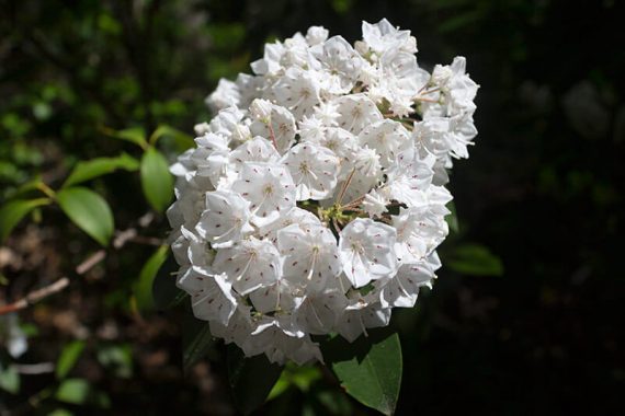
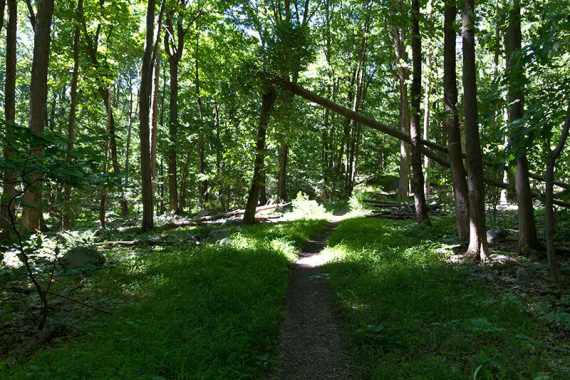
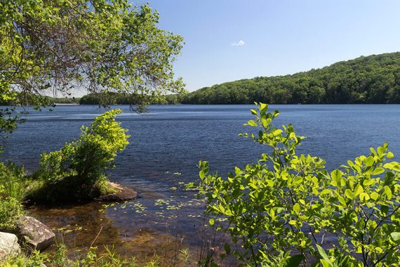
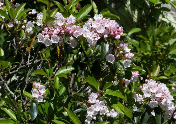
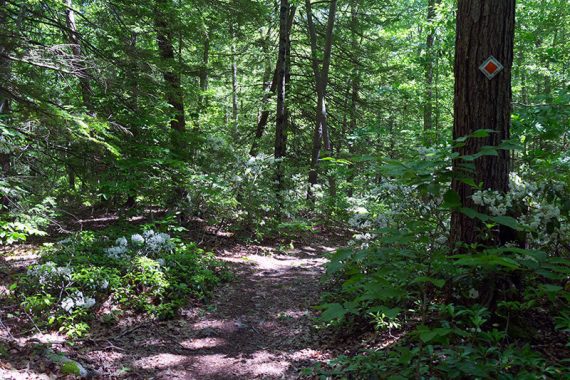
This hike is all about thick, shady forest that is especially excellent when the mountain laurel or rhododendron are in bloom during May/June/July.
Just a few views of the lake and no high up, vast viewpoints – but also no big hills! Extensive trail network to easily shorten or extend a route.
Note: This popular park often fills to capacity in summer and closes.
Bonus fun: canoe rentals available in season, or bring your own.
Updated: 6/2022: minor edits around Furnace. 2/2022: Trail map info. 4/2021: Not re-hiked; description updated to reflect major trail name changes around the lake. 4/2020: Page refreshed, not re-hiked.
Map:
Northern New Jersey Highlands Trails Map is recommended to navigate the network of trails in this park.
Books:
This route isn’t in any books we know of but other ones in the area are in 50 Hikes in New Jersey, Hiking New Jersey (2023),60 Hikes Within 60 Miles: New York City, Hiking the Jersey Highlands. Detailed trail descriptions can be found in the The New Jersey Walk Book.
Parking: N41.19067° W74.42912° [Beach Lot]
From the south: 287N to exit 55 towards 511/Wanaque/Pompton Lakes. Right at bottom of the ramp and follow 511/Ringwood Ave/Greenwood Lake Turnpike through town.
The road will curve left and pass Monksville Reservoir and then Greenwood Lake. The road name changes to Warwick Turnpike.
The park entrance on the left, about 19 miles since getting on 511. Drive past the visitor center lot (fee gate in season) and follow the park road for a bit.
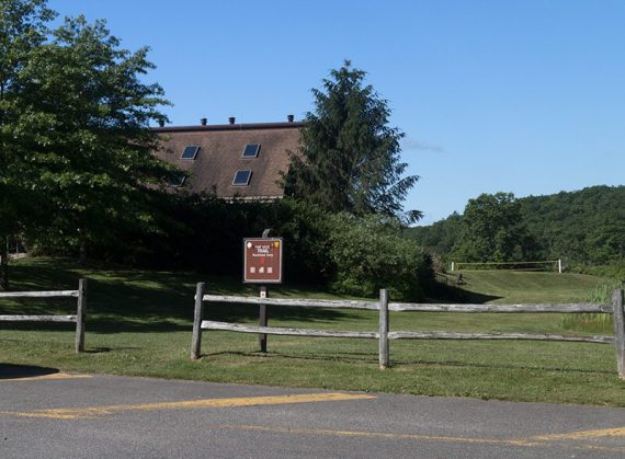
Turn left at the sign for Wawayanda Lake. Park in the first parking lot, don’t continue to the boat lot. Trailhead is near the fence in front of the building.
Note: Google and GPS software may show several of the trails here as drivable roads… they aren’t. It’s allowed on part of Cherry Ridge but you really want one of the main lots.
Wawayanda charges an entrance fee Memorial – Labor day; which is covered by the NJ State Park Pass.
Restrooms:
Regular bathroom in the main lot by the visitor center and at both Wawayanda lake parking lots – the first (beach lot) and the second (boat launch lot).
Composting toilets are by the Furnace which is near the junction of Laurel Pond and Double Pond trails.
Hike Directions:
Overview: Lake Loop (ORANGE) – Boulder Garden (BLUE) – Lake Loop (ORANGE) – Lake Loop Connector (YEL-ORG) – Laurel Pond (YELLOW) – Cherry Ridge Road (WHITE zig-zag on BLACK) – Twin Bridges (GREEN) – RED DOT – Double Pond (YELLOW) – Lake Loop (ORANGE)
Note: Trail names are on the markers, in addition to the color.
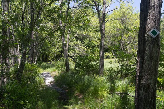
0.0 – Lake Loop trailhead starts at the fence near the building at the end of the first parking lot (beach lot).
Walk through the fence, veer RIGHT across the grass, passing a group of picnic tables nestled in the trees on the left.
The trail follows a woods road for a short bit. Before getting to an auxiliary parking lot and entrance gate, the trail turns LEFT.
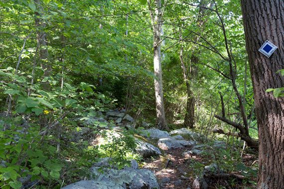
0.7 – Turn LEFT and now follow Boulder Garden (BLUE). This was rocky (… a boulder garden….) and was somewhat overgrown but that gave it a neat feel.
/// Option: Stay on Lake Loop (ORANGE) instead of Boulder Garden (BLUE), which is 0.2 mile longer, probably less rocky, but you’ll end up in the same spot. ///
1.3 – Start following Lake Loop (ORANGE). [Boulder Garden (BLUE) ends].
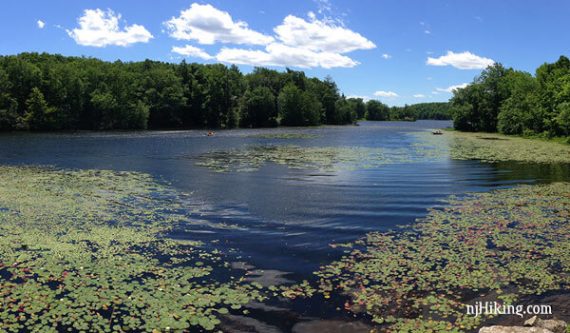
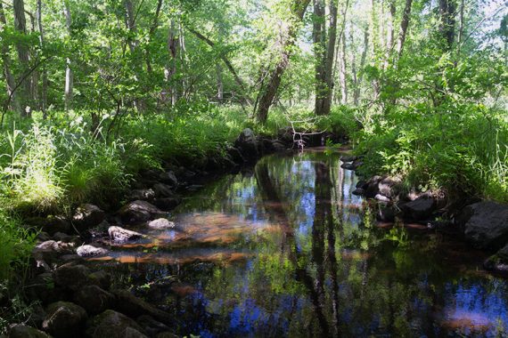
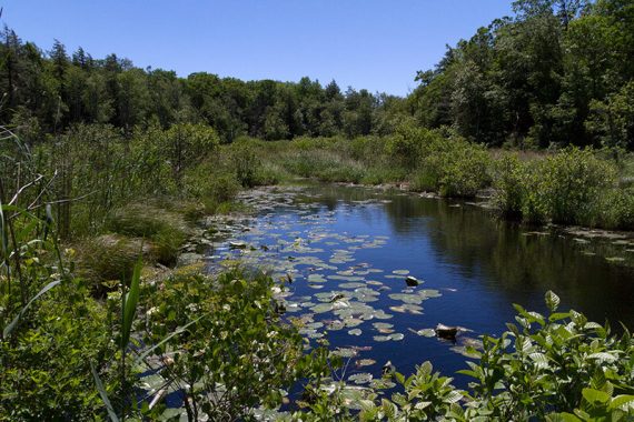
2.0 – Turn RIGHT and follow an unmarked spur trail that goes to the edge of Wawayanda Lake for a nice view and break spot.
[There are other unmarked side trails before this one, and there isn’t an indication where to turn… however, it only goes left and there was ORANGE trail marker on the tree opposite this junction.]
These side trails aren’t shown on the park map, only on the topo Northern New Jersey Highlands Trails Map one.
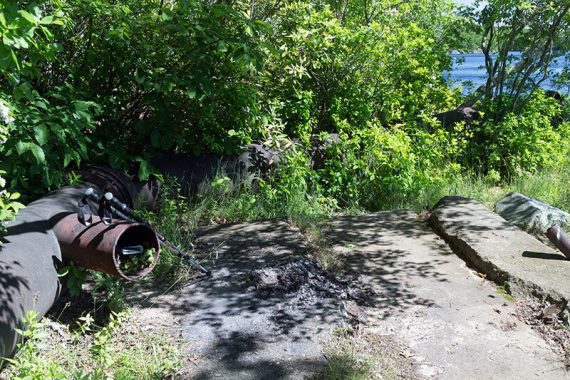
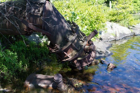
Remnants of pipes are by the edge of the lake, from when water was pumped out to a reservoir during a drought in the 1960s. [Info via Hiking New Jersey (2023).]
Backtrack from the lake. Some pink mountain laurel on this side trail:
2.4 – Turn LEFT back on to Lake Loop (ORANGE).
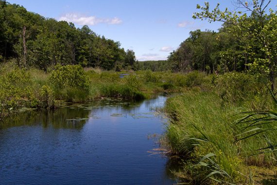
2.7 – Turn LEFT to continue on Lake Loop (ORANGE). [Pumphouse (ORG-YEL) starts ahead]
More pipeline remnants are along the trail.
3.2 – Pass Timber (GREEN) on the right.
3.3 – The trail gets close to the edge of the lake for a view.
3.9 – Turn RIGHT and now follow Lake Connector (YEL-ORG). [Lake Loop (ORANGE) continues ahead.]
Shorter Variation, 5.6 miles total: Instead, turn LEFT and follow Lake Loop (ORANGE) all the way back to the lot. This hugs the edge of the lake and has some nice break spots.
4.2 – Turn RIGHT and now follow Laurel Pond (YELLOW). [Lake Connector (YEL-ORG) ends]
4.5 – Turn LEFT and now follow Cherry Ridge (WHITE zig-zag on BLACK). [Laurel Pond (YELLOW) ends.]
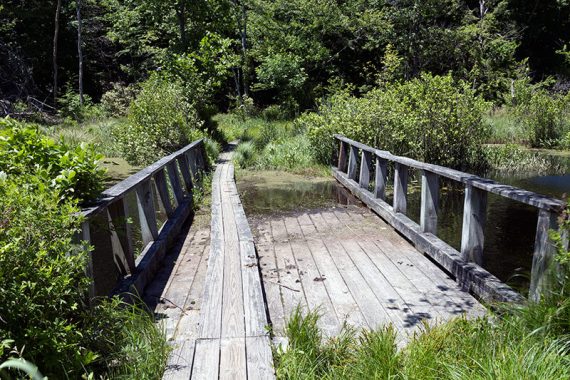
4.8 – Turn LEFT and now follow Twin Bridges (GREEN).
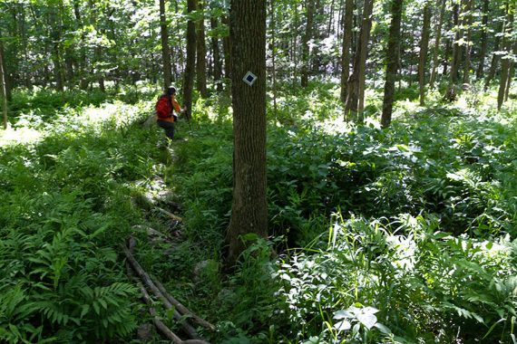
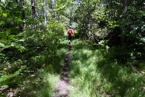
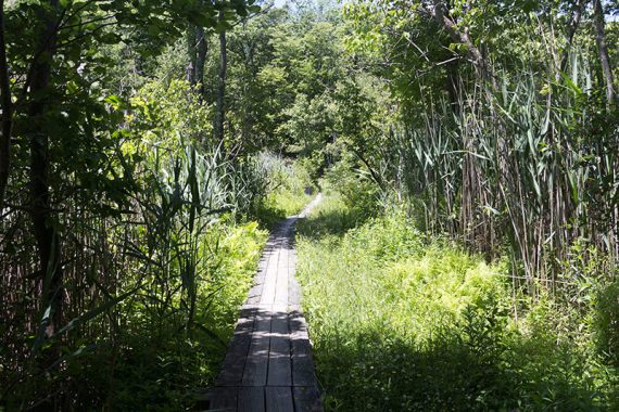
This trail has more grassy/open swampy areas and two bridges. It didn’t have as much rhododendron or mountain laurel.
/// Variation: Continue a little further down Cherry Ridge, turn left onto RED DOT instead, which goes over “Nature Jim’s Bridge”. Twin Bridges (GREEN) and RED DOT still meet up below. ///
6.0 – Turn LEFT and now follow RED DOT.
[Twin Bridges (GREEN) ends at this T-intersection. RED DOT also goes right. This is where you’d meet this description if you take RED DOT, just stay on RED DOT].
6.4 – Turn LEFT and now follow Double Pond (YELLOW). [RED DOT ends].
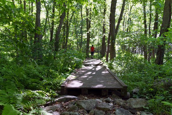
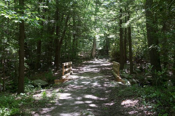
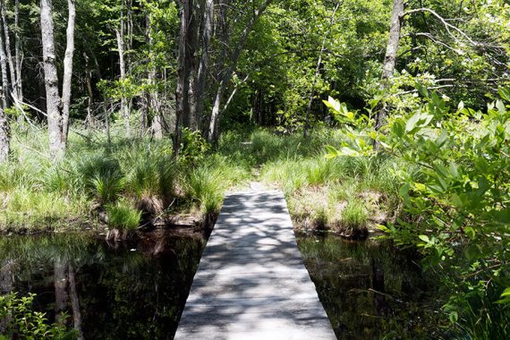
Follow Double Pond (YELLOW) over a plank boardwalk and a bridge.
6.8 – Double Pond (YELLOW) meets up with the park road and goes through a group camping area.
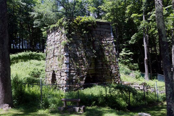
7.0 – Follow the road as it curves around, past composting toilets, to Wawayanda Furnace.
Fun Facts: The Wawayanda furnace was built by William Ames in 1846 and used to smelt ire ore from local mines from 1846 to 1857. It measures 37 feet high by 30 feet wide. Ore, charcoal, and limestone were loaded into the top of the furnace via a pushcart and a ramp on the hillside.
A water-powered bellows on the right provided the heat to melt the ore. Seven tons of iron were produced daily and was of such good quality that it was used to make train wheels. [Source: Park sign, circa 2016]
Follow Double Pond (YELLOW) uphill and over a bridge and continue towards the corner of the lake. [While there may or not be markers, at this corner Double Pond (YELLOW) ends, Lake Loop (ORANGE) begins ahead, Wingdam (BLUE) goes left].
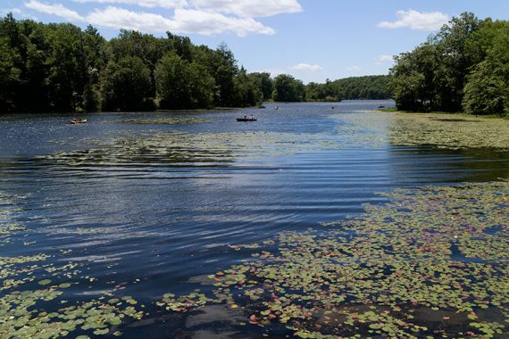
Follow the path along the lake, Lake Loop (ORANGE), past the boat rental shack (this is not the parking lot you started at).
Continue along the lake edge on Lake Loop (ORANGE), towards the beach area, and back to the parking lot.
—
Hiked: 6/12/16.