Climb Torne Mountain and enjoy view after view before reaching Osio Rock for a 360° panorama.
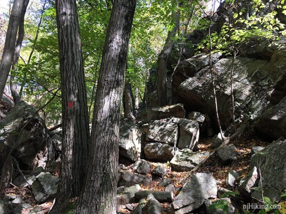
2.7 miles, or 1.6 miles. Rugged with larger rocks to walk over, minor scrambling, steep sections.
| 2.7 miles or less | This hike guide: Detailed instructions and photos follow below. 2.7 miles: Full route. 2.3 miles: Retrace from Osio Rock; noted below. 1.6 miles: Skip Osio Rock; noted below. |
| Longer | Take the trail from the main Otter Hole parking lot to link up with the extensive trail system in the main part of southern Norvin Green. |
| Nearby, same park | Wyanokie High Point, Chikahoki Falls, Otter Hole; Wyanokie High Point, Carris Hill, Buck Mountain; Lake Sonoma, Overlook Rock, Manaticut Point. |
| Nearby | Apshawa Preserve; Apshawa Waterfall; Stonetown Circular; Van Slyke Castle Loop; Grand Castle Loop. |
Our two cents:
Views that don’t quit, a 360° pano from Osio Rock, a chance to spot the NYC skyline, plus a side trail to a funky stone living room all in under 3 miles — the reward-to-effort ratio on this route is really in your favor.
Short but rugged-n-rocky so it is not an easy trail. There is a bail-out point to cut it short if needed.
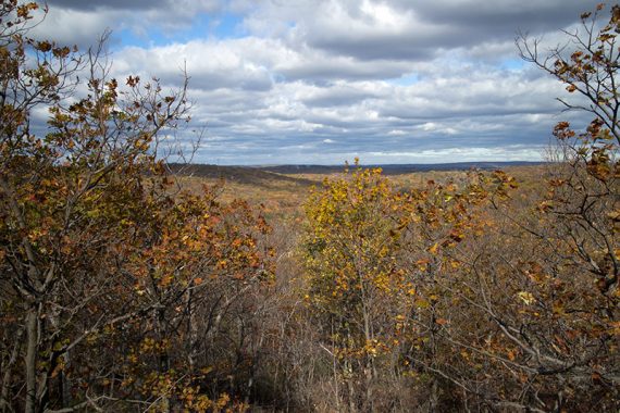
Avid hikers looking for a longer hike will need to add in something from the main part of Norvin Green State Forest. Lots of sun exposure. Many expansive views for fall foliage.
Updated: 12/2023 – Minor edits, re-hiked 10/2023. Older change log at page bottom.
Hike Info:
Map:
The Northern New Jersey Highlands Trails Map has all of Norvin Green State Forest but most of this hike also appears on Morris County Highlands Trails.
Note: Older maps show BLUE (Hewitt Butler) going to Lake Larriwien, it no longer does. The video includes the section to Lake Larriwien that can no longer be hiked.
Books:
This route can now be found in the 2020 version of 50 Hikes in New Jersey (older editions have a different route).
Shorter routes to only Torne Mountain are in Hike of the Week and Hiking the Jersey Highlands. Detailed trail descriptions can be found in the The New Jersey Walk Book.
Parking:
N41.04583° W74.35045°
“Norvin Green State Forest Otter Hole Parking Lot”. 582 Glenwild Ave, Bloomingdale, NJ 07403.
Rt 287 to exit 53, bottom of the ramp turn left onto Hamburg Turnpike, right onto Glenwild Avenue. Pass a small hiker parking area for Wyanokie Crest on the right. Shortly, after a curve, is a small dirt lot on the right.
A sign states it is open from 8am to 8pm. This lot is often filled. Do NOT park along the road, you can get a ticket.
A 2nd parking area is a little further down the road. From this lot, start walking back towards the main lot, and start from the RED trail on the other side of the road, instead. Noted in the description below.
Note: This hike starts at the trailhead on the other side of Glenwild Ave. The trail next to the parking area leads to the rest of Norvin Green State Forest by crossing over Otter Hole cascades (i.e. to Chikahoki Falls, Wyanokie High Point, Buck Mountain).
Restrooms:
None. There was a gas station in town on the way there; and a portable toilet in a small park at the corner of Glenwild Avenue and Bogue Dr.
Hike Directions:
Overview: BLUE (Hewitt-Butler) – RED (Torne)
Note: If you parked at the 2nd lot then start walking back towards the main lot. Watch for the RED trailhead on the other side of the road. Follow this a short ways until the intersection with BLUE. Turn RIGHT to follow BLUE and continue with the direction from
0.0 – From the Otter Hole parking lot, cross the road to the trailhead near a road marker, “Begin 700 Passaic County”.
Start following BLUE (Hewitt-Butler). It heads up right from the start and parallels the road for a bit.
0.2 – Intersection of BLUE (Hewitt-Butler) with RED (Torne). RED is the return route, and the road can be seen off to the right. // If you’ve come via RED from the 2nd lot, turn RIGHT to start following BLUE (Hewitt-Butler).
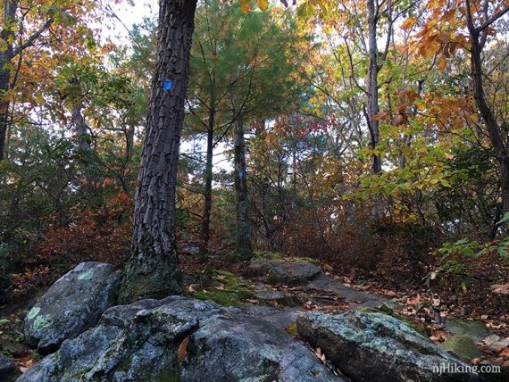
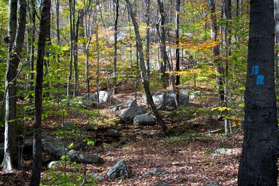
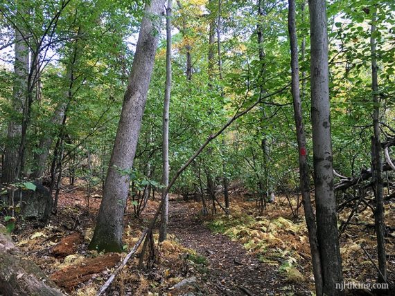
Continue following BLUE (Hewitt-Butler) over a rocky trail surface.
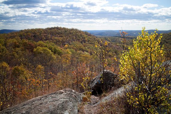
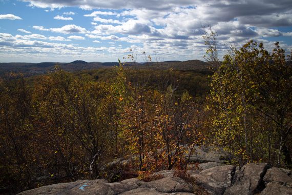
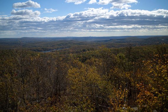
BLUE (Hewitt-Butler) climbs to a limited viewpoint, then the trail comes up and around for a larger view. After this… it’s almost all views in this section.
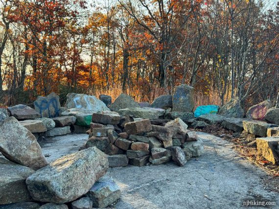
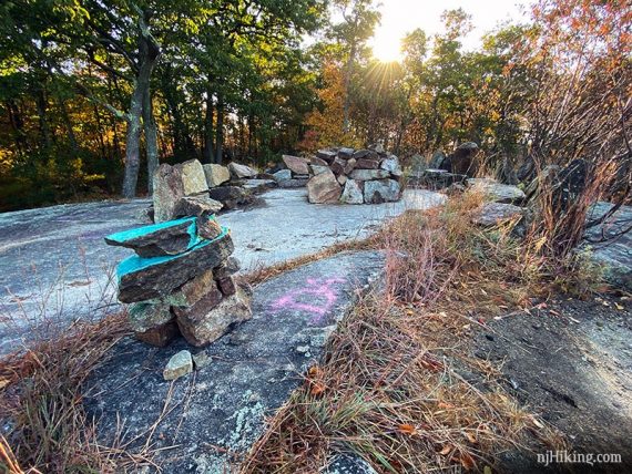
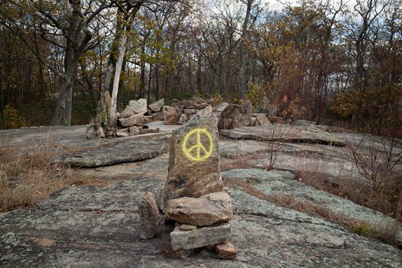
0.5 – In an open area with several rock cairns, look for a faint path ahead leading to the “Stone Living Room”. This is an area of chairs made of stacked stones with a nice view.
It’s easier to spot the living room if the trees aren’t full of leaves. The living room configuration has changed slightly over the years. In 2023:
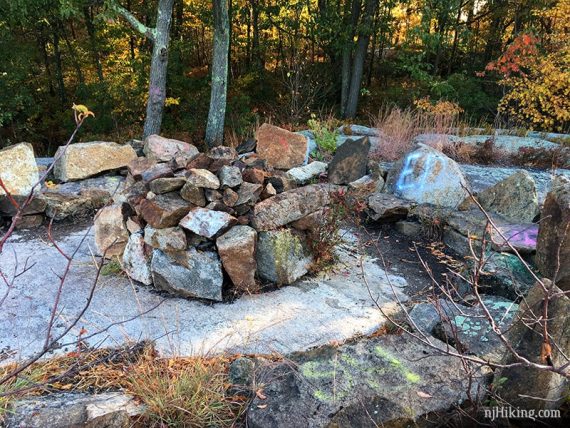
The stone living room in 2019:
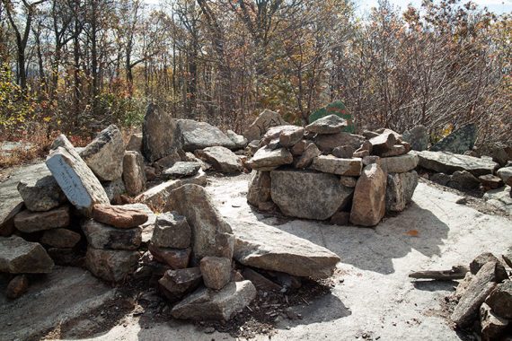
In 2014 the stone living room looked like this:
After checking out the Stone Living Room, retrace and continue following BLUE (Hewitt-Butler).
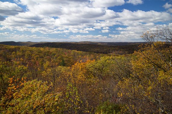
0.7 – At one of the larger wide-open viewpoints is a stone bench. On a clear day the New York City skyline might be visible.
0.8 – Turn LEFT to follow BLUE (Hewitt-Butler) down switchbacks on the “Alternate & Easier Route”.
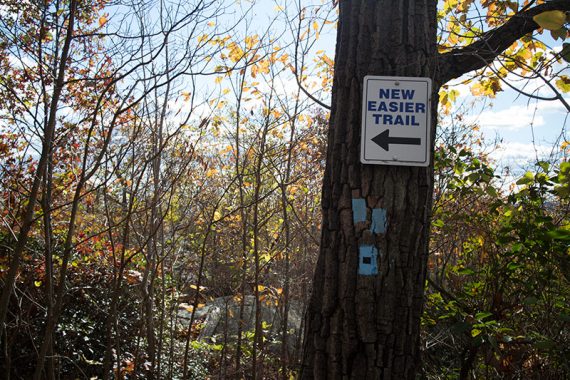
It’s still steep in spots but not a straight shot over rock slabs like the original route, now blazed BLACK DOT on BLUE (can still take this, it meets up with the main trail).
Part-way down there sharp turn to the right that is easy to miss. Basically this zig-zags down and the trail can be a bit hard to determine in some spots.
Pass the other end of the BLACK DOT on BLUE trail.
1.0 – Just after passing RED (Torne) on the right (might not notice it), arrive at a large rock marked with RED and BLUE blazes.
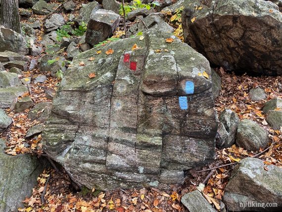
Turn RIGHT to continue following BLUE (Hewitt-Butler). [RED (Torne) goes left and is the return route].
/// Shorter option, 1.6 miles: Had enough? Turn left on RED (Torne) to go directly back, skipping Osio Rock.
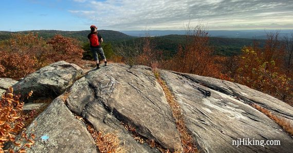
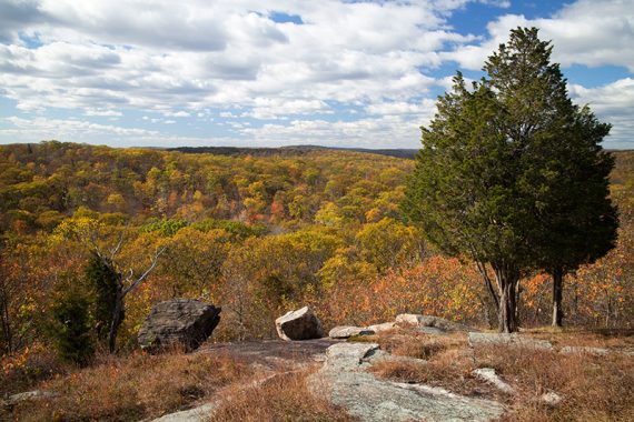
1.4 – Climb up to “Osio Rock” for a 360-degree view over the surrounding mountains with Wanaque Reservoir visible in the distance.
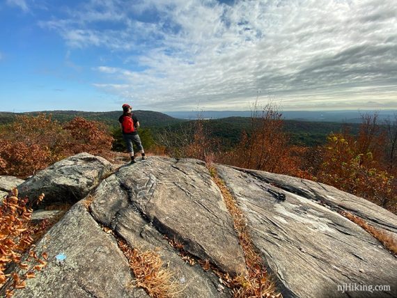
If it’s clear enough, the NYC skyline is also visible (photo below, just barely).
/// Shorter option, 2.3 miles: Instead, retrace BLUE (Hewitt-Butler) back down off of Osio Rock to the intersection with RED (Torne) and take RED back. ///
Continue following BLUE (Hewitt-Butler) by scrambling down the other side of Osio Rock. There are more views as the trail winds downhill.
1.8 – Near a small stream, turn RIGHT to now follow RED (Torne). BLUE (Hewitt-Butler) ends. [To the left is a sign that the trail in that direction is closed.]
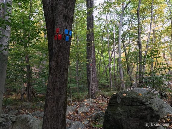
2.1 – Intersection of BLUE (Hewitt-Butler) and RED (Torne) from earlier, at the large rock with RED and BLUE markings.
Continue on RED (Torne) by scrambling up through some large rocks.
The rest of RED (Torne) is shady and level.
2.5 – When almost back at the road, turn RIGHT and follow BLUE (Hewitt-Butler) to the lot…. OR:
// If you’ve parked at the 2nd lot – instead continue ahead on RED (Torne) to the road, turn LEFT and walk along the road to the lot.
// If you’ve parked at the 1st lot but have had enough hiking on trails – instead, continue straight on RED (Torne) to the road, turn RIGHT and walk along the road to the lot.
—
Hiked: 10/28/23.
Hiked: 9/28/19. Trail Blog: “Hiking to Osio Rock and the Stone Living Room“
Hiked: 10/26/14.
Hiked: 6/19/10. Trail Blog: “Norvin Green – Torne Mountain and Osio Rock“
Updated: 10/2020 – Page refreshed, not re-hiked. 10/2019 – Re-hiked, route and description updated to reflect trail changes. Old info archived on the 2010 trail blog page.