Scenic hike around Butler Reservoir that includes a waterfall, dam, and ruins.
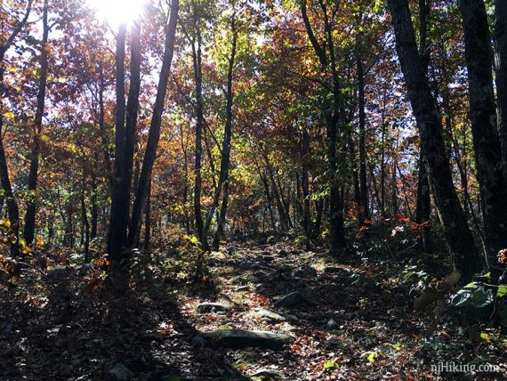
5.3 or 2.2 miles. Roots and rocks, steep sections (especially coming down GREEN), some seasonal rock hops over wet areas or streams.
| 5.3 miles | This hike guide: Detailed instructions, photos, and video follow below. |
| Shorter | 2.2 – To the reservoir viewpoint and back. Noted below. |
| Variation, shorter: | 3.2 – Direct to dam, ruins, waterfall, see “Apshawa Waterfall“. |
| Nearby | Torne Mountain/Osio Rock; Wyanokie High Point, Chikahoki Falls, Otter Hole; Wyanokie High Point, Carris Hill, Buck Mountain; Stonetown Circular; Lake Sonoma, Overlook Rock, Manaticut Point; Pyramid Mountain – Tripod Rock; Valhalla Falls – Turkey Mountain; Turkey Mountain – Perimeter Loop. |
Our two cents:
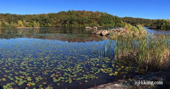
This hike packs a lot of interest in under 6 miles: a large portion of this hike has a water view, plus some waterfalls, water tank ruins from the early 1900’s, a dam, and a couple of viewpoints.
A longer route can’t really be done in this park. Some traffic and yard work noise. Bonus: This is a no-hunting park.
In 2021 Butler Reservoir was renamed “Kathleen M. Caren Memorial Reservoir” for her involvement in preserving open space in Passaic County.
Updates: 4/2026 – Updated description to reflect map changes. Does not affect this route but may increase the mileage by ~0.1 or so; not re-hiked. Older change log at page bottom.
Hike Info:
Trail Map:
Park map linked above and it also appears on Morris County Highlands Trails. Follow along on your smartphone with our Interactive Map link above. The park’s map lists distances of each segment in order to put other loops together.
The 2/2026 trail map has slightly rerouted part of RED on the north side of the reservoir (possibly increasing the total mileage of the hike by 0.1 or so), and removed the old YELLOW on the east side of the reservoir, while adding a new YELLOW on the west side.
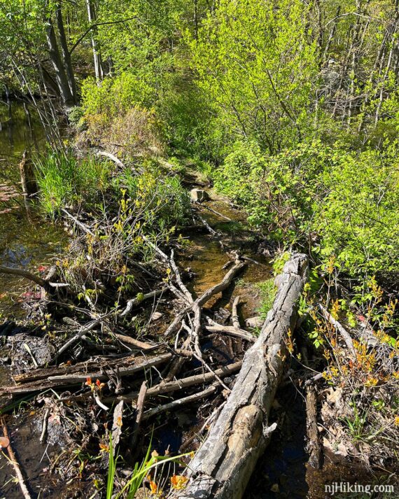
Older maps show a YELLOW trail branching off of RED and going around a pond. This has been closed for years due to busy beavers flooding the trail which then became too overgrown to hike.
Neither of these changes affect the directions below but be sure to have the most current map.
Related: Waterfalls in NJ / Best Waterfall Hikes in NJ
Parking: N41 01.516 W74 22.430
Apshawa Preserve Parking, 4 Northwood Drive West Milford, NJ 07480. Route 287 to Exit 53 for Hamburg Turnpike. Bear R on Macopin Road. L on Northwood Dr. Large dirt lot.
Restrooms:
None. There are gas stations on Hamburg Turnpike, or along Rt 23 if approaching via Exit 52B off of Rt 287.
Hike Directions:
Overview: BLUE – WHITE – RED – GREEN – ORANGE – BLUE
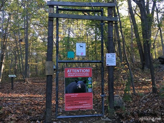
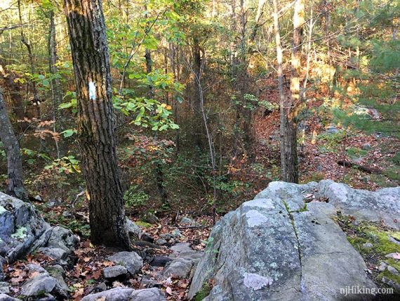
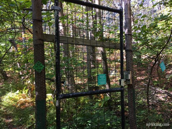
0.0 – Walk through the gate in the deer fence and start following BLUE. It’s the only trail from the lot. Along the route there are dark BLUE markers in addition to the light blue – it’s the same trail.
0.3 – Pass PURPLE on the left; might not notice it. Continue on BLUE as it heads downhill. There is a minor scramble down.
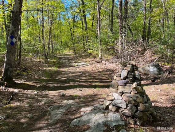
0.5 – Turn RIGHT, now following WHITE. This is a little hard to see on the park map. The blazes are painted on a rock and there now is a large rock cairn (stack-o-rocks). [BLUE continues straight].
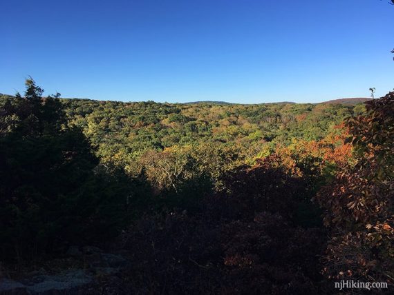
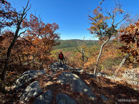
0.8 – Viewpoint over the surrounding hills. Though this was limited view of Butler Reservoir in the distance – but it’s either only when the leaves don’t have leaves, or the trees or too tall now.
0.9 – Go through the gate in the deer fence and turn RIGHT, now following RED. [WHITE ends. RED also goes to the LEFT].
// Shorter Option, 2.2 miles: Turn LEFT on RED instead, to not go around the entire reservoir. Follow RED to the overlook near the dam. Retrace the route, or choose another trail back. //
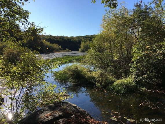
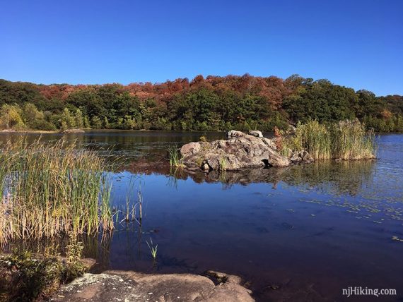
1.2 – Arrive at the edge of the water where a strip of land on the left cuts the reservoir in two. Just before this, you might have missed RED veering down to the LEFT but you’ll arrive at the same spot regardless.
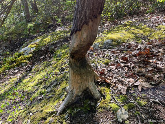
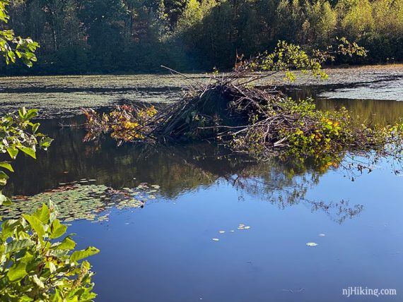
This was once the intersection with the start of a YELLOW trail but beaver activity has closed that and now there are no old markers visible. Two large beaver lodges can be seen across the water.
Busy, busy beavers. Not quite done with this one… yet.
Turn LEFT, still following RED, across a short narrow strip of ground with water on one side.
When we last hiked (5/2023) it was a little overgrown with a jumble of sticks to walk on and a wet area.
At the end of that, turn LEFT, still following RED. Start moving away from the reservoir.
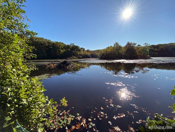
The trail returns to the edge where a large lodge can be seen out on the water, with a dammed area closer to the trail. [The minor reroute of RED should be around this area but we have not re-hiked since this change].
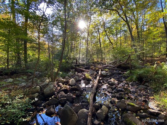
The trail can be wet in this area, requiring rock and log hops depending on the amount of recent rain.
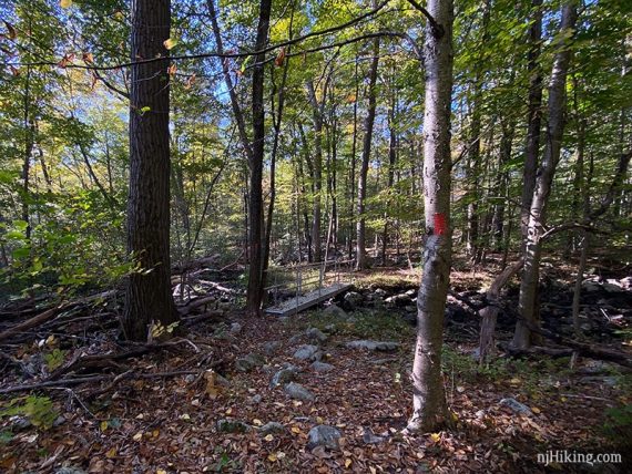
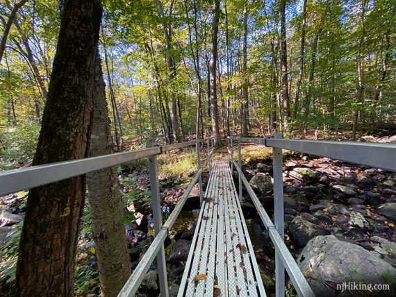
1.5 – Cross a stream on a metal bridge, continuing on RED as it hugs the stream.
Pass the start of the YELLOW trail along here. This has been added since our last hike. It stays inland instead of along the water and will meet back up with RED in 0.5 mile.
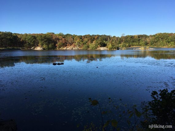
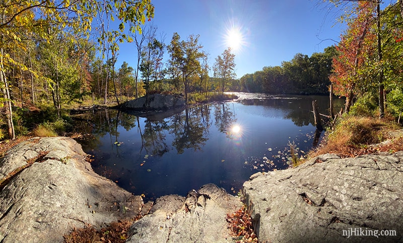
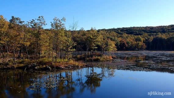
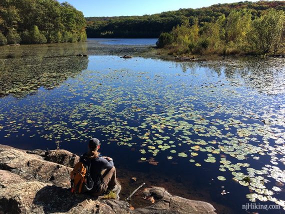
RED returns to the shore of the reservoir, with several rocks to take a break on, and plenty of views of the water.
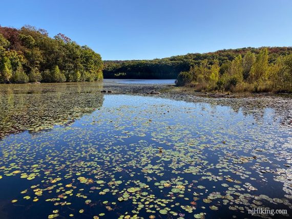
A beaver lodge is visible on the reservoir.
Continue following RED. At some point pass the end of the YELLOW trail.
There is a large flat rocky area to take a break or wait for the next one.
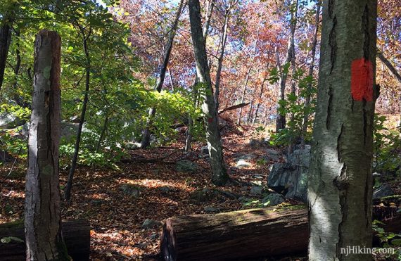
2.3 – Arrive at a woods road, and turn LEFT, still following RED. NOTE: Casual paths in this area have been marked RED since we last hiked here, so there could be minor differences here.
Pass a short trail to the water on the left, and then the GREEN trail gate on the right (for now, you’ll be back to the gate a bit). The trail is now marked RED/GREEN.
When RED/GREEN goes to the right, veer LEFT either on the trail with a faint RED marker, or towards the dam. There are multiple trails, keep along the water basically.
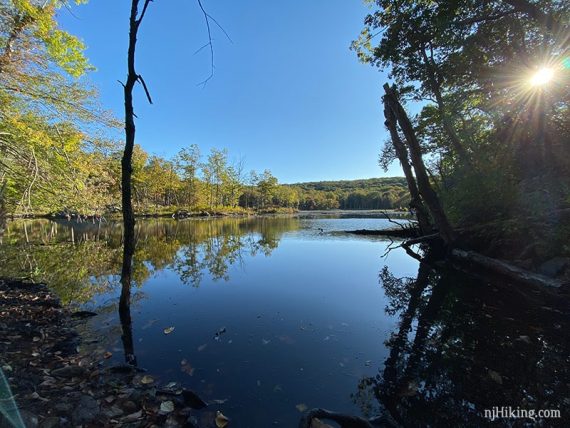
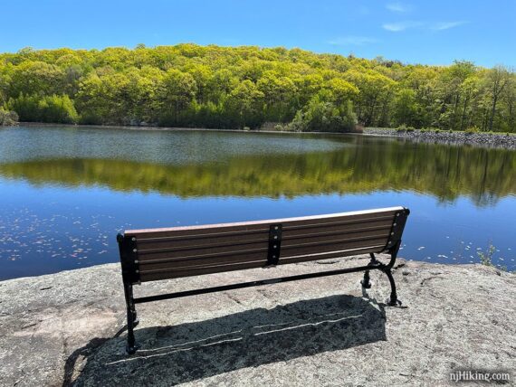
Follow this out to a wide area of flat rock jutting into the reservoir for more nice vantage points and break spot.
There is a bench dedicated to Kathleen M. Caren with a nice view of Butler Reservoir.
Retrace back to the woods road marked RED/GREEN, and turn RIGHT to head back to the gate passed earlier.
2.8 – Turn LEFT through the gate to start following GREEN. [RED continues straight, in the direction you came from].
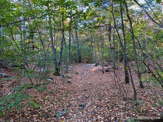
The trail surface is not great for a short bit as it follows a rocky drainage that might be a little overgrown.
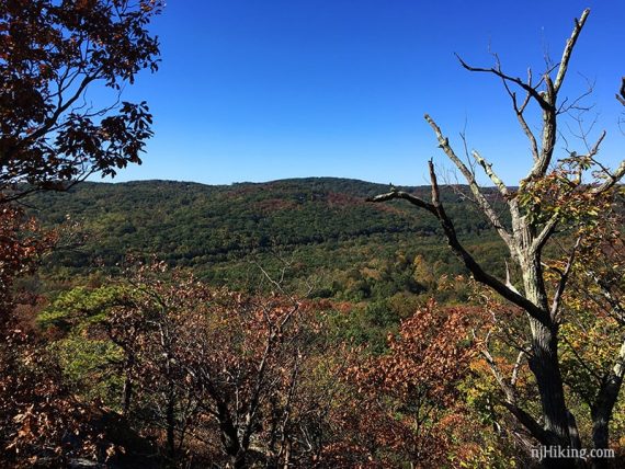
3.1 – Pass a casual path on the right that leads to a view that wasn’t really there anymore, though with leaves down it might be a limited view.
3.2 – This view is partially obstructed by trees but still makes for a nice break spot.
Continue on GREEN steeply downhill, sometimes on switchbacks.
[There once was a spot where the NYC skyline could be seen in the distance, this may be the case when the leaves are down or it’s just grown over].
3.7 – Arrive at a woods road near Apshawa Brook, turn LEFT and follow the brook, still on GREEN.
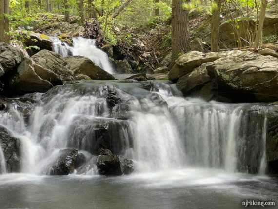
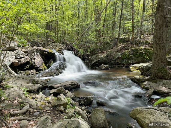
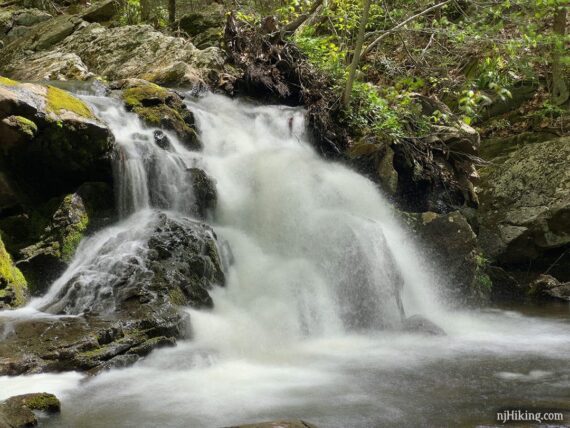
Apshawa Falls consists of a few cascades tumbling over rocks in the brook into a wide pool of water. It’s best after recent heavy rain.
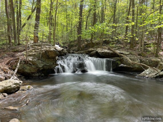
There is another cascade above the main one. To see more of the second falls above the main one, move closer to the stream edge. Or, you find a safe way out on rocks or to the other side of the stream (probably not worth the effort).
Moving back beyond the pool may yield another small cascade to fit into the shot.
Climb up the rocks along the left side of the main falls to see the second one where there is another nice waterfall into a smaller pool. Keep in mind that this is also better after a decent amount of rain.
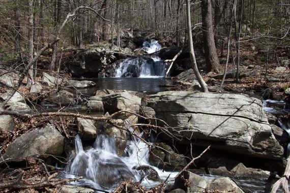
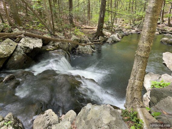
From the rock above the main falls, looking down Apshawa Brook.
In periods of little rain the waterfall may have low flow or be dry. This is the main falls in 2019. Continue following GREEN.
3.8 – GREEN turns RIGHT to cross Apshawa Brook on a section of placed rocks (what was once a potentially tricky rock hop).
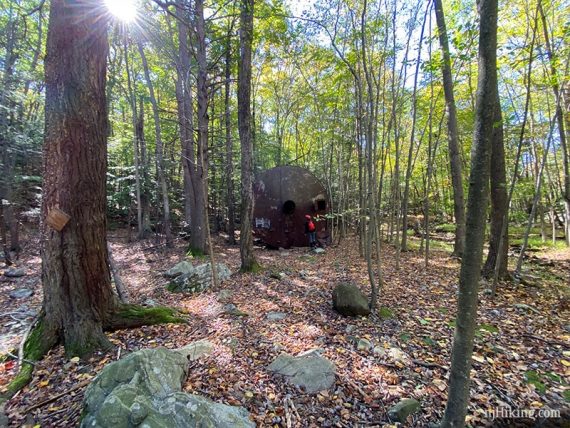
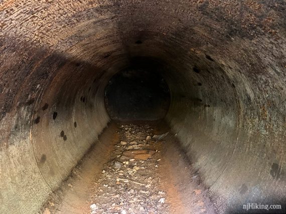
The are several very large water tanks and a stone building.
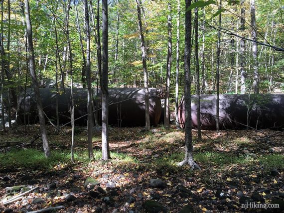
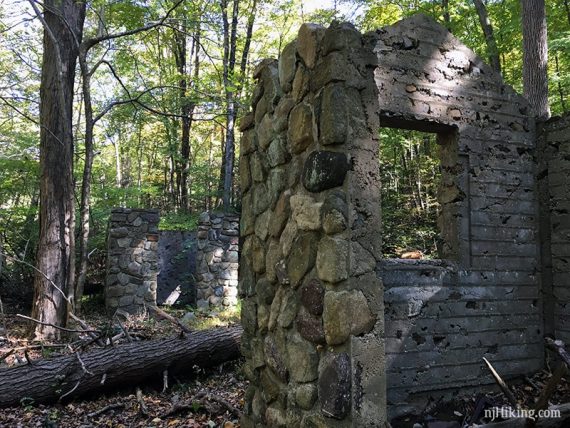
These are remnants of a water purification system built in the early 1900’s.
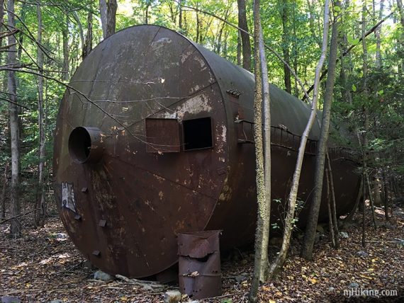
These are quite large – hiker next to one for scale:
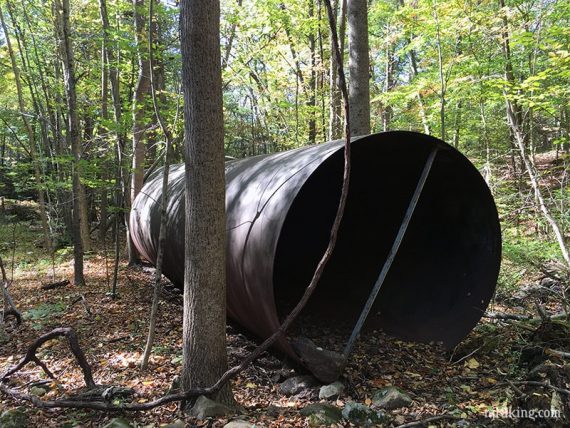
Looking inside one of the tanks:
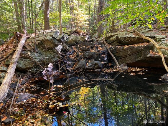
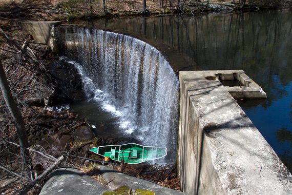
3.9 – Continue on GREEN as it climbs up along the right side of a dam, also built in the early 1900s.
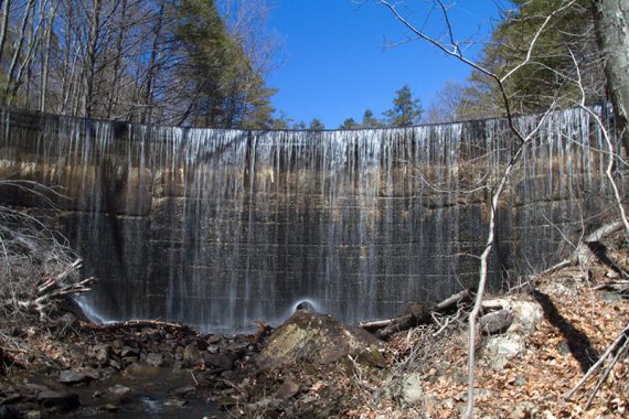
The dam was dry when we hiked this in 2019:
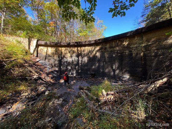
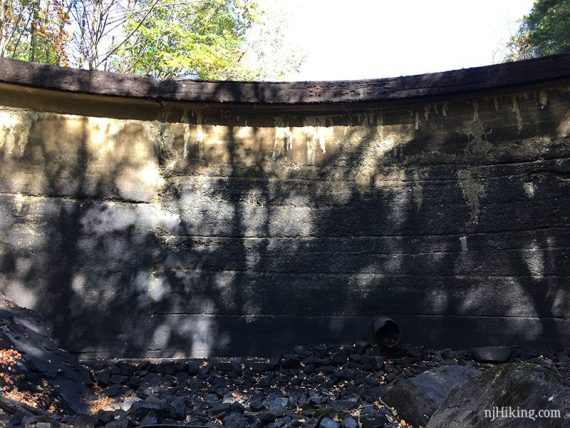
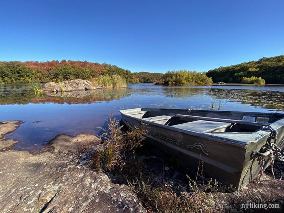
End up above the dam. This canoe whoopsie is from 2014:
4.2 – Bear RIGHT to now follow ORANGE. [GREEN continues to the LEFT]
4.4 – Turn RIGHT to now follow BLUE. [ORANGE ends. BLUE also goes to the LEFT]
4.8 – Pass WHITE on the left. Continue on BLUE back to the lot.
——-
Hiked: 5/7/23.
Hiked: 10/5/19. Trail Blog: “Hiking around Butler Reservoir at Apshawa Preserve“
Hiked: 4/6/14. Trail Blog: “Apshawa Preserve – Butler Reservoir, Waterfalls, Ruins“
Hiked: 11/06/10. Trail Blog: “Apshawa Preserve“
Updates: 5/2025 – Minor edits. 5/2023 – Re-hiked, minor edits, more waterfall photos. 10/2019 – Re-hiked, description tweaks, new photos/video. 4/6/14 – New description to include major changes to the trail colors, new photos.