Hike to a waterfall along Apshawa Brook, a dam, and water tank ruins.
3.2 miles. Roots and rocks; seasonal rock hop over small stream.
| 3.2 miles | This hike guide: Detailed instructions, photos, and video follow below. |
| Longer | 5.3 – Includes Butler Reservoir, “Apshawa Preserve”. |
| Nearby | Torne Mountain/Osio Rock; Wyanokie High Point, Chikahoki Falls, Otter Hole; Wyanokie High Point, Carris Hill, Buck Mountain; Stonetown Circular; Lake Sonoma, Overlook Rock, Manaticut Point; Valhalla Falls – Turkey Mountain; Turkey Mountain – Perimeter Loop. |
Our two cents:
This is a shorter, direct route to Apshawa Waterfall that includes two other interesting features of this park – a dam and ruins of very large water tanks from the 1900s.
Note: In drought conditions the falls may be low or almost totally dry. This route doesn’t go to Butler Reservoir (now named “Kathleen M. Caren Memorial Reservoir”). The video is of the longer variation of this hike.
Some traffic and yard work noise. Bonus: This is a no-hunting park.
Updated: 4/2026 – Minor edits. 5/2025 – Minor edits. 5/2023 – Minor edits, added photos; re-hiked in reverse, as part of the longer route. 7/2020 – Adjusted directions.
Hike Info:
Trail Map:
Park map linked above and it also appears on Morris County Highlands Trails. The park’s map lists distances of each segment in order to put other loops together. Follow along on your smartphone with our Interactive Map link above.
Related: Waterfalls in NJ / Best Waterfall Hikes in NJ
Parking: N41 01.516 W74 22.430
Apshawa Preserve Parking, 4 Northwood Drive West Milford, NJ 07480. Route 287 to Exit 53 for Hamburg Turnpike. Bear R on Macopin Road. L on Northwood Dr. Large dirt lot.
Restrooms:
None. There are gas stations on Hamburg Turnpike, or along Rt 23 if approaching via Exit 52B off of Rt 287.
Hike Directions:
Overview – BLUE – ORANGE – GREEN – ORANGE – BLUE
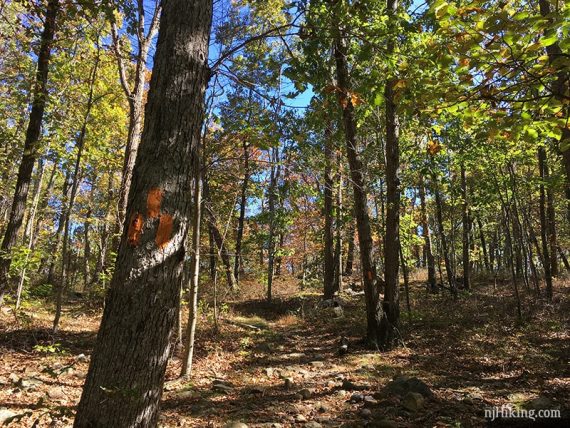
0.0 – Walk through the gate in the deer fence and start following BLUE. It’s the only trail from the lot.
0.3 – Pass PURPLE on the left; might not notice it. Continue on BLUE as it heads downhill. There is a minor scramble down.
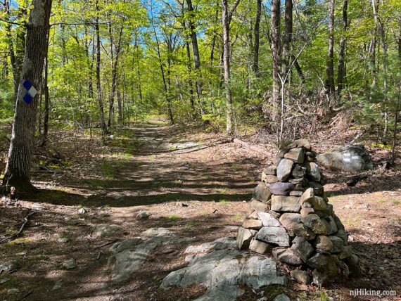
0.5 – Continue straight on BLUE. There is now large rock cairn (stack-o-rocks) at this intersection. [WHITE starts to the right]
0.9 – Turn LEFT to now follow ORANGE. [BLUE continues ahead].
1.1 – Turn LEFT to now follow GREEN. [GREEN also goes right].
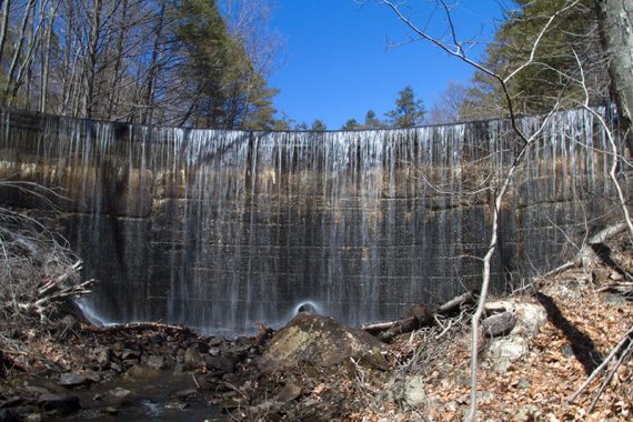
1.4 – Continue on GREEN as it approaches the top of a dam and then heads down next to it. This canoe whoopsie is from 2014:
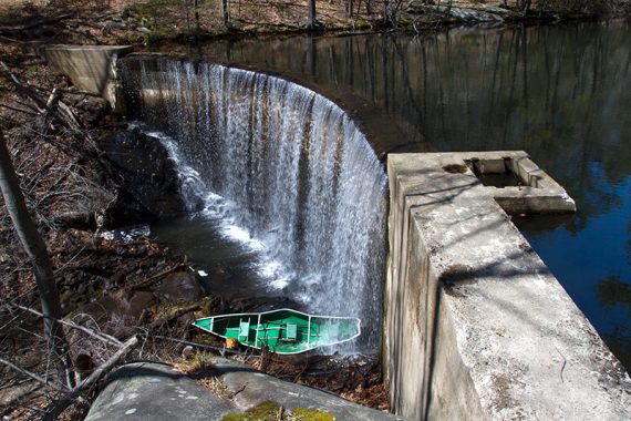
This dam was built in the early 1900s. Once when we hiked here (2019) this was entirely dry.
1.5 – Arrive at a stone building and several very large water tanks that are remnants of a water purification system built in the early 1900’s.
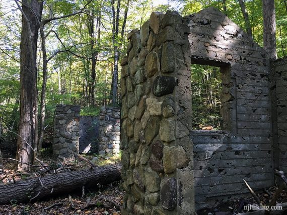
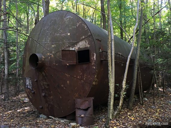
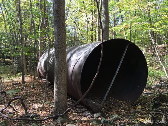
One of the water tanks. Another is open:
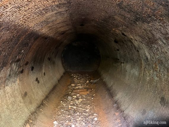
Looking inside the water tank:
After the water tank ruins, cross Apshawa Brook on a section of placed rocks (what was once a potentially tricky rock hop). Turn LEFT to continue following GREEN.
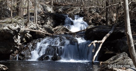
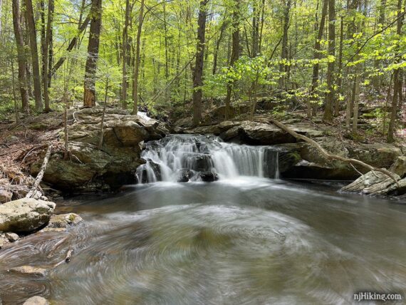
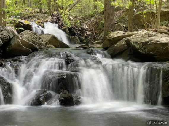
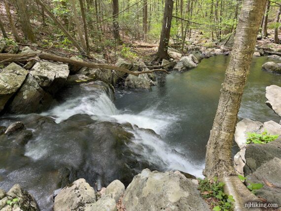
1.6 – Apshawa Falls appears on the left, where there are several pretty cascades along Asphawa Brook.
The falls consists of a few cascades tumbling over rocks in the brook into a wide pool of water. It’s best after recent heavy rain. This was taken in early May 2023:
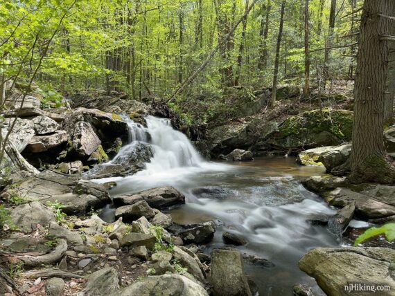
There is another cascade above the main one. To see more of the second falls above the main one, move closer to the stream edge. Or, you find a safe way out on rocks or to the other side of the stream (probably not worth the effort).
Moving back beyond the pool may yield another small cascade to fit into the shot.
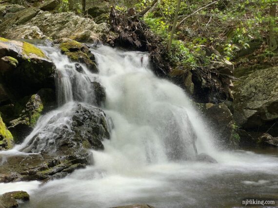
Climb up the rocks along the left side of the main falls to see the second one where there is another nice waterfall into a smaller pool. Keep in mind that this is also better after a decent amount of rain.
From the rock above the main falls, looking down Apshawa Brook.
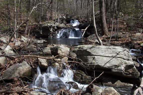
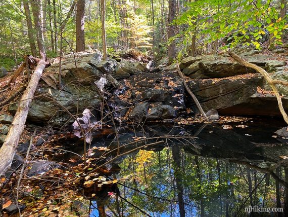
In periods of little rain the waterfall may have low flow or be dry. This is the main falls in 2019:
When ready, retrace the route back to the parking lot. Turn around and start heading back on GREEN.
1.7 – GREEN turns RIGHT to cross Apshawa Brook again and passes the water tanks and stone building, then climbs up above the dam.
2.2 – Bear RIGHT to now follow ORANGE. [GREEN continues to the LEFT]
2.3 – Turn RIGHT to now follow BLUE. [ORANGE ends. BLUE also goes to the LEFT]
2.8 – Pass WHITE on the left. Continue on BLUE back to the lot.
—-
Hiked: 5/7/23. In reverse, as part of the longer route.