Hike through pine forest, around salt marshes, and along beaches while looking for Osprey in nesting platforms.
6.7 miles or shorter, total round trip. Easy surface of sand, pine needles, wood chips, boardwalks. Can be muddy. Level, no elevation change.
- Shorter: Only do RED Loop (1.6) or YELLOW (1.6) or BLUE (1.5).
- Shorter, 3.3 miles: RED + YELLOW; noted below.
- Shorter, 5.4 miles: Skip the ORANGE section; noted below.
- Nearby: Jakes Branch County Park; Double Trouble; Island Beach State Park; Wells Mills County Park; Barnegat Branch Trail.
Hike Info:
Our two cents:
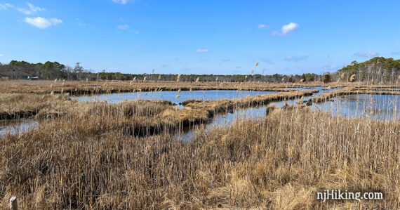
Cattus Island has great photography and birding opportunities plus vast bay views. Osprey build nests in the spring, and we spotted one less than 5 minutes from the parking lot – bring a telephoto lens or binoculars (we use a lightweight monocular).
This route follows the perimeter in order to see the entire park. The trail system is geared toward short loops from the main parking lot – just pick a trail or two for a shorter hike.
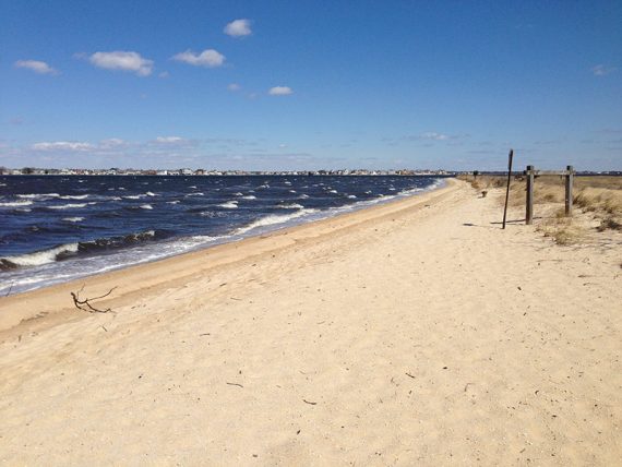
This is one of NJ’s unique beachy hikes and may not fit your definition of “hiking” but it’s very worthwhile. Some road noise along RED.
The Cooper Environmental Center features nature displays, a seasonal butterfly garden, and a 1000′ ADA accessible boardwalk overlooking the salt marsh.
Bikes are allowed on the Main, BLUE, and BLUE/WHITE trails and loaner bikes may be available at the center.
Updated: 2/2023 – Re-hiked, description updated, more photos, interactive map added. 5/2017 – Link to updated trail map; Cooper Enviro center is now open.
Fun Facts: Cattus Island Park is named for John V. A. Cattus who bought the land in 1895 and built a farm, hunting lodge, and boat dock. The land was sold to developers when he died in 1964 but Ocean County was able to purchase it and the park was opened in 1980.
Map:
There were maps at the kiosk outside the visitor center, or print one ahead. Follow along on your smartphone with our Interactive Map link above.
Books:
A 4.8 mile route is in Hiking New Jersey (2023) and a 3.2 mile loop is in 50 Hikes in New Jersey.
Parking: N39.98159° W74.12847°
Cattus Island County Park Parking Lot, 1170 Cattus Island Blvd, Toms River, NJ 08753. This is main lot in the center of the park near Cooper Environmental Center.
There is also a parking area by the park office along the YELLOW loop.
Restrooms:
Inside the Cooper Environmental Center. Portable toilet outside Cooper Environmental, in the parking lot along the YELLOW trail, and at the start of the ORANGE trail.
Hike Directions:
Overview: RED – YELLOW – RED – Main (unmarked) – BLUE – BLUE/WHITE – Main (unmarked) – ORANGE – Main (unmarked) – BLUE/WHITE – BLUE – Main (unmarked)
The Main trail is unmarked but shown as a dotted cream colored line on the trail map.
0.0 – At the far corner of the parking lot, walk through the playground to start following the RED trail. If you reach a boardwalk, that’s the accessible trail. RED is before that, off on the right.
// Alternate: If you visit the Cooper Environmental Center first, take the boardwalk trail back to the playground area and pick up the RED trail that way. //
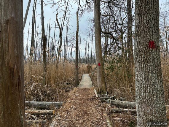
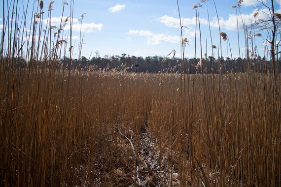
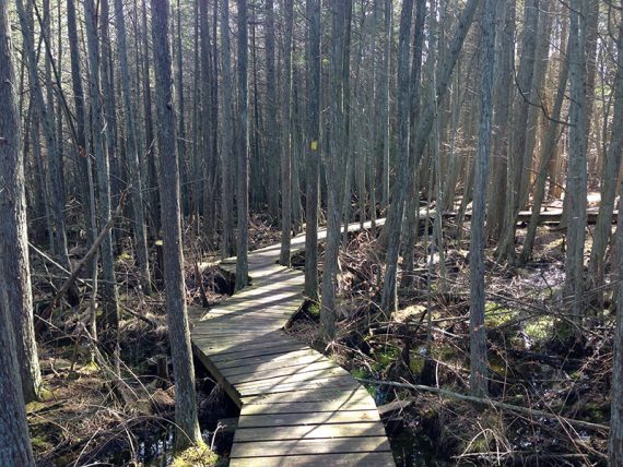
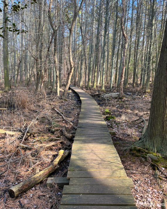
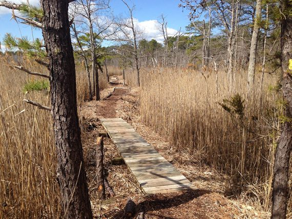
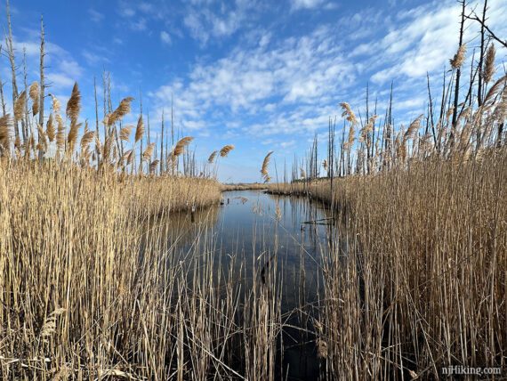
Continue following RED on boardwalks and trails through marsh grasses.
RED gets near some houses. When we last hiked, a section of RED had been bulldozed down to sand, likely for fire breaks. Keep an eye out for large exposed roots just waiting to be tripped over.
0.5 – Continue following RED as it turns LEFT near a bench. [Swamp Crossing (RED/WHITE) is on the right, and is alternate route that ends up in the same place as this trail.]
1.0 – RED turns LEFT at the intersection with the other end of the Swamp Crossing (RED/WHITE).[Unmarked continues straight, this turn is easy to miss… we waltzed right on by.]
1.1 – Turn LEFT at post marked with “Maritime” and “Yellowbank”. You’ll return here after the YELLOW loop.
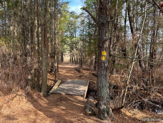
In a few paces are 3 YELLOW markers on a tree. Now follow YELLOW and cross over a small bridge.
Cross another bridge. Veer LEFT when YELLOW splits (it’s a loop) at a sign with “Parks Administration/Bandon Road” and “Yellowbank”.
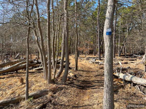
Keep following YELLOW when it crosses the park road. Follow YELLOW as it zig-zags through a cedar swamp on boardwalks.
1.7 – Follow YELLOW past a boat ramp, parking area with a portable toilet, and a park building. Follow the trail marker posts across the grass.
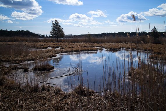
The trail reenters the forest and moves towards the edge of the water.
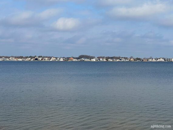
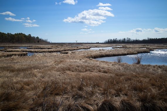
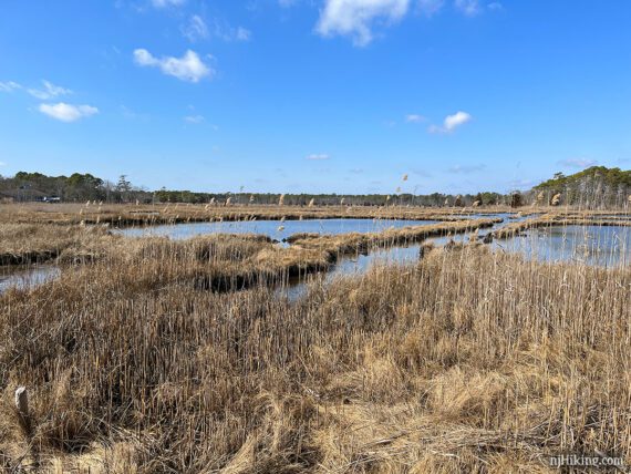
There are a few spots to come out for a view of Silver Bay and houses across the way.
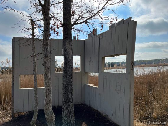
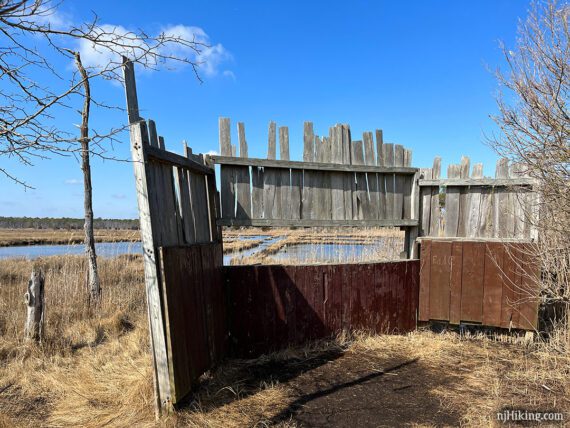
Continue following YELLOW over boardwalks with views over Mosquito Cove. Pass a wildlife blind.
2.6 – Back to where YELLOW split for the loop… continue following YELLOW over the bridges and back to the marker post with “YELLOWBANK”. Turn LEFT at the marker post to now follow RED.
RED has views of the water and marsh grass with a bench along the way.
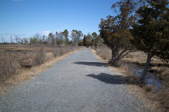
3.1 – RED ends at the park road near Cooper Environmental Center. Turn LEFT, now following the wide gravel Main (unmarked) trail.
// Shorter Option, 3.3 miles total: Instead, turn right to return to the parking lot. //
The area is wide open on either side with water and osprey nest platforms in the distance.
3.3 – Turn LEFT to now follow BLUE. This comes out to a view of Mosquito Cove before heading back in the trees.
3.8 – Continue ahead to now follow BLUE/WHITE. [BLUE goes to the right and meets up with the Main trail].
4.0 – Turn LEFT and follow Main (unmarked).
// Shorter Option, 5.4 miles total: Instead, cross Main (unmarked) and continue on BLUE/WHITE to cut 1.3 miles out. Even Shorter Option: Instead, turn RIGHT and take Main (unmarked) back to the lot. //
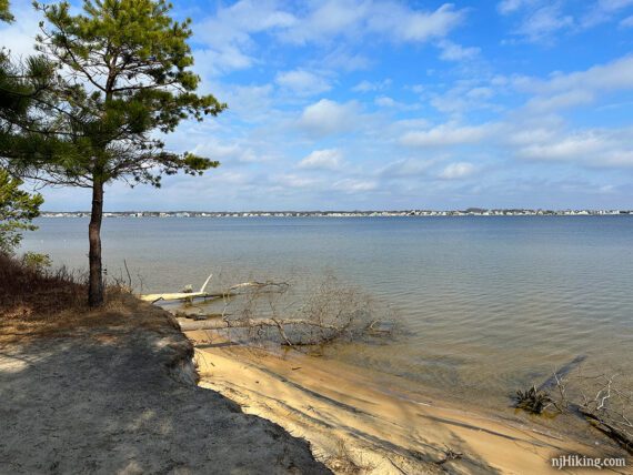
4.3 – A small beach with views over Silver Bay and picnic tables are at the end of Cattus Island.
This AWESOME park sign cracks me up every time. It’s an unusual and striking image for a warning sign (…or, as a graphic designer, this is what amuses me).
I first spotted one at Wells Mills County Park eons ago and now there’s one here too.
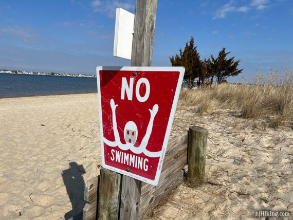
“No Swimming” Sign Fun Facts – Text on the edge reads “© 1969 ANNE STENTIFORD” and the address of a sign company in Louisiana. Anne created it in the late 1960’s as a class project asking students what a “no swimming” sign should look like (for more see “Who is Anne Stentiford?“). It’s the only sign she created and is still sold by the Tri-Safety Sign Company.
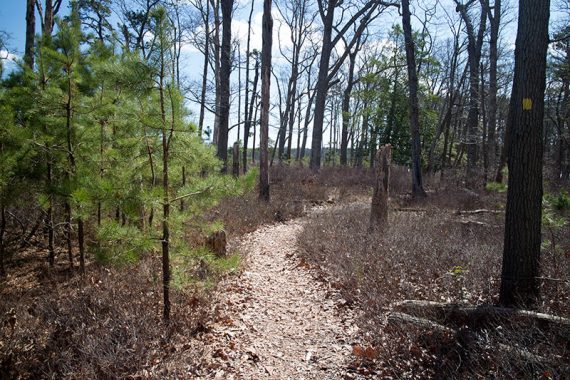
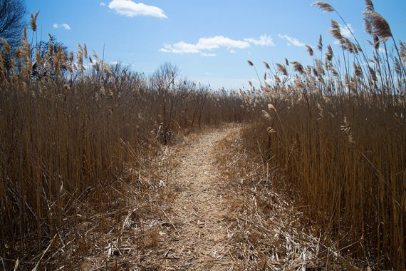
After checking out the beach, Start following ORANGE, which soon heads over a long boardwalk. ORANGE splits into a short loop so choose either direction (we went to the right).
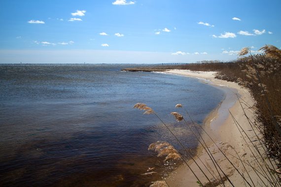
The ORANGE loop overlooks Barnegat Bay.
After completing ORANGE, turn LEFT and retrace Main (unmarked) to BLUE/WHITE.
5.3 – Turn LEFT to follow BLUE/WHITE again.
5.8 – BLUE/WHITE ends at BLUE. Continue ahead to now follow BLUE [which also goes to the right].
At a wildlife blind the Cooper Environmental Center can be seen in the distance, off on the left. You may spot people walking on the Main path across the way.
6.3 – Turn LEFT on Main (unmarked) [BLUE ends]. Continue back to the parking lot.
—
Hiked 2/26/23.
Hiked 4/4/15.