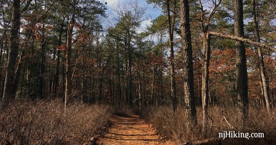
Hike on easy trails through New Jersey’s pine barrens and an Atlantic white cedar bog.
8.7 miles; shorter options noted below. Super-duper easy-peasy, flat, sand-n-pine needle trails (cushiony!). Barely any elevation change.
| 8.7 miles | This hike guide: Detailed instructions, photos, and video follow below. |
| Shorter | 8.3 – This route without SILVER (Absegami); noted below. 3.0 – Cut this route short; noted below. |
| Longer | 10 miles – This route plus an out-and-back on Joe’s Trail along Lake Absegami, ending at an old picnic pavilion; noted below. …And the 50-mile Batona Trail starts just down the road from the main park entrance. |
| Alternate, shorter: | Other options in this park: 4.0 – ORANGE (CCC) loop. 3.1 – YELLOW (Poppy Allen) loop. 1.7 – GREEN (Nisky) loop. One way distances: SILVER (Absegami) – 0.4 miles, Joe’s Trail – 0.65, RED (South Shore) – 0.6, BLUE (North Shore) 0.6 |
| Nearby | Batsto Lake Trail; Tom’s Pond Trail; Edwin B. Forsythe NWR; Wells Mills County Park; Barnegat Branch Trail. |
Our two cents:
This route covers almost all of the park’s trails and features, except for the Batona Trail.
For those who just want a short hike, our pick would be ORANGE (CCC) + SILVER (Absegami), which we feel hit the best of the park. That exact route is detailed in 50 Hikes in New Jersey.
Didn’t run into any wet areas to cross other than a super flooded stretch of PURPLE (Falkinburg) in 2019 after lots of recent rain.
In summer the ticks can be bad in the pine barrens; be sure to have bug protection or hike in the winter.
Updated: 1/2025 – Page refreshed, not re-hiked. Older change log at page bottom.
Hike Info:
Map/Books:
Get a map at the visitor center or print out the Bass River trail map ahead. Follow along on your smartphone with our Interactive Map link above.
Good shorter option in 50 Hikes in New Jersey. There is a brief entry in the The New Jersey Walk Book.
Parking: N39.62582° W74.42522°
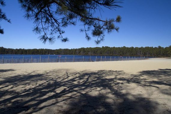
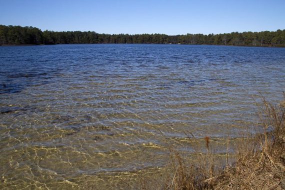
Lake Absegami Day Use Area, 762 Stage Rd, Tuckerton, NJ 08087. This street address is for small lot at the visitor center where you can stop for info and a map. For this hike, continue on the main park road to the large Day Use lot near Lake Absegami.
From the Garden State Parkway southbound take Exit 52, northbound take Exit 50. Follow the brown signs to the park, it’s not very far off the Parkway.
There is another lot outside the fee area at the firefighters memorial on Greenbush Rd.
Note: Fee charged from Memorial to Labor Day. For fee info check out our page on the NJ State Park Pass.
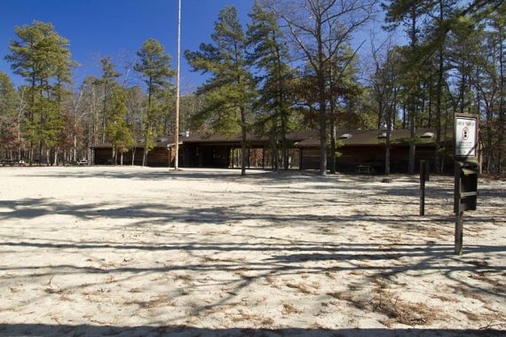
Restrooms:
Outside the visitor center, at Lake Absegami, and composting toilets at the campground along the Yellow trail.
We arrived before the visitor center was open and in the off-season but the bathroom is accessed from outside and was open. Bathrooms at the lake were closed, but the composting toilet near the Group Camping area along the YELLOW trail was unlocked.
Hike Directions
Overview: YELLOW (Poppy Allen) – PURPLE (Falkinburg) – ORANGE (CCC) – SILVER (Absegami) – ORANGE (CCC)
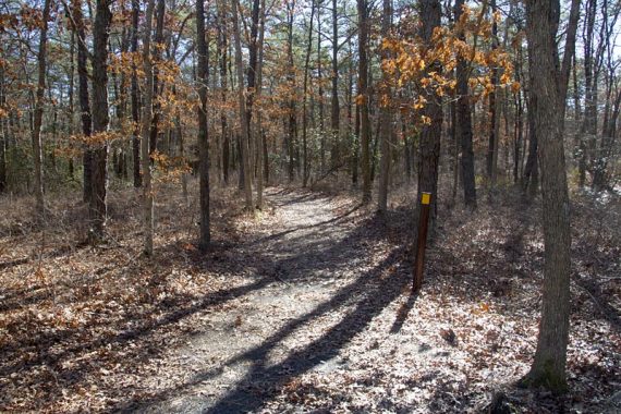
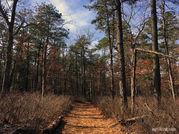
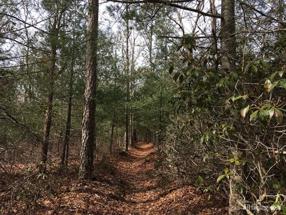
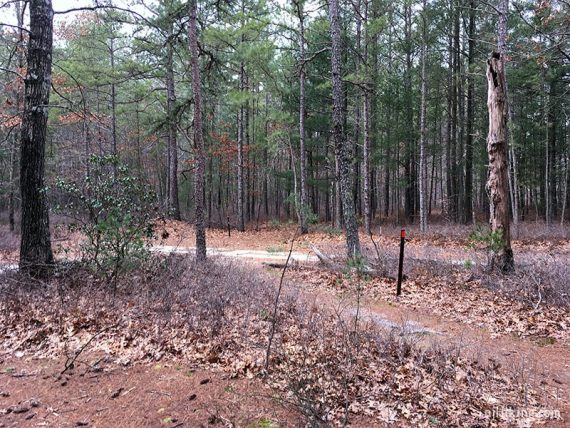
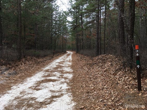
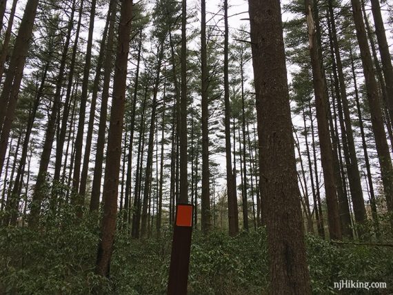
The trail is marked well if sometimes sparsely (because there is just one obvious trail). There are multiple unmarked sand roads that cross the trail, but it is usually clear where to go.
We walked over to the beach area to check out Lake Absegami for photos before we started our hike, and this is not included in the mileage.
0.0 – Go to the far end of the Day Use parking lot and walk on the paved road past a “Campers Only” sign. Opposite the sign for “boat launch” is the start of the YELLOW (Poppy Allen), on the right.
0.2 – Continue following YELLOW (Poppy Allen) as it crosses TAN (Connector).
0.3 – Continue following YELLOW (Poppy Allen) past the Group Camping area.
1.0 – Continue following YELLOW (Poppy Allen) as it turns LEFT onto a wide sand road (didn’t notice markings until the next turn).
1.2 – Turn RIGHT, continuing on YELLOW (Poppy Allen).
1.8 – YELLOW (Poppy Allen) makes a RIGHT, then immediately forks. Bear LEFT to start following PURPLE (Falkinburg).
/// Shorter Option, 3.0 miles total: Bear right onto YELLOW to head back and cut this hike much shorter.
Note: Shortly after getting on PURPLE the last time we hiked this (2019), there was a long deeper-than-our-boots flooded section that required a somewhat gnarly long bushwhack around it… probably is not like this often but just heads up in case.
Continue following PURPLE (Falkinburg) as it does a little zig-zag.
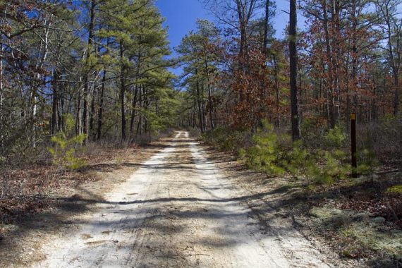
3.1 – Continue following PURPLE (Falkinburg) as it gets near and parallels the Parkway and then Stage Road, on a noisy and less-than-scenic power line access road.
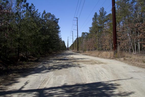
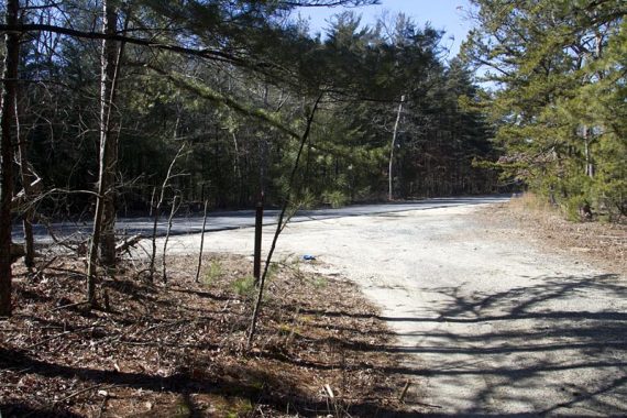
3.4 – Cross Stage Rd to continue on PURPLE (Falkinburg).
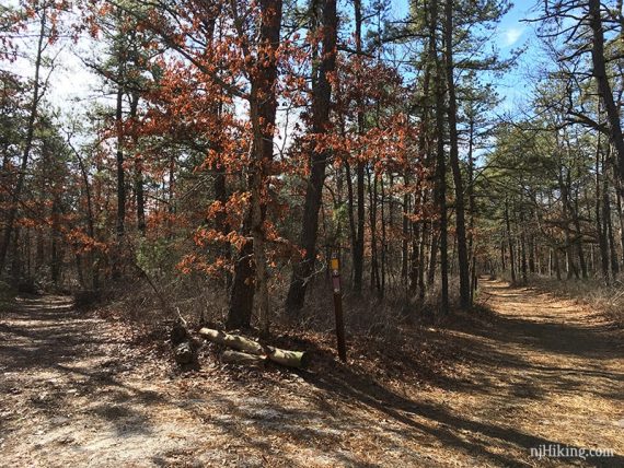
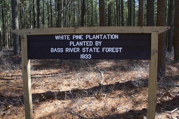
4.2 – PURPLE (Falkinburg) bears right to arrive at a large wooden sign, “White Pine Plantation 1933” and a confusing intersection of PURPLE (Falkinburg), ORANGE (CCC), and GREEN (Nisky) heading in several directions.
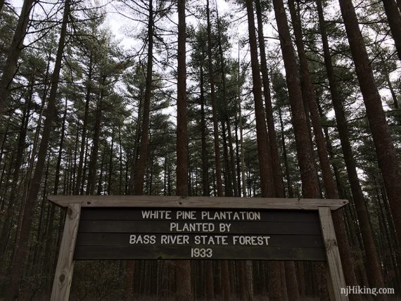
[You’ll be returning to this intersection later, as ORANGE (CCC) is a loop from here]
Standing with your back to the sign, follow ORANGE (CCC)/GREEN (Nisky) ahead to the sand road.
[GREEN (Nisky) also goes sharply to the left, to the right are PURPLE (Falkinburg), ORANGE (CCC) and GREEN (Nisky)]
Now at the wide sand road, turn LEFT to follow ORANGE (CCC)/GREEN (Nisky).
[ORANGE (CCC) also goes straight – if you go this way you’ll just do the route in the opposite direction]
4.6 – Continue on ORANGE (CCC) as it turns RIGHT. [GREEN (Nisky) leaves to the left].
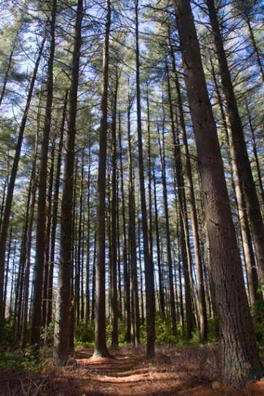
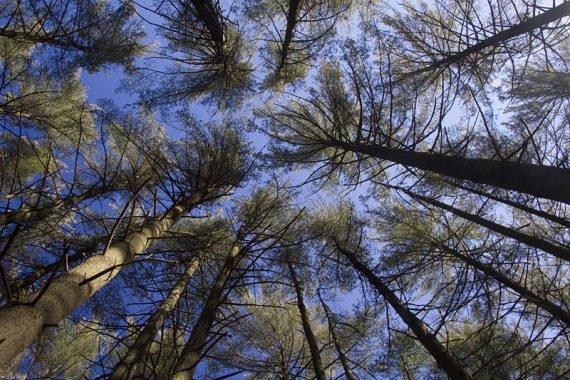
5.0 – Cross Greenbush Rd to continue on ORANGE (CCC). Hike through a White Pine plantation a neat section of tall pines.
5.6 – ORANGE (CCC) starts to skirt a marshy area, and a few houses are visible across the way.
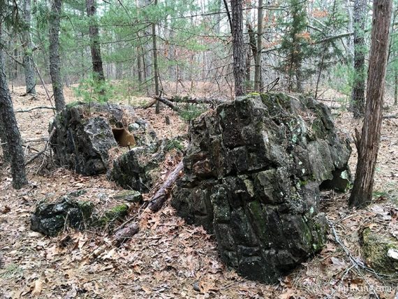
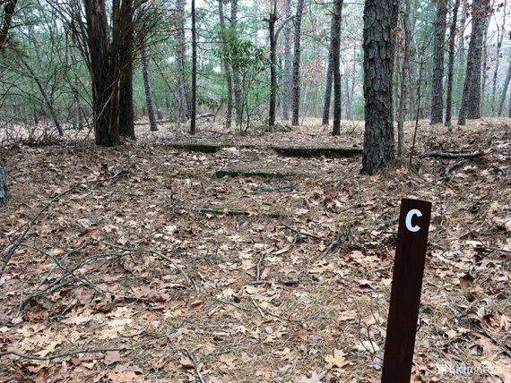
6.7 – Old asphalt underfoot means you have entered the CCC camp area.
All that remains from the 1930s are a few stone foundations and a set of steps.
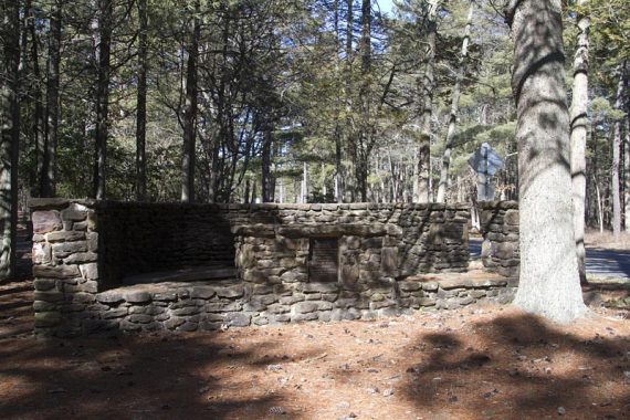
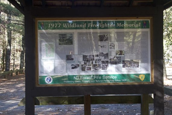
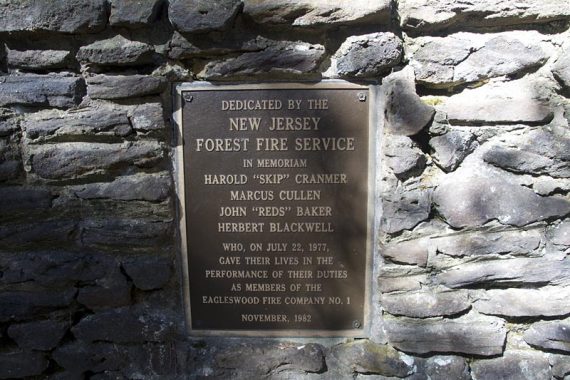
6.8 – ORANGE (CCC) makes a LEFT, but first walk a bit ahead to look at the Firefighters memorial (this is also accessible from Greenbush Rd as there is a small parking lot here).
There are two display boards with info on major fires in the area.

Return and continue on ORANGE (CCC).
6.9 – Come out to the intersection of Greenbush and Stage Roads.
Follow ORANGE (CCC) to cross Greenbush and head back into the woods. ORANGE (CCC) parallels Stage Rd now.
7.7 – Back at the intersection of PURPLE (Falkinburg), ORANGE (CCC), and GREEN (Nisky) from earlier.
Continue on ORANGE (CCC), which is to the LEFT of the “White Pine Plantation 1933” sign.
7.8 – Cross Stage Rd.
7.9 – RED (South Shore) joins PURPLE (Falkinburg), ORANGE (CCC), and GREEN (Nisky).
Continue straight to cross the park road and then turn right to continue following ORANGE (CCC) – as well as PURPLE (Falkinburg), GREEN (Nisky), RED (South Shore), all lead back to the Day Use lot.
Pass the visitor center and curve to the left.
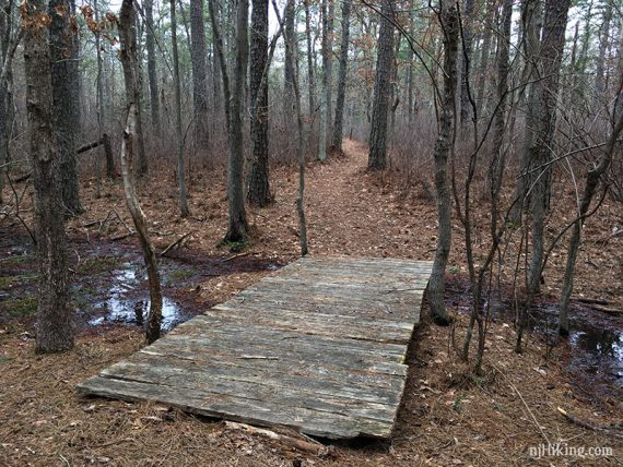
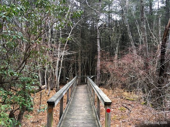
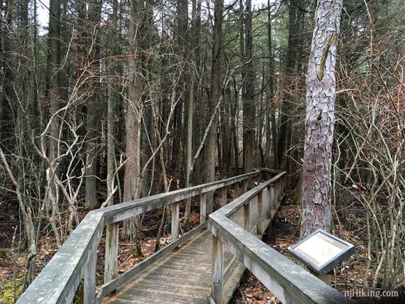
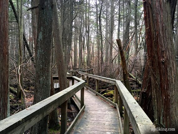
8.0 – Turn LEFT to now follow SILVER (Absegami), a short side loop that includes a boardwalk section through an Atlantic white cedar bog.
/// Shorter option, 8.3 miles total: Skip Absegami and instead continue straight over a small bridge with a view of the water. Keep following ORANGE (CCC) back to the lot.
/// Longer option, 10 miles total: Turn left to out-and-back on Joe’s Trail. This follows along the lake with a few benches along the way and ends at an old picnic pavilion.
After the boardwalk, turn LEFT to continue on SILVER (Absegami) [YELLOW (Poppy Allen) goes right].
8.4 – SILVER (Absegami) ends back at the park road. Follow ORANGE (CCC) back to the lot.
—-
Hiked: 2/17/19. Trail Blog: “Bass River – Absegami and Joe’s Trail“
Hiked: 2/26/12. Trail Blog: “Bass River in February“
Updated: 7/2020 – Page refreshed, not re-hiked. 2/2019 – re-hiked, description updated to reflect trail color changes, added Absegami Trail to the route. 12/2015 – Noticed the PINK trail has been changed to ORANGE and added a link to the new trail map. Left the original map in link 2.