Plenty of waterfalls and cascades along a stream running through a scenic gorge, plus a section of the Highlands Trail.
3.9 miles, total round trip. Very rocky; steep sections; several rock hop stream crossings; long flat easy section before climbing back out of the gorge.
- Shorter – 1.5 miles – At Scout Run take the BLUE trail over to the gorge; noted below.
- Shorter – 3.1 miles – Turn LEFT onto WHITE, noted below.
- Longer – 5.6 miles – Continue on Highlands to Staats Rd. and back, noted below.
- Nearby: Milford Bluffs; Merrill Creek Reservoir; Columbia Trail, Round Valley, Point Mountain Reservation; Spruce Run Kayak.
Hike Info:
Our two cents:
Rugged little loop with lots of cascades. This is a good hike for a beginner to see if they can up their game a bit. The hills and rocky surface is not easy but it’s manageable and there are two bail-out options to shorten the hike.
There is a newer section of ORANGE trail that continues in the opposite direction to Cyphers Road, but in researching it that seemed like it might be overgrown so we decided not to start from that end and extend the hike.
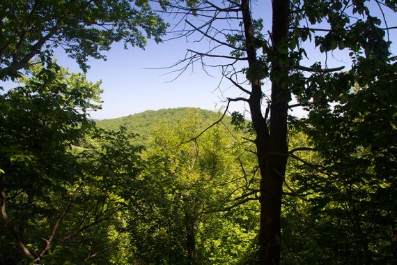
In May 2014 there was a decent amount of poison ivy, especially along Pine Run. In April 2022 it was too early in the season to verify if that is still the case. Limited views and only when trees are bare; some road noise.
Updated: 5/2022 – Description and Interactive Map updated to reflect trail name/color changes; added photos; re-hiked 4/2022. 5/28/14 – Changed route and description, new photos, new GPX; re-hiked.
Map:
Print ahead from the park site, nothing in the kiosk the day we hiked. Follow along on your smartphone with our Interactive Map link above.
Notes: There are old WHITE markers co-joined with other blazes along most of this route, but the only actual WHITE trail on the park map is the switchback trail from YELLOW / TEAL (Highlands) to ORANGE/RailLine.
This route uses a trail along Pine Run that is not marked on the park map. Where YELLOW / TEAL (Highlands) meets the Pine Run stream, the park map doesn’t indicate that there is a trail that follows Pine Run down to the abandoned rail line. The trail is mostly obvious to follow, has a few old WHITE markers, and GPS and smartphone apps usually show it as a trail.
Related: Waterfalls in NJ / Best Waterfall Hikes in NJ
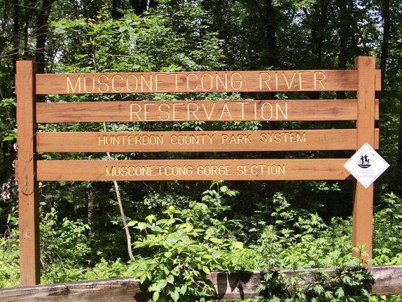
Parking: N40.62722° W75.13577°
“Musconetcong Gorge Loop Trailhead”. 182 Dennis Rd, Bloomsbury, NJ 08804.
Rt 78 W to exit 7 for Rt. 173. Veer L on 639. At stop sign veer L on 519 then again keep L to stay on 519. L on Dennis Rd (gravel). Parking is along the gravel road, by the park sign.
Restrooms:
None. If approaching from Rt. 78 W, soon after exiting there is a “TA Travel Center” rest stop along Rt. 173 W.
Hike Directions:
Overview: YELLOW / TEAL (Highlands) – Unmarked along Pine Run – Unmarked Rail Line trail – ORANGE – BLUE
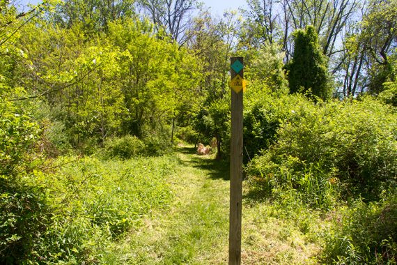
0.0 – Start following YELLOW / TEAL (Highlands) at the end of the parking area, near the bend in the gravel road. [BLUE starts near one of the large park signs and is the return route.]
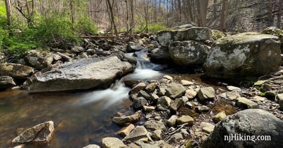
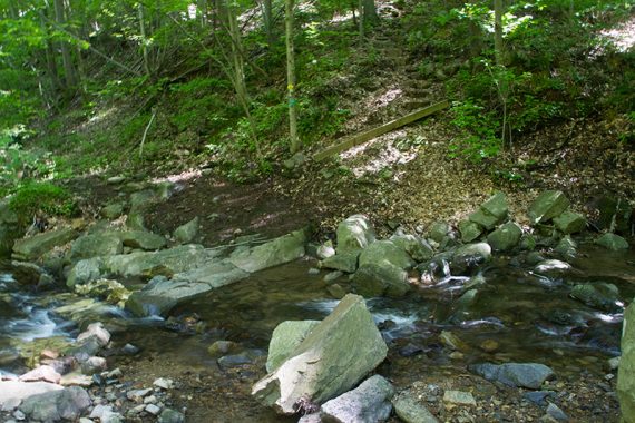
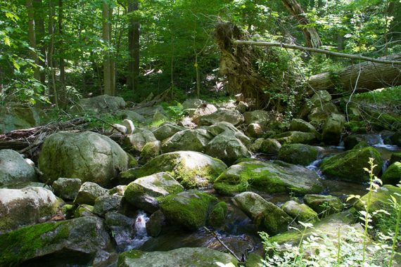
0.5 – Arrive at the Scout Run stream crossing. To the left are some cascades over the rocks.
Rock hop across the stream to continue following YELLOW / TEAL (Highlands).
Depending on water flow and rock locations you may need to look a few steps to the right or left for a better crossing spot. [After crossing the stream, BLUE goes to the left and leads directly to the main gorge cascades].
// Shorter Option, 1.5 miles total: Just after crossing Scout Run, instead turn LEFT onto BLUE and follow that to the gorge area and pick up the description as noted below. //
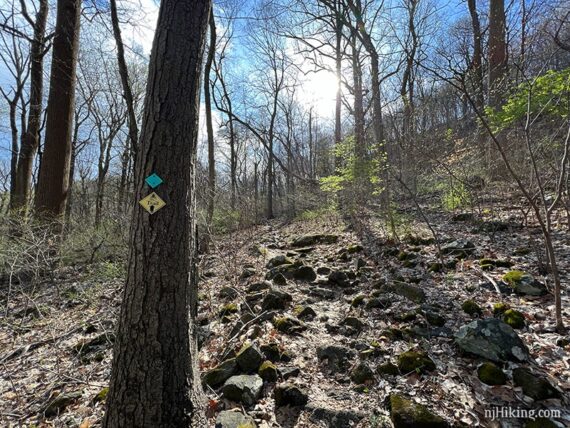
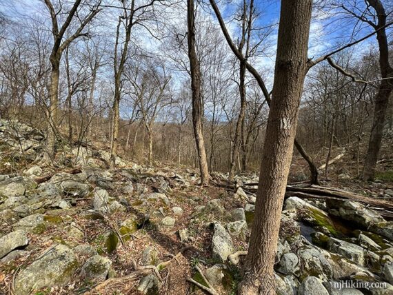
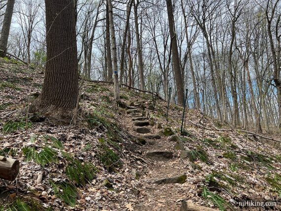
Steeply climb wooden steps and continue on YELLOW / TEAL (Highlands). The rocky trail climbs steadily for about the next 0.6 miles.
1.2 – Continue following YELLOW / TEAL (Highlands) straight. [WHITE is on the left]. The trail is a bit more level for awhile.
// Shorter Option, 3.1 miles total: Instead, turn LEFT on WHITE, head downhill on switchbacks, and pick up the description as noted below. //
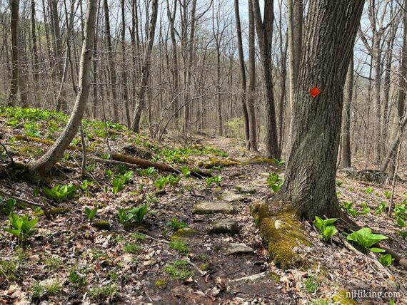
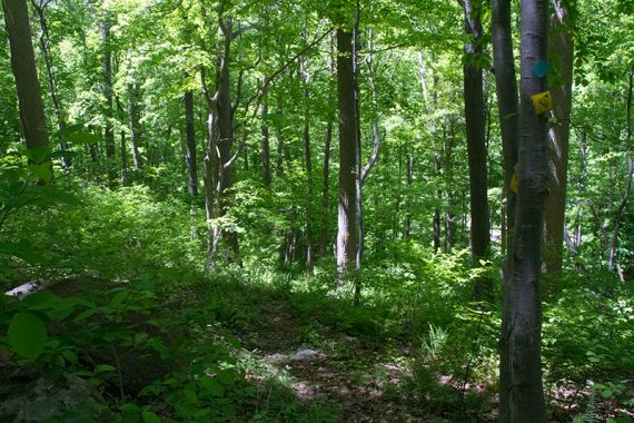
1.6 – YELLOW / TEAL (Highlands) starts to head downhill, somewhat steeply. There are only some limited views through the trees, mostly when there aren’t many leaves on the trees.
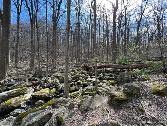
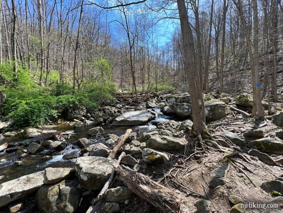
1.8 – Arrive at a wide rocky stream called Pine Run. Don’t cross it – just before it, turn LEFT to now follow an unmarked trail that runs along the stream. [YELLOW / TEAL (Highlands) continues straight, after crossing the stream].
// Longer Option, 5.6 miles total: Instead, rock hop over the stream and continue on YELLOW / TEAL (Highlands). See “Highlands Trail Add-on” at the bottom of the post for photos/info and then return here to continue. //
This unmarked trail is not shown on the map but we spotted a few old WHITE markers along the trail.
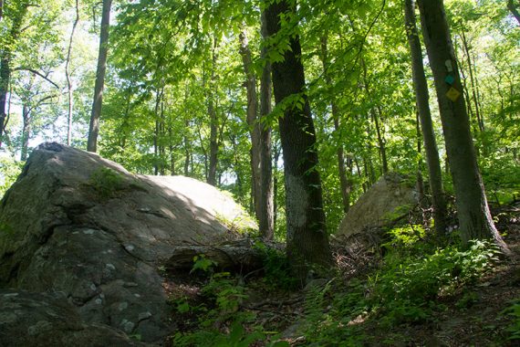
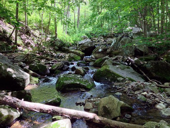
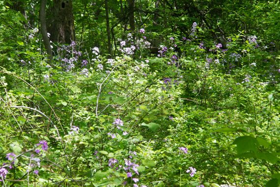
The unmarked trail is generally easy to follow. It hugs the stream as it heads steeply downhill over large rocks in a pretty area. The surface is moderate to challenging depending on your hike experience.
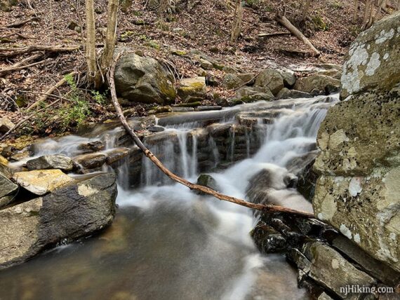
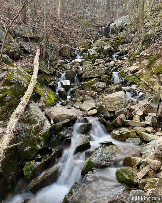
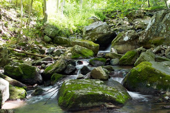
With enough water flow there may be a few cascades along the way.
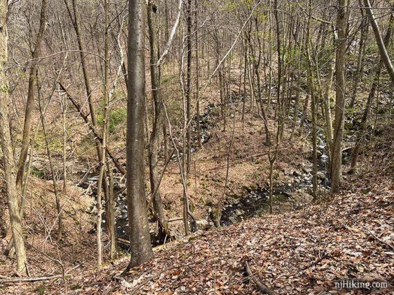
2.0 – The trail drops down a short steep section to a black gravel path. This is an abandoned rail line that is hard to see on the trail map. There was a large washed out section of rail bed and yellow tape across the trail when we hiked in 2022.
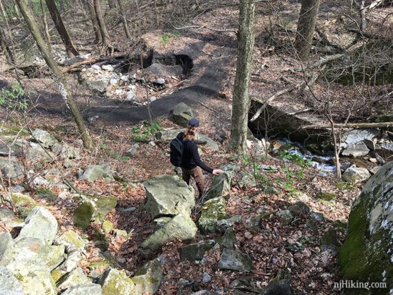
Turn LEFT and start following the abandoned rail line BUT FIRST look to the right for a very nice, large waterfall/cascade. [The rail line also continues to the right].
The cascade is rather long, as Pine Run tumbles down the hill over rocks and into a cement culvert at the rail bed.
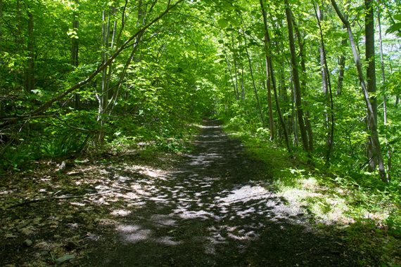
Follow the flat and easy black gravel path of the old rail line. This was the former route of the Lehigh Valley Railroad that served a nearby paper mill.
Down on the right are limited views of the Musconetcong River (when leaves are down), and unmarked side trails down to it.
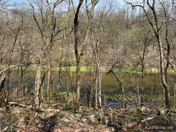
Eventually a small dam on the river may come into the view. This created a narrow canal that was used for the paper mill.
2.7 – Continue on the rail line, passing the end of WHITE on the left. [ORANGE markers are visible up there too but you’ll pick that up a ways in just a minute].
// Continue Shorter 3.0 mile option – Arrive at this point, but facing in a different direction. Just before reaching the gravel trail below turn LEFT to now follow ORANGE. //
In just a bit, veer LEFT onto ORANGE. ORANGE parallels the rail line for awhile before veering away.
3.3 – Intersection of several trails. Looking from extreme left all the way to extreme right: BLUE, ORANGE, BLUE, WHITE, and a gate.
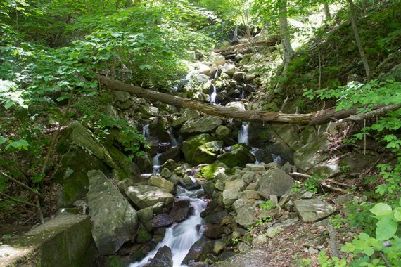
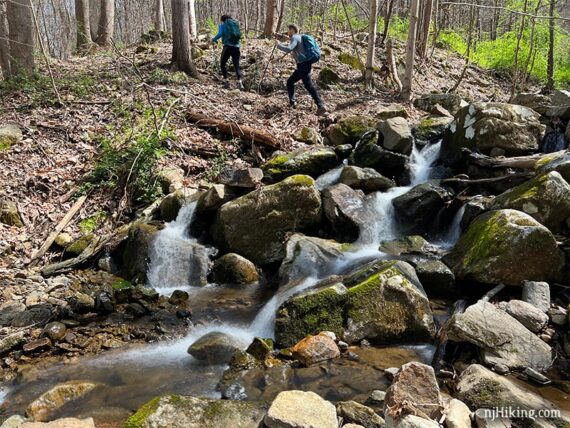
Continue straight ahead on BLUE which leads to cascades in the gorge and a bridge.
// Continue Shorter 1.5 mile option – Arrive at this point, but facing in a different direction. Turn LEFT to continue on BLUE. //
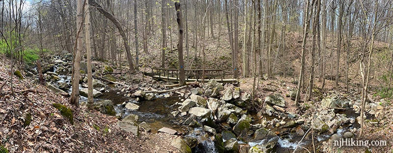
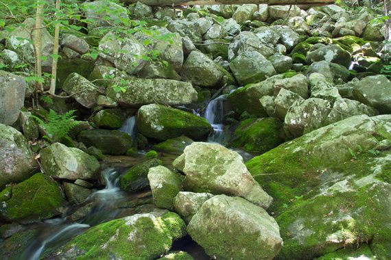
There are cascades and falls all along the stream so wander around for photos from various angles.
BLUE crosses the stream on rocks and then immediately turns LEFT to cross a bridge.
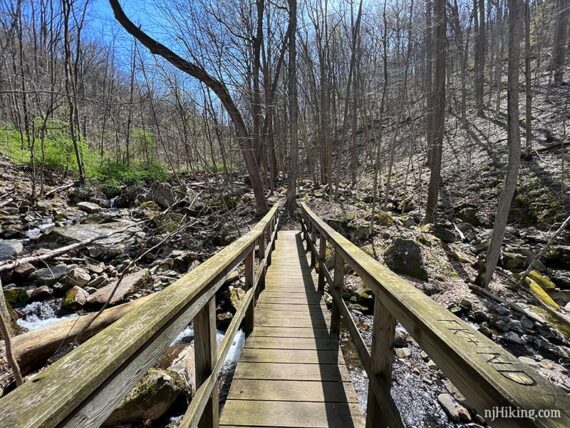
This is taken to the side of the bridge and looking back to hikers who have just crossed the rocks and are traveling in the opposite direction.
Continue following BLUE along the stream. There are few ORANGE markers co-joined with BLUE in spots.
Follow BLUE as it turns RIGHT to cross the stream again and immediately heads steeply uphill. Continue following BLUE as the trail climbs back out of the gorge.
Once up the hill a bit, turn around for an overview of the area – though this will be obscured with more leaves on the trees. The old paper mill may be visible through the trees.
Fun Facts: The paper mill was started in 1873 by John L. Riegel and used the river to run steam-powered machinery to make paper and charcoal. The nearby towns of Warren Glen and Riegelsville were built to house the workers. [Source: Hunterdon Parks website.]
3.7 – The park map shows that BLUE splits in two then soon meets back up – but we don’t recall seeing an intersection at this point. Our original directions noted we veered LEFT at the split.
It’s possible the other side of the split is no longer used (….or we didn’t notice it because we were discussing if post-hike we should do coffees or a flight at Sunken Silo Brew Works…).
3.9 – Continue on BLUE passing ORANGE / TEAL (Highlands). [This leads to a parking area on Cyphers Road and the park map shows it as only ORANGE.]
Follow BLUE past the large sign and back up to the parking area.
// Highlands Trail Add-on continued from above //
This out-and-back section will add 1.2 miles total to the route. There is nothing overly thrilling between here and Staats Road so just do it to make a longer hike. We only did this add-on in 2014.
Continue straight, rock hopping over the stream and continue on YELLOW / TEAL (Highlands).
The trail heads uphill after crossing the stream, and then opens up some. Some areas could turn into long grass if this area isn’t often maintained.
The trail ends at Staats Rd at a few mailboxes (after some road walking, the Highlands Trail does continue if you are so inclined.)
At Staats Rd., turn around and return to Pine Run. Cross back over Pine Run and turn RIGHT onto and unmarked trail and return to the description above.
—
Hiked 4/16/22.
Hiked 5/25/14. Trail Blog: “Musconetcong Gorge – Pine Run Waterfall Loop“
Hiked: 6/14/09. Trail Blog: “Musconetcong Gorge Preserve – White and Yellow“