Hike to three waterfalls – Factory, Fulmer, and Deer Leap – in a shady ravine.
1.4 miles. Easy. Surface is boardwalk walkways, steps, gravel, and dirt/rooty trail. Accessible up until the first falls.
| 1.4 miles | This hike guide: Detailed instructions photos follow below. |
| Shorter | Crossing one of the two bridges in the middle cuts the route down. |
| Longer | Drive to nearby Dingmans Falls for another short hike. |
| Nearby | Raymondskill Falls, Cliff Park, Milford Knob, Hackers Falls; Pocono Environmental Education Center. |
Our two cents:
Three decent sized waterfalls in a short, shady loop that most everyone can enjoy. The path is ADA accessible up until the first waterfall. For avid hikers, this is a worthwhile easy add-on to other hikes in the area.
Updated: 5/2025 – Minor edits. 10/2024: Added note that trail has REOPENED; we have not re-hiked it. 4/2020: Page refreshed, not re-hiked.
Hike Info:
Map/Books:
Kittatinny Trails or the map on the park site. Follow along on your smartphone with our Interactive Map link above.
Longer version in Hiking Pennsylvania and Hiking the Poconos (2026) that connects to Childs Park. No connecting trail is shown on Kittatinny Trails, plus we generally avoid hiking to areas that can be driven to so we haven’t tried this route.
Parking: N41° 14.227′ W74° 55.151′
George W. Childs Park, Silver Lake Rd, Dingmans Ferry, PA 18328. From Rt 80 W take exit 34B for Rt 15 N. Turns into Rt 206 N. LEFT on 560/Tuttles Corner Dingmans Rd. Cross Dingmans Ferry Toll Bridge. Continue on Dingmans Turnpike, crossing, Rt 209. LEFT on Silver Lake Rd. Parking lot is on the left.
Restrooms:
Composting toilet in the parking lot.
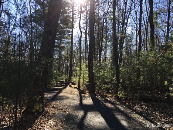
Hike Directions:
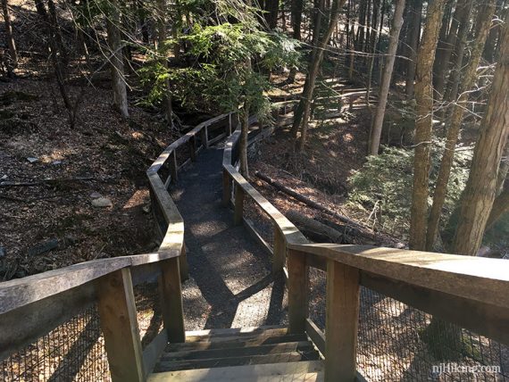
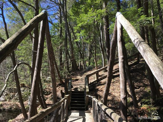
The route is not blazed with markers. From the lot, there is a hiking trail as well as an accessible trail (a little longer) and both lead to a bridge where the trail splits into a loop.
Note: This more direct hiking trail was not on the map when we hiked this, so our route uses the accessible path. But both lead to the same spot.
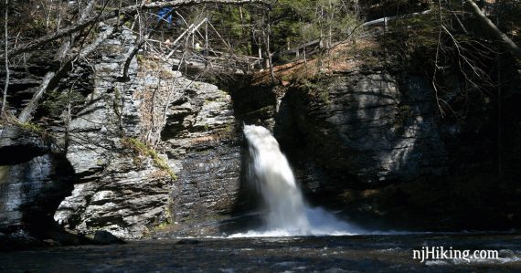
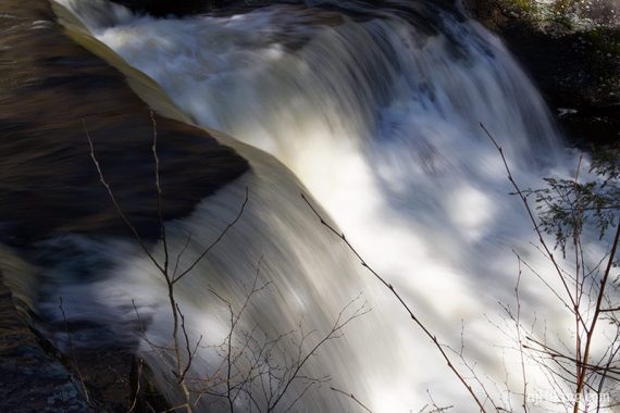
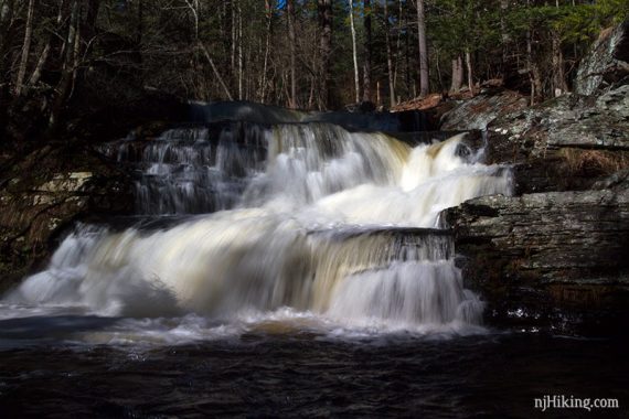
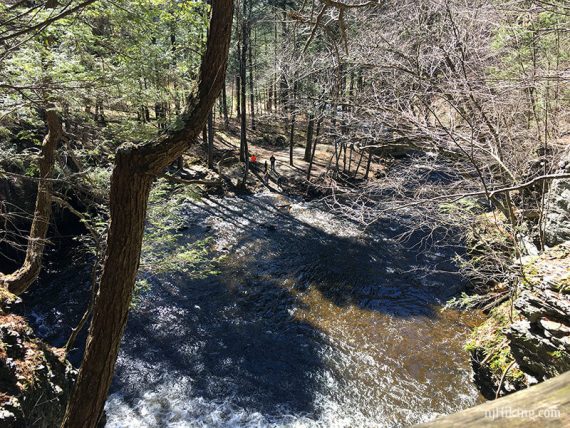
We went to the right to an overlook over Factory Falls (this is the end of the accessible portion of the trail) and then backtracked to cross the bridge.
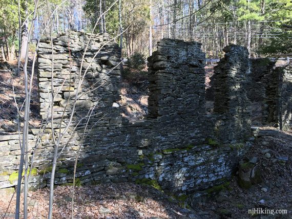
Continue downhill to Factory Falls and the ruins of a woolen mill.
The trail runs along the water so there are many opportunities to view Factory Falls.
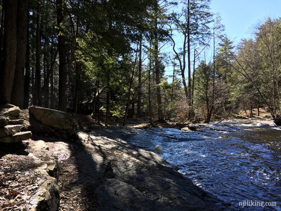
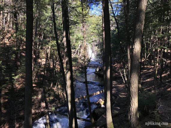
The trail curves around and runs along Dingmans Creek, and passes an old pavilion.
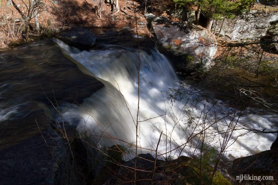
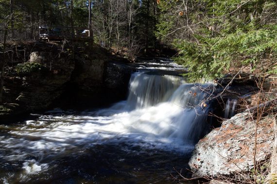
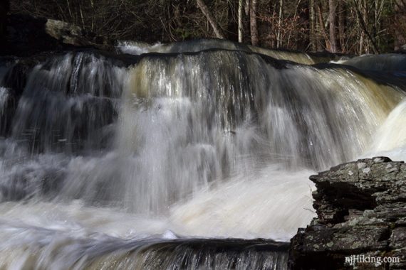
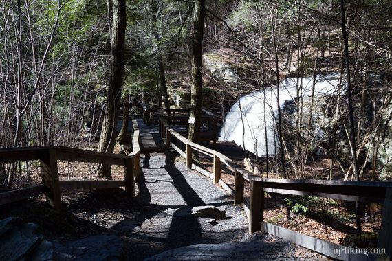
Walk out to a viewing platform to see Fulmer Falls.
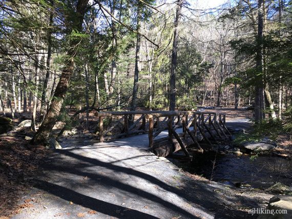
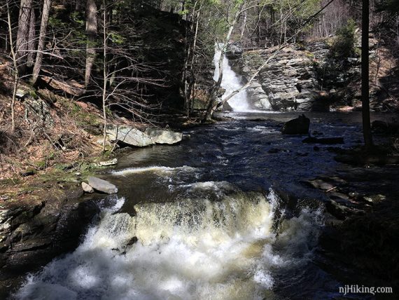
Pass a side trail on the right that leads to a bridge over Dingmans Creek. Further along, pass another side trail to a bridge over the top of Deer Leap Falls.
/// Shorter: These bridges can be crossed to shorten the route.
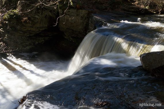
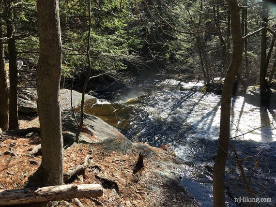
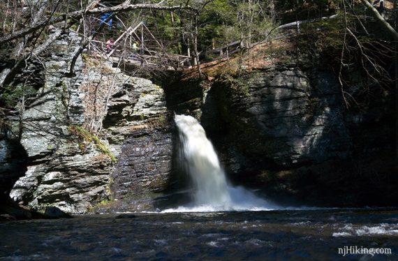
Head downhill to the base of Deer Leap Falls, which cascades out from under the bridge into a large pool of water.
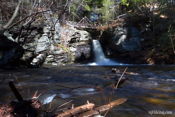
People crossing the bridge above shows the scale of the falls.
At the bottom of Deer Leap Falls, the trail continues over a bridge to head back up – but this was closed the day we hiked so we had to backtrack and cross over the top of Deer Leap Falls.
Looking down from the bridge over Deer Leap Falls to the pool below:
Now on the other side of Dingmans Creek, continue on the trail.
We took a side trip to the right and walked out onto the bridge and back near Fulmer Falls.
Continue on the trail, arriving back to the overlook over Factory Falls and the bridge in the very beginning where the trail split.
Veer LEFT to return to the lot (don’t turn cross the bridge).
—
Hiked: 4/9/17