Hike along a cliff with multiple spectacular views of northern New Jersey, the Delaware River, and Pennsylvania, before heading to Hackers Falls.
7.0 miles. Uphill in the beginning but level along the cliff, with a slightly rocky surface.
| 7.0 miles | This hike guide: Detailed instructions and photos follow below. |
| Shorter | ~4 miles – Hike Cliff Trail to past Minisink Overlook but then take Buchanan to cut out the whole section to Milford Knob – still get some views and a waterfall, but with less distance. 2 miles – Out-and-back to Tri State Overlook. 2 miles – Out-and-back to Hackers Falls (variation; no views). |
| Longer | It’s worthwhile to check out Raymondskill Falls, reached from this lot. |
| Nearby | Dingmans Falls; Pocono Environmental Education Center; High Point Monument Loop; Monument Trail via A.T.; A.T. and Iris Loop; Monument Loop via Steeny Kill Lake. |
Our two cents:
Reward-to-effort ratio is high on this hike. After an initial uphill climb, follow a mostly level ridge with view after view over the Delaware River into New Jersey, where High Point Monument might be spotted in the distance.
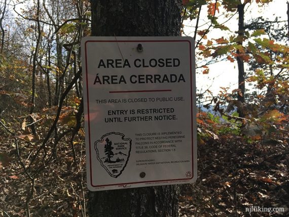
Use the casual path along the cliff for more views than the actual trail, but take care to stay back from the cliff edges as there are steep drop-offs. This path may have seasonal closures (usually Feb to early August) to protect nesting peregrine falcons.
Those with little ones may want to stick to the wider Cliff Trail (still has several viewpoints).
Updated: 5/2025 – Removed shuttle info, no longer running. 12/2024 – Minor edits, updated the Cliff (WHITE) to Pond Loop (BLUE) transition; re-hiked 10/2024. Older change log at page bottom.
Hike Info:
Map:
Maps 122 and 123 of Kittatinny Trails. The 2021 version shows the updated trail area when leaving the Cliff Trail and heading to Pond Loop.
Follow along on your smartphone with our Interactive Map link above. Our route runs along the casual cliff path for most of the route, until after Milford Knob when we follow Cliff (WHITE) back.
Parking: N41.29021° W74.84002°
Raymondskill Lower Lot, Raymondskill Rd, Milford, PA 18337. The Upper Lot, just past this one, has a street address: “983 Raymondskill Rd, Milford, PA 18337.”
Rt 80 W to exit 34B for Rt 15 N. Turns into Rt 206 N, take over the Milford-Montague toll bridge into PA. L on Rt 209. R on Raymondskill Road.
Small dirt lot on the left is Lower Raymondskill/Hackers Falls lot. If it’s full, try the Upper Raymondskill Falls lot just past it – but both lots tend to fill up.
Restrooms:
Composting toilets in a building at the Upper Raymondskill lot, just a few feet past the lot for this hike and connected by a short trail; also in the Cliff Park parking lot about 5 miles into this route.
Hike Directions:
Overview: Hackers (YELLOW) – Cliff (WHITE) – Unmarked – Pond Loop (BLUE) – Buchanan (ORANGE) – Hackers (YELLOW)
0.0 – Trailhead is across the road from the parking lot, between fence posts. Soon, turn RIGHT to start following Cliff (WHITE) [Hackers (YELLOW) goes straight].
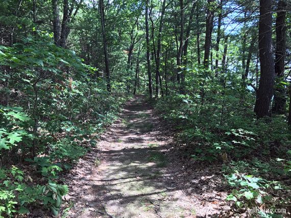
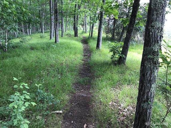
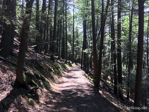
Head steadily uphill, crossing a bridge and a few other trails.
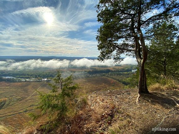
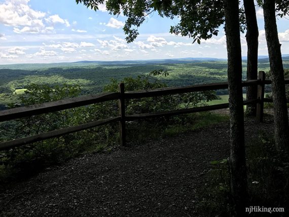
0.5 – Tri State Overlook.
The valley below usually gets low clouds in the morning that obscure the view.
The clouds will burn off as the morning progresses and they can make for some interesting photos.
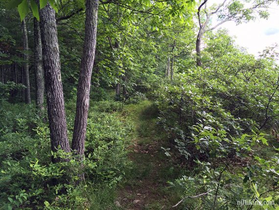
Continue on the wide Cliff (WHITE), or pick up the narrower casual path that runs along the cliff that will offer more views. There are opportunities to switch back and forth between them. If staying on Cliff (WHITE), soon pass YELLOW-WHITE on the left.
Note: Casual paths along the cliff are closed for Peregrine Falcon nesting from February to early August – when there are closed signs posted stick to the Cliff (WHITE) trail only.
Looking north, with the smaller cliff-hugging trail on the left.
The cliffs have a dramatic drop off to the fields below.
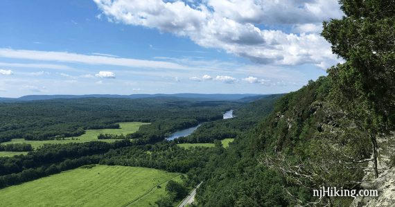
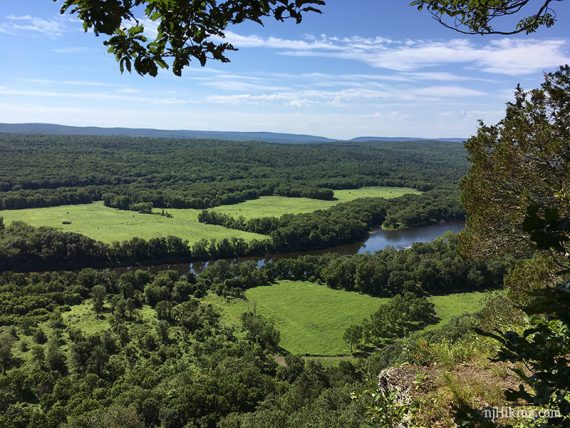
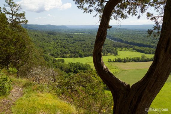
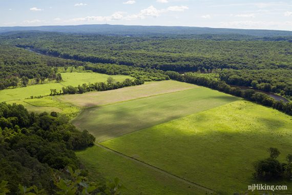
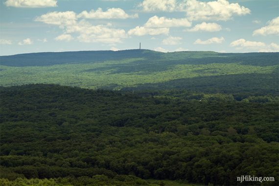
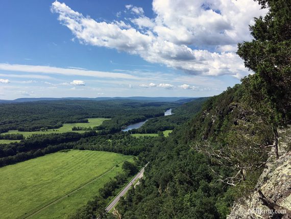
1.0 – Minisink Overlook, with a fence to keep away from the drop off. High Point monument in New Jersey is just visible far in the distance, sitting on a hill, with fields below.
Zoom into the obelisk monument at High Point State Park in New Jersey. All of that forest in the foreground is also Jersey.
The fields below. The trail along the bottom is the multi-use McDade Trail.
Wide view looking south over the field and on to the Delaware River. All the green trees beyond is New Jersey.
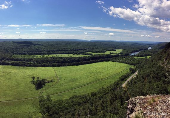
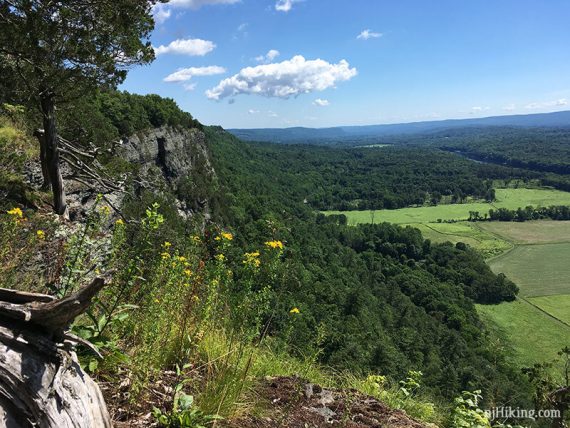
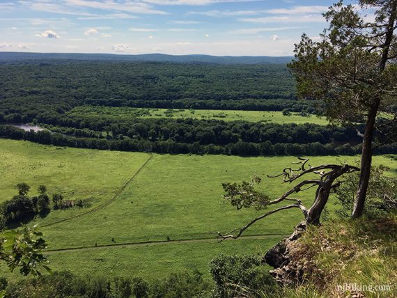
Looking south with a view of the cliff dropping off to the field below and the Delaware River in the distance.
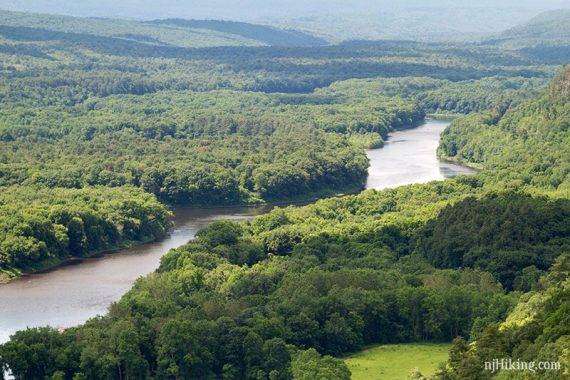
Zoom into the Delaware River from the Cliff Trail.
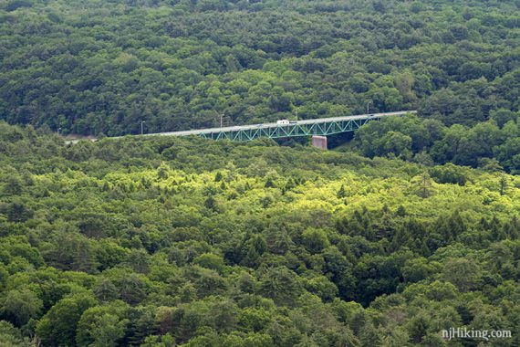
Zoom into the Milford-Montague Toll Bridge crossing the Delaware River between New Jersey and Pennsylvania.
Take the casual path that hugs the cliff if possible (keep right) as staying on Cliff (WHITE) misses the views in the next section. The casual path will rejoin Cliff for a bit and then split off again.
2.1 – Fencing at the Riverview Overlook.
While the casual cliff path offers the most views as it runs parallel to the Cliff Trail, at some points it does move away from the edge and the views.
2.3 – The casual path rejoins Cliff (WHITE) at a junction with Quarry (GREEN/WHITE). Veer LEFT to continue on Cliff (WHITE).
[Quarry (GREEN/WHITE) goes to the right and leads down to Milford Knob (GREEN), from there it goes down to a parking area on Rt. 209 or back up and around to meet this route at Milford Knob Overlook.]
2.9 – Continue straight on Cliff (WHITE). [Milford Knob (GREEN) comes in from the right].
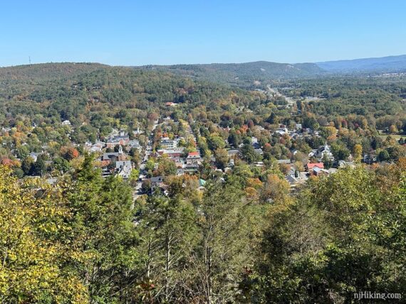
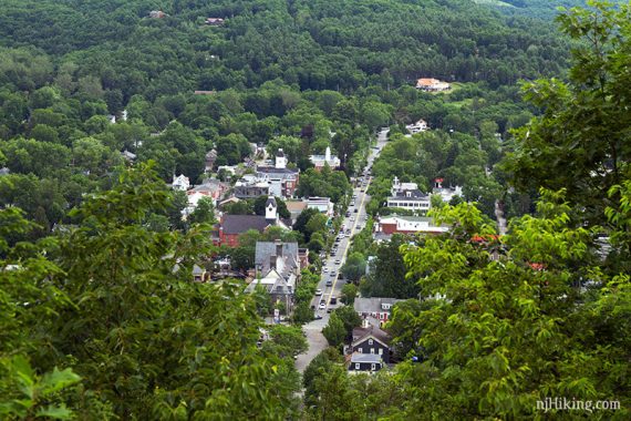
3.0 – Milford Knob Overlook. The town of Milford, PA can be seen below but the view might be somewhat obscured by trees. In June of 2017, actual size:
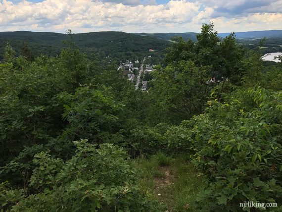
Zoom into the town of Milford below the Cliff Trail at Milford Knob, October 2024.
And zooming into town a bit more, 2017.
There is a casual path to the left but it doesn’t lead to a better view. There once was a metal star on the ground that is gone now.
Retrace on Cliff (WHITE) to well past the Riverview Overlook. Pass an unmarked trail or two.
4.6 – Turn RIGHT to now follow an unmarked trail downhill. This is easy to miss, at a bend in the trail.
On older maps and the first time we hiked here this was marked as Buchanan (ORANGE). The Trail Conference map (2021 version) has this clearly defined trail labeled as unmarked (dotted line) but this trail is no longer shown on the current park map.
You’ll know you missed this turn if you end up at the junction with an ORANGE-WHITE connector trail, 0.35 miles away. If that is the case, see the shorter option box just below – or use the map to connect to the pond.
// Shorter option: Cliff (WHITE) continues straight – take that for a direct route back, missing the waterfall and pond and cutting 1 mile off the route. -OR- Turn right at ORANGE-WHITE and take Buchanan to the falls, cutting the pond off the loop. //
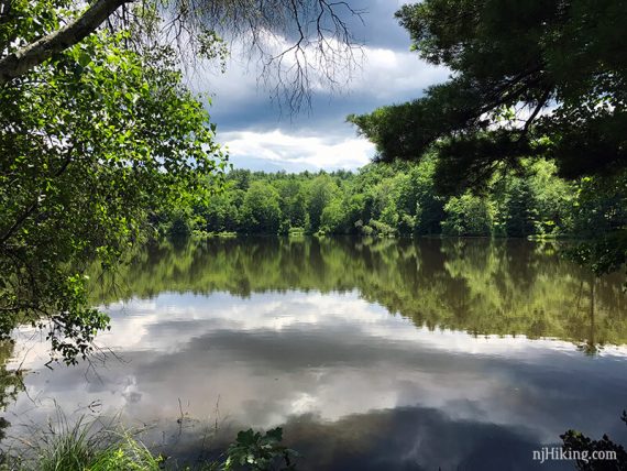
4.7 – Turn LEFT to now follow Pond Loop (BLUE) [Pond Loop (BLUE) also goes right, around the other side of the pond, and ends up in Cliff Park parking lot too – we’ve done this route a couple times too.]
4.8 – Turn RIGHT to continue on Pond Loop (BLUE) [Buchanan (ORANGE) goes left, and is a shorter way to the falls, meeting up with this route at 5.5 below]. Cliff Park pond comes into view.
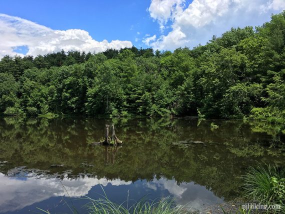
5.1 – Pond Loop (BLUE) ends up in a small parking lot with a toilet.
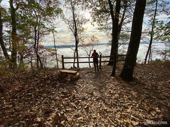
// Optional side trip: Once in the parking lot, turn right and continue around the pond just a bit to a nice wooden bench. A golf course is directly behind. //
Walk through the parking lot towards the left of the composting bathroom to start following Buchanan (ORANGE) on a wide path, past some old buildings.
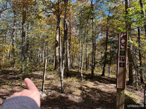
5.5 – Turn RIGHT to now follow Hackers (YELLOW). [Buchanan (ORANGE) continues ahead].
5.7 – Turn LEFT at a trail sign post to continue to following Hackers (YELLOW).
5.9 – Hackers Falls, in October 2019:
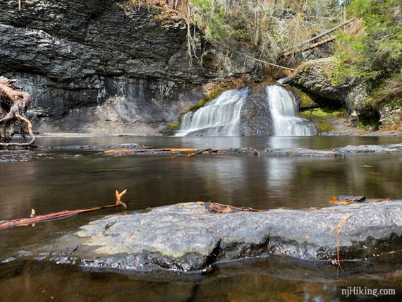
Hackers Falls, with higher water flow, June 2017:
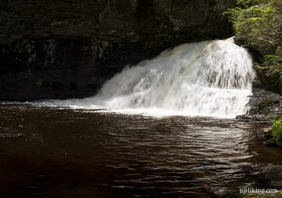
Looking back at the falls from down the path more, and the stream near it.
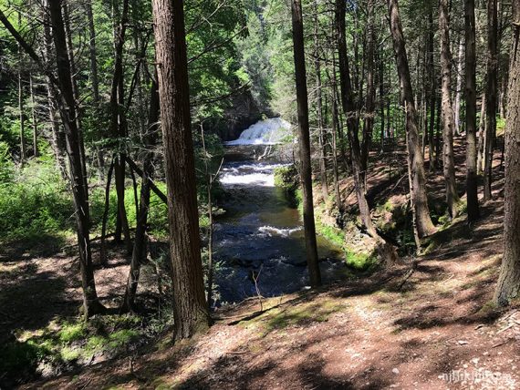
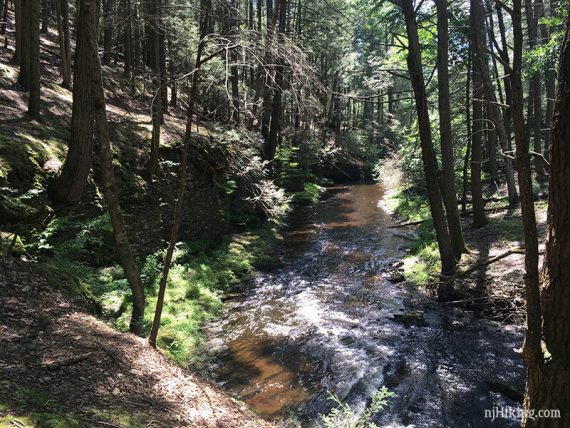
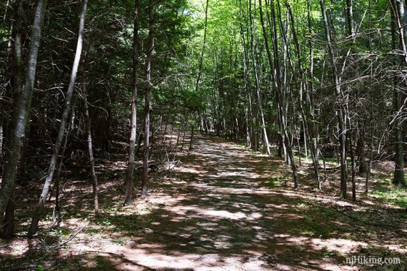
When done, continue following Hackers (YELLOW) on a wide path along the stream on a wide path. Markers might be sparse or not at all. At some curves are faint old trails leading off to nothing.
6.3 – Turn LEFT at a T-intersection to continue following Hackers (YELLOW). Again, don’t think there was a marker here.
Hackers (YELLOW) curves around. At a Y-intersection continue to follow Hackers (YELLOW) as it curves to the RIGHT. This was not marked but should technically be the intersection with Logger Path (YELLOW-WHITE)… and that leads back up to Tri State Overlook and not to the parking lot.
Continue following Hackers (YELLOW) back to the parking lot.
—
Hiked: 10/6/24. with Raymondskill Falls.
Hiked: 10/13/19. Trail Blog “Hiking Cliff Park and Raymondskill Falls in October“
Hiked: 6/25/17.
Updated: 5/2022 – Added new shuttle info. 7/2021 – Page refreshed; not re-hiked. Photos added, minor update that Buchanan junction is now unmarked. 10/2019. Re-hiked, minor description changes.