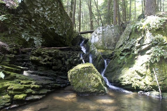
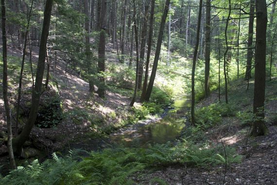
Shady hike through a hemlock forest with several nice waterfalls.
7.5 miles. Some easy sections but also some decent hilly sections.
- Shorter: Several loops leave from the centrally located parking lot.
- Longer: Not really. We used several trails to form the biggest loop we could.
- Nearby: Dingmans Falls; Raymondskill Falls, Cliff Park, Milford Knob, Hackers Falls; George W. Childs Park.
Hike Info:
Our two cents:
While the entire park is nice, the standout sections are the pretty hemlock forest on the RED trail and the waterfalls on Tumbling Waters. Either of those trails alone make for very nice short loops.
There is a steep section on Ridgeline that has a rope to assist. It could be scrambled down without the rope, however.
Updated: 7/2021 – Page refreshed, not re-hiked (NOTE! the route/directions should be the same but we have not hiked this since 2011).
Map:
Print out the trail map from the park site, and the trails also appear in the Kittatinny Trails. Trail maps and guides may be available at the center.
Books:
Trail descriptions and map diagrams for the Ridgeline and Tumbling Waters trails can be found in Hiking the Poconos.
Parking: N41.17118° W74.91460°
538 Emery Rd, Dingmans Ferry, PA 18328.
From the park’s site: Interstate 80 W, take Pennsylvania Exit 309 N for Marshalls Creek/Route 209. Follow Route 209 for approximately 3 miles and make a right turn at the light in Marshalls Creek. Continue North on Route 209 for 14 miles.
You will see two signs for PEEC between mile marker 8 & 9 on Route 209. The first sign is 1/2-mile before the left turn and the second is directly across from the turn. Turn left onto Brisco Mountain Road. When the road forks, bear right at the stop sign and PEEC will be on your right.
Restrooms:
Inside the PEEC center building in the parking lot. Check for opening times if you tend to arrive early, as we didn’t spot a porta-john.
Hike Directions:
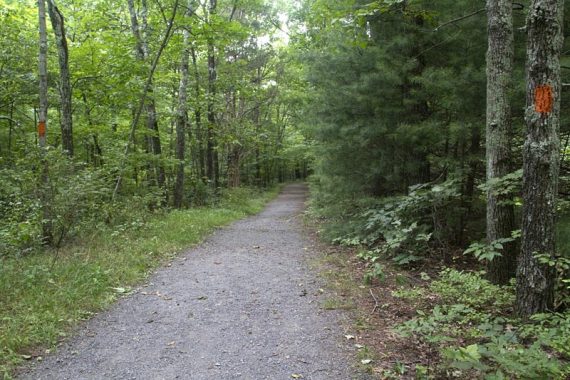
Overview: RED (Scenic Gorge) – YELLOW (Ridgeline) – RED/YELLOW – BLUE (Fossil) – ORANGE (Tumbling Waters) – ORANGE/WHITE (Two Ponds)
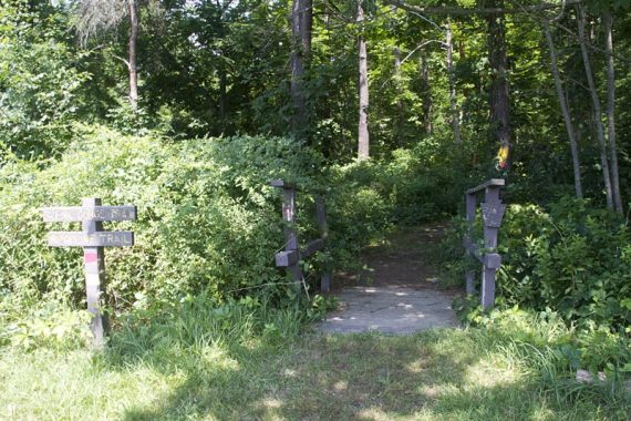
0.0 – The trail head is at the end of the parking lot, to the left if you are facing the building. There are wooden signs for the RED (Scenic Gorge) and YELLOW (Ridgeline) trails. Start following YELLOW/RED.
0.5 – Turn LEFT onto YELLOW (Ridgeline), now following just YELLOW.
0.9 – RED (Scenic Gorge) meets up with YELLOW (Ridgeline) again.
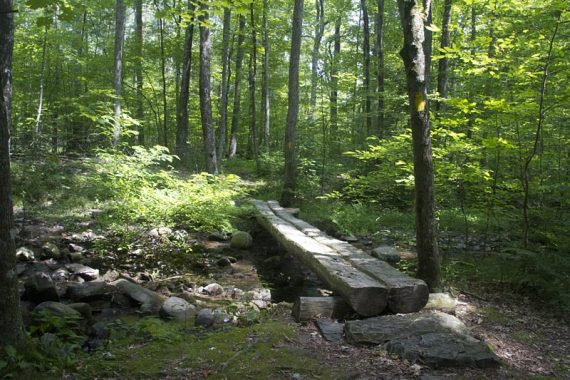
Cross a small stream on a wooden bridge.
1.0 – Continue on YELLOW (Ridgeline), as RED (Scenic Gorge) turns RIGHT.
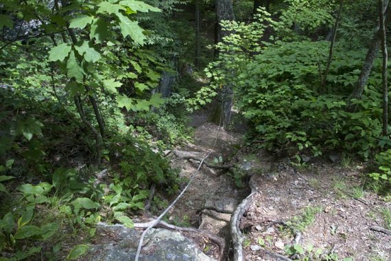
Steep downhill section on the YELLOW trail with rope for assistance. (Actually steeper than this photo appears).
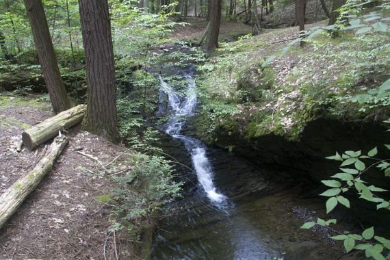
2.6 – Meet up with the RED (Scenic Gorge) trail again, at a waterfall.
Start following YELLOW/RED. [RED goes to the RIGHT]
3.3 – YELLOW/RED trail ends.
// Shorter: Turn right on the park road back to the parking lot. //
To continue, turn LEFT onto the park road, walk down it some, then turn LEFT again between the cabins and walk across the field to a circle of wooden benches around a fire pit. This was not marked.
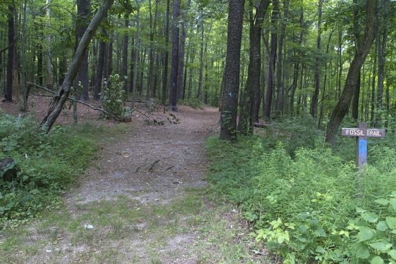
3.4 – At the fire pit there is a sign for BLUE (Fossil). Start following BLUE (Fossil).
4.3 – BLUE (Fossil) comes to a T with ORANGE (Tumbling Waters). Turn LEFT, now following ORANGE (Tumbling Waters).
// Shorter: Turn right and follow orange/blue back to the park road. //
4.5 – Cross Brisco Mountain Road. Continue on ORANGE (Tumbling Waters). The trail is an easy woods road for a bit.
After the remnants of a chimney, it becomes a trail along a ridge.
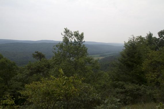
5.4 – Nice view over the Delaware River Valley.
Continue on ORANGE (Tumbling Waters). Head up and then down a hill.
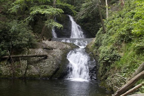
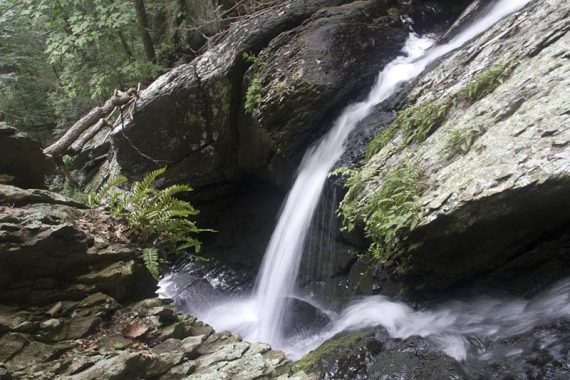
5.5 – Arrive at the wooden steps that lead down to the falls. (Sign with “Falls” and “9”).
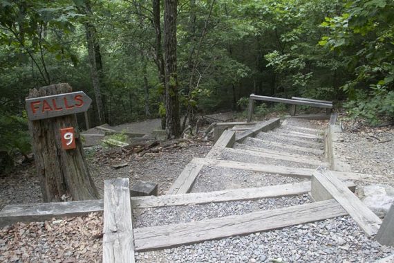
At the bottom of the stairs, the upper falls are visible.
The lower falls off to the right and can be viewed only from above.
When done, climb the stairs back up. At the top, turn LEFT and continue on ORANGE (Tumbling Waters). Head steeply uphill, then back down.
6.5 – WHITE (Two Ponds) joins in from the right. Continue straight, following ORANGE/WHITE on a flat woods road through a pine plantation.
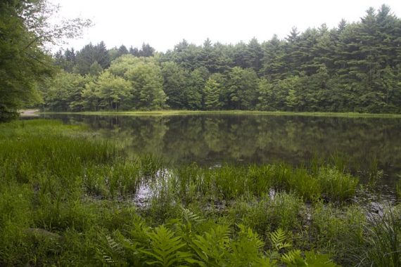
6.7 – The trail turns to run along Pickerel Pond. Continue following ORANGE/WHITE.
6.9 – Cross Brisco Mountain Road. Continue following ORANGE/WHITE.
The trail passes through a wildlife blind just before crossing the road and arriving back to the parking lot.
—
Hiked: 7/18/11. Trail Blog: “PEEC in July“