Hike to a panoramic view from Blue Mountain via the Red Maple Trail, the Appalachian Trail, and Jacobs Ladder.
8.5 miles, mix of woods road and rocky rooty trail. Short steep section over a rock slab up and down on Red Maple, another longer one downhill on Jacob’s Ladder. Steep up/down to Blue Mountain. Stream crossing.
- Shorter: 7.0 – Skipping Blue Mountain removes 1.5 but misses the big viewpoint.
- Longer: The Appalachian Trail keeps going and going…
- Alternate: Red Maple only. It’s 5 miles one-way from the lot to Tillman Ravine.
- Alternate: Loop on Red Maple starting from Tillman Ravine.
- Nearby: Tillman Ravine, Blue Mountain Loop – Lower, Appalachian Trail – Culvers Gap to Blue Mountain; Swartswood S.P. – Spring Lake; Swartswood Grist Mill.
Hike Info:
Our two cents:
The view from Blue Mountain always makes a nice destination and this route incorporates a mix of trails in Stokes.
Map:
Kittatinny Trails or the Stokes park map. There are some minor differences between them regarding the Steffen and Shay trails.
A woods road is marked as Shay Trail on the Stokes park map or unmarked/Brink Road/BLUE on the TC Kittatinny Trails map.
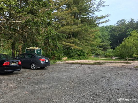
Parking: N41.18410° W74.81167°
29 Struble Rd, Sandyston, NJ 07826.
Rt 206 N into Stokes State Forest, pass the entrance for the park office on the right. Next L onto Struble Road.
In about a half mile Struble turns to the right where there is a large dirt parking area for Lake Ashroe Rec Area and this hike.
Restrooms:
Portable toilet was no longer in the lot as of 11/2020. The Stokes office passed on Rt 206 on the way has a restroom, when open.
There might be a portable toilet in the Culvers Gap/Appalachian Trail lot just before the Stokes office (not there 10/2020). Further into Stokes, the Tillman Ravine parking lots have outhouses.
Outhouse mid-way through the hike at Brinks shelter.
Hike Directions:
Overview: Red Maple (RED LEAF) – Shay Trail – Appalachian Trail (WHITE) – Jacobs Ladder (BLUE/GRAY) – Red Maple (RED LEAF)
0.0 – From the parking lot, follow the dirt driveway in between the wood fence at the “no vehicle access…” sign.
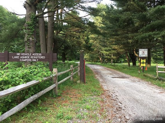
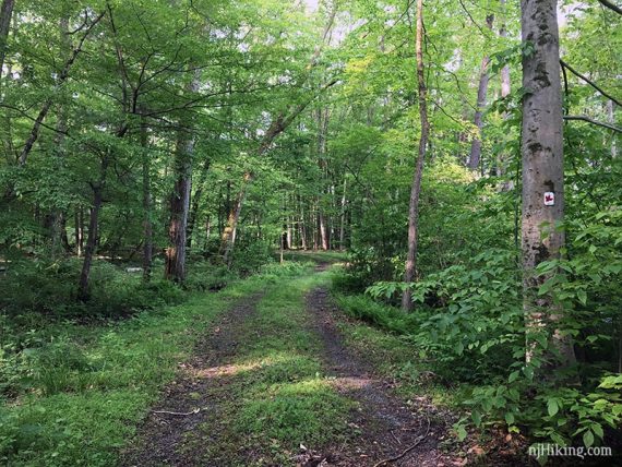
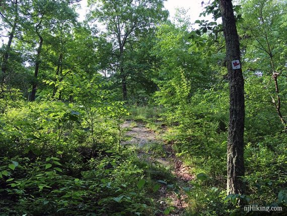
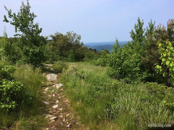
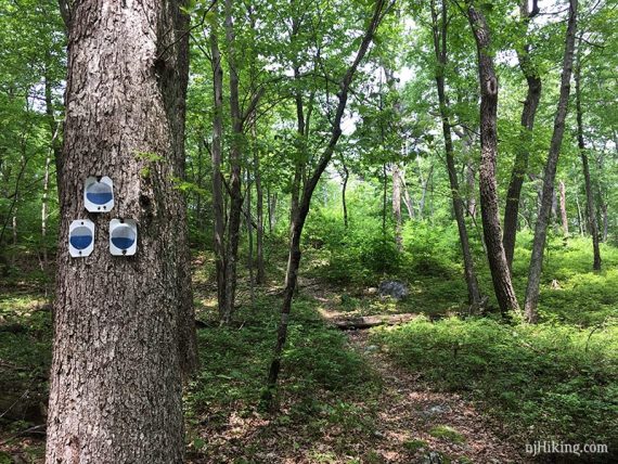
Start following Red Maple (RED LEAF) as it skirts around a scout camp and then heads into the woods and starts uphill.
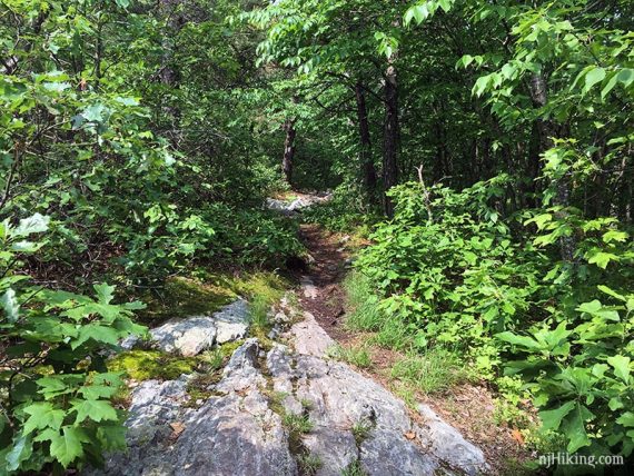
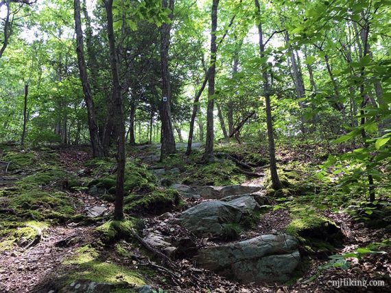
There is a short steep section over a rock slab.
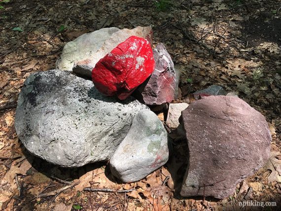
1.1 – At a rock pile with a painted red rock, turn RIGHT to continue on Red Maple (RED LEAF) which is co-joined with Steffen (Black/Gray) for a bit.
[An unmarked trail goes straight. Steffen (Black/Gray) goes left and right. The TC Kittatinny map (2016) shows this is the end of Steffen.]
1.6 – Follow Red Maple (RED LEAF) as it turns LEFT onto a woods road.
[The woods road also goes right, marked as Coss Road on the TC map.]
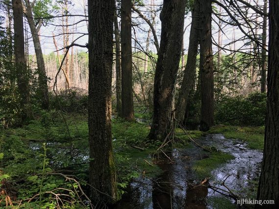
1.7 – In a small clearing follow Red Maple (RED LEAF) as it turns RIGHT onto another woods road. The nearby stream may be audible.
An unmarked woods road goes left and in a few steps leads to Jacobs Ladder (BLUE/GRAY) but it wasn’t noticeable from this intersection. Coming down Jacobs Ladder is the return route.
// Alternate variation: Reverse the loop here by taking Jacob’s Ladder for a steep up instead of down, and then later coming down Shay. //
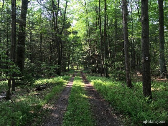
Red Maple (RED LEAF) follows a mostly level woods road.
Eventually we passed a wet area off on the right where frogs and birds were making all sorts of a ruckus the day we hiked (“…what ruckus? could you describe the ruckus?”).
3.1 – Turn LEFT at the gate and now follow a woods road. We don’t recall seeing any blazes.
This woods road is marked as Shay Trail on the Stokes park map or unmarked/Brink Road/BLUE on the TC Kittatinny map.
[Red Maple (RED LEAF) goes straight and continues to Tillman Ravine. Brink Road (unmarked) goes off to the right].
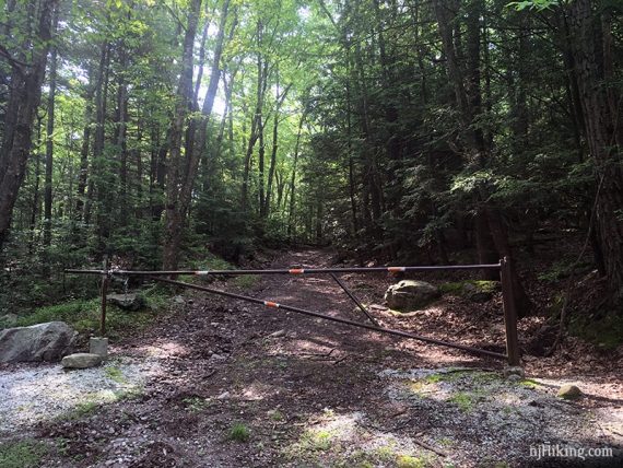
Soon, pass the Brink Road Shelter/outhouse off on the right.
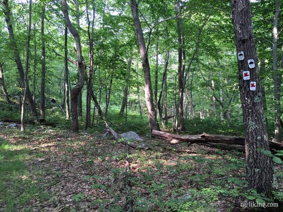
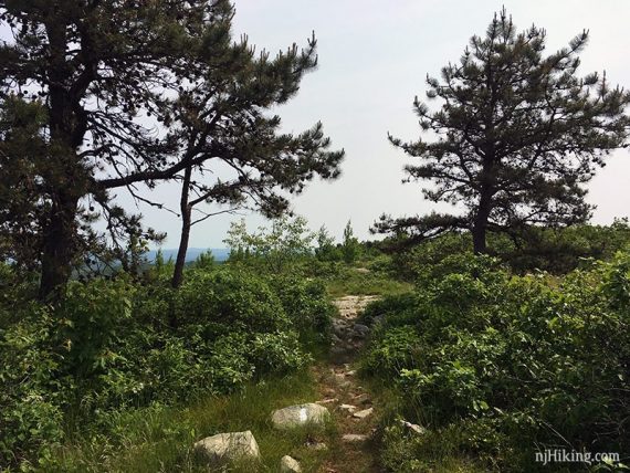
3.3 – Turn RIGHT and now follow Appalachian Trail (WHITE) uphill.
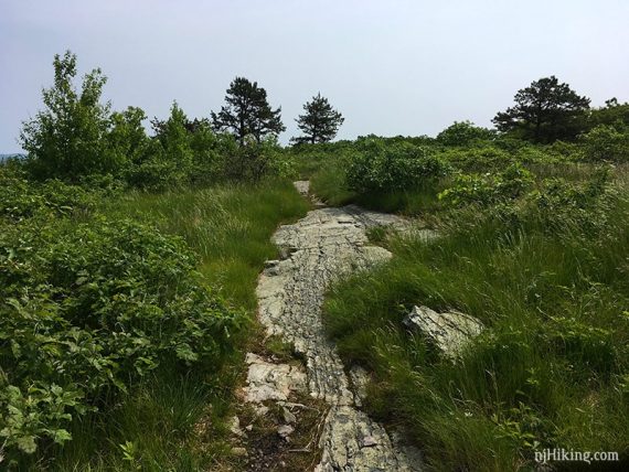
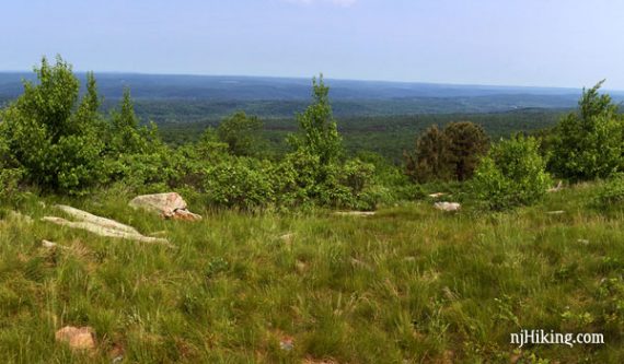
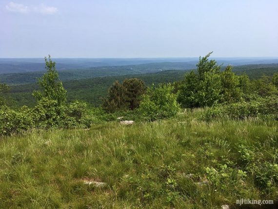
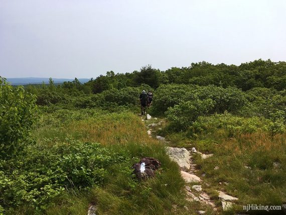
4.1 – At the top it opens up for panoramic views from Blue Mountain over Stokes State Forest and into Pennsylvania.
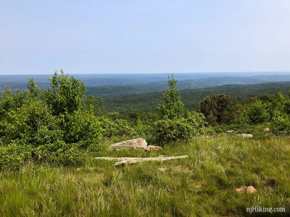
The Appalachian Trail runs along the ridge.
Appalachian Trail on Blue Mountain, looking south:
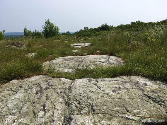
There are a few rocks off on the left that are our usual break spot and turn around point. But the AT just keeps going if you want a longer hike .
When ready, turn around and retrace Appalachian Trail (WHITE) back.
4.8 – Continue straight on Appalachian Trail (WHITE) through the intersection with Shay from before.
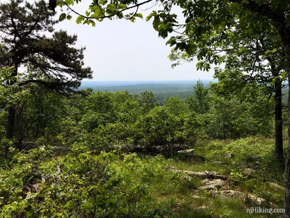
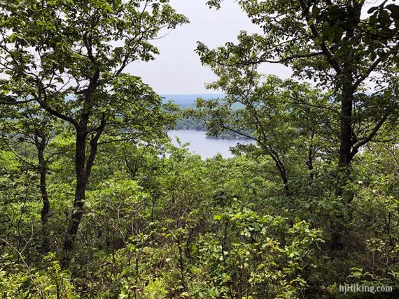
5.9 – The first of two limited viewpoints on the Appalachian Trail (WHITE are on the right – the side trails to them can be hard to spot.
They face the opposite direction over New Jersey than Blue Mountain does.
Continue on Appalachian Trail (WHITE).
6.1 – Second limited view. Continue on Appalachian Trail (WHITE).
6.4 – Turn LEFT to now follow Jacobs Ladder (BLUE/GRAY). [Appalachian Trail (WHITE) continues straight, all the way to Maine.]
Jacobs Ladder (BLUE/GRAY) heads steeply downhill with a section over a long rock slab (with “ladder” in the name I was expecting it to be steeper.)
Looking back up the trail:
6.8 – Cross a stream on sticks/rocks at the end of Jacobs Ladder (BLUE/GRAY). Both times we’ve done this route the crossing involved a bit of a leap.
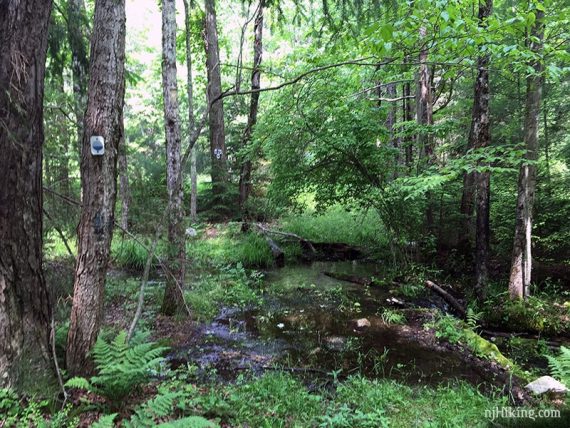
Once across the stream, start following Red Maple (RED LEAF) again by turning LEFT for a few steps and then RIGHT.
Be mindful of the intersection here: after crossing the stream you are on a woods road. To the right it’s unmarked and to the left is Red Maple (RED LEAF) which splits in two directions.
After crossing the stream, be sure to turn LEFT then RIGHT for the correct direction on Red Maple or you’ll be retracing your route back to Blue Mountain.
6.9 – Continue on Red Maple (RED LEAF) as it turns RIGHT.
[A woods road continues ahead, marked as Coss Road on the TC map.]
7.4 – Continue on Red Maple (RED LEAF) as it turns LEFT at the rock cairn with the red mark.
[Steffen (Black/Gray) goes straight. Unmarked is to the right.]
Follow Red Maple (RED LEAF) back to the lot.
—
Hiked: 11/7/20. Alternate; up Jacobs and down Shay/Brinks.
Hiked: 6/1/19.