An enjoyable, relatively level trek through an attractive forest using the lower section of the Blue Mountain Loop that circuits Stokes State Forest.
10.8 or 7.0 miles, total round trip. Surface ranges from super rocky to just dirt. Mostly level. Basically all shade. A few easy stream crossings via stepping stones. Challenging only in length.
| 10.8 miles | This hike guide: Detailed instructions and photos follow below. |
| Shorter | 7.0 miles – Cut over on Stony Brook (BROWN) instead and add waterfalls. Noted below. |
| Longer | 17 miles – Tackle the whole enchilada! Guide for the other half: Blue Mountain Loop – Upper and noted below. |
| Nearby | Sunrise Mountain; Tillman Ravine; Sunrise Mountain – Culvers Gap; Culvers Gap – Blue Mountain; Stony Brook Falls; Stony Lake Loop; Swartswood S.P. – Spring Lake; Swartswood Grist Mill. |
Our two cents:
We really enjoy this loop and is what we’d call a “hiker’s hike”… just a nice trail in a beautiful forest and along a pretty stream – but with no particular goal or big “payoff” like a waterfall or viewpoint.
Can be done in the opposite direction, but doing it this way puts the best parts first (in our opinion). Some road noise slightly mars the otherwise isolated feeling of the hike. Wet trail sections after recent heavy rain.
Want a shorter but still solid pick? Our 7.0 mile version reduces the mileage but adds in the waterfalls and cascades along Stony Brook that the longer route misses.
Want a challenge or are into trail running? The Blue Mountain Loop is a combination of new and existing trails that enable a 17-mile circuit of Stokes. This route uses Tinsley to bisect the trail into upper and lower loops, but you can just keep following those blazes and do the whole thing. Apply lots of ice cream afterwards.
Post-hike: Within minutes of the park on Rt. 206 are multiple restaurants and a Dairy Queen… which is where our Hikemobile automatically makes a beeline to so we can shovel Blizzards into our faces.
Updated: 6/2024 – Re-hiked 7.0 mile version; minor edits, added to the interactive map. The very end of the BML is new trail but the length of the BML is unchanged. 6/2022 – Re-hiked 5/2022; minor description tweaks.
Hike Info:
Map/Books:
Print the park map or get one at the office but Kittatinny Trails is best – but be sure to use at least the 2016 version as earlier maps won’t have the complete trail.
Follow along on your smartphone with our Interactive Map link above. The 7.0 mile version is shown in red on the map, along with points for the waterfalls.
Other section of this trail is now in 50 Hikes in New Jersey.
Parking: N41.18541° W74.79605° [Visitor Center lot]
1 Coursen Rd, Branchville, NJ 07826. Rt 287 to Rt 80 West; Rt 15 North to Rt. 206 N. Park entrance is on the right, then veer L to the parking lot in front of the visitor center. Don’t continue into the park past the gate.
Fee:
While this park charges an entrance fee Memorial – Labor Day (covered by the NJ State Park Pass) this parking lot is before the entry gate.
Restrooms:
At the visitor center, on the left side before entering the building. Open during visitor center hours. Also at Stony Lake about 8.5 miles into the hike (likely seasonal).
Hike Directions:
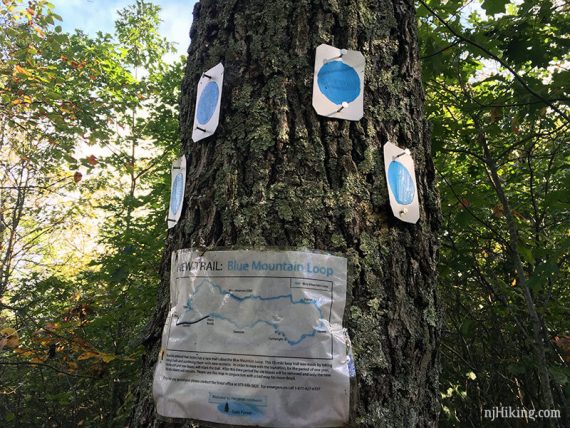
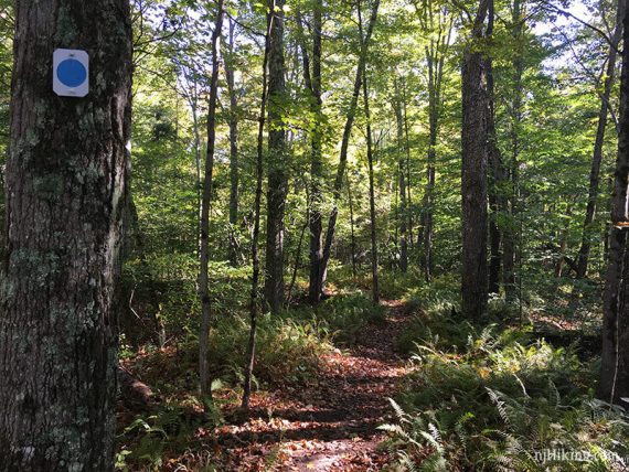
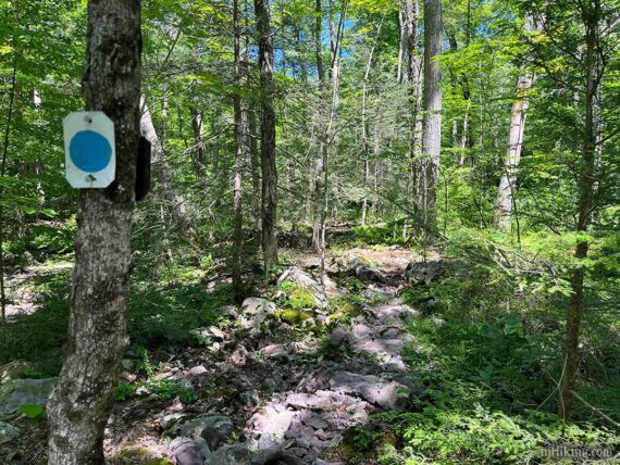
Overview: Blue Mtn (BLUE DOT on WHT) – Tinsley (YELLOW) – Blue Mtn (BLUE DOT on WHT)
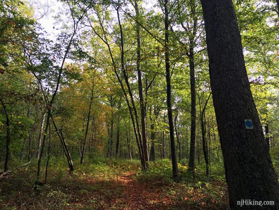
0.0 – From the parking lot, follow the park road (Coursen Rd). Just after a vehicle bridge turn LEFT to start following Blue Mtn (BLUE DOT on WHT).
The path was still hard to spot when we last hiked, but believe there were markers on the opposite side of the road (which is location of the return route).
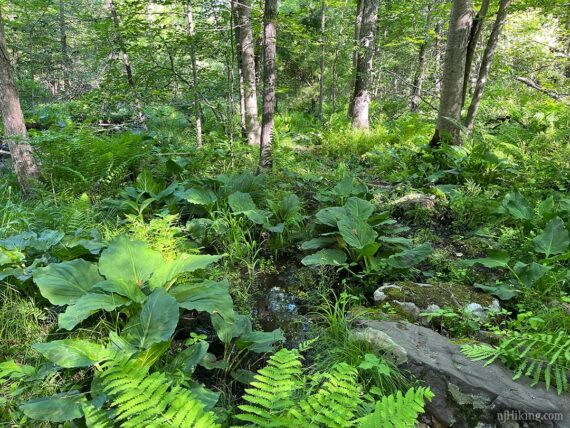
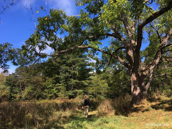
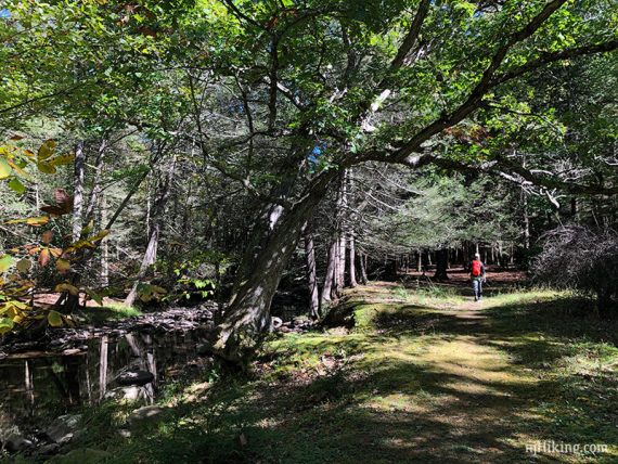
Super rocky for a bit, and after heavy rain this section along the stream can be quite soggy… but this gives it a neat jungle-like quality. In early Spring, massive skunk cabbages lined the trail.
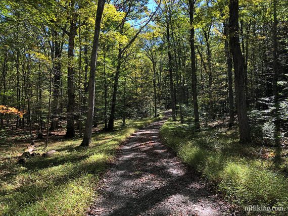
There is also a lot of easier, woods road type trail too. Much of the first 3.5 miles of the Blue Mountain Loop is trail that wasn’t on the map before ~2016 or so.
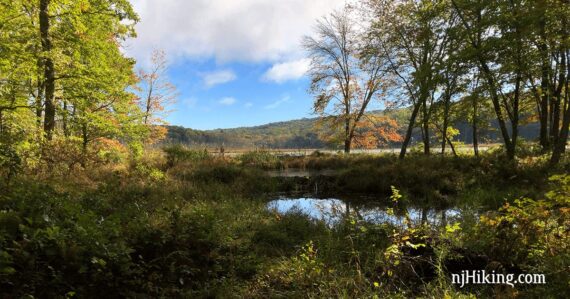
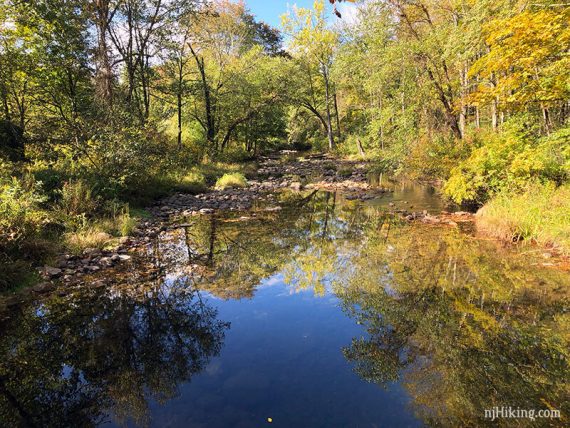
1.2 – Water comes into view on the right, toward the end of it are a few side trails to get a closer look.
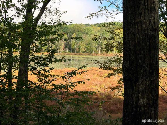
Notice the edge of the pond is all created by beavers, with several levels/sections of water. Possibly spot some trees that have been gnawed at around the base.
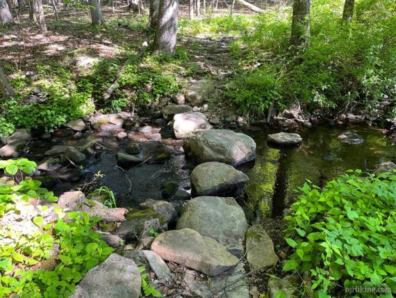
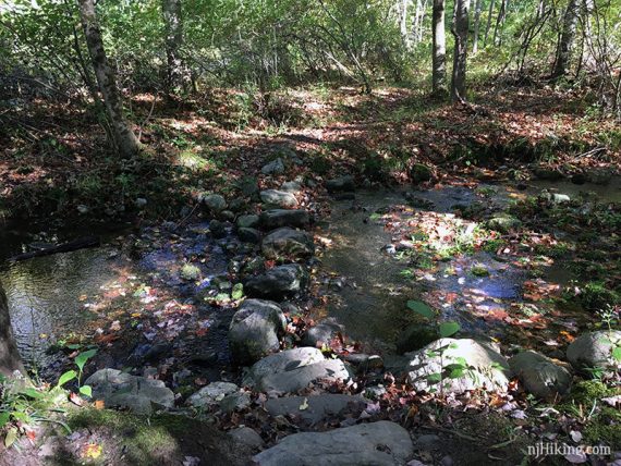
One of several rock hops over streams. The rocks are very large and easy to cross.
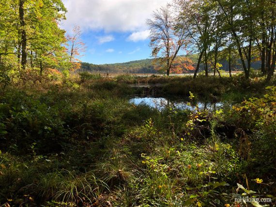
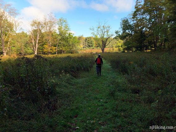
2.3 – Cross through an old farm open area with grasses, large trees, and a rock wall containing a pond.
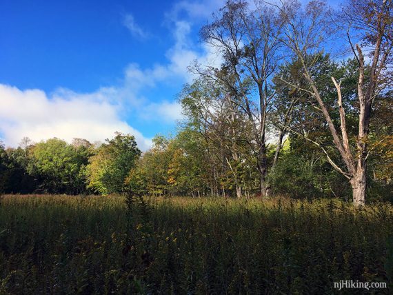
There is a path through the grass but depending on season and traffic the trail might be overgrown in spots.
Stone structure at the edge of the pond. The pond is behind this and shown in the photo after.
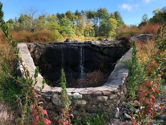
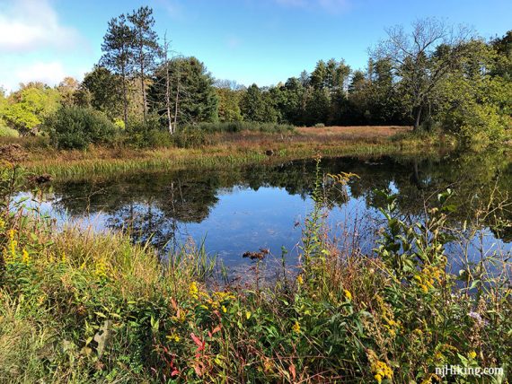
In 2024 this spot was dry, but after recent heavy rain in 2022 this area had a section of nearly ankle deep water. We did a little hiker dance from one large tuft of grass to another but were only moderately successful. Pass some large trees near the pond.
Continue following Blue Mtn (BLUE DOT on WHT) on another easy rock hop over a stream. The rocks should be large enough to be above any stream flow.
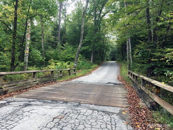
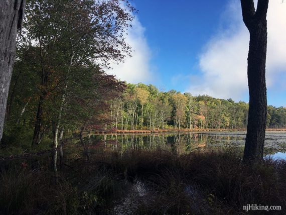
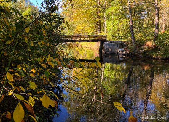
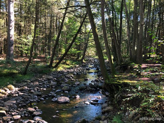
2.5 – Continue following Blue Mtn (BLUE DOT on WHT) as it turns RIGHT just before a small bridge over Big Flat Brook. Before turning, pop on out on the bridge for a view of the brook.
The view of Big Flat Brook from the bridge and then a view of the bridge from the trail.
The trail runs along the brook and eventually goes past a campground.
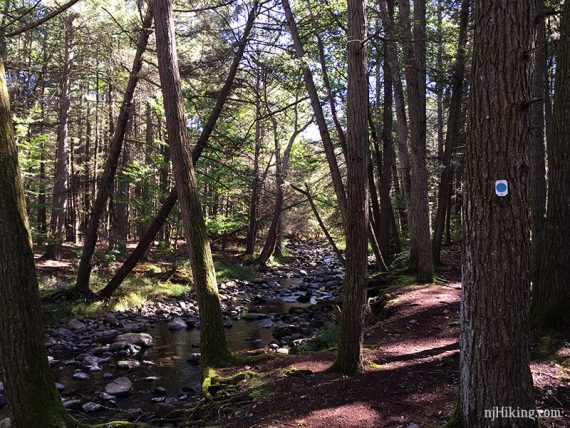
Continue following Blue Mtn (BLUE DOT on WHT) along the scenic stream.
Along the brook is probably our favorite section of this hike.
3.5 – Cross Kittle Road. Stony Brook (BROWN) joins in.
3.7 – Continue following Blue Mtn (BLUE DOT on WHT) as it turns to cross a wooden footbridge.
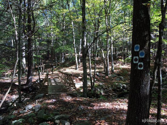
After the bridge turn LEFT to continue on Blue Mtn (BLUE DOT on WHT) [Stony Brook (BROWN) leaves to the right]. In a few steps, follow Blue Mtn (BLUE DOT on WHT) as it turns right, just before a trail barrier.
// Shorter, ~7.0 miles total round trip: Instead, after the bridge turn RIGHT onto Stony Brook (BROWN). In a bit, stepped Stony Brook Falls come into view (veer right off the woods road to get closer). Continue on BROWN past a pavilion/restrooms (don’t walk out to the parking lot), then pass angled Stony Brook Falls. When the trail hits the park road, turn RIGHT on that and pick up the description at 8.6 below. This variation is a nice 7.0 miles. //
Shortly, pass BLUE/BLACK on the left. May not notice it.
4.6 – Continue following Blue Mtn (BLUE DOT on WHT) past Silver Mine (ORANGE) on the right.
5.2 – Continue following Blue Mtn (BLUE DOT on WHT) as it crosses Skellenger Road.
// Longer, 17 miles – The small open dirt parking area off on the left is the parking for the Blue Mountain Loop – Upper route. Use that guide to continue on Blue Mtn (BLUE DOT on WHT) from here instead. Then when it comes around to Tinsley, return to this guide at 6.5 below. //
There are a few random blazes – i.e. “purple finch” – in this area that belong to the State School of Conservation.
5.4 – Turn RIGHT to now follow Tinsley (YELLOW) and turn away from the stream. (We managed to mosey right past this intersection at first even though it was marked).
Cross a paved road and go around the metal gate. Tinsley (YELLOW) is a wide woods road that heads gradually uphill. It may be a little bit before there is a trail marker.
6.5 – Continue on Tinsley (YELLOW) when Blue Mtn (BLUE DOT on WHT) joins in from the LEFT.
6.6 – Veer RIGHT to now follow Blue Mtn (BLUE DOT on WHT). [Tinsley (YELLOW) veers left].
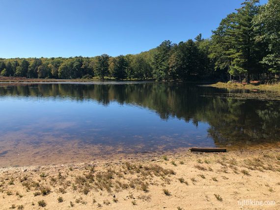
8.5 – Stony Lake parking lot. There are a few picnic tables off on the side.
// Optional: Head left for a short walk over to check out Stony Lake. Bathrooms may be open at the lake in the building on the left. Retrace. //
Stony Lake, if you walk over to it:
8.6 – Continue following Blue Mtn (BLUE DOT on WHT) as it turns onto the park road for just a bit. [Shorter 7.0 variation continues from here].
Blue Mtn (BLUE DOT on WHT) turns LEFT back into the woods at a metal gate and a bend in the park road.
8.7 – Pass Stony Lake Trail on the left.
9.4 – Pass Lead Mine (BLUE GREY) on the right. [Easier option: Lead Mine leads to the park road and is a shorter and easier way back (less trail, more road walking].
10.3 – Blue Mtn (BLUE DOT on WHT) turns to the right. Sticks may be piled up blocking the old route of the trail – it used to cross a footbridge and turn right onto a wide woods road, but was flooded out in 2023.
This new section of trail is a nicer and more interesting end to the day, but is more technical that the woods road it replaced.
10.7 – Arrive at the park road, across from where you started the trail earlier. Turn LEFT onto the park road, cross the vehicle bridge from earlier, and continue back to the parking lot.
—
Hiked: 6/1/24. 7.0 mile variation that includes Stony Brook Falls.
Hiked: 5/29/22.
Hiked: 10/1/17.