Short hike to Laurel Falls along the Douglas Trail.
Laurel Falls is just a brief hike from the Douglas Trail parking lot in Worthington State Forest.
| 0.3 miles, total round trip | Rugged trail, slightly uphill. Detailed instructions, photos, and video follow below. |
| Longer, from this lot | Sunfish Pond – Garvey Springs and Douglas Loop (w/Laurel Falls); Appalachian Trail – Sunfish Pond to Raccoon Ridge |
| Nearby | Coppermines – Rattlesnake Swamp; Van Campens Glen, Catfish Fire Tower; Rattlesnake Swamp – Catfish Fire Tower Loop; Sunfish Pond (via Dunnfield), Mt. Tammany |
Our two cents:
Good as a quick stop if you’re just out for a scenic drive and not looking to do a long hike, but we’ve also got a loop option using Garvey Springs and Douglas too.
Laurel Falls are on a stream that is the runoff of Sunfish Pond and, like any waterfall, the flow depends on recent rainfall and is usually best in Spring.
Updated: 4/2026 – Minor edits. 6/2024 – Re-hiked as part of the longer loop; minor updates, added interactive map. Older change log at page bottom.
Hike Info:
Map:
Kittatinny Trails section #120. Follow along on your smartphone with our Interactive Map link above.
Parking: 41.01317 -75.08217
Douglas Parking Lot Trailhead, 134 Old Mine Rd, Columbia, NJ 07832. Rt. 80 W to the last exit in NJ (1) for Millbrook/Flatbrookville which bears right onto River Road/Old Mine Road.
Cross a one-lane bridge with a stop light and continue on Old Mine Rd for about 4 miles, passing a sign for Worthington and the driveway to the park office. The lot will be on the left and has a sign.
Related: Waterfalls in NJ / Best Waterfall Hikes in NJ
Restrooms:
From the lot, walk back into the campground area to a bathroom building on the left.
Hike Directions:
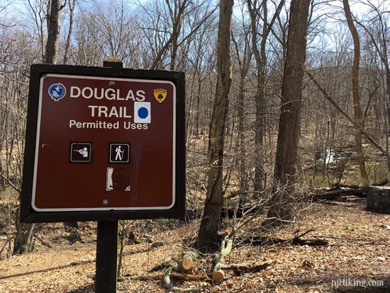
Overview: Douglas (BLUE) / Note: This used to be marked with BLUE DOT on WHITE.
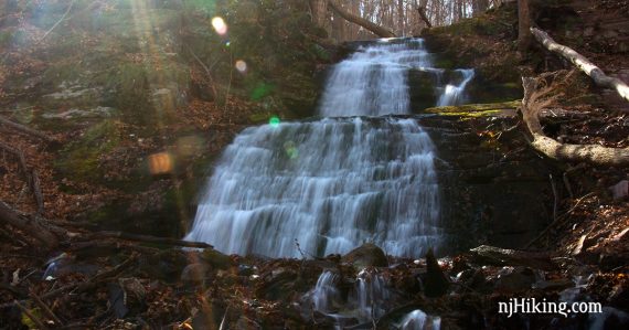
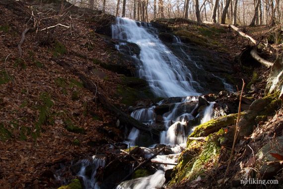
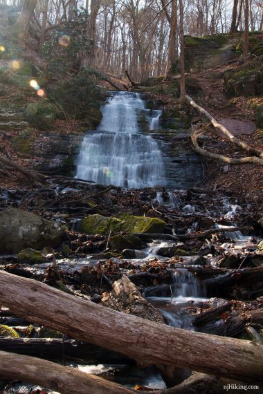
There are three sections to Laurel Falls. The lower section is the closest to the road and is accessed on an unmarked path near the Douglas Trail sign. With leaves on the trees, the path and falls might be harder to spot.
Nearby is a plaque explaining that the Douglas trail is named for U.S. Supreme Court Justice William O. Douglas.
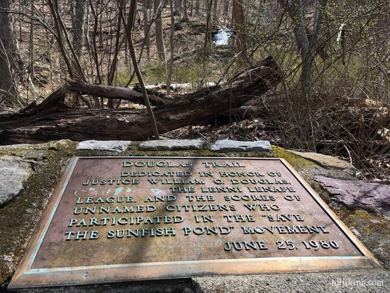
Fun facts: In 1967 Justice William O. Douglas hiked with a thousand others to “Save Sunfish Pond” and protest against expanding the pond for water storage as part of the Tocks Island Dam project. Sunfish Pond was designated a National Natural Landmark in 1970. [Source: Hiking and history at Sunfish Pond]
I was curious what was removed between Douglas and “The Lenni Lenape League” but could not locate a photo of the plaque with all of the word intact.
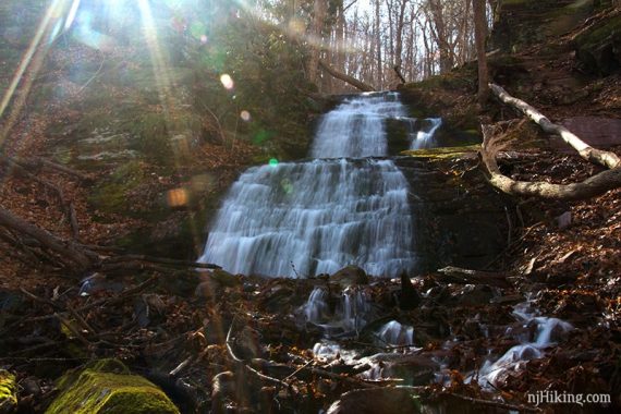
Continue a bit on the unmarked path to arrive at the lower cascade of Laurel Falls:
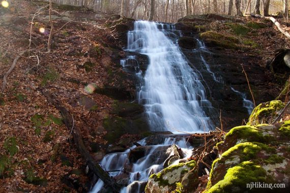
Close up of lower Laurel Falls shows the stepped rock formations that the water tumbles over.
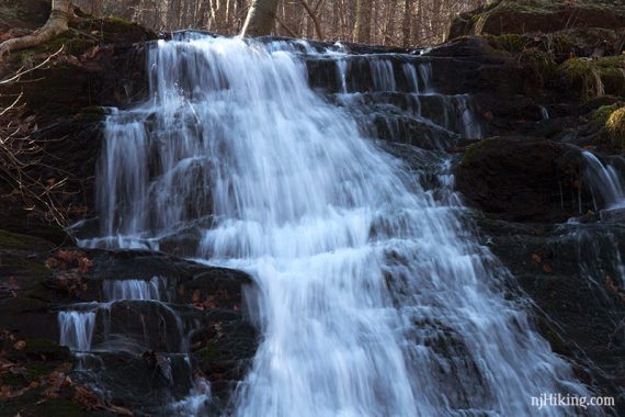
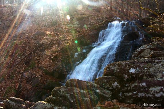
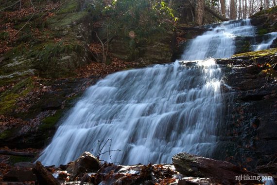
Continue climbing uphill on the casual path to the upper section. The upper cascade of Laurel Falls:
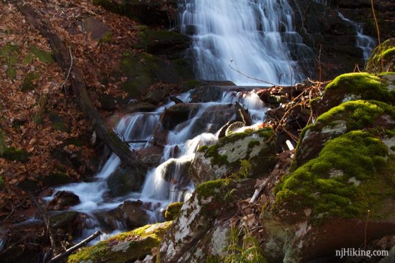
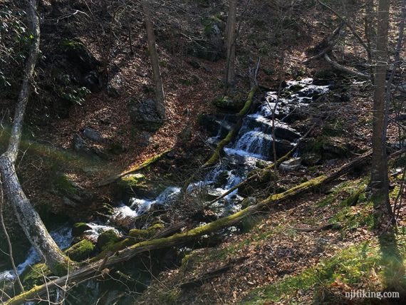
There is a third cascade above that but’s it’s pretty steep up and not as impressive as the main ones and can be skipped. The third cascade of Laurel Falls is longer but not as tall:
Retrace the route back down to the Douglas trail and then back to the parking lot.
—
Hiked: 6/15/24. With the full loop; in reverse.
Hiked: 4/7/19. With the full loop. Trail Blog: “Hiking Laurel Falls and Sunfish Pond in Spring“
Updated: 3/2024 – Changed this page from a Trail Blog about a Sunfish Pond and Laurel Falls hike into a full guide for just hiking to the falls; moved the blog content to it’s own page. Not re-hiked.