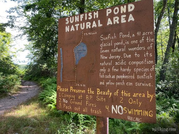
Hike through some of the prettiest forest in New Jersey to a glacial lake 1,000 feet above the surrounding area.
7.9 miles. Other routes listed in the chart below. Very rocky, multiple rock-hop stream crossings that can be tricky to negotiate after heavy rain.
| 7.9 miles | This hike guide: Detailed instructions, photos, and video follow below. |
| Challenging, same lot | Check out Mt. Tammany and Sunfish Pond or our “Mind The Gap“ hike. |
| Same lot | Same lot, but doesn’t go to Sunfish Pond –1.2 mile scenic hike to water cascades. Noted below. –Mt Tammany. |
| Nearby; alternate | Shorter but steeper routes to Sunfish Pond, from Old Mine Road: Sunfish Pond to Raccoon Ridge; Sunfish Pond – Garvey Springs and Douglas Loop. |
| Nearby | Laurel Falls; Mt. Minsi; Jenny Jump – Ghost Lake; Jenny Jump Trail. |
Our two cents:
Sunfish Pond is a popular destination, but rightly so. For newer hikers, this is hike is manageable, but… It’s also not a “walk in the park” and 7.6+ miles may be longer than you realize or can comfortably do.
While on our way back, we’ve passed many weary hikers asking “how much farther to the pond?”
Please bring water, have appropriate footwear, and honestly assess your fitness level. This is not a good choice for your first hike.
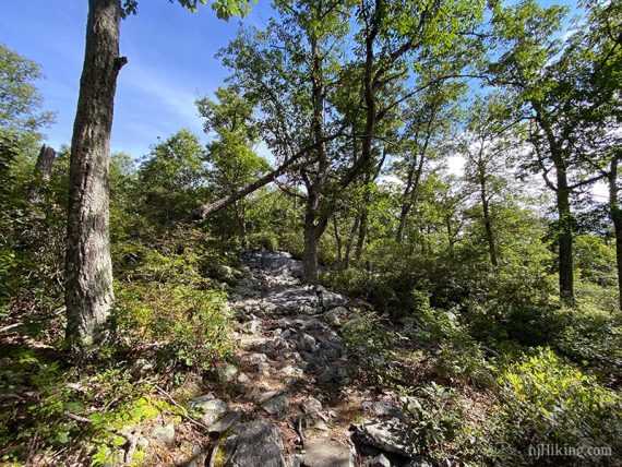
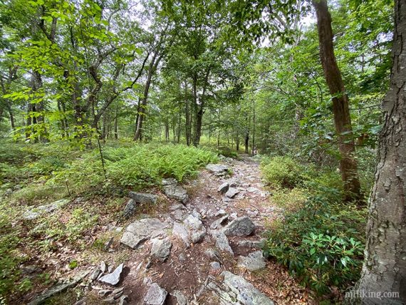
The Gap is notorious for rocks and will give feet and joints a good pounding. It can be hiked in sneakers… but we wouldn’t recommend it. The Appalachian Trail is rockier than the Dunnfield Creek Trail, in our opinion.
Updated: 6/2026 – Minor edits, updated interactive map, more photos, more detail for stream crossings; re-hiked. Older change log at page bottom.
Routes to Sunfish Pond
| There are several ways to Sunfish Pond from the Rt 80 Dunnfield lot: | MILES |
| Appalachian Trail (WHITE) – Sunfish Pond – Appalachian Trail (WHITE) | 7.6 |
| Appalachian Trail (WHITE) .5 miles – Dunnfield Creek Trail (GREEN) – Sunfish Pond – Appalachian Trail (WHITE) [directions below] | 7.9 |
| Appalachian Trail (WHITE) .5 miles – Dunnfield Creek Trail (GREEN) – Sunfish Pond – Dunnfield Creek Trail (GREEN) | 8.2 |
| Appalachian Trail (WHITE) .5 miles – Dunnfield Creek Trail (GREEN) – Sunfish Pond – Around the pond: Fire Road, Buckwood (BLUE) – Appalachian Trail (WHITE) | 9.5 |
| Red Dot – Mt. Tammany Summit – Fire Road – Buckwood (BLUE) – Sunfish Pond – Dunnfield Creek Trail (GREEN) – [Challenging] [Directions: Mt. Tammany and Sunfish Pond] | 10.8 |
| Appalachian Trail (WHITE) .5 miles – Dunnfield Creek Trail (GREEN) – Sunfish Pond – Around the pond: Fire Road, Buckwood (BLUE) – Appalachian Trail North (WHITE) to park boundary sign – turnaround and take AT back to the lot [Challenging] | 13.2 |
Map/Books:
Map# 121 of the Kittatinny Trails map set. Follow along on your smartphone with our Interactive Map link above.
The longer Mt. Tammany to Sunfish route description and map diagram can be found in Hiking New Jersey (2023). Details on all the trails in the area can be found in Kittatinny Trails and The New Jersey Walk Book.
Parking: N40.97213° W75.12592°
Dunnfield Creek Natural Area, I-80, Columbia, NJ 07832. Route 80 West to just before the last exit in New Jersey (exit 1). On the right is a brown sign for Dunnfield Creek Natural Area.
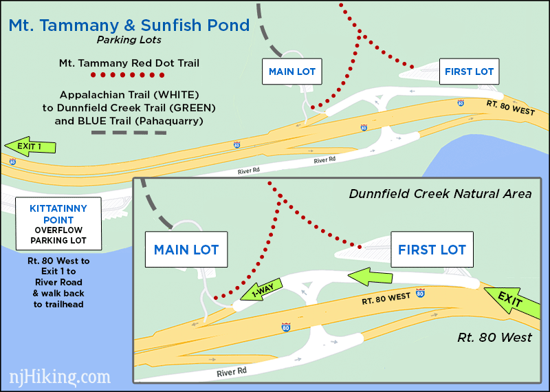
There’s the first parking lot, then a larger main lot. The exit road is one way so you can’t backtrack to a passed lot unless you get back onto Rt 80 and come around.
If both the first and main lots are full, try the parking area at the Kittatinny Point visitor center and walk back to the trailhead in the main lot (~about a 10 min walk).
Kittatinny Point Visitor Center: Head back out onto Rt. 80 from the Dunnfield lot and take the very next exit right, Exit 1 towards Millbrook/Flatbrookville. Then make a sharp left like you are going to go around to 80 E, but instead of merging onto 80, immediately head to the right into the visitor center on River Road.
Overview of the parking lots as it’s just easier to show it than explain it:
Parking may fill EARLY on nice weekends. If those three lots are full you may be able to wait a moment for a spot to open up, use the Hiker Shuttle if running, or switch to a nearby hike listed above. Do not park on roadsides, including Rt. 80.
Seasonal Hiker Shuttle (Free): Runs in season between Kittatinny Point Visitors Center and the DWG Park and Ride just over the bridge in Pennsylvania. Check www.gomcta.com for schedules and routes.
Restrooms:
Portable toilets in the far side of the main lot (there as of 6/2026). Composting toilets should be available in the parking lot at the Kittatinny Point Visitor Center.
There is a rest area on Rt. 80 W about 5 mins before the trailhead: “TA Travel Center” (McDonalds/Exxon) is next to the “Delaware Water Gap Travel Plaza” (Chik-Fil-A / Starbucks / Sunoco).
There are no signs for the rest areas, just exit signs listing the gas / food at each. Either take exit 4-A-B-C to Simpson Road, or continue past them and turn right onto Hainesbug Road (comes up quick and is a non-descrip turn), then immediately turn right onto Simpson Road and follow that back. Just past a maintenance building area is the travel plaza.

NOTE: The video is for the longer Mt. Tammany to Sunfish Route; so it also shows Mt. Tammany, the Fire Road, Buckwood (BLUE)to Sunfish Pond, with Dunnfield Creek as the return trail.
Hike Directions:
Overview: Appalachian Trail (WHITE) – Dunnfield Creek (GREEN) to Sunfish Pond – Appalachian Trail (WHITE).
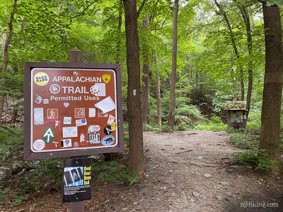
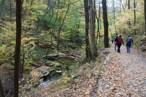
0.0 – At the far end of the main lot, look for a trail sign for the Appalachian Trail (WHITE). Cross the bridge over Dunnfield Creek.
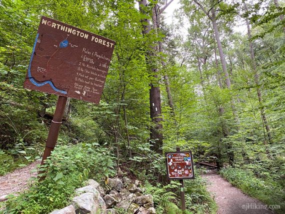
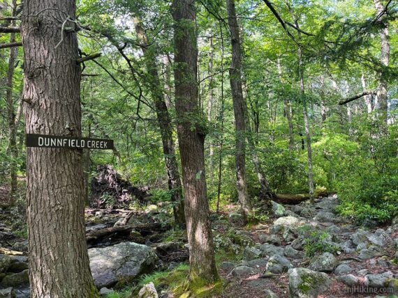
0.4 – A large trail sign is at a V-intersection. Bear RIGHT to start following Dunnfield Creek (GREEN).
[The Appalachian Trail bears left and also leads to Sunfish Pond – and is the return route.]
Cross Dunnfield Creek on a large wooden bridge.
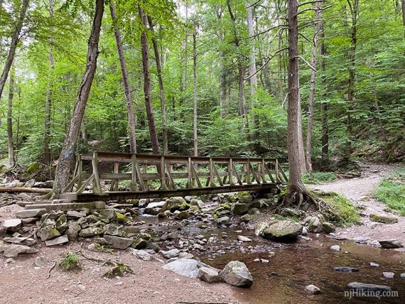
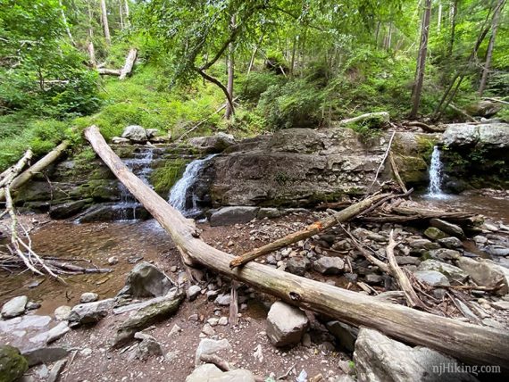
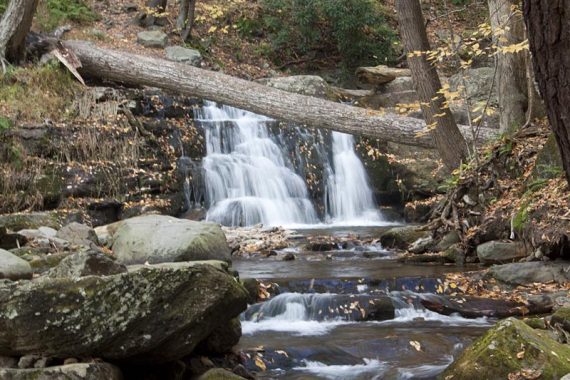
Dunnfield Falls and a few nice water cascades are nearby. A wider view of the falls area during lower water flow, and the falls with more flow:
/// Shorter 1.2 mile hike: Turn around here and retrace the route. ///
0.6 – Continue following Dunnfield Creek (GREEN). Pass the start of the BLUE (Pahaquarry) trail on the right.
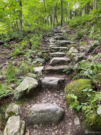
1.0 – Continue following Dunnfield Creek (GREEN) where it veers right up a series of stone steps. This bypasses the original location of the trail before it was washed out (we last hiked the old section in 2015).
The trail come back down closer to the stream again. You might notice a pile of sticks blocking the route of the old trail. Or you might not.
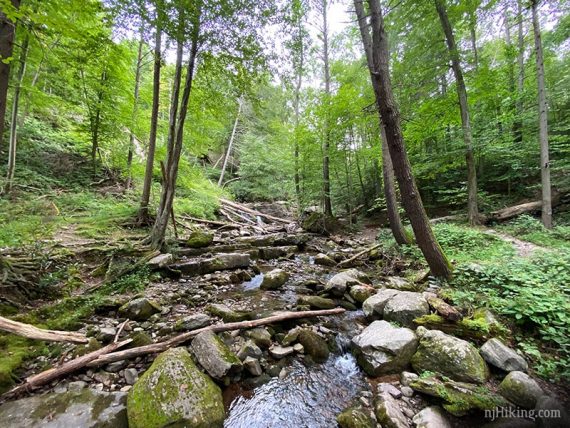
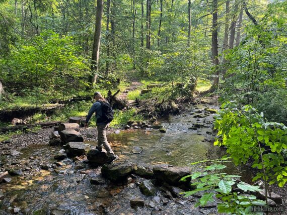
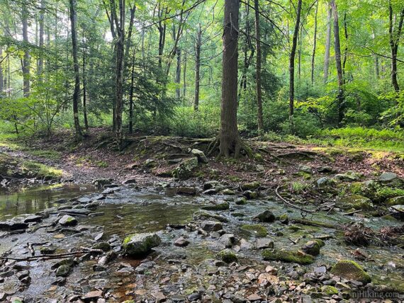
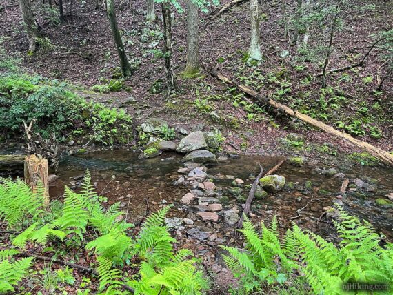
Keep an eye out for the GREEN markers which can be sometimes hard to spot when the leaves are also green. They will also indicate where to cross Dunnfield Creek multiple times.
Crossings may appear different than the photos that follow, depending on water level or flow moving rocks and sticks around (or away). High water might make some crossings tricky but 2 of the 5 have a high water bypass trail.
1.5 – Arrive at the first of several rock hops across Dunnfield Creek. This crossing is easy-peasy (at least for now) over big stable rocks.
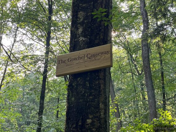
There was a sign here that we’d never seen before: “The Gotchel Causeway – Formerly the Drought Causeway”. I have no info to offer about it… so feel free to make up some fantastical backstory.
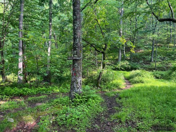
1.8 – Pass Holly Springs (RED) trail on the left. This leads to the Appalachian Trail (WHITE) and you’ll pass the other end of it much later, on the way back.
1.9 – Cross Dunnfield Creek for the second time. This wide crossing often has low water and a lot of small rocks placed in a row.
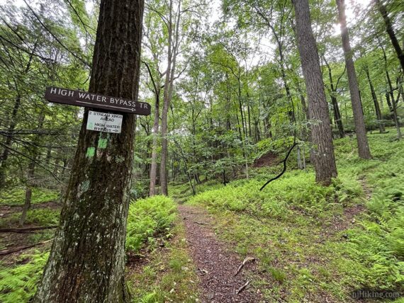
2.4 – High Water Bypass option. Continue ahead to stay on Dunnfield Creek (GREEN).
Bypass Option: If there’s been a lot of rain recently or you just aren’t overly thrilled with the prospect of extra rock hopping… veer right to skip TWO crossings. The bypass will merge back into the main trail.
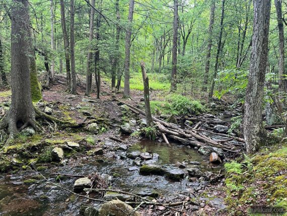
2.5 – Third crossing of Dunnfield Creek (unless you took the bypass). This one might be a little “choose your own adventure” style. We ultimately crossed on the right, just out of this picture.
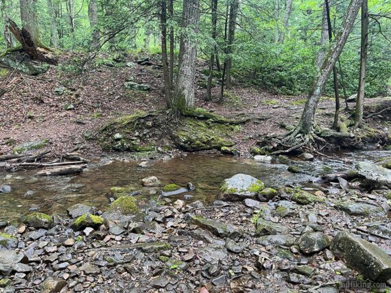
This is looking back at where we crossed – not too hard to pick your way over.
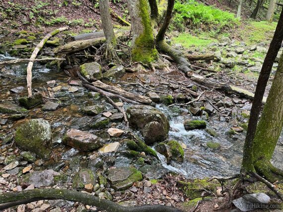
Not long after that is the fourth crossing of Dunnfield Creek (unless you took the bypass). This was a small crossing and easy to waltz over on this day.
Pass a sign for the other end of the Bypass Trail… might not notice it.
2.9 – Cross the creek for the fifth and final time. This was a basic rock hop but that can always change. Keep on truckin’ on Dunnfield Creek (GREEN).
3.2 – After a sign for the creek, Dunnfield Creek (GREEN) starts to turn away from the water.
The trail moves through a rock field. In the past we’ve encountered sloppy mud in this area if it’s been rainy but this last time was just a little bit after the rocks.
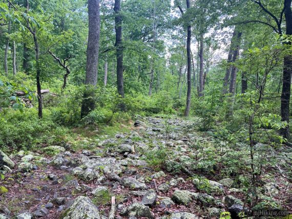
3.7 – Dunnfield Creek (GREEN) starts heading uphill, a little steeply and over some rock slabs, flattens out through some mountain laurel, then heads downhill as it nears the pond.
4.1 – Continue ahead on Dunnfield Creek (GREEN) when the unmarked Sunfish Fire Road comes in from the right.
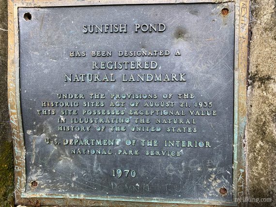
Dunnfield Creek (GREEN) ends at the Appalachian Trail (WHITE) where there is a sign and a plaque.
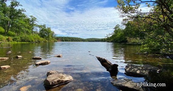
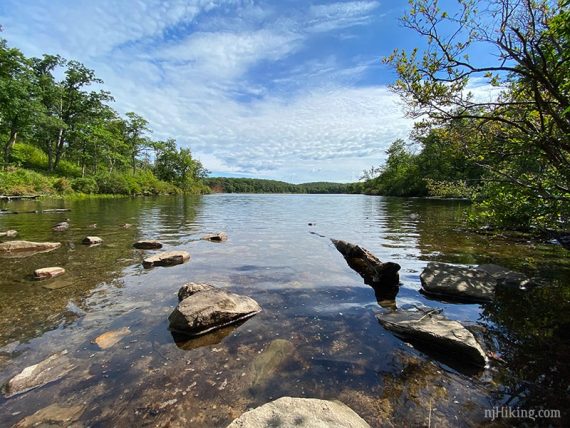
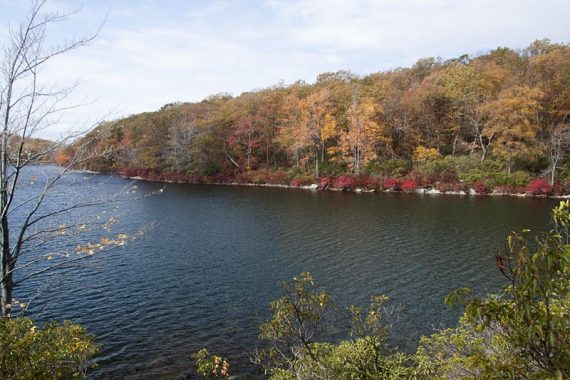
Turn RIGHT towards Sunfish Pond. At the edge is a small open area with a view of the pond and a wooden bench.
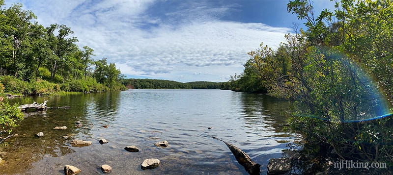
If this is crowded (good possibility) try heading around the left/north side of the pond a bit on the very rocky Appalachian Trail (WHITE) to find a spot.
The Sunfish Fire Road around the right/south side veers away from the pond so it doesn’t offer any break spots at the water’s edge unless you go up to Buckwood (BLUE).
**See below for an optional add-on loop from this point that uses Buckwood (BLUE) to go around Sunfish Pond.**
When ready to head back from Sunfish Pond, retrace your steps to the two signs and start following Appalachian Trail (WHITE).
[Dunnfield Creek (GREEN) goes to the left, where you just came from. Appalachian Trail (WHITE) also continues north around the pond…. all the way to Maine…]
4.8 – Continue following Appalachian Trail (WHITE) as it veers LEFT past Douglas (BLUE) near a trail kiosk and sign with “Appalachian Trail to Route 80”. [An outhouse may be available at the backpacker campsites.]
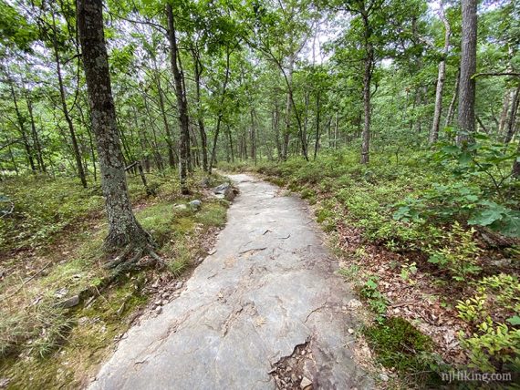
The Appalachian Trail is very rocky and briefly becomes a long stretch of flat rock.
6.4 – Continue following Appalachian Trail (WHITE). [Holly Springs (RED) and Fairview (YELLOW/formerly Beulahland) cross the trail].
7.5 – Continue following the Appalachian Trail (WHITE) as it passes the start of Dunnfield Creek (GREEN) on the left, from earlier on in the hike.
Retrace the route from earlier on the Appalachian Trail (WHITE) back to the parking lot.
**Optional add-on loop**
Sunfish Fire Road/Buckwood (BLUE)/Appalachian Trail: Adding a loop around the pond will make the hike 9.5 miles total.
Return back to the Sunfish Fire Road that was passed on Dunnfield Creek (Green) just before the pond.
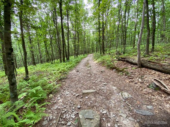
Follow the Sunfish Fire Road north for about .6 miles until Buckwood (BLUE) starts on the left (there is a small pile of rocks).
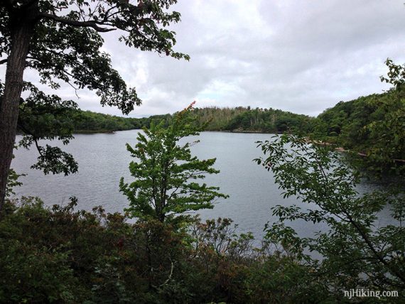
Sunfish Pond from Buckwood (BLUE):
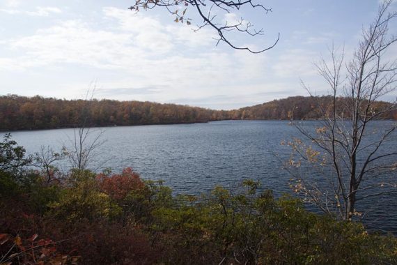
Follow Buckwood (BLUE) to the edge of Sunfish Pond, where there are large rock slabs to sit on and enjoy views over the pond.
Continue on Buckwood (BLUE) around the pond until it meets the Appalachian Trail (WHITE). Turn LEFT to now follow the Appalachian Trail and meet-up with the main directions above.
—
Hiked: 6/7/26. Dunnfield + AT loop; same date as 11 years ago – unintentionally.
Hiked: 8/31/20. Dunnfield + AT loop.
Hiked: 6/7/15. Dunnfield + AT loop.
Hiked: 5/9/11. Trail Blog: “Dunnfield Creek – Sunfish Pond – AT”
Hiked: 8/31/08. Trail Blog: “Gap – Garvey Springs to AT North – out and back“
Hiked: 5/11/08. Dunnfield + AT loop.
Hiked: 5/12/07. Trail Blog: “Gap – Sunfish and Beyond“.
Hiked: 9/3/06. Trail Blog: “Garvey Springs to Sunfish then out-and-back north on AT“.
Hiked: 6/11/06. No GPX, trail log entry only Gap – Sunfish Pond.
Updated: 5/2021 – Description changed to reflect that TURQUOISE is now called Buckwood (BLUE); not re-hiked. 9/2020 – Re-hiked, description adjustments, photos added. 7/2020 – Page refreshed, not re-hiked. 8/2016 – Added GPX file for the Dunnfield – AT route.