Hike up the Rattlesnake Swamp Trail to expansive views from the Appalachian Trail and Catfish Fire Tower.
4.9 or 2.0 miles. Rocky and rugged, steep up to the A.T., can be muddy on Rattlesnake Swamp.
| 4.9 miles | This hike guide: Detailed instructions and photos follow below. |
| Shorter | 2.0 – To the viewpoint on the Appalachian Trail and back. Noted below. |
| Nearby; same lot | Raccoon Ridge from Mohican Outdoor. |
| Nearby; overlaps part of this hike | Catfish Fire Tower – Appalachian Trail; Coppermines, Appalachian Trail, Catfish Fire Tower, Rattlesnake Swamp. |
| Nearby | Van Campens Glen; White Lake Natural Area. |
| Nearby Kayak | Catfish Pond (this lot); White Lake Kayak. |
Our two cents:
Solid just-under-5-miles loop that includes a pond, tons of views from a ridge, climbs a fire tower, and has plenty of beautiful rhododendron and mountain laurel blooms in season. Also a terrific spot to enjoy fall foliage.
Rattlesnake Swamp?! Despite the name, the Rattlesnake Swamp trail isn’t any more likely to have a rattlesnake than anywhere else in Jersey – rattlesnakes are found in a few regions of NJ but are rarely seen and are endangered. Way back in 2011 we did spot a rattlesnake on the Rattlesnake Swamp trail but it was no longer among the living.
Enjoy camping? This hike starts at the AMC Mohican Outdoor Center which offers cabins, tent platforms, and walk-in campsites.
Updated: 5/2026 – Minor edits, not re-hiked.
Hike Info:
Map/Book:
Kittatinny Trails is best. Follow along on your smartphone with our Interactive Map link above.
Note: Underlying Google Maps data has an incorrect “Rattlesnake Trail” hiker icon along the Appalachian Trail, nowhere near the actual intersection of the A.T. and Rattlesnake Swamp Trail.
Also, it shows section of unmarked woods road incorrectly as the Appalachian Trail (as of 3/2022). Our Interactive Map waypoints are the correct locations.
50 Hikes in New Jersey contains a similar route from a different parking area.
Parking: N41.03580° W74.99993°
“AMC Mohican Outdoor Center”, 50 Camp Mohican Rd, Blairstown, NJ 07825.
If approaching from Rt 80W, take exit 12 for Rt 521N/Hope Blairstown Road towards Blairstown. Turn L onto Rt 94; R on Mohican Rd; L on Gaisler Rd; R on Camp Mohican Rd. Continue past the visitor center to a large dirt lot on the left.
Restrooms:
Mohican Outdoor Center should have them but we’ve never actually checked as there is a camp toilet 0.3 miles into this route along Mohican Road.
Hike Directions:
Overview: Mohican Road – ORANGE (Rattlesnake Swamp) – WHITE (Appalachian Trail) – Unmarked Trail – ORANGE (Rattlesnake Swamp) – Mohican Road
0.0 – Turn LEFT out of the parking lot and start following gravel Mohican Road. This gated road is only open to vehicles at certain times for access to the boat launch.
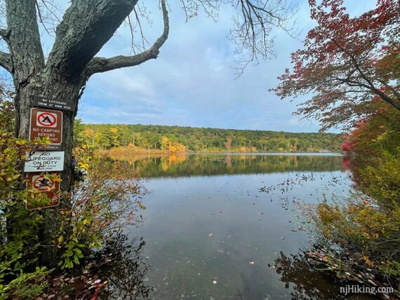
0.2 – Short side trail on the left to an open view of Catfish Pond. This is also the boat launch.
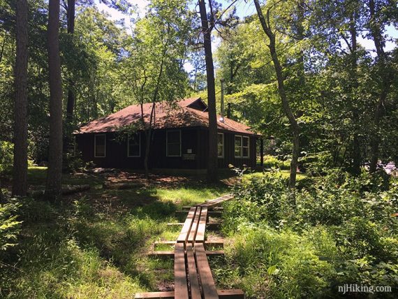
0.3 – Pass camp toilets on the left. Not long after this, veer RIGHT to start following ORANGE (Rattlesnake Swamp). The trail is around the left side of the cabin and is a bit easy to miss.
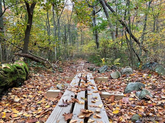
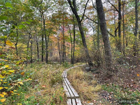
A long plank boardwalk is over potentially wet areas.
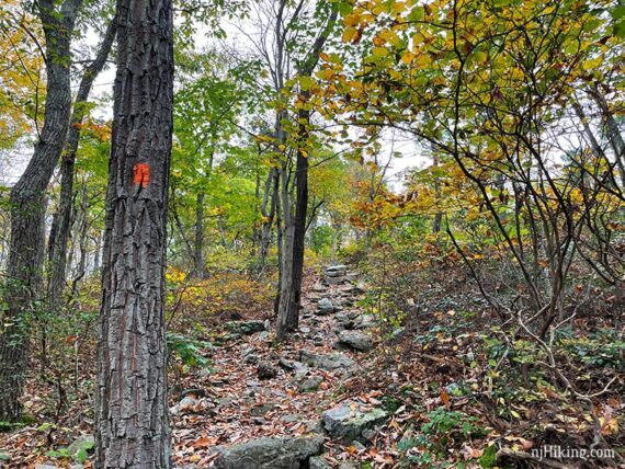
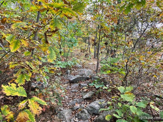
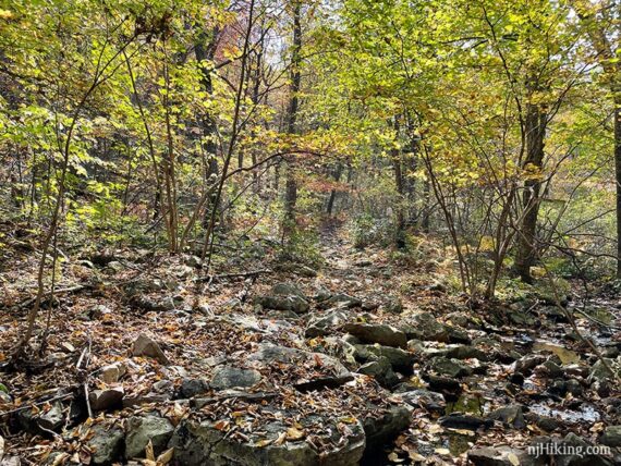
ORANGE (Rattlesnake Swamp) heads steeply up a rocky trail.
0.9 – ORANGE (Rattlesnake Swamp) ends at a junction with WHITE (Appalachian Trail). Looking back at the junction post:
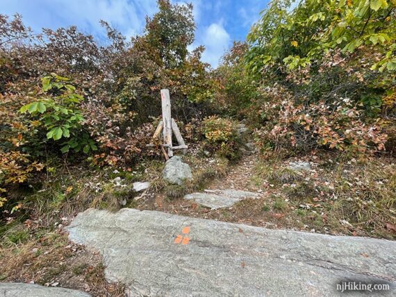
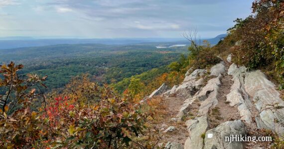
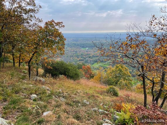
Turn LEFT to start following WHITE (Appalachian Trail) north – but first pause to enjoy the expansive view from the rocky ledge.
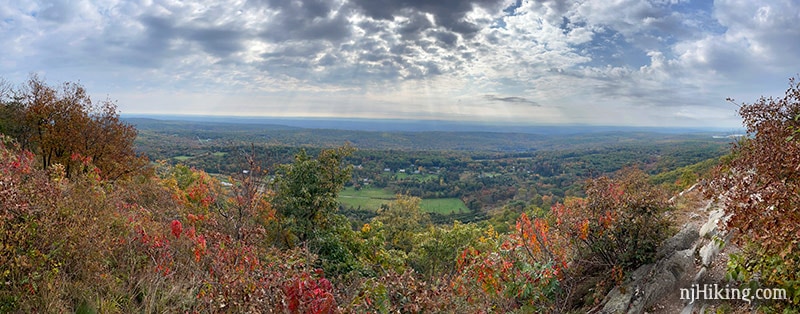
The ridge overlooks houses and fields in the Kittatinny Valley below with tree covered hills stretching out beyond.
Fun Facts: The Kittatinny Valley runs from the Kittatinny Ridge (what you’re standing on) to New Jersey’s Highlands region (Jenny Jump Mountain, Allamuchy Mountain).
“Kittatinny” is from the Lenape Indian word, kitahtëne, meaning endless or big mountain. [Source: Kittatinny Valley – Wikipedia].
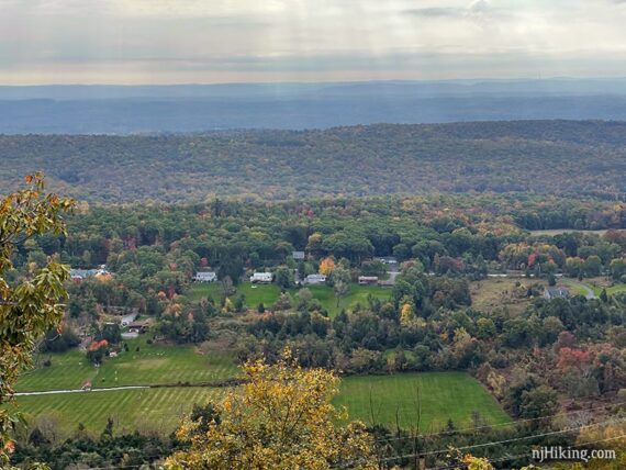
The rocky ridge makes for interesting photos. Off on the right (south) Lower Yards Creek Reservoir can be seen in the distance.
// Shorter option: 2.0 miles total – turn around and retrace the route from here. //
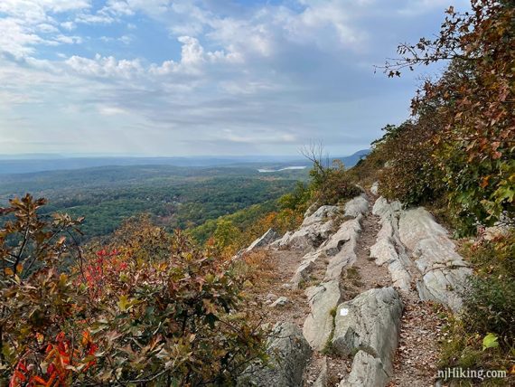
1.5 – Viewpoint. There are several partially-limited views before and after this. These are marked on our Interactive Map but not noted in this description.
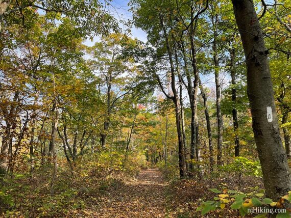
Continue following the rocky WHITE (Appalachian Trail).
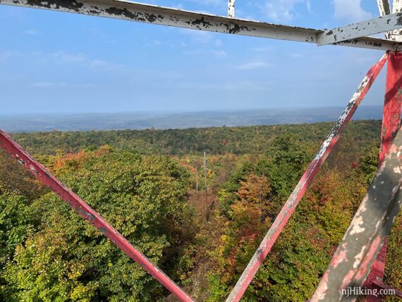
1.9 – Arrive at Catfish Fire Tower. A picnic table is off to the side.
Fun Facts: The 60-foot tower was built in 1922 and is generally manned March through May and October through November (fire season).
It’s at the highest elevation of all the towers in New Jersey – 1,555’ – but is not the tallest in the state.
For a great article about the Catfish Fire Tower and fire observers see “Smoke Detector“ (New Jersey Monthly Magazine).
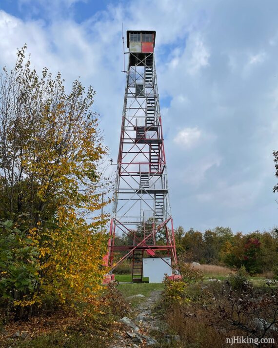
The fire tower has metal steps with open grating.
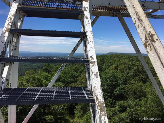
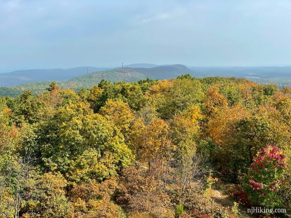
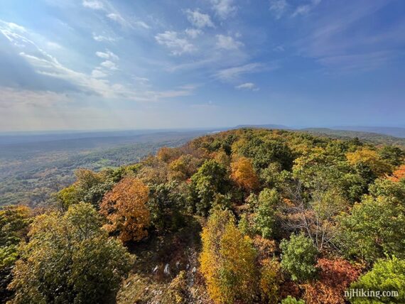
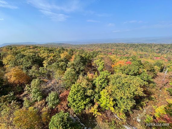
Even part-way up the tower offers outstanding long-distance views in every direction.
The hills of the Kittatinny Ridge that the Appalachian Trail follows in New Jersey are obvious when looking north.
Looking south and back over the section of the Appalachian Trail you just hiked. East looks over the Kittatinny Valley below the ridge.
West looks over the Delaware Water Gap National Recreation Area in New Jersey and into Pennsylvania.
In every direction you are also looking over TONS – seriously, tons – of excellent trails… for hike ideas across this region check the “Delaware Water Gap Area and Northwest Parks” section of our Hiking in NJ page.
Looking down the side of the metal tower at the shadow on the ground below.
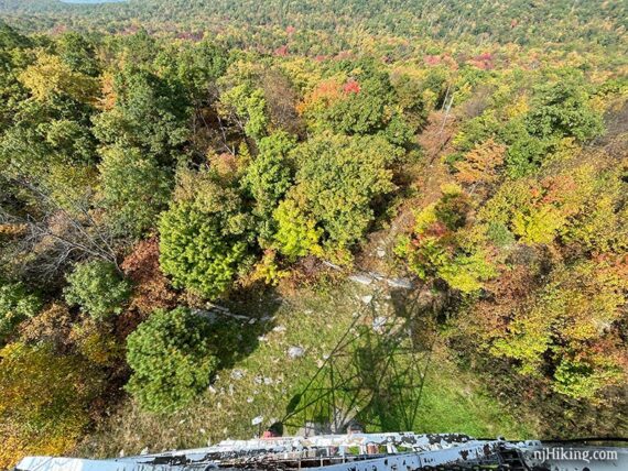
When ready to get moving, continue following WHITE (Appalachian Trail).
2.2 – Follow Appalachian Trail (WHITE) as it heads to the LEFT. An unmarked woods road continues straight.
2.4 – Turn LEFT and now follow another unmarked woods road. [Appalachian Trail (WHITE) continues ahead… all the way to Maine.]
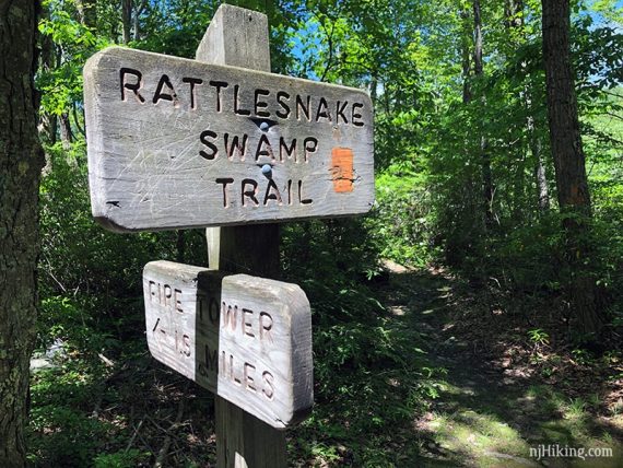
2.6 – Signpost for “Rattlesnake Swamp Trail”. Turn LEFT to start following Rattlesnake Swamp (ORANGE).
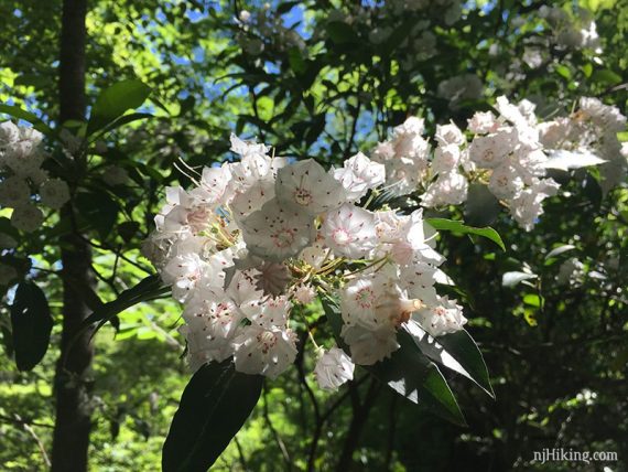
Rhododendron and mountain laurel thickets line the Rattlesnake Swamp Trail. They grow so densely that the trail becomes a long tunnel in some sections.
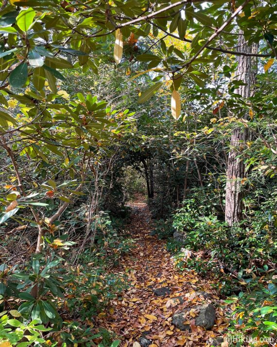
With the right timing you may find spectacular flowers in bloom all along the trail (May-June for laurel, June-early July for rhodos).
Continue following ORANGE (Rattlesnake Swamp) which can be rocky and/or very muddy in spots.
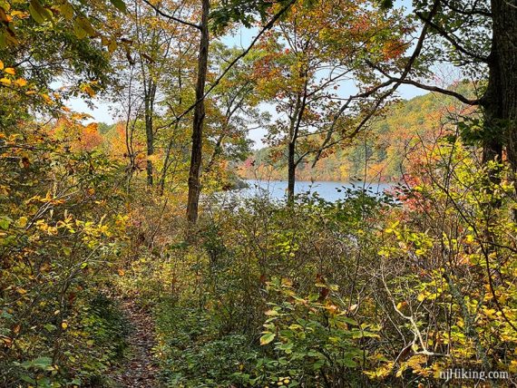
Catfish Pond eventually peeks out through the trees on the right.
4.5 – Signpost indicating “Rattlesnake Swamp/AT” to the left and “Camp Mohican” to the right. Turn RIGHT to now retrace the route through Camp Mohican.
4.6 – Arrive in the main camp area again, pass the cabin and turn LEFT onto the gravel road.
Follow the road through camp, past the toilet and Catfish Pond view again, back to the parking lot.
—
Hiked: 10/15/21.