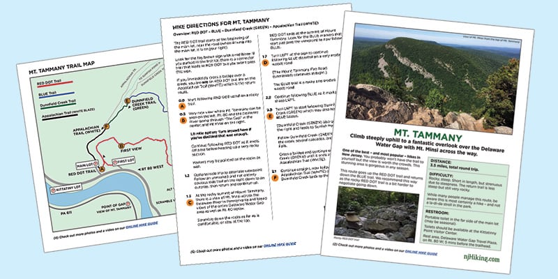
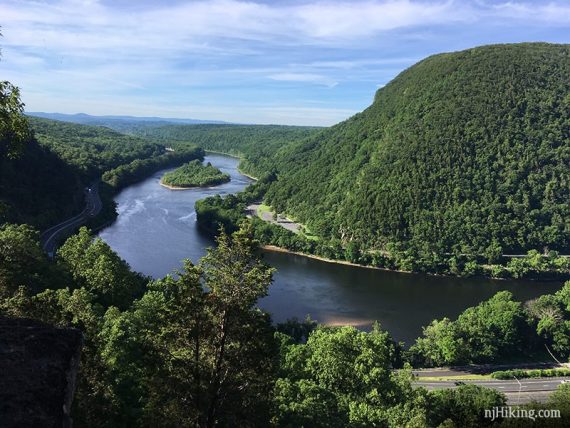
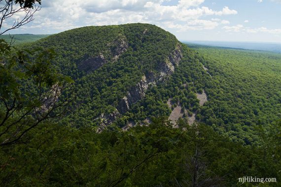
Climb steeply uphill to a fantastic overlook of the Delaware Water Gap and Mt. Minsi across the way.
3.5 miles, total round trip. Rocky, steep. Short in length, but strenuous due to steepness. The return trail is less steep but still very rocky.
Mt. Tammany Hike Options:
This route goes up the RED DOT trail and returns down the BLUE trail. We recommend this way as the rocky RED DOT trail is a bit harder to negotiate going down.
| 3.5 miles | This hike guide. Detailed instructions, photos, and video follow below. |
| Shorter, 1.0 mile | Still steep; to the first viewpoint and return. Noted below. |
| Easier variation: | Up/down on BLUE. Miss a view on RED DOT and it’s a less interesting hike – but it’s easier and arrives at the same viewpoint. |
| Variation, 1.2 miles | Dunnfield Creek Waterfall only; does not summit Mt. Tammany. Noted below. |
| Nearby, same lot | Sunfish Pond. |
| Challenging, same lot | Check out Mt. Tammany and Sunfish Pond or our “Mind The Gap“ hike. |
| Nearby Hikes | Appalachian Trail – Sunfish Pond to Raccoon Ridge; Sunfish Pond – Garvey Springs and Douglas Loop; Laurel Falls; Mt. Minsi; Jenny Jump – Ghost Lake; Jenny Jump Trail. |
Our two cents:
This is one of the most popular hikes in New Jersey. You probably won’t have the trail to yourself but the view is worth the crowds. This is a stunning area of New Jersey and is gorgeous in any season.
And you never know what you are going to get when you hit the top…
We’ve been there on beautiful fall days with only a couple people quietly taking in the view… while one time we arrived to find tons of people, a guitar player belting out tunes, and people passing around a box of donuts. Ahhh, Jersey.
Note: Many people manage this route, but please be aware this is most certainly a hike – and not a la-di-da stroll in the park.
Updated: 10/2024 – Re-hiked, minor edits Older change log at page bottom.
Fun Fact:
The Delaware Water Gap is nowhere near the state of Delaware, as many people often believe. A “water gap” is when a river carves a notch through a mountain range.
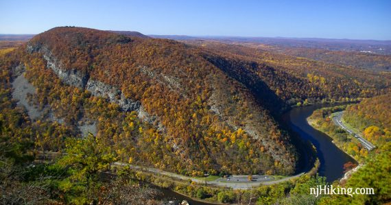
At the border of New Jersey and Pennsylvania, the Delaware River has cut through the Kittatinny Ridge leaving a large gap with Mt. Tammany on the New Jersey side, and Mt. Minsi on the Pennsylvania side.
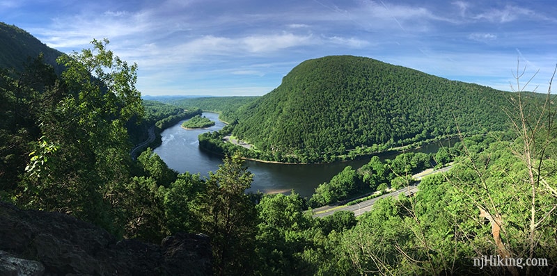
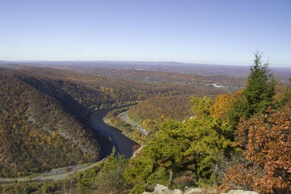
View of Mt. Minsi and the Delaware Water Gap at the first viewpoint.
Map:
Kittatinny Trails. Follow along on your smartphone with our Interactive Map link above.
This hike is within Worthington State Forest (State of New Jersey) as well as The Delaware Water Gap National Recreation Area (National Park Service) so resources can be found on both park sites.
Below we’ve overlaid our GPS data on a 3D topographic map for a unique overview of the hike (not suitable to use as a trail map though!).
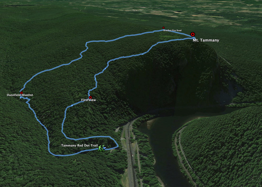
The hike starts at the bottom by the highway then climbs to the first view, then continues up Mt. Tammany to tower above the Delaware River. Return more gradually on BLUE and then along Dunnfield Creek.
NEW! Downloadable Mt. Tammany Hike Guide
Get our new enhanced guide PDF! It features an exclusive, easy to understand trail map plus turn-by-turn hike directions, parking and restroom locations, photos, and more. It’s perfect for beginner or casual hikers or anyone that wants a compact format to print out or use on a mobile phone.
Books:
This hike with a map diagram can be found in 50 Hikes in New Jersey and in Hike of the Week.
A version including Sunfish Pond is in Hiking New Jersey (2023). Info on all the trails in the area can be found in Kittatinny Trails and the The New Jersey Walk Book.
Parking: N40.97213° W75.12592°
Dunnfield Creek Natural Area, I-80, Columbia, NJ 07832. Route 80 West to just before the last exit in New Jersey (exit 1). On the right is a brown sign for Dunnfield Creek Natural Area.
There’s the first parking lot, then a larger main lot. The exit road is one way so you can’t backtrack to a passed lot unless you get back onto Rt 80 and come around.
If both the first and main lots are full, try the parking area at the Kittatinny Point visitor center and walk back to the trailhead in the main lot (~about a 10 min walk).
Kittatinny Point Visitor Center: Head back out onto Rt. 80 from the Dunnfield lot and take the very next exit right, Exit 1 towards Millbrook/Flatbrookville. Then make a sharp left like you are going to go around to 80 E, but instead of merging onto 80, immediately head to the right into the visitor center on River Road.
Overview of the parking lots as it’s just easier to show it than explain it:
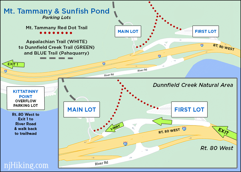
Parking may fill EARLY on nice weekends. If those three lots are full you may be able to wait a moment for a spot to open up, use the Hiker Shuttle if running, or switch to a nearby hike listed above. Do not park on roadsides, including Rt. 80.
Seasonal Hiker Shuttle (Free): Runs in season between Kittatinny Point Visitors Center and the DWG Park and Ride just over the bridge in Pennsylvania. Check www.gomcta.com for schedules and routes.
Restrooms:
Portable toilets in the far side of the main lot (there as of 6/2026). Composting toilets should be available in the parking lot at the Kittatinny Point Visitor Center.
There is a rest area on Rt. 80 W about 5 mins before the trailhead: “TA Travel Center” (McDonalds/Exxon) is next to the “Delaware Water Gap Travel Plaza” (Chik-Fil-A / Starbucks / Sunoco).
There are no signs for the rest areas, just exit signs listing the gas / food at each. Either take exit 4-A-B-C to Simpson Road, or continue past them and turn right onto Hainesbug Road (comes up quick and is a non-descrip turn), then immediately turn right onto Simpson Road and follow that back. Just past a maintenance building area is the travel plaza.
Easy 1.2 mile variation (not up Mount Tammany):
For a scenic short hike to just Dunnfield Creek Falls (that DOES NOT climb up Mt. Tammany):
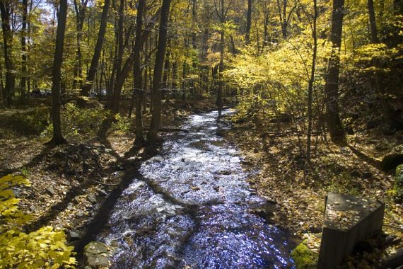
Go to the far end of the main parking lot, head over the bridge, and walk along Dunnfield Creek on the Appalachian Trail (WHITE). At the trail split (big ole sign there, can’t miss it), bear right on Dunnfield Creek (GREEN) to another bridge over the creek for Dunnfield Falls and water cascades. Retrace the route back to the lot.
This is an option if some people in a group don’t want to do the whole Mount Tammany hike. The full route to Mount Tammany passes the falls and bridge on the way back so this could be a meeting area before hiking back along the creek together.
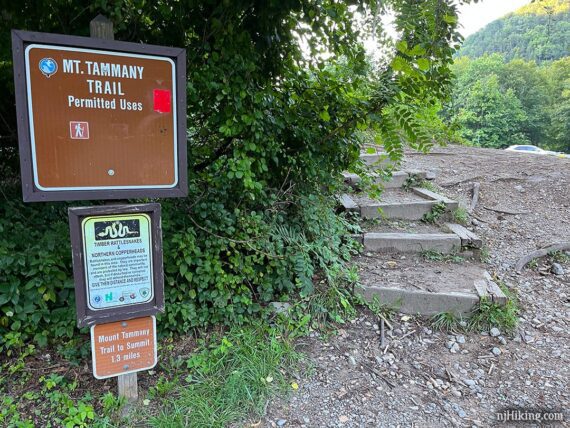
Locating the Mt. Tammany RED DOT Trail:
The RED DOT trail starts at the beginning of the main lot, near the road (when driving into the main lot, it is on your right).
Look for the big brown sign with a red blaze. If you parked in the first lot, there is a connector trail that leads to RED DOT but you won’t pass this sign.
NOTE: At the far end of the main lot is the start of another trail. People often mistake this as the trail to the summit of Mount Tammany. If you immediately cross a bridge over a creek, you are not on RED DOT but are on the Appalachian Trail (WHITE) which leads to Dunnfield Creek (GREEN).
While Mount Tammany can be reached from the BLUE trail off of Dunnfield Creek (GREEN) (and is the return route of this hike), people are usually looking to do the RED DOT trail up to the top of Mount Tammany.
We’ve run into people going the opposite way, miles away along Dunnfield (GREEN) or the Appalachian Trail, that thought they were hiking to Mount Tammany… so make sure to find the right trail.
Directions for Hiking Mount Tammany:
Overview: RED DOT – BLUE – Dunnfield Creek (GREEN) – Appalachian Trail (WHITE)
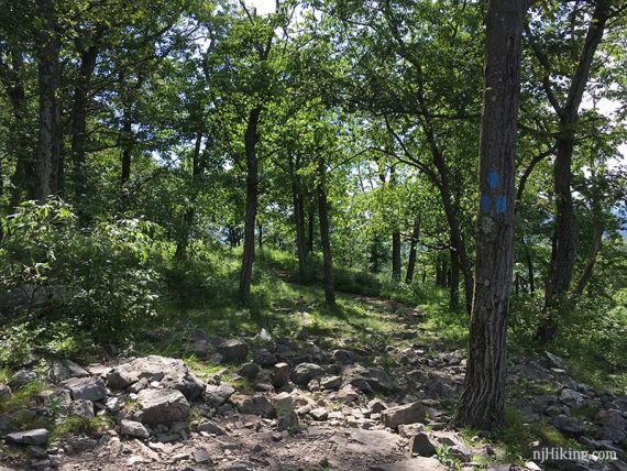
The RED DOT Trail uses a red dot on white marker. Depending on the trail map, the BLUE trail may be BLUE DOT and on newer maps it’s BLUE “Pahaquarry Trail” – but for simplicity we’ve kept it as BLUE.
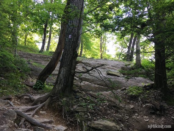
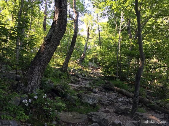
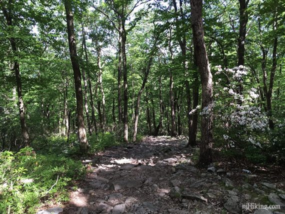
0.0 – Start heading uphill following RED DOT on a rocky trail.
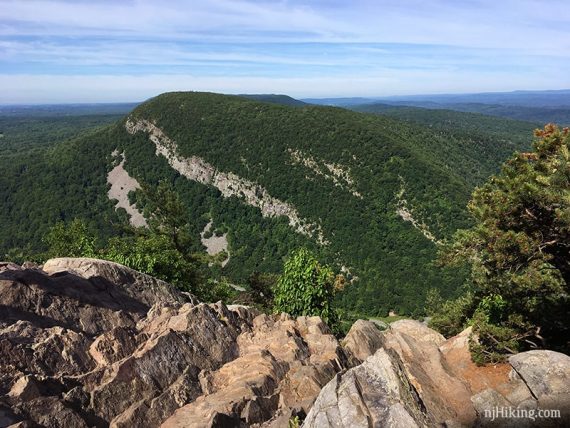
0.5 – Very nice view where Mt. Tammany can be seen on the left, Rt. 80 and the Delaware River going through “The Gap” in the center, and Mt Minsi on the right.
// Shorter 1.0 mile option: Turn around here if you’ve decided that was enough hiking for you. //
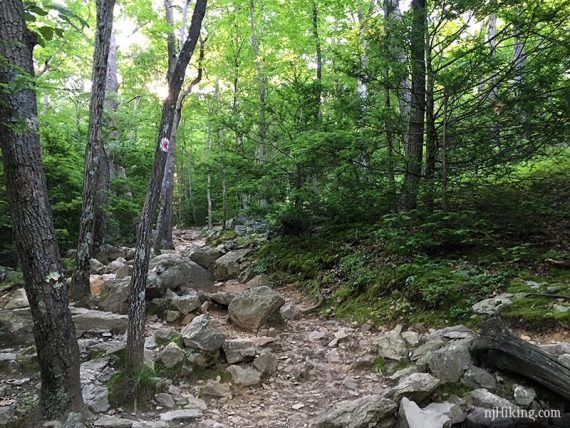
Continue following RED DOT as it levels off a bit before heading up a very rocky section.
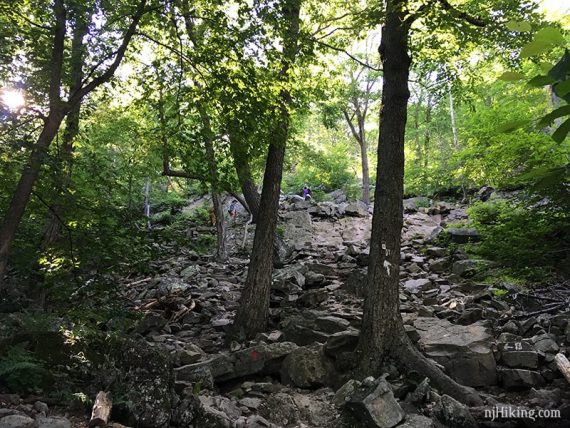
Pay attention on the rocky sections for markers to guide you through – they may be painted on the rocks as well.
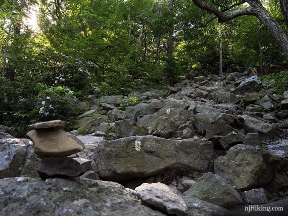
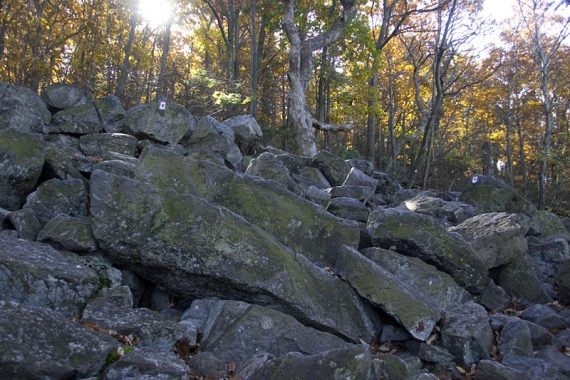
RED DOT trail continues making its way up.
1.2 – Optional side trip to alternate viewpoint: An unmarked and not entirely obvious side trail is on the right. Follow this downhill, with light scrambling, to an overlook for a slightly different angle to view Mt. Minsi.
The main view you’ll arrive at shortly is a bit more straight-on, but this one offers a flatter, wider area to sit. An out-and-back to this point only adds 0.1 mile roundtrip.
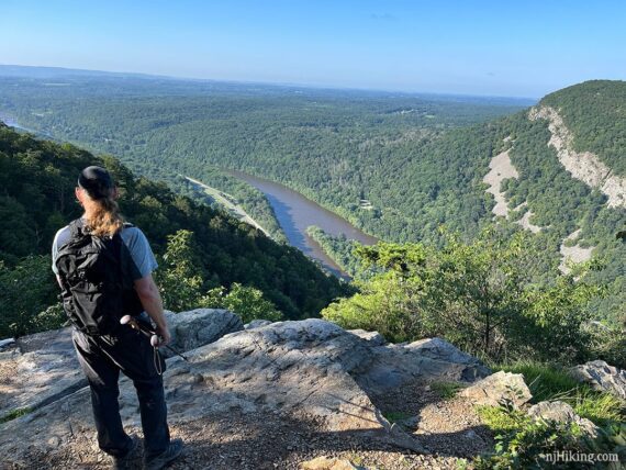
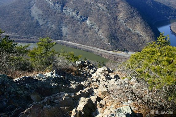
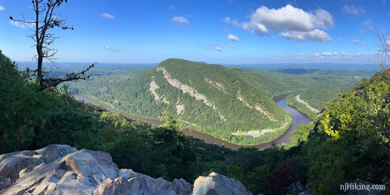
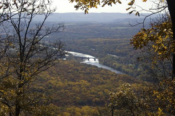
1.3 – At the rocky summit of Mount Tammany, there is a view of Mt. Minsi across the Delaware River in Pennsylvania and broad views of the entire Delaware Water Gap area as well as Rt. 80 below.
Fun Fact: Mt. Tammany is 1,527′ high… but while this point is what is referred to as the summit – it actually isn’t. That point is technically off of the BLUE trail somewhere amongst the trees so we’ve never bothered to go looking for it ’cause the view here is what you want.
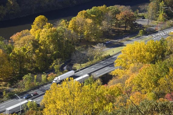
The Delaware River curving through the Gap, with Rt. 80 running alongside it.
Zoom into Rt. 80 below the RED DOT trail:
Because the view from Mount Tammany is of it’s twin, Mt. Minsi, photographs of Minsi are usually used as the featured photo for hiking Tammany. Therefore hikers may not realize a photo like the one below is of Minsi and not Tammany. And vice versa for the Mt. Minsi hike.
This is what Mount Tammany looks like, as seen from Mt. Minsi. They are a mirror image, and it’s easy to see how the Delaware River just cut through the same rock.
Fun Fact: Mt. Tammany is named after the Lenni Lenape chief Tamanend [Source: Wikipedia – Mount Tammany].
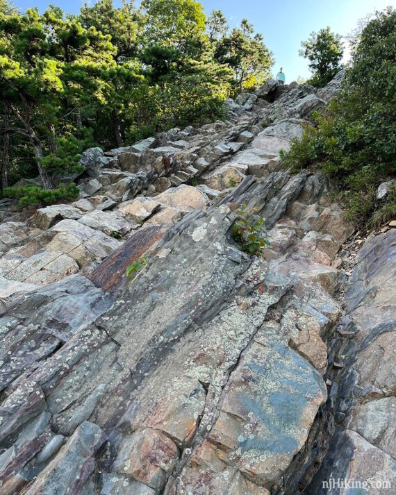
Scramble down the rocks as far as is comfortable, or stay at the top. Of note, the rocks seemed just a bit slippery from being worn down from foot traffic which we never noticed before (8/2023).
The view from the top looking down the rock scramble:
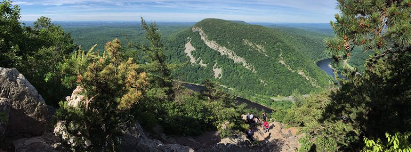
This is a panorama from the end of the scramble down. It’s a good spot to watch hawks and turkey vultures ride the thermal air currents. And, of course, have a snack.
Looking up back up to the top after scrambling down (up is easier than down):
“Mt. Tammany Trail” and an arrow painted on a rock is for hikers coming up the other direction, on the BLUE trail. You’ll pass this as you continue towards BLUE, or if you overshot the viewpoint.
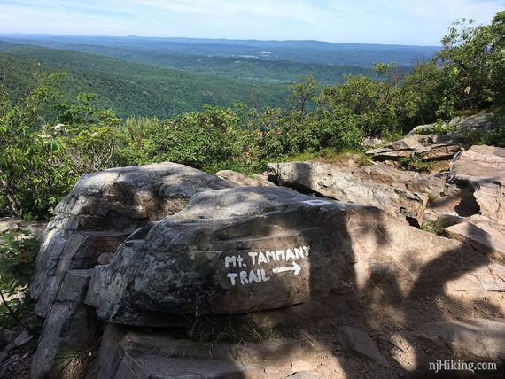
RED DOT ends at the summit of Mount Tammany. Look for the BLUE markers that start just past the viewpoint to now follow BLUE.
/// Variation: Retrace RED DOT back – going downhill over the rocks is steep and can be tricky so most people take BLUE DOT back as it is more gradual. ///
Zoom into a view of a bridge over the Delaware River from the BLUE trail just beyond the summit. Easy to miss this depending on tree cover.
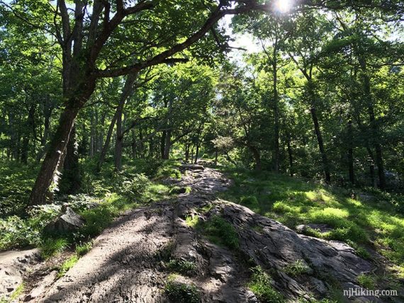
1.7 – Turn LEFT at the sign to continue following BLUE downhill on a very eroded woods road. [The Mount Tammany Fire Road (unmarked) continues straight.]
The BLUE trail is a rocky and eroded woods road.
2.2 – Continue following BLUE as it marks a sharp LEFT.
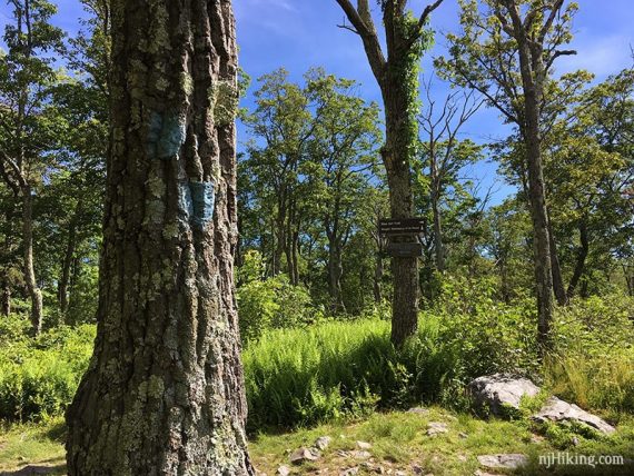
2.9 – Turn LEFT to start following Dunnfield Creek (GREEN) which may also have BLUE blazes. [Dunnfield Creek (GREEN) also goes to the right and leads to Sunfish Pond.]
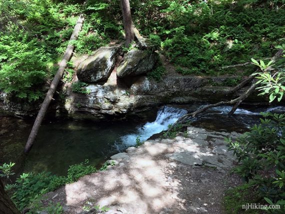
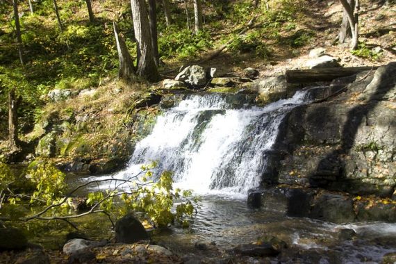
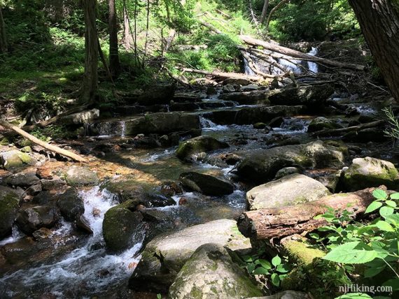
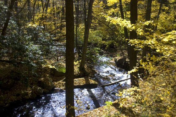
The creek, several cascades, and Dunnfield Falls come into view.
There is a wooden bench looking over the cascades.
Looking down on the falls from the trail…. X marks the spot (that’s not one of us on the tree… I liked how he worked with the photo so I didn’t Photoshop ’em out).
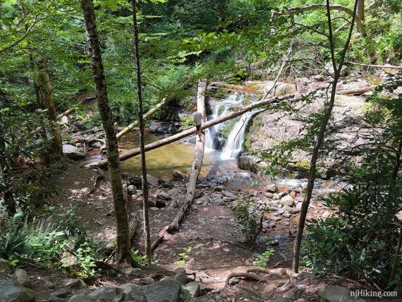
Dunnfield Creek (GREEN) heads down towards the bridge and past the falls. Below is an older photo of the falls (Oct. 2009) before trees fell over it. By our hike in Oct. 2010 the tree at the top left of the falls had fallen across it.
Continue following Dunnfield Creek (GREEN) over a bridge.
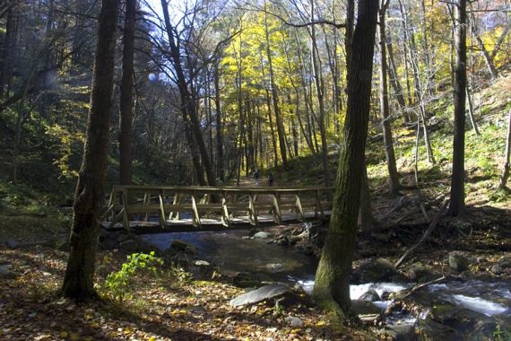
Dunnfield Creek (GREEN) ends at the Appalachian Trail (WHITE).
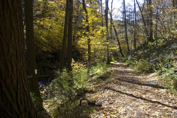
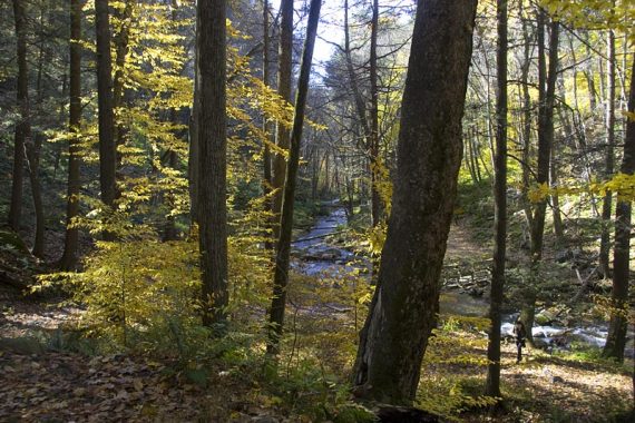
3.1 – Continue straight, now following the Appalachian Trail (WHITE) along pretty Dunnfield Creek and back to the parking lot.
—
Hiked 10/25/24. Peak fall foliage.
Hiked 8/19/23. As part of Mt. Tammany + Sunfish loop.
Hiked 6/9/19. Mt. Tammany, with A.
Hiked 8/22/15. Mt. Tammany, Fire Road, Sunfish, with M.
Hiked 10/23/10. Trail Blog: “Mt. Tammany and Sunfish Pond in the Fall“
Hiked 10/25/09. With Mt. Minsi – Mind The Gap.
Hiked 3/22/09. Trail Blog: “Water Gap: Mt. Tammany, Fire Road, Sunfish Pond, Dunnfield Creek“
Hiked 8/03/08. Trail Blog: “Water Gap – Mt. Tammany to Fire Road to Sunfish to Green“
Hiked 1/22/06. Trail Blog: “Delaware Water Gap – Mt. Tammany Summit and Beyond“
Hiked 10/1/00. with B., T., B.B., and Bela.
Hiked 9/1998.
—
Updated: 9/2023 – Edits and improvements, added photos; re-hiked to Tammany as part of the longer loop with Sunfish Pond 8/2023. 7/2020 – Page refreshed, not re-hiked. 2/2020: All trails are open, and the wildfire from 2/24/20 mainly burned underbrush. 6/2019: Re-hiked the RED DOT and BLUE loop, description updated, added photos, updated GPX file and Interactive Map (same route, just replacing our 10-year-old file (!) with newer GPS data.)