A steep but short approach to Sunfish Pond via Garvey Springs, then expansive views along the Appalachian Trail at Raccoon Ridge.
11.8 or 8.6 or 6.2 or 3.0 miles, total round trip. Versions noted in the description below. Rocky trail surface. Garvey Springs is steep; AT is mostly level until approaching Coppermines if you do the long loop.
| 11.8 miles | This hike guide: Detailed instructions and photos follow below. |
| Shorter | 8.6 miles: Past Raccoon Ridge to a view on the Appalachian Trail and back. 6.2 miles: To Sunfish Pond and Raccoon Ridge viewpoint and back. 3.0 miles: To Sunfish Pond via Garvey Springs and back. |
| Longer, from this lot | ~16 miles – stay on the AT thru Catfish Pond Gap to Catfish Fire Tower out-and-back. |
| Nearby, this lot | Sunfish Pond – Garvey Springs and Douglas Loop; Laurel Falls. |
| Nearby | Coppermines – Rattlesnake Swamp; Van Campens Glen, Catfish Fire Tower; Rattlesnake Swamp – Catfish Fire Tower Loop; Raccoon Ridge from Mohican Outdoor; Sunfish Pond (via Dunnfield), Mt. Tammany |
Our two cents:
Garvey Springs is the short-but-steep way to get to Sunfish Pond (instead of the longer approach via Dunnfield or the Appalachian Trail). Most will want to turn around at the Raccoon Ridge viewpoint, but this long route is enjoyable for avid hikers.
We like to use the Garvey Springs approach when prepping for hiking trips since it puts a steep climb at the start/finish and the Appalachian Trail allows for mileage flexibility.
Raccoon Ridge on Mount Mohican is one of the best places in New Jersey to watch the fall hawk migration and is also a terrific vantage point for fall foliage.
Updated: 5/2026 – Minor edits; partially re-hiked as part of Raccoon Ridge from Mohican. Older change log at page bottom.
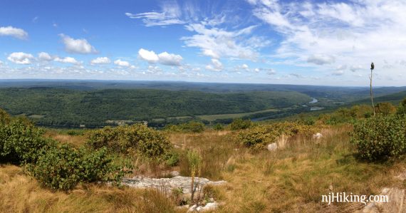
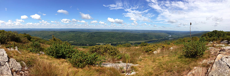
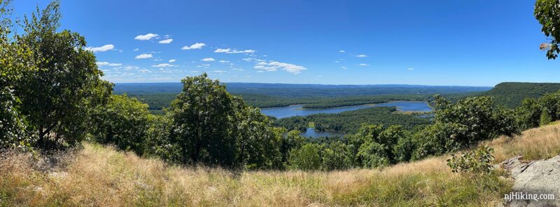
Panorama from Raccoon Ridge:
Hike Info:
Map/Books:
Kittatinny Trails is best. Follow along on your smartphone with our Interactive Map link above.
A shorter variation to Raccoon Ridge that excludes Sunfish Pond is in Hike of the Week.
Restrooms:
From the lot, walk into the campground area a bit and a bathroom building is on the left.
Parking: 41.01317 -75.08217 [Douglas lot; Old Mine Road]
“Douglas Parking Lot Trailhead”, 134 Old Mine Rd, Columbia, NJ 07832. Rt. 80 W to the last exit in NJ (1) for Millbrook/Flatbrookville which bears right onto River Road/Old Mine Road.
Cross a one-lane bridge with a stop light and continue on Old Mine Rd for about 4 miles, passing a sign for Worthington and the driveway to the park office. The lot will be on the left and has a sign.
Hike Directions:
Overview: Garvey Springs (ORANGE) – Appalachian Trail (WHITE) – Buckwood (BLUE) to view of Sunfish – Appalachian Trail (WHITE) – Coppermines (RED) – Coppermines/Kaiser connector (BLUE/RED) – Kaiser (BLUE) – Appalachian Trail (WHITE) – Garvey Springs (ORANGE)
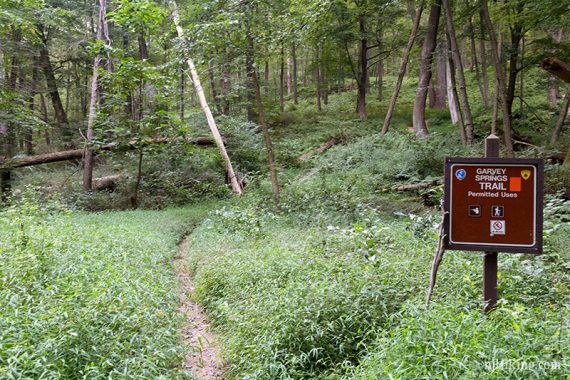
0.0 – From the parking area, cross Old Mine Road and walk to the LEFT past the cement guardrails to start following Garvey Springs (ORANGE).
At a trail bend Laurel Falls off on the right. It is easy to overlook this if the water flow is low. Get a better view of these falls from the Douglas Trail that starts directly across from the parking lot.
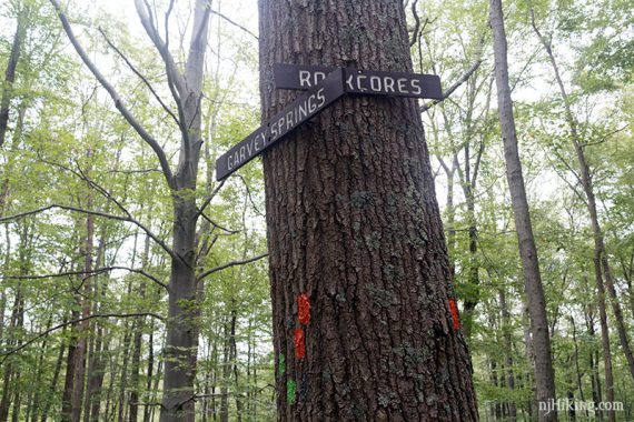
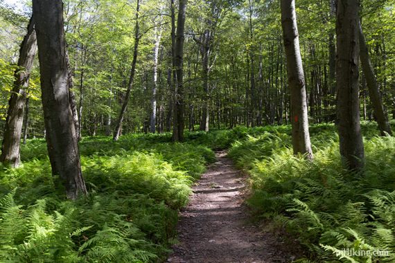
0.6 – Continue on Garvey Springs (ORANGE) as it turns left and is co-joined with Rock Cores (GREEN) for a bit. It levels off for a little break before turning right and continuing steeply uphill.
Continue on Garvey Springs (ORANGE). Tons of ferns in this area.
1.3 – Garvey Springs (ORANGE) ends (just after passing an unmarked trail that veers off to the right). Turn RIGHT and now follow Appalachian Trail (WHITE) briefly.
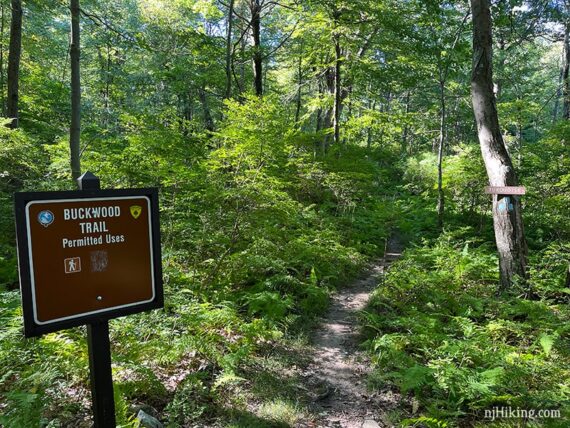
1.4 – Turn LEFT and follow Buckwood (BLUE) over to a view of Sunfish Pond. [Buckwood was originally called Turquoise].
[Alternate: stay on Appalachian Trail (WHITE) to check out the pond instead; skipping Buckwood (BLUE)]
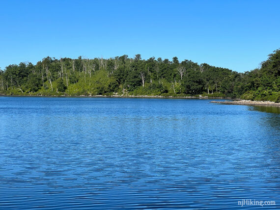
Follow Buckwood (BLUE) as it meanders over towards Sunfish Pond. In a small open area, Buckwood (BLUE) leaves to the left but continue ahead towards the rocky outcrop with a view of the pond.
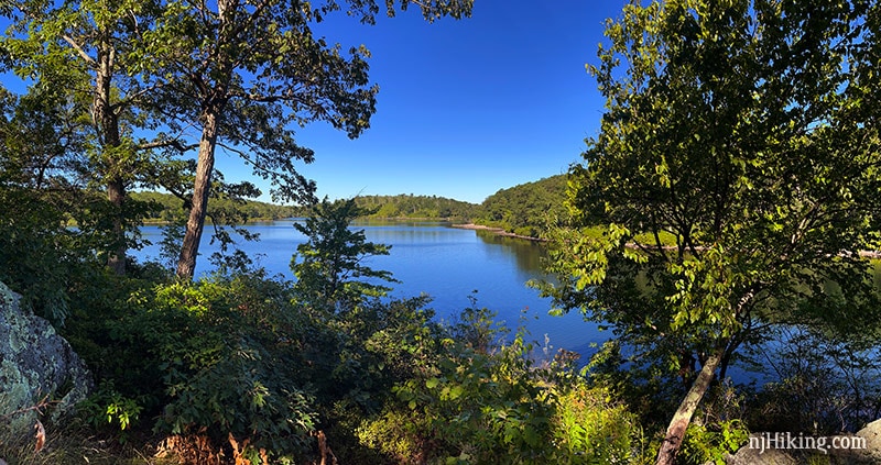
The rocky outcrop makes for a nice break spot. Or continue ahead on a casual trail down to the level of the pond.
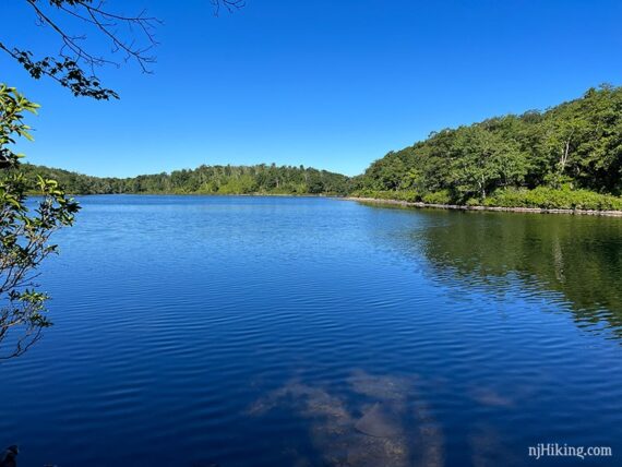
A zoom into Sunfish Pond. The Appalachian Trail (WHITE), heading south, hugs the shoreline. When ready, retrace Buckwood (BLUE) back to Appalachian Trail (WHITE).
1.6 – From Buckwood (BLUE), turn RIGHT to again follow the Appalachian Trail (WHITE). [Pass Garvey Springs (ORANGE) on the left.]
// 3 mile route: Turn left and take Garvey Springs (ORANGE) back down to the lot. //
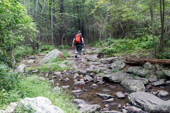
Continue following Appalachian Trail (WHITE). Cross a stream by stepping on large rocks.
Note: If you are using our Interactive Map and happen to zoom in, you’ll notice that Google shows the AT in its very old location. Our track is on the correct route. Many years ago the Appalachian Trail was rerouted from the intersection with Garvey Springs until the stream.
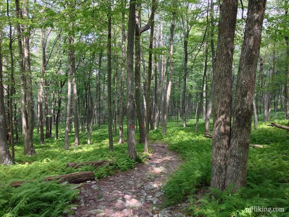
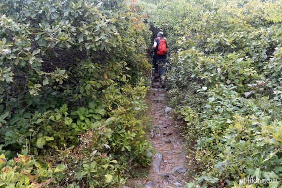
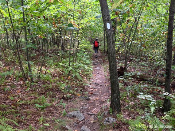
Occasionally the trail is narrow and crowded with vegetation.
Pass a limited view on the left towards Pennsylvania before crossing a power line cut.
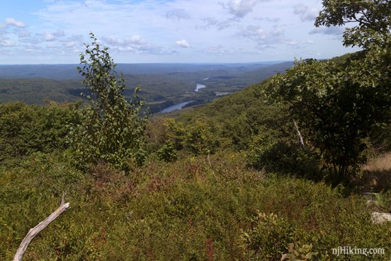
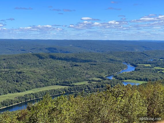
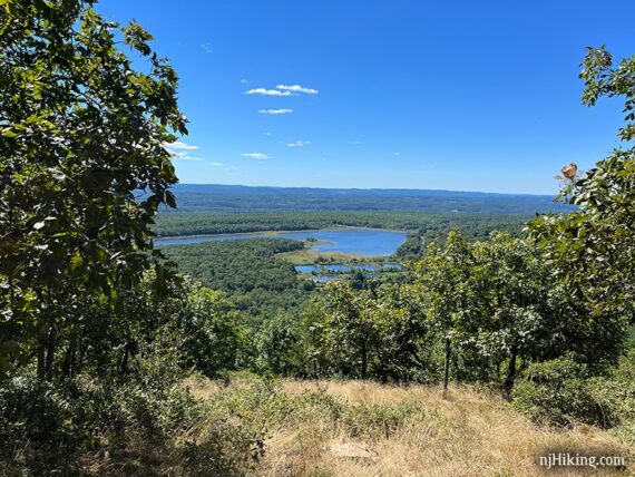
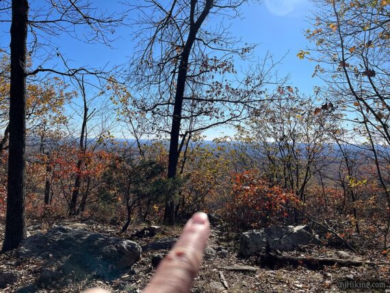
3.3 – Arrive at a wide open rocky area on Mount Mohican called Raccoon Ridge, marked with a large pile of rocks.
There may be an owl decoy on a tall poll (not there 10/2025). The decoy attracts hawks so they can be counted during fall migration.
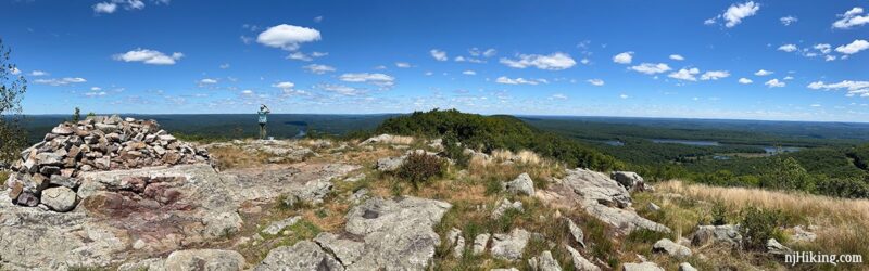
To the right is a panoramic view east over New Jersey with Lower Yards Creek Reservoir in the valley below. Upper Yards Creek Reservoir is on the long flat area to the far right.
Left looks west/northwest towards Pennsylvania with the Delaware River running between PA and NJ.
Poxono Island is at the bend in the river to the north.
// 6.2-mile route: Turn around here and retrace the Appalachian Trail (WHITE) back to the intersection with Garvey Springs (ORANGE). Turn RIGHT and follow it back down to the lot. //
Continue following Appalachian Trail (WHITE).
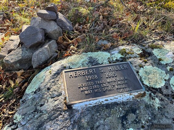
3.4 – On the left on a rock near a cairn, is a plaque for Herbert S. Hiller – trail maintainer and the 23rd Appalachian Trail end-to-ender. This is easy to waltz on by and not notice.
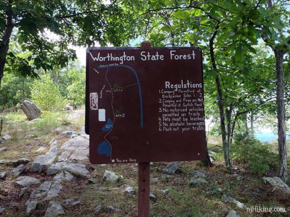
3.5 – At the large sign with the Appalachian Trail and Worthington State Forest on the other side, leave Worthington and enter Delaware Water Gap National Recreation Area.
Kaiser (BLUE) should join in from the right, but we never notice it. Pass a view on the right.
4.0 – Veer RIGHT to continue on Appalachian Trail (WHITE). [Kaiser (BLUE) leaves ahead]. Off to the right is a casual path to a view with long logs that make for a convenient seat.
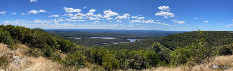
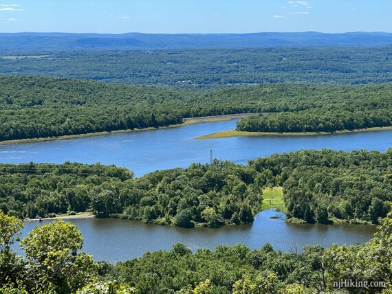
There are a few east-facing views, all of them looking over Lower Yards Creek Reservoir, along this stretch of the Appalachian Trail (WHITE).
4.5 – This is the widest viewpoint and the last one on this stretch of the Appalachian Trail.
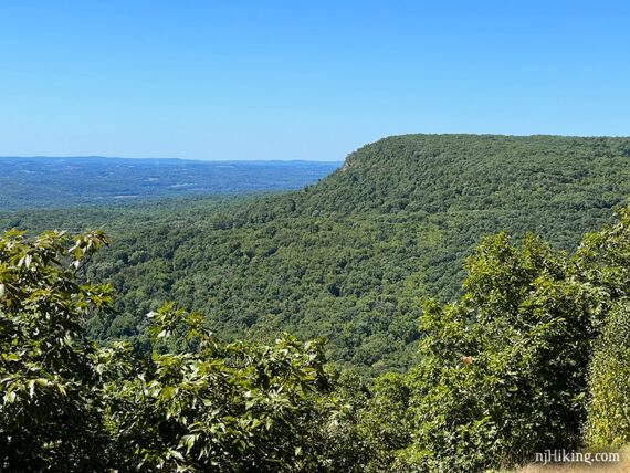
Off to the far right the Kittatinny Ridge sharply into the valley below. The long flat area on top is the location of the Upper Yards Creek Reservoir.
Close up of the Lower Yards Creek Reservoir in the valley below. These reservoirs provide hydroelectric power for the Yards Creek Station.
The next viewpoint, marked with a star on Kittatinny Trails, is 0.8 miles from here but is very similar to what you’ve just been seeing so if you aren’t doing the whole route, this is a good turn around point.
// 8.6-mile route: Turn around here and retrace the Appalachian Trail (WHITE) back to the intersection with Garvey Springs (ORANGE). Turn RIGHT and follow it back down to the lot. //
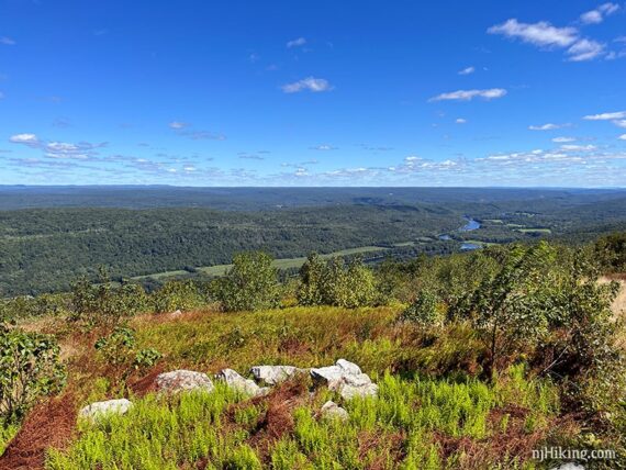
5.3 – The last view on this section of the Appalachian Trail is down a short side trail on the right. It may look like there is none – keep walking through the break in the brush…
…until popping out for your last panorama from the ridge.
5.9 – After heading downhill over a very rocky section, turn LEFT to start following Coppermines (RED). [Appalachian Trail (WHITE) continues straight.]
7.1 – Turn LEFT and now follow Coppermines/Kaiser connector (BLUE/RED). [Coppermines (RED) continues straight.]
7.2 – Turn LEFT and now follow Kaiser (BLUE) on a woods road that heads gradually uphill. [Kaiser (BLUE) also goes right].
8.2 – Kaiser (BLUE) ends, veer RIGHT and start following the Appalachian Trail (WHITE). [Appalachian Trail (WHITE) also goes left – this intersection was passed earlier].
10.6 – Turn RIGHT and now follow Garvey Springs (ORANGE) steeply downhill over rocks, retracing the route back to the parking lot.
—
Hiked: 10/27/25 – partially – A.T. from Mohican to Raccoon
Hiked: 8/14/22. 11.1 miles. Variation; w/o Coppermines/Kaiser loop.
Hiked: 9/3/16. 11.8 miles.
Hiked: 8/31/08. 16 miles. Trail Blog: “Garvey Springs to AT North”
Hiked: 9/3/06. 9.9 miles. Trail Blog: “Sunfish – AT”
Updated: 9/2025 – Minor edits. 6/2024 – Minor edits, re-hiked Garvey portion as part of another loop. 8/2022 – Re-hiked; variation w/o Coppermines/Kaiser loop; improved description and interactive map, added photos. Older change log at page bottom. 5/2021 – Description changed to reflect that TURQUOISE is now called Buckwood (BLUE); not re-hiked.