Loop around Monks Mountain with multiple viewpoints of Monksville Reservoir and the surrounding peaks.
2.7 or 4.3 miles, total round trip. Normal rocky/rooty trail with an uphill to the view. The reservoir is part of Long Pond Ironworks State Park.
| 2.7 miles | This hike guide: Detailed instructions and photos follow below. |
| Longer | 4.3 – Add an out-and-back on a woods road. Noted below. AND/OR use Monks Connector to cross Greenwood Turnpike and extend into another section of Long Pond Ironworks State Park. |
| Nearby | Long Pond Ironworks – Sterling Ridge and Jennings Hollow; Governor Mountain; Horse Pond Mountain to Lake Sonoma Loop; Skylands Manor – Ilgenstein Rock; Bearfort Ridge Loop – Surprise Lake; Surprise Lake Loop via State Line. |
| Nearby Kayak | Monksville Reservoir (this parking lot) Wawayanda Lake Kayak |
Our two cents:
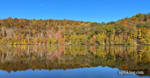
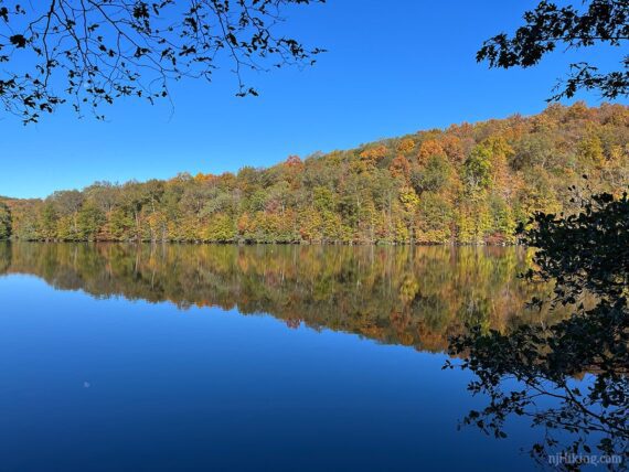
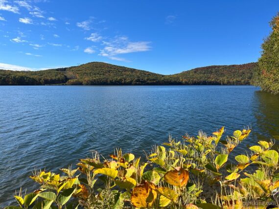
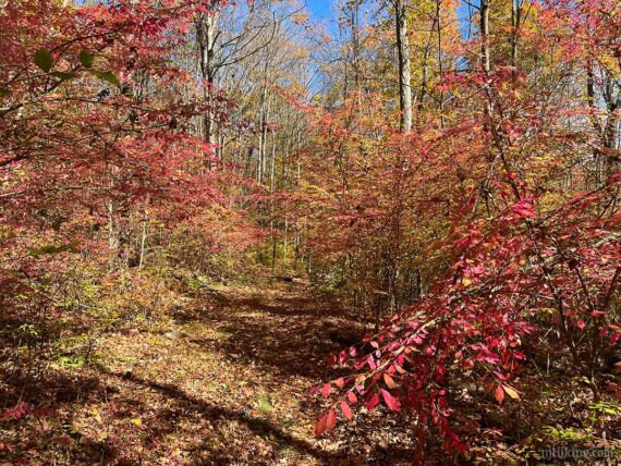
Short hike that let’s you see Monksville Reservoir from multiple sides – without paddling out on the water. The reservoir can be a stunning location for fall foliage as the bursts of color on the mountains reflect in the water.
Kayaking here is a lot of fun too and this loop is short enough to do both in one day! Rentals available in season if you don’t have your own.
Hike Info:
Map:
Northern New Jersey Highlands Trails Map. Follow along on your smartphone with our Interactive Map link above.
Parking: N41.13660° W74.30710° [North Launch]
Monksville Reservoir, North Boat Launch, Ringwood, NJ 07456. Paved parking lot.
From the south: 287N to exit 55 towards 511/Wanaque/Pompton Lakes. Right at bottom of ramp and follow 511/Ringwood Ave/Greenwood Lake Turnpike through town. The road will curve left. Pass the South Launch on the left, and then turn left at the sign for the North Launch.
South Launch – short connector trail to the loop: N41.12711° W74.30108° – Monksville Reservoir South Boat Launch, 1081 County Rd 511, Ringwood, NJ 07456. Boat rental runs from this launch.
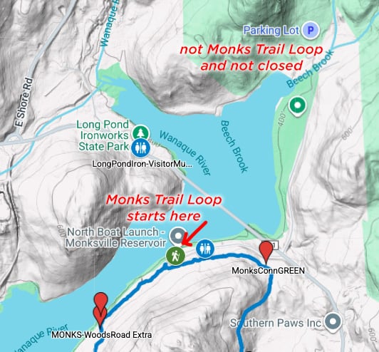
Note! If you search “Monks Trail Loop” on Google it shows the wrong location for this hike and that it is closed when it is not.
Restrooms:
Portable toilet at the parking lot as well as the south launch that is passed half-way through the hike (as of 10/2025).
Gas station and a few stores on Rt 511 just the before the turn for the North Launch. Nearby Long Pond Ironworks Museum & Visitor Center has restrooms but is only open open weekends 1pm-4pm, Apr-Nov.
Hike Directions:
There is a nice view of the reservoir from the boat launch ramp area – head over there first for a no effort photo op. Monksville Reservoir is also a nice spot to hit for a foliage photo even if you’re driving to another hike in the area.
Overview: WHITE (Monks) with two out-and-back WHITE-BLACK spur trails.
The trailhead for WHITE (Monks) is at the far end of the Monksville Reservoir North Launch parking lot.
The route can also be started at the South lot – start following the WHITE-BLACK spur trail from the far end of the south lot (next to a portable toilet), at the intersection with WHITE turn RIGHT and follow the description from 1.6 below.
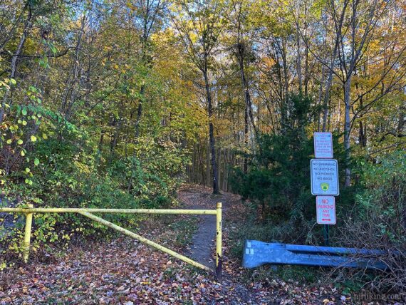
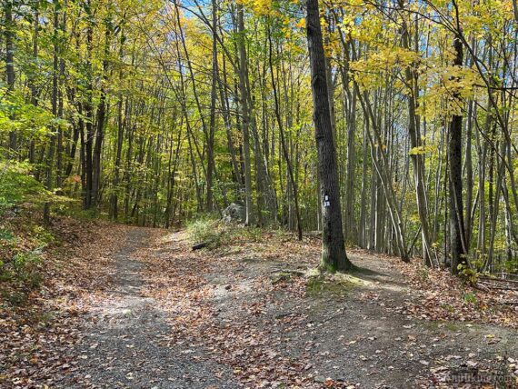
0.0 – Just beyond the gate, veer RIGHT to start following WHITE (Monks). It also goes left, which is the return route. Straight ahead is a wide woods road that runs parallel to the trail.
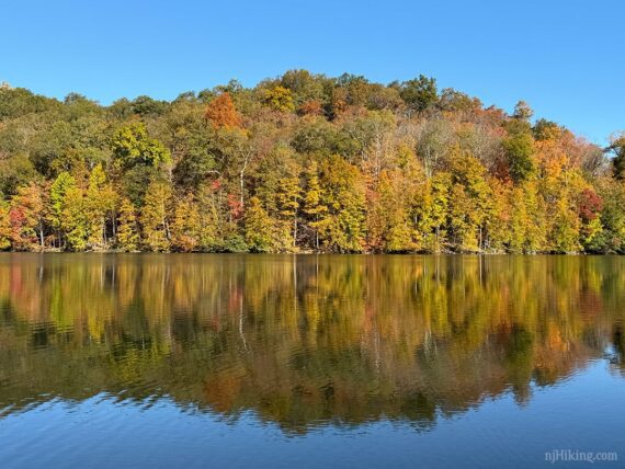
0.3 – Short side path to the edge of the water for a view of Monksville Reservoir and Horse Pond Mountain beyond it.
WHITE (Monks) turns to meet up with the woods road at a pipeline cut, follows the road for a few steps, then turns LEFT back onto a trail.
// Optional – add 1.6 miles total round trip to the route: Instead, continue ahead on the woods road to a viewpoint of the reservoir, then return to this spot, turning RIGHT to continue on WHITE (Monks).
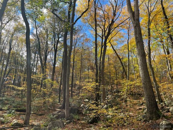
WHITE (Monks) moves away from the edge of the reservoir and soon starts to climb across the side of Monks Mountain, making it’s way up to a viewpoint.
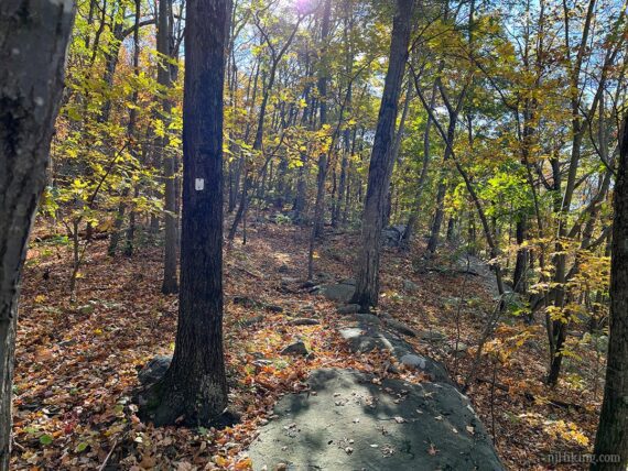
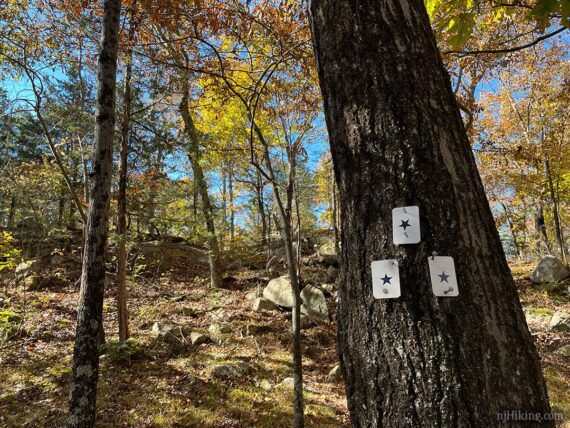
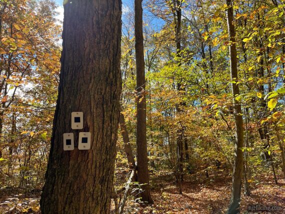
1.0 – Turn RIGHT and follow a spur trail marked with a BLACK STAR on WHITE. This is well marked but the 3 star blazes face the trail not the direction of travel so there is chance you might waltz by at first.
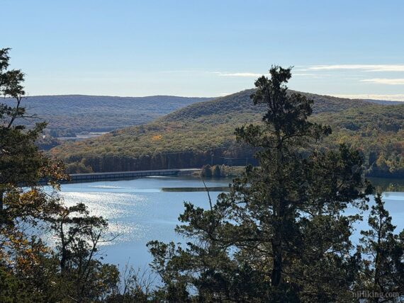
This short side trail arrives at a rock outcrop with a wide view overlooking the other side of the reservoir and is a pleasant break spot.
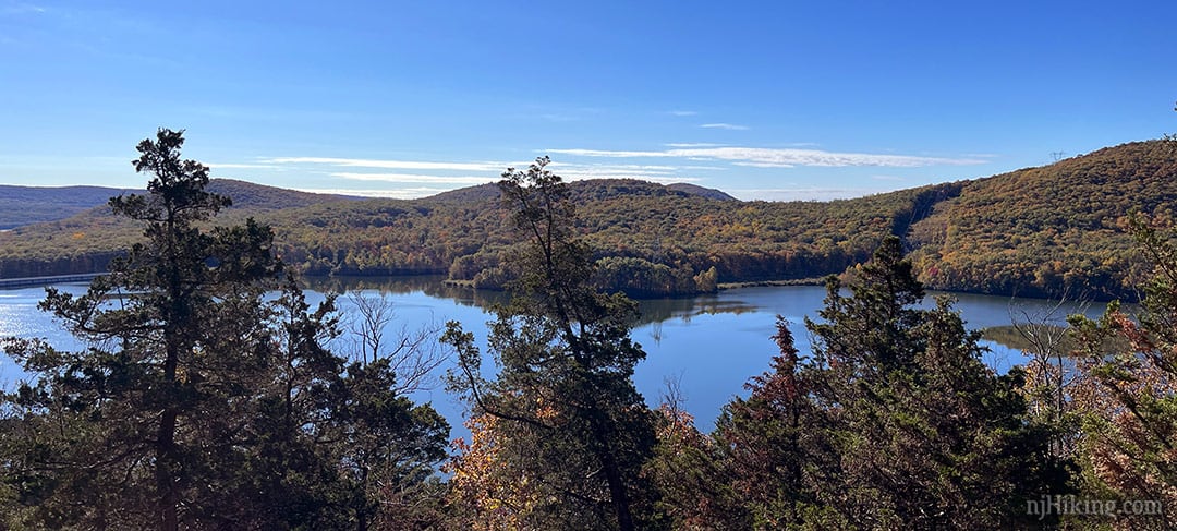
A power line AND a pipeline criss-cross Monks Mountain and are visible running over the surrounding hillsides. Try to mentally Photoshop out those power lines and towers marring the hillsides.
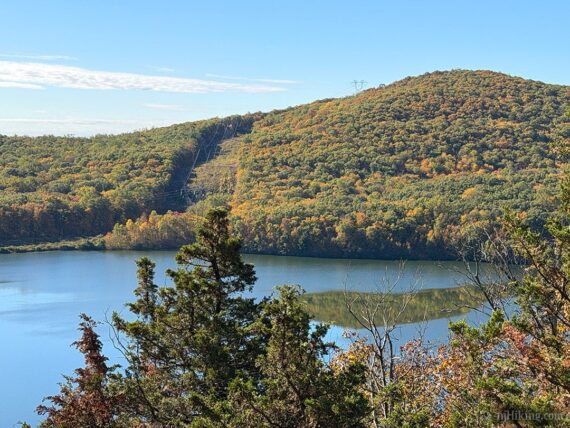
The Monksville dam can be seen off to the left.
Retrace BLACK STAR on WHITE back and turn RIGHT to continue on WHITE (Monks), now heading downhill.
1.4 – Turn RIGHT and follow a BLACK/WHITE spur trail to the large Monksville Reservoir South Launch parking lot (there’s a portable toilet where the trail meets the lot).
Walk down to the floating dock for views and/or veer right for an unmarked trail that leads behind the boat rental to a few spots by the water. There are also casual trails for spots to the left of the floating dock.
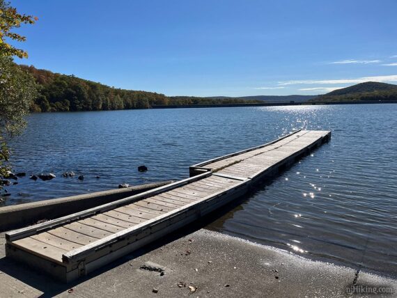
The mileage for this route assumes going out to the floating dock and back – if you wander around then your mileage might be a smidge more (we wandered to all the spots but I took them out of our track for clarity).
1.6 – Retrace the route on BLACK/WHITE and turn RIGHT to continue on WHITE (Monks).
1.7 – WHITE (Monks) veers to the LEFT, away from a wide path that appears to continue ahead (but is not noted on any map we checked).
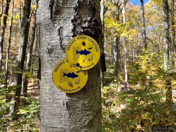
Soon, pass YELLOW markers for Passaic River Coalition’s Meadow Trail. My research indicated this loop off of Monks is somewhat unkept now and we didn’t bother – but give it a whirl if you like.
1.8 – Pass a small mine hole on the right that you might just walk past. This is marked but unnamed on Northern New Jersey Highlands Trails Map and not marked on the park’s trail map.
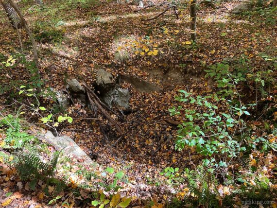
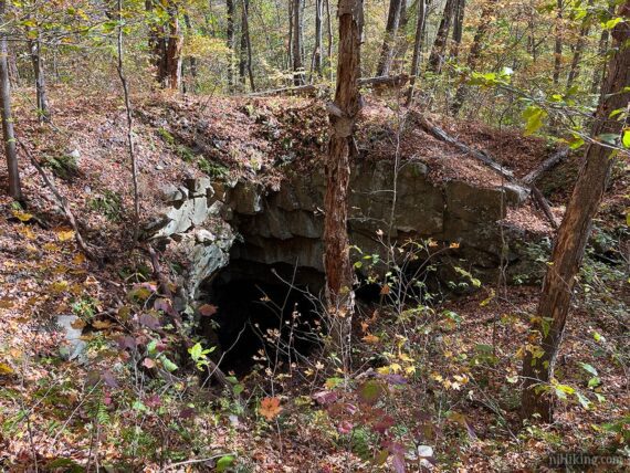
2.0 – Winston Mine is off trail to the right, behind a non-descript dip in the ground. We almost kept walking thinking that this was the mine, as that sometimes all that is left of one.
My index finger points to the dip, and my middle to Winston.
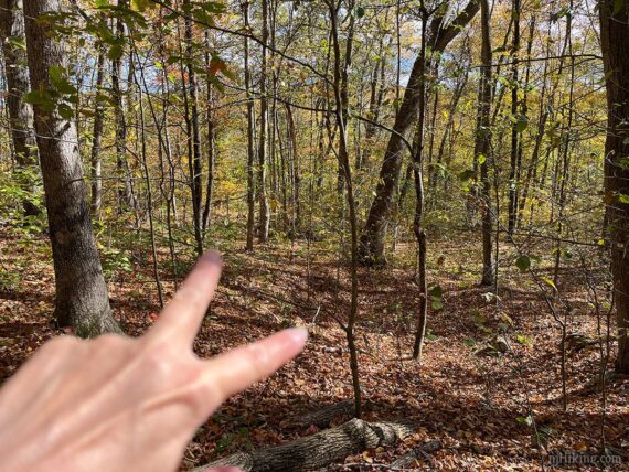
We bushwhacked over but on the return noticed a very faint casual trail and took that – coming from the other way the path would have been more obvious.
Zoomed into the interior of Winston Mine.
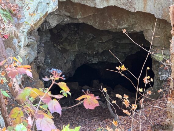
The mine was established in the late 1860’s and abandoned by 1880. [Source: The New Jersey Walk Book] The book notes there are “two open pits 100 feet from the trail” but I hadn’t checked it beforehand and once we saw the dip we figured that was it and moved on.]
2.4 – Continue on WHITE (Monks) past GREEN (Monks Connector). This crosses Greenwood Turnpike and continues further into Long Pond Ironworks towards the Hasenclever Trail.
WHITE (Monks) turns to the right with the park road, Beech Road, below. Pass an open area with some larger rocks on the left.
WHITE (Monks) meets back up with the woods road from the start, turn RIGHT to pass around the gate back to the parking lot.
—
Hiked: 10/10/25.