Hike the Batona Trail from the Carranza Memorial to Apple Pie Hill and climb the fire tower for a panoramic view.
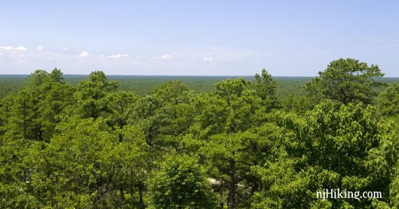
Climb 60’ up the tower for a panoramic view from the highest point in the Pine Barrens (a whopping 209 feet above sea level!) and one of the most unique vistas in the state.
8.4 miles. Trail surface is sand/pine, mostly easy except for a little deep sand in spots, negligible elevation; moderate length. 3 small boardwalk crossings over minor wet areas.
| 8.4 miles | This hike guide: Detailed instructions, photos, and video follow below. |
| Longer | The Batona Trail is ~53.5 miles long… keep on going… |
| Nearby | Franklin Parker Preserve; Franklin Parker Preserve – Chatsworth; Wharton – Atsion to Quaker Bridge. |
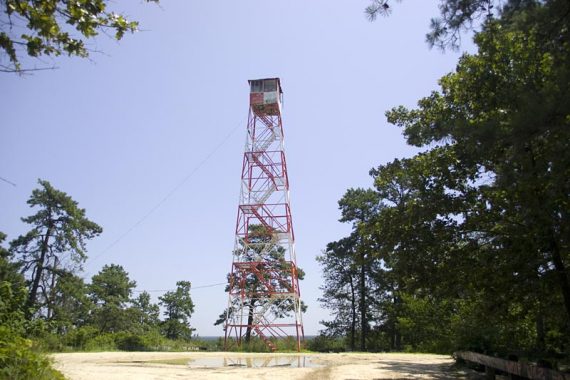
Climbing Apple Pie Fire Tower
NOTE: The fire tower is fenced off (since 9/2016), but is accessible when staffed by a fire watcher – normally everyday until sundown during fire season.
Call NJ Forest Fire Service Division B Headquarters to check at (609)726-9010. Find out when it will be staffed, and you may be able to schedule a visit to climb the tower.
There may be an “open climb” day several times per year, usually on a Saturday in March, June, and September. These are announced in the park’s email newsletter or online.
While this is a nice hike on a section of the Batona Trail, the tower was the focus. There are no views from the hill without being able to climb up the tower at all.
For info on the closure: “Pine Barrens landmark off limits to public due to vandalism“.
Our two cents:
The main focus of this hike is the distinctive view from the fire tower. There is not much of a view from the “hill” itself without going up the tower at least a bit.
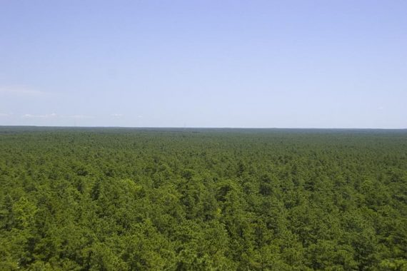
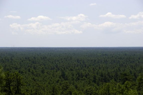
Once up top, the view is of an endless sea of pine trees – very unlike most views in Jersey. On clear days, the Atlantic City and Philly skylines may be visible.
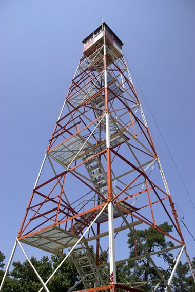
Apple Pie Fire Tower is quite stable and not nearly as rickety as some we’ve climbed, but anyone with a fear of heights may not enjoy the metal-grid see-through steps and the general feeling of openness.
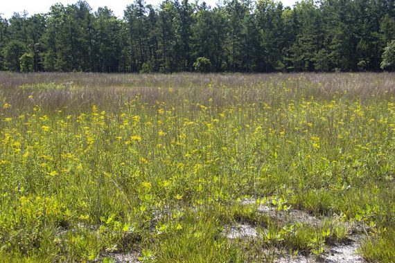
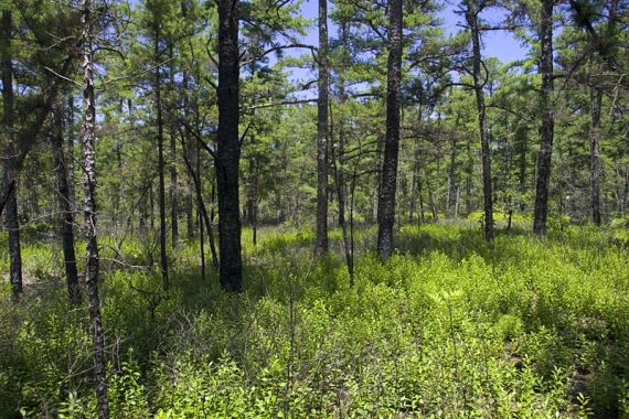
Ticks can be bad in the pine barrens, and there is a decent amount sun exposure on this route. Bonus in August: Wild blueberry bushes are along most of the trail.
Updated: 3/2025 – Refreshed page; not re-hiked. Older change log at page bottom.
Hike Info:
Map:
Print a map ahead from the park website. A little later into the hike is an overview map sign at the Batona Camp. Follow along on your smartphone with our Interactive Map link above. Note: Cell service may be spotty in this area.
The Batona Trail is maintained by the Batona Hiking Club (“Batona”= BAck TO NAture).
Books:
This hike can be found in Best Day Hikes in New Jersey, 50 Hikes in New Jersey, Hiking New Jersey (2023), and Best Day Hikes Near Philadelphia. A variation is in Best Day Hikes in New Jersey.
Parking: N39.77692° W74.63273°
Emilio Carranza Memorial, Tabernacle, NJ 08088. Turnpike to Exit 7 for Rt 206 South; about a mile south of the Red Lion Circle (206 and 70 meet) turn left on Carranza Road (there’s a sign). Go straight at the stop sign in Tabernacle (cross Rt 532).
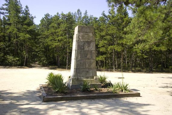
Continue on Carranza Rd for about 7 miles, parking and the Carranza Memorial is on the right; there are two entrances but they are easy to miss.
There is no signage really, until you are driving past it and see the sign for the memorial. The stone monument is pretty easy to spot from the road, however.
Restrooms:
Composting toilet may be in the lot; it’s set back a ways and you may not see it at first. There are also outhouses at the Batona Camp, a short ways into the hike.
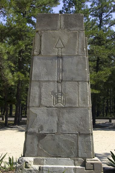
The Carranza Memorial is at the start of the hike, in the large parking lot. The monument is dedicated to Emilio Carranza, whose plane crashed along this road on July 13, 1928 while making made the third longest non-stop flight.
Hike Directions:
This out-and-back route follows the Batona Trail the entire time. It’s blazed PINK, which is super easy to spot.
The trail is well marked but watch for the blazes as there are woods roads, and the trail uses them on and off in the beginning and it can be a bit confusing.
If you lose sight of a blaze, backtrack and make sure you are on the path and not just mindlessly bopping along a sand road.
0.0 – Walk across the road from the memorial and take the sand road until you hit the PINK blazed sand road; make a left.
**Note: the actual Batona Trail is not blazed across the road here, so it’s not clear that it meets up with the trail.
If you’d like to avoid any confusion, walk out of the lot, make a right and walk down the road just a bit – on the left side of the road there is a sand road and a blaze on a tree (blaze is not real visible from walking down the road, but the sand road is)
0.3 – Walk through Batona Camp. There is a trail map sign, and outhouses among the camp sites. The trail snakes through the camp and turns right – watch for the blazes.
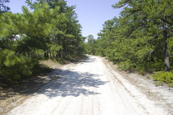
The trail follows on and near the sand road.
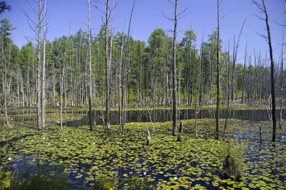
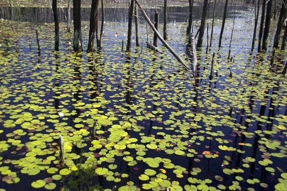
0.6 – Pass close to a wet area with lily pads, called Skit Branch (tributary to the Batsto River). The wet areas passed along the trail are part of this.
The trail joins the sand road.
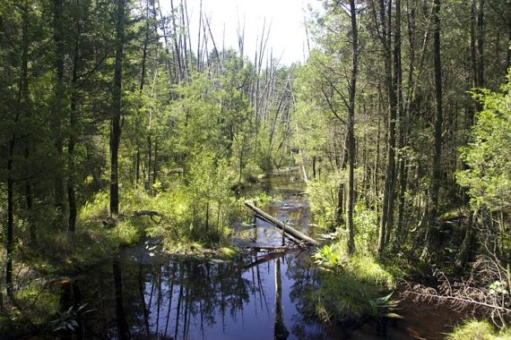
1.0 – Turn LEFT off of the sand road and onto the trail; watch for the blaze, it’s hard to see. The trail becomes overgrown and the cedar swamp is visible through the trees.
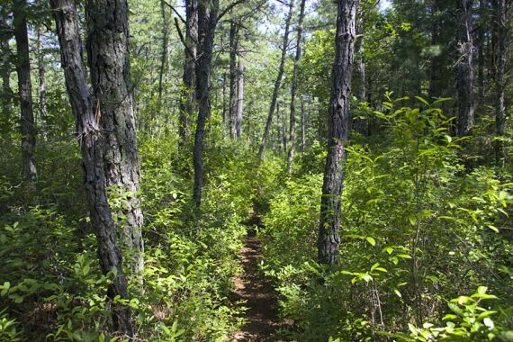
Along the Batona Trail, which is a sand road in places.
View of Skit Branch.
1.1 – The trail meets up with a sand road: turn LEFT onto the sand road, cross a small bridge with tannin colored water running under it.
Almost immediately, turn RIGHT to rejoin the trail. The trail is overgrown in many areas… lots of blueberries though!
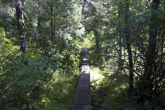
There are some boardwalks over minor wet areas.
2.8 – Cross an unmarked woods road, continue straight.
3.4 – Cross another unmarked woods road with a fire trench nearby; continue straight. In some sections the trail is wider.
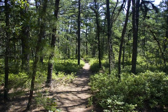
Pine forest all around gives this hike a remote feel.
3.9 – Cross another unmarked woods road. Start heading “up” Apple Pie Hill – very minor elevation change.
4.2 – Arrive at Apple Pie Hill Fire Tower. Note that the tower now has a tall fence around the base.
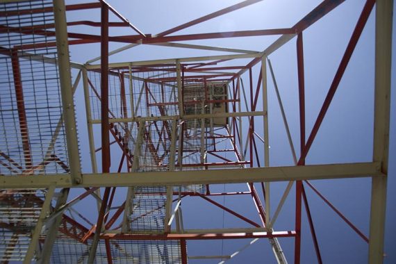
Looking up the stairwell of the Apple Pie Hill fire tower.
Vast views over endless pine forest can be seen from the top of the tower.
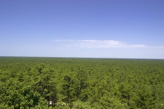
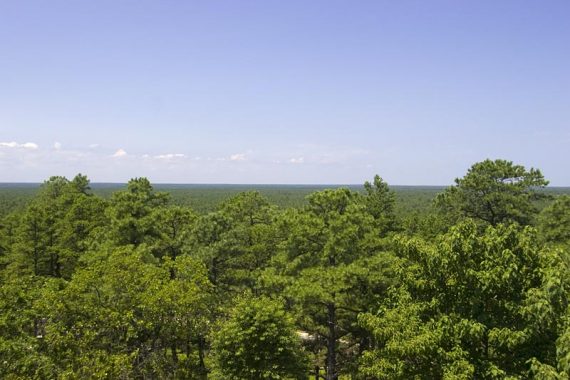
In all directions is an impressive expanse of pine forest. Trees of the same height as far as the eye can see.
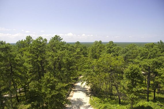
Looking down from the tower at a sugar sand road.
Retrace the route back to the lot.
—
Hiked: 8/1/09. Trail Blog: “Apple Pie Hill – Wharton State Forest“
Updated: 3/2023 – Page checked, minor edits, not re-hiked. 7/2020 – Page refreshed, not re-hiked. 2/2016 – minor link updates and edits.