Hike that includes a view towards the Delaware River and passes a few old farm buildings.
6.7 or 3.2 miles, total round trip. Easy to moderate trail surface; minor elevation change. Some muddy/rutted trail sections due to use by bikes/horses. The trail is mostly hard packed earth, with some rocky areas.
| 6.7 miles | This hike guide: Detailed instructions, photos, and video follow below. |
| Shorter | 3.2 – Head back from the pond, skipping Copper Hill and Kuser Trail. Noted below. |
| Nearby, same lot | Fiddlers Creek Preserve |
| Nearby | Washington Crossing State Park; Goat Hill Overlook; D&R Canal hike/bike. |
Our two cents:
The short 3.2 mile loop gets you all the best bits of the park: fun rocky climb up, pleasant forest and meadows, viewpoint towards the Delaware River, a few old farm buildings. Only do the longer version if you want the miles.
Note: Most of the farm buildings along the trail have been demolished since the video was taken, other than the main lodge area. Check our Trail Blog links at the bottom of the page for photos of the area over the years.
Hunting Season: Entirely CLOSED to hikers during firearm season days in December. Also closed Wed. – Sat. from mid-December to mid-February. See Mercer County deer management for closure dates.
Updated: 11/2025 – Edits, added photos; re-hiked short loop; updated the route to reflect changes to the Copper Hill/Kuser section. Older change log at page bottom.
Map/Books:
Print out a map ahead. Follow this route on your smartphone with our Interactive Map link above. Not sure if the visitor center has maps, we’ve never seen it open.
Note: Directions below have been updated to reflect the changes to the Copper Hill and Kuser Trail section of the park, but we have not re-hiked that portion since the changes.
A similar route was in the 2019 edition of Best Day Hikes in New Jersey. Different routes are in 60 Hikes Within 60 Miles: Philadelphia and Best Day Hikes Near Philadelphia. Some info and history of the area can be found on njskylands.com. (scroll down a bit for Baldpate).
Parking: N40.31823° W74.89042°
Parking Lot, Fiddlers Creek Rd Access, Fiddlers Creek Rd, Titusville, NJ 08560. There are multiple access points listed on the map, which are described on the park page. If approaching from 95S take Exit 1 for 29N/River Road. This route uses the first lot on Fiddlers Creek Road off of Rt 29.
There is signage for the Baldpate lot; ignore the driveway with a gate right before it. Large dirt lot with metal grating. This lot is also for Fiddlers Creek Preserve.
Restrooms:
Portable toilet in the lot (11/2025).The map shows restrooms at the visitor center, which is 1.3 miles up the blue trail. Unsure of their availability – we’ve run into them open only once (not open 11/2025).
If you don’t want to chance the one in the lot, a somewhat nearby alternative is to use the restroom at the end of a large lot on River Drive near Washington Crossing Park: N40.29823° W74.86829°.
Refreshments:
Minutes away on River Road is a french bakery, L’Annexe de Mamie Colette. We had tasty pastries and lattes but they also do crepes. Tons of shops, restaurants, and two breweries are 10-15 minutes away in Lambertville, NJ and over the bridge in New Hope, PA.
Hike Directions:
Overview: BLUE (Summit) – WHITE (Ridge) – RED (NW Loop) – WHITE (Ridge) – Kuser (GREEN) – ORANGE (Copper Hill) – WHITE (Ridge) – BLUE (Summit)
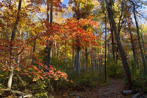
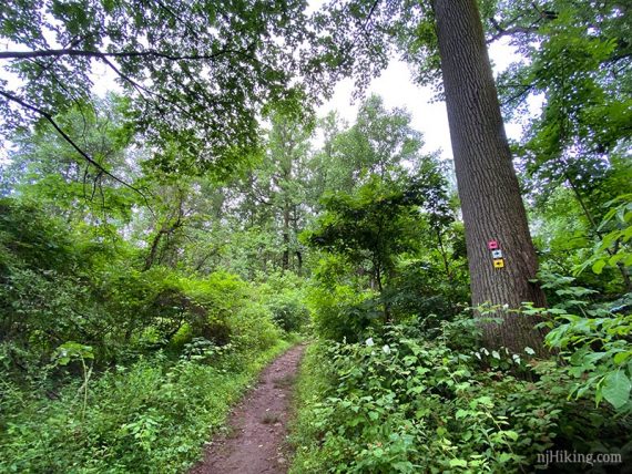
0.0 – Start following BLUE (Summit) just beyond the trail kiosk. Trail is immediately very pleasant, level at first and then heads up through the forest.
As we started our 11/2025 hike it immediately seemed like a LOT of trees had come down or were dead compared to our last hike in 2020. The forest seemed thinned out and we assumed it was damage from the bad storms we’ve had over the last few years.
Well I guess I’d forgotten just how bad until working on updating this guide… in July of 2021 a TORNADO ripped through 200 acres of the park, flattening mature trees in forest dating back before 1930. See “Baldpate Mountain to Receive More Restoration“.
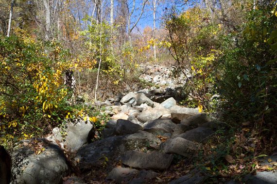
0.4 – Climb steeply up a long series of stone “steps”. The rocks are placed to create a natural staircase yet they blend so well they may not be obvious in photos… this just looks like a pile of rocks but it’s the route up:
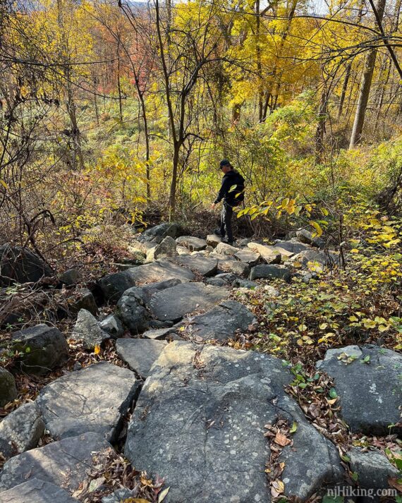
Looking back down shows the slat rock steps more, though the steepness is not obvious from this photo. The stone steps make easy work of what would normally be a scramble over a jumble of rocks.
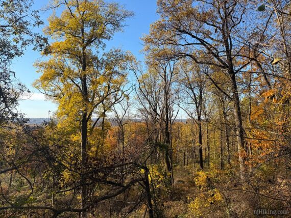
Gaining a little elevation, start to see the hills in the area through the trees.
Turn LEFT to continue on BLUE (Summit) to the top of the mountain. BLUE also goes straight, leading directly to the ridge trail and farm/pond, and is the return route. These markers may be hard to spot.
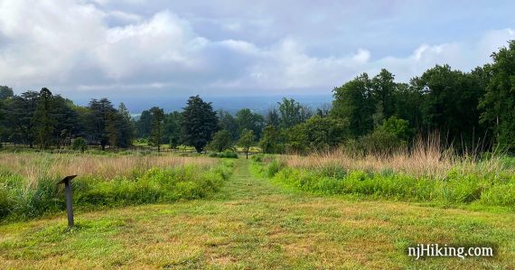
0.8 – Come to a T with a gravel path. Cross the path and jog slightly left to continue on BLUE (Summit). Arrive at an open grass lawn with the Kuser Estate buildings visible off towards the left.
Veer RIGHT to follow BLUE (Summit) along a mowed path.
1.0 – BLUE (Summit) ends. Turn LEFT and start following WHITE (Ridge). [WHITE (Ridge) also goes right].
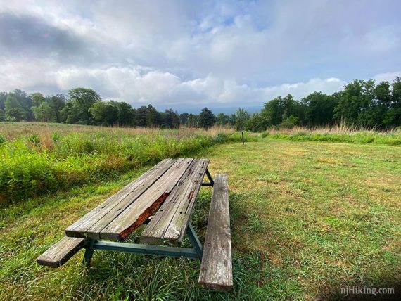
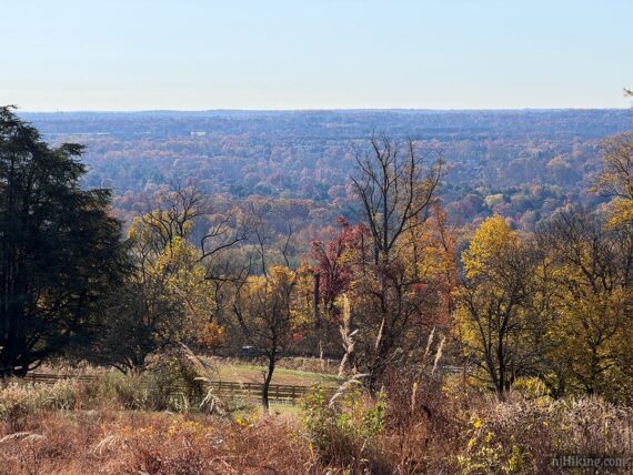
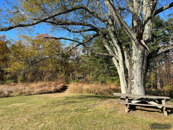
There are picnic tables, a view towards the Delaware River, and a meadow along the mowed path.
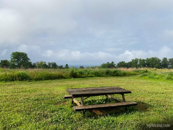
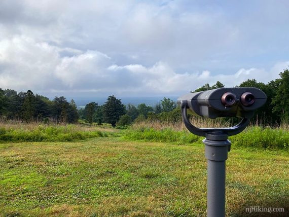
1.1 – More picnic tables and a viewing scope in a mowed grassy area, overlooking the Kuser Mansion and orchard.
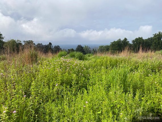
The hilltop viewpoint looks over the park and on to Pennsylvania.
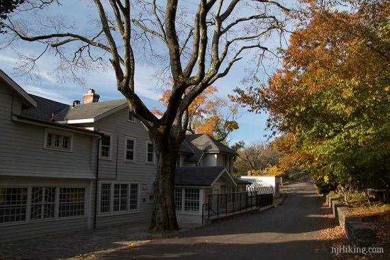
The mowed path down the hill leads to the buildings of the Kuser Estate.
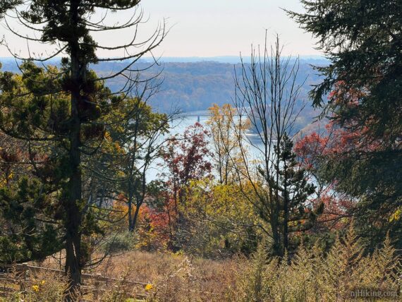
The Delaware River can be seen through the trees if you go down the hill some or when down by the Kuser estate buildings. It used to be more visible from the top of the hill but trees have grown in.
>> Optional side-trip: Walk down hill the to check out the buildings of the estate. Check the Trail Blogs linked at the bottom for more photos of this area.
This will add a bit to the hike distance but depends on how much you walk around. For that reason it’s not included in the turn-by-turn mileage of the description, but will likely add 0.2 – 0.3 miles.
There are just a few buildings. Strawberry Hill Mansion can be rented for events.
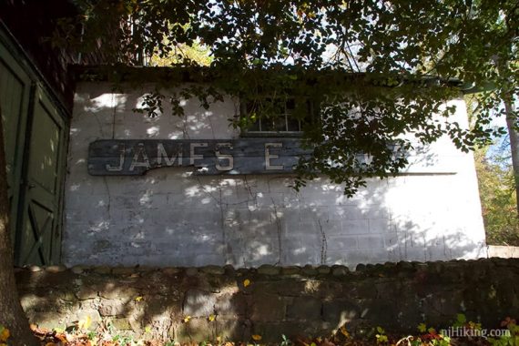
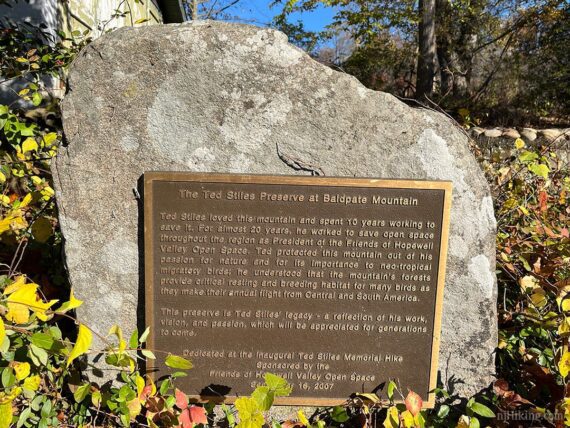
Historical Fun Facts: The Kuser family owned this area for decades before selling the property to Trap Rock Industries in 1986. When the plan to expand the existing quarry didn’t work out, the land was set to be turned into a housing development.
The area was acquired by Mercer County in 1998 after public concern and the efforts of the late conservationist Ted Stiles. [Source: Baldpate Mountain].
>>TO CONTINUE from the Kuser Estate, return to the top of the hill and follow the next direction OR continue back along the base of the hill to find WHITE (Ridge) and follow that to RED (NW Loop); continue after 1.2 below.
>>TO CONTINUE from the hilltop, follow WHITE (Ridge) across the open grassy area, past a large tree with a white marker next to a picnic table, towards the treeline.
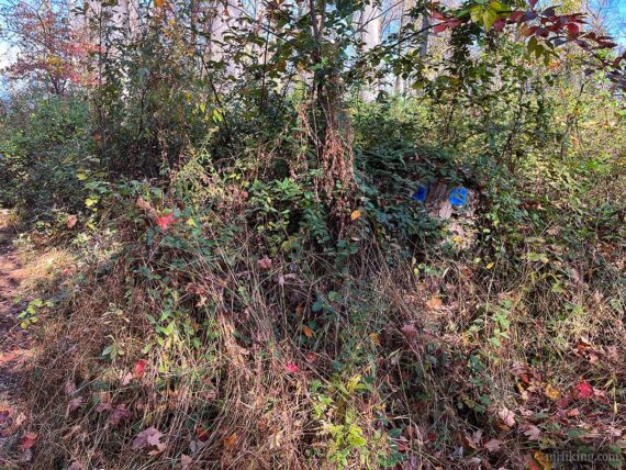
1.2 – Turn RIGHT to start following RED (NW Loop) – you might not spot markers until turning. And there might not be many along the way either.
Shortly, Pass YELLOW (Switchback) on the left. Then piled up logs blocking a trail not in use.
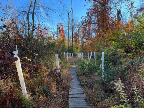
Later, pass a trail blocked with rocks and a “Stone Manor Farm – Private” sign and then tree plantings in tubes along a trail boardwalk.
2.2 – Veer RIGHT and continue following RED (NW Loop). We didn’t spot markers here. TEAL (Pleasant Valley) continues ahead and in a few steps connects again to RED, forming a triangle intersection.
2.4 – Turn LEFT and start following WHITE (Ridge Trail). [RED (NW Loop) ends. WHITE (Ridge Trail) also goes to the right].
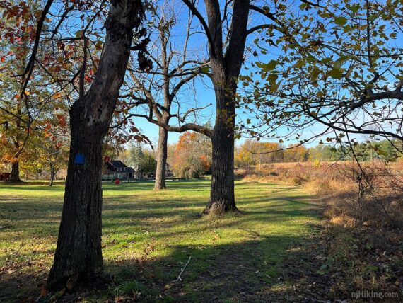
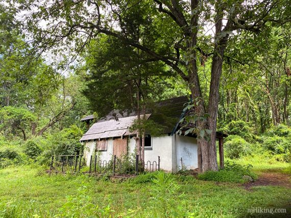
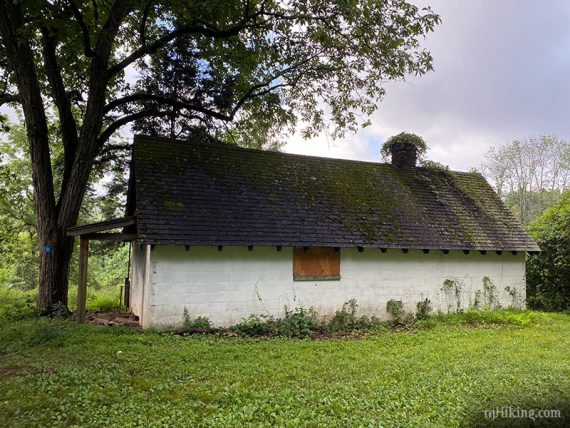
2.5 – Veer RIGHT off of WHITE (Ridge Trail) on to old pavement into an open area. All but two of the farm buildings in this area have been demolished over the years we’ve been hiking here.
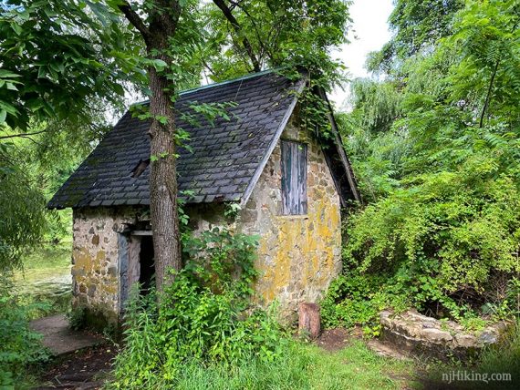
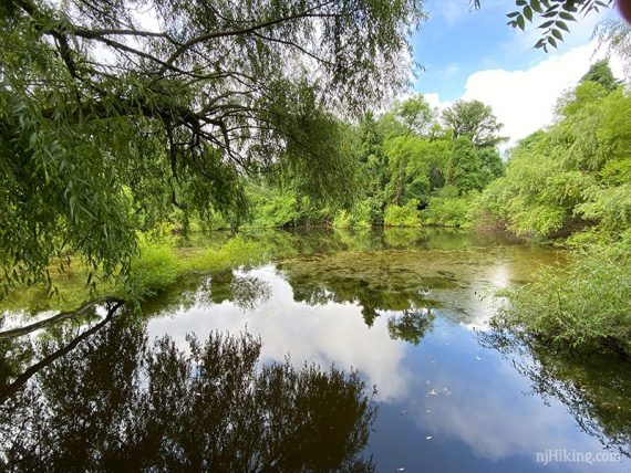
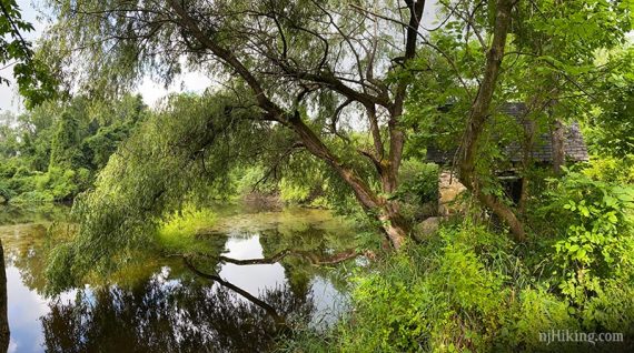
There is a little pond that is not really visible until you walk over to it, it’s by a small stone building and old well.
// Shorter 3.2 mile option: Head back from here by finding the BLUE trail (though there may not be markers) around the side of the stone building/pond. Follow the description from 6.3 below.
TO CONTINUE THE FULL HIKE: From the pond area return to WHITE (Ridge) at a white farm building. Turn RIGHT to continue on WHITE (Ridge). This photo is from 7/2020, it had graffiti along the back of it on 11/2025.
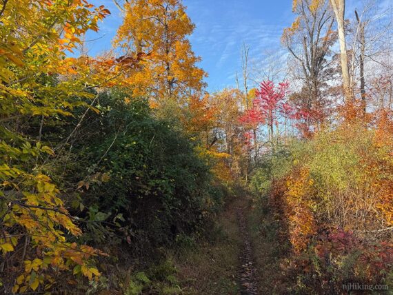
This trail is mostly easy and level with some wide muddy spots if it’s rained a lot.
3.6 – Continue on WHITE (Ridge). Pass ORANGE (Copper Hill) on the right – might not even notice it.
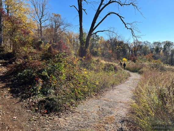
3.8 – Continue on WHITE (Ridge) along the edge of a large parking lot towards a large power tower, passing the other end of ORANGE (Copper Hill).
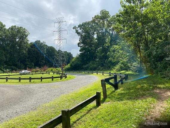
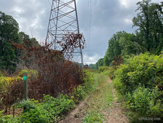
Start following Kuser (GREEN) as the trail leaves the parking area at the tower and follows the power line cut for a bit.
4.0 – Turn RIGHT over a small footbridge and follow Kuser (GREEN) as it heads gradually downhill. Pass an unmarked trail on the left.
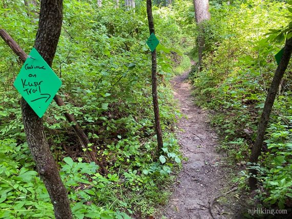
4.4 – Kuser (GREEN) turns SHARP RIGHT. [At one point this was Kuser (GREEN) Connector but it’s no longer on the map as such. [Kuser (GREEN) also continues ahead.] This photo may be out of date:
4.5 – Turn RIGHT and now follow ORANGE (Copper Hill). [ORANGE (Copper Hill) continues to the left to where the trail has been closed.]
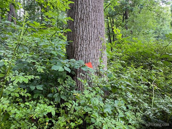
4.7 – When ORANGE (Copper Hill) splits, keep LEFT to continue. [ORANGE also goes right and meets up with WHITE too].
5.3 – Meet up with WHITE (Ridge) and turn LEFT to start following it back. [WHITE (Ridge) also goes right. This intersection was passed earlier].
6.2 – Continue following WHITE (Ridge) until reaching the white farm building from earlier.
Turn LEFT make your way towards the pond and small building from earlier.
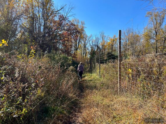
6.3 – Start following the trail that off to the right side of the building. There is a tall deer fence. Eventually there will be a BLUE (Summit) marker, might not be ones before.
6.4 – At the junction with the main BLUE (Summit) trail, keep STRAIGHT – you might just waltz by this without realizing. Retrace the route back down the stone steps and to the parking lot.
—
Hiked: 11/2/25. Short loop.
Hiked: 7/4/20. Determined new route.
Hiked: 10/31/15. Trail Blog: “Baldpate Mountain on Halloween“
Hiked: 5/26/12. Trail Blog: “Baldpate Mountain – Summit, Ridge, and Honey Hollow“
Hiked: 8/16/09. Trail Blog: “Baldpate Mountain in August“
Updated: 2/2024 – Added note about potential trail closure on ORANGE (Copper Hill) that affects the route. 3/2023 – Park link updates. 7/2020 – Re-hiked; adjusted the route to remove the closed trails in Honey Hollow. 7/2020 – Improved route by taking Copper Hill uphill instead of downhill (it’s steep and rocky, more enjoyable as an uphill). Also using the path now also marked as Summit direct from the pond. Mileage now 6.7 from 8.1. Removed links to old maps. New photos.
6/2018 – Added link to a map on park site that wasn’t there before (Map 1) and updated Map 2 link. These versions show fewer trails in Honey Hollow area than older maps (map 3,4) so the description below may be affected. 11/9/15 – Directions revised and route modified slightly; photos added; revised GPX.