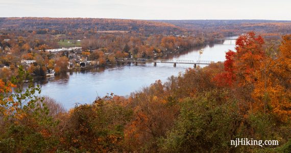
Easy hike to a fantastic view over the Delaware River, Lambertville, NJ and New Hope, PA.
1.0 or 2.4 miles – Easy, gravel path, somewhat uphill to main overlook. Longer route is a regular trail with light rocks.
| 1.0 miles | This hike guide: Detailed instructions and photos follow below. |
| Longer | 2.4 – Extend to the full loop that includes two more overlooks. Described below. |
| Nearby | Walk or bike the D&R Canal towpath (5 min drive) Washington Crossing or Baldpate Mountain (10-15 min drive) Kugler Falls or Lockatong High Falls (20 min drive). |
Our two cents:
Short but popular walk with a nice payoff. The full loop offers two more overlooks and should leave the crowds behind.
For history of the site and the preservation efforts see “Goat Hill Overlook is preserved“.
Updated: 5/2026 – Minor edits, updated Interactive Map, added photos; re-hiked 11/2025. Older change log at page bottom.
Hike Info:
Map:
Print ahead, no paper maps in kiosk. Our Interactive Map linked above shows the full hike in blue with the short Overlook only hike in red over it.
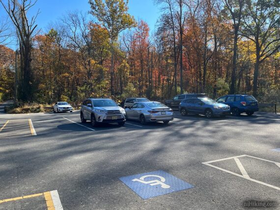
Parking: N40.35300° W74.93729°
Goat Hill Overlook Trailhead, 20 George Washington Rd, Lambertville, NJ 08530. From Goat Hill Road, turn on to George Washington Road.
Take that straight all the way back. Continue straight, following the sign for Goat Hill Overlook (George Washington Road turns right).
Turn LEFT into a small paved lot. Do not park along the side of the road. This lot can fill up but has a relatively quick turnaround.
Restrooms:
None. If you are coming from a hike at Washington Crossing or Baldpate, that is the best bet. It’s also near Lambertville, NJ where there are shops.
Refreshments:
Five to ten minutes away from plenty of restaurants and ice cream in Lambertville, NJ and over the bridge in New Hope, PA.
Related: Best Fall Foliage Hikes in New Jersey
Hike Directions:
Overview, 1.0 mile hike: Overlook Trail (unmarked)
Overview, 2.4 mile full loop: Overlook Trail (unmarked) – WHITE (Quarry) – YELLOW (Goat Hill) – Overlook Trail + the short side trails to each of the overlooks are marked RED
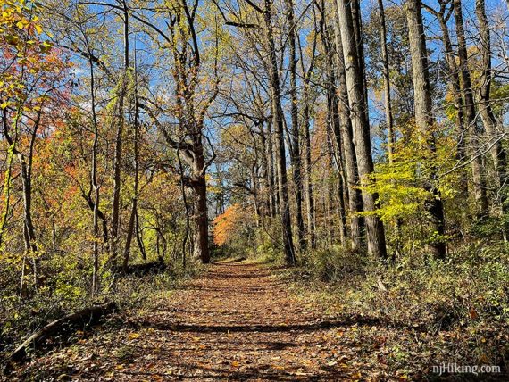
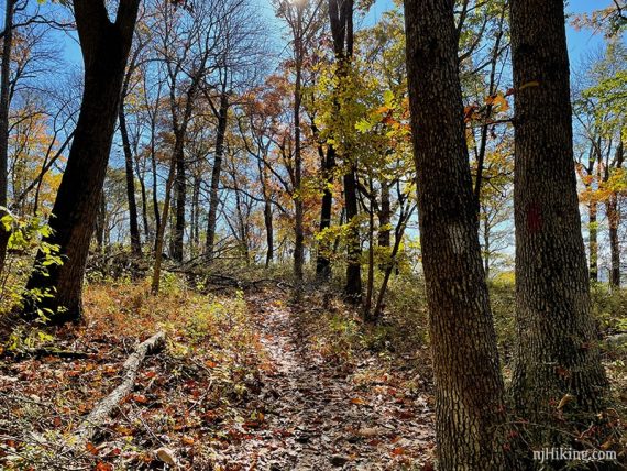
0.0 – From the parking lot, follow the wide gravel path that soon turns to dirt, passing any side trails on the way. (This is the Overlook Trail but is not marked).
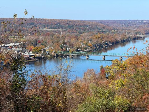
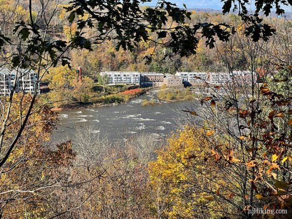
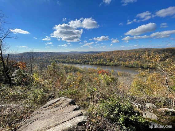
0.5 – The Overlook Trail ends at Goat Hill Overlook, an open grassy hill top. The picnic tables shown in the photo are gone.
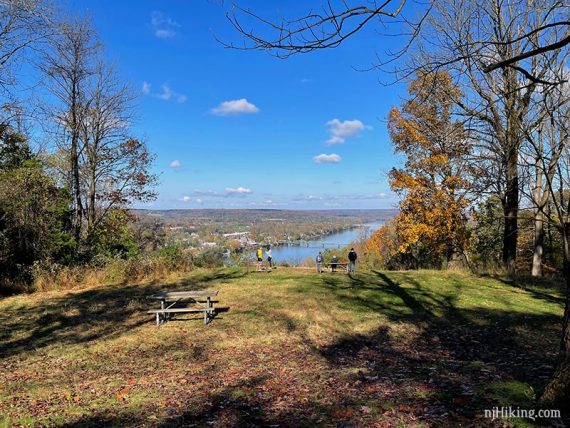
Goat Hill overlooks the Delaware River to Lambertville, New Jersey and New Hope, Pennsylvania.
Note: The trail map indicates a RED trail leading from the viewpoint and looping back to the Overlook Trail. It’s not worth following, is overgrown, several branching trails… don’t bother.
Retrace the Overlook Trail back to where the trail starts to curve around to the left (passing a trail on the right before that).
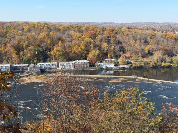
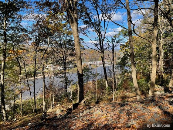
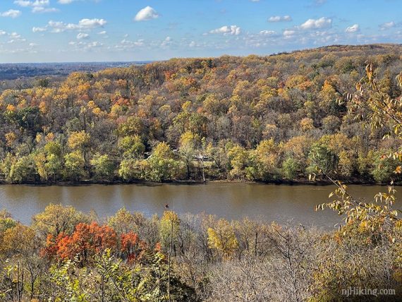
0.7 – At the curve in the trail, turn RIGHT to follow a side trail to the overlook from Washington’s Rock. These rocks, and others in the area, had graffiti on them on our most recent hike.
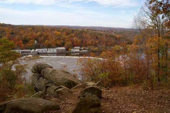
The long white building across the Delaware River in Pennsylvania is the Waterworks Condo. The structures jutting into the water are called “wing dams” – one coming from New Hope and the other from Lambertville – which serve to concentrate the flow of water.
Retrace the side trail back. Just before reaching the Overlook Trail again, a WHITE trail is on the right.
// 1.0 mile version: Follow the Overlook trail back down, retracing the route from earlier directly to the parking lot instead of continuing on WHITE. //
To do the full hike loop…. Turn LEFT to now follow WHITE (Quarry).
0.9 – Turn RIGHT for a RED side trail to Old Mill Overlook, a somewhat limited view. Follow the side trail as it loops past another more limited view.
Return from the side trail to meet back up with WHITE (Quarry). We passed a teepee made of branches (which may or may not still be there). The trail meandered confusingly a bit in this area to get back on WHITE.
Once there, turn towards the RIGHT to continue following WHITE (Quarry).
Pass a GREEN connector trail (might not notice it, we never do).
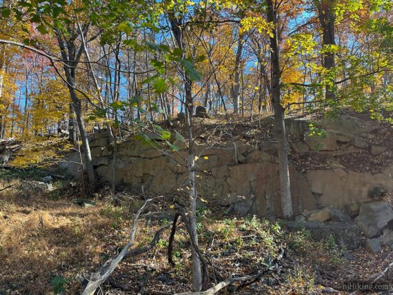
1.3 – Turn RIGHT for a RED side trail to Old Quarry. There is a limited view but the reason for this side trail is the remains of the quarry (rock walls and rocks).
This RED side trail peters out before running into a jumble of rocks…
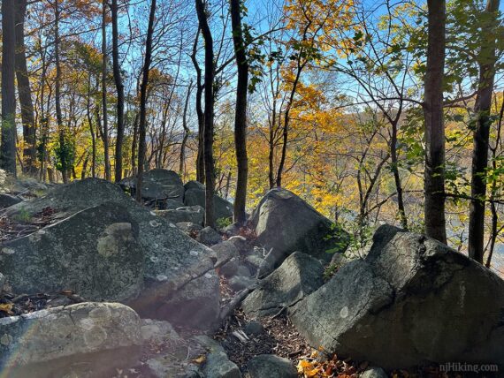
… and off on the left is a long, tall, rock face. Note that the far side had a lot of graffiti on it on our last visit, which isn’t visible from this angle.
Return from the side trail and turn right to continue on WHITE (Quarry).
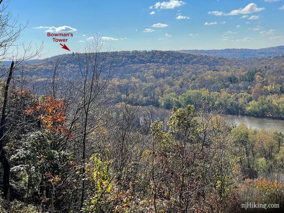
1.6 – Turn RIGHT for a RED side trail to South Overlook.
Bowman’s Tower is just visible across the Delaware River in Pennsylvania, at the far left.
Return from the side trail and continue on WHITE (Quarry). The trail hooks around and starts to head back at this point.
When we last hiked the trail somewhat hard to follow in this section, looking a little unused and with several blowdowns – but that can easily change.
Soon, WHITE (Quarry) turns LEFT. (Many GPS maps, as well as AllTrails, show a trail leading right too – but it was faint if there at all. This trail will loop the long way round to the summit of Goat Hill.)
1.7 – WHITE (Quarry) ends at a T-junction with YELLOW (Goat Hill). Turn LEFT to now follow YELLOW (Goat Hill).
Optional, add 0.2 miles total: RIGHT on YELLOW (Goat Hill) leads to the summit of Goat Hill. However, there is no view or anything to see (other than a large hole and the path splits in two directions). Skippable, unless you collect peaks. The summit is marked on our Interactive Map.
Continue following YELLOW (Goat Hill).
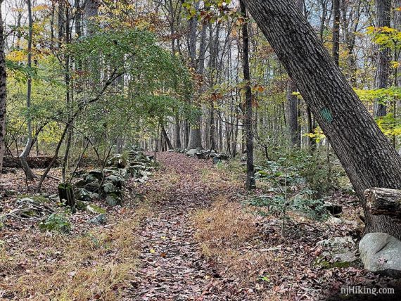
There are no views in this section, just a few rock walls and a couple of metal posts with water spigots (which we didn’t notice 11/2025, might be gone), but it’s a pleasant walk…
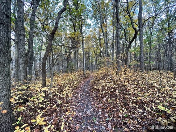
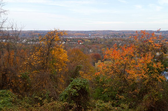
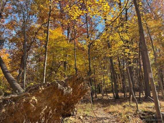
And the fall foliage can be rockin’.

2.0 – Pass GREEN (Central Connector) on the left, which is at this intersection. (This photo is from 2020 – only the lower part of the tree remains, with the rest of it fallen on the other side of the trail.)
2.2 – YELLOW (Goat Hill) runs into the Overlook Trail. Turn RIGHT to follow Overlook back to the parking lot.
—
Hiked: 11/2/25. All the trails. Hiked after Baldpate Mountain. Almost on Halloween again, not intentional!
Hiked: 10/31/20. All the trails. Hiked after Milford Bluffs. Just coincidence it was on Halloween again.
Hiked: 10/31/15. To overlook. On Halloween!
Updated: 3/2025 – Minor edits; picnic tables gone, lot is now paved; not re-hiked. 11/2020 – Re-hiked; full loop. Added description for the longer loop, added photos, updated Interactive Map. 5/2019 – New map (1/2019) added to site. Map had been updated to show marked trails (yellow, white etc).