Hike through fields and forest around Swimming River Reservoir and Marlu Lake in Monmouth County.
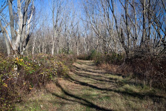
6.4 miles, or less. Surface is mostly easy; some very prominent roots, especially in the beginning, and grassy areas can be quite muddy. Mostly flat, no big elevation changes.
| 6.4 miles | This hike guide: Detailed instructions and photos follow below. |
| Shorter | – Marshy Walk (.3 mile.)or Woodland Trail (.6 mile) – Various loops using multiple trails such as Reservoir and Marlu. – 1-mile track loop for runners (it’s forest and not an artificial surface). |
| Nearby | Holmdel Park – North Section; Holmdel Park – Ramanessin and Bayonet Farm; Tatum Park; Henry Hudson Trail – Marlboro to Freehold. |
Our two cents:
Nice park for short loops and easy strolls, plus a playground, ball fields, and even canoe and snowshoe rentals in season.
Multiple paths to cut this shorter. For the avid hiker, this is pretty mild but we were able to get a nearly 6.5 mile loop out of the trails so it is a good option if relatively nearby.
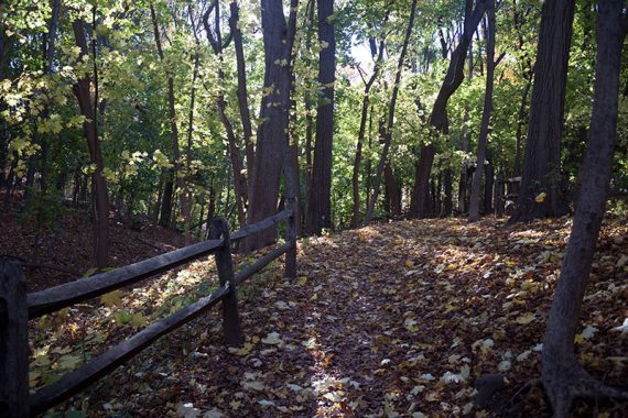
Lots of hiking along fields and not remote feeling. Navigating can be a tad difficult, see note on description below.
Updated: 1/2025 – Minor edits; partially re-hiked 11/2024. Older change log at page bottom.
Hike Info:
Map:
The trail map can usually be found in the trail kiosk, or print ahead from the park site. Follow along on your smartphone with our Interactive Map link above.
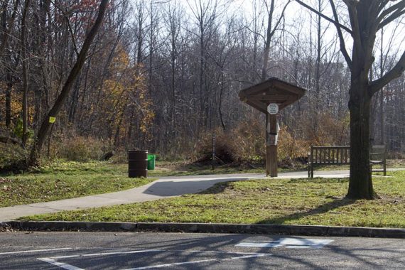
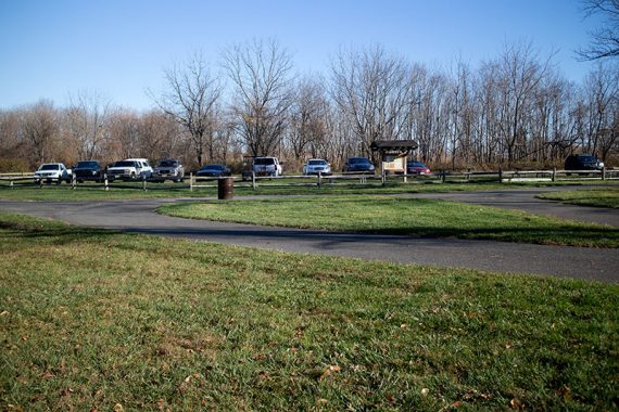
Parking: N40.33085° W74.13978°
Old Orchard Picnic Area, Thompson Park. 805 Newman Springs Road, Lincroft, NJ 07738. This route starts at the “Old Orchard” parking lot.
Note: There is another Thompson Park, in Middlesex County.
Restrooms:
Portable toilet in parking lot, as well as in the lot near the Marlu trail about a mile in. Restrooms at the visitor center.
Hike Directions:
Overview: Thompson Loop – Reservoir Loop – Marlu Trail – Reservoir Loop – Thompson/Inner Loop
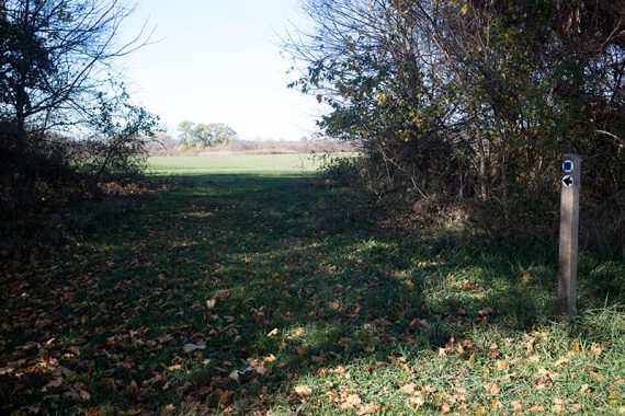
Note: Like most Monmouth County parks, on the trail map a BLUE SQUARE denotes moderate and a GREEN CIRCLE is easy – they aren’t trail markers or blazes. Junctions sometimes posts with the trail names on them but the trails themselves are usually not marked.
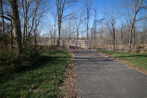
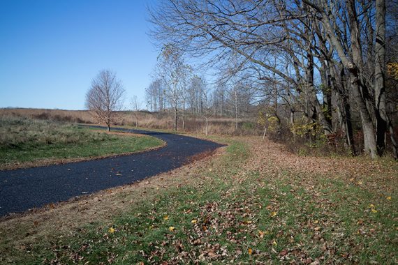
0.0 – Look for the trail kiosk at the end of the parking lot to pick up the paved Thompson Loop.
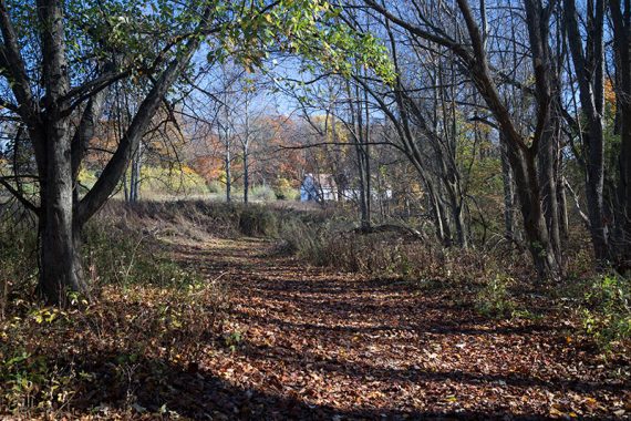
Shortly, when the paved Thompson Loop curves to the right, look for a BLUE marker post at the tree line at left. Walk LEFT towards that and enter the woods and start following Reservoir Loop.
0.2 – Continue on Reservoir Loop as it veers LEFT.
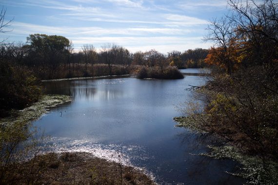
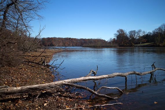
0.4 – Just before getting to a view of the reservoir, the path turns RIGHT. Optionally walk out to the view first, then come back to the turn.
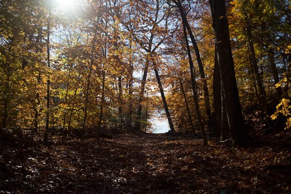
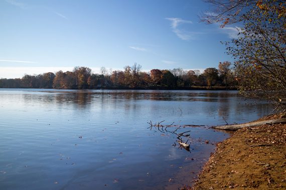
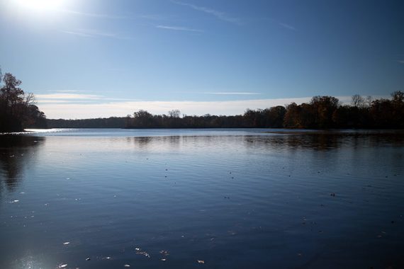
Follow the trail as it hugs the reservoir, traveling above it. Part of the trail running closer to the water is now blocked off and you’ll be directed around.
1.1 – At a trail marker veer RIGHT uphill away from the water to the edge of a field. Turn LEFT for a few steps, then turn LEFT again where the trail re-enters the woods.
1.5 – Come out into a clearing and parking lot. Cross the parking lot and start following the Marlu trail. A trail closer to the water parallels this trail.
1.7 – Veer RIGHT at an intersection. Optionally walk over to the left where there is a wildlife blind by the water, and then return.
The trail splits again shortly – keep RIGHT. At the field, turn LEFT to follow Marlu along field edges.
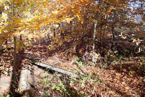
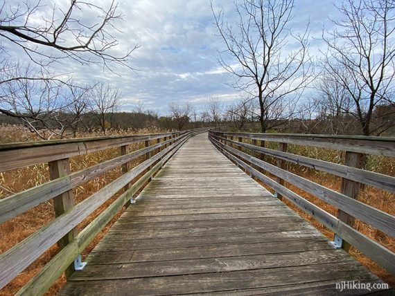
2.4 – The Marlu trail approaches the road, turns left, and ends at a bridge.
Just after crossing the bridge, turn LEFT to start following Reservoir Loop. Continue along the field.
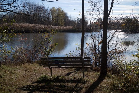
2.5 – BLUE is marked in two directions, either way meets up in a moment at a footbridge. You may as well continue ahead to a bench with a view of Marlu lake.
From the bench, continue on the trail that hugs the water, then head over the bridge. Optionally head over to another wildlife blind off on the left.
2.7 – Continue straight when Reservoir Loop splits, don’t go off to the right.
2.8 – Turn RIGHT at an a T-intersection (with a signpost indicating to make a left). Turn RIGHT again on to the paved park trail.
2.9 – Turn LEFT back onto Reservoir Loop (we noted no markers), then keep sharply left to continue on the trail (now with markers).
This area can be unclear, missing the sharp left will lead you to the back of a house (Ranger Residence).
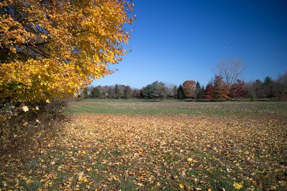
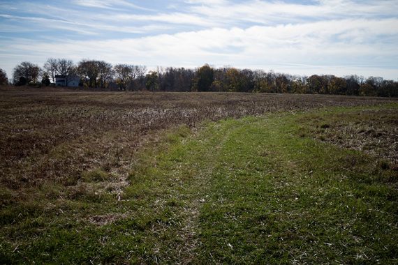
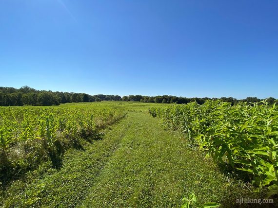
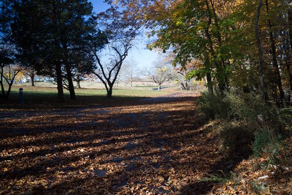
3.0 – Come out to a large open field. Follow the mowed/cleared path to the right, and then as it gently curves back and forth across the field towards a large house/park building in the distance.
The field seen in November then in July:
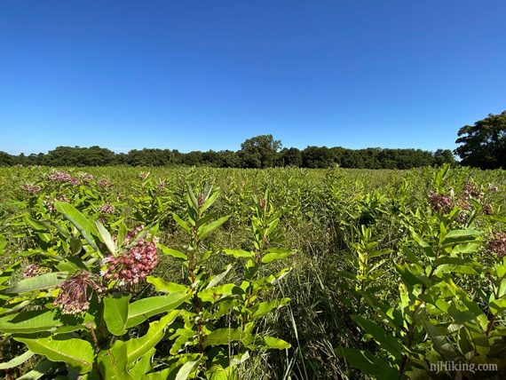
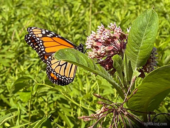
Milkweed has been planted all across this open area. Monarch butterflies use this plant for food and to lay eggs on the underside of the leaves.
Monarchs were flitting all around as we hiked through the field.
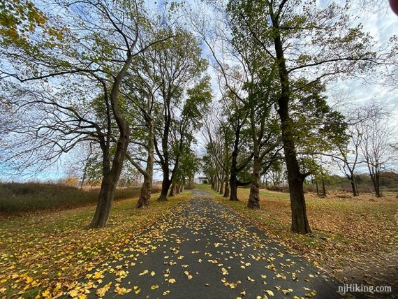
3.5 – Reservoir Loop crosses a dual driveway lined with large trees. Continue on the path between the field and the edge of the forest (don’t follow the driveway).
4.2 – Keep RIGHT for a short out-and-back to a view of Swimming River Reservoir (with an “overlook” trail marker). Continue on the path at the edge of the forest, keeping RIGHT when encountering any splits in the trail.
4.8 – Arrive at a paved road near park buildings (Training Center, Friends of the Parks).
Follow Reservoir Loop as it parallels the road on a path for a short bit then turns back to follow the pavement a bit more (or, you can just stay on the paved road).
5.0 – Turn RIGHT away from the paved road to follow Reservoir Loop on a mowed path along a field.
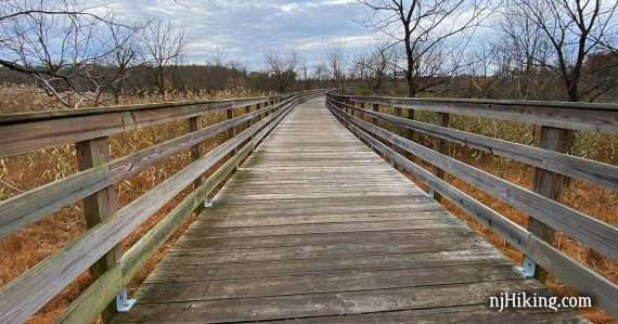
5.3 – Turn RIGHT and follow Reservoir Loop over a long bridge at Marlu Lake.
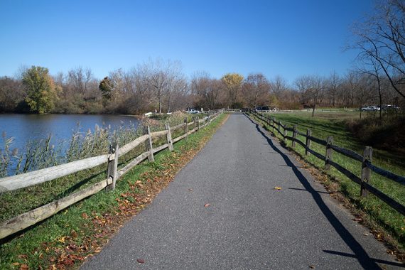
After the bridge, follow the paved Thompson Trail as it passes the Marlu Lake parking lot from earlier, and follow the paved Thompson Trail/Inner Loop back to the lot. Either side of the loop leads back to the lot but we usually stay to the right.
—-
Hiked: 11/10/24. Shorter variation.
Hiked: 1/8/23.
Hiked: 7/12/20.
Hiked: 11/10/19.
Hiked: 11/8/15.
Hiked: 11/20/11. Trail Blog: “Thompson Park – Swimming River Reservoir and Marlu Lake”
Updated: 1/2023 – Minor edits, re-hiked. 7/2020 Re-hiked, minor edits, added monarch photo. 11/2019 – Re-hiked, route adjusted to inner Reservoir Trail to go avoid torn up path along field edge. 11/2015 – Route changed to incorporate Marlu now that the bridge connects it to Reservoir, description updated, new photos.