Easy hike around Stony Lake and to two small waterfalls.
2.5 or 1.3 miles. Easy trail surface mostly, the usual rocks and roots with little elevation change.
| 2.5 or 1.3 miles | This hike guide: Detailed instructions and photos follow below. 2.5 miles: Stony Lake + 2 waterfalls 1.3 miles: Skip the falls; noted below |
| Nearby, same lot | Sunrise Mountain |
| Nearby, same park | Stony Brook Falls (just the falls portion of this hike); Blue Mountain Loop – Lower; Blue Mountain Loop – Upper; Culvers Gap to Blue Mountain; Sunrise Mountain to Culvers Gap |
Our two cents:
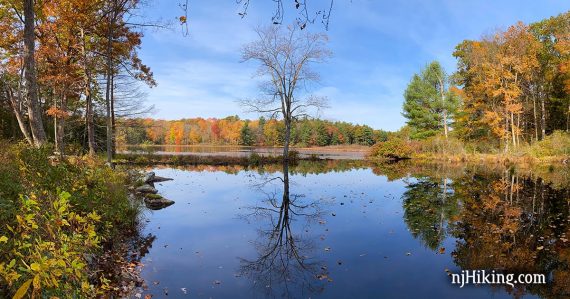
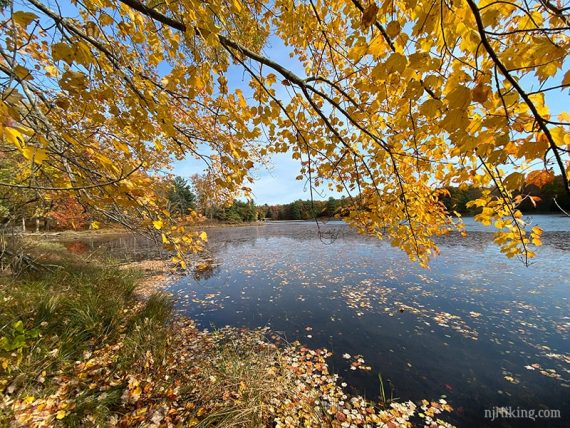
Pleasant short hike that was very pretty in Fall. There was a beaver lodge on the lake.
It’s worthwhile doing the whole loop to add in the two waterfalls but the parking lot is in the middle of the hike – so it’s easy to bail if you’ve had enough.
Updated: 6/2025 – Minor edits. 10/2023 – Minor edits, slight route adjustment at the junction of Stony Lake and Blue Mountain connector; re-hiked.
Hike Info:
Map:
Kittatinny Trails has more detail than the park’s map. Follow along on your smartphone with our Interactive Map link above.
Parking: N41.20292° W74.77338°
Stokes State Forest, 1 Coursen Rd, Branchville, NJ 07826. Note: This is for the main entrance at the park office. The hike starts at the Stony Lake parking lot which has no street address.
Take Rt 206 North until you enter Stokes, pass Rt 636 and then turn right for the park entrance. Drive down Coursen Rd and make a right at the end to get to the trail lot (follow signs for Stony Lake).
Fee: Charged from Memorial to Labor day. Info on the NJ State Park Pass.
Restrooms:
At the Visitor Center. At Stony Lake (walk up the hill from the parking lot) from Memorial to Labor Day.
Near this parking lot, at the Kittle Field lot, bathrooms may be open if the Stony Lake ones aren’t.
Related: Best Fall Foliage Hikes in New Jersey
Hike Directions:
Overview: Tower (GREEN) – Coursen (BLUE) – Stony Lake (BLUE-BROWN) – Stony Brook (BROWN)
0.0 – From the parking lot, walk towards the trail kiosk and then past the metal gate. There are multiple trail markers on a tree: Blue Mountain (LIGHT BLUE), Stony Brook (BROWN), Tower (GREEN).
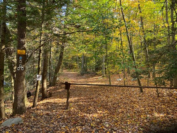
Start following Tower (GREEN) / Stony Brook (BROWN) / Blue Mountain (LIGHT BLUE)].
Soon, continue following Tower (GREEN)/Stony Brook (BROWN) to the RIGHT. [Blue Mountain (LIGHT BLUE) leaves ahead].
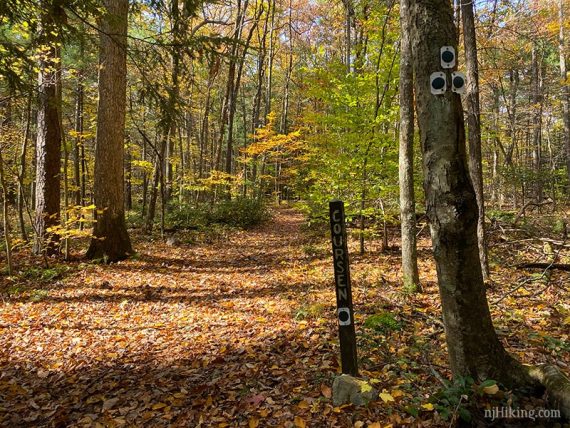
0.2 – Turn RIGHT to now follow Coursen (BLUE). [Tower (GREEN)/Stony Brook (BROWN) leave to the left].
Note: Coursen (BLUE) is blue on maps but in real life appears dark – blue or grey.
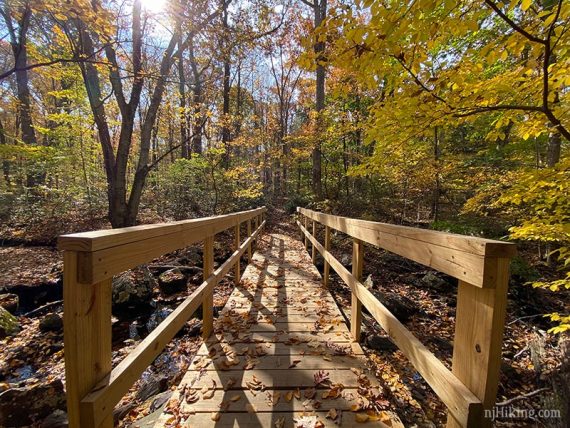
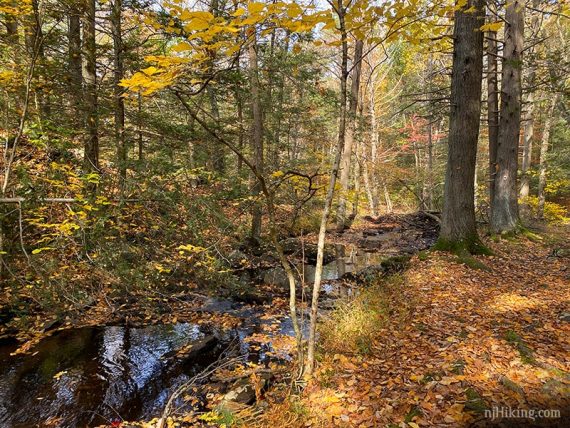
0.4 – Just AFTER a bridge, turn RIGHT to now follow Stony Lake (BLUE-BROWN). [Stony Lake (BLUE-BROWN) also goes to the right before the bridge but is easy to not notice].
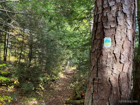
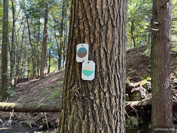
Note: Stony Lake is listed as BLUE-BROWN on the map but on the trail the marker color looks almost light green or aquamarine and yellow.
Perhaps due to fading or maybe the marker has changed. Or we’re missing something here. At any rate, the Stony Lake marker looks like this:
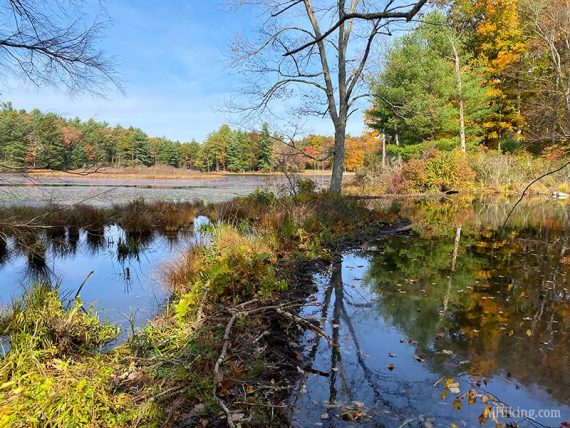
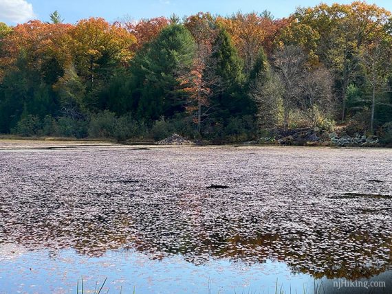
The trail nears the water, where there is evidence of beaver activity.
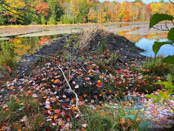
A little further on the there is a beaver lodge by the edge of the lake.
Continue looping around Stony Lake. The beaver lodge can be spotted across the way.
1.0 – Stony Lake (BLUE-BROWN) starts to turn away from the lake and just after the remains of a foundation (might not notice it) keep straight where a connector for Blue Mountain (BLACK DOT on LIGHT BLUE) goes to the left.
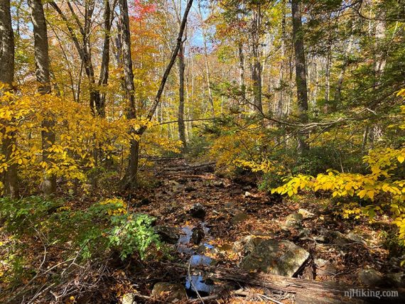
The trail gets closer to a dam at the end of the lake, then follows the stream.
We spotted two different dual-color markers on one tree. Old faded and new? Changing from one trail to another that we can’t find mention of? Blaze color leftover from when Stokes revamped the trail system?
After this the trail was marked with a definite BLUE-BROWN marker. ‘Tis a mystery we cannot explain.
At the park road, turn RIGHT and walk down the road a bit and then turn LEFT to now follow Stony Brook (BROWN). [Stony Lake (BLUE-BROWN) ends at the park road]/
// Shorter option, 1.3 miles: Instead, follow the park road back to the lot, skipping the falls. //
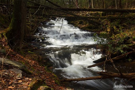
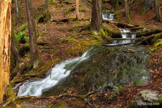
1.3 – Follow the trail down next to the first Stony Brook Falls where water cascades down a sharp angled stone face that is slightly stepped.
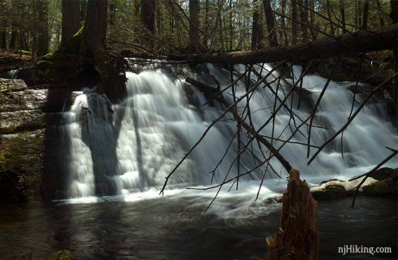
The angled rock face is visible during less water flow.
Follow Stony Brook (BROWN) as it turns RIGHT in just a bit. The turn is easy to miss as the trail appears to continue straight.
Not a big deal if you miss the turn – you’ll just end up by the Kittle parking lot and can pick up the route again by walking towards the bathroom building.
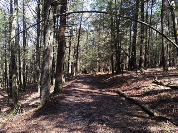
1.5 – Continue following Stony Brook (BROWN) as it turns RIGHT past the bathroom building. Stony Brook (BROWN) is a wide easy woods road in this area.
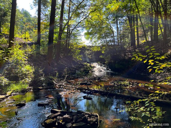
1.7 – Near the start of the Silver Mine (ORANGE) trail, turn LEFT away from that and walk towards the stream. There’s a path but we didn’t spot any markers.
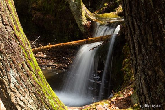
A cascade tumbles over rocks near the remnants of a stone wall from an old sawmill site.
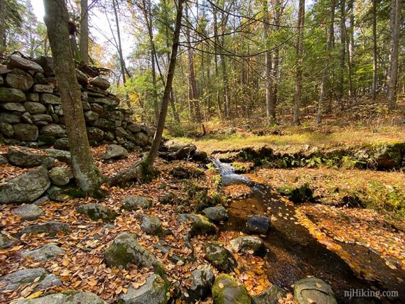
Walk along Stony Brook to get different views of the cascades.
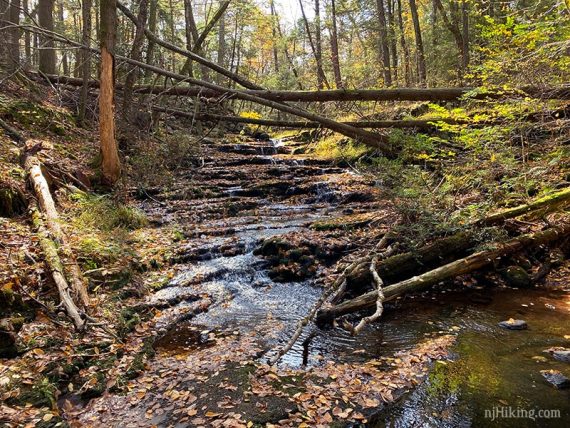
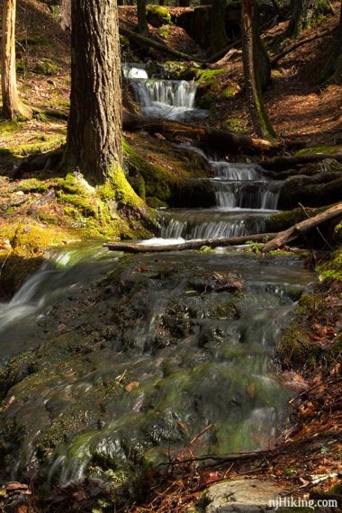
A little further down from the stone walls the fall appear to cascade over short steps. Stony Brook Falls is also known as “Stepping Stone Falls”.
With less flow the steps are much more pronounced.
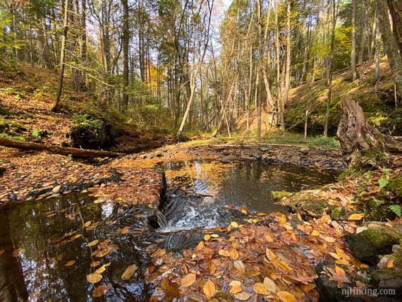
The stream pools into a small basin after the falls.
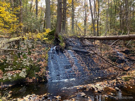
If there’s been a lot of recent rain there might be another cascade coming down the hill and spilling into the stream.
This is a pretty little cascade that slides over roots and rocks and then falls into the pool in the stream below.
It’s not always flowing though, when we hiked here in October 2020 it was totally dry. It was also a mere trickle in October of 2023 and appeared to be blocked by fallen branches.
Return to Stony Brook (BROWN) and turn RIGHT. Follow it back to the bathroom building and turn LEFT. Continue back, past the first falls.
2.3 – Cross the park road and continue on Stony Brook (BROWN) for bit more to the parking lot.
—
Hiked: 10/1/23. Stony Lake Loop, Falls, Silver Mine + Buttermilk, Silver Spray; bobcat spotted.
Hiked: 10/18/20. with Culvers Gap to Fire Tower, and Sunrise Mtn viewpoint.