Rocky hike that encircles Terrace Pond and uses a floating bridge.
3.8 miles – Rugged, rocky surface with scrambling.
| 3.8 miles | This hike guide: Detailed instructions and photos follow below. |
| Shorter: | 3.0 – YELLOW to a viewpoint over the pond and back. Noted below. |
| Also from this lot: | Terrace Pond – West, Circular, North; Terrace Pond Loop; Wawayanda State Park – Old Coal Trail. |
| Nearby | Terrace Pond North, Bearfort Ridge Loop – Surprise Lake; Surprise Lake Loop via State Line Trail; Wawayanda – Hoeferlin, Cedar Swamp; Wawayanda – Iron Mountain and Hoeferlin Loop. |
Our two cents:
Hike to the pond, head over a nifty floating bridge and up a wooden trail ladder, then circle around the pond and retrace.
This is the shortest of our Terrace Pond routes but it’s still a rugged and rocky trail that requires some scrambling. Shorten it further by turning around at the pond instead of hiking around it.
Fun fact: A route that has an out-and-back with a loop is called “lollipop” trail because it resembles a stick with a candy on it. The route is sort of a wonky bent lollipop… but we’re going with it.
Updates: 7/2024 – Page refreshed, partly re-hiked while doing the West, Circular, North loop. 2/2022 – Trail map info.
Hike Info:
Map/Books:
Northern New Jersey Highlands Trails Map is recommended to navigate the network of trails in this park. Follow along on your smartphone with our Interactive Map link above.
Though the trails are considered part of Wawayanda State Park, they are now covered on the Abram Hewitt park site.
Other hikes in this area can be found in 50 Hikes in New Jersey, Hiking New Jersey (2023), Hike of the Week, Take a Hike New York City.
Parking: N41.14288° W74.40743° [P7 lot]
1575 Clinton Rd, Hewitt, NJ 07421. Rt 287N to exit 52 (or Rt 287S to 52A), then Rt 23N towards Butler. Exit for Clinton Road.
The parking lot is past Clinton Reservoir and some other small parking areas. Just past a sign/gate for the Wildcat Mountain Wilderness Center is just a large dirt lot on the left with a small “P7” sign.
Restrooms:
None. There are gas stations and stores along Rt 23 in Butler (a Quick Chek then a super Wawa are roughly 15-20 min. from the trailhead).
Swimming Note:
Though you’ll see people doing it, swimming in Terrace Pond is not allowed – it’s patrolled and ticketed. The sides of the pond are somewhat high above the water on rock ledges in most spots, it’s not like you can walk into the water from a beach.
It can be dangerous and several people have drowned. In addition, it’s difficult for Search & Rescue to reach this remote location quickly. See “Terrace Pond attracts hikers from all over, but there’s a reason why swimming is banned.“
Hike Directions:
Overview: YELLOW (Terrace Pond (TP) West) – WHITE (TP Circular) – YELLOW (TP West)
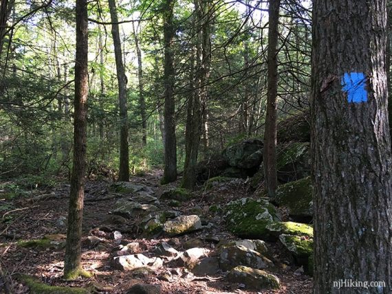
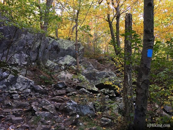
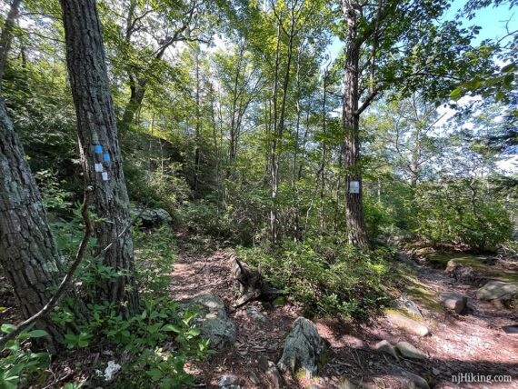
** Due to the changes to the colors of trails in this park, the blazes shown in our photos will not always match what the description states. Any BLUE is the prior trail color. **
0.0 – Walk across the street from the lot to the trail kiosk.
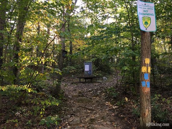
Bear LEFT to start following YELLOW (TP West). The rocky trail is mostly level at first, crossing some wet areas on large rocks (these blue blazes are now yellow).
0.7 – Turn RIGHT onto a pipeline cut to continue following YELLOW (TP West) uphill on the pipeline cut at the edge of the woods.
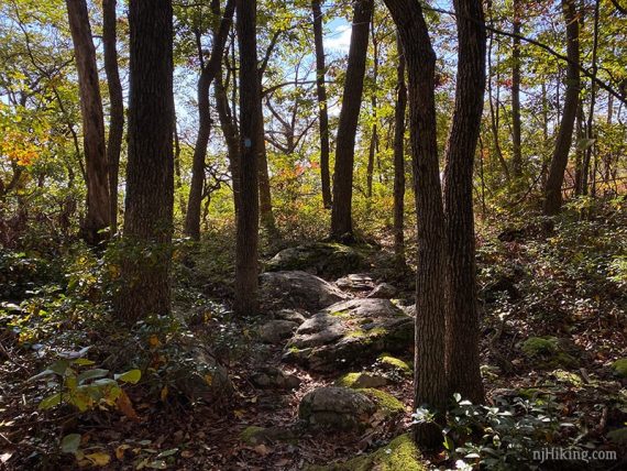
0.8 – Turn RIGHT off the pipeline and back into the woods. Continue following YELLOW (TP West) as it scrambles up and down large rocks.
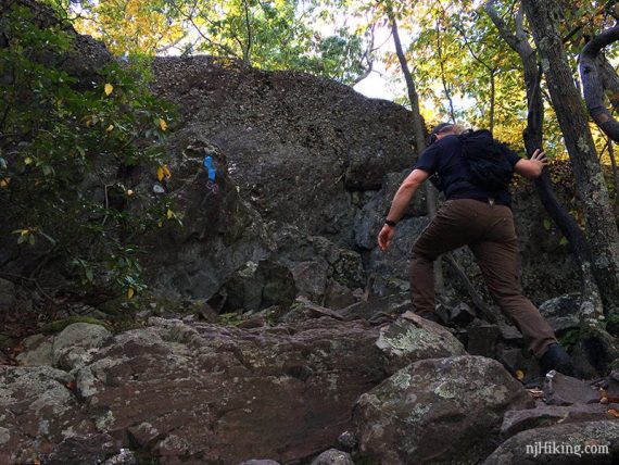
A faint trail on the right scrambles up to an optional view, but there is a better one in just a bit.
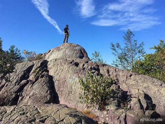
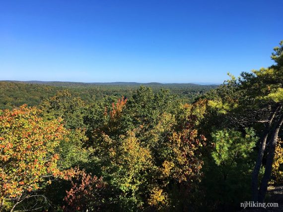
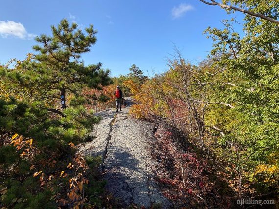
1.2 – Off to the right, optionally scramble up a large protruding rock for a expansive view over the surrounding forest with low hills in the distance.
In the photo below it appears that the trail goes up and continues over this rock fin – it doesn’t. The trail markers are for the trail coming in the opposite direction and are indicating a turn away from the rock.
Return back down to the trail. Cross a potentially wet area on large rocks.
1.4 – Junction of YELLOW (TP West) and WHITE (TP Circular) near Terrace Pond. Turn LEFT to start following WHITE (TP Circular).
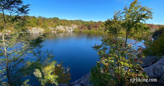
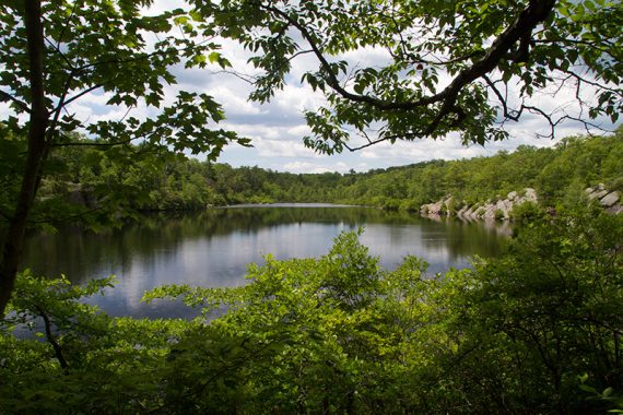
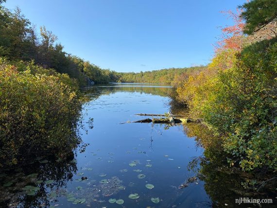
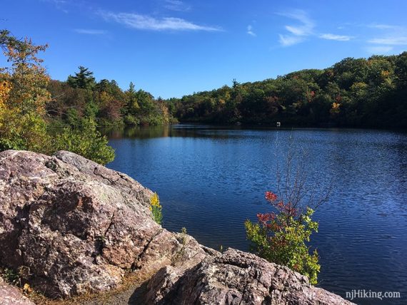
Walk over to the right out to a viewpoint over Terrace Pond.
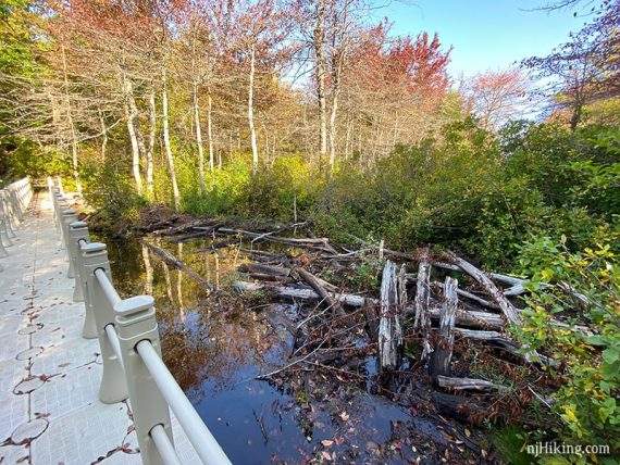
Approach a long floating bridge.
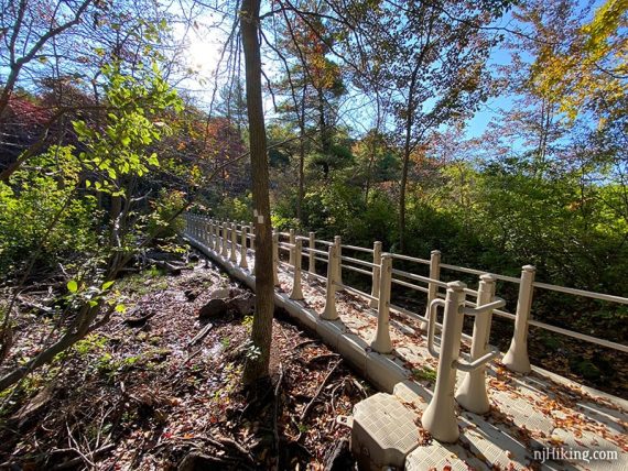
Continue following WHITE (TP Circular) as it goes over the bridge.
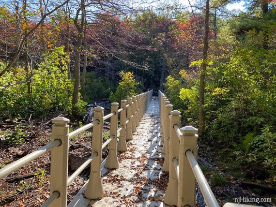
The floating walkway goes over a section of water and replaces a crossing that had become difficult, if not impossible, over the years – it used to require balancing on logs with one misstep leading to a muck covered leg.
Get a peek through the trees into Terrace Pond.
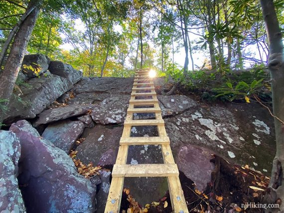
After the bridge the trail soon comes to a steep area of rocks with a ladder.
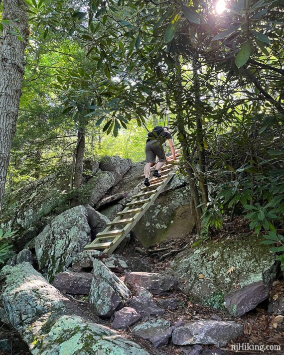
The ladder makes easy work of a scramble up a rock face.
1.5 – Turn RIGHT to continue following WHITE (TP Circular). [BLUE (TP North) is co-joined for a bit. BLUE (TP North) also goes left].
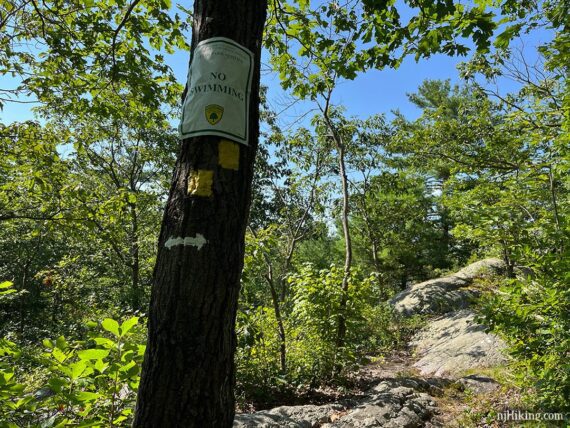
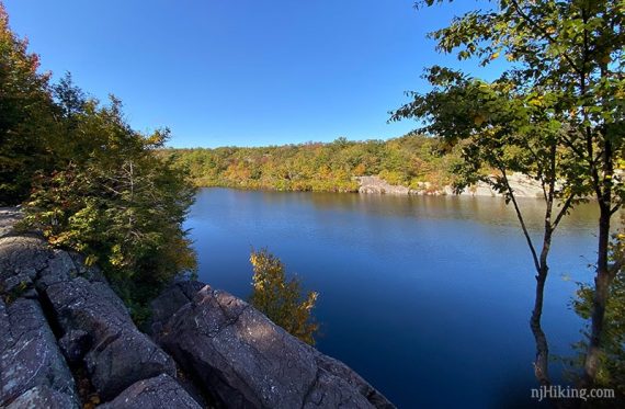
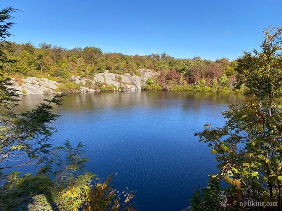
1.6 – There are a few viewpoints/break spots for the pond on the right side. The first is somewhat limited, the second is better, and the next is larger and more open (but may have more people).
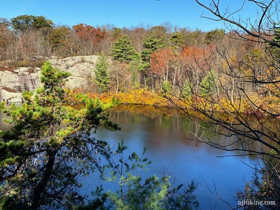
The last, larger viewpoint is actually beyond where you need to turn. Continue ahead on a casual path, past a “no swimming’ sign. Then return to this intersection afterward.
At this last viewpoint there are panoramic views across Terrace Pond. The steep rocky shoreline goes around most of the pond, and there aren’t areas to get down to the edge.
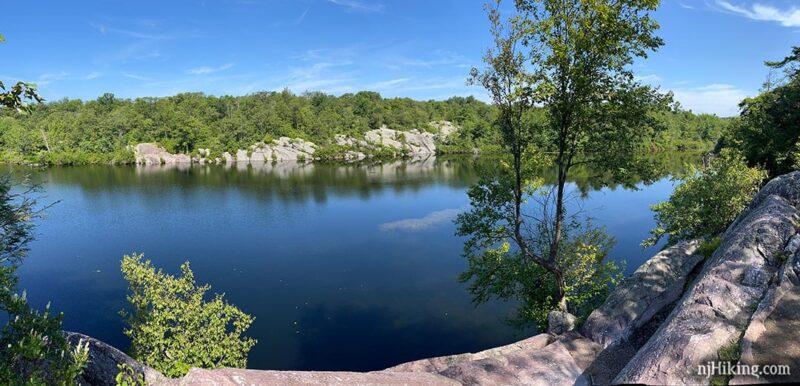
This is a nice place to take a break.
To continue following WHITE (TP Circular) / BLUE (TP North), take a few steps back from this last viewpoint to where the trail turns and heads uphill over stone steps (may have not noticed this when arriving at the overlook).
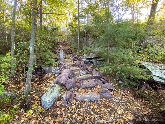
Continue following WHITE (TP Circular) / BLUE (TP North) over some rock slabs.
1.9 – Continue straight on WHITE (TP Circular). [BLUE (TP North) leaves to the left].
2.3 – WHITE (TP Circular) meets up with YELLOW (TP West) and is co-joined as it makes it’s way back towards Terrace Pond. [YELLOW (TP West) also goes to the left].
Continue on WHITE (TP Circular) / YELLOW (TP West) as it goes past several more viewpoints/break spots.
2.4 – Back at the start of the loop, now follow just YELLOW (TP West). [WHITE (TP Circular) leaves to the right, where you were earlier].
Retrace the route on YELLOW (TP West) back to the lot…
2.6 – Pass the scramble up a protruding rock to a view point.
3.0 – Back at the pipeline, turn LEFT and follow YELLOW (TP West) downhill.
3.1 – Turn LEFT back into the woods.
—
4/27/21 – New hike guide page created from existing content.