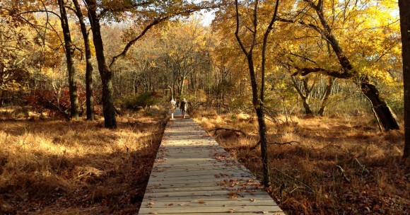
Pleasant hike over rolling hills and through beautiful marshlands with the assistance of numerous boardwalks.
3.2 Miles. Easy to moderate, some minor elevation change; steps.
| 3.2 miles | This hike guide: Detailed instructions, photos, and video follow below. |
| Shorter | Instead, do the RED (1.3 miles) or YELLOW (1.7 miles) loop from the same trailhead. |
| Longer | 4.0 miles – Add YELLOW to the GREEN. 4.3 miles; variation – YELLOW, BLUE & GREEN loop. 4.5 miles – add a side trip to Steamboat Landing. |
| Same park | Start from a different lot and do White Trail and Arrowsmith. |
| Nearby | John Phillips Preserve; Julian Capik Preserve; Henry Hudson/Bayshore Bike Trail. |
Our two cents:
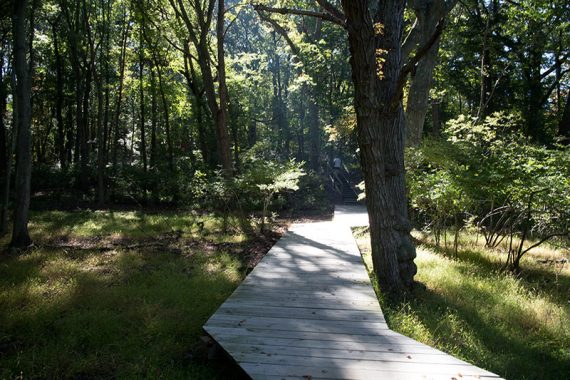
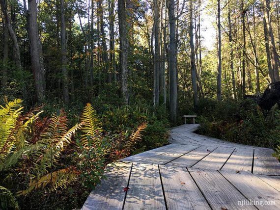
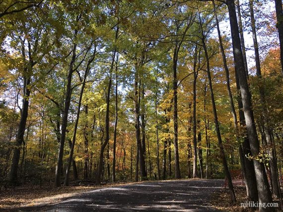
This park is a great intro to hiking, with a nice variety of trees, plenty of boardwalks, a lake, and a crabbing bridge.
Different length loops allow everything from short jaunts to stitching together a 6-8 mile loop. Nice nature center, swimming area in season, playground.
Updated: 2/2024 – Minor edits; refreshed GPS track on the Interactive Map (unchanged, replaced 2014 data); re-hiked 1/1/24; 11/29/24. Older change log at page bottom.
Hike Info:
Map:
Ranger station and interpretive center should have printed park maps or print it out ahead from the park site. Follow along on your smartphone with our Interactive Map link above.
Books:
This hike is now in Best Day Hikes in New Jersey. Slight variations can be found in 50 Hikes in New Jersey, Hiking New Jersey (2023) and 60 Hikes Within 60 Miles: New York City.
A slightly outdated version of this hike is found in Hike of the Week.
Fees: From Memorial Day through Labor Day an entrance fee is charged. You can also purchase an annual NJ Park Pass.
Restrooms:
Restrooms at the ranger station and interpretive center, and comfort stations near the campground (seasonal).
Parking: N40.43608° W74.26553°
“Cheesequake State Park Trailhead”, 287 State Park Rd, Matawan, NJ 07747.
From the Garden State Parkway, take exit 120, follow brown state park signs. Or take Rt 34 to Cheesequake-Morristown Road and turn onto Gordon Rd, and follow into park.
There is a gate with the ranger station on the right. Shortly after is the hikers parking on the left.
The hiker lot gets filled to capacity very often now. There may be parking back at the ranger lot. Or, continue on and follow signs to “Hooks Lake” for a very large lot further in the park and connect to trails from there.
The GREEN, RED, BLUE, and YELLOW trails from this lot are foot traffic only. The WHITE biking trail is another area of the park.
Hike Directions:
Overview: This route is entirely on the GREEN trail but RED, BLUE, and YELLOW will join and leave along the way.
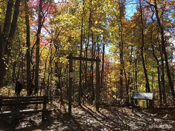
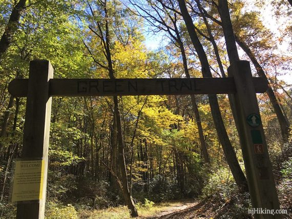
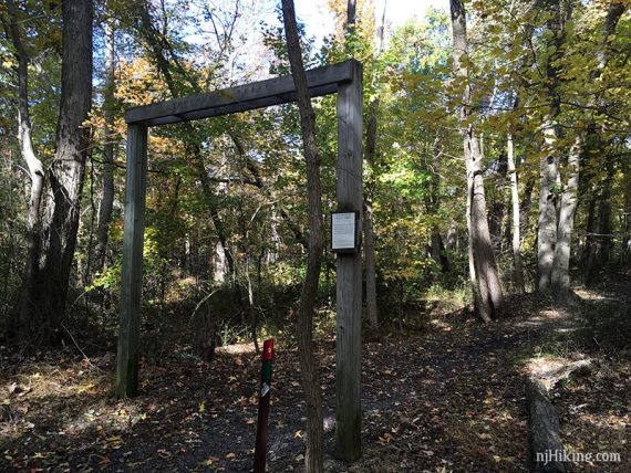
0.0 – Start at the huge wooden TRAIL HEAD arch near the trail kiosk and map sign.
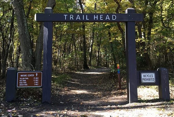
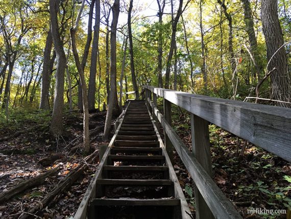
Follow GREEN. Almost immediately the trail splits: bear LEFT and follow the stepped boardwalk down. [YELLOW veers right at another huge arch]
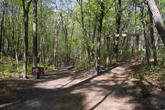
At the end of the stairs, turn LEFT. [The YELLOW trail continues straight].
Walk over a small bridge and head up the hill to the Interpretive Center, continuing on GREEN. Check it out and then continue. The trail is marked RED-GREEN-BLUE at this point.
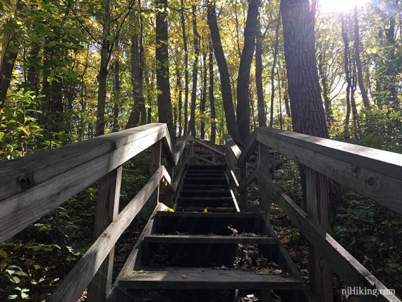
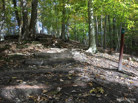
0.3 – Long set of steps up a hill.
At the T-junction turn left and follow RED/GREEN. [BLUE leaves to the right].
0.6 – Cross the park road (Perrine Road, on the trail map), and turn RIGHT to follow GREEN [RED leaves to the left]. There is a bench and a sign about the RED and GREEN trails.
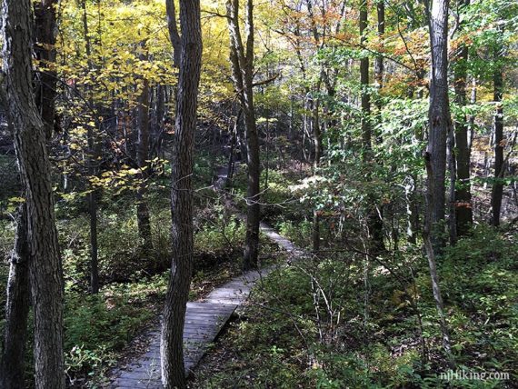
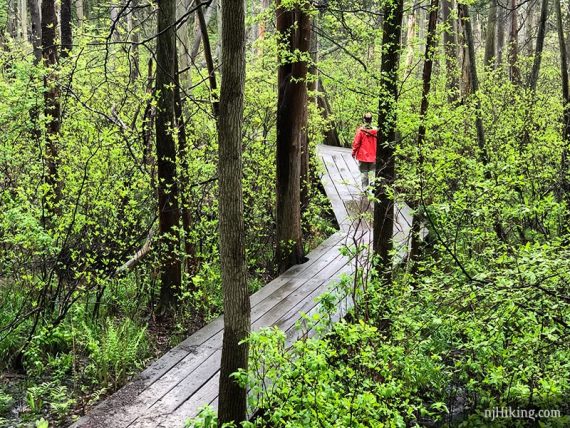
The trail continues down a hill and a large flight of wooden steps, and over a long boardwalk over a seasonally wet area.
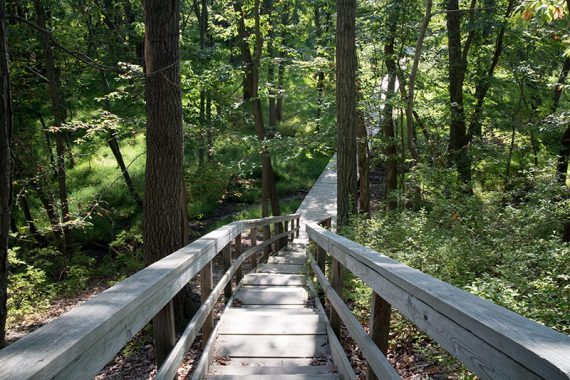
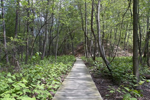
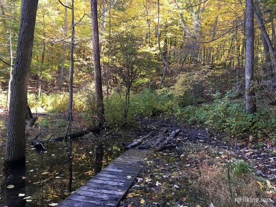
1.0 – After a short set of steps up, turn RIGHT, following the trail as it zig-zags over a boardwalk through a cedar swamp… really nifty and our favorite spot in the park.
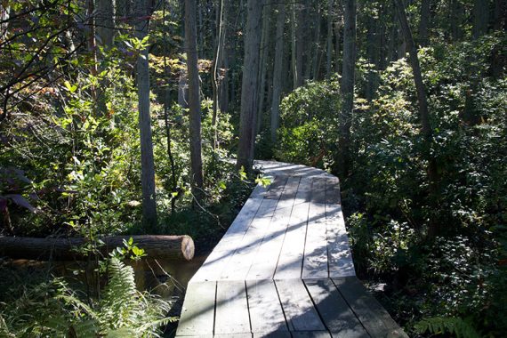
This area was extensively damaged by Hurricane Sandy and closed for over a year.
Cross the wide dirt park road (called Museum Rd on the trail map), continuing under the wooden arch for GREEN.
// Optional to Steamboat Landing, out-and-back adds 1.3 total miles: Instead, turn RIGHT on the wide dirt park road (Museum Rd). After the gate, turn RIGHT (Dock Rd). At the end, follow the path through reeds to the edge of Cheesequake Creek. Photos and full directions see Steamboat Landing.
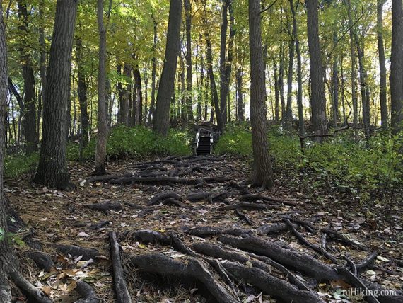
1.4 – The GREEN trail bears left and goes up a slightly steep root-covered hill and a set of stairs.
The trail runs along the back of several business properties and over some bridges. Keep following GREEN when it bears sharply left – there are a few unmarked paths in this area that lead off.
1.9 – Follow GREEN to the RIGHT when approaching the park road.
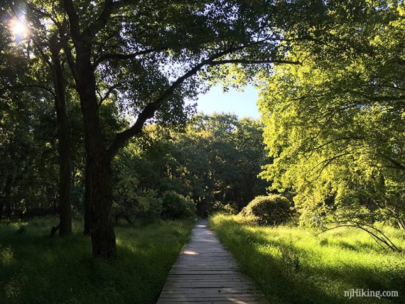
2.0 – Turn LEFT onto a long boardwalk and then cross a wooden bridge over a stream (9/2017 – absolutely no water here, just lots of sand).
2.3 – After a somewhat marshy area (it used to be more so) with a lot of roots and a small observation platform, the trail heads uphill to the right.
2.6 – GREEN joins the park road near the campground. Turn LEFT and walk along the park road, passing the group campgrounds and comfort stations.
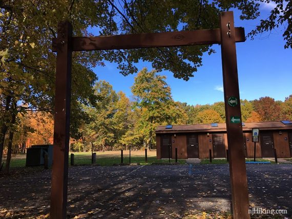
2.7 – Turn RIGHT at the wooden trail arch off of the park road and onto trail again, now following GREEN/RED. Continue past the campgrounds on the right before arriving at the park road.
2.8 – Turn RIGHT onto the park road (called Museum Rd on the trail map) and follow it back to the parking lot.
—
Hiked: 1/1/24.
Hiked: 11/29/24.
Hiked: 9/17/22.
Hiked: 2/20/22.
Hiked: 1/1/21.
Hiked: 3/30/19. Variation 3.5 m. Yellow + Road + Green.
Hiked: 5/12/18.
Hiked: 9/23/17. Variation; 4.0m – Yellow plus Green loop.
Hiked: 11/3/15. Variation; Yellow, Blue, and Green trails.
Hiked: 9/20/14. Variation Green and Blue trails.
Hiked: 1/6/14. Trail Blog: “Snowy Green Trail“
Hiked: 12/14/13. Trail Blog: “Green Trail in the Snow“
Hiked: 2/18/13. Trail Blog: “Yellow, Red, Green“
Hiked: 1/5/13. Trail Blog: “Green and Yellow Trails”
Hiked: 11/23/12. Trail Blog: “After Hurricane Sandy”
Hiked: 4/21/12. Trail Blog: “Steamboat Landing”
Hiked: 9/10/11. Trail Blog: “After Irene”
Hiked: 1/16/11. Trail Blog: “Winter Hikes: D&R Canal, Cheesequake S.P.”
Hiked: 4/4/09. Trail Blog: “Green Trail”
Updated: 2/2023 – Minor edits, added optional side trip to Steamboat Landing; re-hiked 9/2022. 2/2022 – Re-hiked, minor edits. 4/2020 – Page refreshed, photos added, not re-hiked. 11/2014– New video. Photos added that show the trail through the seasons. Description and GPX updated to reflect that the detour around the cedar swamp is gone, and include the green trail reroute from early 2013.