Scramble through the Lemon Squeezer – a narrow rock crevice on the Appalachian Trail – and hike past Island Pond, Boston Mine, Green Pond, and the Valley of Boulders.
8.2 or 4.0 miles, total round trip. Rugged and rocky trail surface, but other than the Lemon Squeezer area, no real scrambling.
| 8.2 miles | This hike guide: Detailed instructions, photos, and video follow below. |
| Shorter | 4.0 miles – Just to the Lemon Squeezer and back, also passes Island Pond. Plus plenty of bail-out opportunities to shorten or vary the hike. Noted below. |
| Longer | Harriman has such an extensive network of trails… anything is possible. |
| Nearby | Jackie Jones Fire Tower; Black Rock and Hogencamp; Pine Meadows Loop; Almost Perpendicular & Elbow Brush; Seven Hills & HTS; Seven Hills & Raccoon Brook; West Mountain & Doodletown; Sterling Forest Fire Tower. |
| Similar name, different hike | This is the “Lemon Squeezer” at Harriman State Park and NOT the “Lemon Squeeze” at Mohonk Preserve (but that’s a great hike too!) |
Our two cents:
The route uses multiple trails to visit Island Pond, the Lemon Squeezer, open rock slabs with views over Island Pond, Boston Mine, Green Pond, and the Valley of Boulders.
The Lemon Squeezer is a really interesting and fun section of the Appalachian Trail in Harriman State Park in New York (not far from the border with NJ).
The Appalachian Trail goes through a tight opening in large rocks, squeezes through a narrow section, then scrambles up a rock face.
The Lemon Squeezer and/or the scramble can be easily avoided by following a trail around it. But at least give it a shot… it’s a fun challenge.
While not a challenging hike per se, this route not a casual stroll either – there’s plenty of up-n-down, narrow rocky trail, sections of rock slabs (there for we recommend avoiding this hike if the trails are wet). Encountered some tall grass along the trails in late June so be rockin’ some bug protection.
Updated: 7/2024 – Re-hiked, minor edits, added photos; archived replaced photos onto a Trail Blog. Older change log at page bottom.
Hike Info:
Map/Books:
#119 of the Harriman-Bear Mountain Trails map set. This map is really recommended when hiking at Harriman, simply because there are so many trail junctions. Follow along on your smartphone with our Interactive Map link above.
This route in the opposite direction is now found in 50 Hikes in the Lower Hudson Valley. Shorter variations are found in Circuit Hikes in Harriman, Take a Hike New York City and Hike of the Week. Detailed trail descriptions can be found in Harriman Trails: A Guide and History.
Parking: N41.26480° W74.15443° [Elk Pen Lot]
“Elk Pen Parking Lot at Harriman State Park”, 1010 Arden Valley Rd, Southfields, NY 10975.
Garden State Parkway North to 17 N to Rt 287 N to Rt 87/17N. Take exit 15A and turn left onto Rt 17 N. Pass the main entrance to the park and keep going, then turn right on Arden Valley. Cross the bridge over the Thruway, and turn right into the large dirt lot next to a field.
There are many parking areas to access the extensive trail system at Harriman, and you can approach the Lemon Squeezer from a lot of directions. We chose to start at the Elk Pen lot, which is probably the closest to the Squeezer.
Fun Fact: This lot is called “Elk Pen” because it held around 60 elk that were brought from Yellowstone in 1919. They didn’t do well and the remaining were sold in 1942. [Source: 50 Hikes in the Lower Hudson Valley].
Restrooms:
None. There is a Valero gas station on Rt. 17 N. in Mahwah NJ just before getting onto Rt. 287 (about 20 min from the trailhead)…. or use the last rest area on the Parkway if taking that to Rt 87 instead.
There are some stores along 17 in New York but unsure if they have, or let you use, the bathroom (i.e. the Dunkin Donuts; a small gas station). You could detour to the visitor center on Seven Lakes Drive but it would be out of the way.
The Tuxedo train station might have them. Then another gas station a little further along had a portable toilet in the parking lot (?… doesn’t seem like a great option).
Note: On the NY Thruway are signs for the Sloatsburg rest area that is 2 miles north of exit 15a – but once at the rest area there is no turnaround and the next exit is far far out of the way… we made that mistake many years ago, so now you don’t have to.
Video Note: The cool stone bridge at the end of the video is no more as it was washed out in 2011 during Hurricane Irene.
Refreshments:
Assorted options along Rt 17… Dottie’s is closest to the trailhead and seems to have a nice breakfast/bakery/sandwiches menu (but not open till 8am).
Post-hike we stopped at Seven Lakes Station in Sloatsburg where we enjoyed a flight of local beers with a tasty eggplant fritters appetizer and sandwiches on the outdoor patio. Next door is Village Blend coffee. On weekends the parking lot just behind them is open to non-commuters. Easy-peasy!
If you’re leaving to the west instead of heading back to Jersey… about 20 min. from the trailhead is the popular Bellvale Farms Creamery while Drowned Lands Brewery is about 25 min away.
Hike Directions:
Overview: Appalachian Trail (WHITE) – Long Path (TEAL) – Arden-Surebridge (A-SB – RED TRIANGLE on WHITE) – Lichen (Blue L on White) – Ramapo-Dunderberg (RED DOT on WHITE) – Dunning (YELLOW) – Nurian (White) – Stahahe Brook (RED BAR on WHITE) – Arden-Surebridge (A-SB – RED TRIANGLE on WHITE) – Appalachian Trail (WHITE)
Quick note about blaze color… there are multiple trails marked red, blue etc, but they often have ways to differentiate… a BLUE L, a RED triangle, a RED DOT. The back of the Harriman-Bear Mountain Trails lists the color and shape, if any, for each trail.
0.0 – From the parking lot, follow the path through the center of the field to the edge of the woods.
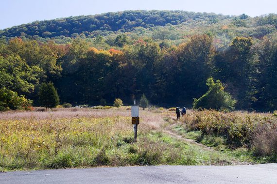
Quickly turn LEFT and Start following the Appalachian Trail (WHITE) ahead (technically, it’s a right, then quick left at the sign, but there is a short casual path that skips that and meets up).
The trail soon heads steadily uphill for awhile while it climbs Green Pond Mountain before heading downhill as it approaches Island Pond.
1.2 – Follow the Appalachian Trail (WHITE) as it turns LEFT when reaching a woods road [the road also goes to the right].
In just a bit, you may spot a casual trail on the right (but we didn’t last time). This also leads to the pond but it’s not worth it.
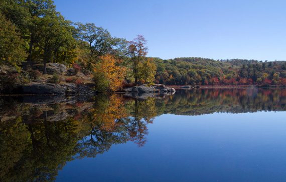
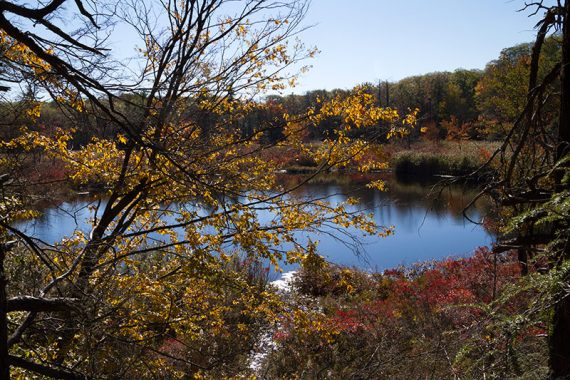
1.4 – Arrive at a wide gravel road, called Island Pond Road on some maps. Turn RIGHT and follow the gravel road through the small parking lot for nice views over Island Pond.
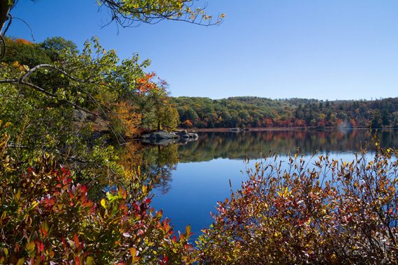
There are casual paths to the rocks for a break with views of the pond. If you skip coming down the gravel road to see the pond, there isn’t another spot to get close to it from the Appalachian Trail – though you should see it if the leaves aren’t on the trees.
When ready, retrace your steps and turn RIGHT to keep following the Appalachian Trail (WHITE).
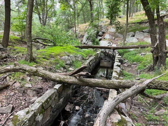
Pass some stonework on the Appalachian Trail. This is the remains of a 1930’s-era spillway created by the CCC for a dam on Island Pond that was never completed.
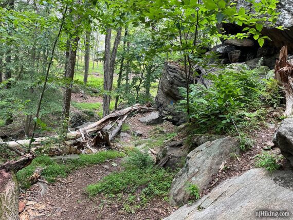
2.0 – Continue on the Appalachian Trail (WHITE) to the LEFT and approach the entrance to the Lemon Squeezer.
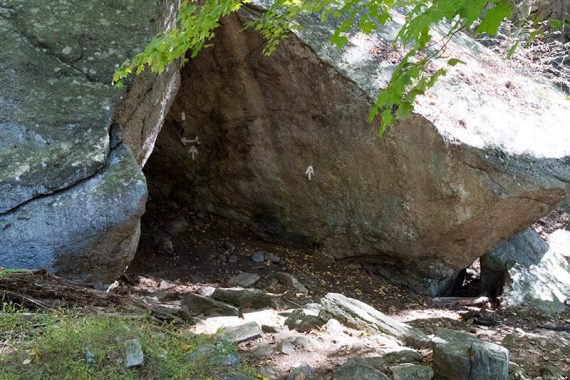
Enter the area through an initial narrow break in the rocks.
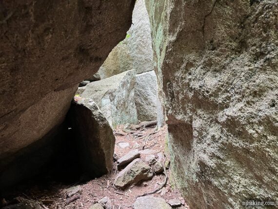
Maneuver over and around some large boulders.
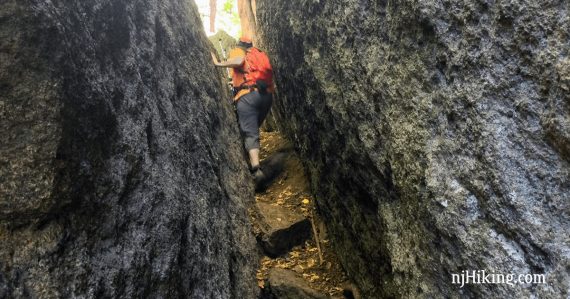
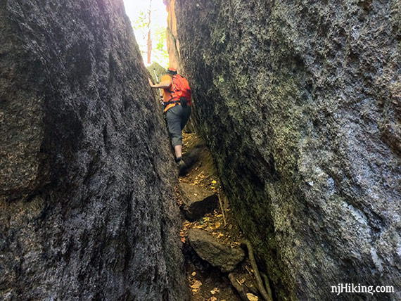
Shimmy through the tight passage – the “Lemon Squeezer“.
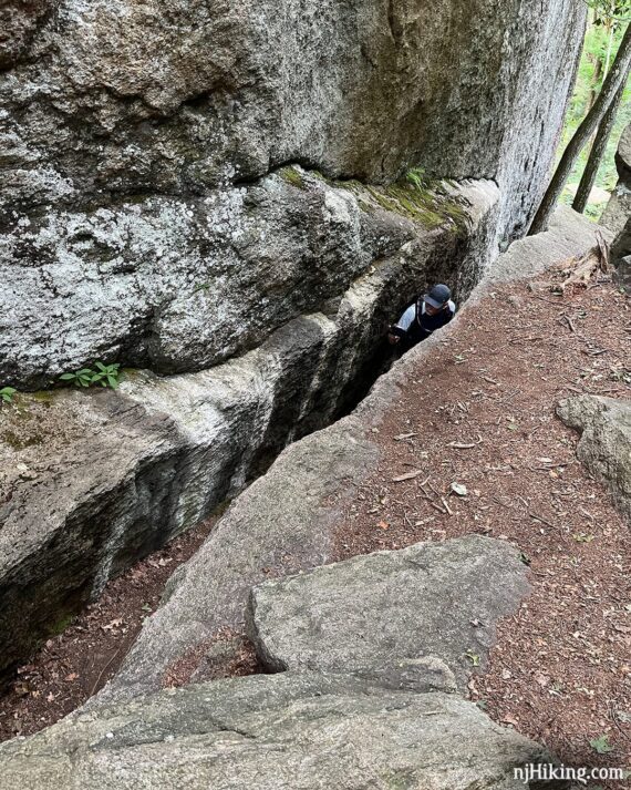
After negotiating the lemon squeezer section, turn around and look at what you just went through. You can stand on the rocks above and look down into the narrow crevice.
Fun Fact: The “Lemon Squeezer” was discovered and named by J. Ashton Allis, creator of multiple hiking trails including the Arden-Surebridge Trail (1921) and Appalachian Trail (1922). [Source: Harriman Trails: A Guide and History; Wikipedia].
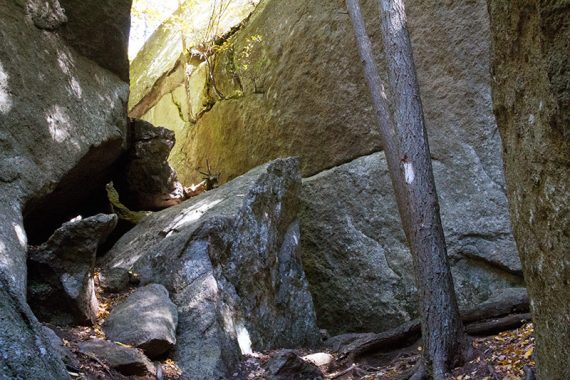
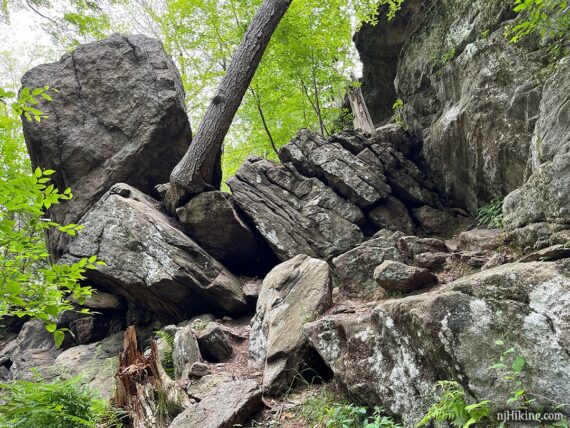
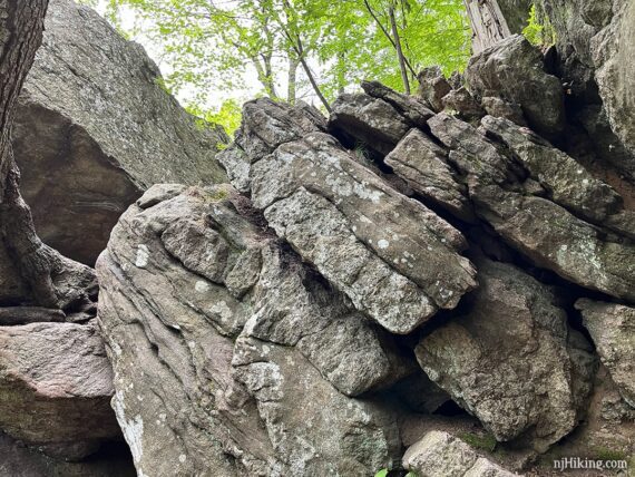
After the lemon squeezer, make your way up a jumble of rocks to approach a short rock wall.
// Short, out-and-back variation, 4 miles total roundtrip: Either before after the next scramble, return back to the Appalachian Trail, and turn RIGHT to retrace the route back to the lot.
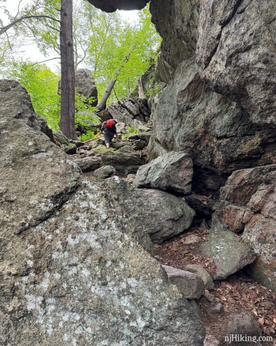
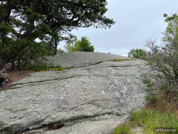
Choose your own adventure: either scramble up the wall of rock or follow the blue markers around the left side to take the easy way out.
And check out the crazy tree wedged in the rock and growing at an angle. When comparing it to our older photos this is leaning more severely now and two trees are missing, one leaning on it and one where the stump remains (pics are in the Trail Blogs linked at the bottom of the page).
“The Easy Way” – The BLUE markers point to a trail on the left, avoiding the scramble straight up this short wall. There used to be an “easy way” wooden sign but we notice it so it’s likely gone. Follow this path around and re-join the Appalachian Trail (we’ve never taken the easy way ’round but it may still be a rocky uphill to rejoin the AT).
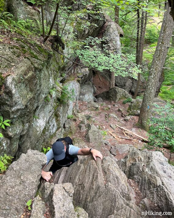
Climb the Wall – The scramble up is taller and harder than it appears from looking at a photo and the shorter you are, the harder it is – but it’s totally doable for most. Unlike most scrambles in the area… you actually need to use your arms to haul yourself up there.
It also is nice to have someone spotting you because you are leaning back a bit.
For those who are also lacking in the height department: The white blaze is on the left, but going up on the right side is easier.. maybe. Honestly… not sure at this point, having gone up various ways over the years. And even Tom, who is tall, found it a wee bit awkward getting good grip and foot placement.
Looking back on the Lemon Squeezer from atop the rock scramble.
Either way, continue on the Appalachian Trail (WHITE).
//Shorter, minus 1.2 miles: We enjoy this next section but cutting out the Long Path thru Dismal Swamp is an obvious way to reduce mileage… Instead, return to the entrance of the Lemon Squeezer. Turn LEFT on Arden-Surebridge (A-SB – RED TRIANGLE on WHITE) and follow that past the intersection with Long Path and White Bar until reaching Lichen (Blue L on White). Re-join the description at 3.8 below.
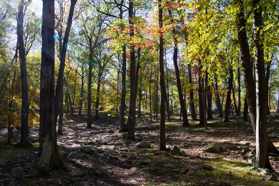
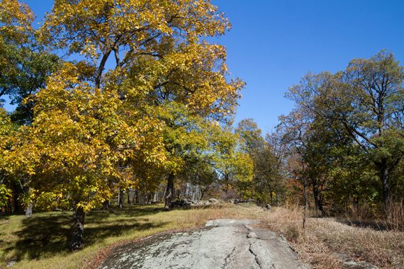
This next section of trail is an easy break across a more open area as it traverses Island Pond Mountain, with a few rocks for sitting.
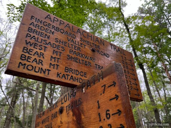
2.9 – Large signpost for a 4-way junction. The third sign from the top was missing on our last hike.
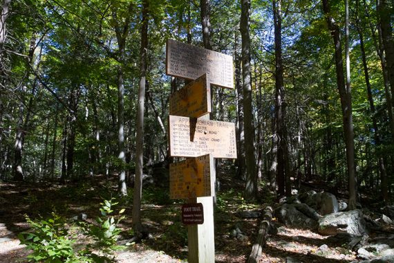
This missing sign was the one for Appalachian Trail south with the “Lemon Squeezer” on it. This is the one for the Appalachian Trail to the north.
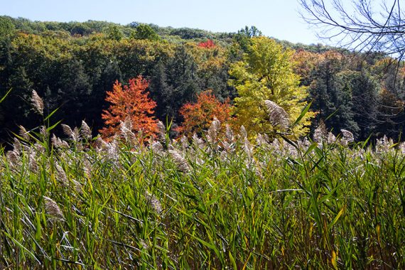
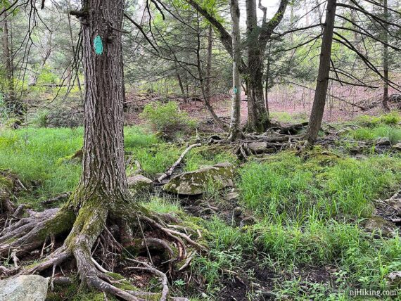
Turn RIGHT and now follow the Long Path (TEAL). The Long Path follows the edge of a wet swampy area on the left called “Dismal Swamp” though it’s neat and not very dismal.
The narrow trail ducked through a small tunnel created by large fallen trees at one point, then crossed a small stream on the exposed roots of trees.
3.5 – Turn LEFT and now follow Arden-Surebridge (A-SB – RED TRIANGLE on WHITE). (Also blazed for Long Path). [In a few steps, pass the WHITE BAR trail on the right.]
3.8 – Turn RIGHT and now follow the Lichen Trail (BLUE L on WHITE).
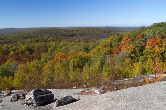
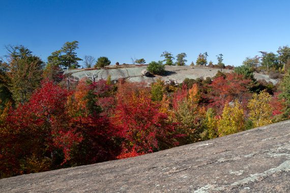
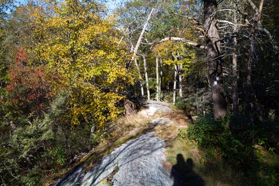
The Lichen trail heads up to an open rock slab area with some boulders to sit on for a break with a wide view to the west and Island Pond (which you were at earlier on this route).
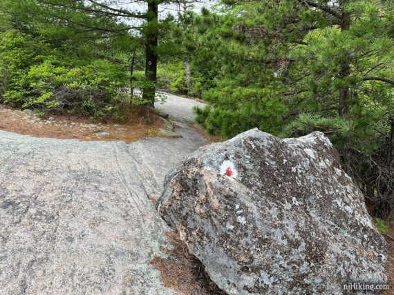
4.3 – Turn RIGHT and now follow Ramapo-Dunderberg (RED DOT on WHITE). [Lichen Trail (BLUE L on WHITE) ends].
Follow the markers across open rock faces.
There were tasty ripe blueberries along the trail the both times we hiked this at the end of June… so if it’s late June into July or early August, maybe you will luck out too. The bigger the berry, the better the taste.
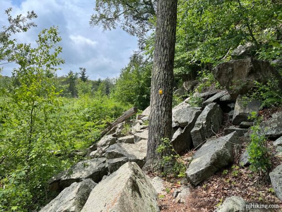
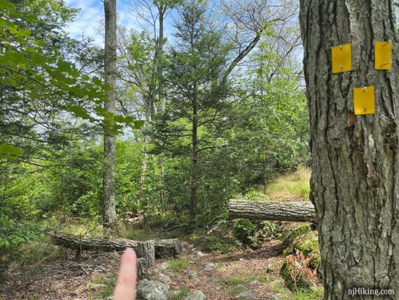
4.7 – Turn RIGHT and now follow Dunning (YELLOW). This intersection was easy to miss when we hiked 6/2024 – you may need to look at the side of the tree for the yellow marker. [Dunning (YELLOW) also goes left. Ramapo-Dunderberg (RED DOT on WHITE) continues ahead].
From this point you’ll be generally be losing elevation most of the way back.
5.1 – Keep following Dunning (YELLOW) as it turns LEFT, and is co-joins with WHITE BAR (which came in from the right; might not notice it).
5.3 – Continue following Dunning (YELLOW) as it turns RIGHT and is no longer co-joined with WHITE BAR. [WHITE BAR continues ahead].
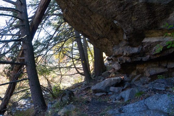
5.8 – Arrive at the outer entrance to the Boston Mine, on the right. You’ll know it’s coming up when there are many small rocks piled up on the right (leftover from what was extracted from the mine).
There was a medium size boulder placed at the intersection and Dunning (YELLOW) makes a left turn here. But first pop over to take a looky at the mine, last worked in 1880.
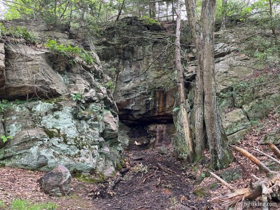
The mine has varying levels of water in it. This last hike we were again able to walk inside the outer entrance to the mouth of the mine.
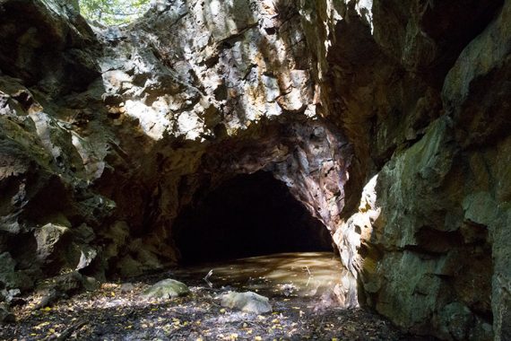
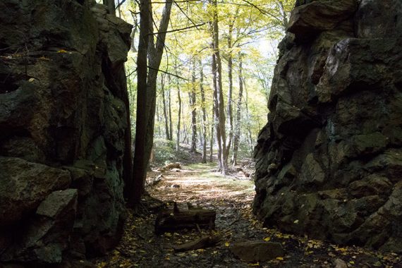
Looking out from the rock that surrounds Boston Mine. This area was damp but walkable, with rocks and sticks to stand on if it’s wetter.
Continue following Dunning (YELLOW). The Nurian (WHITE) trail comes in, is co-joined with Dunning (YELLOW) for a just a sec, then leaves.
// Option: Instead, start following Nurian (WHITE) where it leaves Dunning (YELLOW). This skips the narrow, slightly scrambly trail around Green Pond. Re-join the description at 6.4 below, at the intersection of Dunning (YELLOW) and Nurian (WHITE).
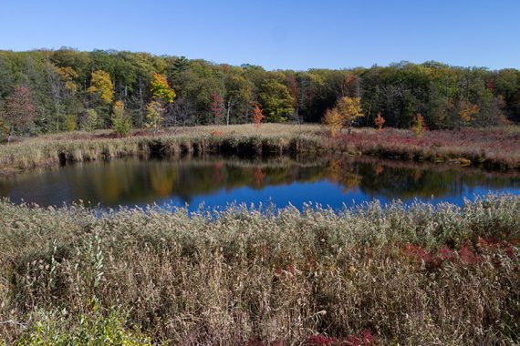
6.1 – Continue on Dunning (YELLOW) past the small Green Pond.
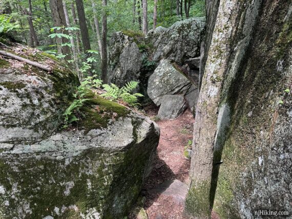
The trail is rocky and more technical, with just a little bit of almost scrambling.
Continue on Dunning (YELLOW) near Green Pond.
View of Green Pond.
6.4 – Dunning (YELLOW) ends. Continue ahead to now follow Nurian (WHITE). The continuation of Nurian (WHITE) wasn’t clear. [Nurian (WHITE) also goes to the right].
Follow Nurian (WHITE) down some long rock slabs.
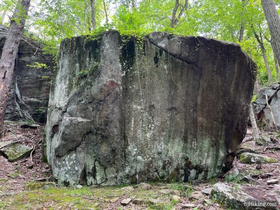
Head through the Valley of Boulders (a section of large boulders to walk through and around), including this massive, almost cylindrical one.
Follow Nurian (WHITE) as it zig-zags downhill on switchbacks.
7.0 – Near a stream, but don’t cross it…. start following Stahahe (RED BAR on WHITE) ahead. [Nurian (WHITE) goes left and crosses the stream.]
7.5 – Stahahe (RED BAR on WHITE) turns to the right near where the remnants of a stone bridge are visible. Continue following Stahahe (RED BAR on WHITE) on what is now a woods road.
Stahahe (RED BAR on WHITE) ends and becomes Arden-Surebridge (RED) [which also goes RIGHT] but you likely won’t even notice. Pass fields on the left.
8.1 – Turn LEFT back onto the Appalachian Trail and soon arrive at the parking lot.
—
Hiked 6/29/24. Almost 14 years to the day from the 2010 hike; unintentionally!
Hiked 10/12/15. Traill Blog: “Hiking through the Lemon Squeezer“
Hiked: 6/27/10. Trail Blog: “Lemon Squeezer – Harriman State Park, NY“
Hiked: 10/21/06. WHITE BAR to Lemon Squeezer. Trail Blog “White Bar Trail in October“
Hiked: 8/13/06. Lake Skatanati to the Lemon Squeezer; Trail Blog: “Long Path from Lake Skannatati“
Updated: 8/2023 – Updated parking directions; Arden Valley Rd to Elk Pen lot reopened. 8/2022 – Parking directions via Tiorati Circle added, not re-hiked. 6/2021 – Page refreshed, not re-hiked. 7/2018 – Minor change in parking directions (via Rt 17) and update to yellow trail. 10/15/15 – Revised description; adjusted for the reroute of Stahahe where it no longer crosses the stream due to the bridge being gone. Added new photos and GPX.