Hike the Appalachian Trail to an impressive panoramic view from Mount Mohican.
5.5 miles, total round trip. Rocky. An uphill in the beginning to gain the ridge, so again at the end to descend, but minor elevation change otherwise.
| 5.5 miles | This hike guide: Detailed instructions and photos follow below. |
| Shorter | Turn around before reaching the biggest view at Raccoon Ridge – there are multiple viewpoints along the way. |
| Variation | 5.5, includes an extra hill – Use Kaiser and Coppermines Trails to make a loop. Noted below. |
| Longer version | 8.8 up to 10.2 – Continue past Raccoon Ridge to Sunfish Pond. Noted below. |
| Longer version, nearby | 11.8 or 8.6 or 6.2 – Approaching via A.T. northbound – from Sunfish Pond to Raccoon Ridge. |
| Nearby, same lot | Rattlesnake Swamp – Catfish Fire Tower Loop |
| Nearby | Catfish Fire Tower – Appalachian Trail; Coppermines, Appalachian Trail, Catfish Fire Tower, Rattlesnake Swamp. Van Campens Glen; White Lake Natural Area. |
| Nearby Kayak | Catfish Pond (this lot); White Lake Kayak. |
Our two cents:
Easy navigation (out-and-back on the Appalachian Trail) packed with multiple viewpoints over New Jersey before reaching the sweeping view from Raccoon Ridge of New Jersey, the Delaware River, and Pennsylvania.
Optionally, create a loop using Kaiser and Coppermines Trails OR keep on truckin’ on the A.T. to pretty Sunfish Pond (both noted in the description below).
This a nice trail to peep some fall foliage in season, with sweeping views along the ridge then a 360° panorama from Raccoon Ridge (which is also a hawk watch location in season).
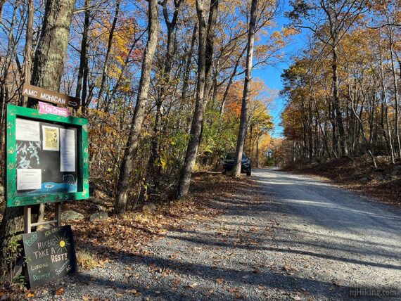
Enjoy camping? The AMC Mohican Outdoor Center which offers cabins, tent platforms, and walk-in campsites.
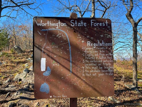
Map:
Kittatinny Trails is best as it shows the whole route on one map. Follow along on your smartphone with our Interactive Map link above.
Raccoon Ridge, also called Mount Mohican, is located on the Kittatinny Ridge that runs along the northwest corner of New Jersey (that flat angle on maps of the state!).
Most of the hike is within the Delaware Water Gap National Recreation Area, but crosses into Worthington State Forest just before reaching Raccoon Ridge… but neither of the park sites really cover the area.
Fun Fact: The “Delaware Water Gap” is nowhere near the state of Delaware, as many people often believe. A “water gap” is when a river carves a notch through a mountain range. At the border of New Jersey and Pennsylvania, the Delaware River cut through the Kittatinny Ridge – leaving Mt. Tammany on the New Jersey side and Mt. Minsi on the Pennsylvania side.
Parking: N41.03580° W74.99993° [AMC Lot]
“AMC Mohican Outdoor Center”, 50 Camp Mohican Rd, Blairstown, NJ 07825. Gravel park road, with some potholes.
If approaching from Rt 80W, take exit 12 for Rt 521N/Hope Blairstown Road towards Blairstown. Turn L onto Rt 94; R on Mohican Rd; L on Gaisler Rd; R on Camp Mohican Rd. Continue past the visitor center to a large dirt lot on the left.
From this lot, walk back on Camp Mohican Road 0.4 miles to the trailhead.
NOTE – This is the largest parking area so we’re directing you to this… but there are also a couple of pullout spots along Mohican Road that are closer to the trailhead that might be available (more likely on weekdays): couple right at the trailhead (we started here) and 4-5 a smidge further up the road on the right side.
Restrooms:
The Mohican Outdoor Center should have them but we’ve never actually checked as we start kinda early. Blairstown is about 10 mins from the trailhead.
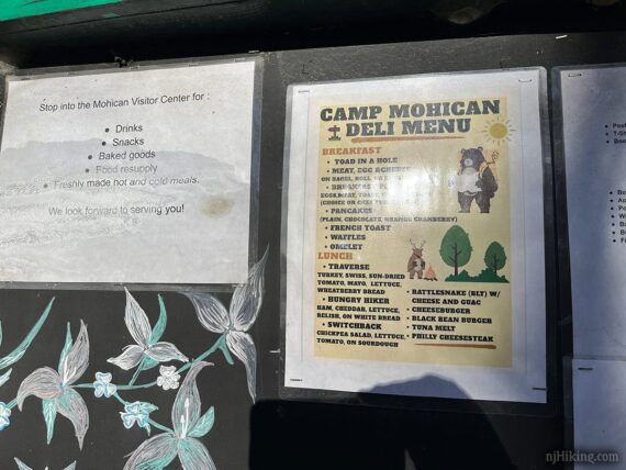
Refreshments:
The onsite Mohican Outdoor Center offers drinks, snacks, ice cream, sandwiches in season. Nearby Blairstown offers various restaurants and a brewery.
Hike Directions:
Overview: WHITE (Appalachian Trail – “A.T.”) out-and-back
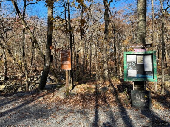
Trailhead location: On the drive in, it’s on the left side of Mohican Road by signs (the trail continues on the right side of the road too, for the A.T. heading northbound).
Our description/mileage starts at the trailhead. If you’ve parked at the large Mohican Center lot, figure adding 0.4 mile, each way.
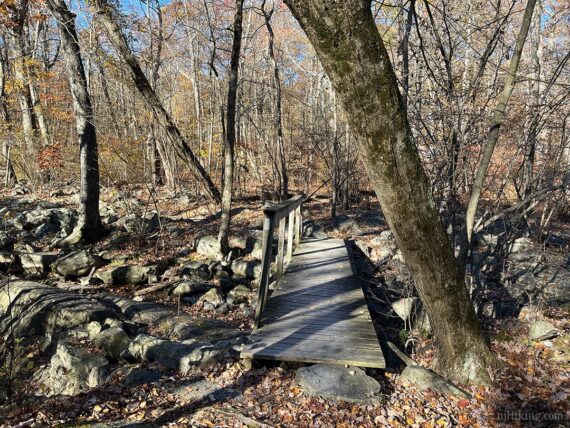
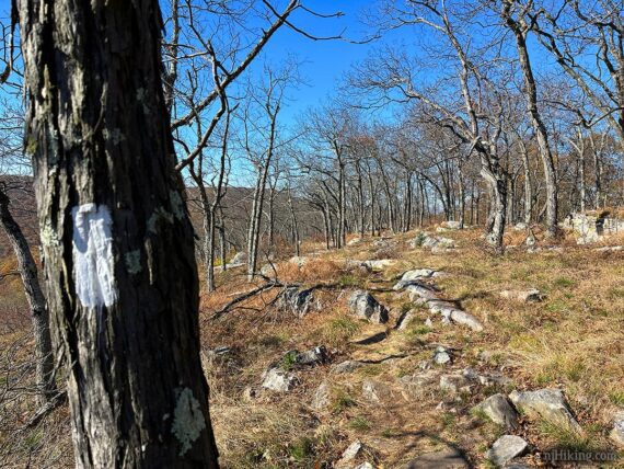
0.0 – Start following WHITE (Appalachian Trail – “A.T.”) and immediately cross a wooden footbridge.
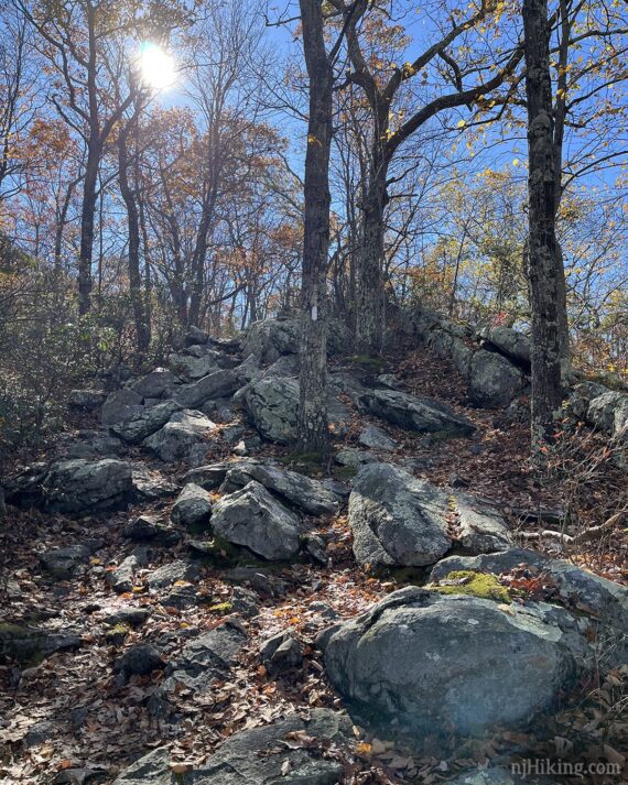
If a few steps, veer LEFT to continue on the WHITE (A.T.) while RED (Coppermines) is straight ahead. The rocky trail starts heading uphill for this first stretch.
// Variation option: The loop using Coppermines and Kaiser can be done from this direction, with a return via the A.T., but we suggest doing the A.T. first to get the views in early.
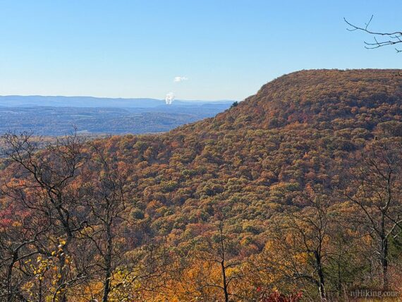
0.6 – The first of many views is on the left, down a short side trail. It may look like there is none – keep walking through the break in the brush…
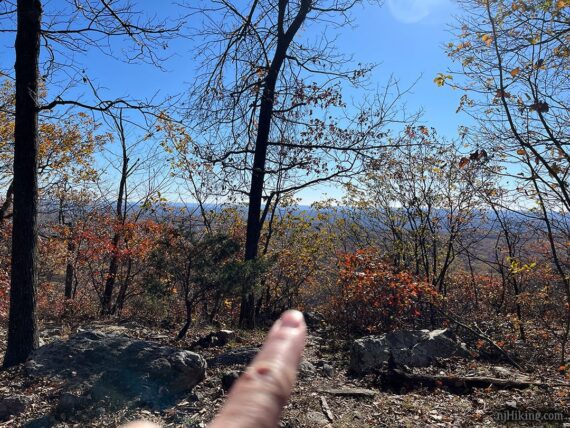
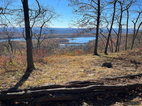
…until popping out for your first panorama from the ridge. There are a few east-facing views, all of them looking over Lower Yards Creek Reservoir, along this stretch of the Appalachian Trail (WHITE).
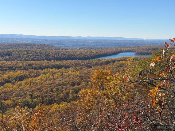
1.6 – Approach a wide open viewpoint that stretches on for a bit. This is the start of it when going in this direction.
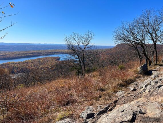
Just a bit further along and it opens up into an even better view.
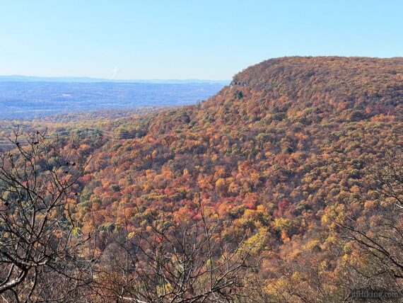
Off to the far right the Kittatinny Ridge drops off sharply into the valley below. The long flat area on top is the location of the Upper Yards Creek Reservoir.
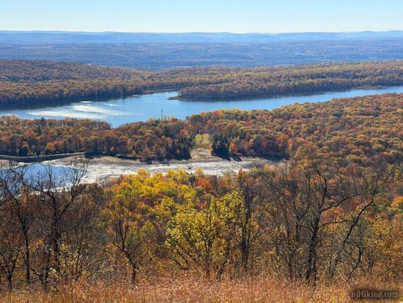
Close up of the Lower Yards Creek Reservoir in the valley below. These reservoirs provide hydroelectric power for the Yards Creek Station.
Continue following WHITE (A.T.) past another similar viewpoint. The Appalachian Trail can be very rocky along the ridge.
We refer to these as “pointy-jabby” rocks (surely this is the proper geologic term). These are found all across northern New Jersey, in varying degrees, depending on location.
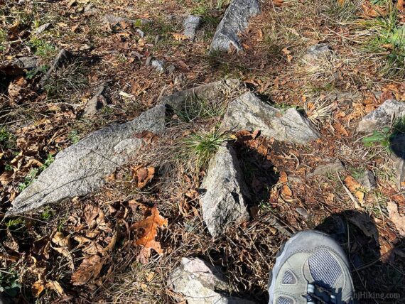
It’s important to note that there is a rule – the pointier and jabbier the rocks are, the more post-hike ice cream (or any other tasty treat) you should have. Hey, we don’t make the rules, we’re just letting ya know.
2.1 – The BLUE (Kaiser) trail comes in from the right. Off to the left is a casual path to a view with long logs that make for a convenient seat.
// Variation option; if doing the loop with Kaiser/Coppermines: Remember this intersection for the way back after Raccoon Ridge. //
Pass another view on the left. Kaiser (BLUE) should leave to the right, but we never notice it.
2.6 – At the large sign with Worthington State Forest and the Appalachian Trail on the other side, leave the Delaware Water Gap National Recreation Area and enter Worthington.
Continue following WHITE (A.T.).
2.7 – Through a break in the trees on the right, get a glimpse of the Delaware River with Pennsylvania beyond it.
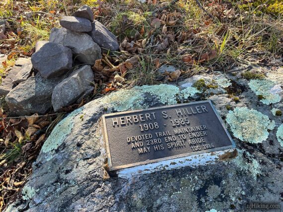
Nearby, on a rock near a cairn, is a plaque for Herbert S. Hiller – trail maintainer and the 23rd Appalachian Trail end-to-ender. This is easy to waltz on by and not notice.
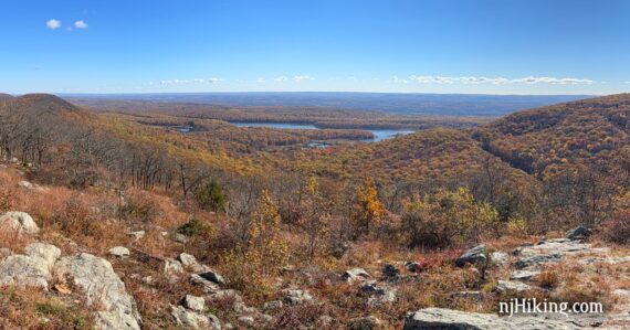
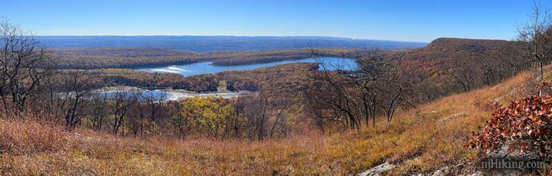
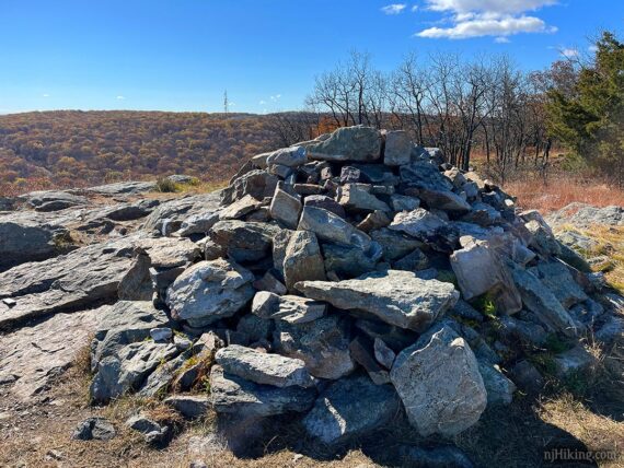
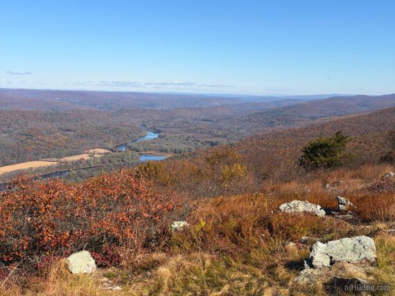
2.8 – Arrive at a wide open rocky area at the 1580′ peak of Mount Mohican, also called Raccoon Ridge, marked with a gigantic rock cairn (pile of stacked rocks).
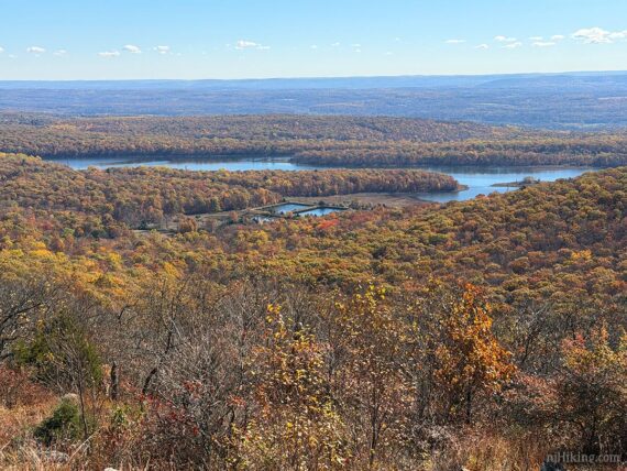
Looking from the direction of approach: on the left is a panoramic view east over New Jersey with Lower Yards Creek Reservoir in the valley below.
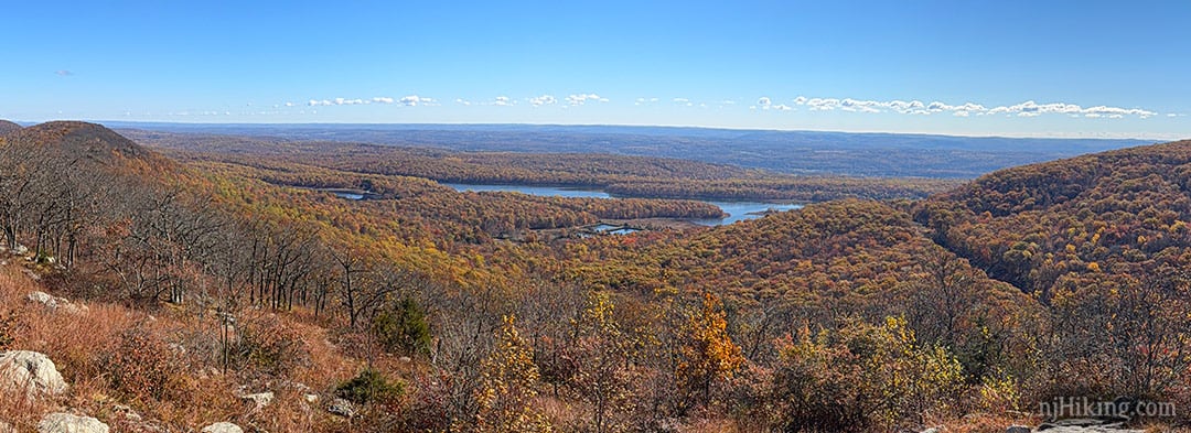
A zoom into the holding ponds that make up the lower reservoir.
The Upper Yards Creek Reservoir, out of sight, is located on the top of long flat area that drops off dramatically.
Right looks towards Pennsylvania with the Delaware River winding between PA and NJ.
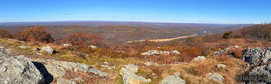
Poxono Island is at the bend in the river to the north.
This is vantage point is a popular hawk watch during fall migration and you may encounter groups of people counting hawks as they soar overhead.
When your eyeballs have had enough of all the views, turn around and retrace the route on WHITE (A.T.) – or try one of the variations:
// Variation: loop with Kaiser/Coppermines: For a change of scenery and add a descent/climb… Follow the A.T. back until the intersection with BLUE (Kaiser) from earlier… leave the A.T. by veering LEFT to start following BLUE (Kaiser) downhill. Take the RED/BLUE connector. Turn RIGHT to start following RED (Coppermines) uphill back to the A.T. then continue over the footbridge to the trailhead.
// Longer version, 8.8 to 10.2 miles total, round trip, to Sunfish Pond: Not ready to head back? Just keep following WHITE and follow the directions below to Sunfish Pond. Waypoints on included on our interactive map. //
When continuing on to Sunfish Pond, you’ll dip back into the forest and there aren’t as many views in this stretch.
8.8 mile version – Just before reaching Sunfish, turn LEFT on Buckwood (BLUE). Follow this a short way to a view and nice break spot looking over the pond (photo below)… OR keep on WHITE a bit further until reaching the pond.
up to 10.2 mile version – Continue on WHITE (A.T.) as it hugs the shore with views along the way. Turn around at any point or keep going to a viewpoint/break spot at the far end of the pond. [WHITE (A.T.) continues past the pond… all the way to Georgia…]
—
Hiked: 10/27/25. From pullout parking to Raccoon Ridge.
Hiked: 8/14/22. As part of a 11.1 mile route. Variation; w/o Coppermines/Kaiser loop.
Hiked: 9/3/16. As part of a 11.8 mile route.
Hiked: 8/31/08. As part of a 16 mile route. Trail Blog: “Garvey Springs to AT North”
Hiked: 9/3/06. As part of a 9.9 mile route. Trail Blog: “Sunfish – AT”