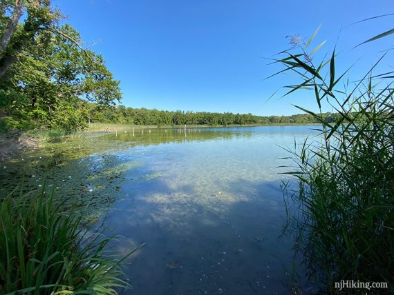
Hike around White Lake and past the remnants of a large ice house.
3.8 miles. Surface is root and dirt, not that rocky; minor hills.
| 3.8 miles | This hike guide: Detailed instructions and photos follow below. |
| Shorter | Use GREEN to truncate the loop. Noted below. |
| Same lot | White Lake Kayak |
| Nearby | Jenny Jump – Ghost Lake; Jenny Jump Trail. Allamuchy Pond Trail; Allamuchy Mountain – Deer Park; Kittatinny Valley; Rattlesnake Swamp – Catfish Fire Tower Loop; Catfish Fire Tower – Appalachian Trail; Swartswood S.P. – Spring Lake; Swartswood Grist Mill. Paulinskill Valley Trail – Cedar Ridge to Aqueduct. |
| Nearby Kayaking | Lake Aeroflex Kayak |
Our two cents:
Short hike through forest and fields with a few views of an interesting crystal clear lake, and the remains of large buildings once used as an ice house/marl processing plant.
Bonus: Pair your hike with an easy paddle on White Lake.
Fun Fact: The name “White Lake” comes from the white chalky material that lines the bottom called “marl”. Marl is composed of freshwater shells and clay and was processed for use in fertilizer and cement.
Updated: 8/2023 – The remains of the icehouse have been fenced off [thanks Lori. P for the update]. 3/2022 – Added photos of the bench and view. Re-hiked to viewpoint and back 10/2021.
Hike Info:
Map:
Print ahead, or there may be brochures in the trail kiosk. Follow along on your smartphone with our Interactive Map link above.
Parking: N41.00207° W74.91660°
White Lake Parking Lot. 97 Stillwater Rd. Hardwick, NJ 07825. Large dirt lot adjacent to the road. Don’t continue further down the driveway as that’s just the kayak launch.
Restrooms:
Portable toilet in the parking lot.
Hike Directions:
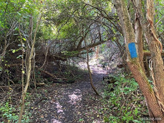
Overview: BLUE – YELLOW (Ridge & Valley) – BLUE
0.0 – From the parking lot, continue down the driveway to the kayak launch to check out White Lake.
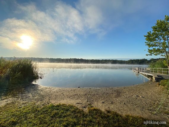
Head out on the dock for a closer look.
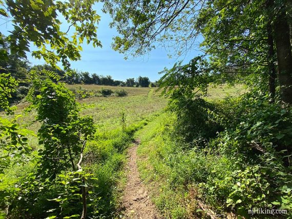
With your back to the lake, turn LEFT to follow BLUE on a mowed path through a field.
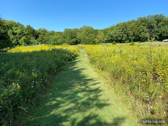
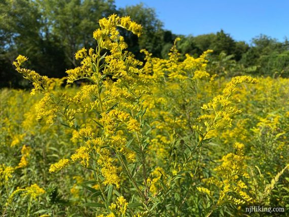
In the right season there may be wildflowers on either side.
RED co-joins BLUE for a section on the trail map, though we don’t recall seeing red markers.
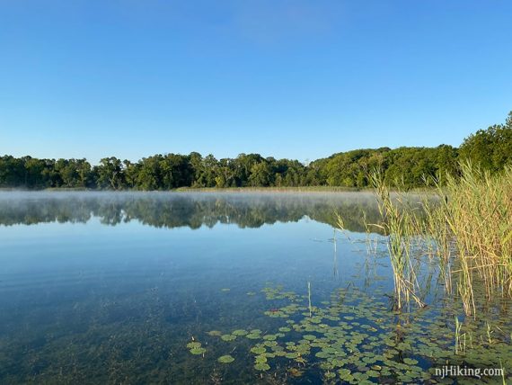
0.4 – Continue on BLUE as it heads to a bench and viewpoint over the lake.
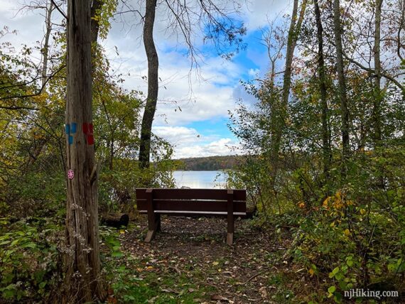
The view of White Lake from the bench.
Continue on BLUE up an elaborate section of stone steps.
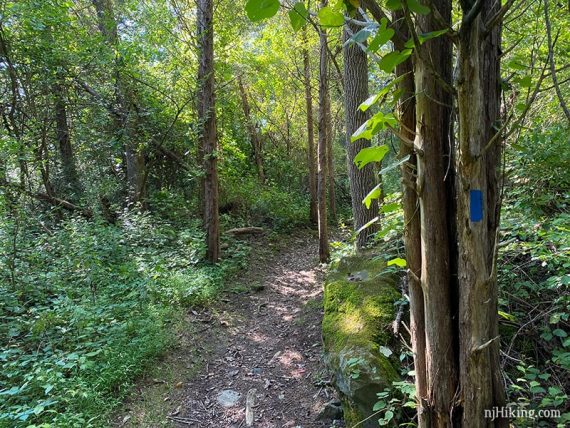
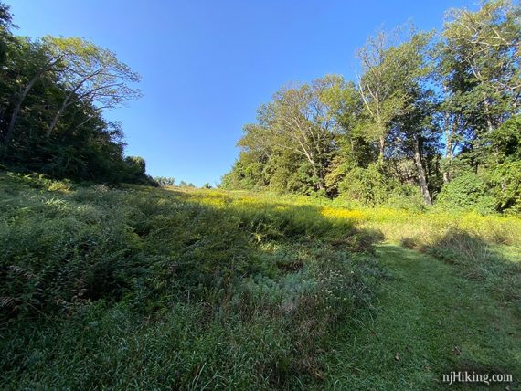
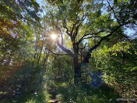
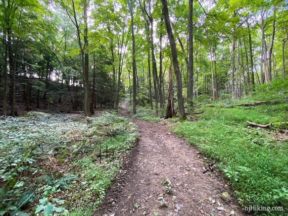
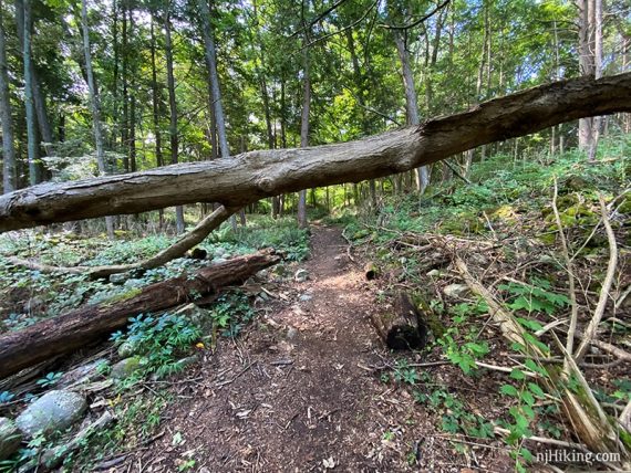
BLUE continues, from the forest to crossing open fields on mowed paths.
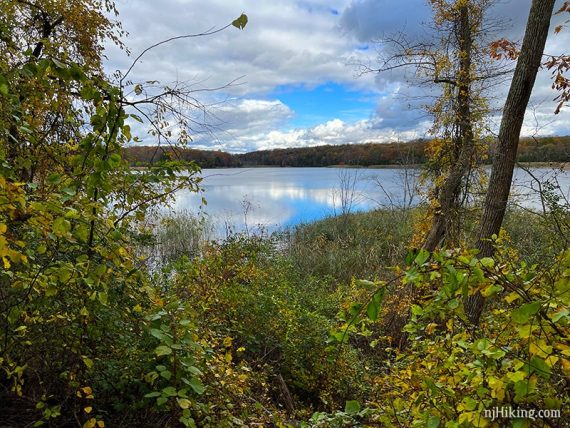
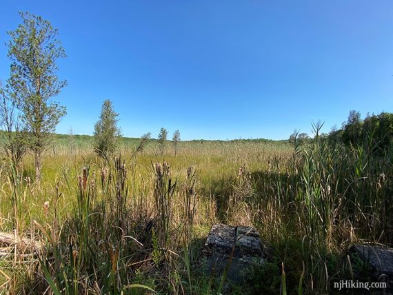
1.0 – View of White Lake. The posts in the water are from an old dock.
Continue following BLUE.
1.1 – Turn LEFT to now follow YELLOW (Ridge & Valley). [BLUE ends.]
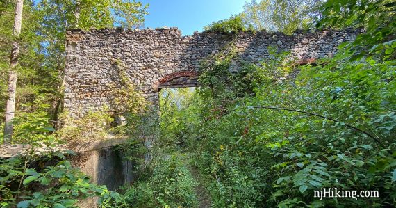
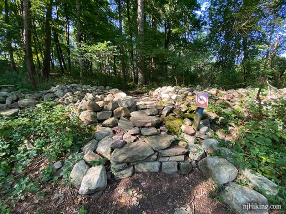
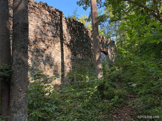
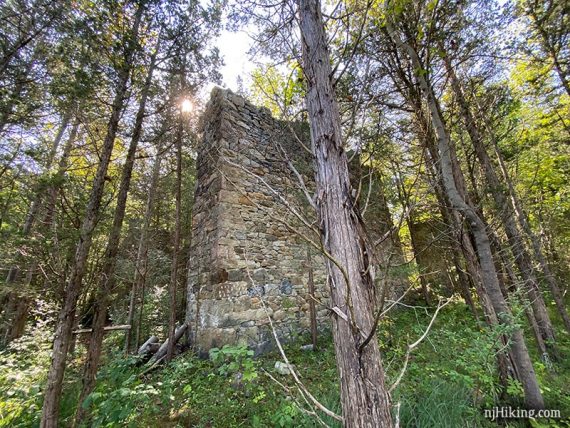
1.2 – Arrive at the remains of the marlworks/ice house. Note: These are now fenced off and can’t be explored. We’ve left the photos here as an archive. Just continue past them, following YELLOW (Ridge & Valley).
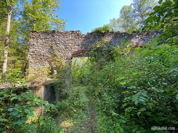
We meandered through and around the buildings. Some areas may be overgrown.
Many of the openings have brick archways over them.
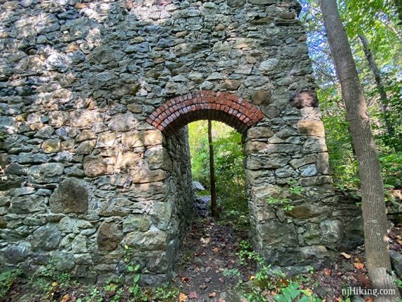
Walking through an opening to the other side of the stone wall.
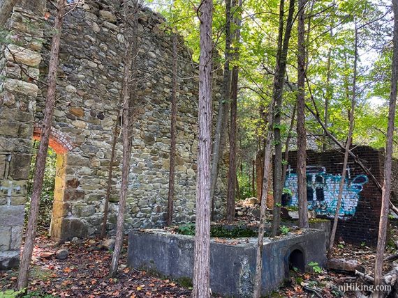
Trees are growing all through the building interiors.
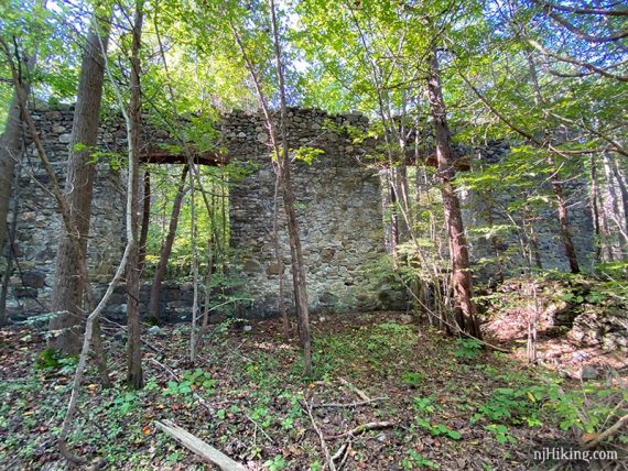
Tall stone walls being taken over by the forest.
From the marlworks is a view out to an open marshy area.
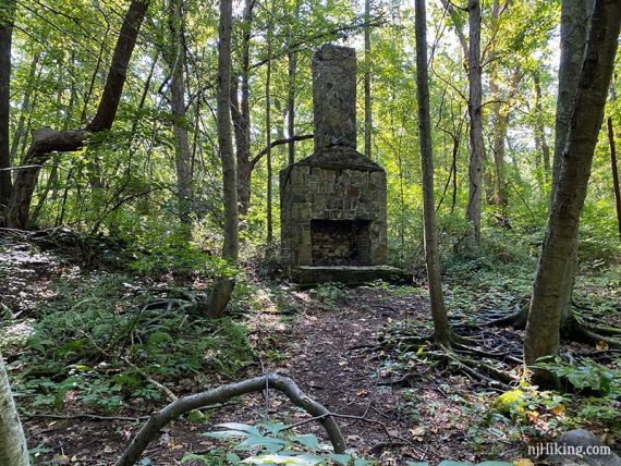
Continue following YELLOW (Ridge & Valley). Pass the remains of a chimney.
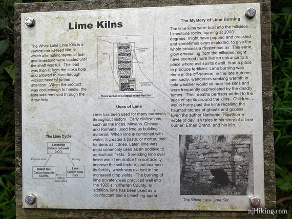
2.1 – Sign for a lime kiln nestled somewhere in the foliage.
Continue following YELLOW (Ridge & Valley) past the GREEN trail on the left. Pass GREEN again in a bit. Note that the trail map only shows one junction with GREEN.
// Shorter: Take GREEN back instead. At the junction with BLUE, turn LEFT and follow BLUE back to the lot. //
Continue following YELLOW (Ridge & Valley) as it loops back around.
3.0 – Turn LEFT to start following BLUE. [YELLOW (Ridge & Valley) continues a bit further before ending at Stillwater Road.]
Continue on BLUE, crossing the GREEN trail. BLUE continues across a field and back to the log.
—
Hiked: 10/21/21. To viewpoint and back.
Hiked: 8/6/20.