Rugged, hilly, challenging route to Wyanokie High Point, Carris Hill, Buck Mountain and Chikahoki Falls with views of the NJ Highlands and NYC Skyline.
8.1 miles, total round trip. On the lower end of challenging only due to not having high mileage. Very rocky, relentless up-n-down (typical of the Highlands area of Jersey) plus scrambling in several areas.
| 8.1 miles | This hike guide: Detailed instructions, photos, and video follow below. |
| Similar but easier: | High Point, Chik Falls, Otter Hole Loop |
| Longer | Cross Otter Hole and add Torne Mountain/Osio Rock hike for an additional hilly/rugged 2.6 or 1.6 miles (round trip) and some more fine views. Noted below. |
| Nearby | Apshawa Preserve; Apshawa Waterfall; Stonetown Circular; Lake Sonoma, Overlook Rock, Manaticut Point |
Our two cents:
Don’t let the “low” mileage fool you, this is a hilly workout with some scrambles. Your payoff is tons of fantastic views plus waterfalls thrown in for good measure.
While everyone hikes at a different pace, for a rough idea this took us 5.75 hours including breaks for photos and snacks.
Updated: 1/2026 – Updated description/interactive map to reflect major trail reblazing throughout park, and that the beginning of the trail has been rerouted off Weis property and onto the road; not re-hiked. Older change log at page bottom.
Hike Info:
Map:
Norvin Green (south section) was entirely reblazed in the Fall of 2025. The physical location of the trails themselves are unchanged but the colored markers (blazes), and in some cases the names, are different.
Currently the only updated map available is here: “Norvin Green State Forest (southern section) Reblazing Complete“. Follow along on your smartphone with our Interactive Map link above.
Note! The current Northern New Jersey Highlands Trails Map (2021 edition), and the trail map (version dated 7/19) on the NJ State Park site are no longer accurate. In addition, the NJ State Park site’s map has the location of Wyanokie High Point in the totally wrong spot, putting after the intersection with the WHITE (Lower) trail.
We really recommend using the Northern New Jersey Highlands Trails Map for this as there is such an intricate network of trails and this map includes unmarked trails but also because it is topographic… so you can see all those hills comin’ up…
Related: Waterfalls in NJ / Best Waterfall Hikes in NJ
Books:
A longer variation and map diagram can be found in 60 Hikes Within 60 Miles: New York City and another variation can be found in Take a Hike New York City.
A shorter Wyanokie High Point hike is in Hiking New Jersey (2023), two other ones in 50 Hikes in New Jersey and shorter Norvin hikes can be found in Hiking the Jersey Highlands.
Detailed trail descriptions can be found in the The New Jersey Walk Book.
Related: Challenging Hikes in NJ
Parking: N41.06986° W74.32171°
139 Snake Den Rd, Ringwood, NJ 07456. Rt 287 to exit 55, take 511 N (Wanaque), continue through Wanaque for several miles. Make a left onto West Brook Rd. Continue across Reservoir.
At the T-intersection, turn left. Then make the 2nd left on to Snake Den Road. There should be a sign for The New Weis Center for Education, Arts & Recreation and the Highlands Natural Pool.
Continue uphill and bear left on Snake Den, past some houses until arriving at a dirt lot on the right-hand side. Note! Parking allowed from 9 am to dusk.
Restrooms:
Nothing at the parking lot and the restrooms at the New Weis Center are not open to hikers. Best bet is a gas station or store along Rt. 511.
Hike Directions:
Overview: PURPLE/BLACK (High Point Spur) – PURPLE (High Point Loop) – TEAL DIAMOND (Highlands) – RED (Wyanokie Circle Loop) – RED/BLACK (Wyanokie Circular Spur) – RED (Wyanokie Circle Loop) –YEL (Wyanokie Crest) – Unmarked woods road – GREEN (Den) – PURPLE/BLACK (High Point Spur)
DESCRIPTION UPDATED BUT NOT RE-HIKED. BLAZE COLORS IN PHOTOS WILL NOT MATCH THE NEW TRAIL SYSTEM.
0.0 – Start following PURPLE/BLACK (High Point Spur) from the end of the parking lot, by the gate and some signs. The first portion of this hike is now along paved Snake Den Road. The trail no longer is on Weis Center property nor passes by the Highlands Pool.
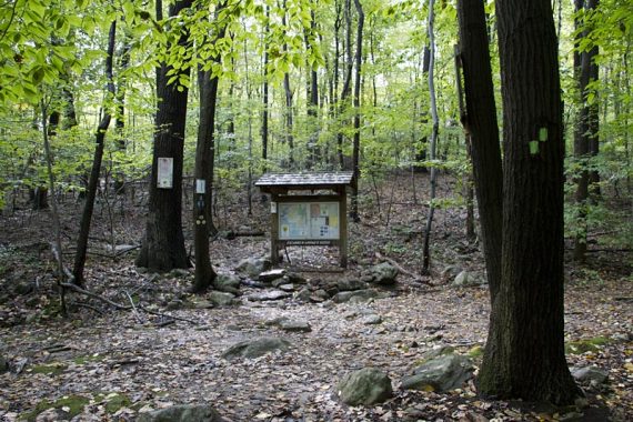
0.4 – At the trail kiosk (“Richard N Warner Kiosk”,) continue following PURPLE/BLACK (High Point Spur) [GREEN (Den) starts to the right, which will be the return route].
0.6 – Now follow PURPLE (High Point Loop) to the RIGHT. [It also goes to the left]. Continue steeply uphill past short side trails to several (limited) viewpoints – a preview of things to come.
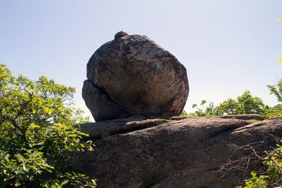
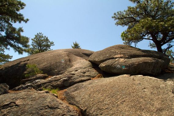
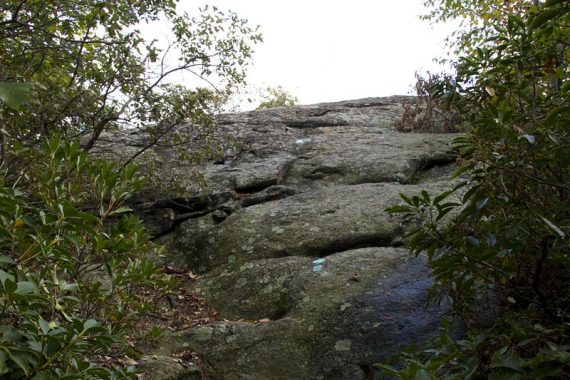
1.0 – Continue following PURPLE (High Point Loop). [Pass an unmarked trail on the right, formerly WHITE (Macopin)]. Head uphill past a large glacial erratic.
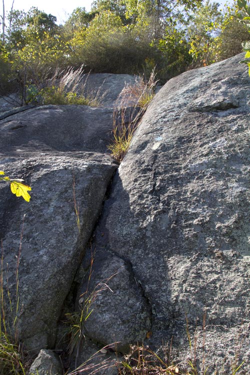
Cross sections of bare rocks on the way to Wyanokie High Point.
1.2 – At an intersection with a large boulder, follow the HI POINT arrow sign towards the large rock painted with “HI POINT”. [TEAL DIAMOND (Highlands) is co-joined here and also goes to the right].
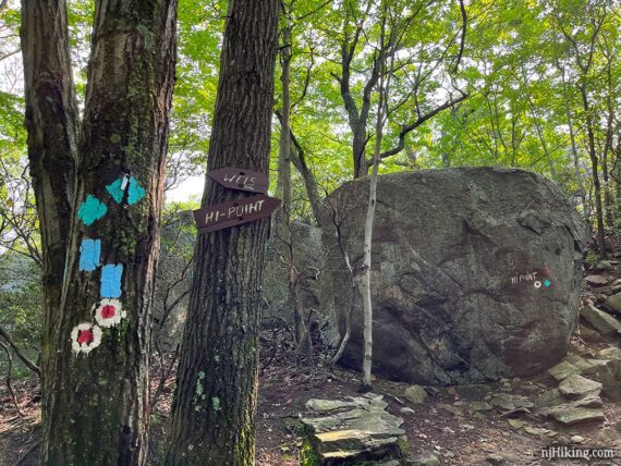
Continue following PURPLE (High Point Loop) by walking around the right side of the rock and scrambling up behind it.
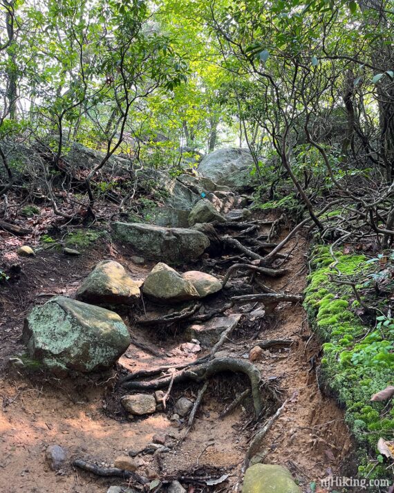
This next section is a little steep and more technical than an average trail but isn’t very long – and the payoff is worth it.
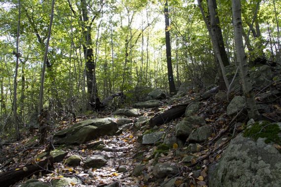
Continue up an eroded gully filled with exposed roots and large rocks.
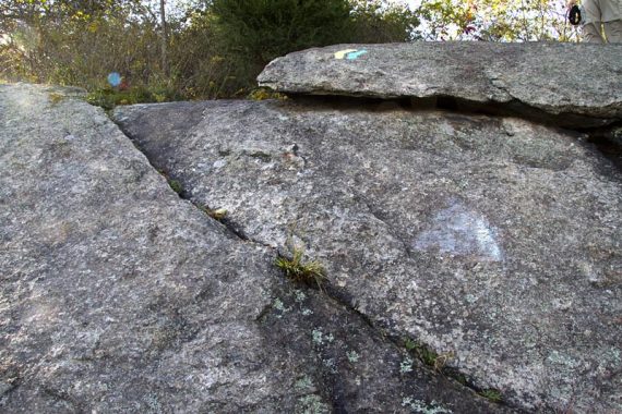
Then climb up a long slanted slab of bare rock. If it’s super duper wet, or icy, going up the slab here may not be something you want to do as this route is going to take you back down it too.
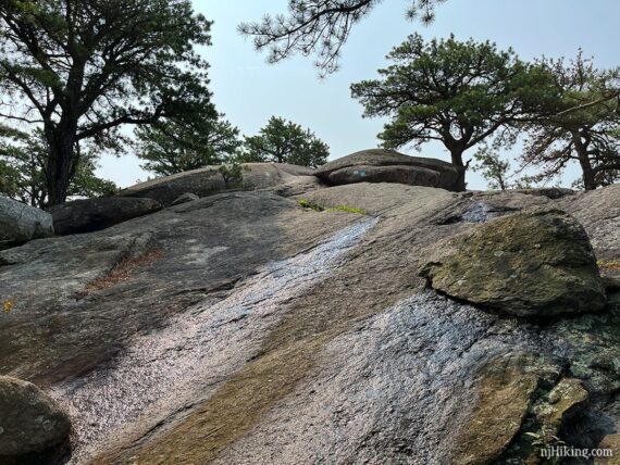
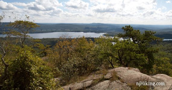
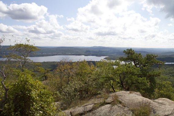
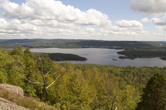
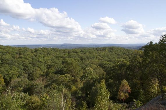
1.3 – Arrive at Wyanokie High Point for a 360-degree view and a large area of open rock slabs. This is a terrific spot for a break and there are a few trees to sit under to keep out of the sun. Be sure to walk all around the rock slabs for different vantage angles.
Fun Fact: Norvin Green State Forest is named for Norvin Hewitt Green who donated the land to the State of New Jersey in 1946. Norvin was the nephew of Abram S. Hewitt who owned Ringwood Manor and has a park named after him that includes other great hikes like Bearfort Ridge – Surprise Lake. [Source: The New Jersey Walk Book]
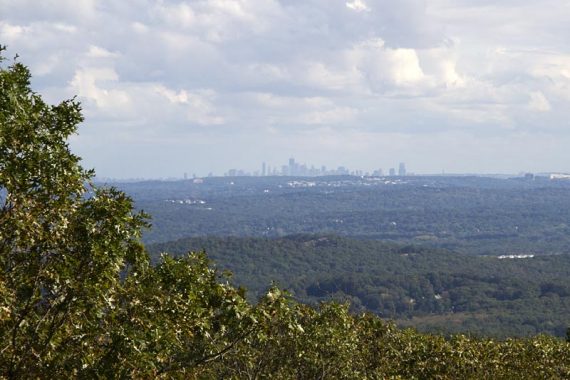
Head over to the far end to spot the New York City skyline – if it’s a clear day.
Fun Fact: Wyanokie is a variation of the Native American Lenape word Winaki. It was first written down by a Frenchman who spelled it phonetically, Wanaque. [Sources: The New Jersey Walk Book and Hiking New Jersey (2023)].
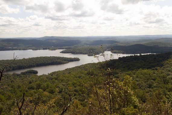
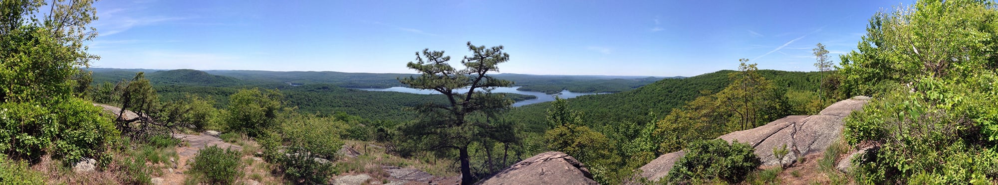
Panorama from Wyanokie High Point, with the Wanaque reservoir seen in the center:
Backtrack, going back down the slab to the junction with the big rock and the trail signs. Head LEFT to start following TEAL DIAMOND (Highlands).
1.4 – Junction with RED (Wyanokie Circle Loop). Veer LEFT to start following RED (Wyanokie Circle Loop). [RED (Wyanokie Circle Loop) also goes to the right].
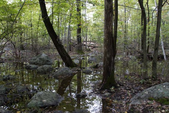
Cross some potentially wet low areas while on RED (Wyanokie Circle Loop).
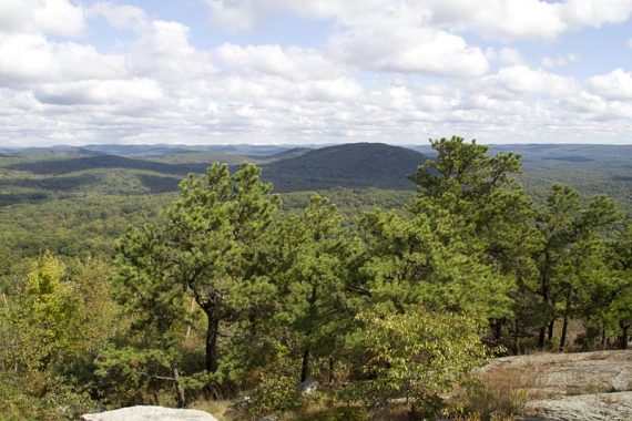
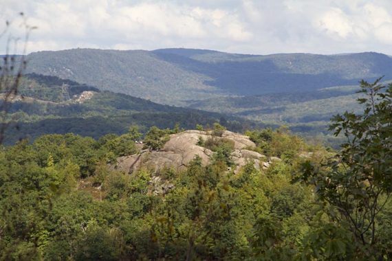
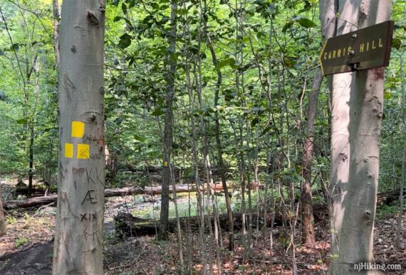
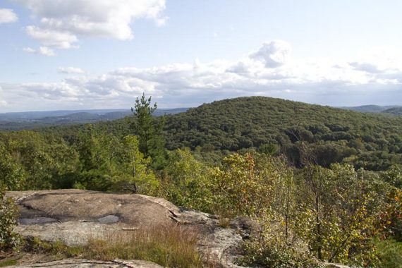
2.1 – A little bit of a scramble up to Carris Hill viewpoint.
Turn to the left to look over to Wyanokie High Point and spot hikers enjoying the view from where you just were.
Zoomed in to Wyanokie High Point from Carris Hill:
Continue following RED (Wyanokie Circle Loop). [RED-BLACK (Carris Hill Connector) is off to the right, heading to “O-H PRKG” (this indication may not still be here)].
2.3 – Short scramble down after a large glacial erratic.
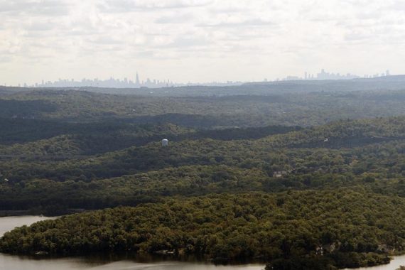
Head steeply downhill on short switchbacks with a few lovely viewpoints along the way as the NYC skyline gets closer (visible only if it’s a clear day).
2.9 – RED (Wyanokie Circle Loop) reaches an intersection with WHITE (Lower) and BLACK (Posts Brook). Turn RIGHT to continue on RED (Wyanokie Circle Loop).
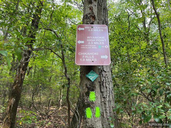
There may be arrow signs for “Carris Hill” and “Weis 2.4 miles”.
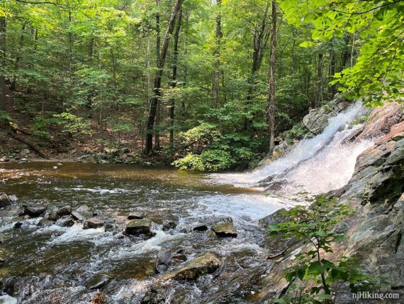
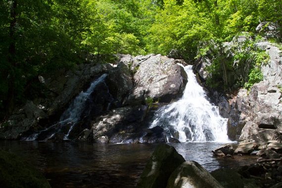
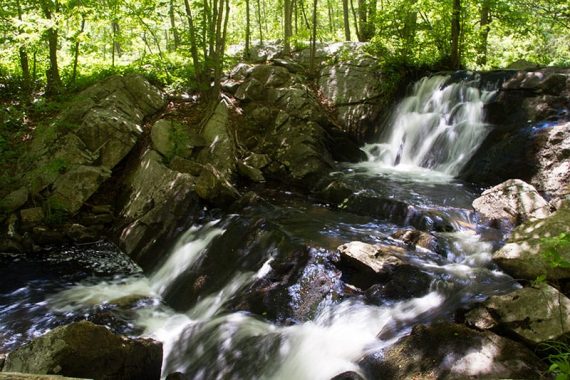
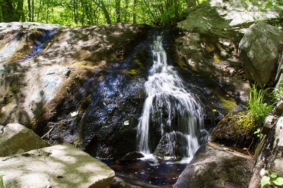
3.3 – Arrive at Chikahoki Falls. The trail approaches it from the side and then continues up along side the falls to the top.
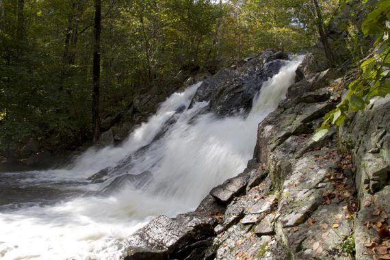
Optional: Cross the stream to get a front view of the falls. The feasibility of this depends on water levels/flow and the location of logs or rocks to cross on. Makes for a nice break spot.
One time we crossed it required using a fallen log, more recently we’ve encountered rocks piled into a walkway.
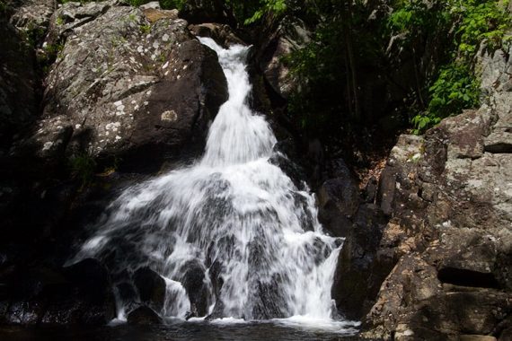
The rock hop after a lot of recent rain (July 2023). We didn’t feel the risk-to-reward ratio was in our favor – why risk wet feet or falling – so we didn’t bother crossing. But then we’ve also seen Chikahoki Falls lots of times.
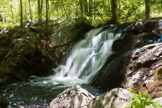
Chikahoki Falls viewed after crossing the stream:
Continue following RED (Wyanokie Circle Loop) up sharply to the right as it passes by the top of the falls.
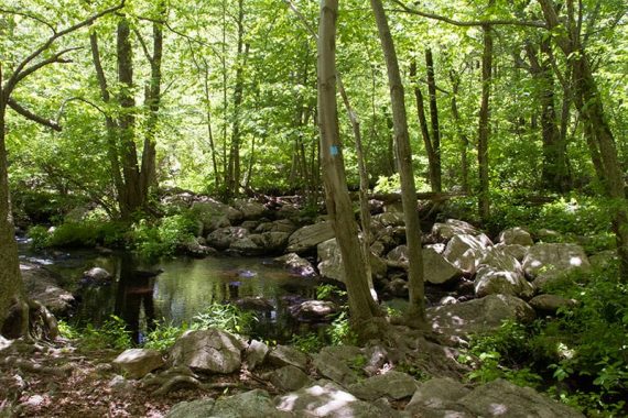
Posts Brook can be seen through the trees on the left before RED (Wyanokie Circle Loop) starts moving away from it. There may be several more large cascades on the stream when water is high.
3.4 – Continue following RED (Wyanokie Circle Loop), passing [RED/BLACK (Carris Hill Connector) on the right. There may be a wooden sign for “O-H PRKG” (Otter Hole parking).
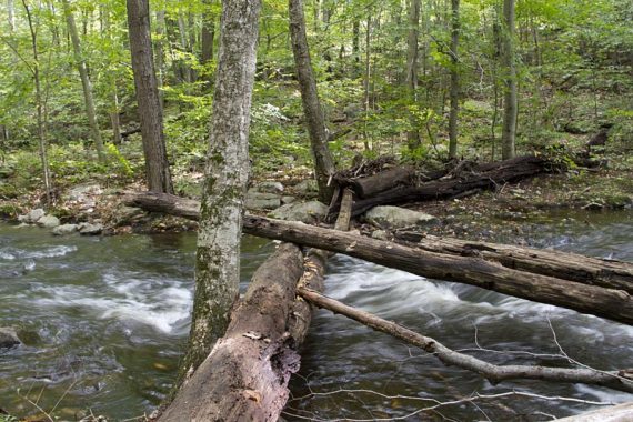
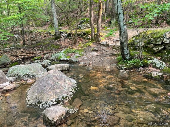
Soon after is a stream crossing on rocks or a log.
3.8 – Continue on RED (Wyanokie Circle Loop) as it crosses YEL (Wyanokie Crest) on the right and then left.
Continue on RED (Wyanokie Circle Loop), passing an unmarked trail on left.
4.4 – Junction of RED (Wyanokie Circle Loop) and RED/BLACK (Wyanokie Circular Spur).
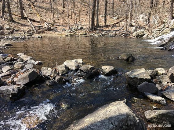
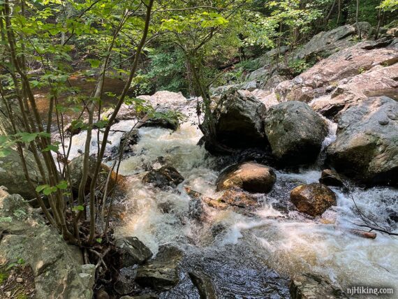
The hike will continue on RED (Wyanokie Circle Loop) to the RIGHT… but first turn LEFT for a short side trip on RED/BLACK (Wyanokie Circular Spur) to check out Otter Hole – a nice water cascade that makes for a good break spot.
At the top of Otter Hole is a water crossing over a jumble of rocks – don’t continue over these (beyond the water crossing is the Otter Hole parking lot).
// Longer option: If adding the Torne Mountain/Osio Rock hike to make this a really long route, continue beyond Otter Hole via a sometimes tricky rock hop to a parking area on Glenwild Avenue. //
Instead, clamber down the left side of the rocks to view the cascades of Otter Hole.
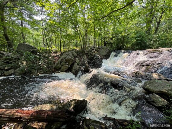
Like all waterfalls or cascades, more water is better. The top photo is after heavy rain (July 2023), the second is with less flow.
Retrace to the junction. Continue following RED (Wyanokie Circle Loop) ahead, towards Weis Center (unsure if this sign is still here).
4.8 – Turn LEFT to now follow YEL (Wyanokie Crest) which is co-joined with TEAL DIAMOND (Highlands). There might still be another sign: Weis/Pkg is 1.6 miles.
[RED (Wyanokie Circle Loop) continues ahead, YEL (Wyanokie Crest) also goes right].
// Shorter option: RED (Wyanokie Circle Loop) continues ahead and can be used to shorten this route some if you’ve had enough. //
The trail climbs steeply up Buck Mountain, with some scrambling over angled rock slabs. This is more scrambly than it appears:
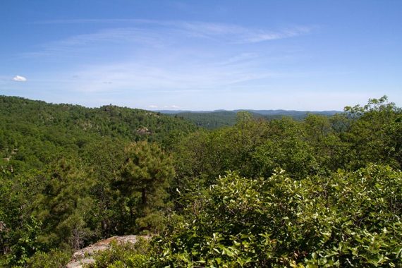
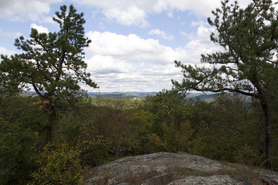
Panoramic views back over most of Norvin Green State Forest from the top of Buck Mountain.
Continue following YEL (Wyanokie Crest) / TEAL DIAMOND (Highlands).
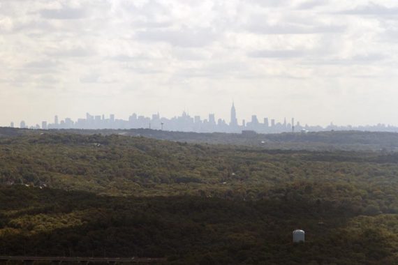
5.1 – At an open rock slab, there are views to the west and of the New York City skyline. Nice break spot with a large shady tree.
Turn sharply right to continue following YEL (Wyanokie Crest) / TEAL DIAMOND (Highlands) along the ridge of Buck Mountain.
5.3 – Continue following just YEL (Wyanokie Crest) now as the TEAL DIAMOND (Highlands) leaves to the left.
6.6 – Turn RIGHT onto an obvious unmarked woods road that crosses YEL (Wyanokie Crest).
Possibly spot a few old faded white blazes on the unmarked woods road. It’s rocky, eroded and potentially very wet but if it is you can walk on the higher edges on either side of the road.
Continue on the unmarked woods road as it crosses over GREEN (Den).
6.9 – Reach GREEN (Den) again and veer LEFT to start following GREEN (Den). [GREEN (Den) also veers right].
GREEN (Den) continues on a mostly level but rocky woods road then veers up to the left back onto a trail. Pass stone building remains on the right. Cross Blue Mine Brook on rocks.
7.7 – At the trail kiosk from earlier, turn LEFT, following PURPLE/BLACK (High Point Spur) back to the parking lot.
—
Hiked: 4/14/18. Trail Blog: “High Point, Carris Hill, and Buck Mountain in Spring“
Hiked: 10/2/11. Trail Blog: “Norvin Green: Wyanokie High Point, Carris Hill, Buck Mtn.“
Updated: 7/2023 – Page updated; adjusted for WHITE trail changes (end points of Lower and Post Brook changed); portions re-hiked as part of another route. 7/2020 – Page refreshed, not re-hiked. 4/2018 – Re-hiked, updated description/GPX/Interactive Map; route slightly modified to turn onto a unmarked woods road earlier.