Short hike that includes stone ruins, Lake Valhalla Overlook, a waterfall, and the 100 Steps.
3.7 miles, total round trip. Minimal elevation gain.
| 3.7 miles | This hike guide: Detailed instructions, photos, and video follow below. |
| Shorter | 3.2 – Out-and-back to ruins and waterfall. Noted below. |
| Longer variation, same lot | Turkey Mountain – Perimeter Loop. |
| Nearby | Apshawa Preserve; Apshawa Waterfall; Butler (Kakeout) Reservoir; Tourne County Park; Four Birds Trail – Wildcat Ridge; Four Birds Trail – Splitrock Reservoir; Splitrock Reservoir Loop. |
Our two cents:
Manageable hike that packs in most of what Turkey Mountain has to offer. Is generally less busy than Pyramid Mountain (home of the super popular Tripod Rock) which uses the same parking lot.
Note!! Valhalla Falls is best after decent rainfall. It can have a smaller flow or be TOTALLY dry if precipitation has been lacking. Photos below show both extremes.
Hike Info:
Map:
Use the park’s map linked above and/or check the visitor center for a printed map. This park is included on Morris County Highlands Trails (any versions prior to 2022 are outdated). Follow along on your smartphone with our Interactive Map link above.
Related: Waterfalls in NJ / Best Waterfall Hikes in NJ
Books:
Other routes are in Take a Hike New York City and 60 Hikes Within 60 Miles: New York City.
Parking: N40.94700° W74.38780°
“Pyramid Mountain Parking”, 472 Boonton Ave, Boonton, NJ 07005. Rt 287 to exit 45. L on Wootton St, R on 511/Boonton Ave. Large gravel parking lot that often fills on weekends.
Restrooms:
In the visitor center when open. Portable toilets in the parking lot (may be seasonal).
Hike Directions:
Overview: YELLOW – ORANGE DOT – GREEN DOT – YELLOW
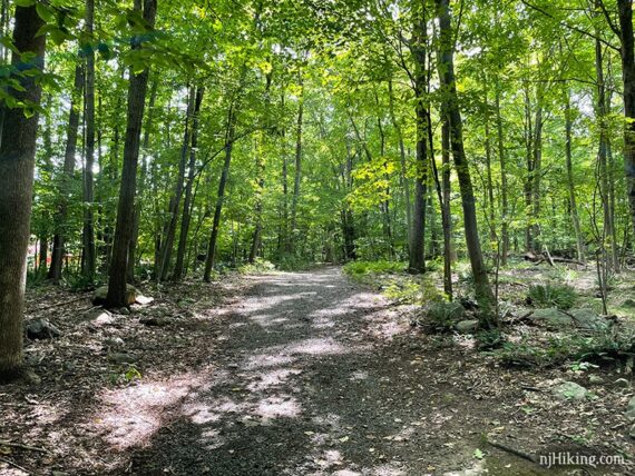
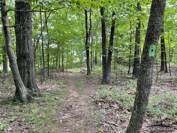
0.0 – YELLOW starts near the exit driveway. Cross the road. The YELLOW trail is wide and easy at first.
0.2 – Continue following YELLOW, passing RED DOT on the right. [RED DOT is an out-and-back to a wildlife viewing blind which would add 0.5 miles total to this route.]
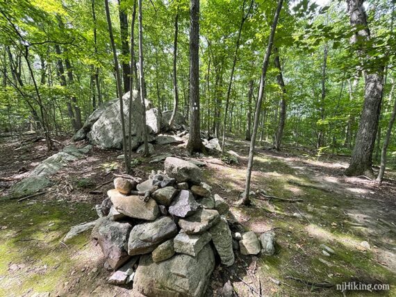
0.3 – Continue following YELLOW, passing a large rock cairn and WHITE on the right.
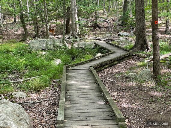
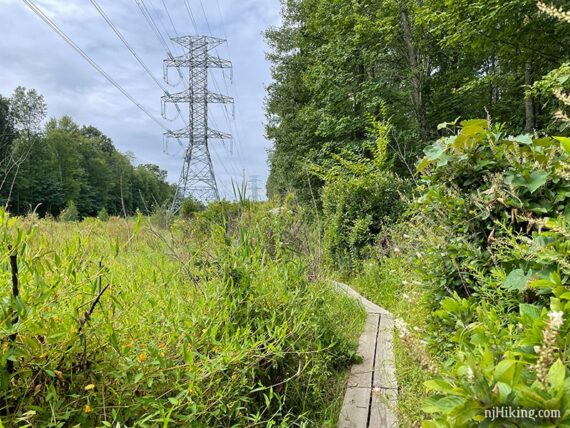
0.5 – Turn LEFT to start following ORANGE DOT and immediately walk over a plank boardwalk. [YELLOW continues ahead.] Look closely in the photo below to spot a curious deer peering back at us.
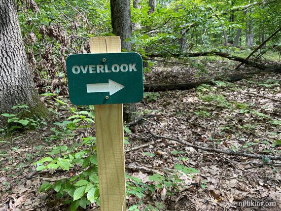
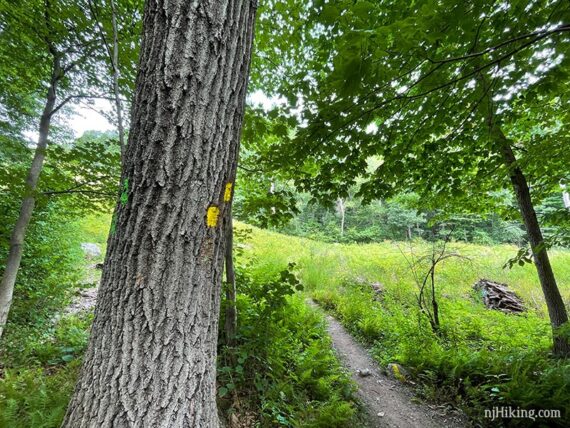
0.8 – Turn RIGHT to start following GREEN DOT at a sign for “Overlook”. [ORANGE DOT continues straight.]
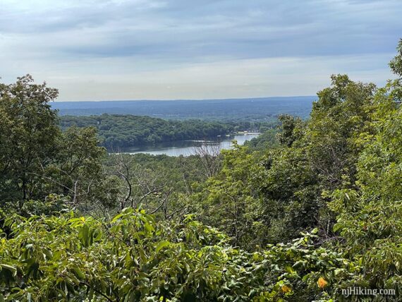
0.9 – Continue following GREEN DOT to overlook in an open rocky area.
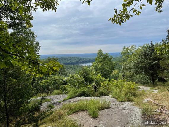
From the overlook, Lake Valhalla can be seen in the distance. Continue following GREEN DOT.
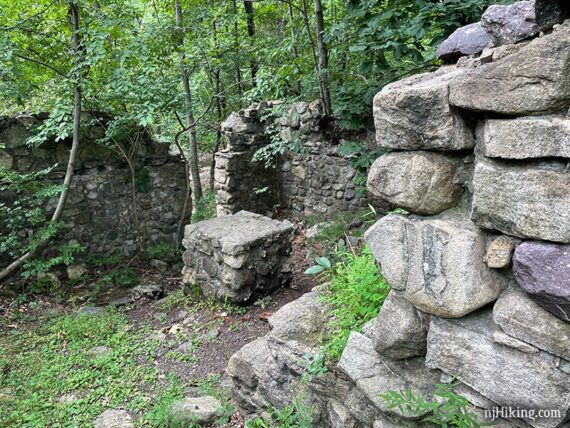
1.0 – Continue following GREEN DOT to the remains of a small stone cabin.
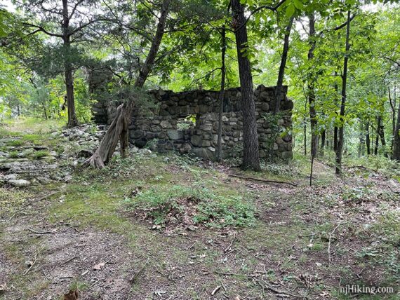
According to the The New Jersey Walk Book the cabin was abandoned when the power lines were added.
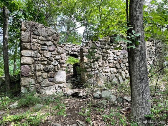
When we’d hiked here way back in 2010 there was a “scenic overlook spur” trail behind the cabin that led to a view of the NYC skyline from the power line cut. We made our way over to that point but couldn’t spot the skyline – it’s likely that the trees have grown to block it.
The remains of a stone chimney are still visible across the cut but it’s too overgrown to check out. Looking into the cabin from around the back of it:
Continue following GREEN as it heads steeply downhill.
1.2 – Start following YELLOW and cross the power line cut. [YELLOW also goes to the right. GREEN DOT ends]. Possibly pass the old red trail, now unmarked, though we did not notice it.
1.4 – Continue following YELLOW in direction of the “waterfall” sign. [PURPLE DOT is on the right. “Visitor Center” sign points back.]
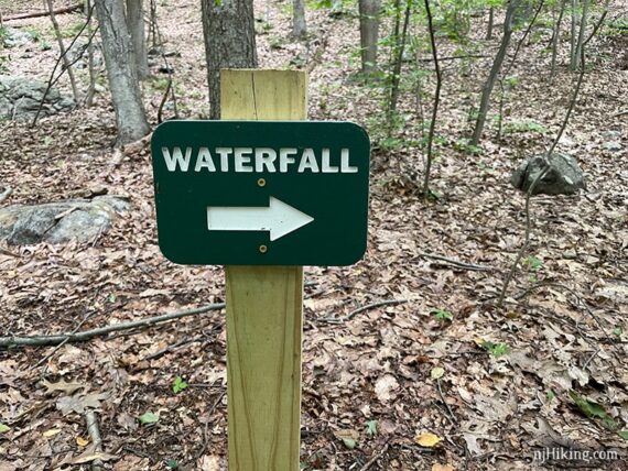
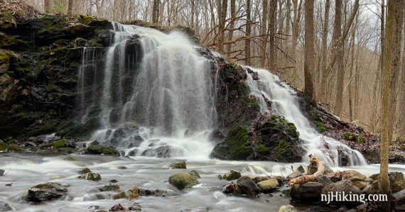
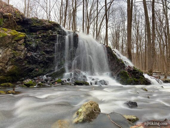
1.6 – Arrive at YELLOW and RED blazes on a tree in front of a waterfall cascading over a small hill into North Valhalla Brook.
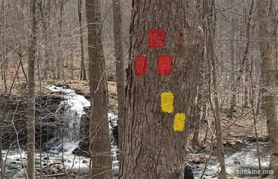
The brook curves around a mound of earth and rocks that the water flows over. A footbridge off on the far right is the route of the RED trail.
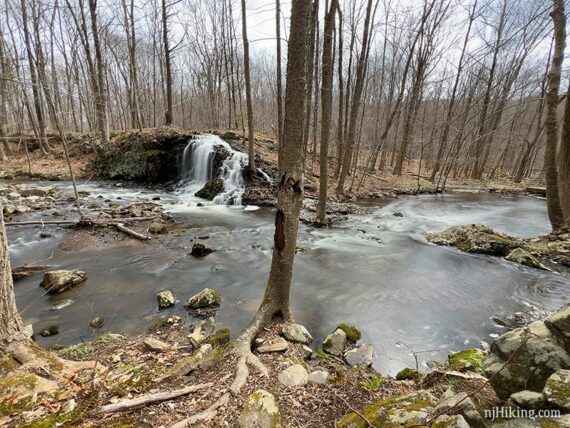
The falls aren’t usually named on maps but since they are on North Valhalla Brook, they are often referred to as “North Valhalla Brook Falls” or “Valhalla Brook Falls” but we’ve always just called them “Valhalla Falls”.
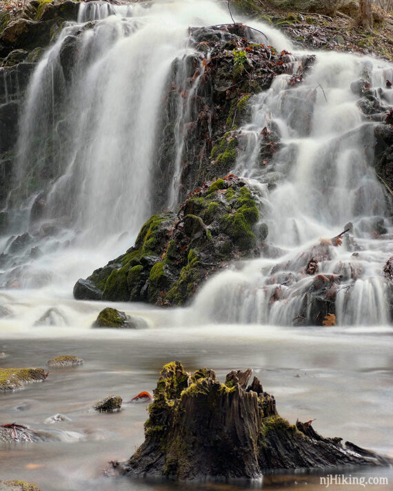
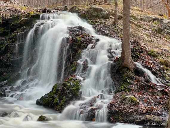
There are several vantage points to get different angles of the falls that require picking your way a short way over rocks or down the embankment to the water level.

Valhalla Falls is most impressive just after heavy rainfall (these photos were taken in April right after a TON of rain). It often has less flow than shown here.
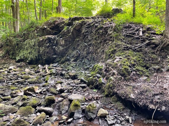
This next photo is from the same spot as the first falls photo above but taken in August. The falls and most of the brook was entirely dry – we could even stand where the water would normally be running.
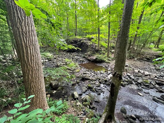
The rocky structure of the hill is visible when it’s Valhalla-Not-A-Falls. This is a pleasant hike even when the waterfall isn’t gushing.
After checking out the falls, continue following YELLOW – with your back to the brook/waterfall take YELLOW to the RIGHT. [YELLOW also goes straight, back the way you came].
Shorter variation, 3.2 miles total: Instead, retrace the route back. With your back to the brook/waterfall take YELLOW straight, then GREEN DOT, left on ORANGE DOT, right on YELLOW.
2.2 – Continue following YELLOW to the LEFT at the “visitor center” sign. [RED is straight ahead].
2.6 – Continue following YELLOW to the RIGHT at the large rock cairn (pile-o-rocks). [Old red trail with a painted over blaze goes to the left.]
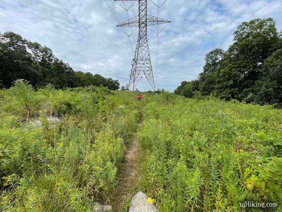
3.1 – YELLOW continues back out to the power line cut. Follow it as it turns RIGHT at the sign for “100 Steps/Visitor Center”. [ORANGE DOT is straight and is an alternate way back, about 0.2 miles longer].
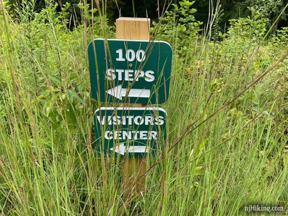
YELLOW continues along the cut and goes under a tower for power lines. These larger towers were installed around 2014. The trail was pretty overgrown and grassy in August.
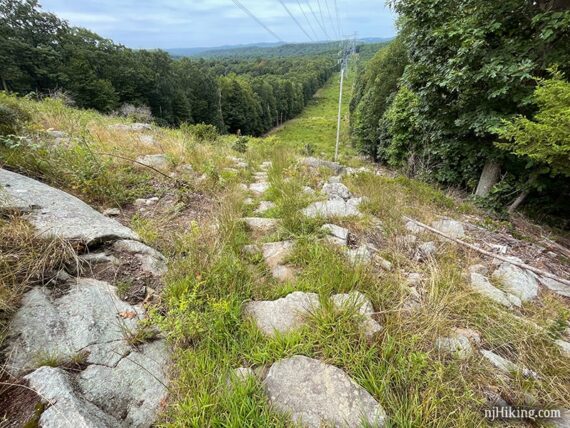
YELLOW eventually heads downhill on rough stone steps. Many are just rocks and not defined steps so it’s difficult to get a count – but it should be more than 100. Tom tallied 115 but we’ve seen higher totals.
Eventually YELLOW bears RIGHT off of the cut and into the forest.
Continue following YELLOW as it turns LEFT to run next to the road. Cross the road and re-enter the parking lot.
—
Hiked 4/10/22. For falls photos, did Perimeter version.
Hiked 8/16/21.