Explore the history of Watchung Reservation and hike around Lake Surprise.
6.1 miles, total round trip. Surface ranges from dirt to rooty/rocky trail; rolling hills.
- Shorter: Large network of trails to cut it short.
- Same trailhead: Watchung Reservation – Sierra Trail.
- Nearby: South Mountain Reservation – Hemlock Falls via Lenape and Rahway; Hemlock Falls Loop; South Mountain Fairy Trail; Great Swamp NWR; Great Swamp – Blue Trail; Great Swamp – Orange Trail.
Hike Info:
Our two cents:
This hike features informational signs posted at historical locations along the way and also loops around Lake Surprise. Stops include a gorge that was once mined for copper, as well as sites where a mill, Drake Farm House, Girl Scout cabin, and boathouses once stood.
This route doesn’t visit the Deserted Village of Feltville but can be modified (noted below) or do a side trip to it.
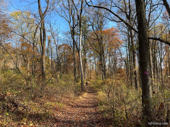
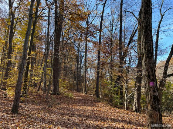
The navigation on this loop is straight-forward with only one color but there are a few intersections that aren’t clear.
The extensive trail system offers plenty of opportunities to extend or shorten the hike. Considerable traffic noise in many areas.
The fall foliage tends to peak in early to mid-November so this is a good choice for something later in the season, after much of New Jersey is past peak.
Post-hike suggestion: Tasty sandwiches from Avenue Deli with a flight at Untied Brewing.
Bonus: Mostly no hunting – except for certain weekdays between Oct. and mid-Feb; see our page for Union County/Watchung schedule.
Map:
On the park site or print ahead, possibly brochures in the map box at the trailhead. Follow along on your smartphone with our Interactive Map link above.
Books:
Other routes are in Best Day Hikes in New Jersey, Hiking New Jersey (2023), 50 Hikes in New Jersey, 60 Hikes Within 60 Miles: New York City and Best Day Hikes Near New York City. A detailed trail description is found in the The New Jersey Walk Book.
Parking: N40.68340° W74.37297°
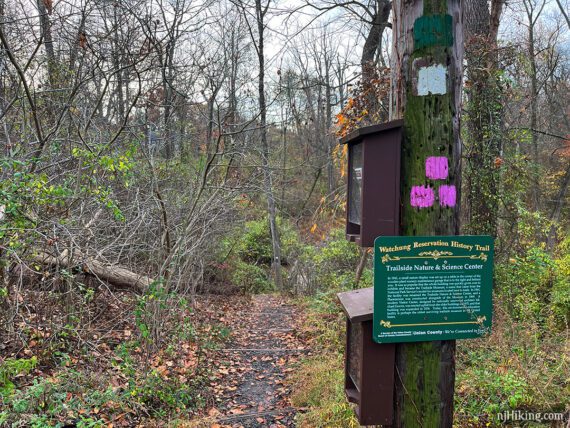
“Trailside Nature & Science Center”, 452 New Providence Rd, Mountainside, NJ 07092. Detailed directions from various approaches found on the park site.
Restrooms:
Inside the Trailside Nature Center at the main parking lot. Other restrooms were open earlier in a nearby building, follow the sign at the end of the parking lot near the museum. If facing the Nature Center, these are off to the right.
Restrooms are around the back of the Village of Feltville Store/visitor center if you made a side trip to that. Portable toilets shown on the trail map may be a seasonal.
Hike Directions:
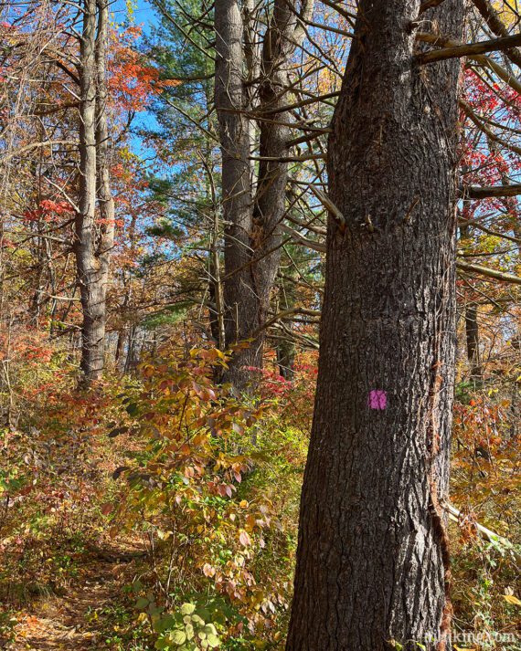
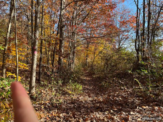
Overview: PINK (History) for the entire route. The trail may look or be marked PURPLE on some maps.
The historical facts below are from the park’s “History Trail” brochure.
0.0 – From the parking lot, with your back to the Trailside Nature Center, turn RIGHT on the road at the edge of the lot. Follow this park road for just a bit, then turn LEFT at the trail post marked with WHITE, GREEN, and three PINK blazes to start following PINK (History).
There are other trails co-joined with the History Trail so different colored markers will come and along the way. Just keep following PINK (History).
0.2 – Continue following PINK (History) as it turns to the LEFT. [YELLOW and GREEN go to the right]. Follow the well-blazed trail as it loops around.
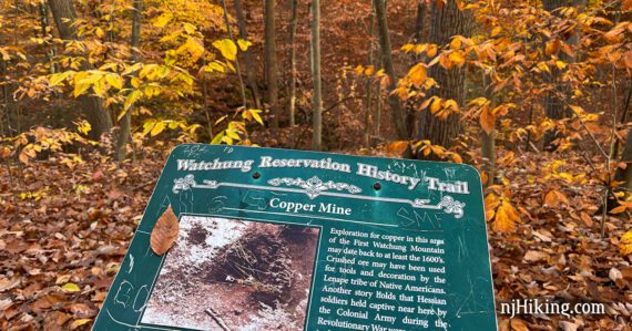
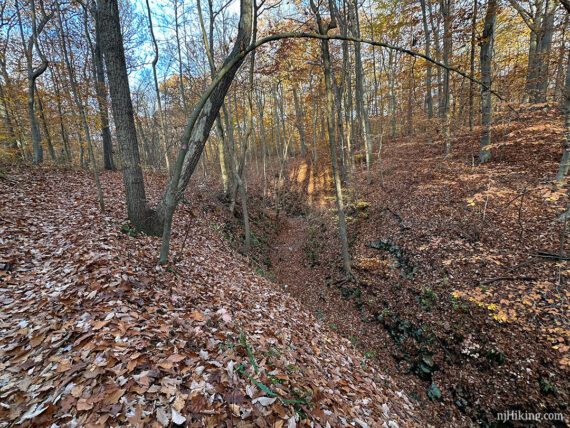
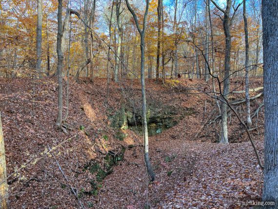
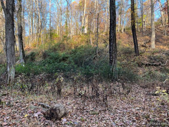
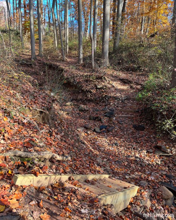
1.3 – PINK (History) turns to run above a narrow rock-lined gorge. Soon, arrive at a sign for the copper mine.
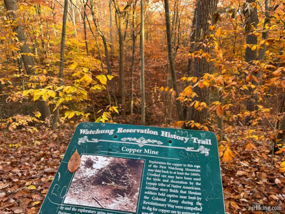
The ore from the mine was of low quality, was only explored for 15 feet, and part of the mine has collapsed. We tried to match the sign photo to real life and think it’s referencing the area shown below, but we’re not 100% sure on that.
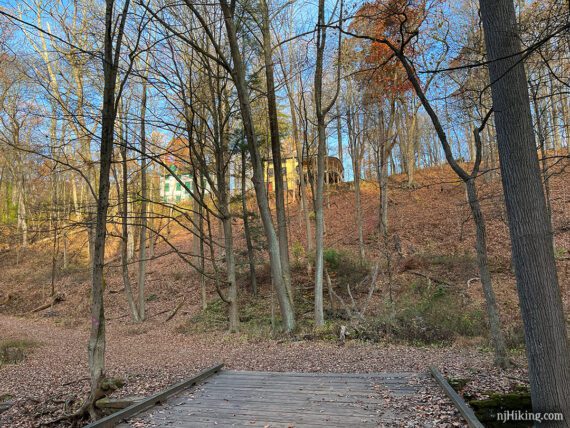
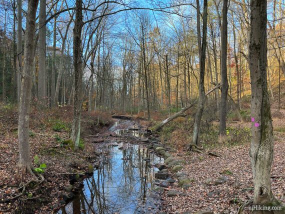
1.7 – Continue following PINK (History) on a wide wooden footbridge over Blue Brook. Buildings from the Deserted Village of Feltville can be seen on the hill (but might not be visible with leaves on the trees).
Continue on the trail as it turns LEFT along the brook.
1.3 – Arrive at the site of the Feltville Mill. A three and a half story mill that was powered by water from the Blue Brook was built in 1845 for David Felt’s printing factory.
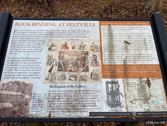
The town seen on the hill above, Feltville, was built for the mill workers. The mill was torn down in 1930 and some overgrown foundations are just visible.
Continue following PINK (History) along the brook where the trail widens into a rocky woods road that may be a little flooded in spots.
2.3 – Three-way unmarked intersection. Turn LEFT to continue on PINK (History).
[WHITE (Sierra) also goes left and right, with an unmarked trail ahead – but no indications whatsoever, as of 11/2022]. This intersection is near “Hermit’s Pond” marked on the map, but we didn’t notice it.
// Variation: Instead, turn RIGHT here and follow WHITE (Sierra) and then a road through the Deserted Village of Feltville past several buildings. Continue on the road until reaching a parking lot and turn RIGHT to continue on the PINK (History) and pick up the directions at 3.6 below. //
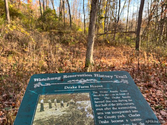
2.6 – Turn LEFT for a short side trip to the site of the Drake Farm House (you’ll return to this intersection to continue). Pass WHITE (Sierra) leaving to the right.
There’s an info sign and a faint path past it. Stone foundations from the farm house and barn, used until the 1940’s, are somewhat visible.
Return to the intersection and continue ahead on PINK (History), passing the remains of the Drake Barn on the left.
2.7 – Continue on PINK (History) as it turns RIGHT. Pass through a short section of evergreen forest.
3.1 – Climb down a short ladder/steps into a rock filled gully, then right back up on thick wooden steps.
3.3 – Turn LEFT to continue on PINK (History). An unmarked trail continues ahead and seems like the obvious route.
Easy to miss – we blew right past this turn and didn’t realize it right away (probably discussing what to eat post-hike…).
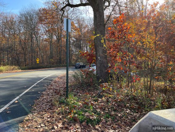
3.6 – Continue on PINK (History) through a parking lot and across Cataract Hollow Road.
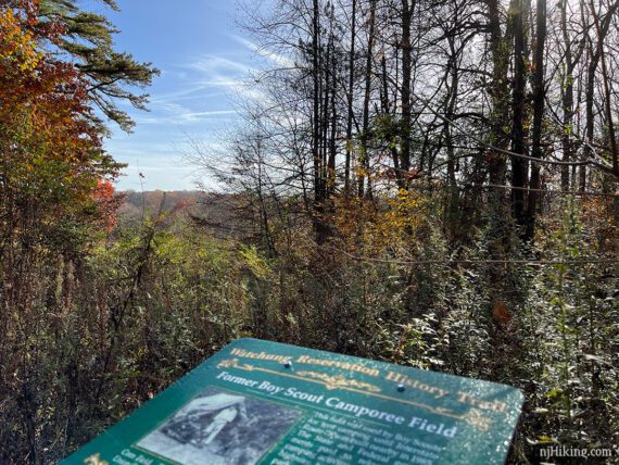
4.0 – Sign for the Old Scout Camporee Field. This location was used by Boy Scouts for tent camping until 1985 when I-78 was built nearby. After the highway was created, the camp was moved to the other side of the park.
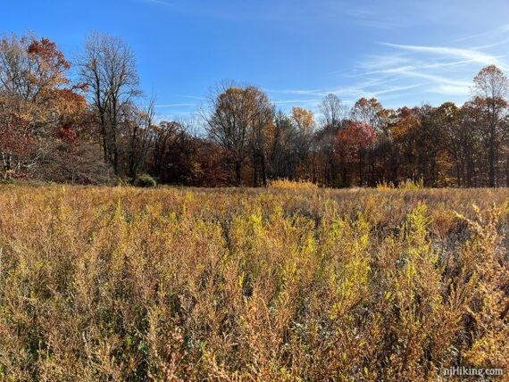
4.3 – Continue on PINK (History) on a narrow path through a field. Rt 527 is just of to the left, and Rt 78 just beyond that.
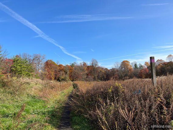
This area is named “The Corn Field” for the crop that was farmed here before this area became a Boy Scout camp in the 1920’s. This and the Camporee Field are the largest wildflower meadows in Union County.
After the field, the trail turns to the RIGHT, moving away from the road.
4.4 – At an unmarked/unclear T-intersection, turn LEFT to continue on PINK (History). [Going right will loop back around the corn field].
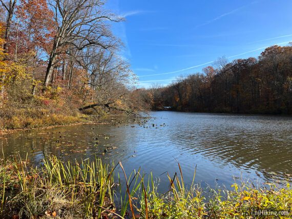
4.7 – Lake Surprise comes into view. There are some openings to get a view of the lake. WHITE (Sierra) merges into PINK (History) and is co-joined.
Follow PINK (History) as it turns RIGHT along a road for a short stretch, before turning LEFT back around the lake.
5.2 – Sign for the Girl Scout Cabin which used to be up on a bluff but burned down in 1975.
PINK (History) is a level wide path with a view of the lake. There are a few picnic tables along the way.
5.5 – Signs for the Lake Surprise Boathouse and Bathhouse. In the 1930s, rowboats could be rented here and there were buildings for refreshments and restrooms. All were taken down in the 1970s.
Follow PINK (History) as it veers to the LEFT away from the lake (a path continues ahead). Then makes a LEFT and a RIGHT. Continue onto an open grassy area with a building.
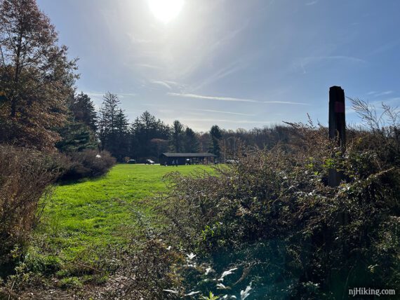
Follow PINK (History) across the grass, towards the left. Pass restrooms on the way to the parking lot.
—
Hiked: 11/5/22.