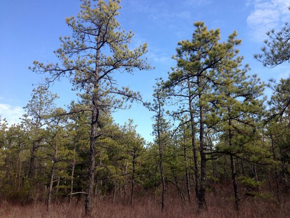
A great intro to the terrain of the Pine Barrens that also travels through Atlantic white cedar swamps.
8.4 miles. Easy trail surface of pine and sand, some boardwalks over wet areas, minor rolling hills (really minor – the elevation of Laurel Hill is only 130′!!!). The boardwalks can be slippery in wet or icy conditions.
| 8.4 miles | This hike guide: Detailed instructions, photos, and video follow below. |
| Shorter | 4.5 – Shorter version, noted below. 3.5 – GREEN loop, 0.9 – BLUE, 0.5 – PINK loop – or use the GREEN trail in conjunction with WHITE for varying loops. |
| Nearby | Barnegat Branch Trail; Double Trouble; Jakes Branch; Cattus Island; Island Beach State Park; Bass River. |
Our two cents:
We chose this as a ‘best hike’ not only because it’s a nicely kept park that is a good intro to hiking the pine barrens but there is something for everyone.
The WHITE trail is a long loop for avid hikers, but that route is also good for hikers trying to see if they can up their mileage as there are several bail-out points to cut it short if needed.
For beginners or families, there are short loops from the visitor center and a nice a playground.
Note: There is no-hunting at this park, but it often closed during firearm season days in December due to close proximity to areas where hunting is permitted.
Updated: 1/2025 – Page refreshed, updated references to YELLOW; not re-hiked. Older change log at page bottom.
Hike Info:
Map:
Print from the link above, or the visitor center probably has them when they are open. Follow along on your smartphone with our Interactive Map link above.
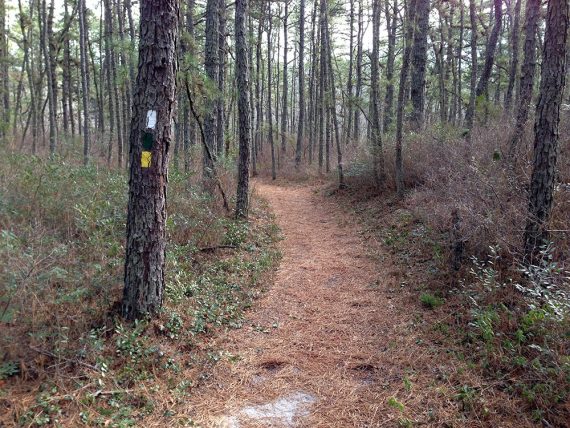
Trails are VERY well blazed. There are also mileage markers along WHITE, so if you’ve started the beginning near the visitor center, the mileage will be pretty accurate as you go along.
Books:
This hike is now in Best Day Hikes in New Jersey in addition to Hiking New Jersey (2023) (the driving directions aren’t good however). A good 4.5 mile variation is in 50 Hikes in New Jersey.
Ticks: The Pine Barrens are notorious for ticks. We don’t use bug spray in January but it got warm enough that day that we had one on a pant leg. So if you can pick up a tick here in January, imagine what you may end up with in the summer – be prepared for ticks.
Parking: N39.79528° W74.27620°
Wells Mills County Park, 905 Wells Mills Rd, Waretown, NJ 08758. From the Garden State Parkway Southbound or Northbound: Exit 69 (Waretown); turn LEFT (west) onto Wells Mills Road, Route 532; proceed approx. 2.5 miles to park entrance on the LEFT. Large paved parking lot.
Restrooms:
Seasonal restrooms, right at the parking lot. (not sure when they are open; were closed in Jan.) Bathrooms in nature center, one sign had 8am open and another 10am, but this is closed on holidays.
The Forked River rest area on the Parkway around exit 74 has restrooms (…and a Starbucks).
Hike Directions:
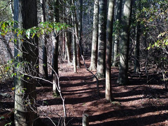
Overview: This route entirely follows the WHITE trail. It’s very well marked through the entire hike, there wasn’t one instance where we questioned where to go.
To locate the trailhead, walk past the bathrooms and trail kiosk towards the visitor center.
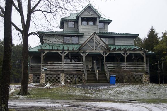
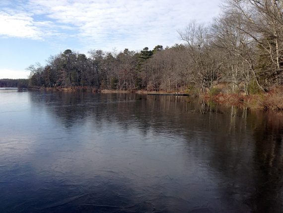
Walk around the right side of the visitor center and heads towards the lake.
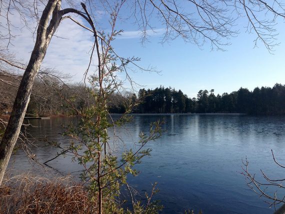
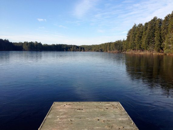
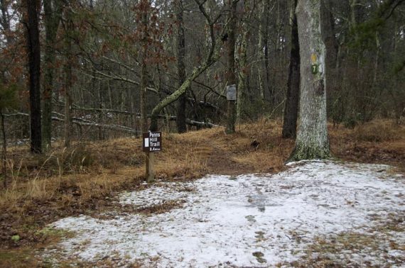
0.0 – Look to your right and there is a sign with “Penns Hill 8.4 miles”.
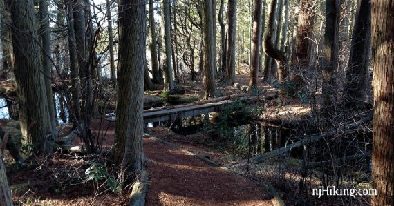
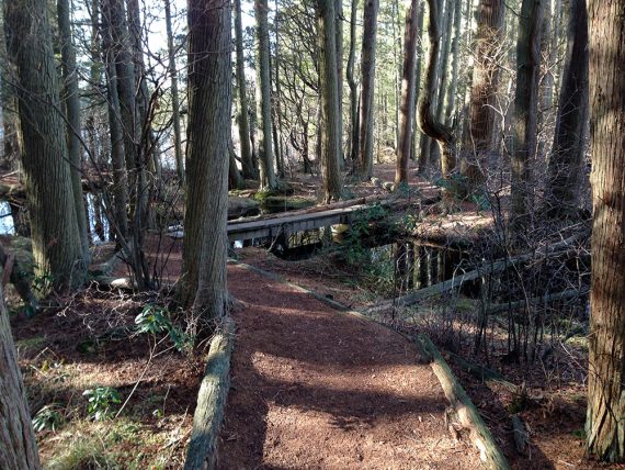
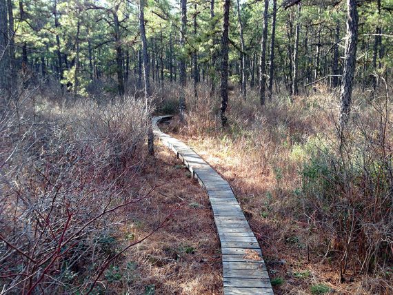
Start following the WHITE markers, which will hug the shoreline. Shortly, go through a cedar swamp – a very pretty, dark, wet area crossed on boardwalks.
0.2 – Pass the BLUE (Conrad) trail on the right. As you exit the swamp area, the trail veers to the right and heads away from the water.
0.3 – Keep straight on WHITE as GREEN (Estlow) and YELLOW (Bike Trail) cross the trail. The trail becomes more hilly and you don’t pass any other blazed trails for awhile.
3.4 – Step through a wooden fence
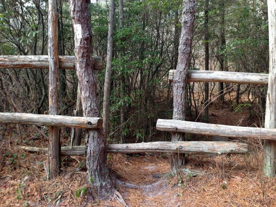
Turn RIGHT onto a woods road to continue following WHITE. At this point, WHITE is co-aligned with GREEN (Estlow).
// Shorter option, 4.5 miles total: Instead, turn LEFT at the fence instead and follow GREEN (Estlow) back to the parking lot – this is the route in 50 Hikes in New Jersey.]
3.5 – Turn sharply left, still following WHITE. [A barricade blocks the trail straight.]
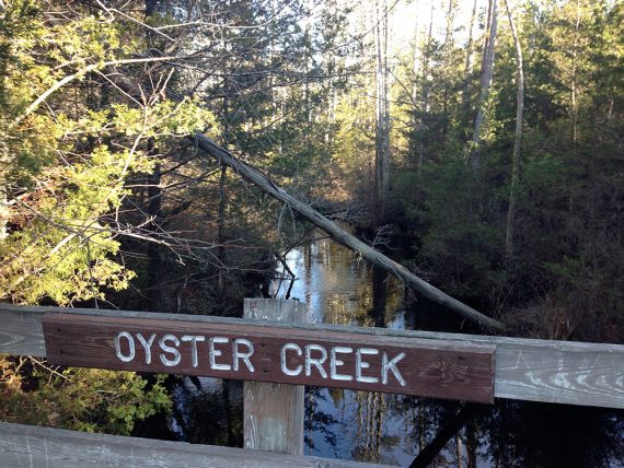
3.8 – Cross over Oyster Creek on a boardwalk.
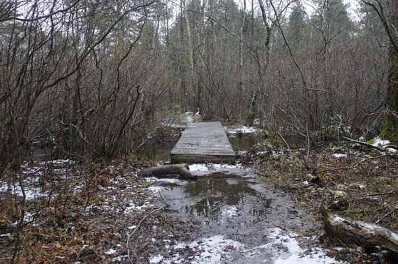
4.0 – Follow WHITE as it turns left. [GREEN (Estlow)/YELLOW (Multi-use) continue straight.] Head over a long boardwalk. The trail loops around, going over an area called “The Island” on older park maps.
5.9 – Cross over the GREEN (Estlow)/YELLOW (Multi-use) trail.
8.2 – Turn RIGHT, continue following WHITE back to the lot, passing the lake again. [Trail is co-aligned with GREEN (Estlow)/YELLOW (Multi-use).]
—-
Hiked: 1/1/17.
Hiked: 1/1/14. Trail Blog: “Wells Mills County Park – New Year’s Day 2014“
Hiked: 1/1/10. Trail Blog: “Wells Mills County Park – Penns Hill Trail“
Updated: 4/2020 – Page refreshed, not re-hiked. 4/2010 – Minor tweaks, added photos. 1/2017 – Minor text changes. 1/2014 – Hike description updated, GPS file added, photos added. There is a newer park map now, and this lists the WHITE trail as the “Macri” trail, which used to be called “Penns Hill” trail. It’s been simplified to WHITE in the description below.