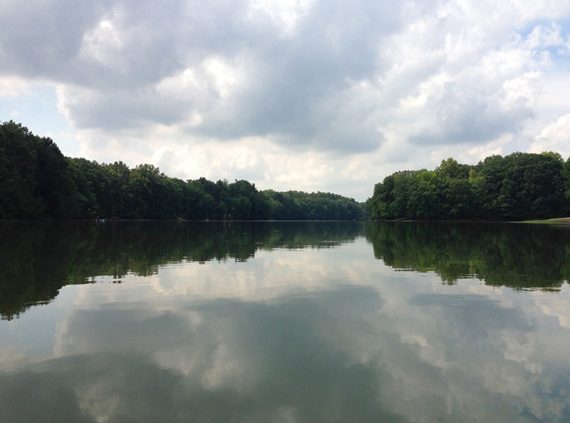
Enjoyable paddling on a quiet lake tucked away in suburbia.
Spot plenty of herons and other birds along a lake lined with trees and a few houses.
Miles: ~8.0. Entire length of lake. Lake Size: 290 acres. Average Depth: 6’, max depth: 12’.
| Miles: up to ~8.0 | Detailed instructions, photos, and video follow below. |
| Nearby kayaks | D&R Canal Kayak – Blackwells Mills; Carnegie Lake Kayak. |
| Nearby hikes | Farrington Lake Trail, Ireland Brook, Davidson’s Mill Pond; Forest Brook Trail; Van Dyke Farm; Tamarack Hollow. |
Our two cents:
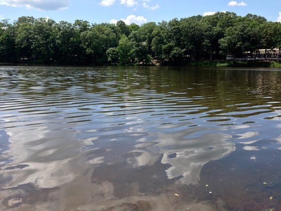
The entire lake is a pleasant and easy paddle. The south end is narrower and shallower than the north end (and more interesting in our opinion), but is more affected by low water.
This southern end is technically called “Lawrence Brook” but one just flows into the other so we’ve always considered the whole thing “Farrington Lake” (…which was created by damming the Lawrence Brook).
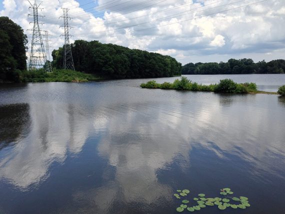
Relatively quiet area but some power lines and houses that border the lake are visible, with the associated noise of mowers etc.
Road noise, especially along the southern section. Lots of fishing boats but it’s electric motors only and there is room to spread out.
Plenty of wildlife – herons, other birds, turtles. A solid choice for those in central Jersey, but not something you need to drive far for.
Updated: 6/2024 – Minor edits; re-kayaked south section to end. Older change log at page bottom.
Parking:
N40.42449° W74.47690° [Riva & Church Ave. lot] “Farrington Lake Small Boat Launch” 549 Riva Ave, East Brunswick, NJ 08816. Small dirt lot. Launch from shore.
N40.43897° W74.46667° [Hardenburg Ln lot] 211 Hardenburg Ln, East Brunswick, NJ 08816. Dirt lot. Launch from shore.
A small launch area is further south on Rive Ave., and books show another launch at the far north end of the lake on Farrington Blvd near the dam/spillway but we’ve never tried either of those.
Restrooms:
None (6/2024). Facilities may be open down the road from the Hardenburg Ln. lot at Bicentennial Park, 176 Hardenburg Ln, East Brunswick, NJ 08816.
Kayak Rentals:
No rentals but Kayak East sometimes runs guided trips here.
Book:
Appears in Quiet Water New Jersey (2010) and Quiet Water Mid-Atlantic (2018).
Note: Our go-to kayaking book is Quiet Water New Jersey (2010), available as an e-book or a used printed book.
The newer version is “Quiet Water Mid-Atlantic (2018)”. This contains 13 of the 52 locations in the New Jersey-only book and is available both in printed and online formats.
Related: Kayaking NJ overview page.
Launch:
The small launch area at Church and Riva is shown below. It’s a murky and muddy/gravely gradual entry. The Hardenburg Lane lot/ launch area is bigger but is sometimes filled with boat trailers.
The Route:
We think of Farrington Lake as two sections, split at the Church and Riva lot, and usually do one half or the other as the whole lake is a bit much to do at once.
The lake is orientated northeast-southwest but we’re just using north/right and south/left from the launches for simplicity.
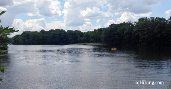
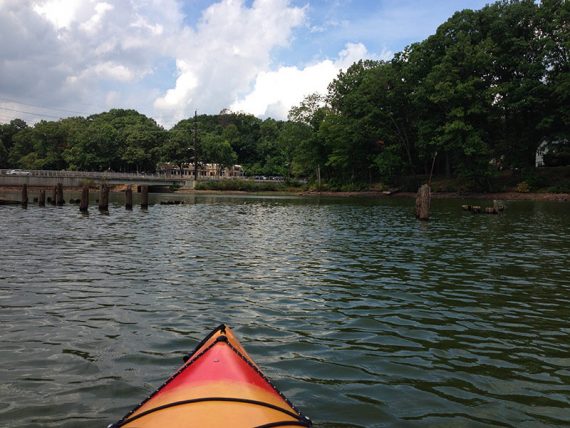
North/right from Church & Riva lot:
Goes towards the widest area. Passes a dock for a day camp, houses nestled in the trees, and some power lines.
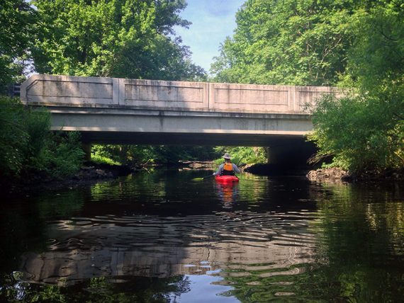
The bridge on Hardenburg Ln can be paddled under and we’ve never seen the water high enough that it’s not possible. Just past this is a strip of land jutting out into the lake where there are submerged pylons. These are easily navigated through.
They aren’t visible when the water level is high but there are metal rods stuck in them to make them easier to avoid.
There is a cove with walls in front of it, and the lake ends at a splillway/dam. The spillway has a decent drop off so stay clear of it.
South/left from Church & Riva lot:
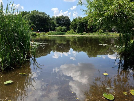
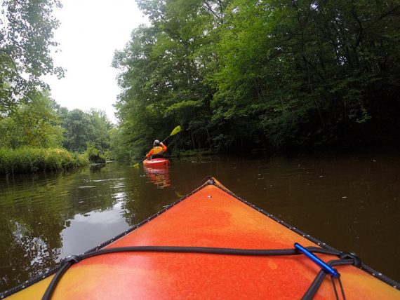
Immediately paddle under the Church Lane bridge and into a narrower area that is filled with lily pads.
This area is much wilder in feel than the more open sections in the north of the lake.
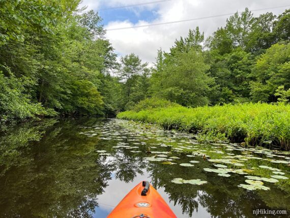
This continues to narrow, with overhanging branches, passing under another bridge. This southern section is the Lawrence Brook.
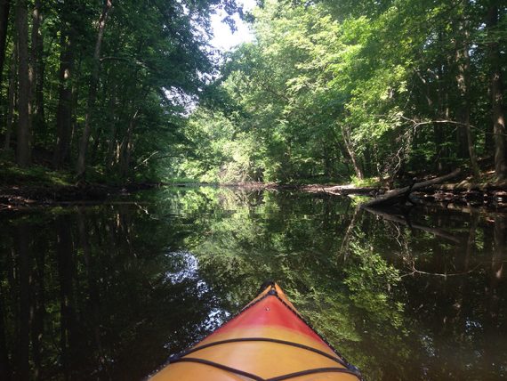
When the water level is low, this 2nd bridge may be tricky as there are rocks or cement pieces under it.
You never know what will tag along while kayaking….
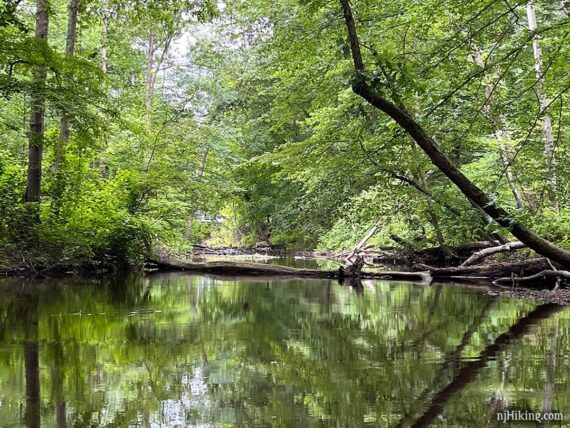
It eventually becomes more shallow, just short of entering Davidsons Millpond.
The furthest point is where the water becomes very shallow and large fallen logs are across the entire width. Even if you portaged over the logs the water soon heads under the road to a dam at Davidson’s Mill Pond.
—
Kayaked 6/8/24. 3.0 miles, left from Riva.
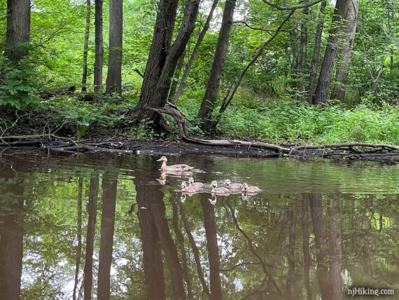
Kayaked 7/4/23. 3.0 miles, left from Riva. Lots of herons, momma + baby duckies
Kayaked 5/20/22. ~4.0 miles, right.
Kayaked 6/5/21.
Kayaked 7/26/20. w/ B & S.
Kayaked 7/15/20, 5/23/20.
Kayaked 8/10/19. 4.7 miles, right. Wildlife: an absurd amount of great blue herons and egrets.
Kayaked 7/4/19. 4.0 miles, left.
Kayaked 8/18/18. 3.4 miles. Hardenburg Ln.
Kayaked 7/4/17. 4.0 miles. Wildlife: multiple herons, turtles popping up in front of us.
Kayaked 6/26/16. 3.0 miles. Wildlife: several herons, including one that flew right over us with a loud squawk.
Kayaked 8/23/15. 3.9 miles.
Kayaked 5/25/15. 2.6 miles.
Kayaked 8/03/14. 4.9 miles.
Kayaked 7/12/14. 5.0 miles.
Kayaked 7/7/14. 3.8 miles.
Updated: 7/2023 – Refreshed page, added photos; re-kayaked south section to end. 6/2022 – Refreshed page; re-kayaked north half.