Paddle a long lake that runs along the Delaware & Raritan Canal in Princeton.
Pass by islands, bridges, large houses, and the Princeton rowing center.
Miles: Up to about 7 – 8 miles roundtrip, if going left from the launch to the dam, and then back the other way down to Turning Point basin. About 3-3.5 hrs at a slow pace. Lake Size: 237 acres. Average Depth: 4′.
- Park Info: Carnegie Lake at Princeton University (University owns the lake).
- Nearby kayaking: D&R Canal Kayak – Blackwells Mills; Farrington Lake Kayak.
- Nearby hiking: Delaware Canal Towpath; Mountain Lakes Open Space Princeton; Institute Woods; Plainsboro Preserve; Griggstown Grassland Preserve.
Our two cents:
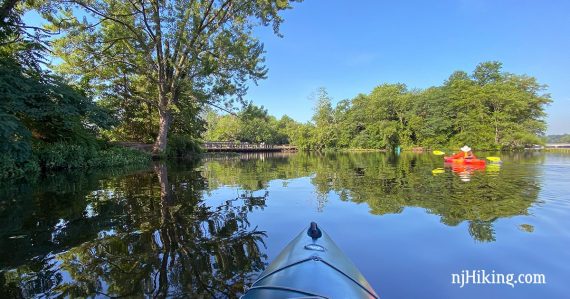
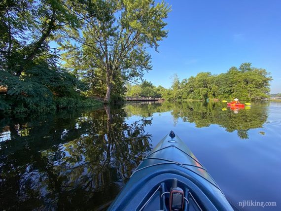
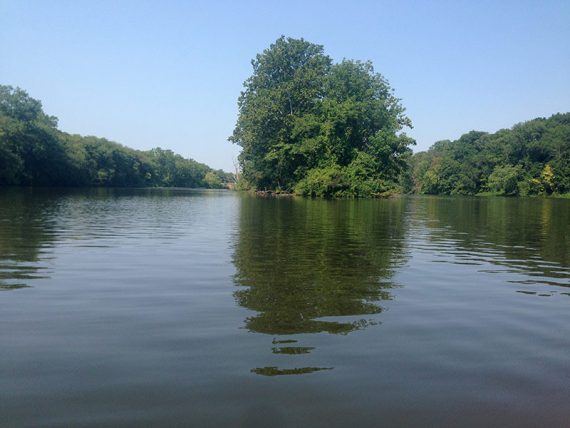
One side of this long skinny lake is forest and the D&R Canal and towpath, and the other is lined with large lake houses. Mostly sunny but you can park under one a bridge for a shady break.
Near the launch area the marked lanes for the Princeton University rowing team start and run down part of the lake.
Avoid these lanes – crew boats have the right of way at all times and they aren’t as maneuverable as a kayak. Check that a race or regatta is not being held.
Updated: 8/2023 – Page revised, photos added; re-kayaked.
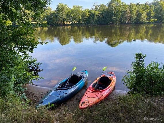
Parking: N40.36684° W74.62572°
Lake Carnegie Public Boat Launch. 875 Princeton – Kingston Rd, Princeton, NJ 08540. Large paved lot.
There is another launch at the south end at Turning Basin which we have not tried.
Restrooms:
None and not much in the immediate area. The lot for the D&R Canal at Kingston right around the corner on Rt 27 and Old Lincoln Highway may have a portable toilet [there 7/2023].
May be a portable toilet in the Rocky Top Dog Park on Rt 27 about 5 min away [2020]. Also could try restaurants in Kingston or continue into Princeton.
Book:
Appears in Quiet Water New Jersey (2010), Trip #24. Doesn’t appear in the 2018 version.
Note: Our go-to kayaking book is Quiet Water New Jersey (2010), available as an e-book or a used printed book.
The newer version is “Quiet Water Mid-Atlantic (2018)”. This contains 13 of the 52 locations in the New Jersey-only book and is available both in printed and online formats.
Launch:
Gradual sandy shore put in at water’s edge, or use the floating dock.
Related: Kayaking NJ overview page.
The Route:
From the launch you can choose either direction. There’s only a short section to the left. Either way, don’t cross the lanes to switch lakes sides if there are rowers present.
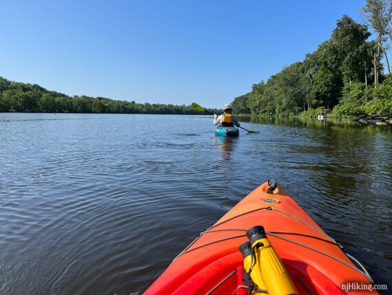
Start to the RIGHT and hug the house-lined shore.
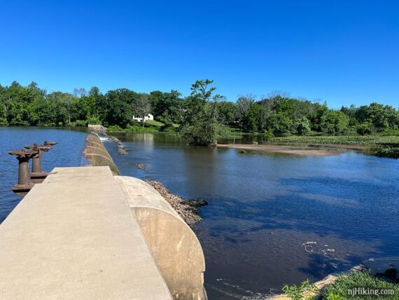
OR, head to the LEFT, around the marked rowing lanes, and towards the dam at the north end of the lake. The dam has a steep drop off so heed the safety line boundary.
This is the dam drop off as seen from the other side of the lake from the D&R Canal towpath. The towpath is a fun bike ride or easy hike so check that out afterwards, or another day.
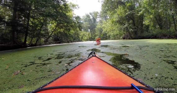
From the dam continue around to the tree-lined shore. The towpath and canal is on the other side of the trees.
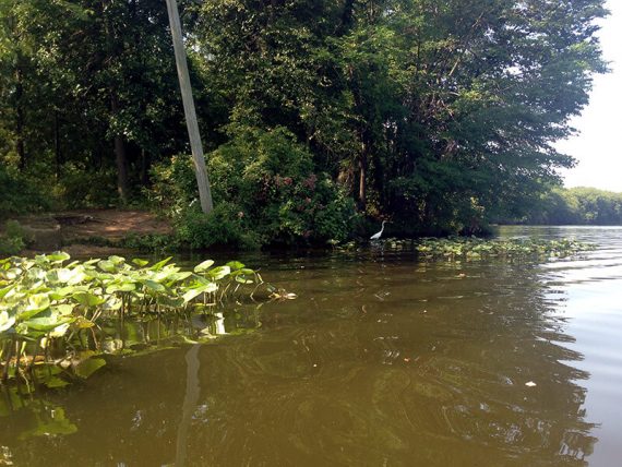
Plenty of wildlife to spot here – herons, geese, turtles. In 2020 a bald eagle flew right over us. Cool. And later a very large turtle breached the water, made a hissing sound, and stared us down.
In a bit the Millstone Aqueduct bridge can be seen at the edge of Carnegie Lake.
Bike riders on the D&R Canal towpath crossing over the bridge.
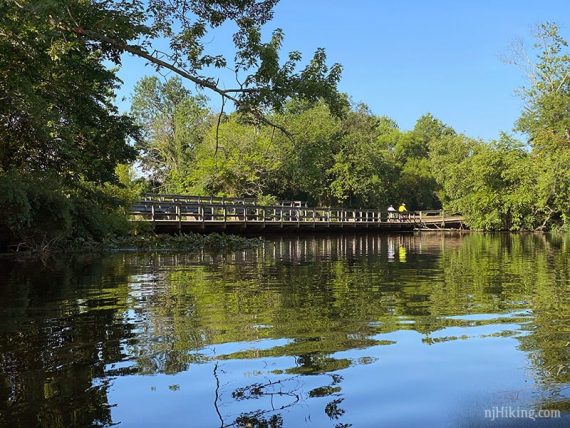
Harrison Street Bridge, with signage for Princeton University, spans Carnegie Lake.
Fun Facts: Carnegie Lake is named for Andrew Carnegie, one of the wealthiest businessmen of the late 1800s who in his later years donated the majority of his fortune to charities and universities, including Princeton University to construct a lake for the rowing team.
The lake was created by constructing a dam at the confluence of the Millstone River and Stony Brook and was finished in 1906. [Source: Wikipedia].
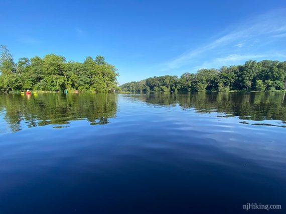
There is a large island in the middle but we didn’t spot any landing areas.
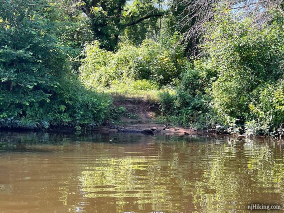
In 2020 we found a small somewhat muddy area to land on the left side to get out for a leg stretch (not long after Harrison Bridge).
This was less obvious in 2023. There are a few possible spots but against a little embankment. We wouldn’t count on being able to land; your results may vary.
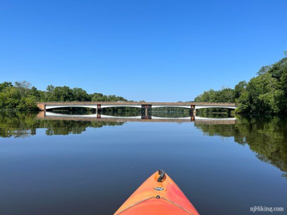
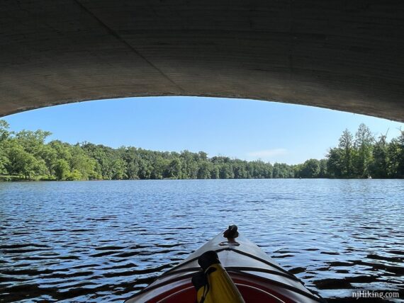
The next bridge is for Washington Road and is a series of arches. Bridges make for shady break spots.
Fun Fact: While at Princeton, Albert Einstein enjoyed sailing on Carnegie Lake. Scroll down the linked page for a photo of him on the lake.
Carnegie Lake ends at a train bridge but the waterway narrows and continues as Stony Brook.
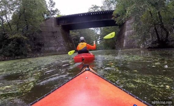
Pass under a bridge for Alexander Road into Turning Basin park and turn around.
—
Kayaked 7/23/23 – 5.5 miles.
Kayaked 7/19/20 – 5.0 miles. w/ the new yaks.
Kayaked 8/16/15 – 4.5 miles.
Kayaked 8/31/14 – 7.3 miles.