Hike the Cooper Union Trail to a rock outcrop for a stunning view over the Wanaque Reservoir.
7.3 or 2.2 miles, total round trip. Somewhat rocky, elevations changes not major; can be wet in a few areas.
| 7.3 miles | This hike guide: Detailed instructions and photos follow below. |
| Shorter | 2.2 – Start from Carletondale Road. |
| Nearby | Skylands Manor – Ilgenstein Rock/Erskine Lookout; Long Pond Ironworks; Ramapo Valley County Reservation; Van Slyke Castle Loop; Norvin Green – Wyanokie High Point; Pine Meadows Loop. |
| Nearby kayak | Monksville Reservoir Kayak. |
Our two cents:
Manageable hike with a sweeping view as the reward. The shorter version delivers the same view for less effort – but the full route is a worthwhile ramble though a pretty forest.
The description below contains parking directions and hike instructions for both versions.
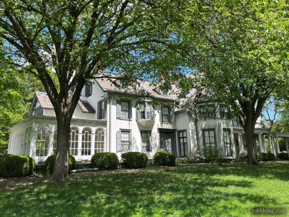
After your hike, explore Ringwood Manor, the Victorian-era summer estate of Abram S. Hewitt.
Note: As of 1/2026, interior tours of Ringwood Manor are closed to the public due to an exterior restoration project, but the grounds and carriage barn are open in season. Check the park’s site for current status.
Hike Info:
Map/Books
Northern New Jersey Highlands Trails Map. Follow along on your smartphone with our Interactive Map link above.
Not in any current books that we’re aware of but routes to Governor Mountain appeared in prior versions of 50 Hikes in New Jersey (2006, 1997).
Parking: N41.13782° W74.25364° [Long Hike]
Ringwood Manor to Governor Mountain, 7.3 mile version, starts at the carriage barn parking area: 1304 Sloatsburg Rd, Ringwood, NJ 07456.
From Sloatsburg Road, continue straight through stone pillars near the park sign. JUST past the booth, turn RIGHT and park near the carriage barn. The pavement is rough in several areas. If this small parking area is full, park at the main manor lot and walk down to the trailhead.
Fee: The barn parking area is just past the fee booth – an entrance fee is charged from Memorial Day through Labor Day, see the NJ Park Pass.

Parking: N41.12016° W74.26046° [Short Hike]
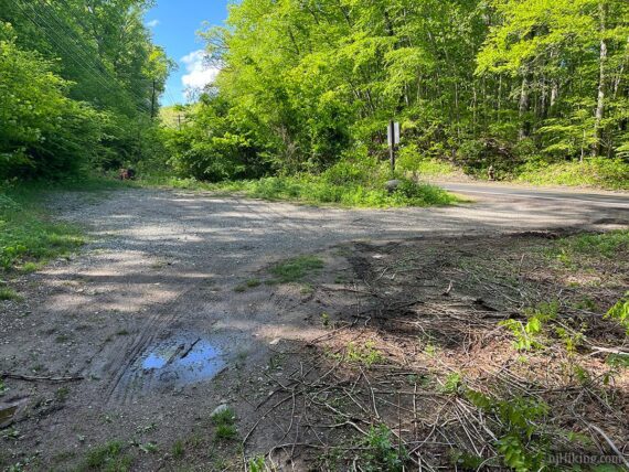
Carletondale Road to Governor Mountain, 2.2 mile version, starts at a small roadside dirt parking area with room for a few cars (3?): 145 Carletondale Rd, Ringwood, NJ 07456. This is the address, but Google will likely direct to a bit past it to a church.
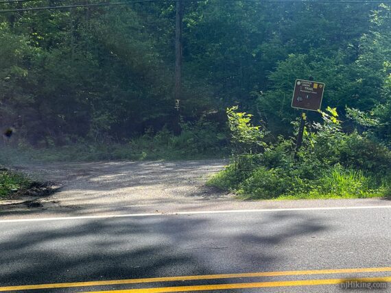
A trail sign for the Cooper Union Trail is posted at the entrance, but it’s easy to miss. This angle shows the parking area from standing within it, while looking out at the road. The lot was empty on our hike through it, while two cars were in the lot on our way back and maybe another one could have fit – depends on how people park.
Optionally, parking may be available in the church parking lot just past the roadside parking. At the back of the church parking lot is a short trail that meets up with the route (from that trail, turn LEFT onto Cooper Union). Sign posted: “Church & School Parking Only, Monday – Friday 6:30am – 6:30pm, All others call 973-962-7413 or 973-962-0859 for permission”.
Restrooms:
Park at the Ringwood Manor lot (also called Lot A; in season this lot has a fee), follow the sign for park office/restrooms, they are on the right side of the manor building.
If not going into the manor… there aren’t gas station/stores close to the park; start looking a bit further out like on Skyline Drive or Greenwood Lake Turnpike (depending on your approach).
Hike Directions:
Overview: Crossover (WHITE)/Ringwood-Ramapo (RED) – Crossover (WHITE) – Cooper Union (YELLOW) – Crossover (WHITE) – Crossover (WHITE)/Ringwood-Ramapo (RED)
!!! The short version only uses Cooper Union (YELLOW) – scroll the description to the grey box indicating where it starts.
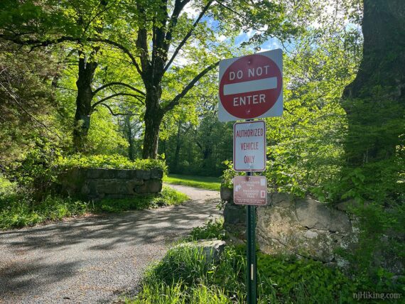
0.0 – From the carriage barn parking area, walk the paved road towards the “DO NOT ENTER” sign near the stone wall. Immediately beyond the wall, turn RIGHT, where there are trail signs for Crossover (WHITE) and Ringwood-Ramapo (RED).
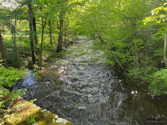
Follow the grassy path. Soon, cross Ringwood Creek on a stone bridge, then cross somewhat busy Sloatsburg Road.
Continue following Crossover (WHITE) / Ringwood-Ramapo (RED). These are co-joined for the first little bit of this route so the trail is marked with both red and white.
0.6 – Turn RIGHT to now just follow Crossover (WHITE). [Ringwood-Ramapo (RED) goes to the left].
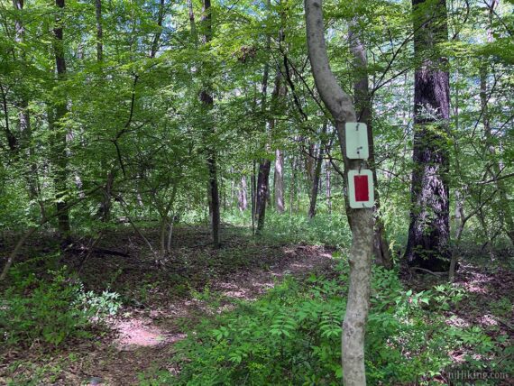
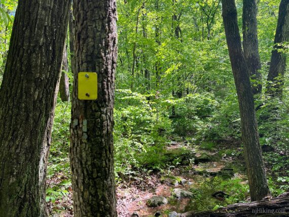
0.9 – Continue straight on an unmarked trail, despite markers indicating that Crossover (WHITE) turns left. While this short trail is unmarked on maps it has the occasional white marker in real life, just to keep things spicy. Soon the unmarked trail merges into Cooper Union (YELLOW). Now follow Cooper Union (YELLOW).
MAP NOTES: Various trail maps/apps show slight differences at this intersection, likely due to trail changes over the years. If you do continue left on WHITE… it soon leads to a 4-way intersection; turn RIGHT onto YELLOW (no marker until well down the trail); and soon pass the other end of the unmarked trail. You’ll end up in the same spot, but it’s slightly out of the way.
Soon, Cooper Union (YELLOW) crosses Morris Road. There are a variety of unmarked trails running all through this area – ignore them. YELLOW is pretty well marked so if you haven’t seen one in a bit, stop and check you’re on track.
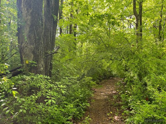
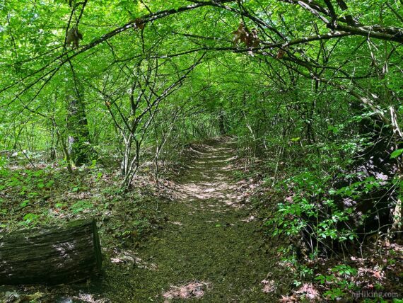
This section of Cooper Union, in May, had several tunnel-like stretches where the vegetation arched over the trail.
1.4 – Cooper Union (YELLOW) crosses a pipeline cut. Eventually arrive at the roadside parking on Carletondale Road.
Short, 2.2 mile version – START FROM HERE
Note: Where the long and short hike directions overlap, mileage is indicated as 0.0 / 0.0 – use the first number if doing the long hike, and the second for the short.
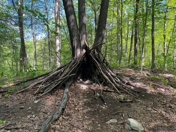
2.5 / 0.0 – From the dirt parking lot, cross Carletondale Road to follow Cooper Union (YELLOW). You might spot a teepee type structure off the trail.
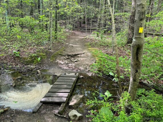
2.7 / 0.2 – Pass a side trail on the left that leads to a church, then cross a small stream on a footbridge. Cooper Union (YELLOW) starts to gently go uphill.
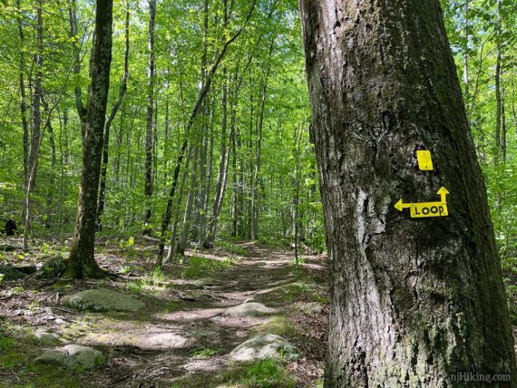
2.8 / 0.3 – Cooper Union (YELLOW) splits into a loop – continue straight ahead (the left will be the return route but you could go that way and follow the loop clockwise instead… go whatever way your little heart desires.)
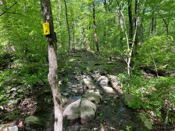
While much of the Cooper Union (YELLOW) is a dirt trail with some roots and rocks, there are some rockier and and potentially wet sections to navigate.
3.4 / 0.9 – Pass two prominent glacial erratics along the trail.

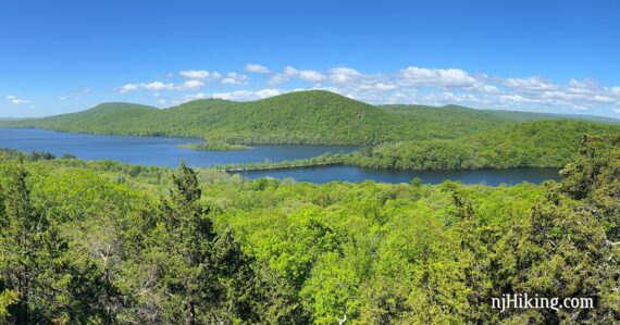
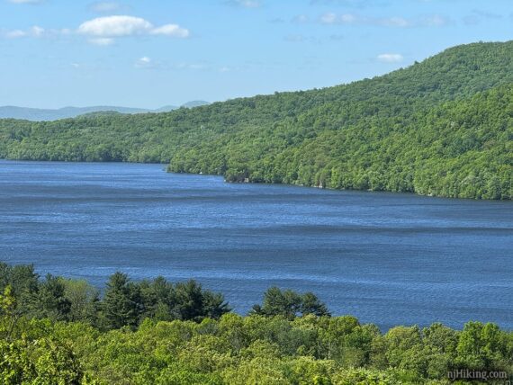
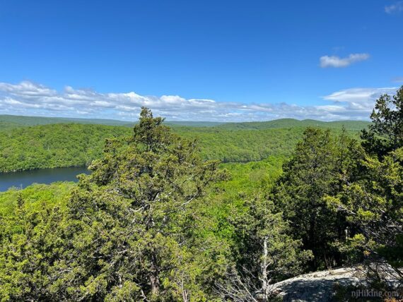
3.6 / 1.1 – Arrive at Governor Mountain’s partially-obscured view of the Wanaque Reservoir. The YELLOW markers show the continuation of the loop to the left BUT you can make your way down to a wide open view – be sure to do this!
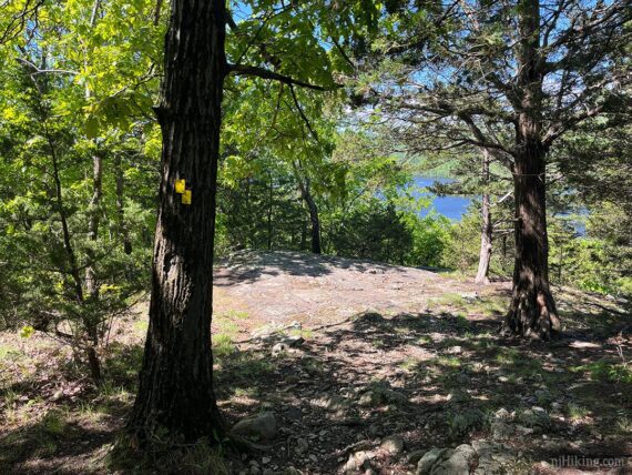
Either continue straight ahead down a few rocks, or follow YELLOW around to the left a bit more where there is a more obvious trail down. A large open ledge area comes into view.
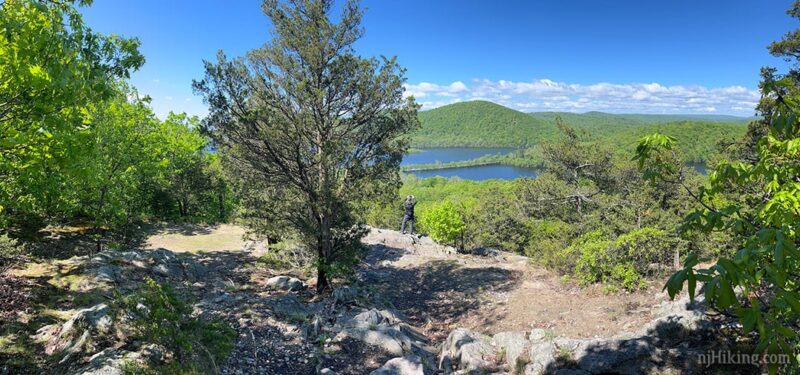
From the rock outcrop is a wide panorama of the Wanaque Reservoir and all of the hills and mountains around it, with the Greenwood Lake Turnpike cutting across the reservoir on a skinny strip of land. The prominent peaks are Windbeam, Bear, and Board Mountains.

These mountains are part of the epic Stonetown Circular, one of the most challenging hikes in New Jersey – worth checking out if you’re into harder hikes. (The nifty Peak Finder mobile app will show the names of nearby mountains).
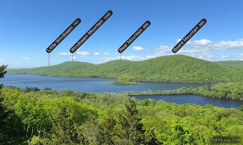
A zoom from the viewpoint on Governor Mountain into Greenwood Turnpike crossing the Wanaque Reservoir. Fun Facts: “Governor” is likely an alteration of “Gouvernour“, the family that owned the Ringwood Ironworks until the late 1700’s. [ Source: 1997 edition of 50 Hikes in NJ.]
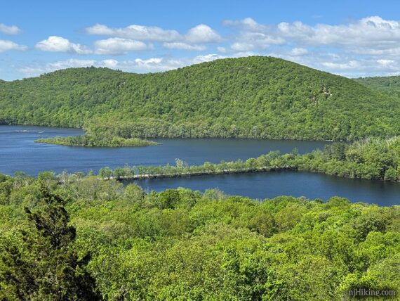
And a zoom into the Wanaque Reservoir. Fun Facts: A man-made lake created from the Wanaque River in 1928, it is the 2nd largest reservoir in NJ by volume with Round Valley Reservoir at number one. [Source: Wanaque Reservoir on wikipedia.]
The panoramic view continues over to the right (northwest), towards Sterling Forest in New York (according to the New Jersey Walk Book – forgot to Peak Finder this side…).
After enjoying the view (and hopefully a snack…) head back up towards the actual Cooper Union (YELLOW) trail. Ignore an unmarked trail that heads downhill to the right.
Turn RIGHT to continue on Cooper Union (YELLOW). [Turning left will return via the same stretch of trail]. Immediately the trail steps down a brief steep section of rock before going through a potentially wet area.
Continue following Cooper Union (YELLOW). There are no more viewpoints along this section.
MAP NOTES: Various trail maps/apps show additional viewpoints but these were limited and are now overgrown and not worth looking for. There is just the one main view at the southwest corner of the loop.
4.5 / 2.0 – Arrive back at where Cooper Union (YELLOW) split into a loop. Turn RIGHT to continue. Cross the footbridge and pass the side trail to the church.
4.7 / 2.2 – Cross Carletondale Road to the parking area. Long version: Keep on truckin’ on Cooper Union (YELLOW).
Short 2.2 mile version – ENDS HERE
5.9 – Cooper Union (YELLOW) crosses a pipeline cut.
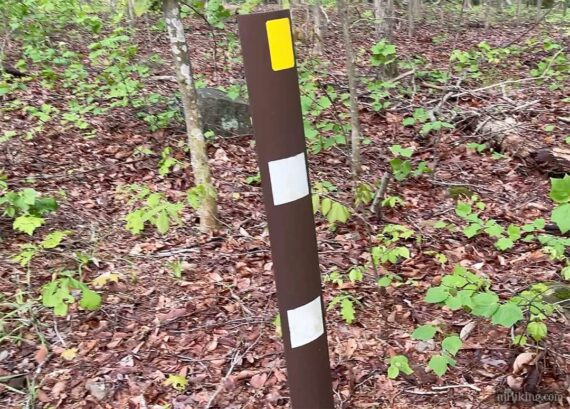
6.3 – Cooper Union (YELLOW) crosses Morris Road. Soon, where Cooper Union (YELLOW) starts to curve to the right at a brown post with double white markers and a single yellow – keep STRAIGHT to follow the unmarked trail.
6.4 – Crossover (WHITE) merges in from the right. Now follow Crossover (WHITE).
6.7 – Turn LEFT to follow Crossover (WHITE)/Ringwood-Ramapo (RED), cross Sloatsburg Road, the bridge, and follow the trail back to the parking area at the carriage barn.
Exploring Ringwood Manor and Estate
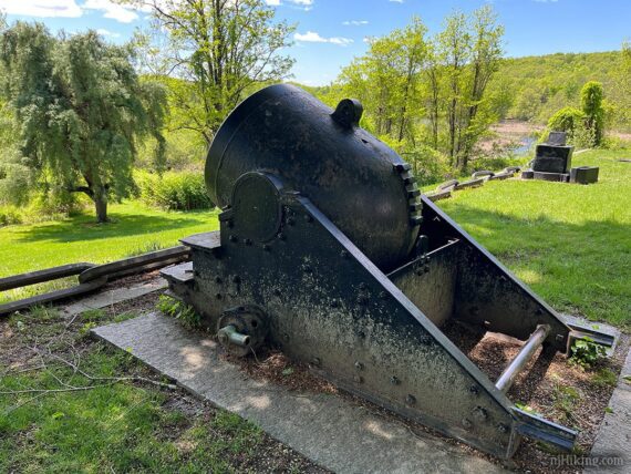
The area around Ringwood Manor was used for iron production during the Revolutionary and Civil Wars, but the buildings and property reflect their use as the Hewitt family’s summer estate in the late 19th-century. The family donated the property to the State of New Jersey in 1938 [Source: Ringwood Manor website].
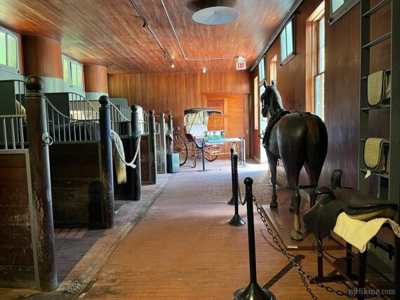
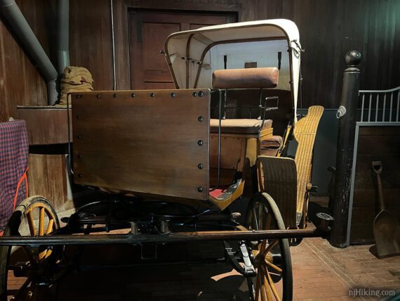
The carriage barn was open after our hike so we popped in to take a looky inside. Many displays are about Sarah Cooper Hewitt, second daughter of Abram and Sarah Amelia Hewitt, an avid equestrian.
Then we drove back up to the main lot and did a quick whirl around the outside of the manor.
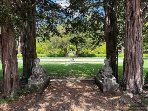
All sorts of nifty sculptures and whatnot to photograph.
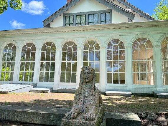
We found a bench and sat for a spell but there’s a lot more of the manor grounds to check out. Eventually the interior of the manor will be back open and tours should start again.
—
Hiked: 5/10/25. Yowza took awhile to get back around to this one… nearly 20 years… from my notes it seems the bridge from Ringwood pkg to access Crossover was closed in 2014 and I’d shelved redoing until the bridge was repaired. Eventually noticed the 2021 TC map had added parking at the barn and RED/WHT access to Crossover, and removed the old trail section near the closed bridge.
Hiked: 1/8/06. 6.6; started from the manor lot, over a bridge, to the Crossover Trail; “Ringwood State Park – Cooper Union Trail“