Short hike to two beautiful waterfalls and a brook.
1.8 or 1.2 miles. Easy; wide dirt path with minor roots and rocks. Full hike has a small stream crossing and a short uphill/downhill.
| 1.8 miles | This hike guide: Detailed instructions, photos, and video follow below. |
| Shorter | 1.2 miles – To Hemlock Falls and back only; noted below. |
| Longer | Extensive trail system at this park allows for very long loops. |
| Nearby, different lot | 5.9 mile variation – Hemlock Falls. 1 mile – South Mountain Fairy Trail. |
| Nearby | Watchung Reservation – History Trail; Watchung Reservation – Sierra Trail; Great Swamp NWR; Great Swamp – Blue Trail; Great Swamp – Orange Trail. |
Our two cents:
Short hike packs two waterfalls and a little brook. Good for beginners and kids. Great for a quick cold-weather hike as the falls are interesting and especially beautiful when frozen.
Falls vary depending on rainfall and can be minimal in dry conditions. Some road noise. This area and entire park in general is VERY popular.
Updated: 3/2026 – Minor edits. 5/2024 – Edited map and parking info. 12/2024 – Minor edits.
Hike Info:
Map/Books:
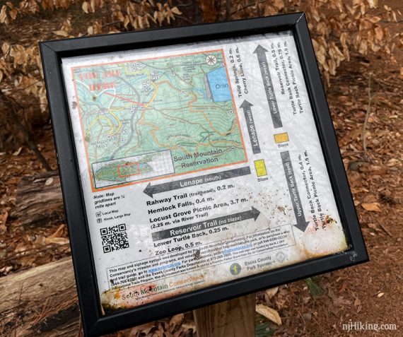
There are large maps posted on kiosks; one at the parking area and one along the way. A smaller trail map plaque at an intersection. Follow along on your smartphone with our Interactive Map link above.
The map available linked at the bottom of the park page is OK (in Hike Info above) but the color and waterproof SMR Map that can be ordered from the South Mountain Conservancy is better. This map can also be found at Words Bookstore, the Millburn Free Public Library, and a few other locations listed on the SMC site.
They also offer a “Trail Guide to the South Mountain Reservation” booklet that describes individual trails. Other hikes in this park are in 50 Hikes in New Jersey and Hiking New Jersey (2023).
Parking: N40.75567° W74.29172° [Tulip Springs]
Tulip Springs, 64 Cherry Ln, West Orange, NJ 07052. Medium-sized paved lot.
An alternate small lot closer to the falls is off of South Orange Ave (Rt. 510), which will shorten the hike (but is often filled). This lot is at N40.75296° W74.28995° or use “Hiking Trail – South Mountain Reservoir” in Google. There is no street address for this small lot.
Related: Waterfalls in NJ / Best Waterfall Hikes in NJ
Restrooms:
Portable toilets in the Tulip Springs lot. According to the trail map, these should be available year-round.
Hike Directions:
Overview: YELLOW (Lenape) – RED DOT on WHITE (Hemlock Falls Loop) – YELLOW (Lenape).
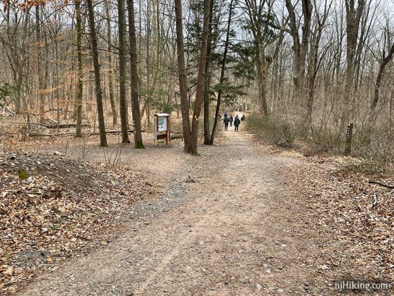
0.0 – Starting from the Tulip Springs parking lot, the trailhead is across from the, opposite a trail info kiosk with a large park map (though the kiosk may be slightly hidden if cars are parked around it)
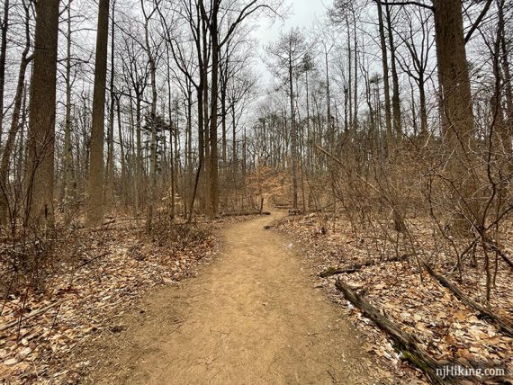
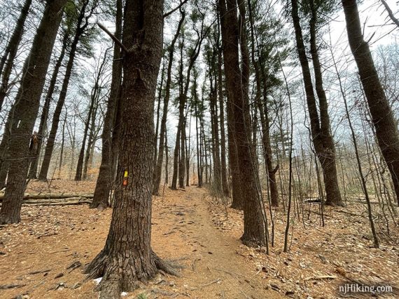
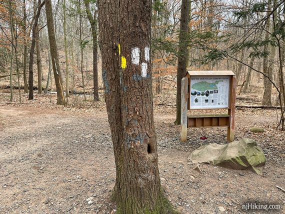
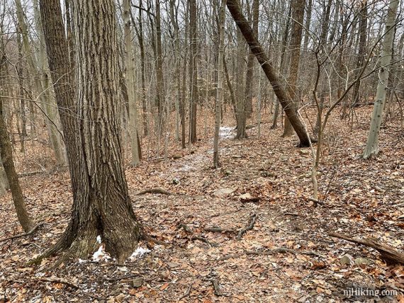
There are ORANGE and GREEN blazes as well as YELLOW at the trailhead. Start following YELLOW (Lenape) on a wide footpath through a forest.
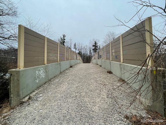
0.2 – YELLOW (Lenape) turns RIGHT (at a small trail map plaque) and soon crosses a bridge over South Orange Ave.
Follow YELLOW (Lenape) when it turns RIGHT, with a small parking lot visible off to the left (this an alternate starting area).
0.4 – Continue following YELLOW (Lenape) as it turns LEFT at an intersection with a trail info kiosk with a map.
Pass a stone bridge on the right and small Hobble Falls comes in to view.
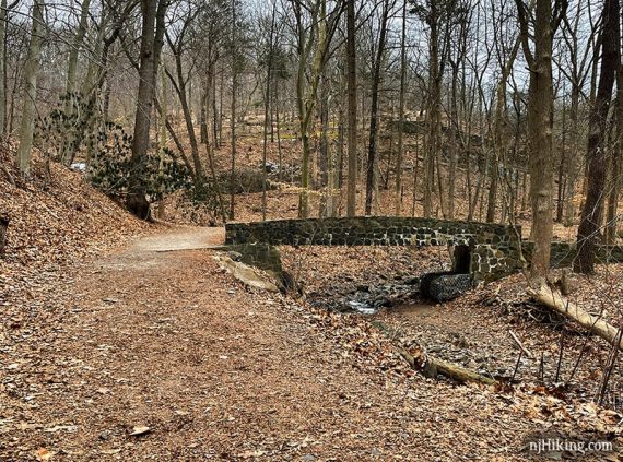
Hobble Falls is a small waterfall on the left side.
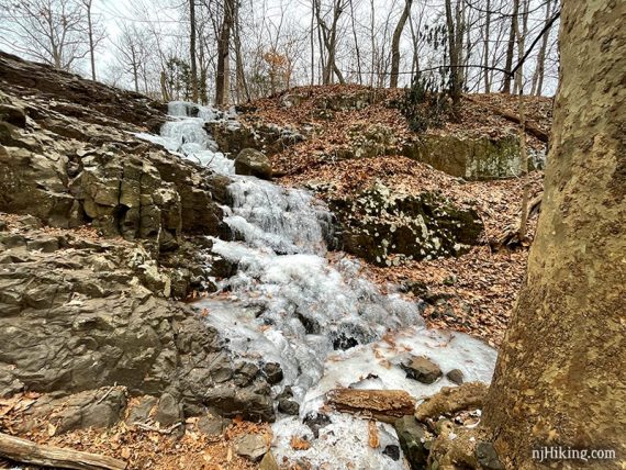
Fun Fact: Older maps may have this as “Cobble” Falls.
Continue following YELLOW (Lenape).
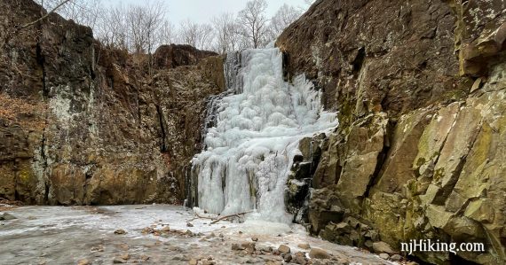
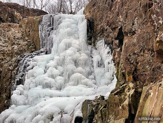
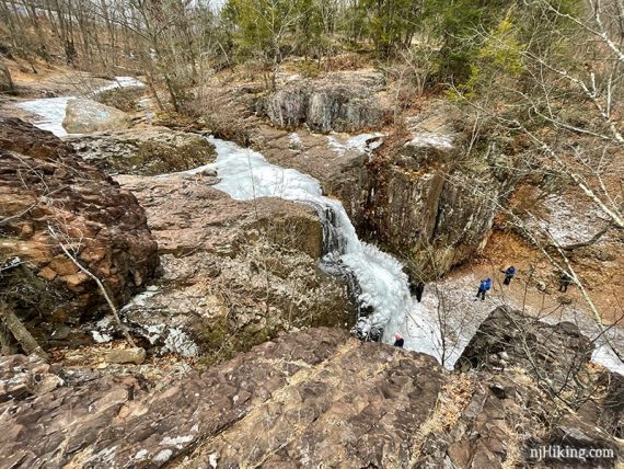
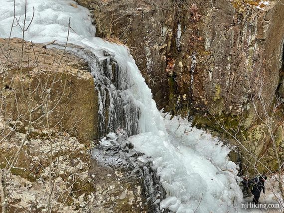
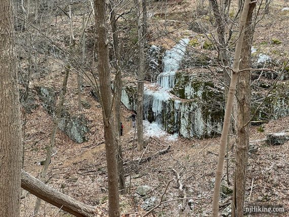
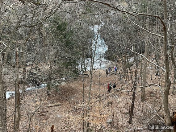
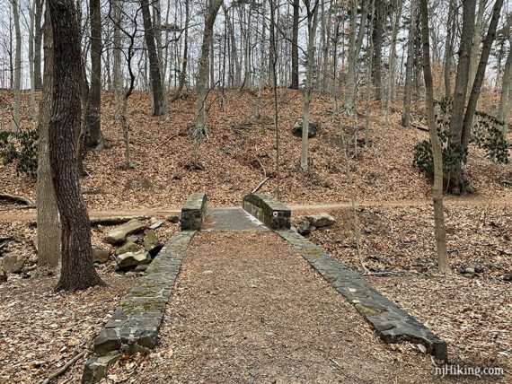
0.6 – Cross a stone bridge at the base of Hemlock Falls. At 25 feet, these are the tallest falls in the park.
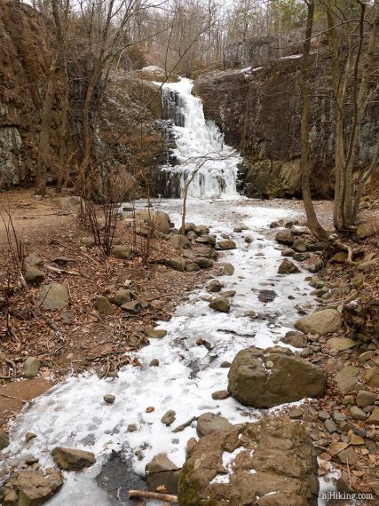
The falls vary depending on water flow, so they are best after heavy rain or when it’s very cold out.
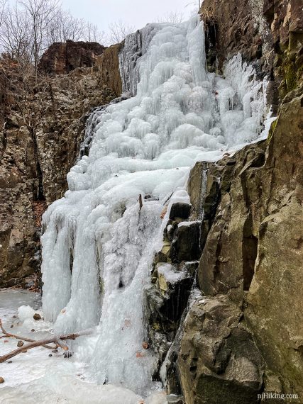
A period of cold temperatures will freeze the waterfall nearly solid and into an icy sculpture.
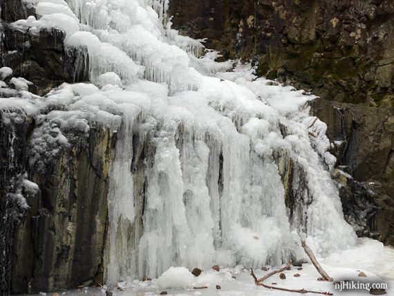
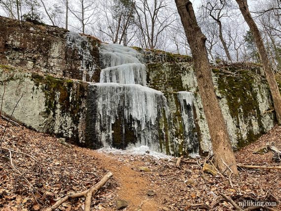
In winter there may be frozen cascades running over the cliff face just past Hemlock Falls.
When done enjoying the falls from below, backtrack over the stone bridge to the stone steps.
// Shorter, 1.2 miles: Retrace the route back from Hemlock Falls, skipping the loop that starts up the stairs. //
Take the steps up, now following RED DOT on WHITE (Hemlock Falls Loop).
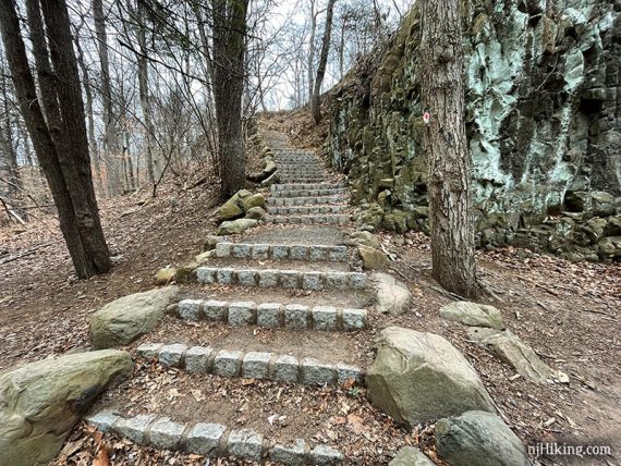
The steps curve up to the top for views of Hemlock Falls from above and of Hemlock Brook feeding the falls.
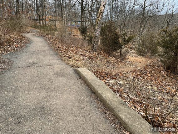
There are a few benches, and the path is briefly paved in this section.
Exercise caution if you venture from the path and on to the rocks for a closer look at the falls – there are no guardrails.
0.8 – Continue following RED DOT on WHITE (Hemlock Falls Loop) as it veers to the RIGHT off of the pavement and back on a trail.
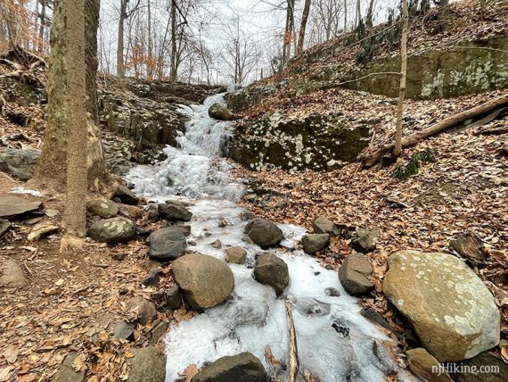
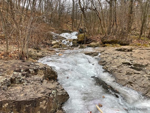
Continue following RED DOT on WHITE (Hemlock Falls Loop) as it crosses Hemlock Brook.
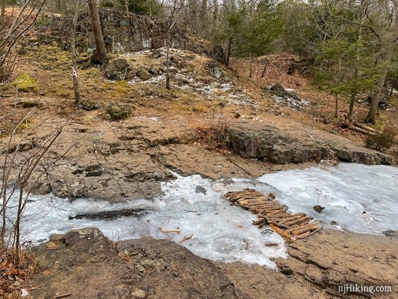
The brook was frozen the day we hiked. Logs had been placed across the ice, but this may be tricky if the water is high.
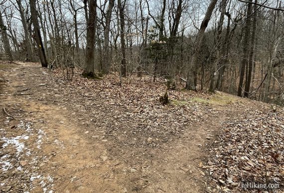
Continue following RED DOT on WHITE (Hemlock Falls Loop) as it climbs uphill. Pass an unmarked woods road.
The trail curves around with views down to the frozen cascades and falls but these will be obscured when leaves are on the trees.
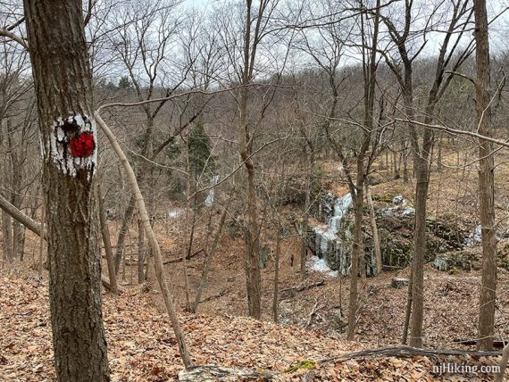
From here the size of the cascades can be seen – note the person for scale.
Hemlock Falls comes into view in just a bit.
1.2 – Continue following RED DOT on WHITE (Hemlock Falls Loop) as it veers RIGHT. [YELLOW (Lenape) continues to the left.]
The trail switchbacks downhill.
Cross over a stone bridge and turn LEFT to now follow YELLOW (Lenape), retracing the route from earlier.
1.4 – Turn RIGHT at the trail info kiosk and continue following YELLOW (Lenape).
Turn LEFT to continue following YELLOW (Lenape). [The small alternate parking lot is ahead if you’ve started there.]
Cross the pedestrian bridge over South Orange Ave again.
1.6 – Shortly, veer LEFT at the small trail map plaque and follow YELLOW (Lenape) back to the lot.
—
Hiked: 1/31/21.