Moderate hike that takes in a viewpoint from historic Washington Rock, Hemlock Falls, and the Rahway River.
5.9 miles, total round trip. Somewhat rocky trails; couple muddy sections after rain. A few easy stream crossings, and one over the Rahway River that may be tricky depending on water level/rock shifting.
| 5.9 miles | This hike guide: Detailed instructions, photos, and video follow below. |
| Shorter | There are multiple parking areas, trails, and woods roads to create shorter routes. The woods roads also tend to be easier and more level. |
| Longer | Use the Lenape and Oakdale Trails to add in the other half of the park or extend the route with the Turtle Back trail. |
| Nearby, this lot | Short, family-friendly loop, South Mountain Fairy Trail, is contained in this longer route. |
| Nearby, different lot | Hemlock Falls Loop |
| Nearby | Watchung Reservation – History Trail; Watchung Reservation – Sierra Trail; Great Swamp NWR; Great Swamp – Blue Trail; Great Swamp – Orange Trail. |
Our two cents:
Shady route to Hemlock Falls in South Mountain Reservation that hits the hiking sweet spot of just under 6 miles in length with the falls coming in at about the halfway point – perfect timing to use the benches there for a break. Rolling hills, not too many rocks, plus rhododendron blooms in season.
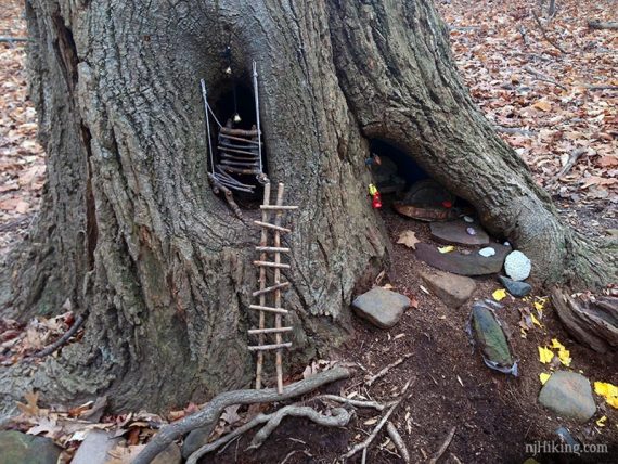
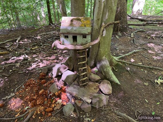
Fairy Fun Fact: There are whimsical, tiny “fairy houses” made entirely of natural materials to fit in with the landscape. They are found along the Rahway trail at the end of this hike.
Updated: 4/2026 Minor edits; not re-hiked. Older change log at page bottom.
Trail Map/Books:
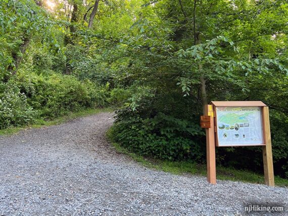
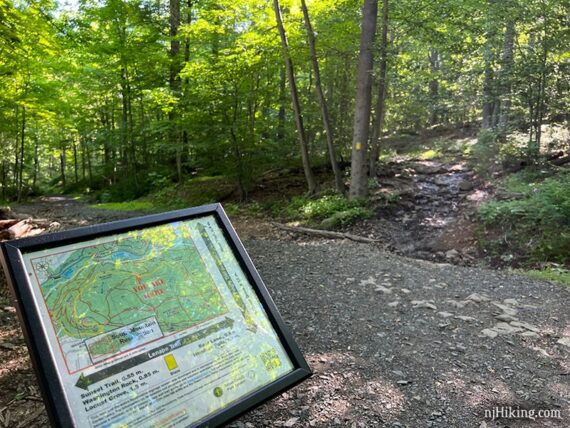
Follow along on your smartphone with our South Mountain Reservation Interactive Trail Map. There was an overview trail map at the kiosk but no printed maps.
The map available linked at the bottom of the park page is OK (in Hike Info above) but the color and waterproof SMR Map that can be ordered from the South Mountain Conservancy is better. This map can also be found at Words Bookstore, the Millburn Free Public Library, and a few other locations listed on the SMC site.
They also offer a “Trail Guide to the South Mountain Reservation” booklet that describes individual trails.
A similar route with detailed instructions and a trail map can be found in Hiking New Jersey (2023) and Best Day Hikes Near New York City. A longer option is in 50 Hikes in New Jersey. The park trails are described in the The New Jersey Walk Book.
Related: Waterfalls in NJ / Best Waterfall Hikes in NJ
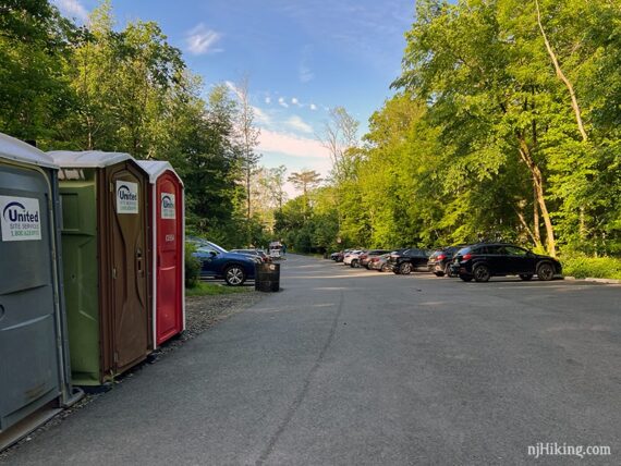
Parking: N40.72832° W74.30421°
“Locust Grove Parking Lot, Millburn, NJ 07041“, South Mountain Reservation, 197 Glen Ave, Millburn, NJ 07041.
From east of the park (westbound) on I-78: Take exit 50 B “Millburn” “Maplewood”. At the end of the ramp, you must go right. Drive through 3 traffic lights, not counting the one at the end of the ramp. At the fourth light (Millburn Ave.), turn left. Drive to the second traffic light (the road makes a turn to the right and becomes a one-way street called Essex Ave.).
Turn right onto Lackawanna Place, go under the RR tracks, and you come almost immediately to Glen Ave. Across the street and a little to the right is a driveway entering the park with a sign “Locust Grove”.
Directions for other approaches on the park site. Via train: Milburn Train station is 100 yards from the Southern entrance to the Reservation- Locust Grove Trailhead, check njtransit.com.
Note: This lot often fills to capacity – if the lot is full, park across the street. When we started our hike around 8am on a Sunday the lot was nearly half-full, and by the time we finished around noon there were cars were waiting for our spot.
Restrooms/Picnic Area:
Multiple portable toilets in the paved parking lot; one at Washington Rock (as of 6/2022). Just beyond the trail kiosk at the back of parking lot is a picnic grove with tables.
Hike Directions:
Overview: Lenape (YELLOW) – Rahway (WHITE)
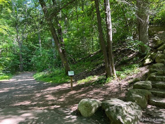
This route starts from South Mountain Reservation’s Locust Grove parking area. There are many other trails as well as unmarked woods roads, but the hiking trails are mostly well blazed. We’ve not noted all of these trail intersections as they are too numerous.
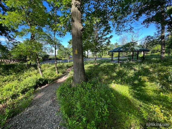
0.0 – Start in the back corner of the lot, by the wooden trail kiosk. Begin following Lenape (YELLOW) into a picnic area.
The next blaze is across the picnic area, in the back left corner. Follow Lenape (YELLOW) uphill on a woods road, with houses on the right. This short section of trail is steep and very rocky but is not an indication of how the rest of the hike is! A large rounded structure behind a fence is on the left, but you might not notice it.
0.5 – Cross the paved road and turn LEFT to continue on Lenape (YELLOW). The trail narrows up a small hill with a bench or two and a limited view of New York City possibly visible off on the left. Arrive back at the paved road near a circular shelter.
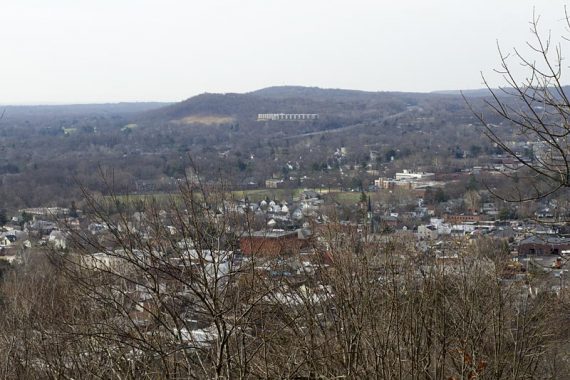
From the stone wall on the left there is a partial view over the surrounding area and it helps to be tall to get a peek. More might be visible when the leaves are down, but the trees have grown since the first time we hiked here.
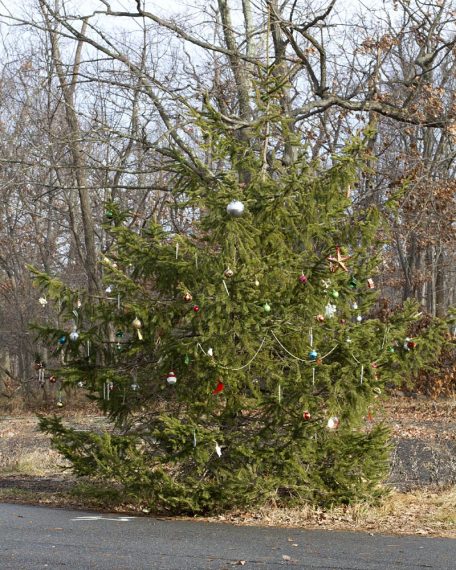
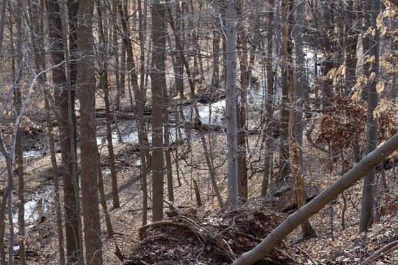
Basically the same spot in late December of 2011:
In December of 2011 and 2015 there was an evergreen tree decorated with Christmas ornaments. There was still an evergreen tree along the paved road and was probably the same one, just much bigger.
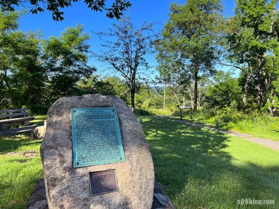
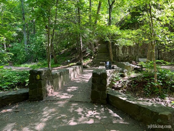
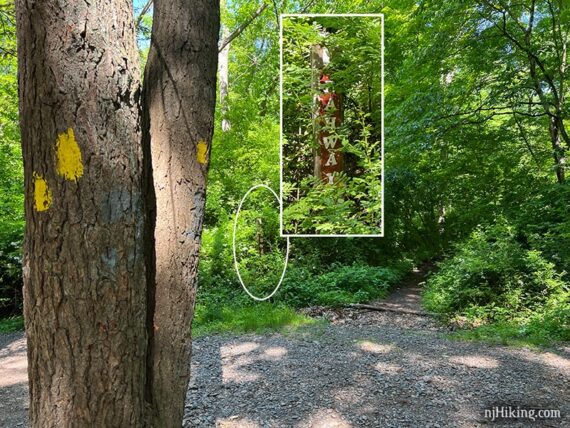
Follow the trail past a monument to General Washington and head down a few steps to a stone lookout platform.
Historic Fun Fact: In the summer of 1780, Washington Rock is where a signal beacon warned the Army at Jockey Hollow in Morristown of the British Army’s approach. During the Revolution most of the trees in the area would have been cut down to build housing or ships, leaving a clear view of the valley below. [Source: Plaque; 50 Hikes in New Jersey]
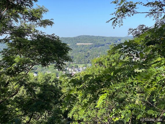
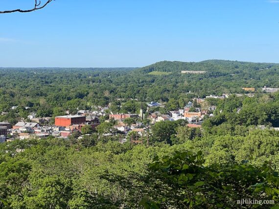
0.7 – At the platform most of the view is blocked by trees (but there’s a side trail to a little better view in just a bit). Continue following Lenape (YELLOW).
0.8 – Optionally, turn LEFT to follow an unmarked casual trail to a partial view, then continue ahead on this path to where it rejoins Lenape (YELLOW) in just a bit.
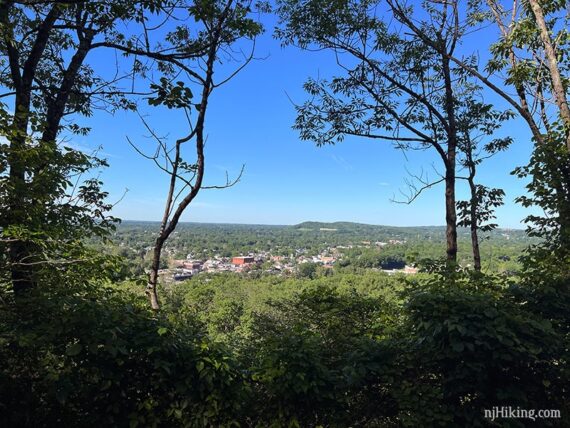
Look out over the town of Millburn and towards Watchung Reservation.
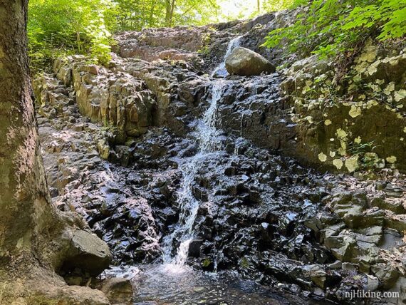
1.3 – Cross Maple Brook where there are several water cascades off on the left called Maple Falls Cascades.
Continue following Lenape (YELLOW). Intersections sometimes have map plaques.
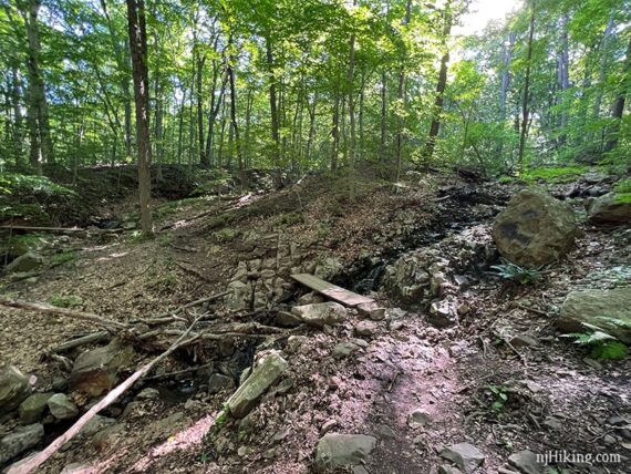
1.9 – Cross Beech Brook Cascades on a couple of wooden boards.
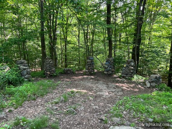
2.6 – Arrive at Ball’s Bluff. The stone pillars are all that remains of a picnic pavilion that was built in 1908. Lenape (YELLOW) continues to the right of the pillars.
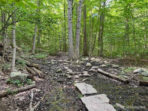
Some sections of trail may be wet, especially after heavy rain. Many of these areas have stepping stones but other spots might just be muddy.
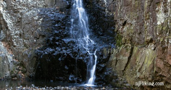
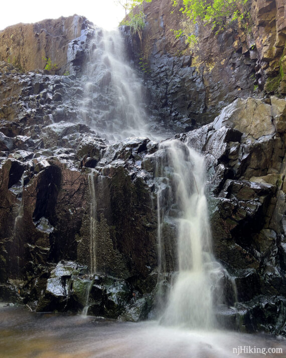
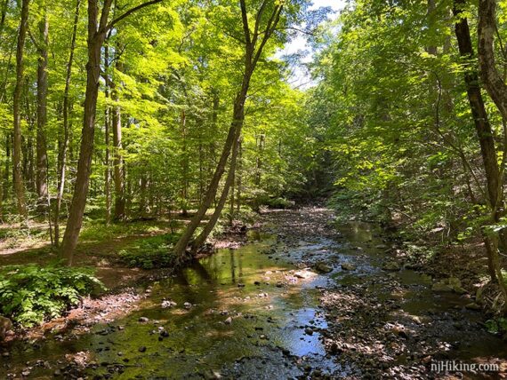
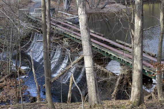
3.1 – Hemlock Falls comes into view if the leaves aren’t on the trees or people may be heard below at the falls. Turn RIGHT, continuing on Lenape (YELLOW) as it curves around down to the base of the falls. [RED DOT on WHITE veers off]
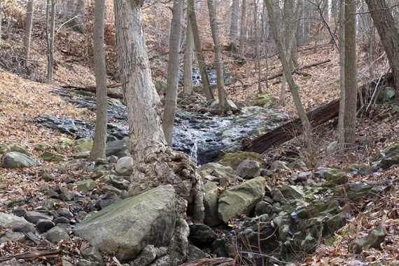
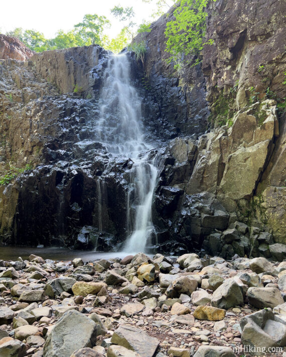
3.2 – Arrive at a large stone bridge with Hemlock Falls off on the right.
The falls are created where Hemlock Brook drops over a cliff face into a very shallow pool. The falls can be just a trickle if there hasn’t been much rain. It’s also nice to visit in the winter when it may be frozen.
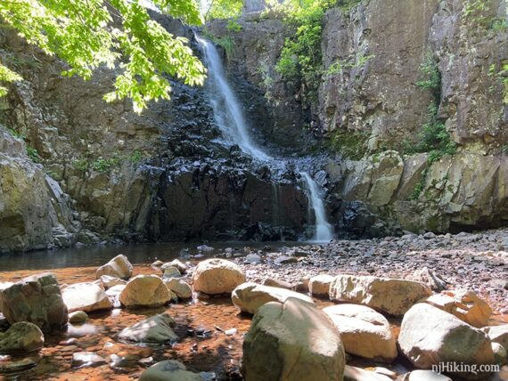
Hemlock Falls is nestled in an alcove and can be in shadow depending on the time of day; these photos were taken around 10am in June.
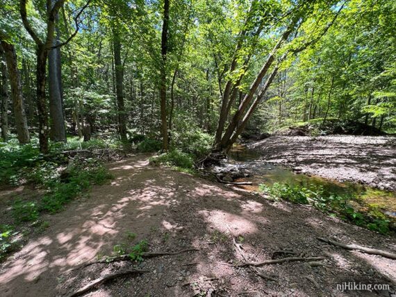
There are a couple benches around the falls area, making it a nice spot to take a break. South Mountain Reservation, and Hemlock Falls in particular, is a popular spot so expect to be sharing the falls with a few – or many – people.
When ready to continue, cross over the bridge and bear LEFT, continuing to follow Lenape (YELLOW). [RED DOT on WHITE is straight ahead up the stairs – optionally take these to look down on the falls from above and then come back down to continue.]
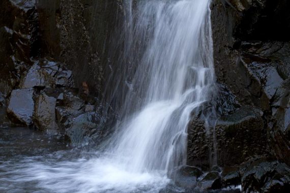
3.3 – Pass a smaller waterfall off on the right called Hobble Falls. Easy to not notice, especially if there’s little or no flow.
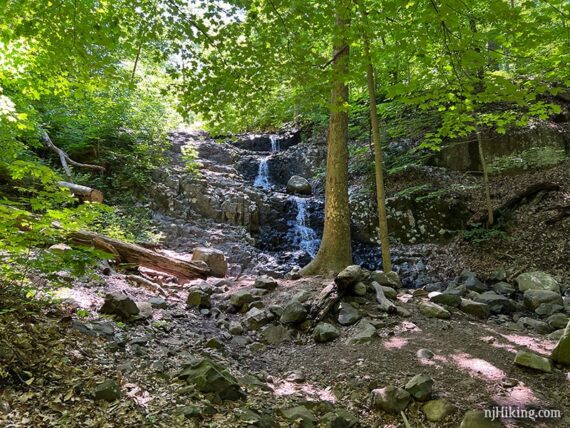
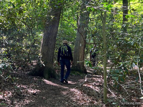
This waterfall is also easy to get close up to and see the texture of the rock that is common in South Mountain Reservation. Continuing following Lenape (YELLOW).
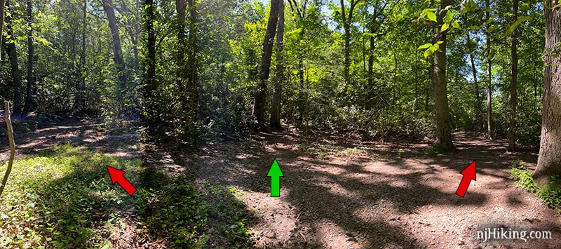
3.4 – Come to a trail junction. Start following Rahway (WHITE) straight. There is a marker post but this was almost covered by vegetation when we last hiked it. [Lenape (YELLOW) leaves to the right.]
Pass a trail on the right that is also marked WHITE. If the stream crossing in just a minute is too hard, take this “high water bypass” path that uses the road to cross and then loops back to the other side of this point.
3.6 – Cross over the Rahway River. This was no problem on 6/2022 but in years past we’ve run into it being a bit tricky (and the bypass trail wasn’t there or at least wasn’t noted on the map).
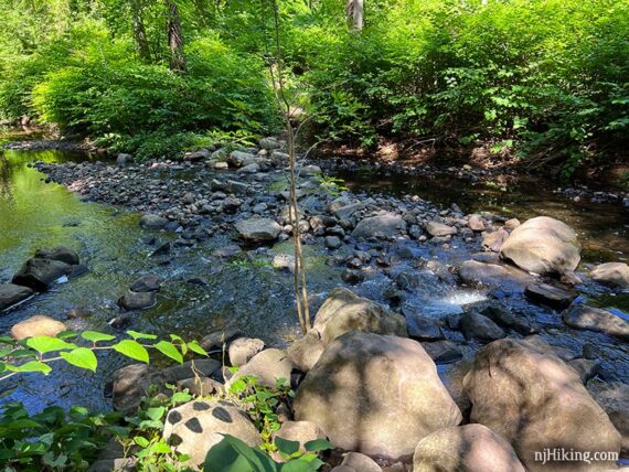
3.9 – Pass West Connector (GREEN over WHITE). Rahway (WHITE) continues in a pretty area along a ridge with the river below.
4.1 – Continue following Rahway (WHITE) when it turns LEFT onto a gravel road. [The trail is also briefly co-joined with with Rahway High/Low Ext (WHITE over RED) and West Connector (GREEN over WHITE)].
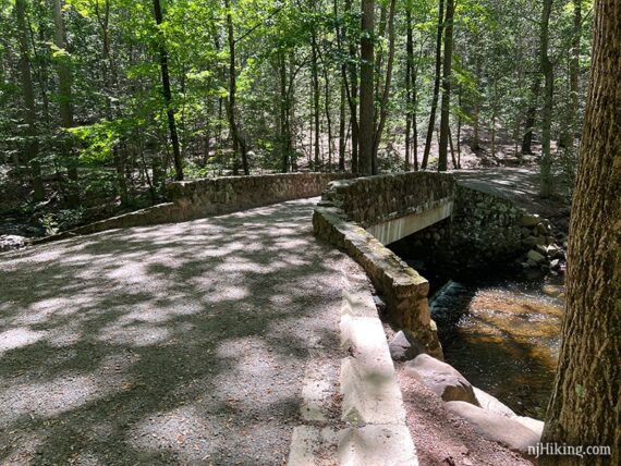
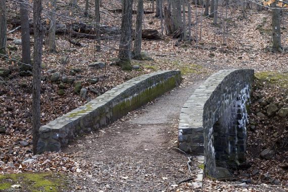
4.2 – Cross over the Rahway River on a large stone bridge, and turn RIGHT just after the bridge, continuing to follow Rahway (WHITE).
There are two WHITE markers indicating the turn, but if you find yourself at the tree just ahead that has markers for the end of Rahway High/Low Ext (WHITE over RED) and West Connector (GREEN over WHITE)], you missed the turn. Rahway (WHITE) is a path along the river, not the woods road.
Continue following Rahway (WHITE) as it hugs the river.
4.5 – Unclear intersection where there is a concrete dam in the river on the right there were no visible trail markers (as of 6/2022). Don’t turn left or follow the trail off on the right that hugs the river (though this will meet up Rahway (WHITE) soon, it gets more and more overgrown – which is how we realized we weren’t on the actual trail. Too busy discussing post-hike treats again.)
At this intersection, continue on the path straight ahead and in just a bit a white marker appears for Rahway (WHITE).
4.7 – Possibly pass Painter’s Point (BLUE over WHITE) on the right – we did not spot this on our most recent hike. Continue straight on Rahway (WHITE) along the river.
4.9 – Trail intersection where the WHITE marker might be a little hard to spot. A footpath continues along the river where a pond can be seen ahead, and a woods road veers off to the left. The Rahway (WHITE) trail is between these.
There are two trees are near each other and one has a WHITE marker.
Note: Taking any of these routes is fine however. The woods road that veers to the left (unmarked woods road that is shown as River Trail on the map) closely follows Rahway (WHITE) at this point on and meets back to Rahway (WHITE) at a bridge. The path to the right goes along Campbell’s Pond and meets up with Rahway (WHITE) as well.
Rahway (WHITE) will join and cross the woods road many times, just keep following the WHITE markers. Pass a building that was a steam-powered pumping station, and then a dam on the Rahway Trail.
5.2 – Continue on Rahway (WHITE) over one of many stone bridges in the park.
5.3 – Rahway (WHITE) veers to the right when a woods road veers left. Soon, fairy houses start to pop up here and there along the trail (none are off-trail), becoming more numerous and concentrated the closer the trail gets to the end.
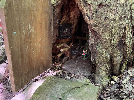
The trail may also get more crowded. At one point the trail splits and one side goes down by the river where a lot of families were hanging out. For more info and photos about this last section of trail, see our South Mountain Fairy Trail page.
Continue following Rahway (WHITE) back to the parking lot.
—
Hiked 6/5/22.
Hiked 12/11/15. Extended route, from Turtle Back picnic parking.
Hiked: 12/22/11. Trail Blog: “South Mountain Reservation in December“
Updated: 5/2025 – Added map/bookstore info. 12/2024 – Minor edits. 7/2022 – Re-hiked 6/2022 – minor edits and improvements, new photos. 5/2020: Page refreshed, not re-hiked. 8/15/17; 12/11/15 – Minor revisions to the description.