
Views of the NYC skyline (Ilgenstein Rock) and of Wanaque Reservoir (Erskine Lookout) are along this hike in Ringwood State Park.
Miles: 10.0 or 7.9 total, round trip; shorter options noted in the description. Typical rugged Jersey trail surface.
- Shorter version: 7.9 miles, skips 2 viewpoints.
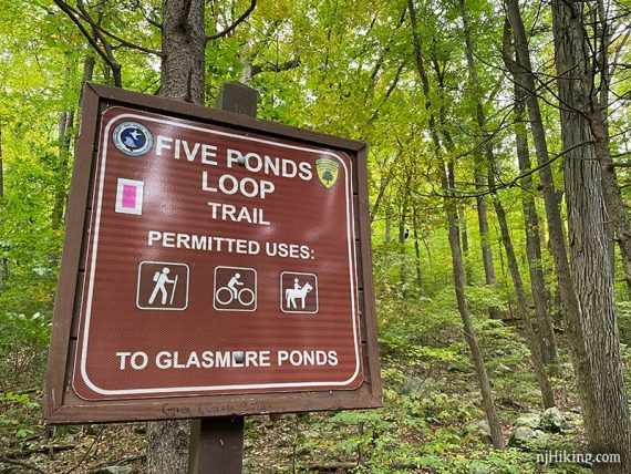
- Alternative, from same lot: Five Ponds Loop, 5 miles, noted below.
- Nearby: Governor Mountain; Long Pond Ironworks; Ramapo Valley County Reservation; Van Slyke Castle Loop; Norvin Green – Wyanokie High Point; Pine Meadows Loop.
- Nearby kayak: Monksville Reservoir Kayak.
Hike Info:
Our two cents:
A stunning section of forest with a couple of nice views as a goal, but this long route leans more towards avid hikers comfortable with a complex trail network.
On Ramapo-Ringwood there is a section of switchbacks made for bikes that we find annoying to hike, but not a deal breaker.
Plenty of shorter options are possible and are indicated in the description below. Consider doing the 7.9 version that removes two viewpoints, you may not feel they are worth the additional 2.1 miles of effort over slightly more rugged terrain (and those switchbacks).
Alternate: A ~5-mile Five Ponds Loop (PINK) was created in 2020 (we have not hiked it). It can be accessed by using this route as noted below, or start at Lot C and just follow PINK for the whole loop.
Updated: 2/2022 – Trail map info. 10/2021: Re-hiked, description/trail changes (large section of Halifax had been changed to Five Ponds). 6/2020: Page refreshed, not re-hiked. 11/2015 – Description and GPX updated, foliage photos added.
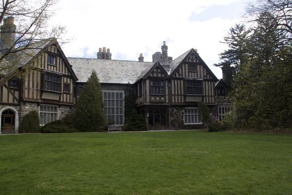
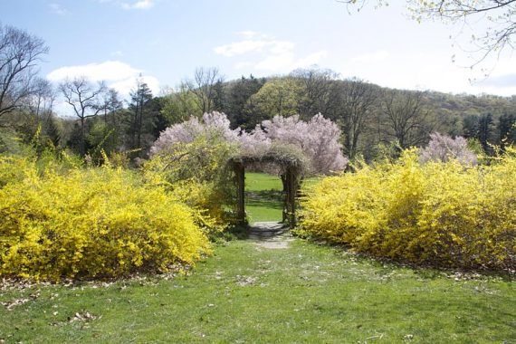
The Skylands Manor gardens and grounds are worth a visit before or after a hike (map on their site). Check the site for when Manor tours are scheduled. No dogs allowed on Skylands’ grounds.
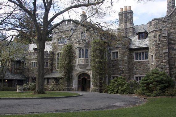
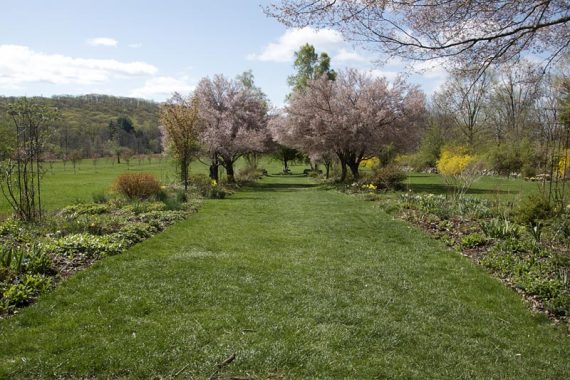
Looking at the grounds from the manor.
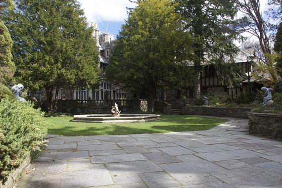
Gardens around Skylands Manor.
Map:
Northern New Jersey Highlands Trails Map s recommended to navigate the network of trails in this park. Follow on your smartphone with our Skylands Manor – Ilgenstein Rock Interactive Map.
Note that the park map (version dated 1/21) in a few spots doesn’t match real life or the Trail Conference map: Bear Swamp trail is not shown, Blue on White is not named and is greyed out, Erskine Lookout is an unnamed viewpoint, the location of “warm puppy rock” is in the wrong spot.
Books:
Other, shorter, hikes in Ringwood can be found in 50 Hikes in New Jersey, Hiking the Jersey Highlands, Hike of the Week, and Take a Hike New York City.
Detailed trail descriptions found in the The New Jersey Walk Book.
Parking: N41.12733° W74.23788° [Lot A]
5 Morris Rd, Ringwood, NJ 07456 – This is the address of the manor; the parking lot will be reached just before.
Rt 287 N to exit 55 to Rt 511. Turn right onto Sloatsburg Rd and look for signs for Ringwood. At a sign for State Botanical Gardens – Skyland Manor, turn right onto Morris Ave. Go straight where there are stone eagles on either side of the road, and parking lot A will be on the left.
A GPS might direct instead through the park using Skylands Road. There are two other lots, B and C, connected by one-way roads within the park.
Weekends and holidays from Memorial Day weekend to Labor Day, there is a State parking fee (cash only) of $5 (NJ) / $7 (non-NJ). Info on the NJ State Park Pass.
Restrooms:
At the Visitor Center. Walking out of the parking lot A, follow the road around and shortly arrive at the visitor center and bathrooms on the left, with the Manor on the right. Opens at 10am (as of 10/2021). Lot C had a portable toilet (as of 10/2021).
Hike Directions:
Overview: Crossover (WHITE) – Five Ponds (PINK) – Halifax (GREEN on WHITE) – Pierson Ridge (BLUE) – Crossover (WHITE) – Hoeferlin Memorial (YELLOW) – Old Guard (GREEN LEAF) – Ringwood-Ramapo (RED on WHITE) – Crossover (WHITE)
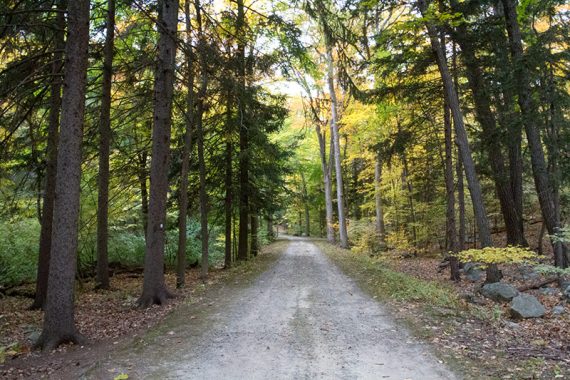
0.0 – Walking out of parking lot A, turn LEFT and start following the Crossover (WHITE) trail on a level gravel road.
Pass a few buildings and follow Crossover (WHITE) where it leaves the gravel road and enters the woods on a trail.
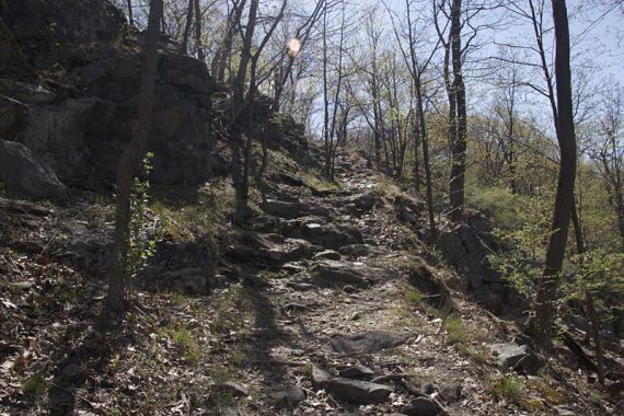
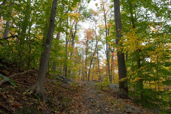
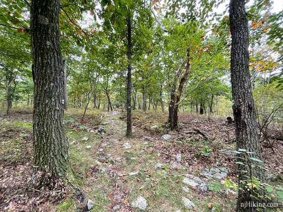
0.4 – Turn LEFT and start following Five Ponds (PINK). Head up a rocky incline. The first part of this route climbs quite a bit and then levels off once arriving at Pierson Ridge.
0.7 – Turn LEFT on a short side trail to a viewpoint, marked PINK with a STAR. Return and continue following Five Ponds (PINK).
0.9 – Continue on Five Ponds (PINK) as is briefly merges with Ringwood-Ramapo (RED on WHITE), turning right then left. Soon cross Skyland (BLUE TRIANGLE).
Continue downhill on Five Ponds (PINK). (These two photos have the old green blazes when this used to be Halifax).
1.3 – The trail arrives at a gravel path and junction with Five Ponds Connector (PINK with BLACK BAR).
Continue following Five Ponds (PINK) by turning LEFT then making a quick RIGHT. [Mountain Bike Trail (a woods road) leaves ahead]. Five Ponds (PINK) is on a strip of land between the two sides of Glasmere Pond.
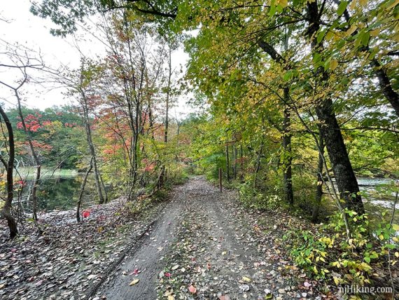
Glasmere pond to the left, and on the right.
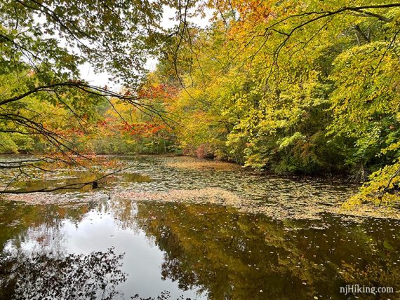
Soon after Glasmere Pond, Five Ponds (PINK) veers LEFT. [Mountain Bike Trail continues straight.]
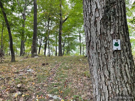
1.6 – Five Ponds (PINK) turns at an intersection with an unmarked woods road (Mountain Bike Trail). Veer LEFT to start following Halifax (GREEN on WHITE). [Five Ponds (PINK) continues ahead].
2.0 – Turn RIGHT and start following Pierson Ridge (BLUE). [Halifax (GREEN on WHITE) continues straight, while a woods road continues left].
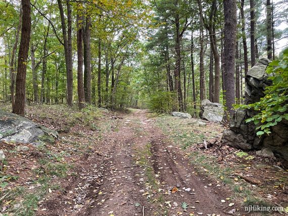
Go straight through the gas pipeline cut (don’t turn down the right). Didn’t notice blue markers until after the cut. Pierson Ridge (BLUE) is a wide woods road for awhile, a nice break from the uphill/downhills up to this point.
Continue on Pierson Ridge (BLUE) when it veers LEFT and leaves the woods road.
2.7 – Pass Bear Swamp (RED on WHITE) on the left (appears on the TC map but not the park map.)
2.9 – Pierson Ridge (BLUE) ends. Start following Crossover (WHITE) straight. [Crossover (WHITE) also leaves off to the right.]
// Shorter Option: Need to bail out? Turning right onto Crossover (WHITE) is a much shorter route back – follow Crossover (WHITE) all the way to the parking lot. //
3.5 – Turn RIGHT and start following Hoeferlin Memorial (YELLOW)/Crossover (WHITE). [Hoeferlin Memorial (YELLOW) also goes left].
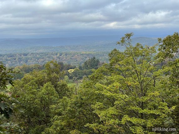
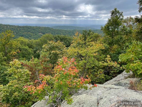
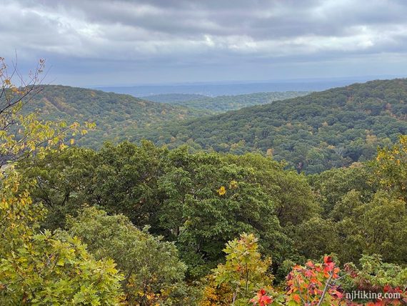
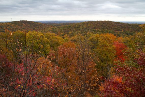
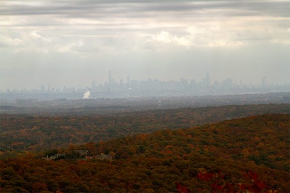
3.9 – Arrive at a rock outcrop called Ilgenstein Rock that overlooks Ramapo Mountain State Forest. Bear Swamp Lake is slightly visible below on the left (not seen in these photos).
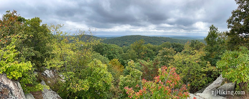
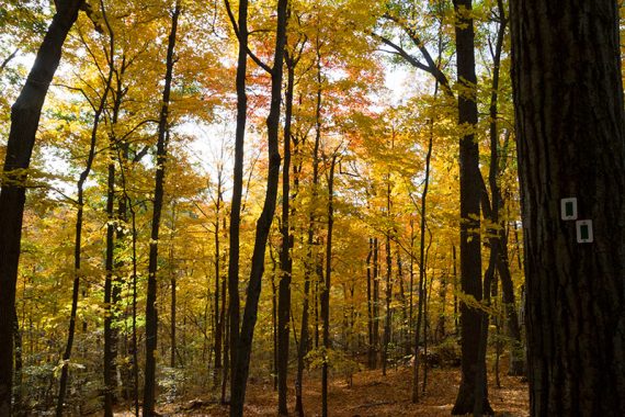
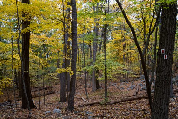
First photos from Ilgenstein Rock are from early fall of 2021 and the last is of peak color in October of 2015 (which happened to be a great year for fall foliage in New Jersey).
Off to the right the NYC skyline may be seen in the distance, you may need to move to see through between some trees. This zoom into the skyline is from 2015:
Continue following Hoeferlin Memorial (YELLOW). The marker is tucked away a bit; with your back to the view the YELLOW marker is off to the left. [Crossover (WHITE) continues; though we totally did not notice it].
4.3 – Continue following Hoeferlin Memorial (YELLOW) as it crosses BLUE on WHITE.
// Shorter Option, 7.9 miles total: Turning right on BLUE on WHITE will cut 2.1 miles from the hike. This skips Erskine Lookout, another unnamed viewpoint, and a section of long switchbacks. When BLUE on WHITE ends, turn RIGHT onto Ringwood-Ramapo (RED on WHITE) and rejoin the description at 7.0 miles below. //
4.8 – Continue following Hoeferlin Memorial (YELLOW) past GREEN on the left. (GREEN is on the TC map but not on the park map).
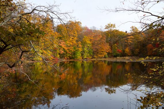
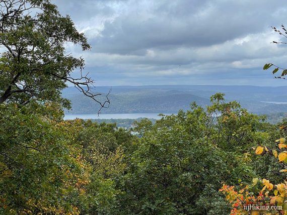
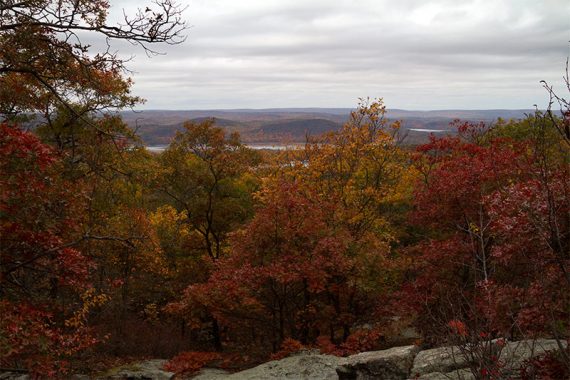
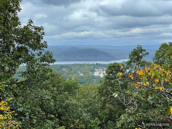
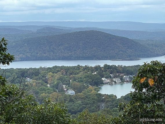
In a few more steps arrive at Erskine Lookout, with views of the Wanaque Reservoir.
5.3 – Turn RIGHT and start following Old Guard (GREEN LEAF on WHITE). [Old Guard (GREEN LEAF on WHITE) also goes left; Hoeferlin Memorial (YELLOW) continues straight].
We blew right past this intersection at first because the markers on either side of the trail are a little hard to spot (…or because we were discussing our next snack break).
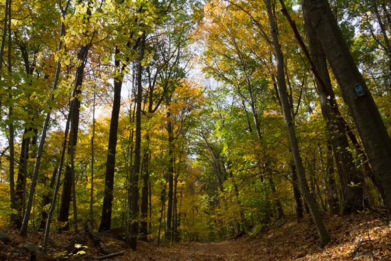
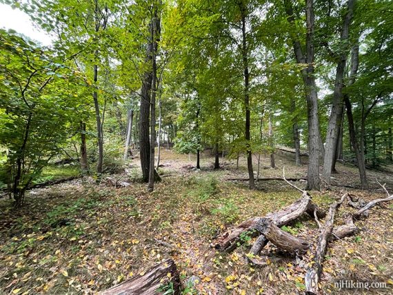
Old Guard (GREEN LEAF on WHITE) continues through an open area.
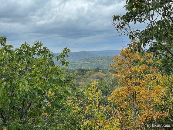
5.5 – Turn RIGHT and start following Ringwood-Ramapo (RED on WHITE) – but before doing so, walk to the left a bit to check out a limited view.
[Ringwood-Ramapo (RED on WHITE) and Old Guard (GREEN LEAF on WHITE) also go left.]
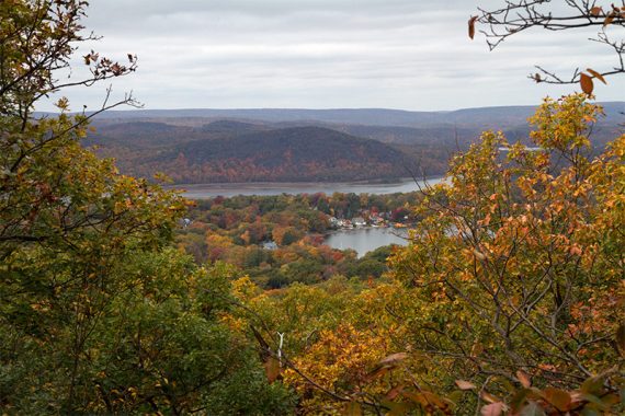
The Wanaque Reservoir is in the distance with the mountains of Norvin Green State Forest behind it (should be basically seeing part of the Stonetown Circular hike).
All the way on the right the dam can be seen on Monksville Reservoir (but not in these photos).
Continue following Ringwood-Ramapo (RED on WHITE).
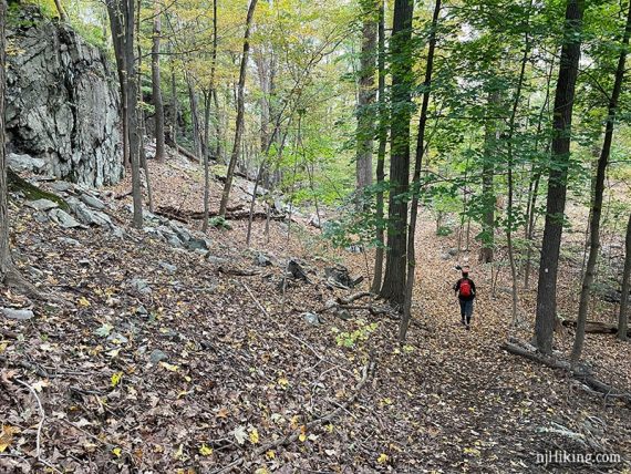
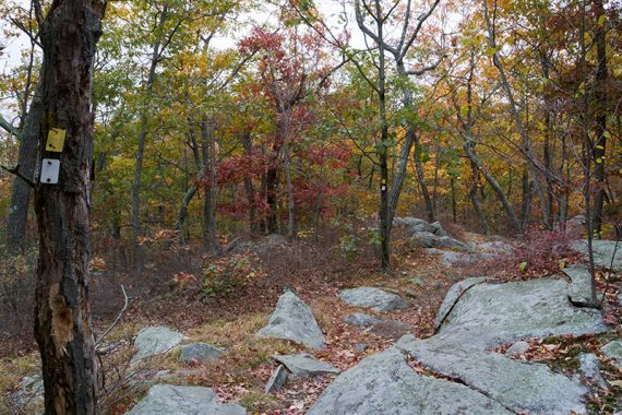
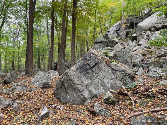
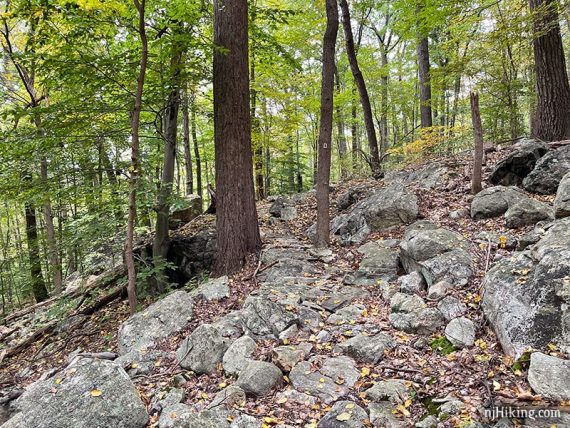
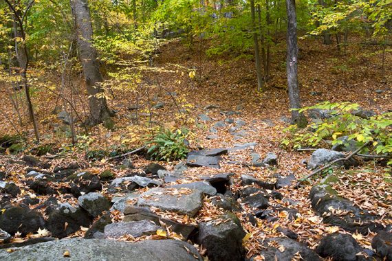
There are large areas of rocks along the way.
6.1 – Encounter sections of long “switchbacks”. (Switchbacks zig-zag along a hillside and allow for a more gradual ascent/decent than a straight trail. They can also help with trail erosion).
The switchbacks are especially pronounced in this section and seems like they are doubling back on themselves. This can be tedious when hiking – like you aren’t getting anywhere.
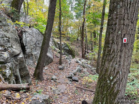
The trail also has a lot of rock enforcements to prevent erosion. Large sections of the trail have rocks fitted together to form a flatter solid surface.
6.7 – Cross High Mountain Brook on a rock bridge. Continue following Ringwood-Ramapo (RED on WHITE) with the stream on the right.
7.0 – Continue following Ringwood-Ramapo (RED on WHITE). [Pass BLUE on WHITE on the right].
Watch the markers as Ringwood-Ramapo (RED on WHITE) makes some turns and switches from trail to woods roads and back a couple times.
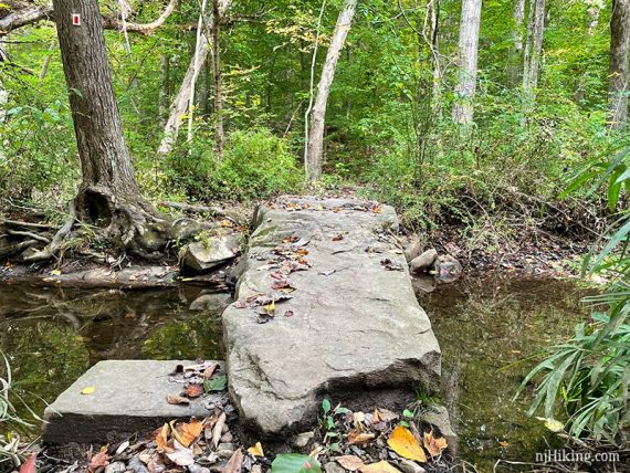
7.8 – Ringwood-Ramapo (RED on WHITE) turns to the RIGHT, easy to miss as the path appears continue straight too. Cross a stream on a bridge made out of one large rock slab.
Encounter more reinforced trail sections as Ringwood-Ramapo (RED on WHITE) makes it’s way up and around.
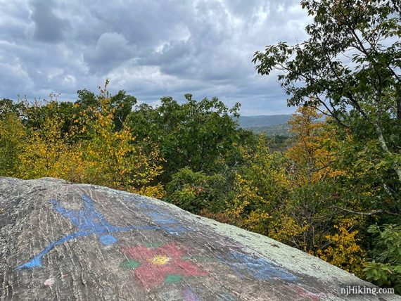
8.7 – Continue up a large rounded rock on the left to a rock outcropping.
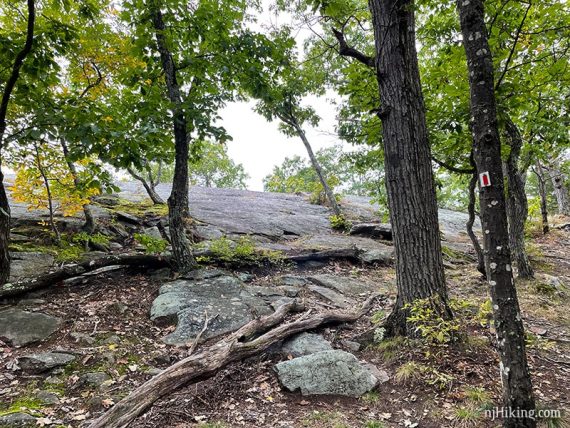
This rock/view is named “Warm Puppy Rock” on some maps – as well as written on the rock face.
We don’t know the origin of the name but have always assumed its straight forward – the large rock is open to the sun and is enticing to dogs (…and humans) to bask on.

There is a limited view of the surrounding hills from Warm Puppy Rock.
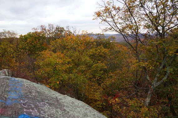
Same spot in October of 2015. When ready, continue following Ringwood-Ramapo (RED on WHITE).
8.8 – Turn LEFT and start following Crossover (WHITE), a woods road that leads back to parking lot A. This is co-joined with Five Ponds (PINK).
[Ringwood-Ramapo (RED on WHITE) continues ahead, Five Ponds (PINK) also goes to the right, Crossover (WHITE) also goes sharp right almost behind].
Optional: Instead of continuing entirely on Crossover (WHITE), once the trail nears the gardens at Skylands Manor turn LEFT and take a path into the gardens and work your way back to the parking lot.

—
Hiked: 10/9/21.
Hiked: 10/24/15.
Hiked: 4/10/10. Trail Blog: “Hiking to Ilgenstein Rock and Erskine Lookout“