Paddle a beautiful lake with islands and surrounded by an interesting shoreline.
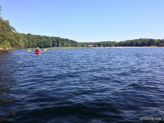
Wawayanda Lake is in the center of the state park and getting out on the water gives a different perspective than hiking the trails, many of which hug the shore line.
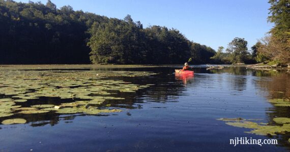
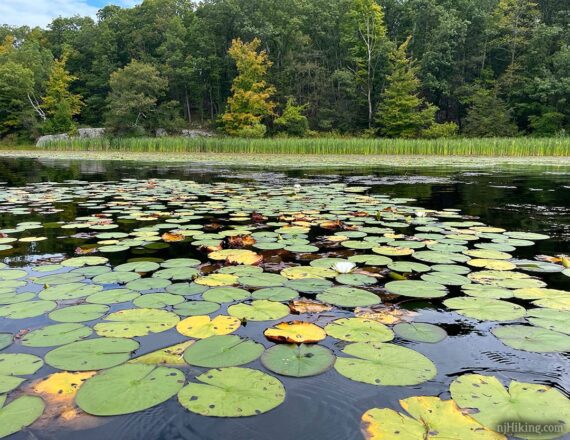
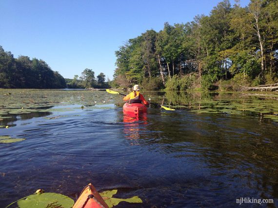
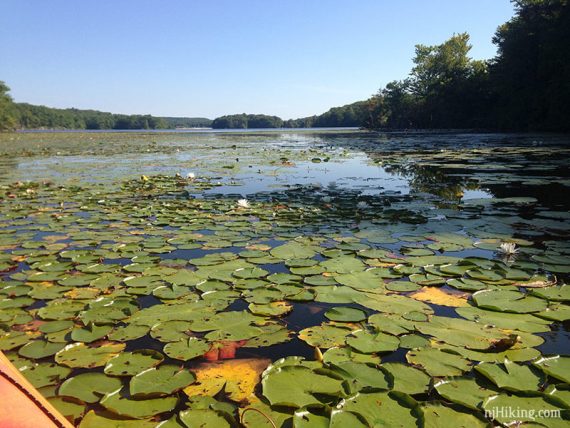
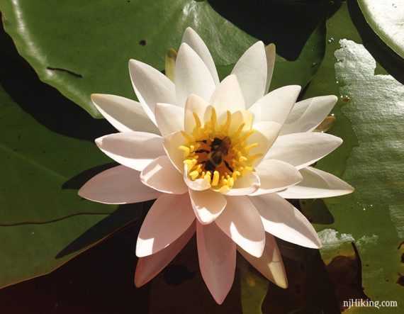
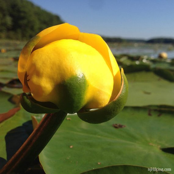
Immediately to the left of the launch is a small cove with a lot of lily pads near a spillway.
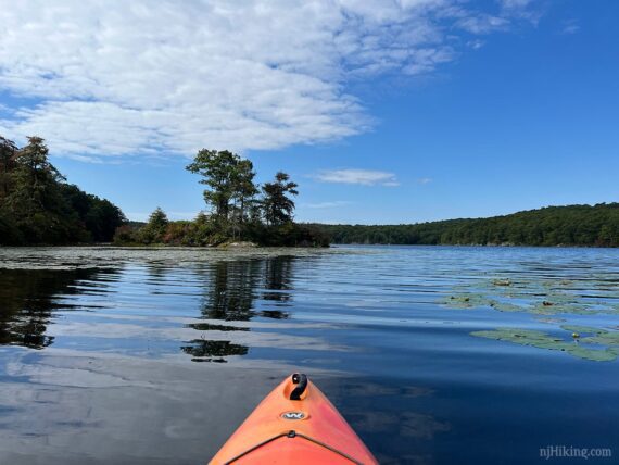
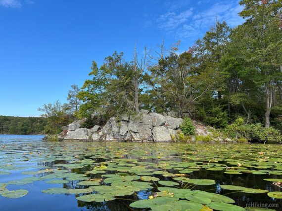
In the center of the lake are several islands of different sizes. All the way out to the southern most reaches is another large area of lily pads.
Some pumphouse remains are also visible on the shore, near a view point off the Lake Loop (formerly the Pumphouse Trail).
Miles: up to about 4.0. Entire length of lake, around the perimeter. About 2.0-2.5 hrs at a slow pace. Lake Size: 255 acres. Average Depth: 30′
| Miles 4.0 | Detailed instructions and photos follow below. |
| Park info | Wawayanda State Park |
| Nearby kayak | Monksville Reservoir |
| Nearby hikes; this park | Furnace Loop; Lake Loop; Lake Loop and Twin Bridges; Hoeferlin, Cedar Swamp, Red Dot; Iron Mountain and Hoeferlin Loop; Old Coal Trail, Lookout Lake, Laurel Pond Trail. |
Our two cents:
Scenic but very popular. Rentals available and this is a good place for beginners. Pack a lunch and land on an island or shore, or use one of the many picnic tables afterward.
Note that the park often closes temporarily due to capacity on summer days… sometimes by early morning. It’s more crowded closer to the launch. Avid paddlers can head out to the far end to try for more solitude, but in summer we found this to be a busy place even with an early start.
Swimming is allowed in season – but that is at the beach parking area and not this lot (boat launch).
Updated: 4/2026 – Minor edits. 9/2025 – Minor edits, added photos; re-kayaked. 7/2024 – Page refreshed, not re-kayaked.
Parking: N41.18860° W74.42673° [Boat Lot]
“Wawayanda Boathouse”, Boat Launch, Highland Lakes, NJ 07422.
From the south: 287N to exit 55 towards 511/Wanaque/Pompton Lakes. Right at bottom of the ramp and follow 511/Ringwood Ave/Greenwood Lake Turnpike through town.
The road will curve left and pass Monksville Reservoir and then Greenwood Lake. The road name changes to Warwick Turnpike.
The park entrance on the left, about 19 miles since getting on 511. Drive past the visitor center lot (fee gate in season) and follow the park road for a bit.
Turn left at the sign for Wawayanda Lake. Drive through the first parking lot (for the beach), and continue to the boat launch lot.
Note: Google and GPS software may direct you to the auxiliary entrance near Barry Lakes instead of the main entrance. This gate may be open seasonally, only weekends/holidays, with limited hours (check the park site). If it’s closed you’ll either need to hike from that lot over to the boat launch lot or drive back around.
Google/GPS may also show several of the trails in Wawayanda as drivable roads… they aren’t. Driving is allowed on part of Cherry Ridge but you really don’t want to drive through the park.
Wawayanda charges an entrance fee Memorial – Labor day; which is covered by the NJ State Park Pass.
Restrooms:
Regular bathroom in the main lot by the visitor center and at both Wawayanda lake parking lots – the first (beach lot) and the second (boat launch lot).
Composting toilets are by the Furnace which is near the junction of Laurel Pond and Double Pond trails.
Kayak Rentals:
Flatwater Paddle Co. rents single and tandem kayaks, SUP (stand-up paddle boards), and row boats from the boat launch parking lot in season; contact them or the park office for info on availability.
Book:
Appears in Quiet Water New Jersey (2010) and Quiet Water Mid-Atlantic (2018).
Note: Our go-to kayaking book is Quiet Water New Jersey (2010), available as an e-book or a used printed book.
The newer version is “Quiet Water Mid-Atlantic (2018)”. This contains 13 of the 52 locations in the New Jersey-only book and is available both in printed and online formats.
Related: Kayaking NJ overview page.
Launch:
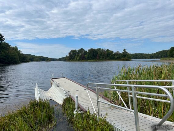
Easy peasy…. choose from the new-ish kayak launch or the boat ramp.
We loooove these kayak launches: lower the ‘yak into the cradle, step in and sit, set your paddle across the notches and use them to pull the kayak into the water. Reverse on the return. All without getting your feet wet!
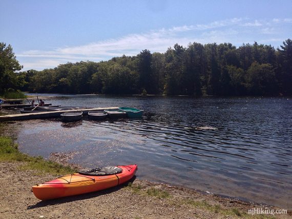
What the launch area looked like in 2016:
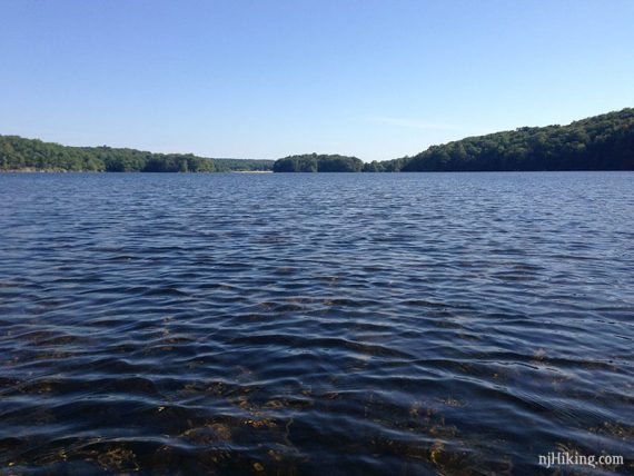
And a panorama from the shore looking out at the whole lake.
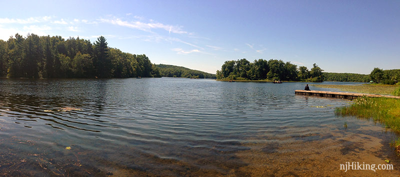
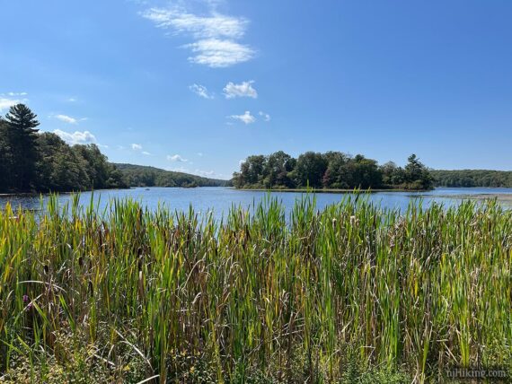
Tall grasses line much of the launch shore of Lake Wawayanda, making for pretty photo ops.
The Route:
Note that Wawayanda is a wide open lake so if it’s windy it can get a bit choppy.
From the launch, we head left into the small cove which usually has lots of lily pads on the side. A stone wall is at the far end. This cove is passed on the way to many hiking trails in the park.
Head back out of the cove and hug the shore or go our towards the islands. There are a couple of large islands and then smaller ones to paddle around.
There are possible landing spots on the larger islands, or on the rocky shore.
Fun Facts: Wawayanda Lake was once called “Double Pond” (the name of one of the hiking trails now) when it was two sections of water split by a narrow piece of land, the remains of which is the large island in the center.
The lake was dammed in the mid-1800’s by the Thomas Iron Company. This raised the water level 7.5 feet. [Source: The New Jersey Walk Book].
The lake can be a busy in summer even early just after the park opens at 8am. We saw many boats when here during August while on a lovely September we saw few people until nearly noon.
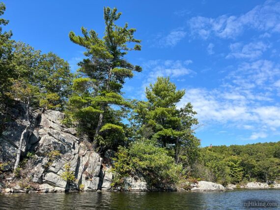
Wawayanda shoreline and edge of the islands are rocky.
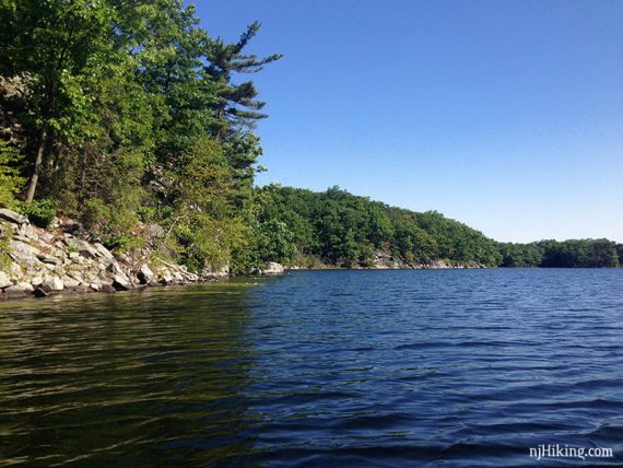
In some areas the rocky shoreline is quite tall.
Lily pads at the south end of the lake. Even when it was busy, fewer people traveled past the main islands and this end is quieter.
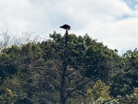
In 2025 we spotted an Osprey swooping along the shore line as we approached the end of the lake. He finally settled in a tall dead tree to enjoy his freshly caught breakfast.
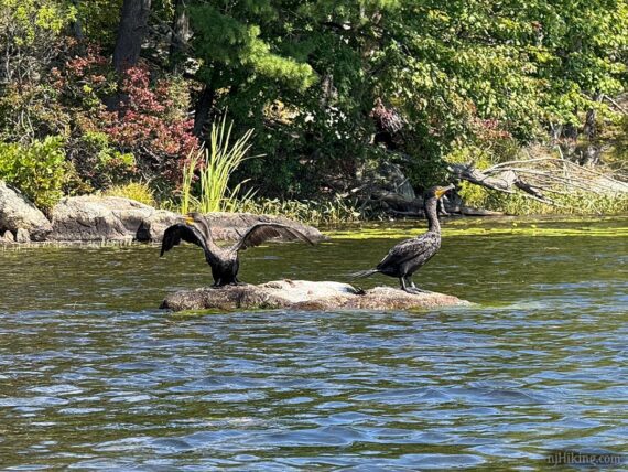
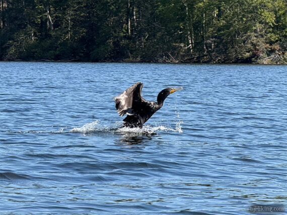
We also spotted several Cormorants throughout the lake which are always fun to watch (big goofy ducks basically).
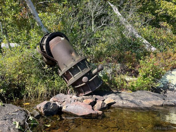
A few rusted pipes are the remains of a pump house are along the western shore towards the end of the lake. You might spot some more pipe all the way at the far shore of the lake, beyond the lily pads.
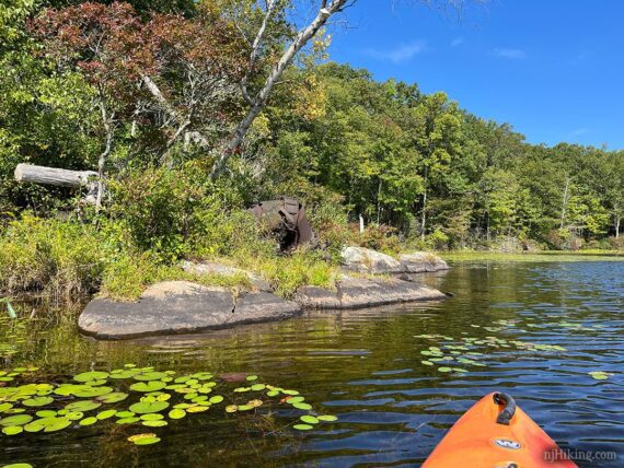
These are leftover from when the lake was tapped to feed a reservoir during a drought in the 1960’s, and last used in about 1980. [Source: Hiking New Jersey (2023)]. You can also hike to these (makes a nice break area) on the Lake Loop (formerly the Pumphouse Trail).
Not quite in the middle, in a open area on the western shoreline, is an easy to miss plaque laying flat on the rocks. I wasn’t able to get a good photo from my low angle in the kayak but it reads “Black Eagle Scout Camp, Warwick, NY” with two troops, 1925-40 and 1955-61 (? not clear in my zoom), placed there in 2016.
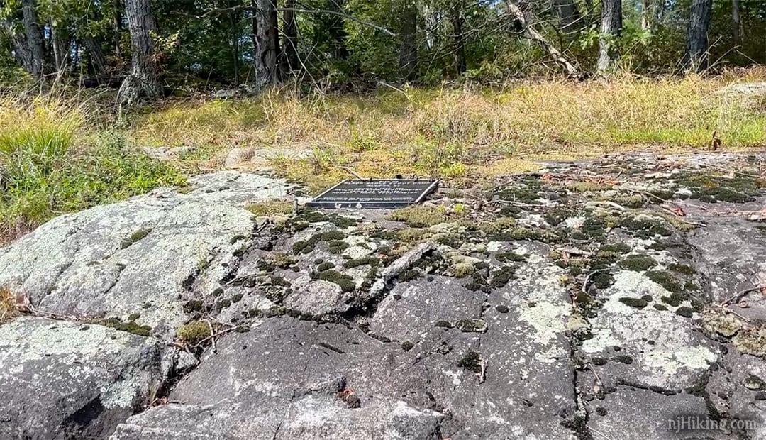
Fun Facts: Doing a little online search on this camp yielded an interesting archive from 1933, “History of Wawayanda Lake By Elizabeth Blauvelt Shaw“. This mentions that Black Eagle was a Leni-Lenape Chief in the area, along other interesting historical tidbits such as possible translations of “Wawayanda” other than the usual “winding, winding, water”.
Paddling on… eventually the beach is visible in the distance. Once back near the beach follow it to the right, back to the launch area.
—
Kayaked 9/13/25. 3.5 miles.
Kayaked 8/28/16. 4.0 miles