Rhododendron filled hike that circles a lake.
5.6 or 3.9 or 6.1 miles. Moderately rocky trail, minor elevation changes.
- Shorter, 3.9 miles: Noted below
- Longer, 6.1 miles – add a short spur trail, noted below.
- Nearby, boat lot: Furnace Loop; Cedar Swamp and Lake Lookout.
- Nearby, beach lot: Lake Loop and Twin Bridges.
- Nearby, visitor lot: Hoeferlin, Cedar Swamp, Red Dot; Iron Mountain and Hoeferlin Loop.
- Nearby: Old Coal Trail, Lookout Lake, Laurel Pond Trail.
- Alternate: Wawayanda Lake Kayak.
Hike Info:
Our two cents:
Pretty trail with lake views and plenty of rhododendron in season, easy-peasy navigation (1 blaze color), and manageable mileage.
If you’re wondering if 5.6 miles is too much, there is an easy bail-out option noted below that reduces the hike to 3.9 miles.
Note: This popular park often fills to capacity in summer and closes. Bonus fun: Canoe rentals available in season, or bring your own.
Updated: 2/2022: Trail map info.
Related: Best Fall Foliage Hikes in New Jersey
Map:
Northern New Jersey Highlands Trails Map is recommended to navigate the network of trails in this park. Follow along on your smartphone with our Interactive Map link above.
Books:
This route isn’t in any books that we know of. Other books with hikes in this park: 50 Hikes in New Jersey, Hiking New Jersey (2023), and Hiking the Jersey Highlands.
Parking: N41.18860° W74.42673° [Boat Lot]
“Wawayanda Boathouse”, Boat Launch, Highland Lakes, NJ 07422.
From the south: 287N to exit 55 towards 511/Wanaque/Pompton Lakes. Right at bottom of the ramp and follow 511/Ringwood Ave/Greenwood Lake Turnpike through town.
The road will curve left and pass Monksville Reservoir and then Greenwood Lake. The road name changes to Warwick Turnpike.
The park entrance on the left, about 19 miles since getting on 511. Drive past the visitor center lot (fee gate in season) and follow the park road for a bit.
Turn left at the sign for Wawayanda Lake. Drive through the first parking lot (for the beach), and continue to the boat launch lot.
Note: Google and GPS software may direct you to the auxiliary entrance near Barry Lakes instead of the main entrance. This gate may be open seasonally, only weekends/holidays, with limited hours (check the park site). If it’s closed you’ll either need to hike from that lot over to the boat launch lot or drive back around.
Google/GPS may also show several of the trails in Wawayanda as drivable roads… they aren’t. Driving is allowed on part of Cherry Ridge but you really don’t want to drive through the park.
Wawayanda charges an entrance fee Memorial – Labor day; which is covered by the NJ State Park Pass.
Restrooms:
Regular bathroom in the main lot by the visitor center and at both Wawayanda lake parking lots – the first (beach lot) and the second (boat launch lot).
Composting toilets are by the Furnace which is near the junction of Laurel Pond and Double Pond trails.
Hike Directions:
Overview: Wawayanda Lake Loop (ORANGE) – referred to as just “Lake Loop (ORANGE)” below.
Note: Trail names are sometimes on the markers, in addition to the color.
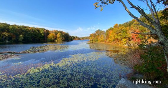
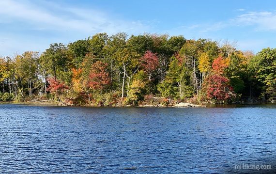
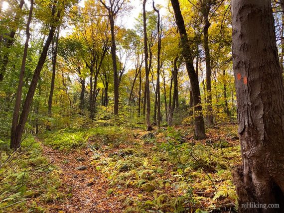
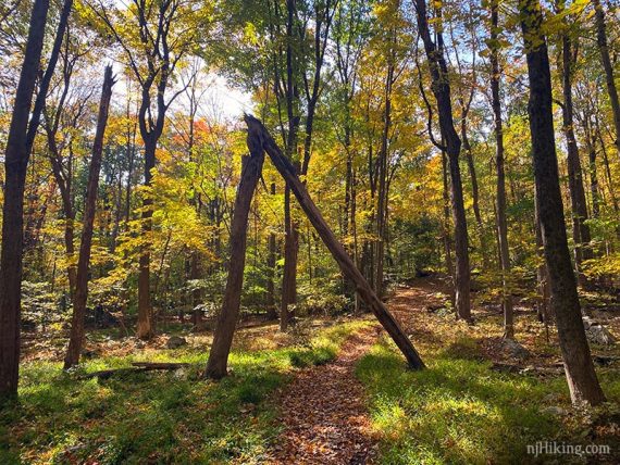
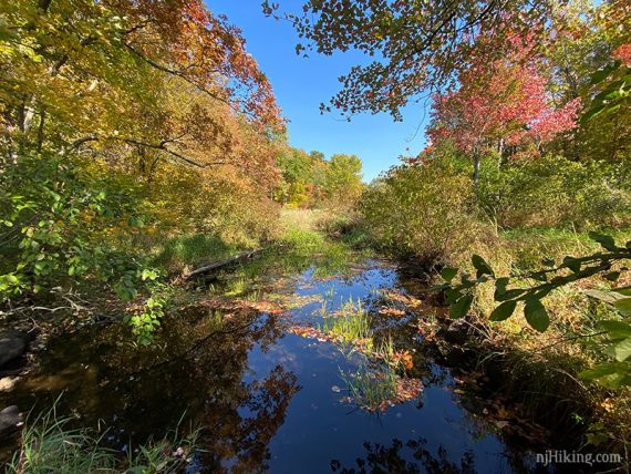
New Jersey Fall Foliage was especially brilliant in 2020 and we hit this area just as the season was ramping up… so there are a lot of photos.
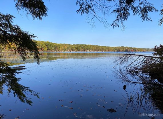
0.0 – Facing the lake from the boat launch parking lot, turn LEFT and follow the wide path next to the lake.
There may not be blazes but this is part of the Lake Loop (ORANGE).
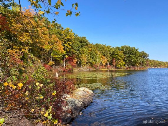
Plenty of views of the lake along the way.
0.2 – At the corner of the lake, follow Lake Loop (ORANGE) to the right towards a bridge over a spillway. [Double Pond (YELLOW) continues ahead.]
// Optional: Take Double Pond (YELLOW) out-and-back to see the Wawayanda Furnace. Adds 0.2 miles. //
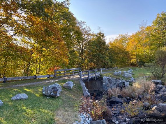
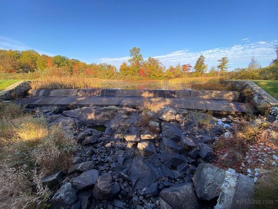
View of the spillway from the bridge.
Follow ORANGE to the RIGHT. [Wingdam (BLUE) continues ahead and will meet up shortly if you don’t turn here.]
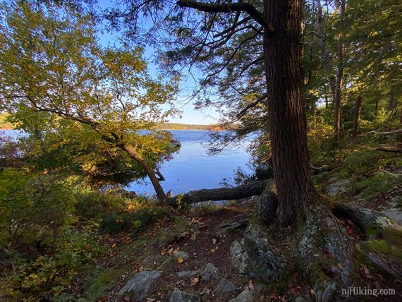
This hugs the shore with some views over the lake.
0.8 – Meet up with Wingdam (BLUE) again. Turn RIGHT to continue on Lake Loop (ORANGE).
1.0 – Turn RIGHT to continue on Lake Loop (ORANGE). [Wingdam (BLUE) continues ahead].
The trail hugs the shore again, with several spots to view the lake along the way.
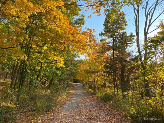
Lots of rhododendron along this route.
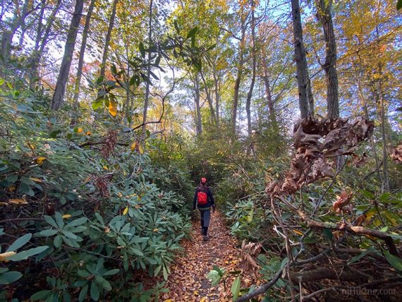
Continue on Lake Loop (ORANGE)… which is often not near the lake.
2.0 – Turn RIGHT to continue on Lake Loop (ORANGE). [Wawayanda Lake Connector (YEL-ORG) goes to the left]
Shorter bail-out, hike reduced to 3.9 miles total: Instead, turn LEFT on Wawayanda Lake Connector (YEL-ORG). Then turn LEFT at the T-intersection with Laurel Pond (YEL). At the Furnace, veer LEFT to take Double Pond (YEL) and Lake Loop (ORANGE) back to the lot.
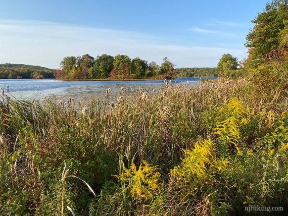
2.3 – As it gets closer to the southern end of the the lake, the trail curves around and gets close to the lake for another view.
2.5 – Continue on Lake Loop (ORANGE). [Pass Timber (GREEN)].
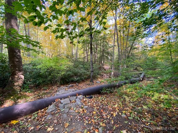
2.8 – Walk over a very long pipe. Soon after this, the trail jogs to the left where an unmarked trail goes right.
3.0 – At a T-intersection, turn RIGHT to continue on Lake Loop (ORANGE). [Pumphouse (ORG-GREEN) goes left].
3.2 – Pass an unmarked spur trail on the right. On this side of the lake, there aren’t any lake views other than down unmarked side trails.
// Optional add-on: take the unmarked spur to a view of the lake. Adds 0.5 miles roundtrip.
For the add-on… Turn RIGHT to follow the unmarked spur trail slightly downhill to the lake (therefore uphill on the return).
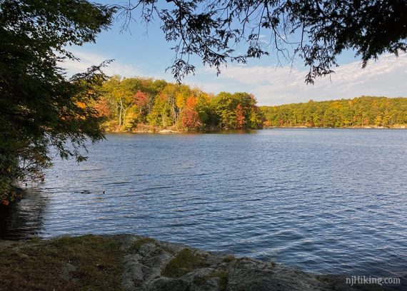
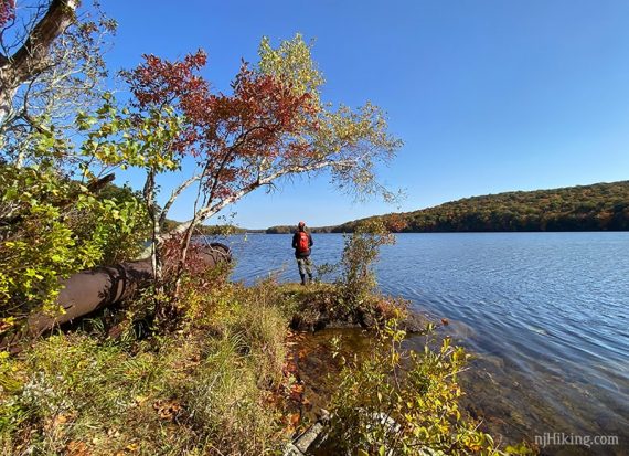
This leads to a view of the lake with old pipes from a pumphouse. It’s also a nice break spot.
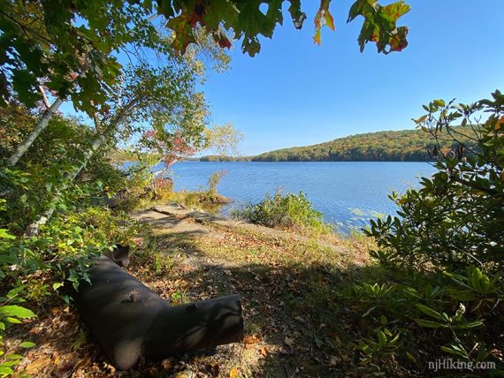
The pipes are from when water was pumped out to a reservoir during a drought in the 1960s. [Source: Hiking New Jersey (2023)].
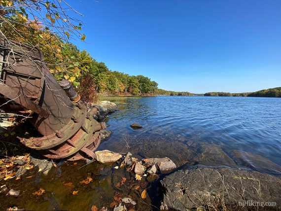
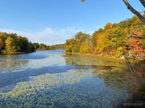
This side trail allows a view of the lake from the opposite side that the hike started on.
When ready, retrace the spur trail back and turn RIGHT to continue on Lake Loop (ORANGE).
One last photo from here, was such a nice day…
End of Optional add-on //
Continue following Lake Loop (ORANGE).
3.9 – Turn LEFT to continue on Lake Loop (ORANGE). [Boulder Garden (BLUE) continues straight and will meet up with the route later]
// Variation, 0.2 miles shorter: Taking Boulder Garden (BLUE) straight instead is more direct but possibly a bit rockier. //
Continue on Lake Loop (ORANGE).

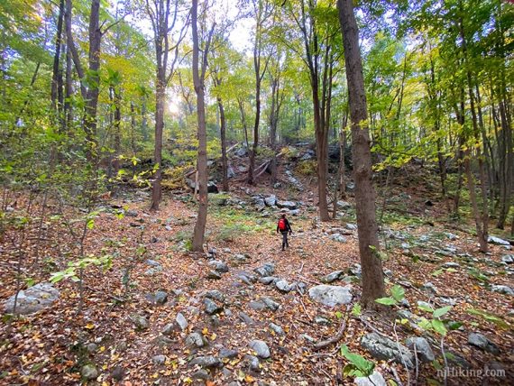
Cross a small stream on a large pile of jumbled rocks, with a view of a wet area.
4.7 – Continue on Lake Loop (ORANGE). [Boulder Garden (BLUE) ends].
5.2 – Turn RIGHT to continue on Lake Loop (ORANGE) near an auxiliary entrance and small parking lot.
Continue past the beach area and buildings, then on to the boat parking lot.
—
Hiked: 10/10/20.