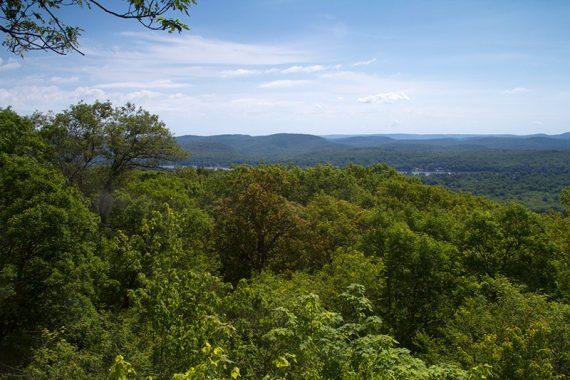
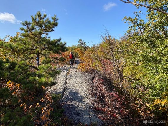
Rugged, rocky trail that runs along a ridge with many expansive viewpoints before arriving at Terrace Pond.
Mileage: 7.4 miles round trip. Surface varies from a generally level rocky trail to traversing rock slabs to short sections of scrambling up and down.
| 7.4 miles | This hike guide: Detailed instructions, photos, and video follow below. |
| Shorter | 3.4 – Views but skips the pond. Noted below. |
| Variations | 5.5 – Out-and-back to the pond 6.3 – Out-and-back with a loop around the pond. 7.9 – This route plus a loop around the pond. Noted below. |
| Very Nearby | Bearfort Ridge Loop – Surprise Lake |
| Nearby | Surprise Lake Loop via State Line; Terrace Pond Loop; Terrace Pond Lollipop; Terrace Pond – West, Circular, North; Wawayanda – Old Coal Trail; Wawayanda – Hoeferlin, Cedar Swamp; Wawayanda – Iron Mountain and Hoeferlin Loop; Long Pond Ironworks. |
Our two cents:
Multiple nice viewpoints, interesting trail with some scrambling, and a scenic pond.
We enjoyed the extension of the trail as it allows for more of a loop and less retracing as an out-and-back. Not-as-avid hikers may want to stick to the original shorter 5.5 mile or 6.3 variations.
This is not the popular, shorter route to Terrace Pond. There is a variation noted below that loops around the pond and uses the new floating bridge and ladder.
On a brisk fall morning we saw no other hikers. In summer expect it to be busy around the pond.
This route requires walking down a gas pipeline cut. While that is one of our least favorite things to do, it’s not a long section (and now the loop only requires it once). Sometimes the pipeline has very overgrown tall grass in sections.
The prominent road noise in the beginning fades pretty quickly.
Updated: 7/2024 – Page refreshed, partly re-hiked while doing the West, Circular, North loop. Older change log at page bottom.
Map/Books:
Northern New Jersey Highlands Trails Map is recommended to navigate the network of trails in this park. Follow along on your smartphone with our Interactive Map link above. Our hike directions contain GPS notes that match our map.
Located in the Bearfort Mountain Natural Area that is part of Wawayanda State Park but trails are shown on the Abram S. Hewitt park map.
This route isn’t in any that we know of. Alternate Terrace Pond routes are in 50 Hikes in New Jersey, Hiking New Jersey (2023), Take a Hike New York City, Hike of the Week, Best Day Hikes Near New York City.
Parking: N41.15757° W74.36742°
Rt 287 N to exit 55, follow 511 North through Wanaque. Bear left at the Y-intersection with Skyline Drive.
Keep straight past the intersection with Lakeside Road, following Rt 513. Stay straight at the fork, becoming Warwick Turnpike.
Pass the trailhead for Bearfort Ridge/Jeremy Glick and their two small parking pullouts on the right side (the first is right after a concrete bridge and the guardrail, then another shortly after). This hike starts at the third pullout further down the road with room for 5 or so cars.
There trailhead is across the road, in line with the start of the pullout. Traffic moves quick and around a corner so crossing can be a tad dicey.
Note: Google shows this parking as “Quail Trailhead” although that naming is incorrect. What used to be called Quail (ORANGE) started from the Bearfort Ridge trail, nearer to the start of the Bearfort Ridge – Surprise Lake hike.
Restrooms:
None. Best bet are gas stations along 511, there is one nearest the trailhead at the intersection of Lakeside Rd.
Also: Porta-john at the Monksville reservoir on Rt 511. Look for the “Long Pond Ironworks” park sign on the left and follow the driveway down.
Restrooms are at the visitor center for Long Pond Ironworks but usually open very limited hours (Usually 1-4).
Swimming Note:
Though you’ll see people doing it, swimming in Terrace Pond is not allowed – it’s patrolled and ticketed. The sides of the pond are somewhat high above the water on rock ledges in most spots, it’s not like you can walk into the water from a beach.
It can be dangerous and several people have drowned. In addition, it’s difficult for Search & Rescue to reach this remote location quickly. See “Terrace Pond attracts hikers from all over, but there’s a reason why swimming is banned.“
Hike Directions:
Overview: BLACK SQUARE on BLUE (Terrace Pond North Spur) – BLUE (Terrace Pond North) – BLACK SQUARE on BLUE (Terrace Pond North Spur)
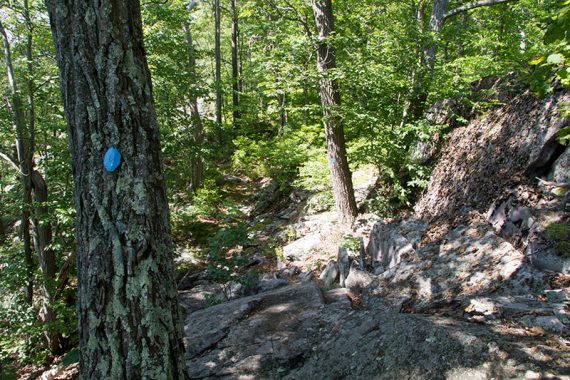
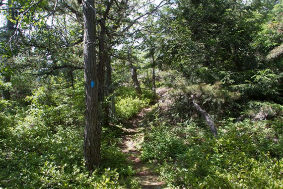
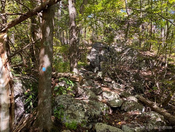
0.0 – After crossing the road, BLACK SQUARE on BLUE (Terrace Pond North Spur) immediately travels through a beautiful rhododendron tunnel and heads uphill a bit.
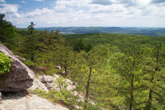
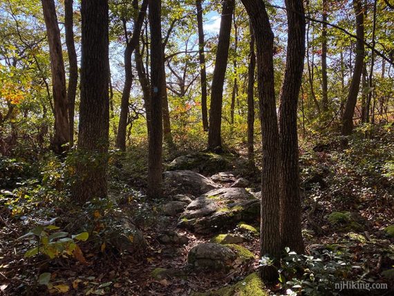
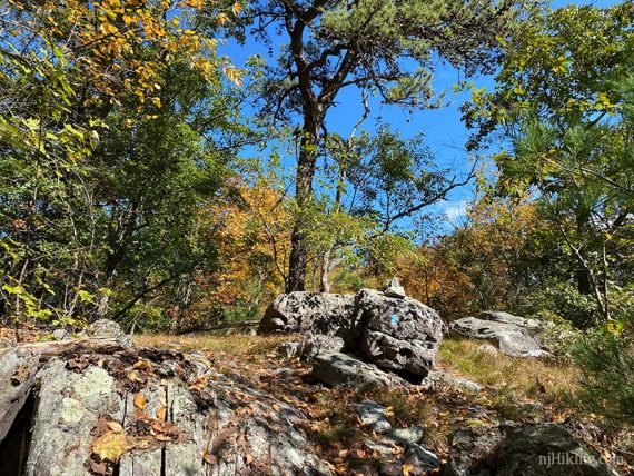
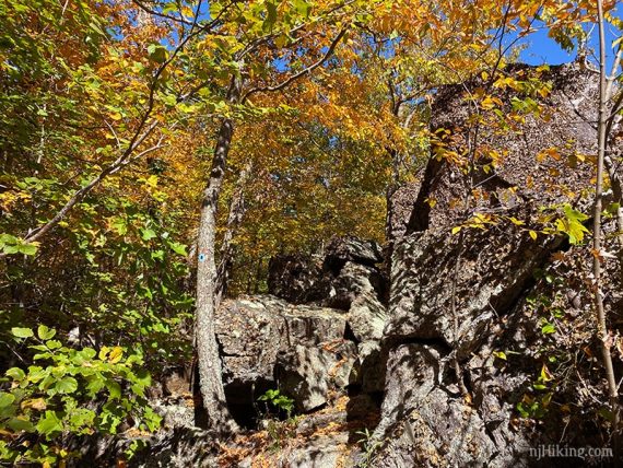
The rugged trail climbs to multiple outcrops.
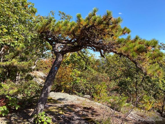
There are many views so we’ve just noted a few standouts. Watch for turkey vultures and hawks gliding in the valley below.
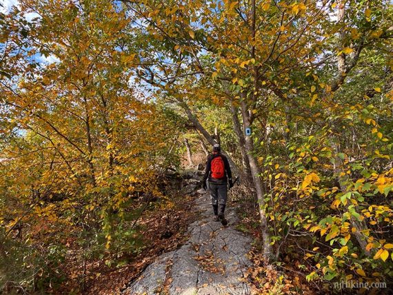
The rugged trail has rocky areas as well as long slabs of rock to traverse.
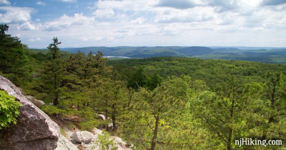
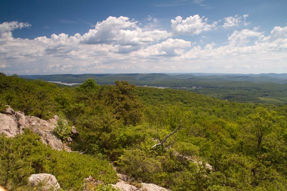
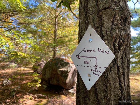
0.6 – Viewpoint. GPS: View1-TPN
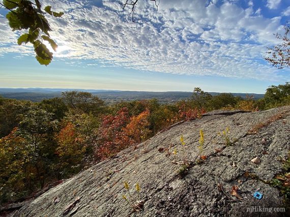
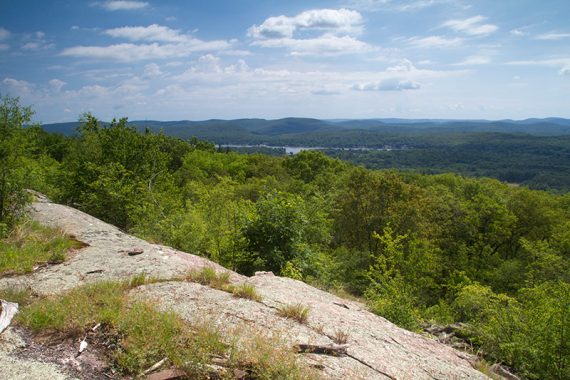
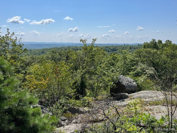
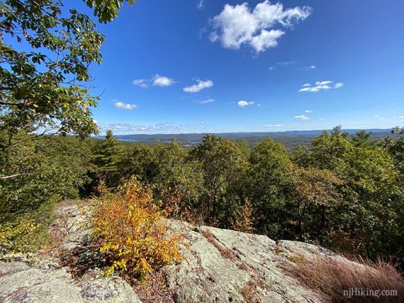
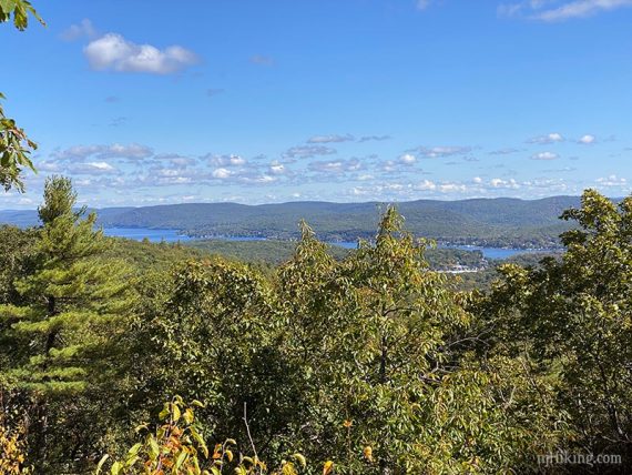
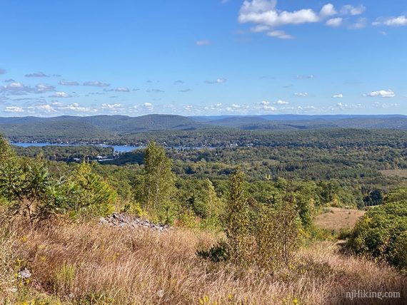
0.8 – Viewpoint. GPS: View2-TPN The lake seen in the distance is Greenwood Lake.
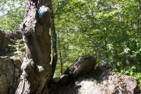
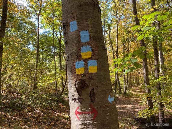
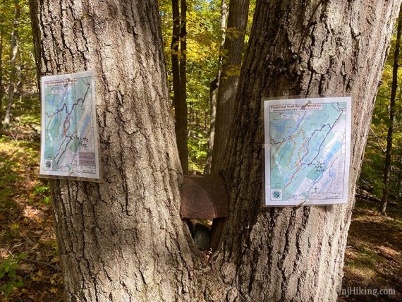
1.0 – BLACK SQUARE on BLUE (Terrace Pond North Spur) ends. Turn RIGHT to now follow BLUE (Terrace Pond North). GPS: TPN-TPNspur
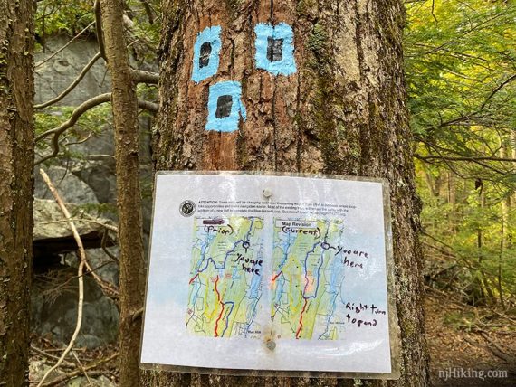
***Note! Watch for this intersection. BLUE (Terrace Pond North) also continues straight ahead and is the return route. Missing this turn will not only make the rest of the description wrong but since it’s all on BLUE you might not realize it for awhile. And if you’re looking to do the original shorter out-and-back to the pond you’ll be hiking a couple more miles than intended. ***
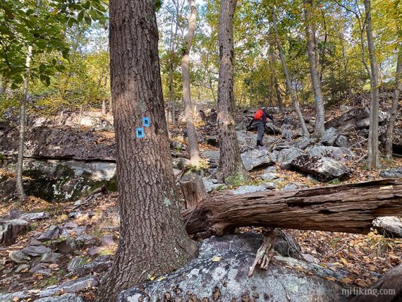
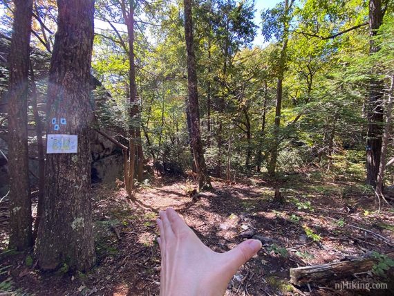
There was a trail map posted at this intersection showing the old and new maps but those won’t be there forever.
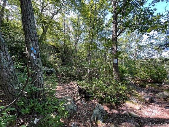
This photo shows the sign, markers for the end of the spur trail, and the two sets of blue blazes… follow my thumb…
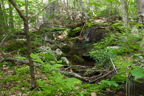
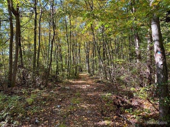
Continue following BLUE (Terrace Pond North) thru a pretty area with a stream and mossy rocks.
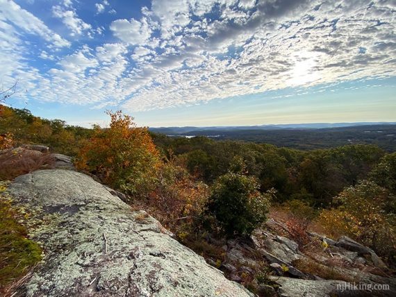
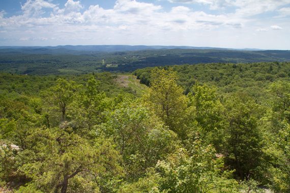
1.5 – Viewpoint, right after a climb up and near a large rock. Greenwood Lake becomes visible to the left, while the NYC skyline can be seen off on the right if it’s clear. GPS: View3-TPN
1.7 – Viewpoint. GPS: View4-TPN
/// Shorter: Turn around now and retrace the route for a 3.4 mile hike. ///
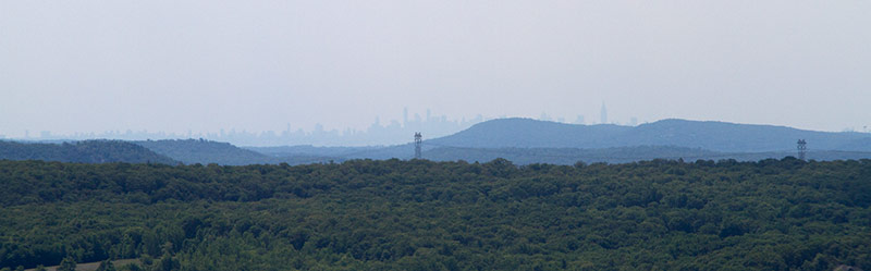
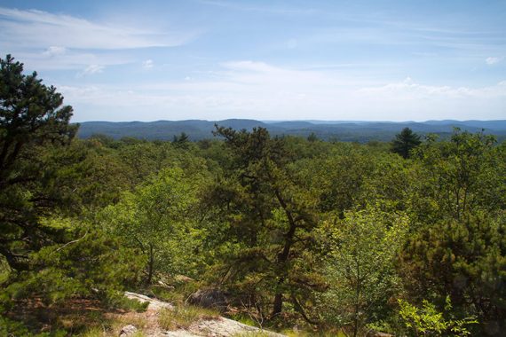
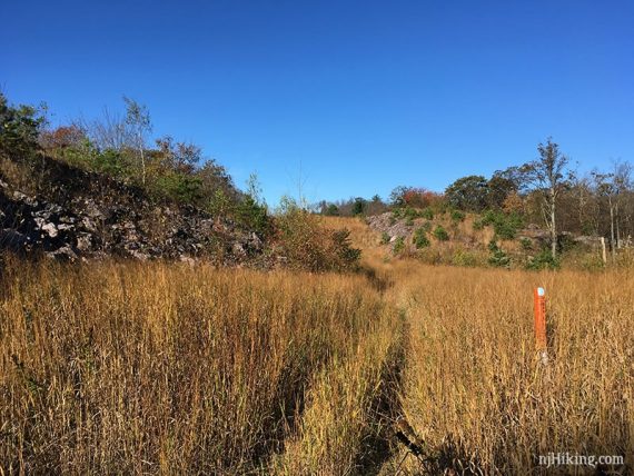
1.8 – Meet up with the gas pipeline cut. Viewpoint, NYC skyline may be visible.
Turn RIGHT and continue following BLUE (Terrace Pond North) along the right side of the cut, then follow it as it crosses to run along the left side. GPS: Pipeline1/TPN
2.1 – Turn LEFT, still following BLUE (Terrace Pond North), as it re-enters the forest and leaves the pipeline. GPS: Pipeline2/TPN
2.6 – Turn LEFT to continue following BLUE (Terrace Pond North). [WHITE (Terrace Pond Circular) goes left and right] GPS: BLUE-TPN1/WHT-TPC
/// For variations from this point (or to check out the new floating bridge) – see “Terrace Pond Circular” at the bottom of the page. ///
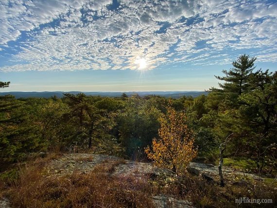
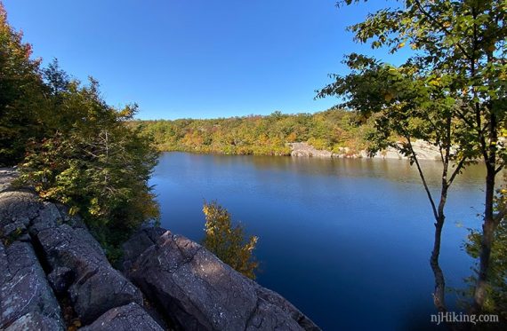
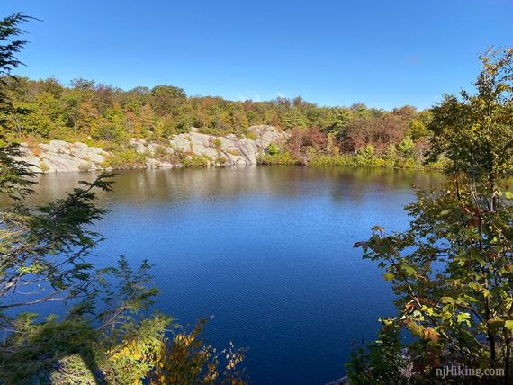
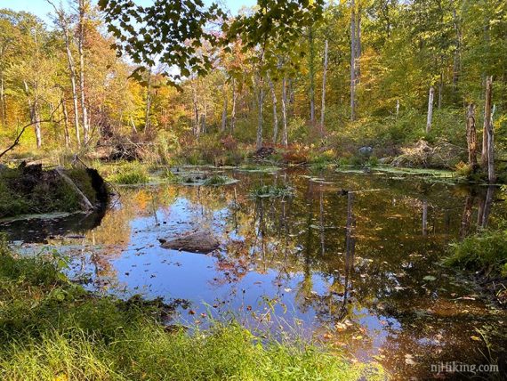
2.7 – There are a few viewpoints/break spots for the pond on the right side. The first is somewhat limited, the second is better, and the next is larger and more open (but may have more people). GPS: VIEW1/2/3-TPC
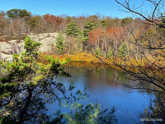
The last, larger viewpoint is actually beyond where you need to turn. Continue ahead on a casual path, past a “no swimming’ sign. Then return to this intersection afterward.
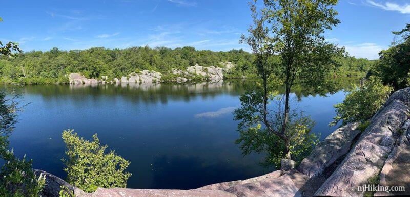
At this last viewpoint there are panoramic views across Terrace Pond. The steep rocky shoreline goes around most of the pond, and there aren’t areas to get down to the edge.
This is a nice place to take a break, but there also is another viewpoint/break spot a little later (of hills, not of the pond).
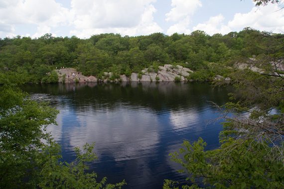
One of the other viewpoints on the other side of the pond.
/// Shorter: Turn around now and retrace the route for a 5.5 mile hike. ///
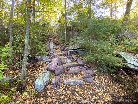
To continue following BLUE (Terrace Pond North), take a few steps back from this last viewpoint to where the trail turns and heads uphill over stone steps (may have not noticed this when arriving at the overlook).
Continue following BLUE (Terrace Pond North) over some rock slabs.
3.1 – Turn LEFT to continue following BLUE (Terrace Pond North). [WHITE (Terrace Pond Circular) leaves ahead]. GPS: BLUE-TPN3/WHT-TPC
The trail heads downhill before leveling out an a long stretch of easy woods road.
Follow a very short side trail marked BLUE with BLACK STAR to an overlook of the surrounding hills, and then return.
3.8 – At a tree with multiple markers, turn LEFT to continue following BLUE (Terrace Pond North). GPS: TPN/TP-RED/YEL-BLUE
[At this intersection is also Terrace Pond Red and YEL-BLUE (Terrace Pond Connector)]
4.0 – Turn LEFT to continue following BLUE (Terrace Pond North). [Terrace Pond Red leaves to the right.] GPS: BLUE-TPN/TP-RED
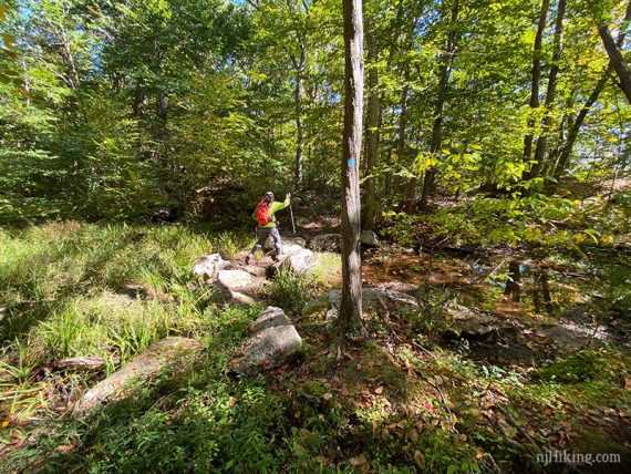
Pass a small wet area with a beaver dam on the far side.
4.4 – Turn LEFT to continue following BLUE (Terrace Pond North). [An unmarked path continues ahead that used to be Spring North trail]. GPS: BLUE-TPN/Unmarked
The day we hiked this there were signs for the old and new trail system… and a wedged hunk of metal in a tree.
Keep on chugging along this new stretch of trail. From here until just after crossing the pipeline cut is what has been marked to create a Terrace Pond North loop.
The trail map shows “Pinecliff Reservoir” off to the left in this section. We didn’t spot any side trails to it but there is a little stream from it to hop over.
6.1 – Turn RIGHT at a white diamond marker for a short side trail to an overlook. GPS: View5-TPN
This is the only viewpoint on this stretch of trail and it’s another nice wide view of Greenwood Lake.
Soon get another view when crossing the pipeline cut.
Scramble up some rocks then back down into the forest.
6.4 – Now start following BLACK SQUARE on BLUE (Terrace Pond North Spur) and retrace the route back to the parking area. GPS: TPN-TPNspur
(I think we take a photo of this tree on the way back, every time we hike this…)
*Variation, Terrace Pond Circular:
At the intersection of BLUE (Terrace Pond North) and WHITE (Terrace Pond Circular) GPS:BLUE-TPN1/WHT-TPC – instead turn RIGHT and follow WHITE (Terrace Pond Circular).
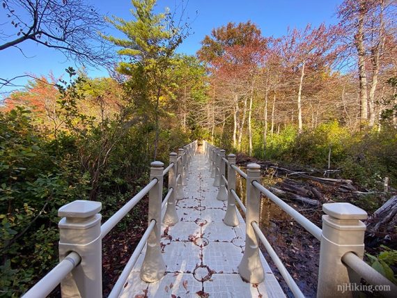
Follow WHITE (Terrace Pond Circular) down the ladder and over the bridge then up to the other side of Terrace Pond where there are more viewpoints.
Note! Until about 9/2020 this section required a hard scramble and crossing a long area of deep water/mud on logs that had gotten trickier to negotiate over the years.
Now the trail has a ladder and a nifty floating bridge making it oh so easy peasy.
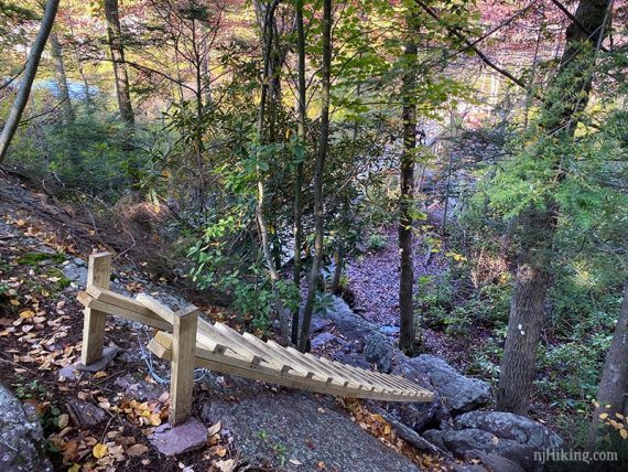
Note the jumble of logs on the right side as that is where this trail used to cross.
Continue on WHITE (Terrace Pond Circular) as it goes around the pond before moving away from it.
At the junction with BLUE (Terrace Pond North) GPS: BLUE-TPN3/WHT-TPC choose your own adventure :
(1) Turn RIGHT to get back on BLUE (Terrace Pond North) and continue the original route (adds 0.5 miles) or…
(2) Continue on WHITE/BLUE and in a bit it goes down stone stairs to another view of the pond (6.3 miles) before returning to the junction of BLUE and WHITE from before .
Once back at the point where you took the variation GPS:BLUE-TPN1/WHT-TPC – turn RIGHT and follow BLUE (Terrace Pond North) to BLACK SQUARE on BLUE (Terrace Pond North Spur).
—
Hiked: 10/3/20. New route; 7.4 miles.
Hiked: 10/19/19. Trail Blog: “Hiking the Terrace Pond North Trail in October“
Hiked: 6/22/14. Trail Blog: “Terrace Pond North – Ridge Vistas and around the Pond“
Hiked: 5/25/09. Trail Blog: “Terrace Pond North Trail“
Updated: 2/2022 – Trail map info. 10/2020 – re-hiked, changed description to reflect the new section of trail plus associated changes; added photos. 10/2019 – re-hiked, minor description changes. 6/24/14 – re-hiked, route/description revised, new GPX, new photos.