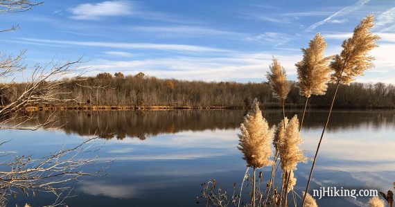
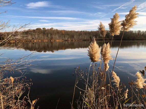
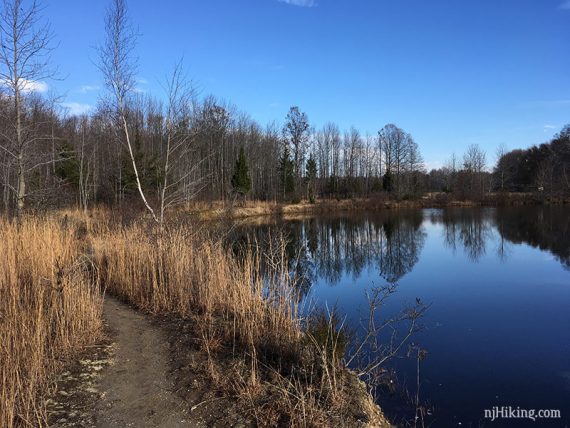
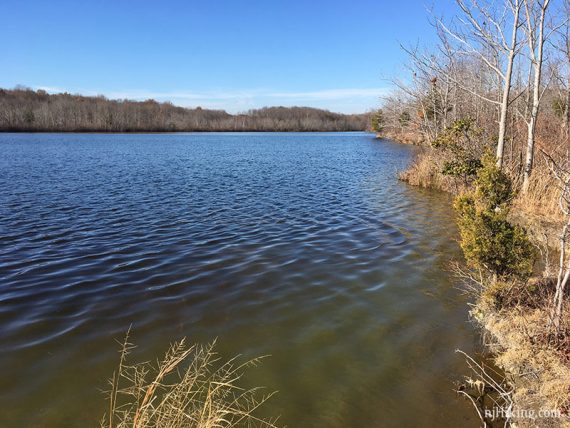
Small park with easy trails featuring McCormack Lake in the center.
4.6 or 5.5 miles, total round trip. Surface is gravel or dirt. Little elevation change. No dogs allowed.
| 4.6 miles | This hike guide: Detailed instructions and photos follow below. |
| Shorter | 1.0 – ORANGE only. 2.9 – WHITE – Maggie’s – WHITE – YEL – RED – PURPLE. 3.7 – WHITE – Maggie’s – BLUE – WHITE. |
| Longer | 5.5 – Add in ORANGE for a view of the lake from a different angle. Noted below. |
| Nearby | Mountain Lakes Open Space; Institute Woods; Davidson’s Mill Pond; Farrington Lake Trail; Ireland Brook Conservation Area; Forest Brook Trail; Tamarack Hollow; Van Dyke Farm; Bunker Hill; Thompson Park – Middlesex County; Thompson Park Conservation Area. |
Our two cents:
More of a casual hike destination but a good central Jersey option to get some miles in with plenty of views of McCormack Lake.
Maggie’s trail is probably the most interesting, as it extends into the lake on a skinny strip of land. ORANGE is a worthwhile add-on, or do on its own for an easy 1.0 miles.
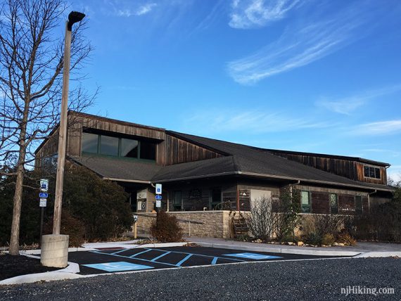
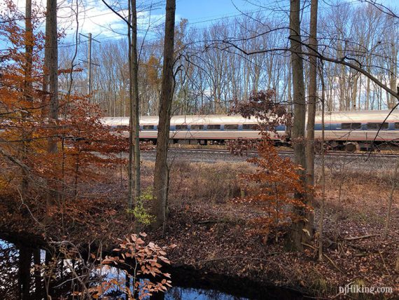
Nice nature center with many displays. Train noise in much of the park.
Updated: 3/2025 – Page refreshed, not re-hiked. 3/2023 – Minor edits, added photos, re-hiked. Older change log at page bottom.
Hike Info:
Map/Books:
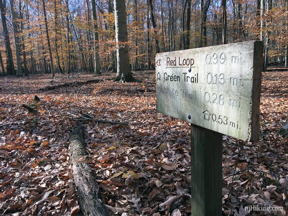
Print ahead or check the map box outside the visitor center entry door. Follow along on your smartphone with our Interactive Map link above. Our map shows this route as well as the ORANGE trail add-on.
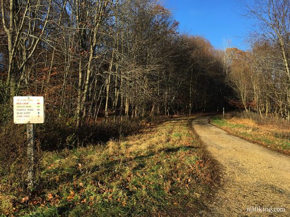
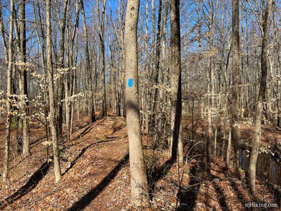
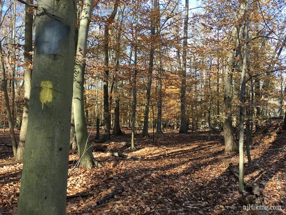
Some intersections have signs denoting color and direction. Similar route now appears in Best Day Hikes in New Jersey.
Parking: N40.34961° W74.55999°
80 Scotts Corner Rd, Cranbury, NJ 08512. Via various back roads depending on location, or Turnpike Exit 8a to Cranbury South River Road to 32W to Friendship Rd, R on Broadway, L on Scotts Corner, R into the park.
Restrooms:
Inside the visitor center. No portable toilet in the lot.
Hike Directions:
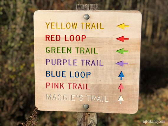
Overview: WHITE – Maggie’s – BLUE – WHITE – YELLOW – RED – YELLOW – PURPLE
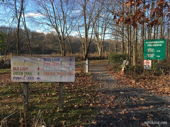
0.0 – Start following WHITE at the trail kiosk at the edge of the parking lot. This is a wide gravel path that runs along the water.
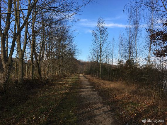
0.2 – Continue on WHITE. [YELLOW goes left. To the right is an opening in the trees to get closer to the water].
0.4 – Continue on WHITE. [YELLOW goes left].
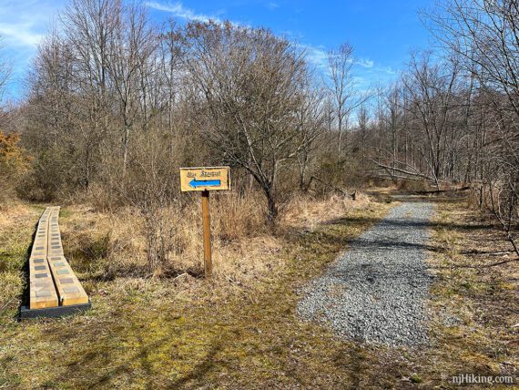
0.7 – Turn RIGHT and continue on WHITE. Shortly, turn RIGHT and take Maggie’s Trail out to the end and back.
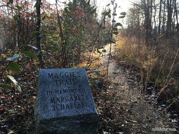
Who is Maggie? The trail honors Maggie Scrivo Schaefer, a preservation advocate who supported the acquisition of the 1,000 acres of open space, trails, and lake that became Plainsboro Preserve.
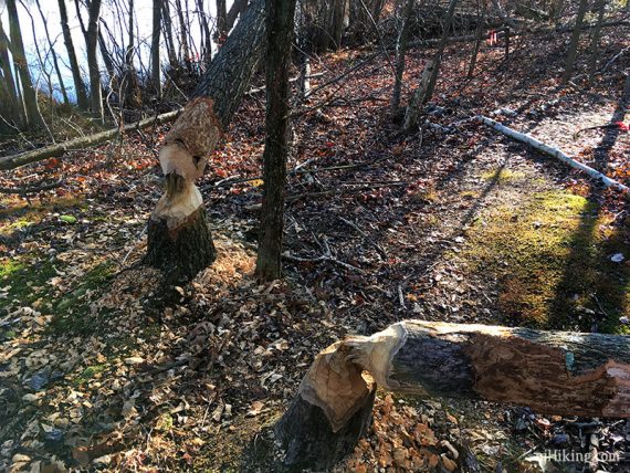
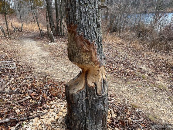
Busy beavers on Maggie’s Trail. You may notice a lot of gnawed-on trees all over the preserve.
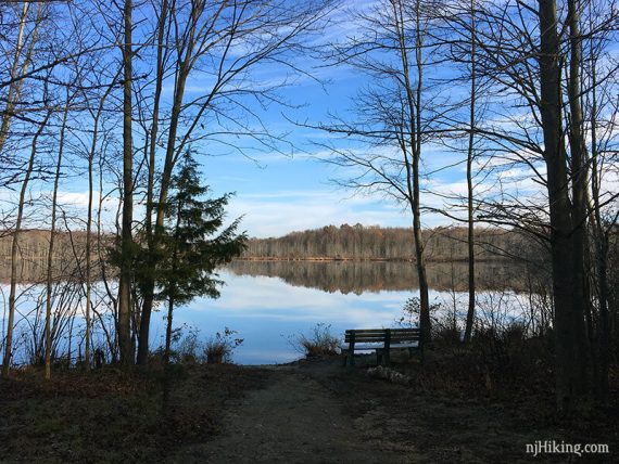
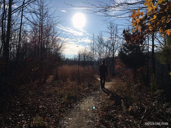
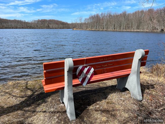
Benches and the view at the end of Maggie’s Trail. Retrace the route back to the stone marker.
1.3 – Turn RIGHT and start following BLUE. Veer RIGHT to keep on BLUE, passing a sign for BLUE SHORT CUT on the left.
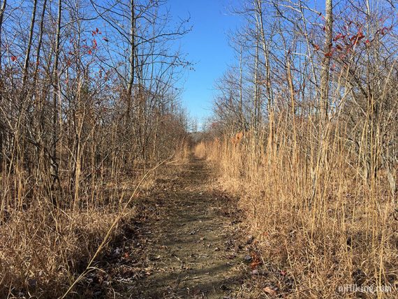
The trail enters the woods and meanders around some small hills.
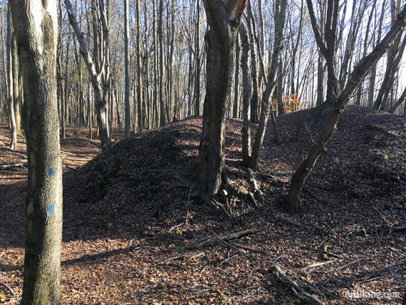
Fun Fact: These hills and others around the park are material taken from the lake called “dredge spoil”.
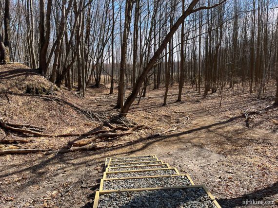
1.4 – BLUE splits in a Y that isn’t on the trail map. Keep LEFT to follow this route. [Or veer RIGHT to loop around a different way which meets up in just a bit].
Head down some steps to continue on BLUE. [The other side of BLUE meets back here].
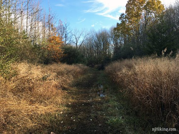
Continue on BLUE as it turns LEFT at the edge of a field.
2.1 – BLUE turns LEFT and follows a raised berm next to a stream.
Blue turns LEFT again and runs parallel to train tracks. Trains are fast and frequent but there is a large wooded separation between the trail and tracks.
2.5 – Continue on BLUE. [Pass BLUE SHORTCUT on the left which leads right back to Maggie’s Trail].
2.8 – BLUE curves around. Pass PINK markers on the left that are not on the map. As BLUE continues to curve around, another wide path joins in from the right.
3.1 – Turn RIGHT and follow WHITE again.
3.3 – Turn RIGHT and now follow YELLOW.
3.5 – At a bench, turn RIGHT to continue on YELLOW. [GREEN starts to the left]
3.6 – Follow YELLOW as it turns LEFT at a sign, then shortly turn RIGHT and start following RED. [Shorter: Continue on YELLOW instead and continue at 4.0 below].
RED loops around and comes back to YELLOW.
4.0 – Turn RIGHT to follow YELLOW again.
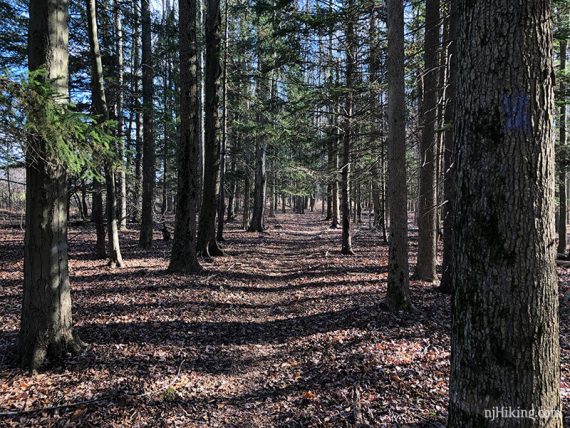
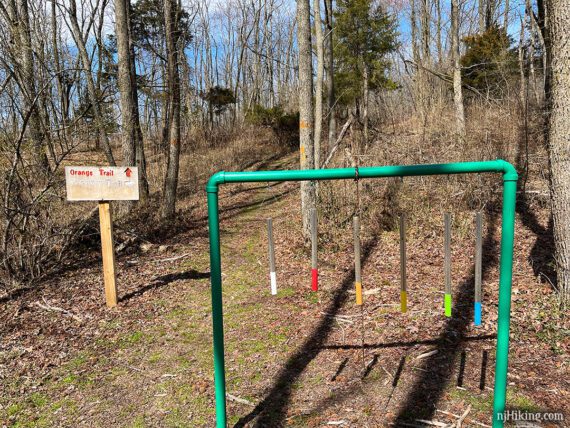
4.2 – Just before a field, turn RIGHT to now follow PURPLE though tall stands of evergreen trees. [YELLOW continues ahead, across the field, and will meet up with the WHITE trail from earlier].
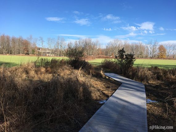
4.4 – PURPLE turns to the left and crosses a field back to the parking lot.
Optional ORANGE add-on:
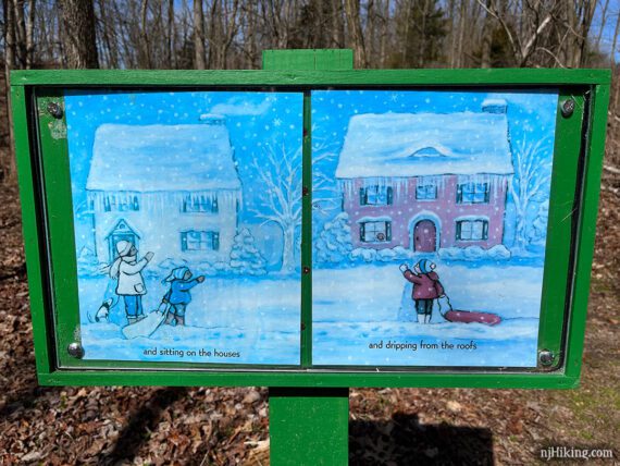
Continue through the parking lot and around to the opposite side of the visitor center to pick up ORANGE at the tree line. A Storybook Trail had been added to since we last hiked here.

Pages from an illustrated book are displayed at points along the trail for some bonus fun on a hike.
Continue on ORANGE past a metal chime (…of course you’ll need to ding it at least once. We certainly did…). To follow the Discovery/Story Book trail instead, turn right.
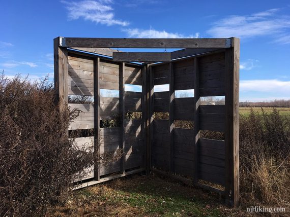
ORANGE approaches a field with a wildlife blind, then turns LEFT.
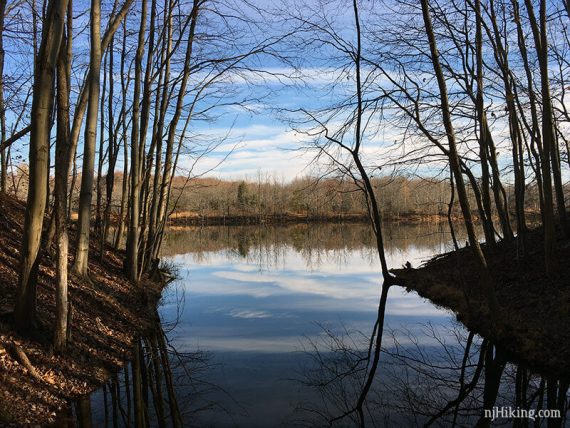
The trail continues out towards the edge of McCormack Lake.
Eventually ORANGE follows along the shore of the lake.
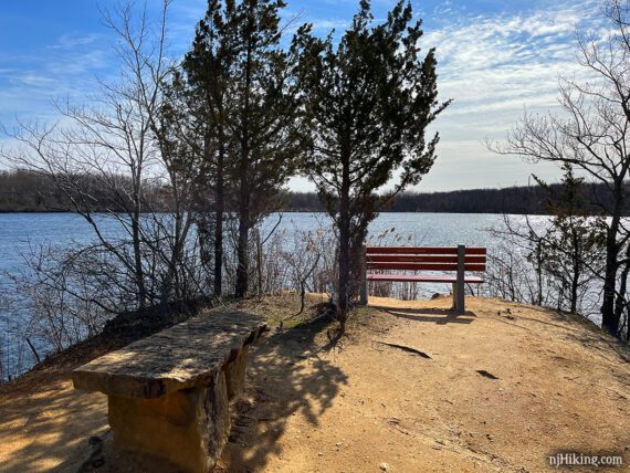
Follow ORANGE out to where it ends at bench and a nice view over Lake McCormack.
Backtrack, then followe ORANGE as it keeps right to hug the lake. There were a lot of gnawed trees in this section.
End up at the lawn in back of the nature center. Head around the right side of the building back to the parking lot.
—
Hiked: 3/18/23. With ORANGE.
Hiked: 11/25/17. With ORANGE.
Hiked: 4/7/13. Trailblog: “Plainsboro Preserve in Spring“
Updated: 4/2020 – Page refreshed, not re-hiked. 11/2019 – Noticed this now allows bow hunting certain days; closes entirely for firearm. Check park site for latest details. No-hunting park year-round.