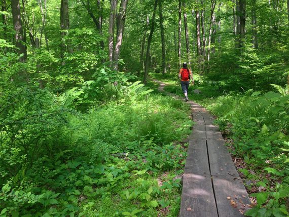
Hiking to Deer Park Pond in the Allamuchy Natural Area.
*This is an archive of our original hike guide – the route has since been updated, use Allamuchy Mountain – Deer Park *
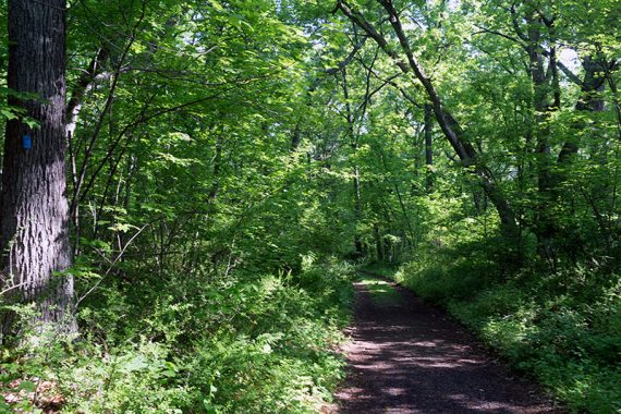
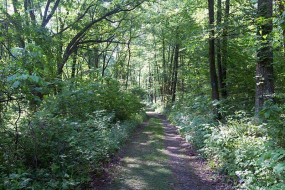
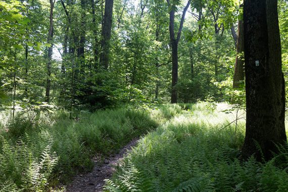
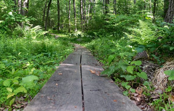
6.1 miles. Trail surface is dirt woods roads and trails, with few rocks, minor elevation changes, and generally not overgrown. Overall, an easy trail surface that is well maintained. Multi-use and a favorite area of mountain bikers.
- Shorter: Several options to take different trails to cut this shorter.
- Longer: Start at the 1st parking area and take WHITE or the park road to join this description.
- Nearby: Allamuchy Pond Trail; Allamuchy Mountain – North; Stephens State Park; Jenny Jump – Ghost Lake.
Our two cents:
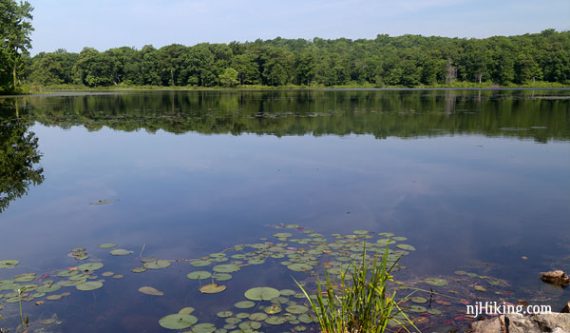
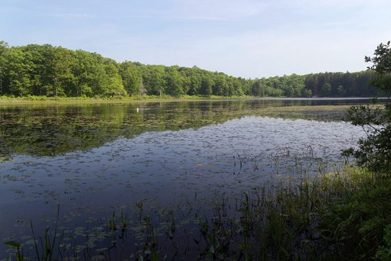
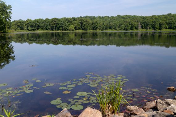
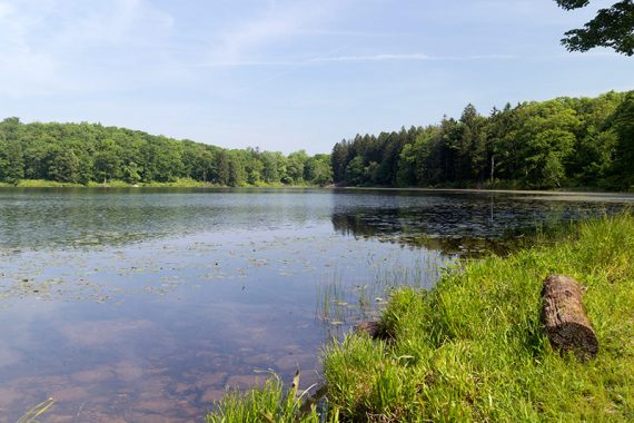
Pleasant hike with nice lake views. The trail surface is mild compared to most north Jersey trails.
Most hikers will want to park at the 1st lot and follow the WHITE (Deer Path) trail to meet up with this hike, or simply walk along Deer Park Road to the 2nd parking area – see parking notes.
Updated: 4/2020: Page refreshed, not re-hiked.
Map:
Recommend having the Morris County Highlands Trails to negotiate the network of both marked and unmarked trails in this area.
Books:
An extension of this hike from the first parking lot is in 60 Hikes Within 60 Miles: New York City and another variation is in Hiking the Jersey Highlands. The 1998 version of 50 Hikes in New Jersey has a variation of this hike.
Parking: N40.88787° W74.81405° [1st Parking Area]
Rt. 80 W to exit 19. Take 517 South. Left on Deer Park Road – there were no signs for the park at the turn or along the road.
Continue on Deer Park Road through a residential area until arriving at a small dirt lot that is the 1st parking area. There is a small shack of unknown purpose and a composting toilet.
Note: There are two parking areas along Deer Park Road. This first one is the main lot. We started our hike from the 2nd lot that is further along Deer Park Road.
To get to #2 requires driving on an unmaintained dirt road that is unsuitable for regular cars due to the amount of holes and ruts.
There isn’t a compelling reason to start at #2 but it does lessen the hike distance.
If you have a SUV or high-clearance AWD car and, like us, cannot help but go looking for a wee bit of adventure…. you can opt to start at lot #2:
[2nd Parking Area – rough dirt road] N40.89461° W74.80341°
Follow directions to lot #1 and then continue on Deer Park Road until arriving at an open area with no markings.
The trail starts at the far left corner where there is an overgrown P sign and a gate.
!!! Gate was up, could not access the other lot and it appears to have been closed awhile (10/2021).
Restrooms:
Composting toilet at the 1st parking lot (10/2021 not great).
Hike Directions:
Overview: BLUE (Lake View) – WHITE (Deer Path) – Unmarked Connector – BLUE (Lake View)
These directions start from parking lot #2 so distances will vary if starting from lot #1.
Be sure to have Morris County Highlands Trails. Some trails have multiple blazes even though the map might show it’s only the WHITE trail, for example.
- Deer Path (WHITE) trail from lot #1 will add about 1.5 mile.
- Deer Park Rd from lot #1 to lot #2 will add about 1 mile.
0.0 – From lot #2, the trail starts at the far left corner near an overgrown P sign and a gate.
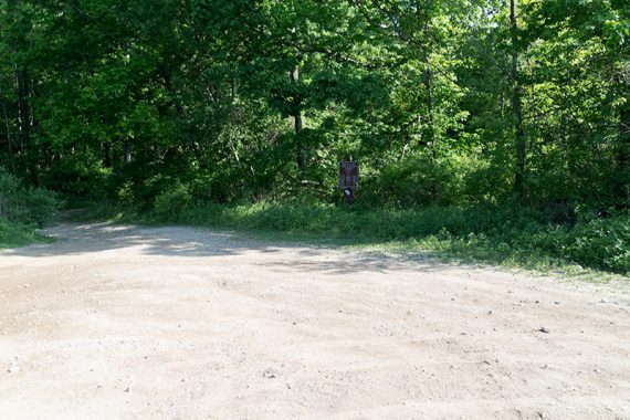
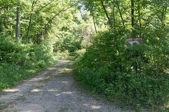
Start following a dirt road that is the BLUE (Lake View) trail.
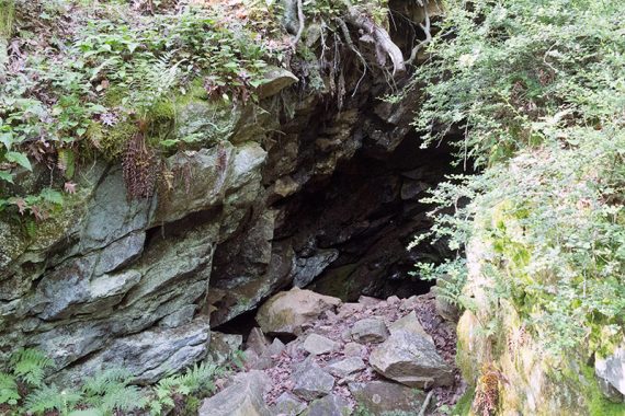
0.2 – An old mine entrance is on the left.
0.4 – Continue on BLUE (Lake View). [Pass the start of WHITE (Deer Path) on the right].
0.7 – Continue on BLUE (Lake View) as it curves to the right. [Pass a connector trail, blazed with RED and WHITE on a wooden post].
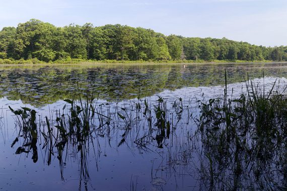
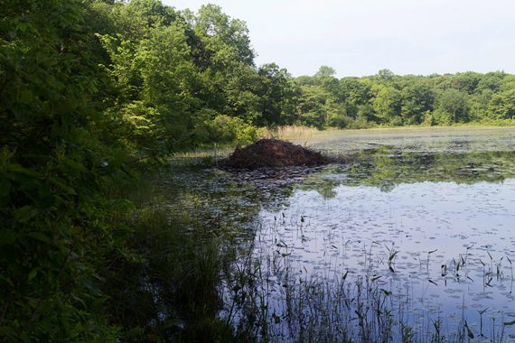
1.3 – Continue on BLUE (Lake View), passing on the left 2 areas to get a close view of the pond, the 2nd is more open.
A beaver dam is visible near to shore.
According to the map, WHITE (Deer Path) should come in and co-join BLUE (Lake View) for a bit but we totally didn’t notice it.
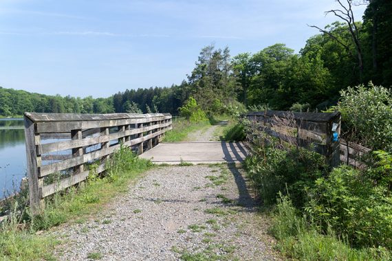
1.6 – Cross a large bridge with wide views of Deer Park Pond. Just past the bridge is a shady spot near the lake.
1.7 – Veer RIGHT and now follow WHITE (Deer Path).
[Option: Instead, continue on BLUE (Lake View) to shorten the hike by about 1 mile. Pick up the description at 3.4 below]
2.2 – Continue on WHITE (Deer Path). [Pass GREEN (Waterloo South) on the right].
2.8 – Continue on WHITE (Deer Path). [Pass ORANGE (Waterloo North) on the right].
3.4 – Continue on WHITE (Deer Path). [Pass BLUE (Lake View)]
3.9 – Turn LEFT to continue on WHITE (Deer Path).
[Straight is an unmarked trail on the map that was blazed YELLOW on the trail. The map shows this unmarked trail as looping around to access the scenic overlook on Rt. 80 Eastbound.
We took it for a little bit to see where it lead before turning around. Instead of the expected loop, it crosses a break in a fence and starts to curve towards the rest area on Rt. 80 Eastbound so we assume it ends up there.]
4.2 – Continue on WHITE (Deer Path). A somewhat faint side trail on the right goes to the scenic overlook on Rt. 80.
————————
Option: Follow this unmarked side trail over a downed log, through a break in a fence, and downhill to the overlook. We used one of the picnic tables there for our break.
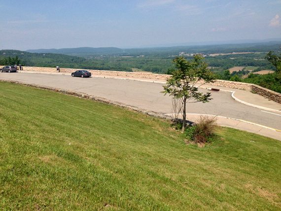
Just keep track of where you come out of the woods as the path isn’t obvious once at the overlook.
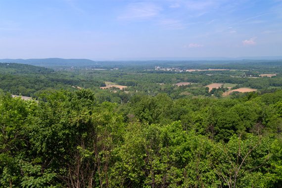
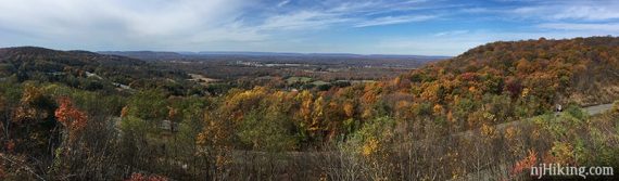
Round trip adds about 0.4 to the hike and is worth it for the view of the Delaware Water Gap in the far distance, with Pennsylvania’s Mt. Minsi on the left side of the “gap” and New Jersey’s Mt. Tammany on the right…
…and for the confused stares from people parked at the overlook when we popped out of the woods, seemingly from nowhere, and strolled across the lot and down the grassy hill in our hiking gear… totally worth it.
————————
5.1 – Continue on WHITE (Deer Path). [Pass Barberry (RED)].
5.4 – At a Y-intersection with no trail markings, veer LEFT and now follow an unmarked trail.
[The right fork is actually WHITE (Deer Path) but was not marked here].
Shortly, arrive at BLUE (Lake View) by a wooden post with RED and WHITE markings (same spot as earlier, at 0.7).
Turn RIGHT and retrace BLUE (Lake View) back to parking lot #2.
—
Hiked: 10/24/21. Variation, parking lot 2 gated.
Hiked: 5/29/16.
Hiked: 10/30/04.