Rugged hike along Splitrock Reservoir to a nice viewpoint and break spot.
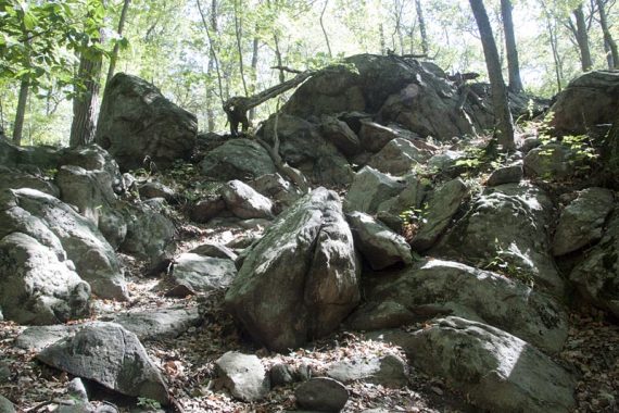
6.2 miles, total out-and-back. Typical rugged Highlands terrain with multiple small elevation changes. Some scrambling.
- Longer: 8.4 miles – hike to another viewpoint noted below.
- Longer – This is in the middle of a 19.4 trail so you can go farther in either direction.
- Longer – do the whole Splitrock Reservoir Loop.
- For other hikes on the Four Birds Trail in nearby Farny State Park, try Four Birds Trail – Wildcat Ridge or Four Birds Trail (North).
- Nearby: Pyramid Mountain – Tripod Rock; Valhalla Falls – Turkey Mountain; Turkey Mountain- Perimeter Loop; Mahlon Dickerson/Beaver Brook to Lost Lake; Butler (Kakeout) Reservoir.
- Kayak it: Splitrock Reservoir Kayak.
Hike Info:
Our two cents:
Manageable mileage with a nice view/break spot destination as your reward makes this a solid pick for the average hiker – but not ideal for beginners.
Rocky, rugged terrain with a potentially tricky stream rock-hop crossing that can be tricky when water is high. Trail is well-blazed but sometimes the marks/trail might take a minute to find.
Fun Fact: Though often spelled “Split Rock Reservoir”, it is actually one word – “Splitrock“. The road it is on is “Split Rock”.
VIDEO: This hike ends at :55 seconds in the video (the rest is from the full Splitrock Reservoir Loop hike).
Updated: 11/2022 – Re-hiked as part of the longer loop; description updated, photos added. Older change log at page bottom.
Map:
Morris County Highlands Trails is what should be used. Follow along on your smartphone with our Interactive Map link above.
There is another link in the Hike Info box above but it’s not as up-to-date or detailed. Most of this route falls under Wildcat Ridge W.M.A. but also a bit of Farny State Park.
Books:
This hike is part of a longer hike in Hiking the Jersey Highlands and detailed trail descriptions can be found in the The New Jersey Walk Book – but both of these books are hard to find now.
Parking: 40.96252, -74.45800
“Split Rock Reservoir Boat Launch”, 342 Split Rock Rd, Boonton, NJ 07005. Large dirt/gravel lot off of Split Rock Road.
This often fills up and if it is, you are out of luck…. only park in the lot, you will get ticketed if you park along the road.
From the south: 287N to exit 43, at the end of the ramp turn left, then right onto Fanny Rd to Powerville, left on Valley, right on Rockaway Valley, stay left onto Split Rock and follow to parking lot.
From the south, alternate: 287N to Rt 80 W to exit 37 for Rt 513/Green Pond Rd. Right on Meridian. Left on Lyonsville. Left onto Split Rock Rd to parking lot.
If you are traveling from elsewhere the exit may be different, so you’ll want to check directions from where you are. Split Rock road in good shape as of 9/2022.
Restroom:
Portable toilet in the parking lot, as of 9/2022. The Fanny Road route doesn’t offer much in the way of restroom possibilities.
If you don’t want to chance the toilet not being there or prefer a real bathroom… use the alternate Rt. 80 route for gas stations and a Dunkin once getting on 513.
Hike Directions:
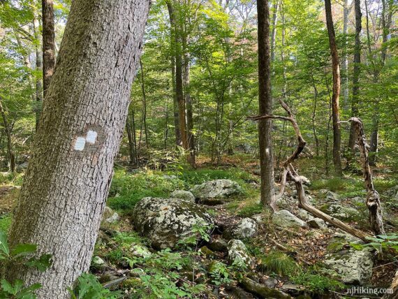
Entire trail is blazed WHITE.
0.0 – With your back to the parking lot, turn RIGHT and walk down the dirt road and over a bridge.
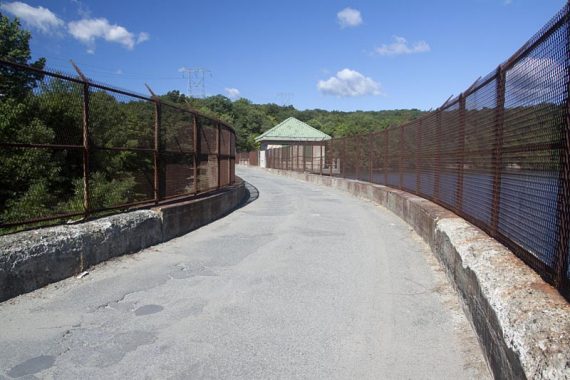
There are views of Splitrock Reservoir from the bridge, through a chain link fence. Keep walking down the dirt road.
0.5 – Watch for WHITE blazes on the RIGHT. These were set away from the road and hard to spot. There was a large rock at the side and it feels like you’re walking on the road longer than a half mile.
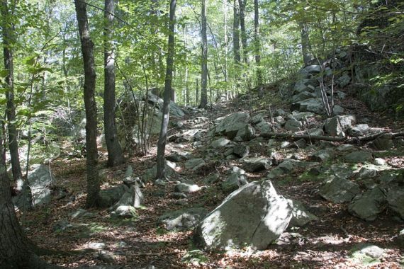
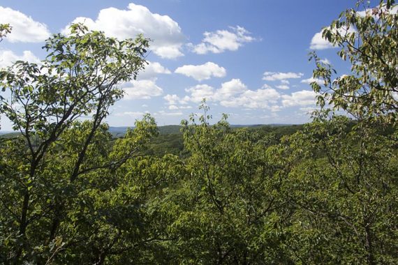
Turn RIGHT to start following Four Birds Trail (WHITE). Scramble up a hill immediately.
0.8 – Pass an unmarked side trail on the right leads to a viewpoint at the water’s edge.
Optional: We didn’t notice this trail in 2022 (had a small orange flag in 2018) and the latest trail map no longer has a star marked there…. so it’s up to you if you want to go take a looky. The viewpoint was nice but the trail had trash and an old car.
Continue following Four Birds Trail (WHITE).
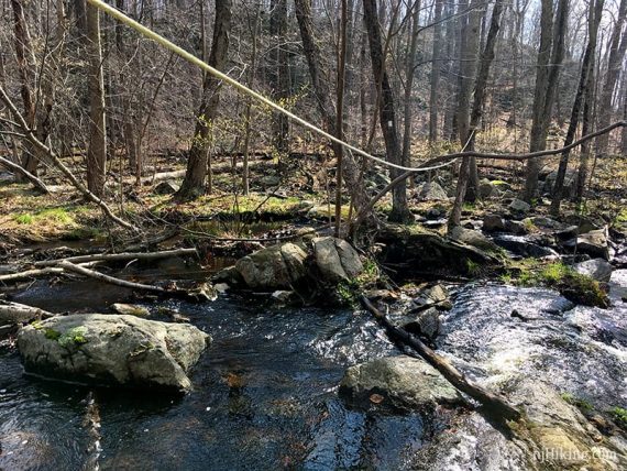
0.9 – Cross a wide rocky wet area. We’d had drought all summer so the crossing was easy:
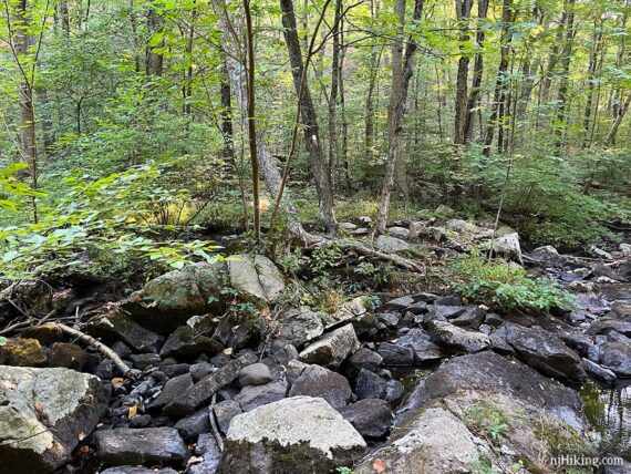
But this can be tricky when there is more water (photo below). This is basically the narrowest place to cross, but you might find better spots up or down stream. Note: the rope (2018) was no longer there.
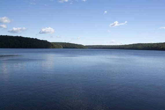
1.9 – Limited viewpoint over the reservoir. In the next section there are a few instances where the trail may be hard to follow in spots.
3.1 – To the right is a rocky piece of land jutting out into the water a bit. There may be a rock hop over a little water or it could be dry (in 9/2022 this was dry and overgrown).
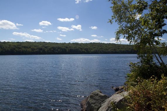
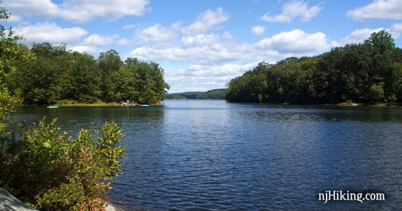
From this nice break spot there are fantastic views of Splitrock Reservoir in either direction.
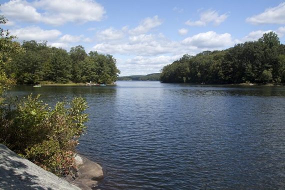
// Optional extension: Continue on and turn around at some point later… and at 4.2 is another view of the reservoir and a break spot off to the right, on an open rocky point.
—
Hiked: 9/3/22, 4/28/18, 8/30/15, 11/2/08, 9/5/10 – As part of the whole Splitrock loop.
Hiked: 11/17/2006.
Hiked: 4/15/2006. Less; 5.0 miles.
6/2020 – Page refreshed, not re-hiked. 4/2018 – Re-hiked as part of the longer loop; description updated.