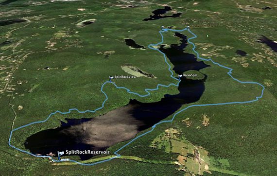
Challenging loop around Splitrock Reservoir with views of the reservoir and Misty Pond from Indian Cliffs.
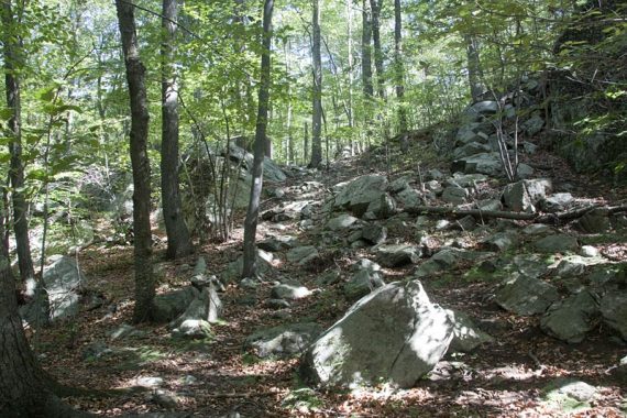
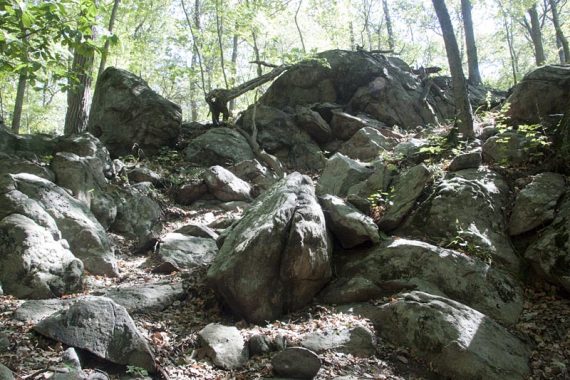
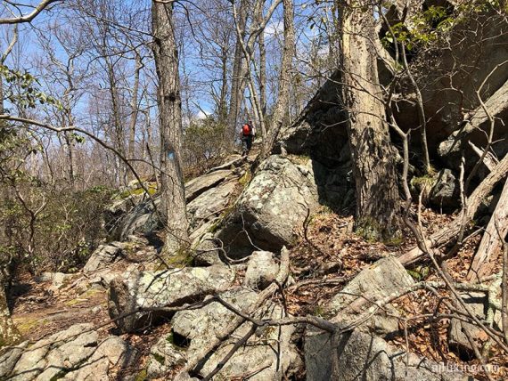
11.1 miles; challenging. Very rocky, with the relentless minor elevation changes typical of Highlands terrain; some scrambling.
- Shorter: An out-and-back segment of this hike: Four Birds Trail.
- Longer: Both Four Birds and Splitrock trail connect below Splitrock Road allowing for a bit longer loop.
- Alternates in the area: Four Birds Trail is 19.4 miles one way – do a long out-and-back of part of it instead try Four Birds Trail – Wildcat Ridge or Four Birds Trail (North).
- Nearby: Pyramid Mountain – Tripod Rock; Valhalla Falls – Turkey Mountain; Turkey Mountain- Perimeter Loop; Mahlon Dickerson/Beaver Brook to Lost Lake; Butler (Kakeout) Reservoir.
- Kayak it: Splitrock Reservoir Kayak.
Hike Info:
Our two cents:
We’ve done this loop in both directions and think it’s better clockwise (the directions below) because that puts the “easier” rocky woods road sections (Charlottesburg Road) at the end.
Clockwise also offers some bailout options. Charlottesburg Road is a woods along the east side that intersects with Splitrock (BLUE). It’s is easier and a bit shorter than continuing on rugged trail. Two bailout options are noted in the description.
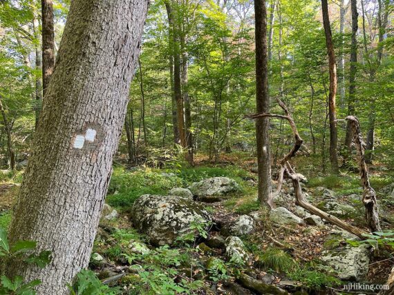
Several rock-hop water crossings can be tricky when water is high. The entire route is well-blazed but sometimes the marks/trail might take a minute to find.
Either direction requires a dusty walk along Split Rock Road at the beginning and end of the hike.
Fun Fact: Though often spelled “Split Rock Reservoir”, it is actually one word – “Splitrock“. The road it is on is “Split Rock”.
Updates: 11/2022 – Added photos and more directions, archived old pics to Trailblogs; re-hiked 9/2022. Removed optional side trip to the stone bridge on YELLOW due to Camp Winnebago trail closures. Older change log at page bottom.
Related: Challenging Hikes in NJ
Map:
Morris County Highlands Trails is what should be used. Follow along on your smartphone with our Interactive Map link above.
There is another link in the Hike Info box above but it’s not as up-to-date or detailed. Most of this route falls under Wildcat Ridge W.M.A. but also a bit of Farny State Park.
Parking: 40.96252, -74.45800
“Split Rock Reservoir Boat Launch”, 342 Split Rock Rd, Boonton, NJ 07005. Large dirt/gravel lot off of Split Rock Road.
This often fills up and if it is, you are out of luck…. only park in the lot, you will get ticketed if you park along the road.
From the south: 287N to exit 43, at the end of the ramp turn left, then right onto Fanny Rd to Powerville, left on Valley, right on Rockaway Valley, stay left onto Split Rock and follow to parking lot.
From the south, alternate: 287N to Rt 80 W to exit 37 for Rt 513/Green Pond Rd. Right on Meridian. Left on Lyonsville. Left onto Split Rock Rd to parking lot.
If you are traveling from elsewhere the exit may be different, so you’ll want to check directions from where you are. Split Rock road in good shape as of 9/2022.
Restroom:
Portable toilet in the parking lot, as of 9/2022. The Fanny Road route doesn’t offer much in the way of restroom possibilities.
If you don’t want to chance the toilet not being there or prefer a real bathroom… use the alternate Rt. 80 route for gas stations and a Dunkin once getting on 513.
Books:
This hike (but in the opposite direction) is in Hiking the Jersey Highlands. Detailed trail descriptions can be found in the The New Jersey Walk Book.
Hike Directions:
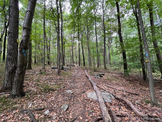
OVERVIEW: Road – Four Birds Trail (WHITE) to Splitrock (BLUE ) – Road. There are unmarked trails or woods roads which we haven’t marked or noted, just stick to the blazed trails.
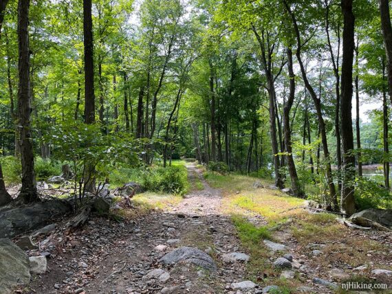
0.0 – With your back to the parking lot, turn RIGHT and walk down the dirt road and over a bridge.
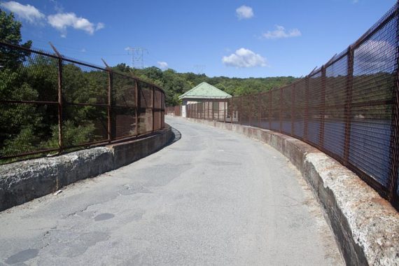
There are views of Splitrock Reservoir from the bridge, through a chain link fence. Keep walking down the dirt road.
0.5 – Watch for WHITE blazes on the RIGHT. These were set away from the road and hard to spot. There was a large rock at the side and it feels like you’re walking on the road longer than a half mile.
Turn RIGHT to start following Four Birds Trail (WHITE). Scramble up a hill immediately.
0.8 – Pass an unmarked side trail on the right leads to a viewpoint at the water’s edge.
Optional: We didn’t notice this trail in 2022 (had a small orange flag in 2018) and the latest trail map no longer has a star marked there…. so it’s up to you if you want to go take a looky. The viewpoint was nice but the trail had trash and an old car.
Continue following Four Birds Trail (WHITE).
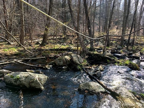
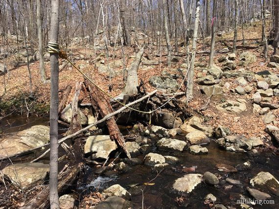
0.9 – Cross a wide rocky wet area. We’d had drought all summer so the crossing was easy:
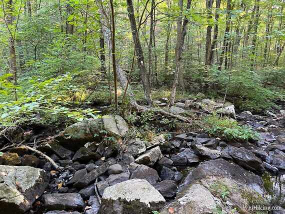
But this can be tricky when there is more water (photo below). This is basically the narrowest place to cross, but you might find better spots up or down stream. Note: the rope (2018) was no longer there.
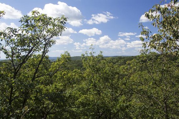
1.9 – Limited viewpoint over the reservoir. In the next section there are a few instances where the trail may be hard to follow in spots.
3.1 – To the right is a rocky piece of land jutting out into the water a bit. There may be a rock hop over a little water or it could be dry (in 9/2022 this was dry and overgrown).
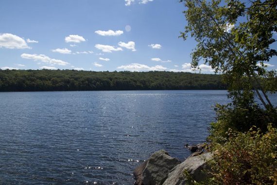
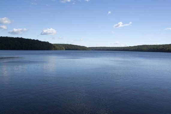
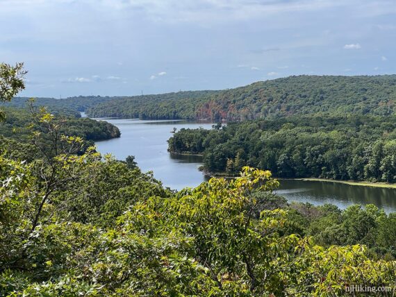
From this nice break spot there are fantastic views of Splitrock Reservoir in either direction.
Continue following Four Birds Trail (WHITE) as it follows closer to the reservoir. Not long after the break spot, cross a stream that empties into the reservoir.
This was so dry 9/2022 that we didn’t notice it, while in 2018 there was a rope to help cross:
4.0 – A limited view of the reservoir (marked with a star on trail map), but the next one is better.
4.2 – Off to the right is an open rocky point that can be walked out to get another view of Splitrock. Some of the islands on the reservoir can be seen from here.

4.5 – Keep following Four Birds Trail (WHITE) straight where the water is nearby in a small cove just off to the right. [YELLOW starts to the left and follows a woods road to Durham Pond – but this is no longer on the latest trail map].
4.6 – Keep following Four Birds Trail (WHITE) past the start of Beech (ORANGE).
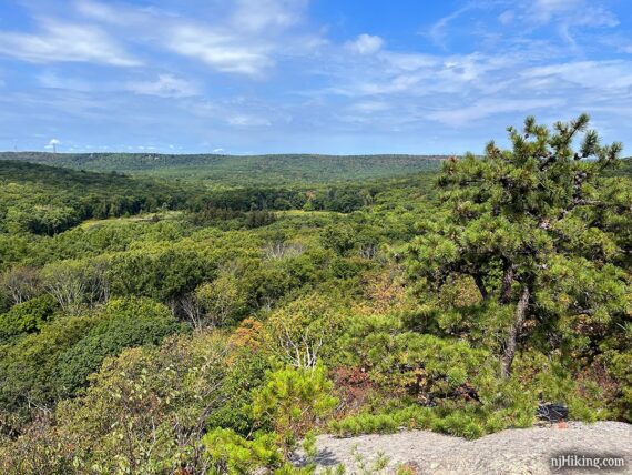
5.4 – The trail climbs to a limited view of the open rock face called Indian Cliffs that is across the reservoir. You might need to move around to find a spot through the trees to see the cliffs.
Oh and you’ll be hanging out on these cliffs in about a half hour or so. Probably having a snack. Mmmm snacks.
5.5 – Keep following Four Birds Trail (WHITE) when RED comes in from the right, is briefly co-joined, then leaves to the left.
Shortly, turn RIGHT and now follow Splitrock (BLUE). [Four Birds Trail (WHITE) continues ahead, there are yellow signs for Four Birds north and south plus some old emergency markers]
Splitrock markers are light blue but there are some dark blue ones here and there too but it’s the same trail.
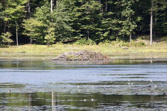
5.7 – The trail skirts Misty Pond with a beaver dam out in the middle of it.
You are now north of the reservoir and are heading to the east side.
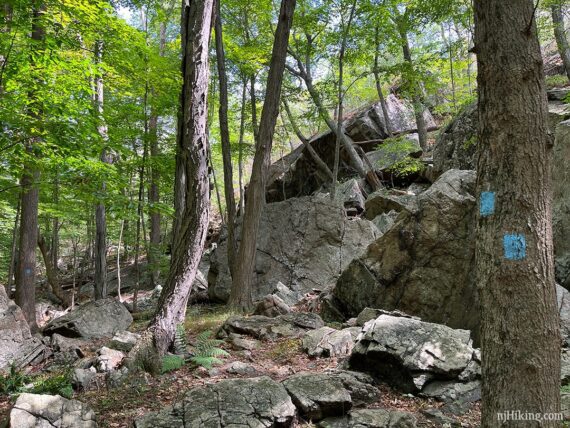
5.9 – Cross a woods road. [RED is to the right]. Shortly, climb through and up a steep rocky section.
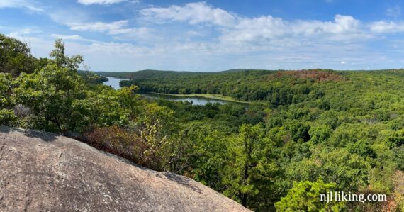
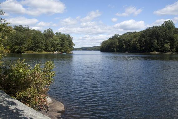
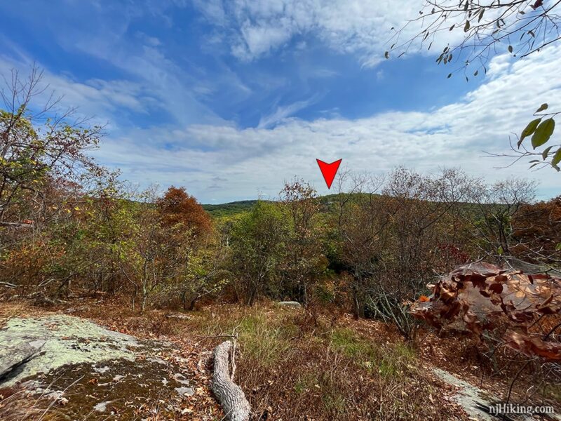
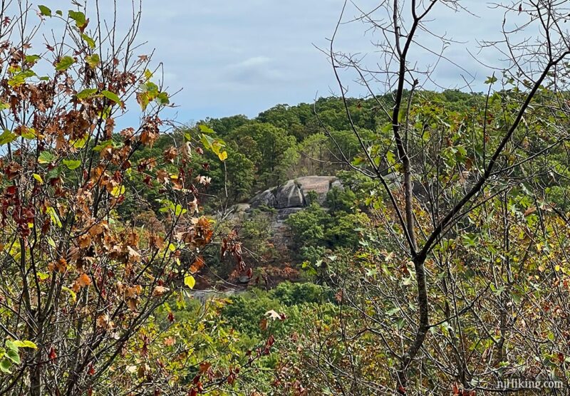
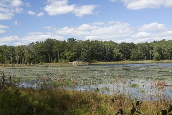
6.2 – Arrive at Indian Cliffs with fantastic views over Splitrock Reservoir and of Misty Pond. There is a large rock slab to take a break on (but little shade).
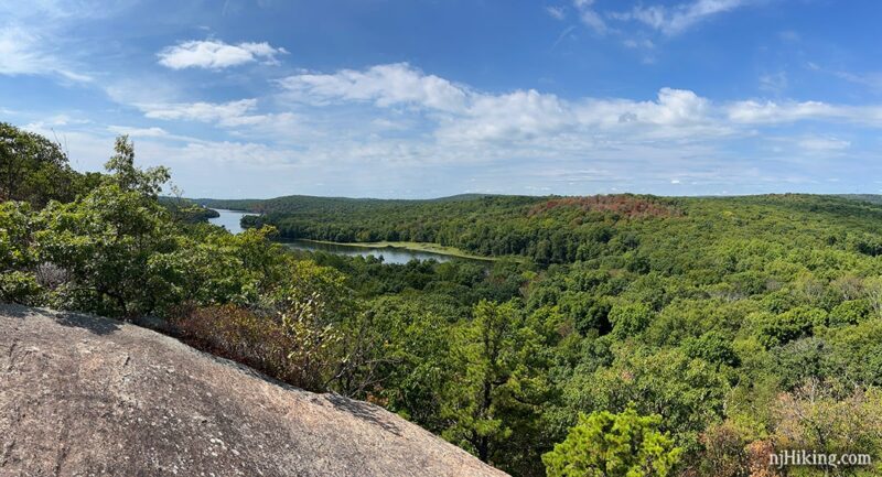
Get a good look at the northern end of Splitrock Reservoir from this viewpoint.
Looking north towards Misty Pond (that you just hiked past) from atop Indian Cliffs. The pond is the lighter green indented area in the far left of this photo.
Continue following Splitrock (BLUE) straight. (Don’t turn left just after the viewpoint, that’s not the BLUE trail).
6.4 – Pass Beech (ORANGE) on the right.
6.7 – Continue following Splitrock (BLUE) as it crosses an unmarked eroded woods road (Charlottesburg Rd). The trail moves closer to the shore of Splitrock Reservoir.
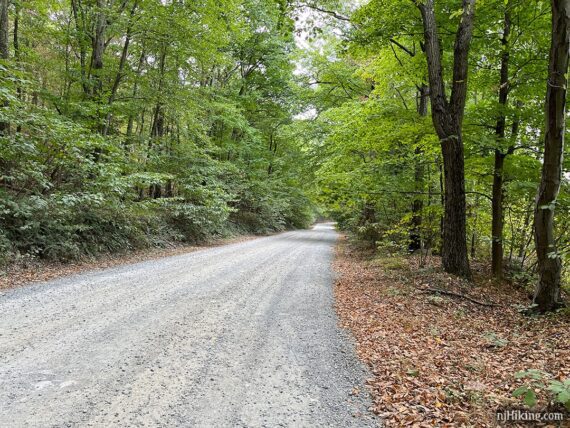
7.0 – Turn RIGHT to continue on Splitrock (BLUE) as it follows Charlottesburg Rd.
7.6 – Continue following Splitrock (BLUE) as it leaves Charlottesburg Rd, heading east back onto a trail.
// Bailout Option 1: Had enough? Stay on Charlottesburg Rd instead. This replaces 2.1 miles of rugged steep hiking with 1.2 miles of woods road. Pick up the directions at 9.7 below by turning RIGHT back onto Splitrock (BLUE). There isn’t anything utterly amazing in this section that you’ll miss. //
There is a starred view on the trail map but there really wasn’t anything, must be grown over. There are a few large and interesting rocks along the way.

8.8 – Just after that pointy rock is a faint unmarked trail. You probably wouldn’t notice it unless you’re looking for it, though there is a small rock on the ground at the intersection.
This unmarked trail leads to “Double D Peak”. We finally checked this out after wondering about this section of the map for years. We don’t think it’s worth the effort but give it a whirl if you’re curious.
9.7 – Continue following Splitrock (BLUE) as it crosses Charlottesburg Rd for the final time.
// Bailout Option 2: Turn left on Charlottesburg Rd and take that back instead. This replaces 1.0 miles of potentially overgrown or muddy trail with 0.9 miles of woods road. //
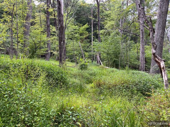
Splitrock (BLUE) skirts closer to the reservoir. The first section was overgrown and grassy, and in wetter years we’ve run into muddy sections in a few spots.
10.7 – Arrive at Splitrock Road. Turn RIGHT onto the road and follow it back to the lot.
Note: Just before Splitrock Road, the map shows an unmarked trail leading back to the lot but we’ve never noticed it, so instead of bushwhacking around looking (and delaying our post-hike treat more…) we just always take the road.
—
Hiked: 9/3/22.
Hiked: 4/28/18. Trail Blog: “Splitrock Reservoir in Spring“
Hiked: 8/30/15.
Hiked: 9/5/10. Trail Blog: “Splitrock Reservoir Loop on Labor Day“
Hiked: 11/2/08. Trail Blog: “Farny – Split Rock Reservoir Loop“
Updates: 7/2020 – Added photos, minor tweaks. 4/28/18 – Re-hiked; description updated. 9/10/15 – Description updated, GPX added.