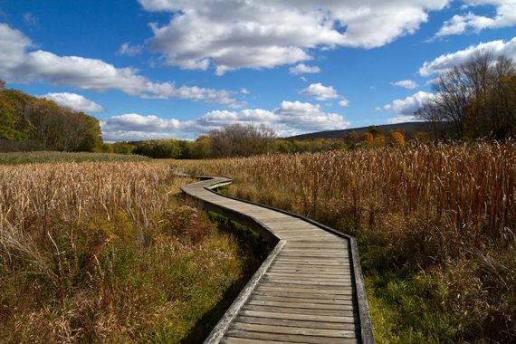
Hike boardwalks, a suspension bridge, hardwood forest, fields of wildflowers, train tracks, a cow pasture, and a boulder field before steeply climbing the “Stairway to Heaven” to Pinwheel’s Vista.
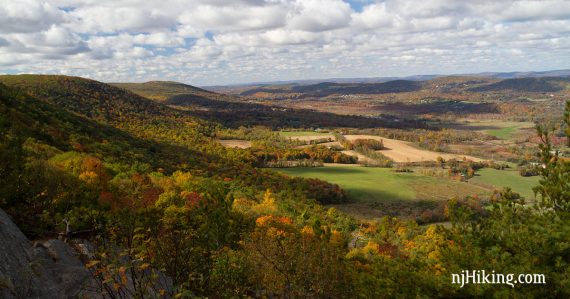
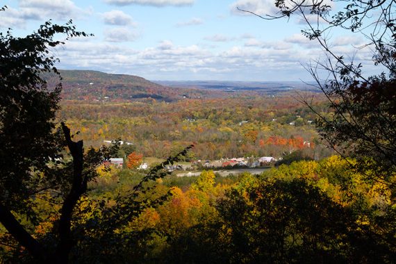
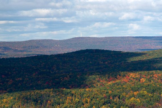
From one of the best viewpoints in New Jersey, “Pinwheel’s Vista”, the Kittatinny Mountains are can be seen in the distance, farms in the valley below, and on a clear day, the High Point Monument.
Miles: 7.3 total, round trip. Trail surface ranges from super-duper-easy-peasy boardwalks to flat, hard packed to dirt to serious rocky sections. The “Stairway to Heaven” is a series of rock slab steps steeply switch-backing up Wawayanda Mountain.
| 7.3 miles | This hike guide: Detailed instructions, photos, and video follow below. |
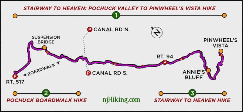
| Note: There are three popular hikes on the Appalachian Trail in this area, shown on the diagram below: 1. Stairway to Heaven: Pochuck Valley to Pinwheel Vista – This hike. 2. Pochuck Boardwalk – Appalachian Trail – 2.0 miles, from this parking area. 3. Stairway to Heaven NJ – 2.6 miles. | |
| Nearby Hikes | Cedar Swamp and Lake Lookout; Lake Loop and Twin Bridges; Hoeferlin, Cedar Swamp, Red Dot; Iron Mountain and Hoeferlin Loop; Wallkill River NWR. |
| Nearby Kayaking | Wawayanda Lake via Kayak. |
Our two cents:
This is a popular area – everything from people taking a casual stroll to Appalachian Trail thru-hikers – so don’t expect solitude.
Most people were on the boardwalk section in the beginning, or on the section from the lot on 94 to Pinwheel’s Vista. Excellent for fall foliage.
Hike Info:
Map/Books:
Northern New Jersey Highlands Trails Map map set. Follow along on your smartphone with our Interactive Map link above.
Hiking New Jersey (2023) has a detailed description and a diagram of the 7.4-mile route. 50 Hikes in New Jersey and Hiking the Jersey Highlands has the popular short route (only 2.5m round trip) from the Rt 94 parking up to Pinwheel.
Updates: 3/2026 – Minor edits; not re-hiked. 12/2024 – Minor edits; not re-hiked.
Restrooms:
None. Gas stations and fast food in Butler (more options), or in Vernon.
Refreshments:
Near the Rt 94 road crossing is Heaven Hill Farm market (ice cream, bakery mmmm cider donuts) and a hot dog stand. Lots of stuff in the Vernon area. We like Daily Bean (coffee, sandwiches, garden seating) on Rt 515 and Alias Brew Works further away off of Rt 94.
Parking: 41.234733, -74.480867 [Rt 517 lot]
Stairway to Heaven, 893 County Rd 517, Vernon, NJ 07418. Rt 287 to Rt. 23. Follow 23 to the exit for 515N. Left onto 644 (Vernon Crossing). Right on 517.
Sign with a hiker symbol is at the trailhead. Parking for roughly 15-20 cars along the shoulder of 517. Obey all posted signage; there are no parking signs at either end of the road. Do not park on surrounding streets. Parking illegally in the area may generate a ticket.
**NOTE** This trailhead is in a residential area that is experiencing issues with the parking situation. Please be respectful of the residents and their property. As always, Leave No Trace – trash or otherwise.
Weekends/Holidays from 6 a.m. to 6 p.m. NO PARKING is in effect on Carol Drive, Meadowlark Drive, Ann Place, Cove Court, Vlietstra Drive, Thistle Avenue, Ivy Place and Old Glenwood Circle. Parking on these streets is permit-only for residents. Vernon Police Press Release.
–Alternate lot for boardwalk: 41.231694, -74.462111 [Canal Road North]
23 Canal Rd, Vernon Township, NJ 07462 – Should take you to the intersection of Canal Road and Bucky Lane. Small lot is on Canal Road with room for about 10 cars.
Follow the path until it intersects with the Appalachian Trail. Turn RIGHT onto that. It’s a footpath for a bit before meeting up with the boardwalk.
Hike Directions:
Overview: Appalachian Trail (WHITE) – BLUE spur trail – then backtrack.
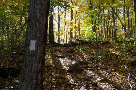
Follow the WHITE blazes of the Appalachian trail for the entire route, except for the BLUE side trail to the vista.
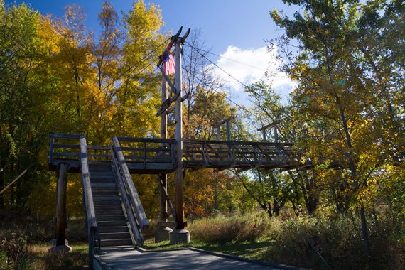
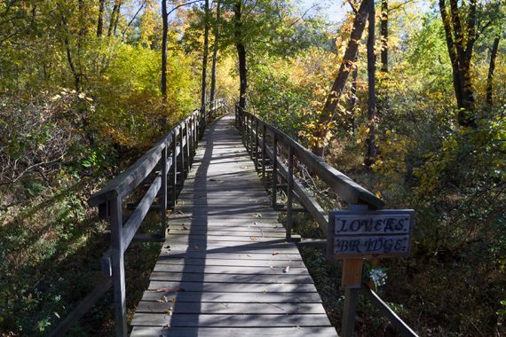
0.0 – From parking on the side of Rt. 517, follow a slight path along the road to a trail kiosk and turn onto the start of the boardwalk.
There may be turtles in the large green pool of muck crossed on a wooden bridge.
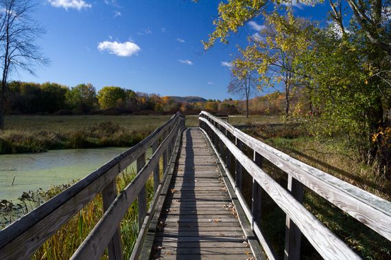
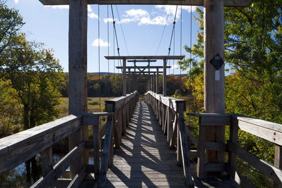
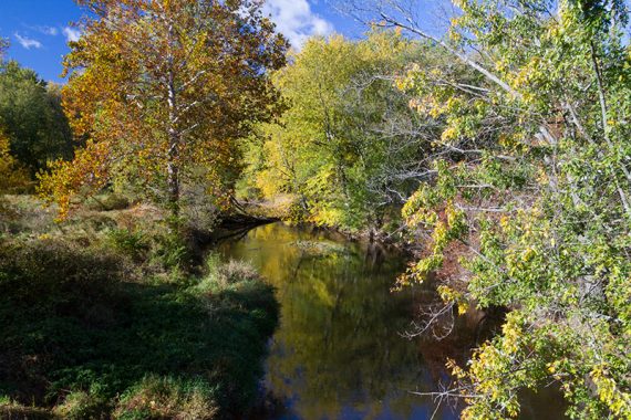
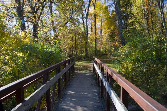
A little further, cross Pochuck Creek on the very large Pochuck Suspension Bridge.
1.0 – Boardwalk ends, start walking in a forest.
1.3 – Walk through an opening in a wooden fence to a wide woods road. (The woods road is a bicycle path, look left and there is a sign. On maps, the path may be marked “Canal Road”.)
Turn RIGHT down the woods road. Cross a bridge, then quickly turn LEFT to continue on the Appalachian Trail. [The woods road continues straight]
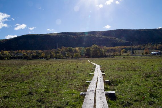
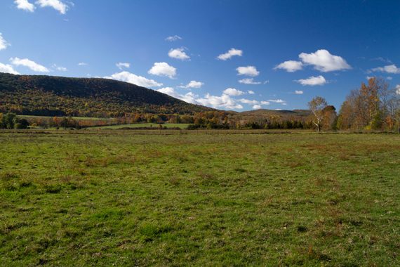
Continue through a mix of forest and fields with tall grass.
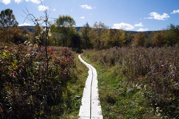
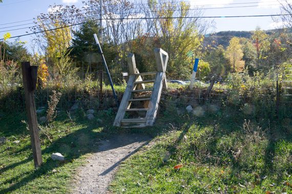
Some areas are on plank walkways, and there is a wire fence to cross on a stile (steps over a fence). However, the last time we hiked this the fence was down.
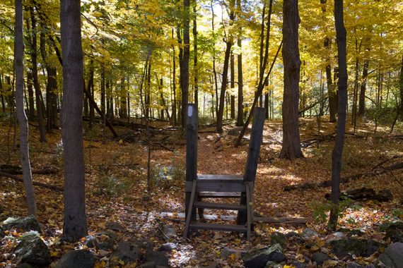
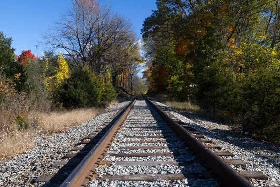
2.2 – Climb over or around a stile and immediately walk across railroad tracks.
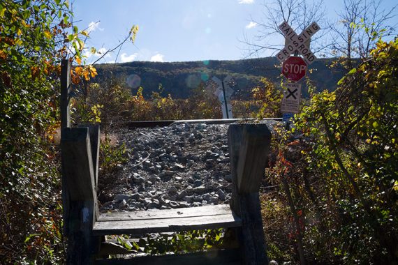
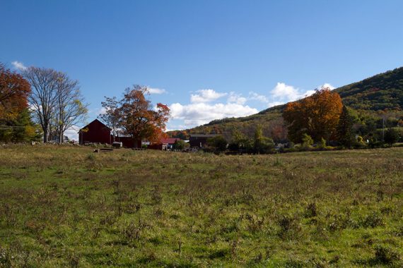
Then climb another stile and enter a cow pasture that is crossed on wooden planking. Wawayanda Mountain – which you are going to hike up – is in front of you.
There may be cows in the pasture so be nice to them if they are there and watch where you step! Farm and fields on both sides.
2.3 – Cross another stile (careful as you go over, you are practically standing in the road on the other side). Cross busy Rt 94 into the hiker’s parking lot.
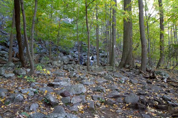
The trail is easy until the woods. Shortly after that, pass through a large boulder field and then the trail becomes very rocky and starts to climb steeply.
3.1 – “Annie’s Bluff” – a limited viewpoint, near a large rock after a bit of a steep climb. Easy to miss.
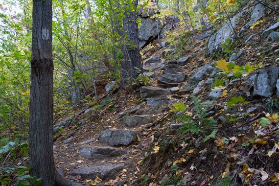
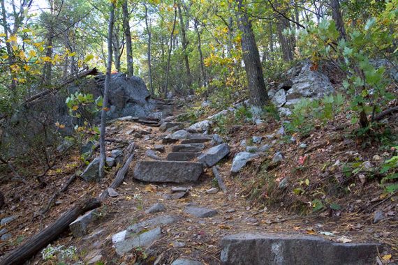
The trail starts getting rockier and rockier.
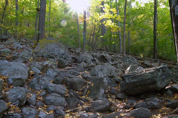
Notice that slabs of rock have been placed as steps along the way – the “Stairway to Heaven”.
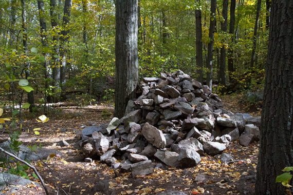
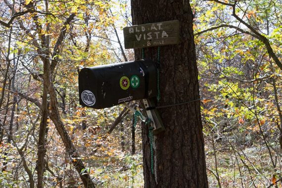
3.6 – Turn LEFT and follow the BLUE spur trail to Pinwheel’s Vista. This is marked by BLUE blazes and a very large cairn (hiker’s term for pile-o-rocks used as a trail marker).
Sometimes there is a sign for the vista (new was added in 2024). This side trail can be easy to miss, look for the rocks.
(If you arrive at a mailbox with an Appalachian Trail log book in it, you’ve missed the turn.)
Follow BLUE to a rock outcrop called Pinwheel’s Vista. There are several places to sit and take in the view of the mountains and the valley below.
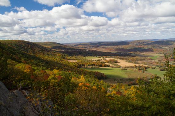
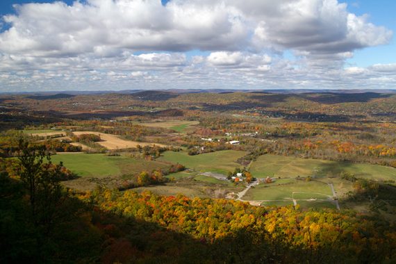
On a clear day, High Point Monument may be visible.
When done, retrace your steps back to the lot on Rt. 517.
// Optional extension: To get in a little more mileage (adds 1.3 miles round trip)… After Pinwheel, walk back to the pile of rocks and turn LEFT instead.
Follow the Appalachian Trail (WHITE) up a rock-studded hill to a mailbox attached to a tree that contains an Appalachian Trail log book for thru-hikers to sign. A new mailbox was installed in 2024, this photo is an older version.
Turn RIGHT and follow the unmarked and slightly faint trail to an old viewpoint. It’s partially obscured.
Retrace steps back. You aren’t missing much if you skip it, but is good for those who want a little longer hike and the mailbox makes for a nice photo.
—
Hiked 10/19/21. Stairway portion only.
Hiked 10/17/15.
Hiked: 7/31/10. Trail Blog: “Stairway to Heaven: Appalachian Trail and Pinwheel Vista“
—
Updates: 2/2022 – Trail map info. 9/2019 – Added parking overview map. 6/2018 – Added parking info for an alternate lot; 10/20/15 – Re-hiked, description updated, new fall foliage photos, GPX added.